Flight: 08-005-05
Date: August 23, 2008
Aircraft: DOE B200, #798
Deployment: RSL August 2008
Flight Location: Roca & Poomacha Fires (2007)
Principal Investigator: Simon Hook (NASA JPL)
Additional Sensors: None
|
Data Evaluation
Overall data quality is good.
|
Processing Information
Level-1B Data in HDF format is available
Flight Line Summary
Spectral Band Configuration
Spectral Response Function Table
Spectral Response Function (text)
|
Browse Imagery
Flight Tracks: 12
Scanlines: 47151
|
Browse Imagery Table
|
Click a Flight Track number to view a quicklook image
Lat/Lon ranges are for the BEG-END scanline nadir pixels
|
Flight
Track |
Time Span
(UTC) |
Heading
(Deg) |
Lat Range
(Deg N) |
Lon Range
(Deg W) |
Length
(Scanlines) |
Altitude
(Meters) |
| 1 |
18:17 - 18:19 |
265.8 |
33.448 - 33.448 |
116.796 - 116.889 |
2153 |
2870 |
| 2 |
18:23 - 18:25 |
91.4 |
33.404 - 33.404 |
117.021 - 116.944 |
1768 |
3349 |
| 3 |
18:29 - 18:31 |
267.8 |
33.383 - 33.383 |
116.858 - 117.014 |
3623 |
3346 |
| 4 |
18:35 - 18:38 |
93.0 |
33.365 - 33.364 |
117.067 - 116.894 |
3997 |
3347 |
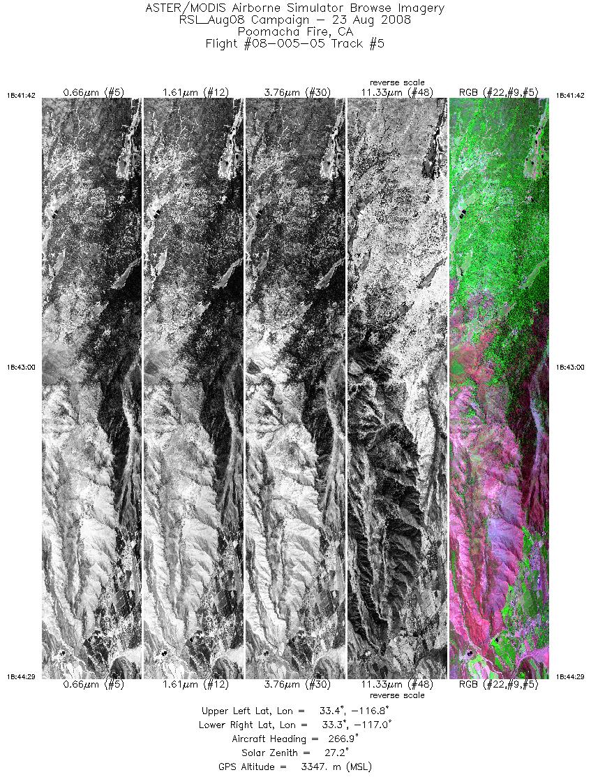
| 5 |
18:41 - 18:44 |
267.3 |
33.348 - 33.348 |
116.843 - 117.023 |
4161 |
3348 |
| 6 |
18:47 - 18:49 |
93.4 |
33.332 - 33.331 |
117.037 - 116.885 |
3496 |
3348 |
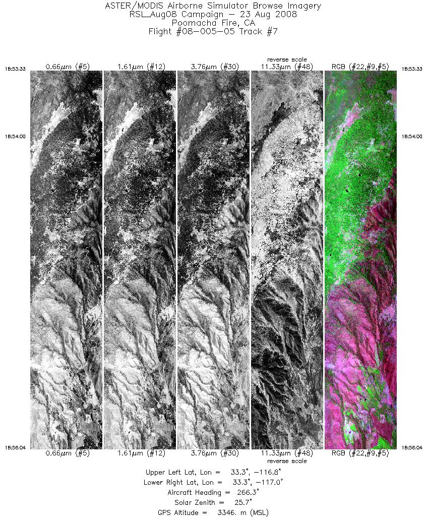
| 7 |
18:53 - 18:56 |
266.6 |
33.314 - 33.315 |
116.803 - 116.965 |
3758 |
3348 |
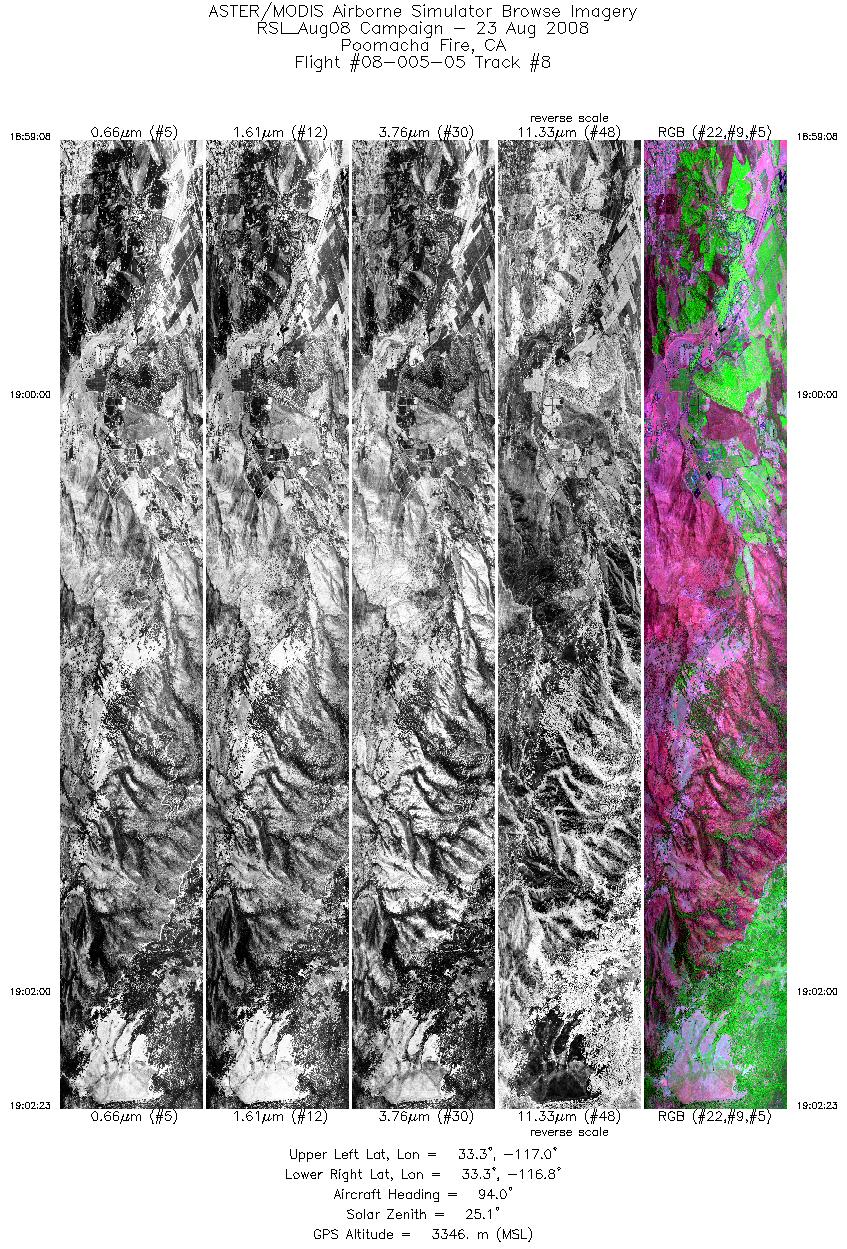
| 8 |
18:59 - 19:02 |
94.8 |
33.297 - 33.297 |
117.016 - 116.807 |
4847 |
3348 |
| 9 |
19:05 - 19:08 |
266.2 |
33.278 - 33.279 |
116.762 - 116.984 |
5075 |
3345 |
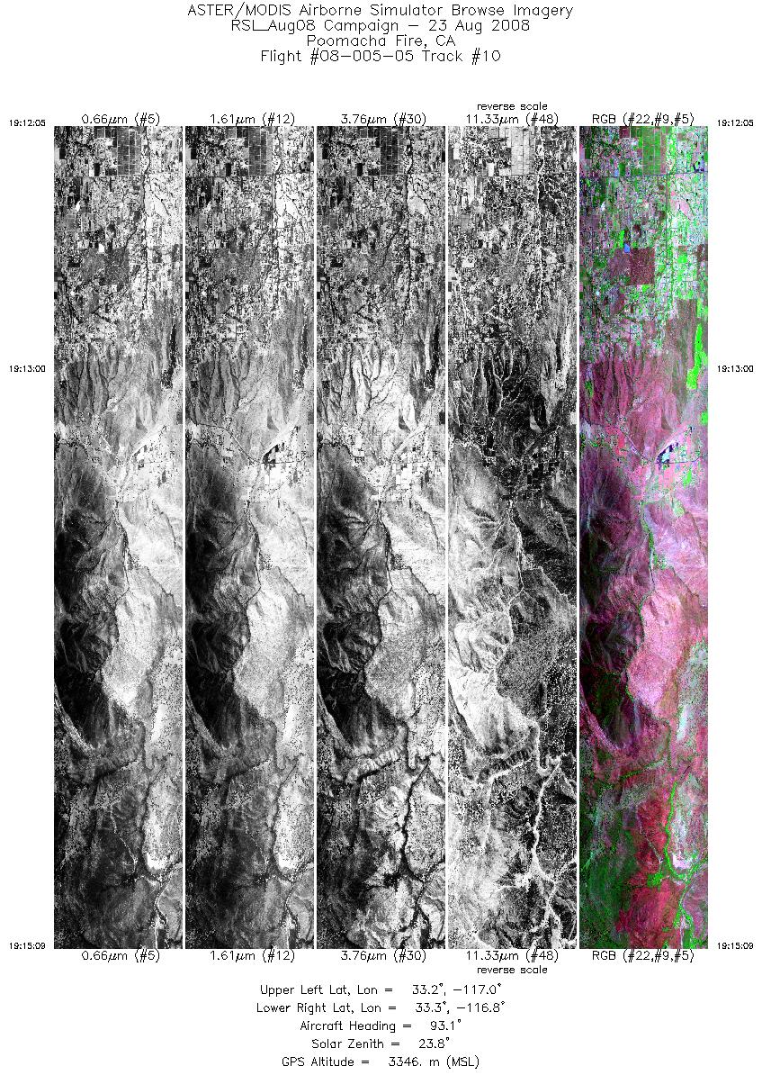
| 10 |
19:12 - 19:15 |
94.6 |
33.260 - 33.260 |
117.034 - 116.836 |
4573 |
3346 |
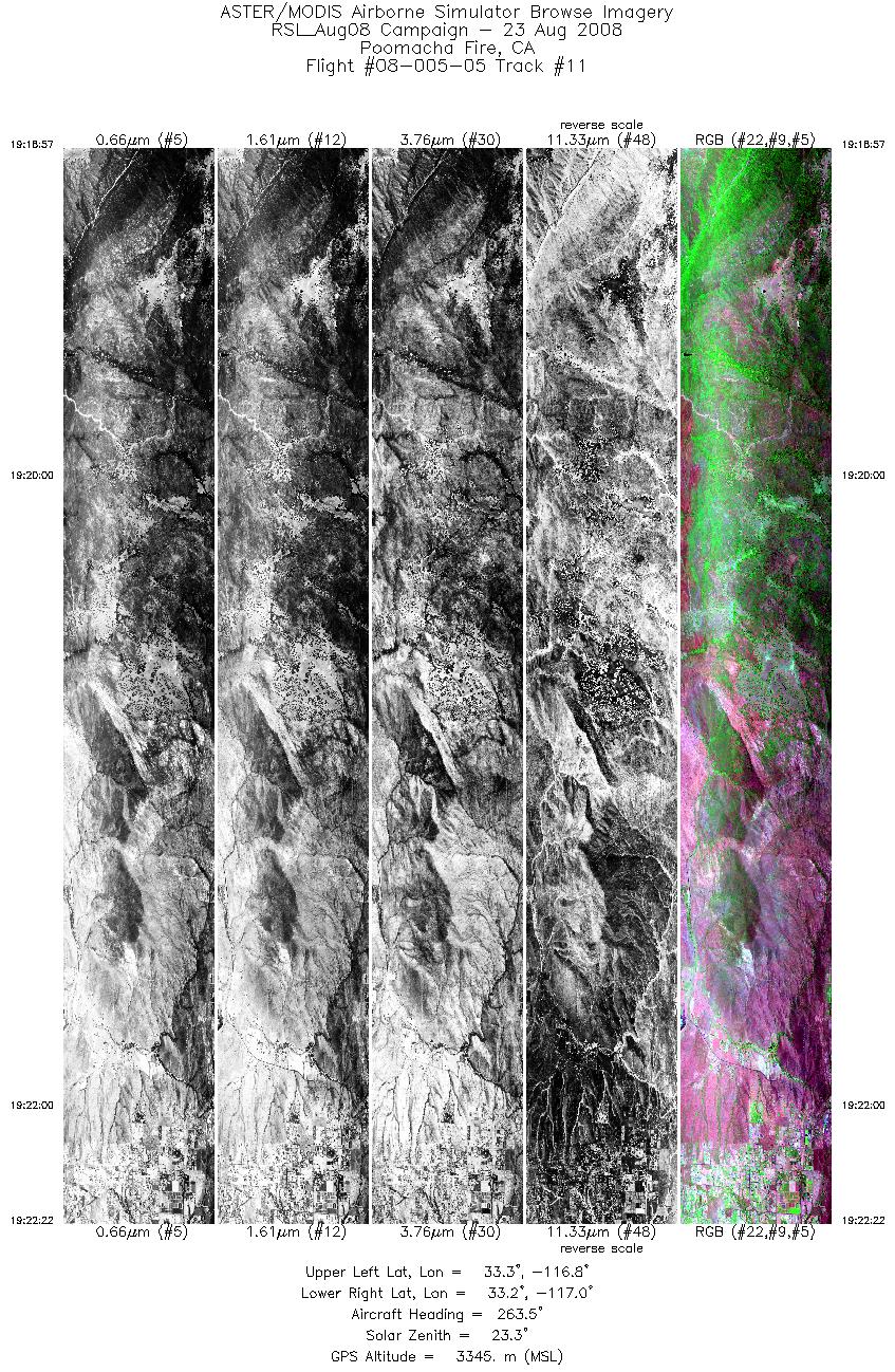
| 11 |
19:18 - 19:22 |
265.9 |
33.240 - 33.241 |
116.776 - 116.997 |
5092 |
3346 |
| 12 |
19:31 - 19:34 |
265.1 |
33.220 - 33.220 |
116.785 - 116.985 |
4608 |
3347 |
|


