Flight: 08-005-04
Date: August 22, 2008
Aircraft: DOE B200, #798
Deployment: RSL August 2008
Flight Location: Harris & Witch Fires (2007)
Principal Investigator: Simon Hook (NASA JPL)
Additional Sensors: None
|
Data Evaluation
Overall data quality is good.
|
Processing Information
Level-1B Data in HDF format is available
Flight Line Summary
Spectral Band Configuration
Spectral Response Function Table
Spectral Response Function (text)
|
Browse Imagery
Flight Tracks: 15
Scanlines: 107534
|
Browse Imagery Table
|
Click a Flight Track number to view a quicklook image
Lat/Lon ranges are for the BEG-END scanline nadir pixels
|
Flight
Track |
Time Span
(UTC) |
Heading
(Deg) |
Lat Range
(Deg N) |
Lon Range
(Deg W) |
Length
(Scanlines) |
Altitude
(Meters) |
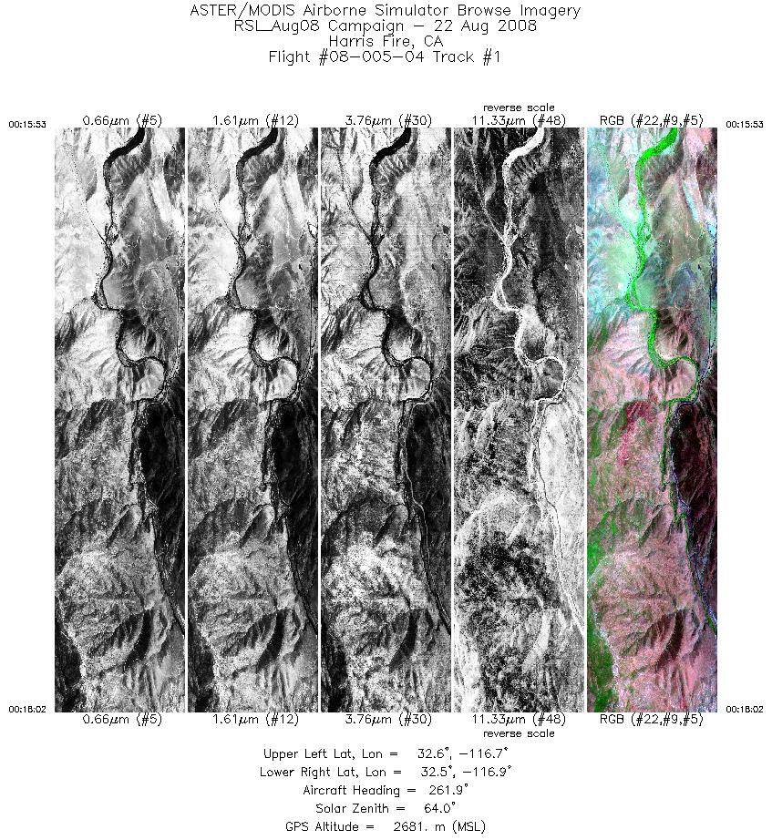
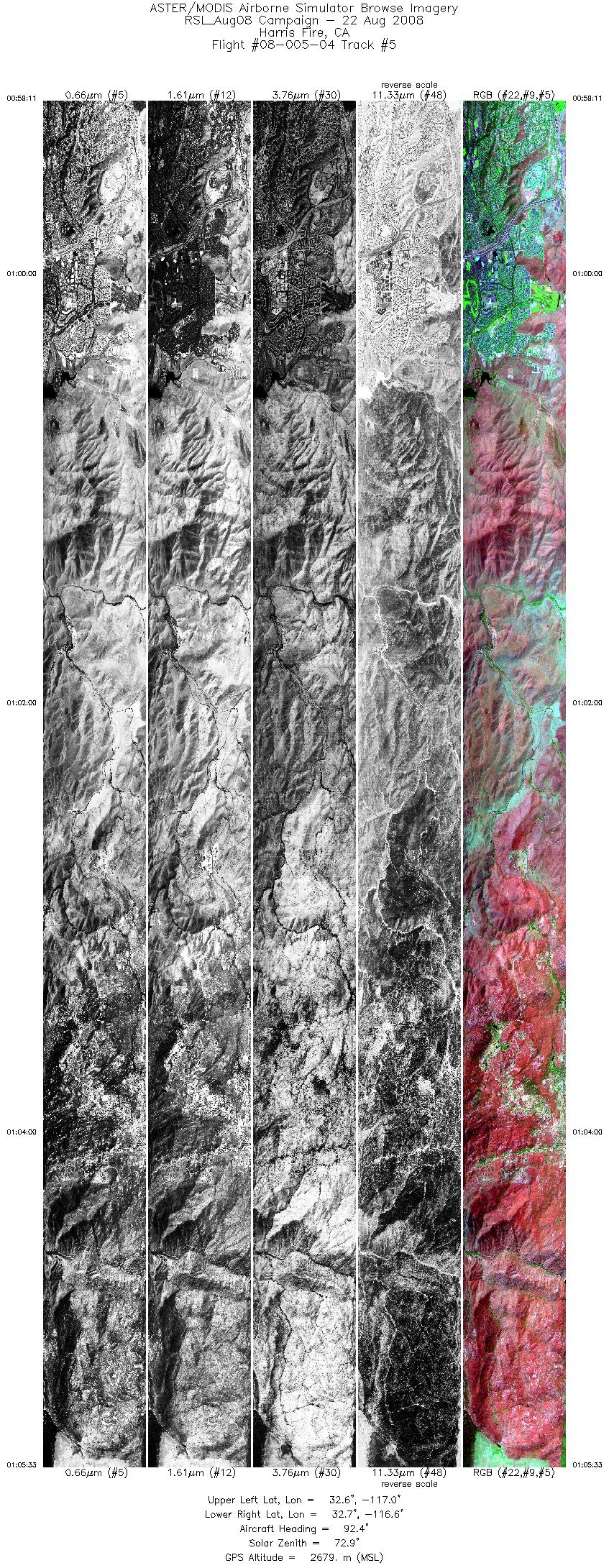
| 1 |
00:15 - 00:18 |
263.6 |
32.564 - 32.563 |
116.738 - 116.879 |
3213 |
2682 |
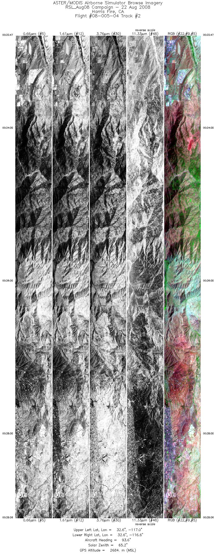
| 2 |
00:22 - 00:29 |
93.6 |
32.586 - 32.584 |
116.964 - 116.568 |
9459 |
2687 |
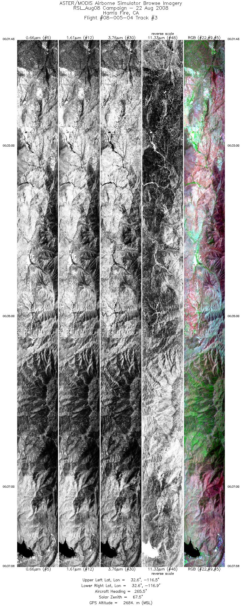
| 3 |
00:31 - 00:37 |
266.2 |
32.603 - 32.605 |
116.549 - 116.940 |
9225 |
2685 |
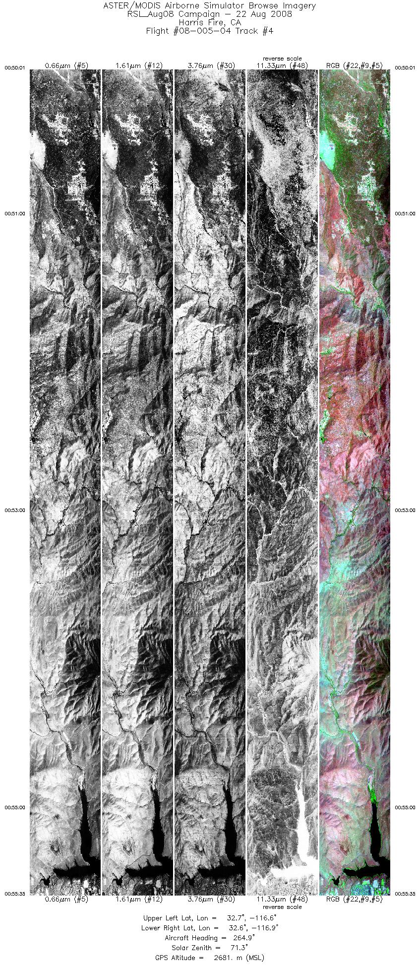
| 4 |
00:50 - 00:55 |
265.8 |
32.641 - 32.642 |
116.584 - 116.941 |
8326 |
2683 |
| 5 |
00:59 - 01:05 |
92.9 |
32.662 - 32.661 |
117.014 - 116.616 |
9508 |
2680 |
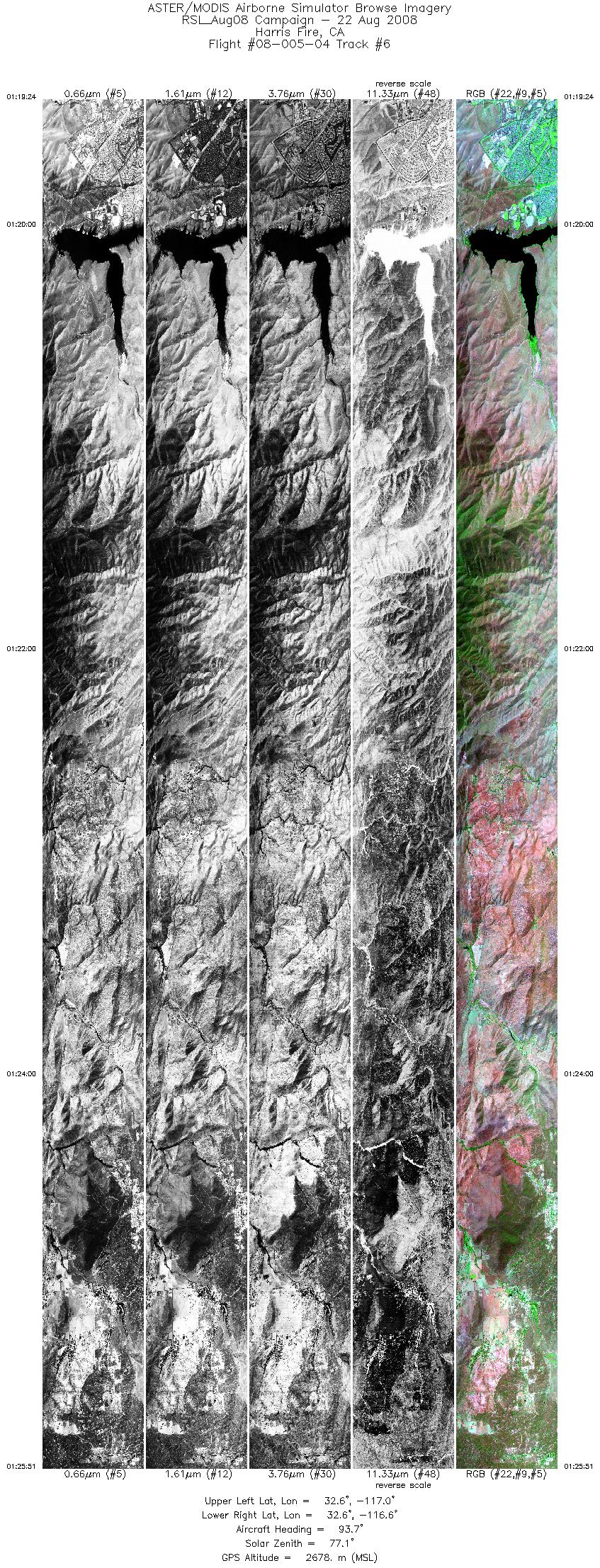
| 6 |
01:19 - 01:25 |
93.9 |
32.623 - 32.622 |
116.970 - 116.558 |
9665 |
2678 |
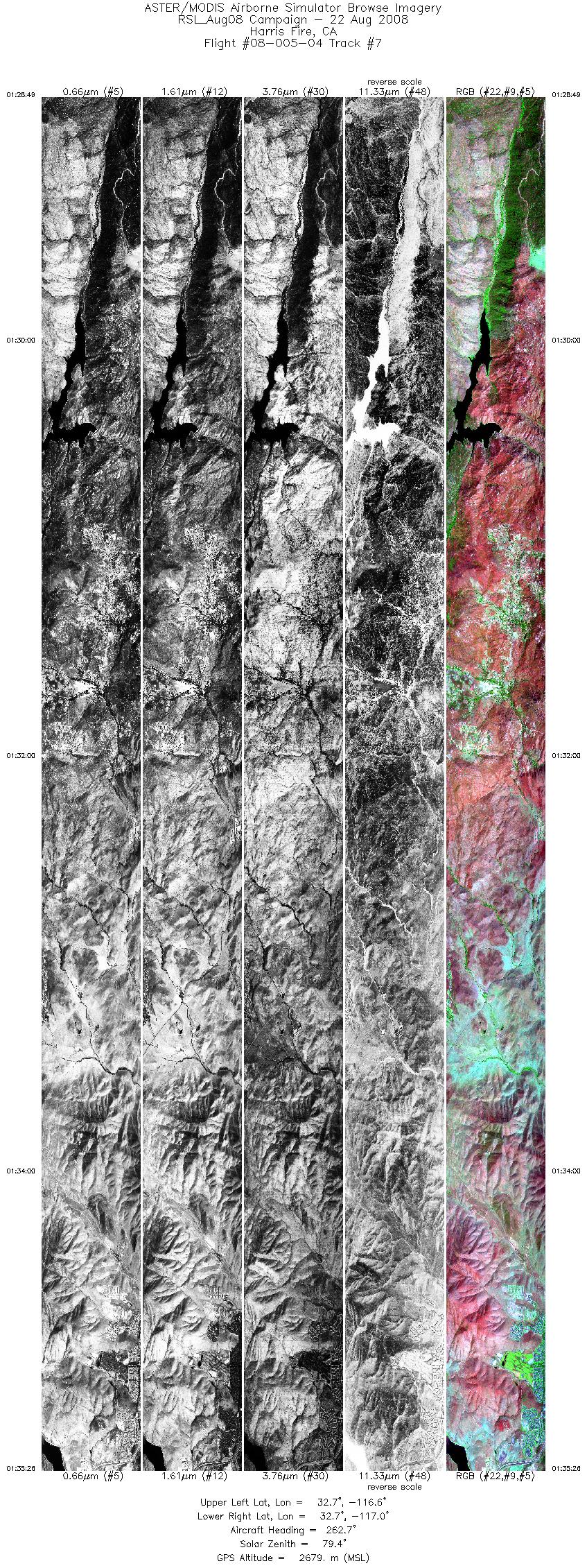
| 7 |
01:28 - 01:35 |
265.2 |
32.680 - 32.681 |
116.568 - 116.989 |
9906 |
2678 |
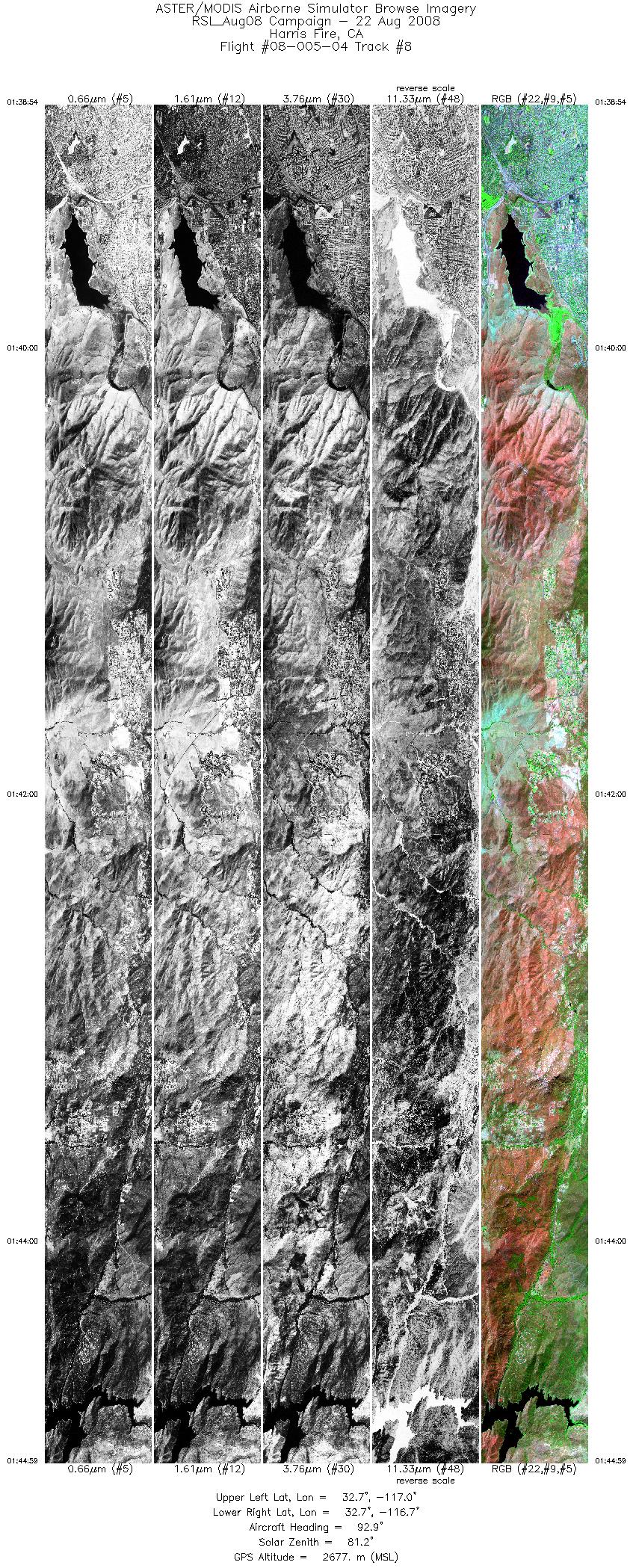
| 8 |
01:38 - 01:44 |
93.4 |
32.700 - 32.699 |
117.038 - 116.656 |
9090 |
2678 |
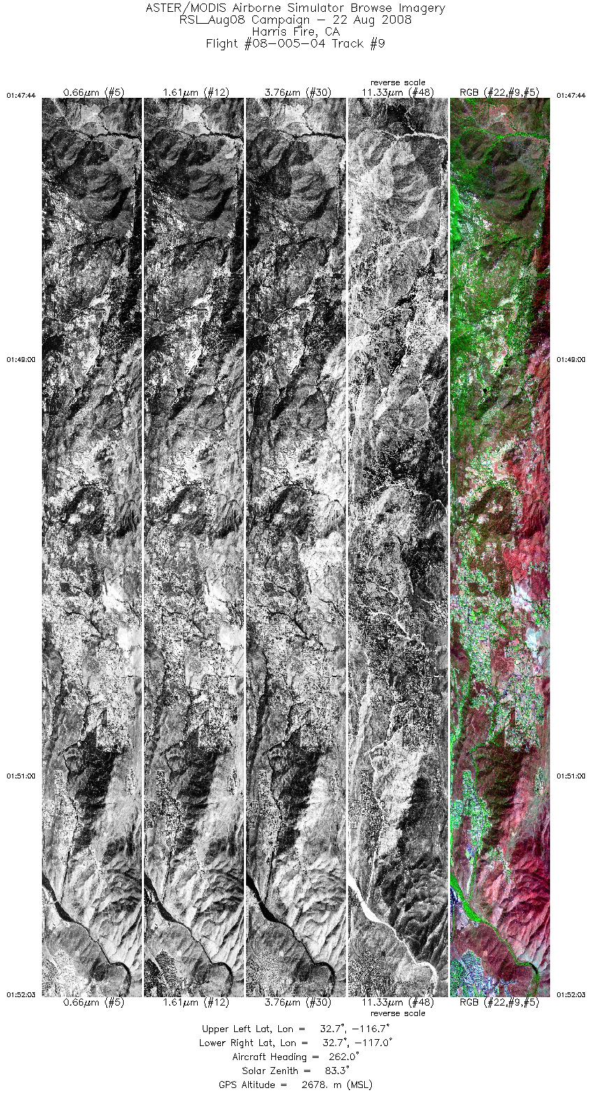
| 9 |
01:47 - 01:52 |
264.7 |
32.718 - 32.719 |
116.692 - 116.969 |
6439 |
2678 |
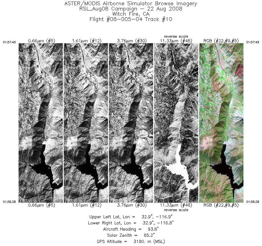
| 10 |
01:57 - 01:59 |
94.2 |
32.881 - 32.881 |
116.879 - 116.767 |
2589 |
3180 |
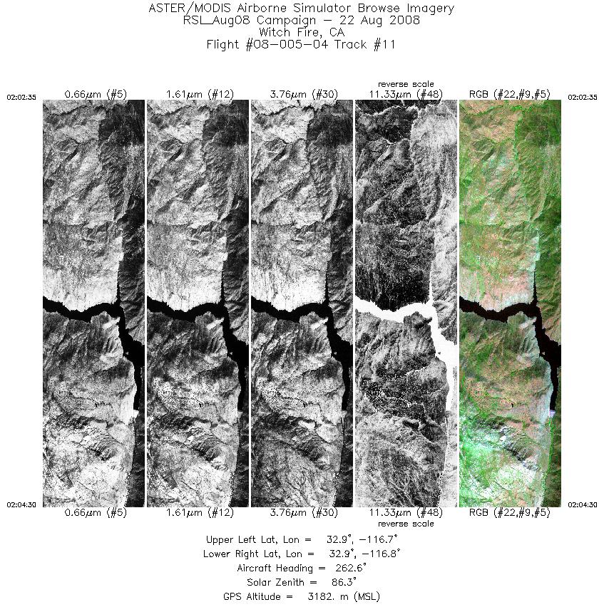
| 11 |
02:02 - 02:04 |
265.0 |
32.903 - 32.903 |
116.717 - 116.840 |
2864 |
3184 |
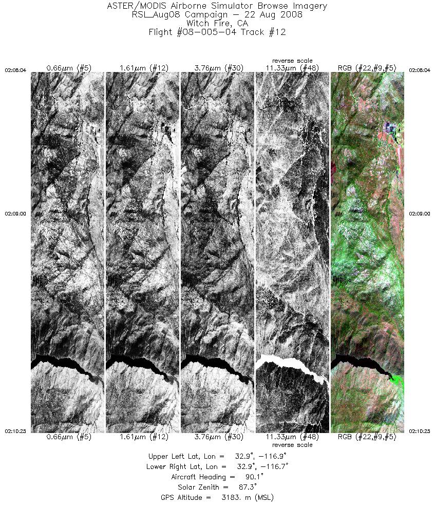
| 12 |
02:08 - 02:10 |
92.2 |
32.924 - 32.924 |
116.897 - 116.748 |
3514 |
3183 |
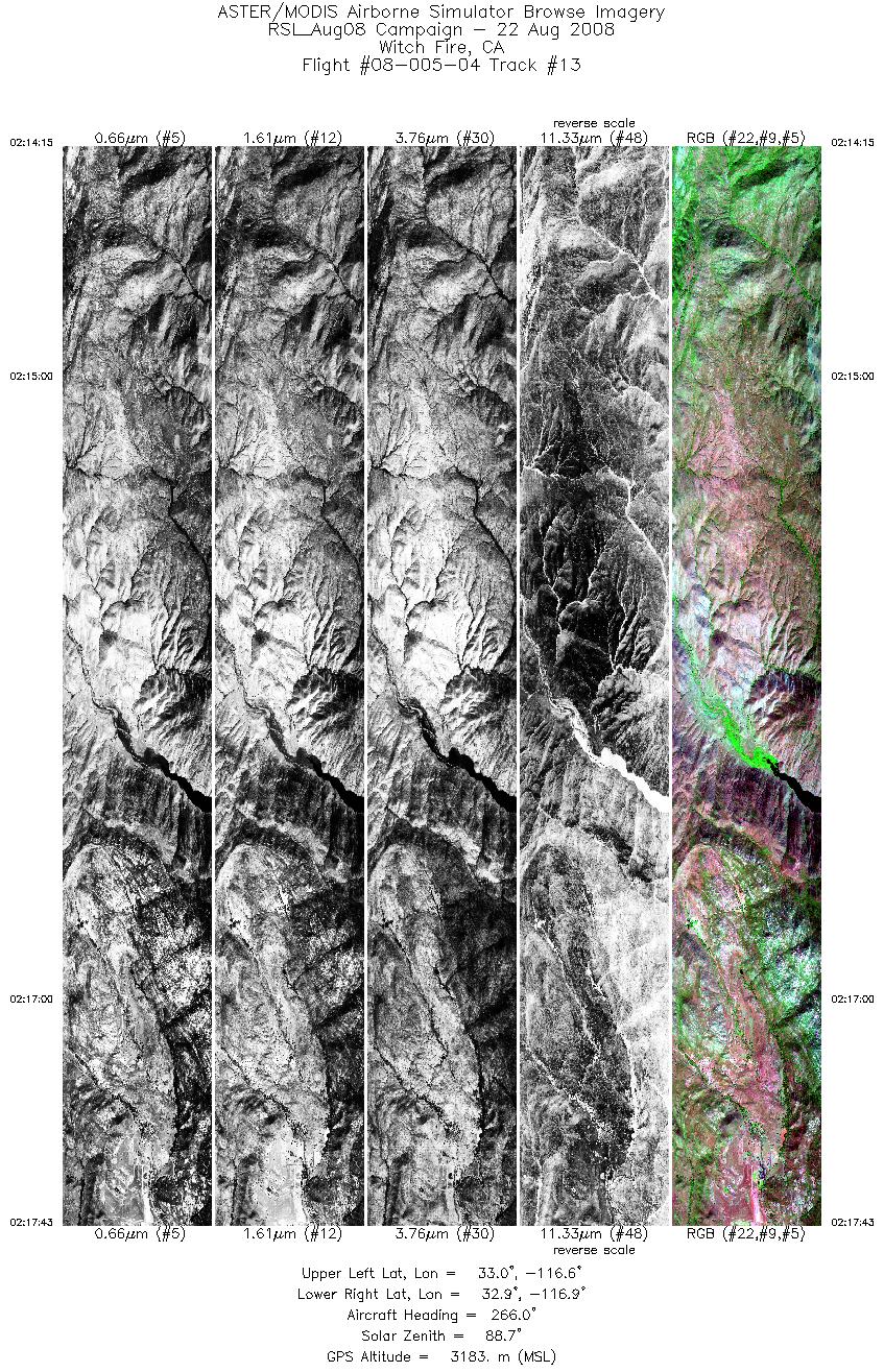
| 13 |
02:14 - 02:17 |
266.7 |
32.945 - 32.946 |
116.647 - 116.868 |
5177 |
3181 |
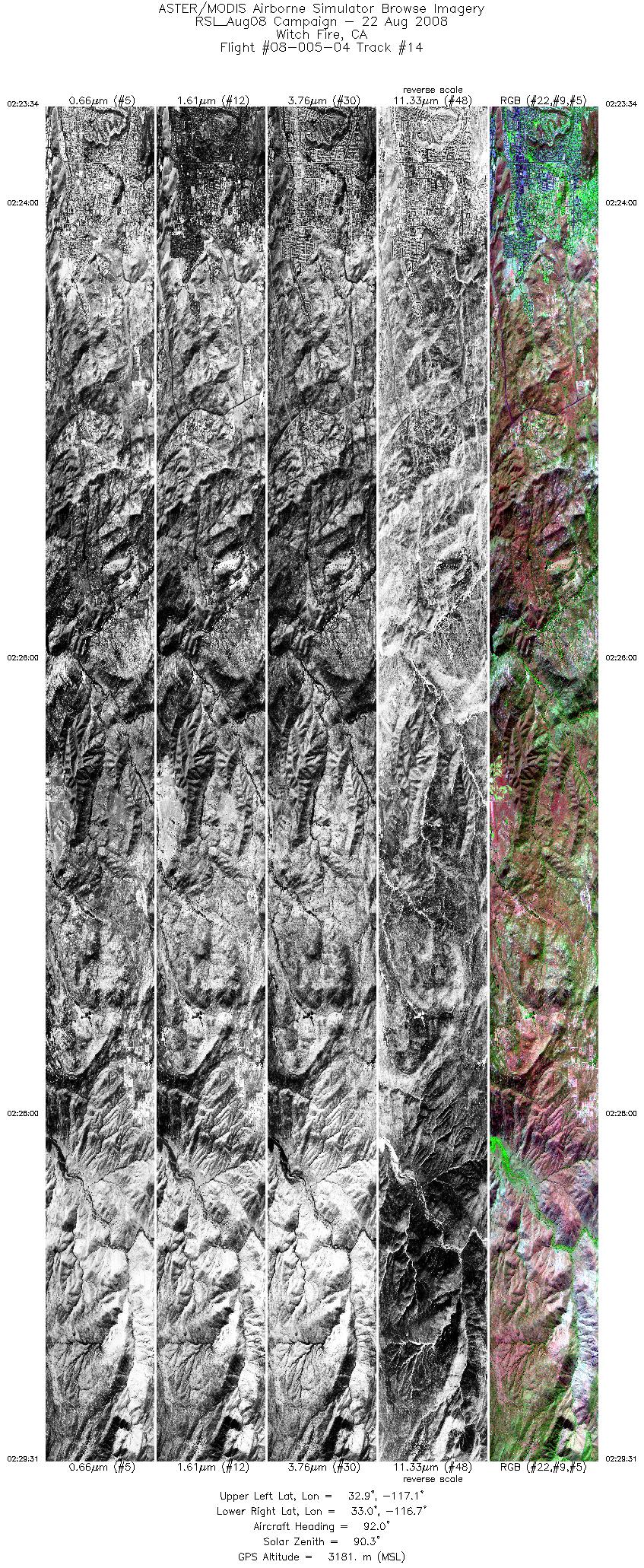
| 14 |
02:23 - 02:29 |
92.7 |
32.967 - 32.965 |
117.055 - 116.679 |
8907 |
3183 |
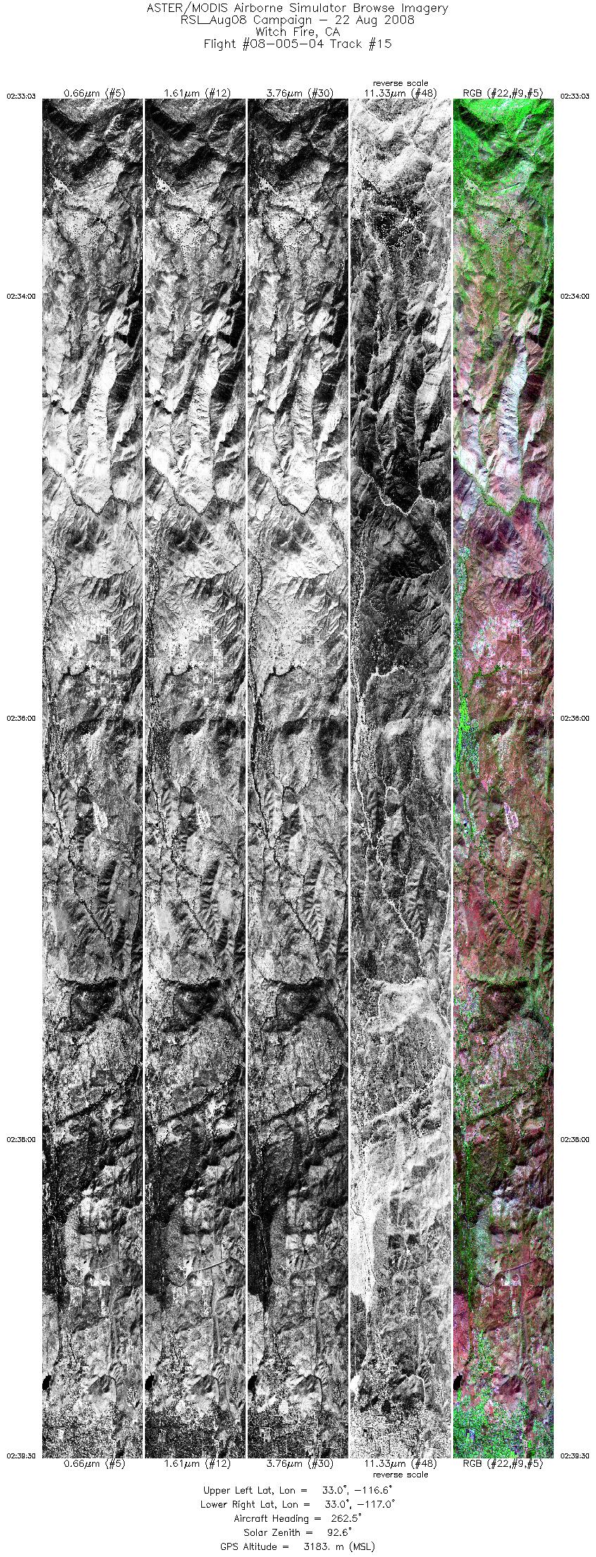
| 15 |
02:33 - 02:39 |
264.8 |
32.983 - 32.984 |
116.618 - 117.033 |
9652 |
3185 |
|


