Flight: 08-003-05
Date: April 17, 2008
Aircraft: DOE B200, #798
Deployment: RSL April 2008
Flight Location: Witch, Pumacha, Roca, Santiago, & Canyon Fires (2007)
Principal Investigator: Simon Hook (NASA JPL)
Additional Sensors: None
|
Data Evaluation
Overall data quality is good.
|
Processing Information
Level-1B Data in HDF format is available
Flight Line Summary
Spectral Band Configuration
Spectral Response Function Table
Spectral Response Function (text)
|
Browse Imagery
Flight Tracks: 27
Scanlines: 118588
|
Browse Imagery Table
|
Click a Flight Track number to view a quicklook image
Lat/Lon ranges are for the BEG-END scanline nadir pixels
|
Flight
Track |
Time Span
(UTC) |
Heading
(Deg) |
Lat Range
(Deg N) |
Lon Range
(Deg W) |
Length
(Scanlines) |
Altitude
(Meters) |
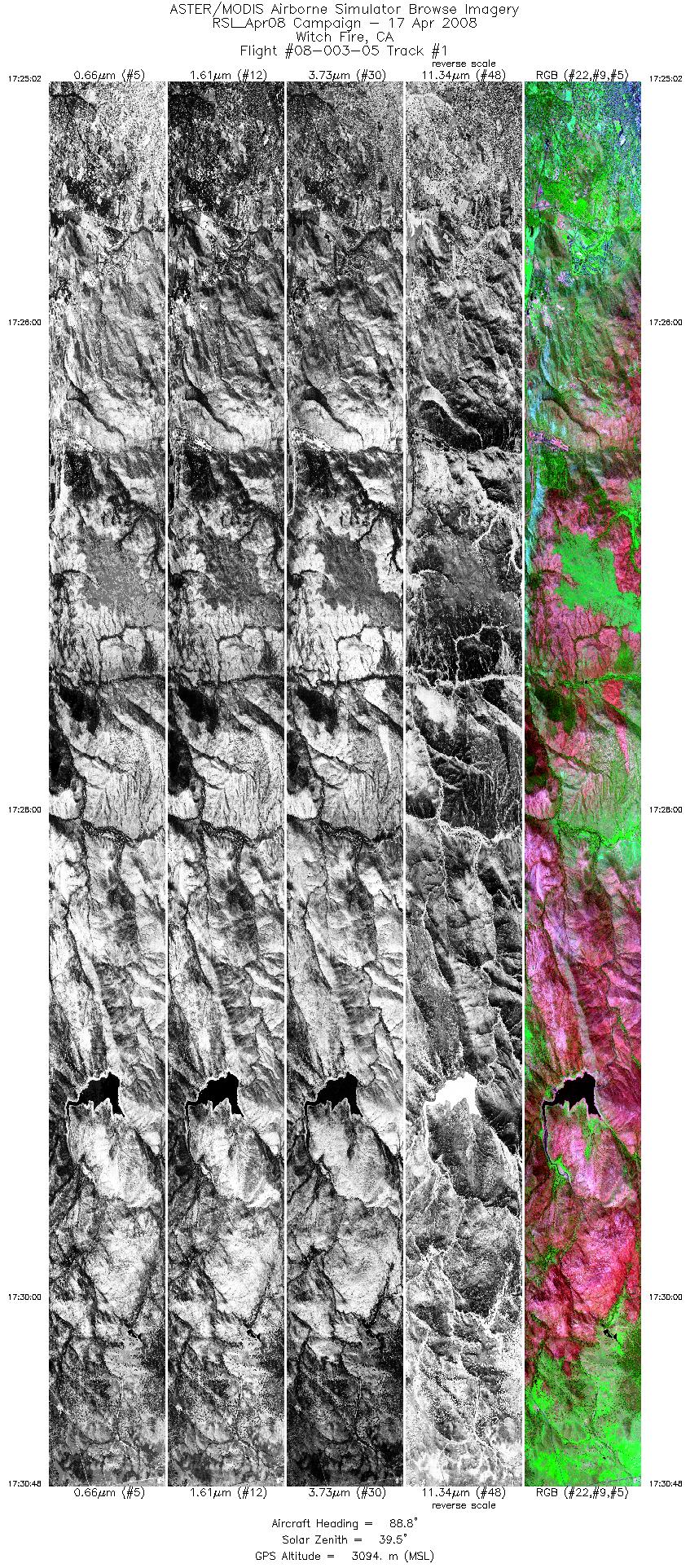
| 1 |
17:25 - 17:30 |
88.2 |
33.116 - 33.113 |
117.054 - 116.675 |
8624 |
3094 |
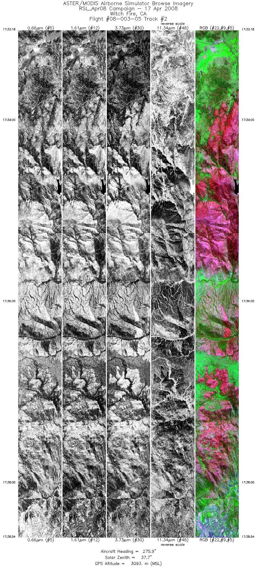
| 2 |
17:33 - 17:38 |
275.6 |
33.132 - 33.135 |
116.671 - 117.046 |
8360 |
3093 |
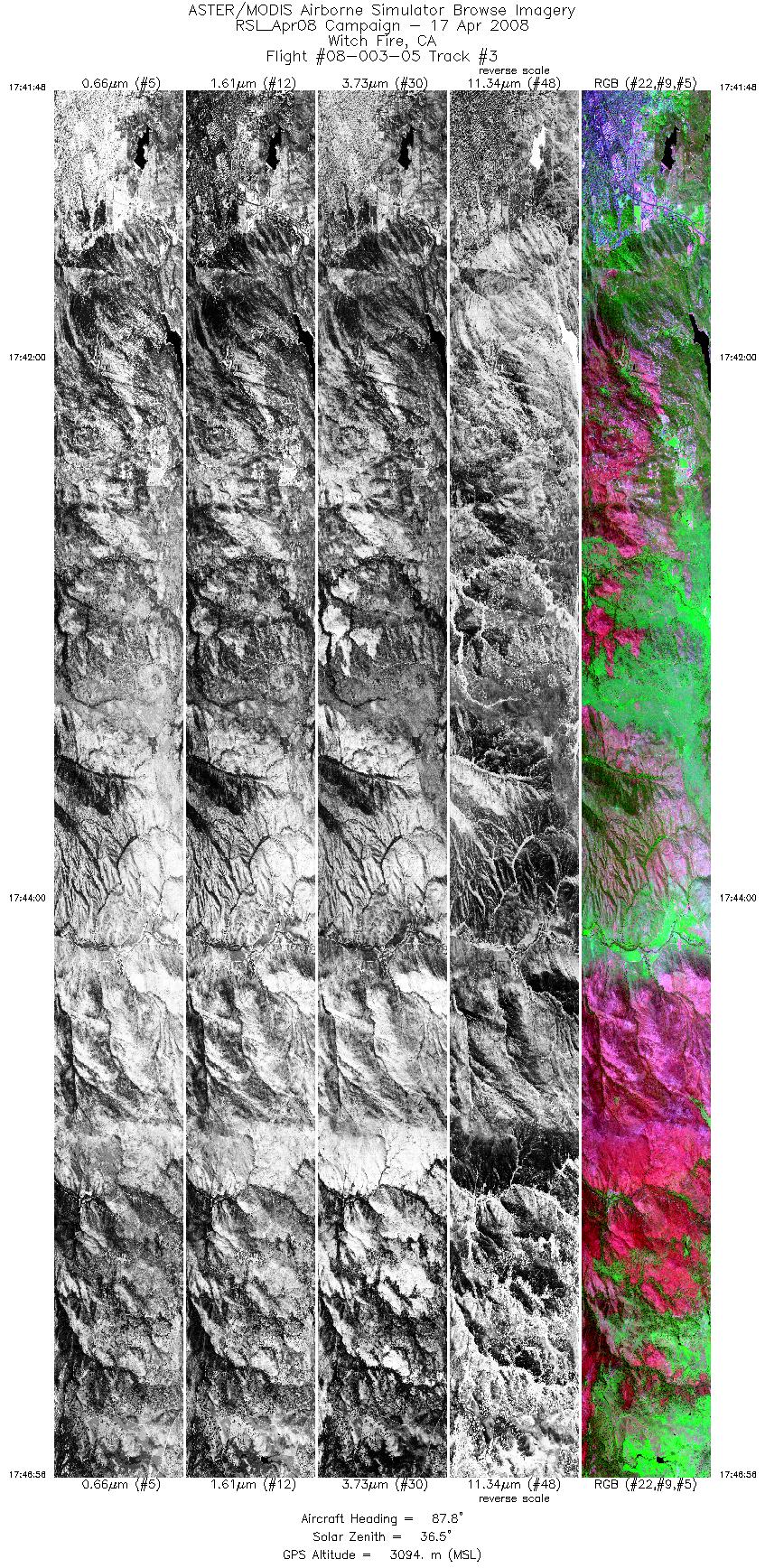
| 3 |
17:41 - 17:46 |
87.2 |
33.154 - 33.152 |
117.059 - 116.722 |
7680 |
3097 |
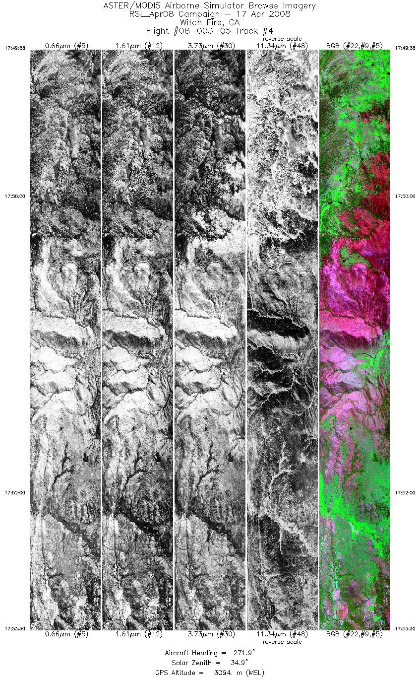
| 4 |
17:49 - 17:53 |
273.4 |
33.171 - 33.173 |
116.717 - 116.979 |
5851 |
3097 |
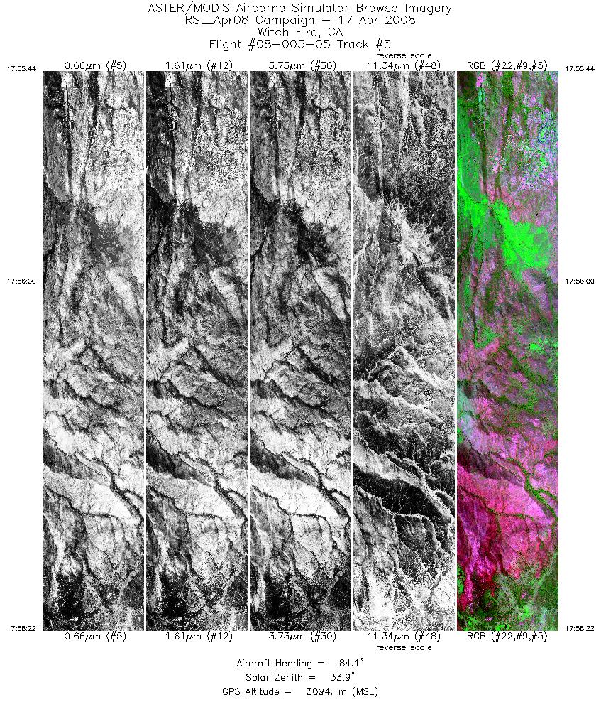
| 5 |
17:55 - 17:58 |
84.5 |
33.192 - 33.192 |
116.964 - 116.793 |
3942 |
3095 |
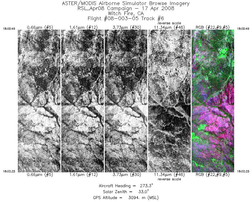
| 6 |
18:00 - 18:02 |
273.5 |
33.213 - 33.214 |
116.775 - 116.878 |
2407 |
3095 |
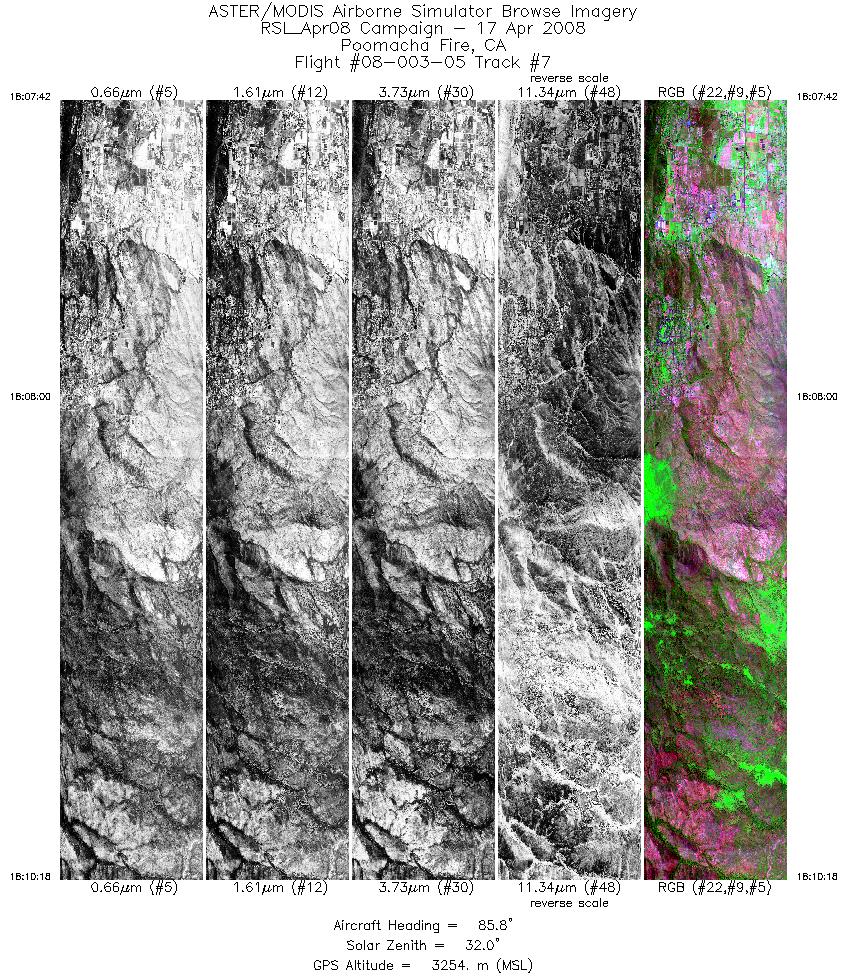
| 7 |
18:07 - 18:10 |
86.9 |
33.220 - 33.220 |
116.999 - 116.824 |
3903 |
3254 |
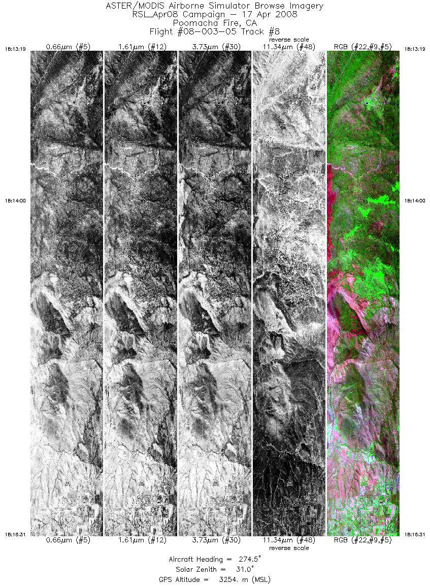
| 8 |
18:13 - 18:16 |
274.4 |
33.240 - 33.241 |
116.782 - 116.999 |
4787 |
3256 |
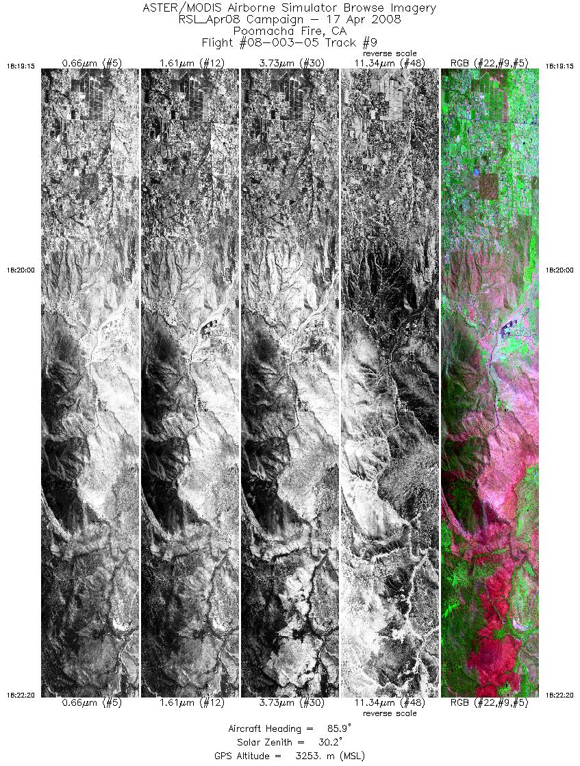
| 9 |
18:19 - 18:22 |
87.1 |
33.260 - 33.260 |
117.040 - 116.831 |
4599 |
3253 |
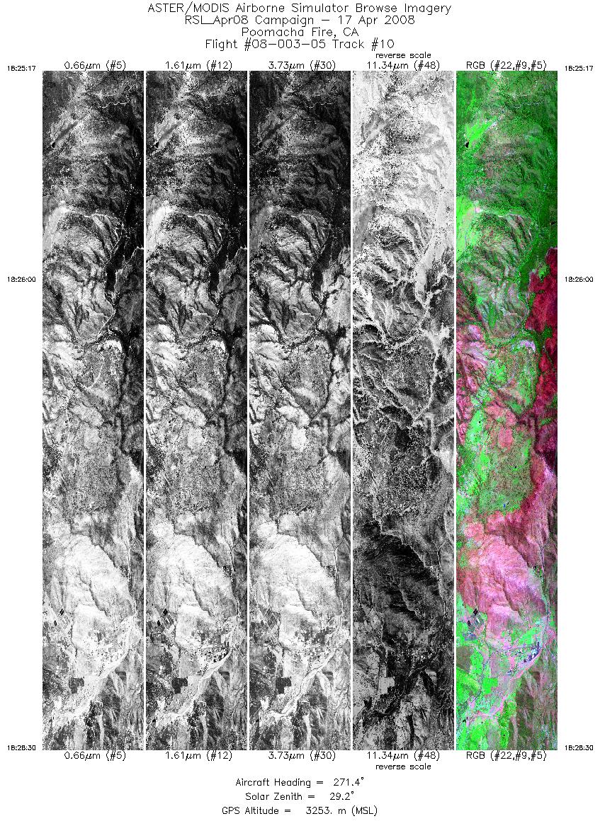
| 10 |
18:25 - 18:28 |
272.5 |
33.278 - 33.279 |
116.774 - 116.988 |
4800 |
3253 |
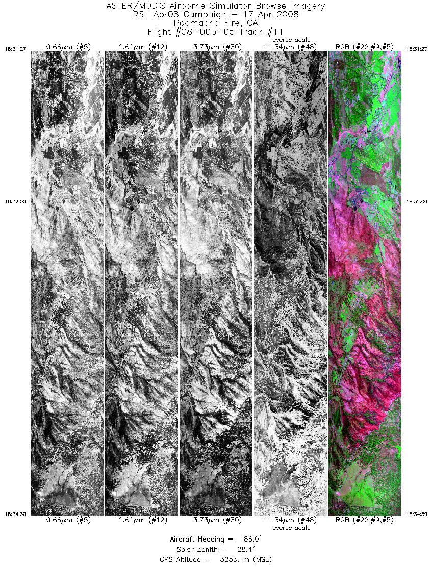
| 11 |
18:31 - 18:34 |
86.1 |
33.297 - 33.297 |
117.010 - 116.804 |
4563 |
3254 |
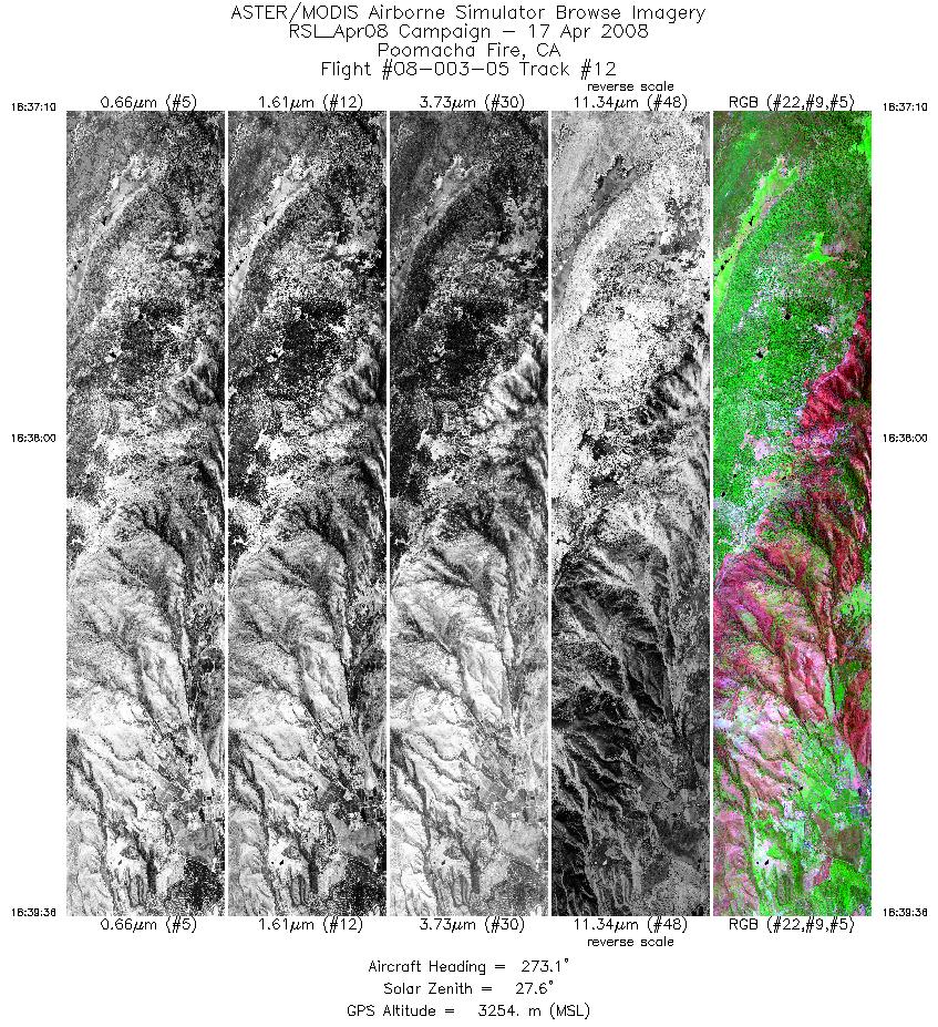
| 12 |
18:37 - 18:39 |
274.0 |
33.314 - 33.314 |
116.808 - 116.970 |
3637 |
3254 |
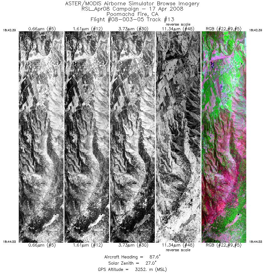
| 13 |
18:42 - 18:44 |
86.9 |
33.332 - 33.331 |
117.032 - 116.880 |
3389 |
3254 |
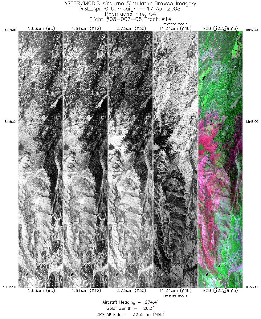
| 14 |
18:47 - 18:50 |
273.7 |
33.348 - 33.348 |
116.848 - 117.027 |
4180 |
3255 |
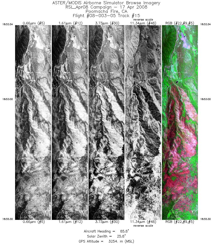
| 15 |
18:52 - 18:55 |
86.3 |
33.365 - 33.364 |
117.066 - 116.889 |
3878 |
3255 |
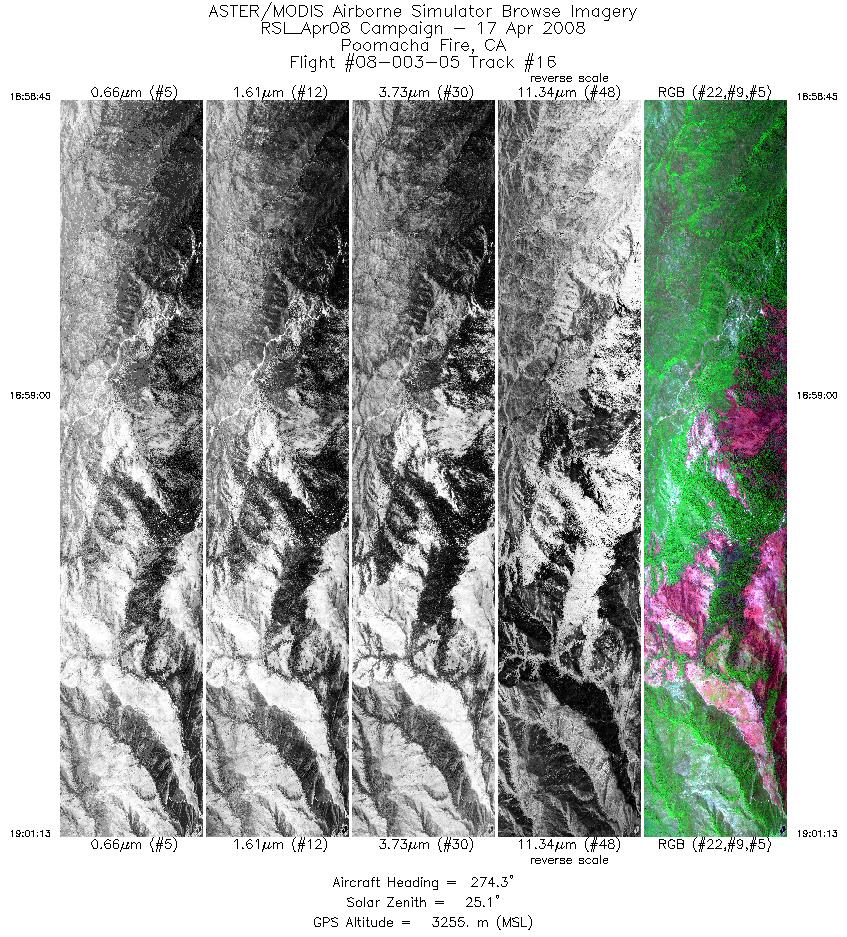
| 16 |
18:58 - 19:01 |
273.8 |
33.383 - 33.383 |
116.852 - 117.016 |
3688 |
3255 |
| 17 |
19:03 - 19:04 |
85.7 |
33.405 - 33.404 |
117.013 - 116.941 |
1602 |
3253 |
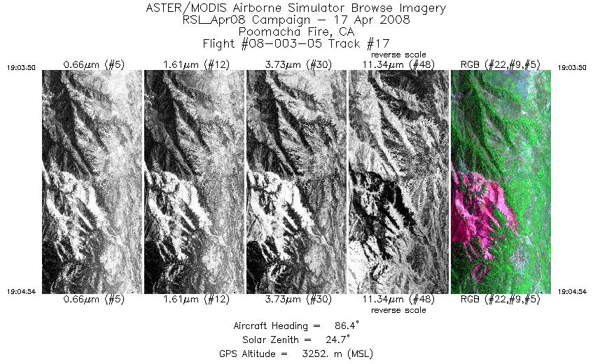
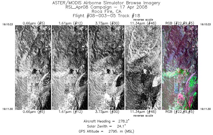
| 18 |
19:10 - 19:11 |
276.0 |
33.448 - 33.448 |
116.813 - 116.890 |
1682 |
2797 |
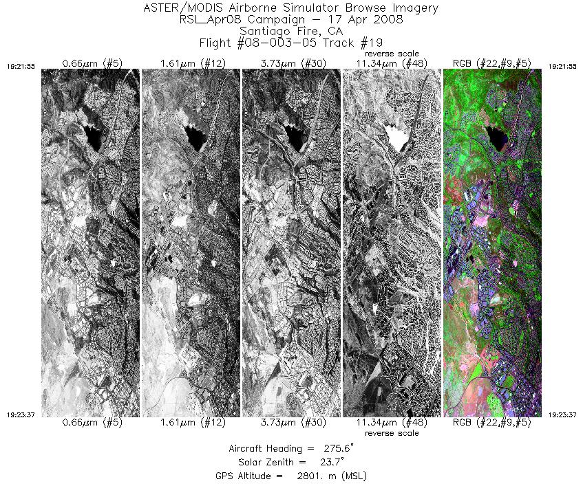
| 19 |
19:21 - 19:23 |
274.1 |
33.663 - 33.663 |
117.605 - 117.721 |
2539 |
2799 |
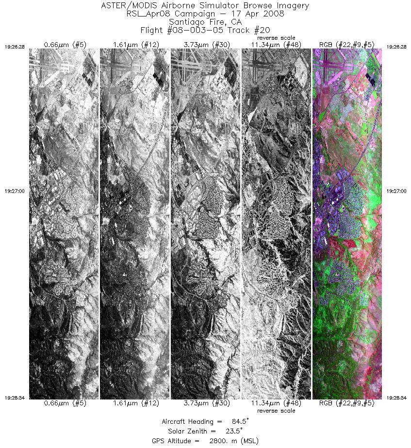
| 20 |
19:26 - 19:28 |
85.9 |
33.684 - 33.684 |
117.736 - 117.575 |
3624 |
2801 |
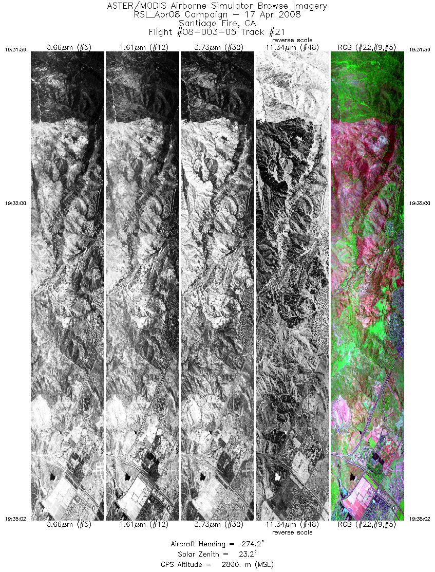
| 21 |
19:31 - 19:35 |
274.1 |
33.702 - 33.703 |
117.542 - 117.752 |
4569 |
2799 |
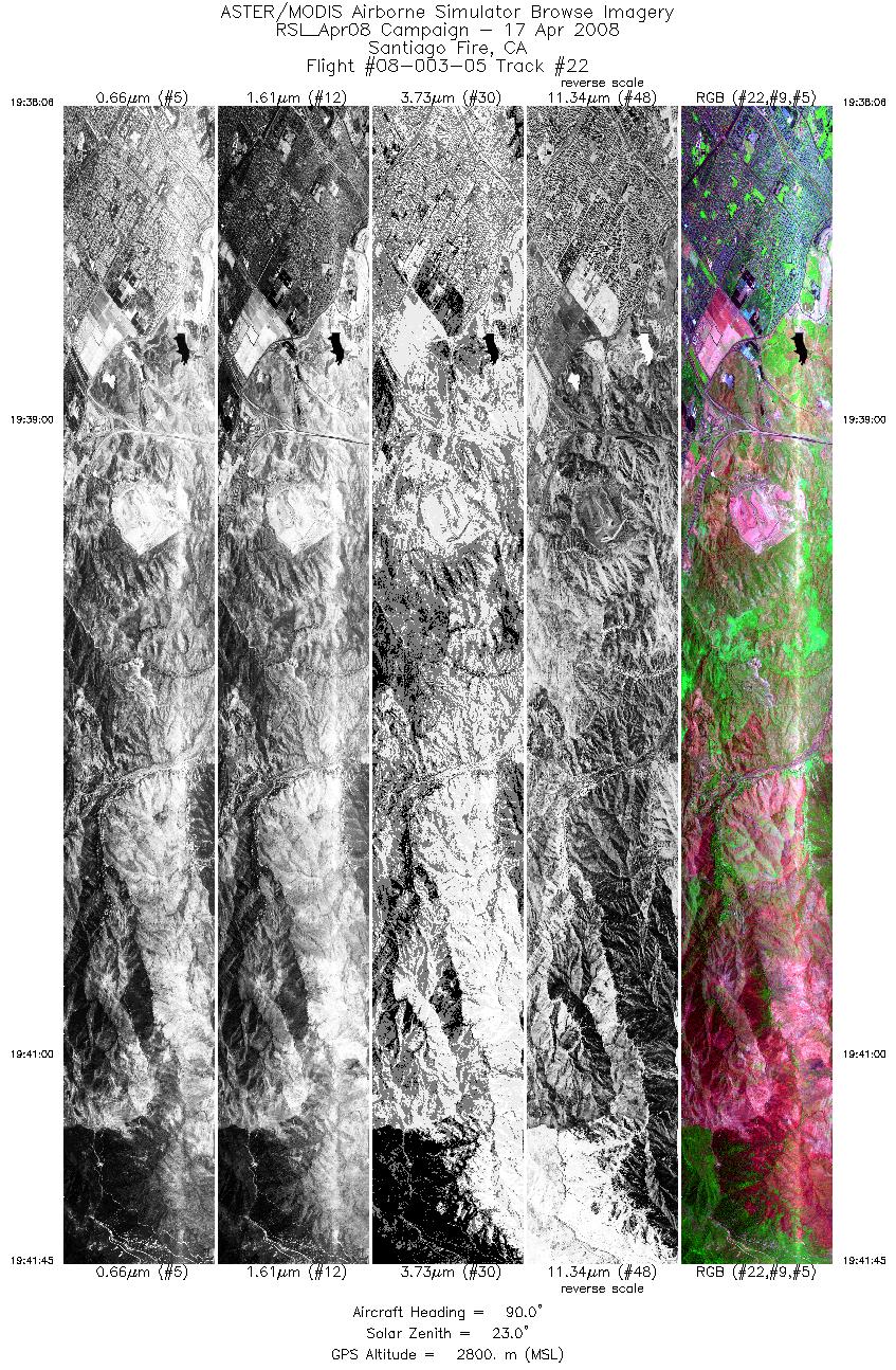
| 22 |
19:38 - 19:41 |
88.9 |
33.719 - 33.717 |
117.788 - 117.545 |
5474 |
2800 |
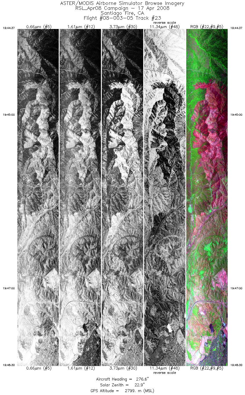
| 23 |
19:44 - 19:48 |
275.4 |
33.732 - 33.733 |
117.506 - 117.768 |
5818 |
2798 |
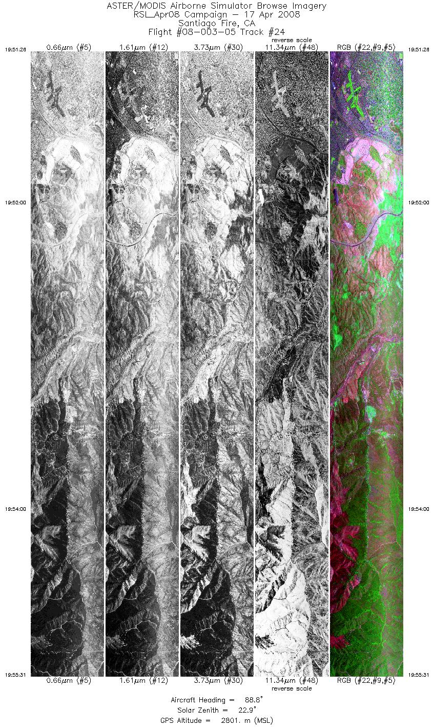
| 24 |
19:51 - 19:55 |
88.2 |
33.747 - 33.746 |
117.801 - 117.536 |
6092 |
2803 |
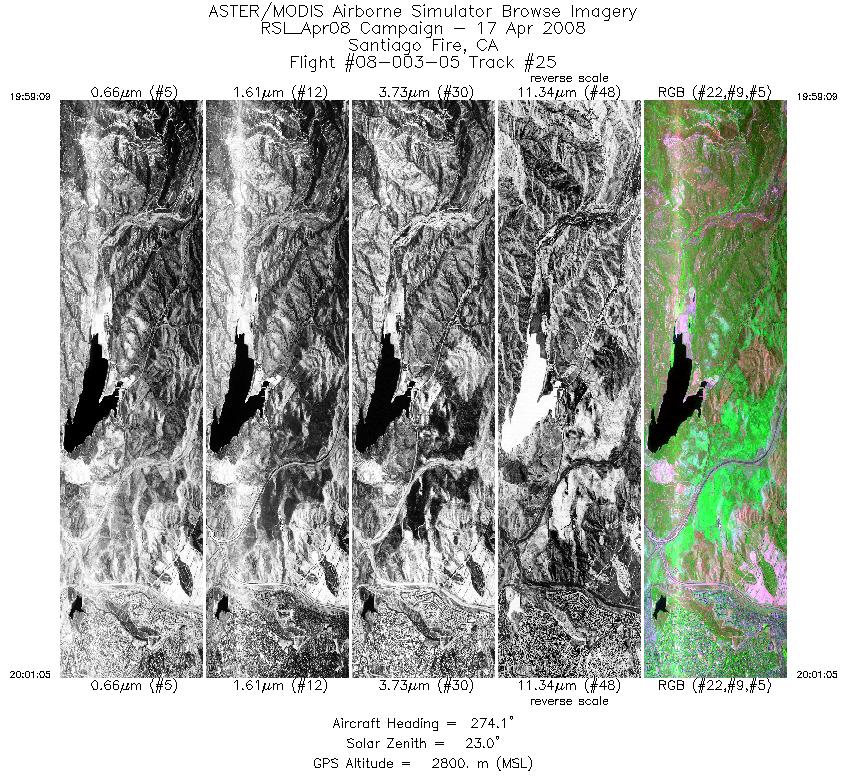
| 25 |
19:59 - 20:01 |
274.4 |
33.766 - 33.766 |
117.653 - 117.780 |
2892 |
2800 |
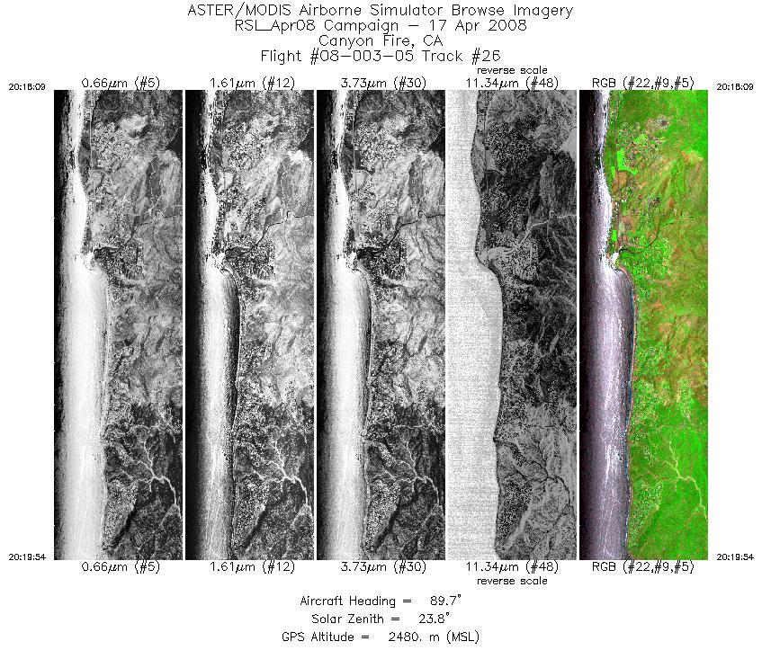
| 26 |
20:18 - 20:19 |
91.8 |
34.041 - 34.041 |
118.722 - 118.605 |
2617 |
2481 |
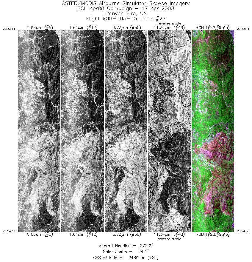
| 27 |
20:22 - 20:24 |
272.4 |
34.064 - 34.064 |
118.571 - 118.722 |
3391 |
2481 |
|


