Flight: 08-002-17
Date: November 14, 2007
Aircraft: DOE B200, #796
Deployment: RSL November 2007
Flight Location: Southern California Fires
Principal Investigator: Hook (JPL), Myers / Coffland (UCSC)
Additional Sensors: None
|
Data Evaluation
Overall data quality is good.
|
Processing Information
Level-1B Data in HDF format is available
Flight Line Summary
Spectral Band Configuration
Spectral Response Function Table
Spectral Response Function (text)
|
Browse Imagery
Flight Tracks: 19
Scanlines: 83934
|
Browse Imagery Table
|
Click a Flight Track number to view a quicklook image
Lat/Lon ranges are for the BEG-END scanline nadir pixels
|
Flight
Track |
Time Span
(UTC) |
Heading
(Deg) |
Lat Range
(Deg N) |
Lon Range
(Deg W) |
Length
(Scanlines) |
Altitude
(Meters) |
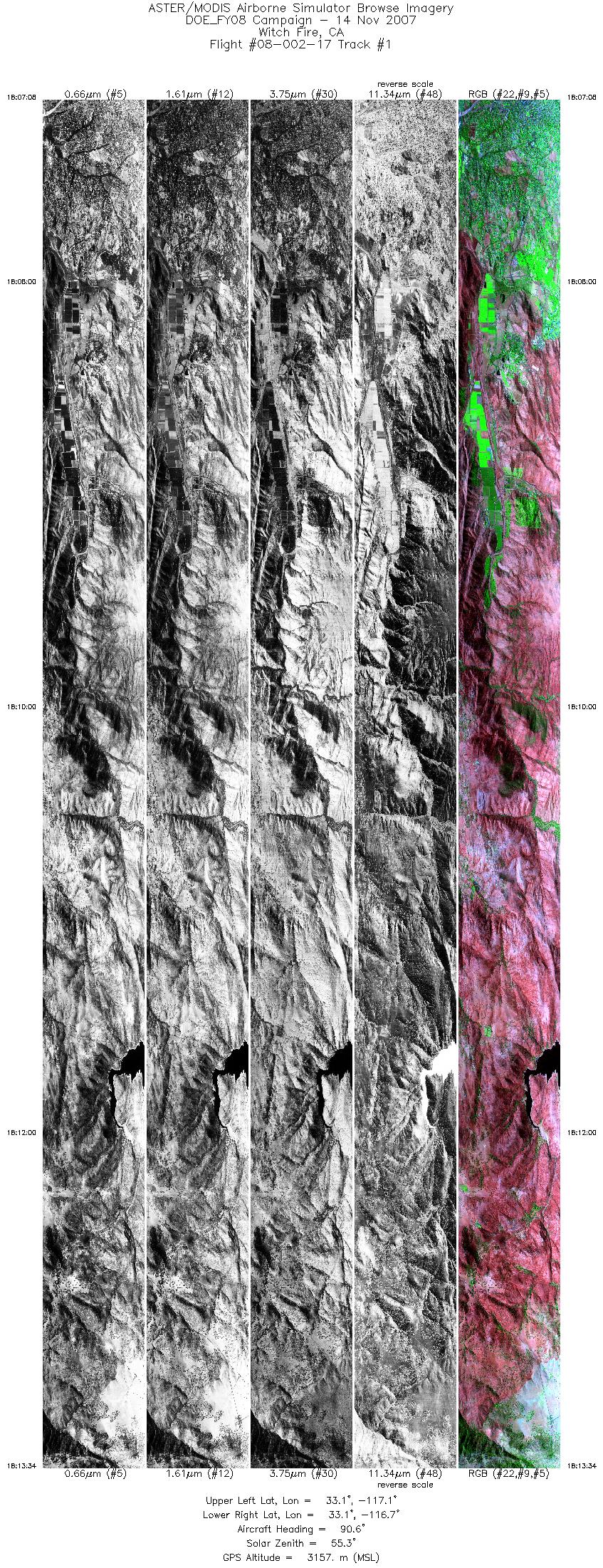
| 1 |
18:07 - 18:13 |
90.0 |
33.097 - 33.095 |
117.073 - 116.659 |
9614 |
3156 |
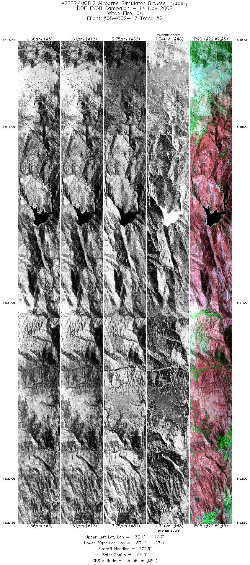
| 2 |
18:18 - 18:23 |
270.8 |
33.113 - 33.116 |
116.655 - 117.012 |
8172 |
3156 |
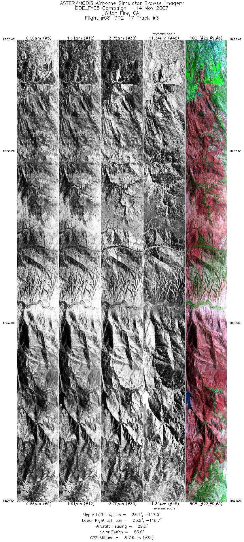
| 3 |
18:28 - 18:34 |
90.0 |
33.135 - 33.133 |
117.046 - 116.707 |
8000 |
3155 |
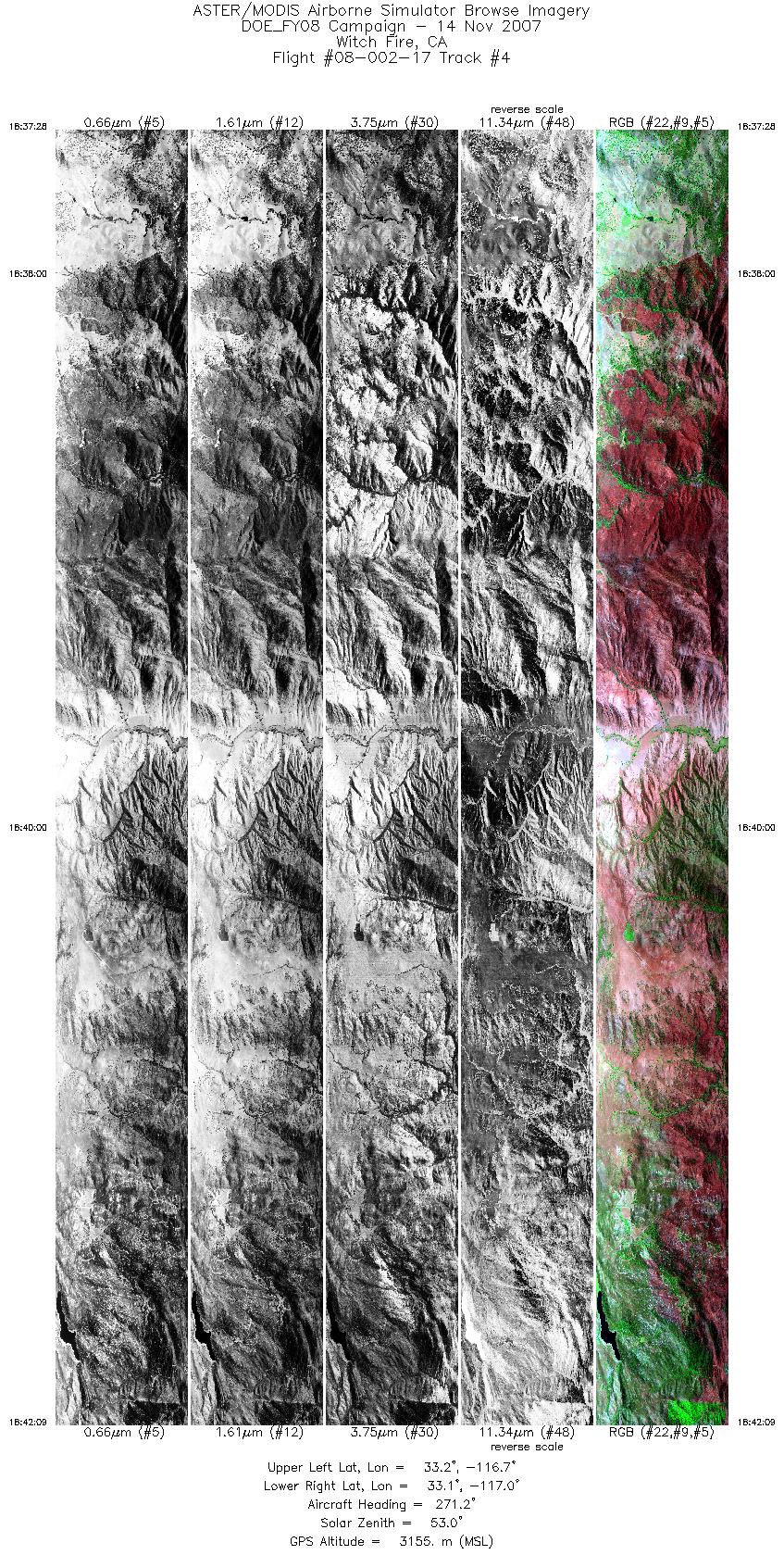
| 4 |
18:37 - 18:42 |
270.9 |
33.152 - 33.154 |
116.707 - 117.022 |
6995 |
3155 |
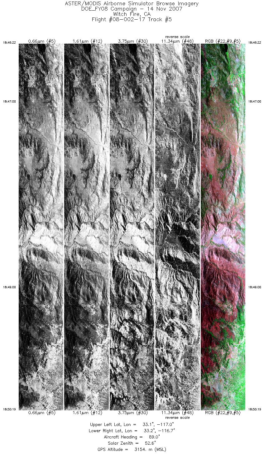
| 5 |
18:46 - 18:50 |
89.9 |
33.173 - 33.171 |
116.992 - 116.736 |
5888 |
3155 |
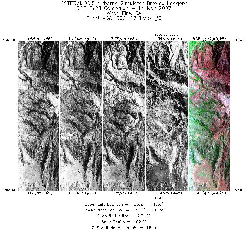
| 6 |
18:55 - 18:56 |
271.4 |
33.192 - 33.193 |
116.809 - 116.925 |
2555 |
3154 |
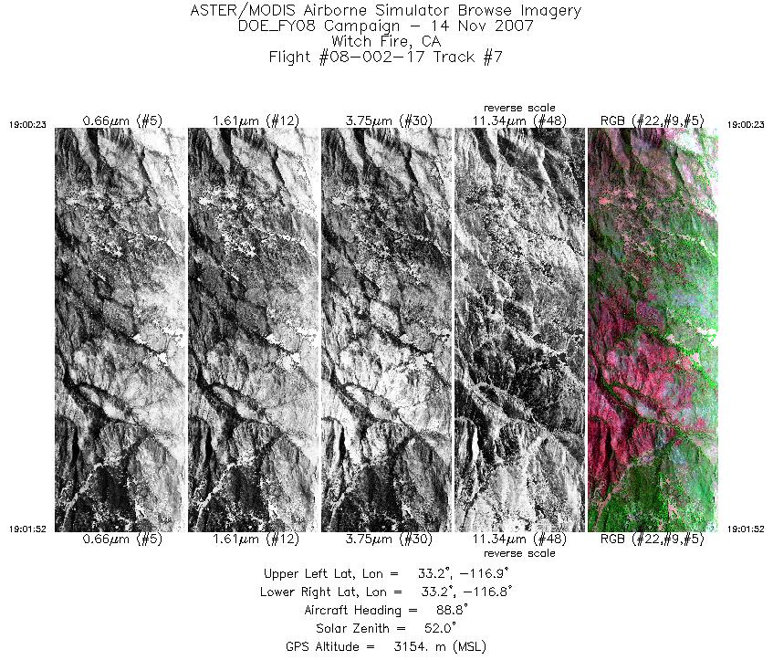
| 7 |
19:00 - 19:01 |
88.8 |
33.215 - 33.215 |
116.897 - 116.802 |
2215 |
3154 |
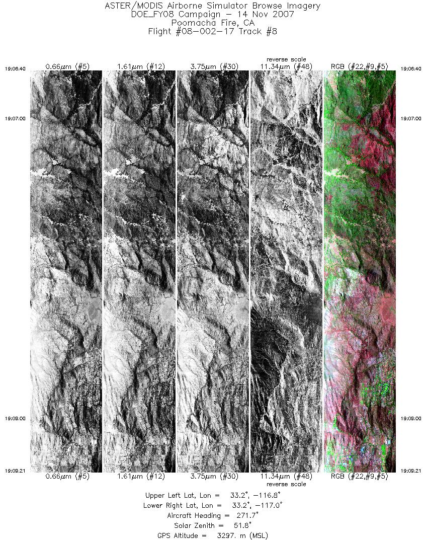
| 8 |
19:06 - 19:09 |
271.0 |
33.220 - 33.221 |
116.804 - 116.985 |
3998 |
3297 |
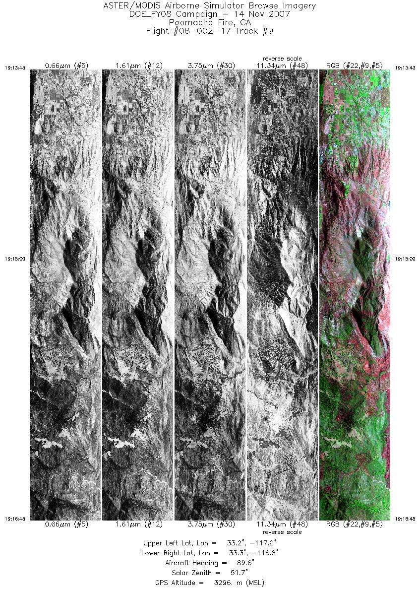
| 9 |
19:13 - 19:16 |
89.3 |
33.241 - 33.240 |
117.012 - 116.813 |
4547 |
3295 |
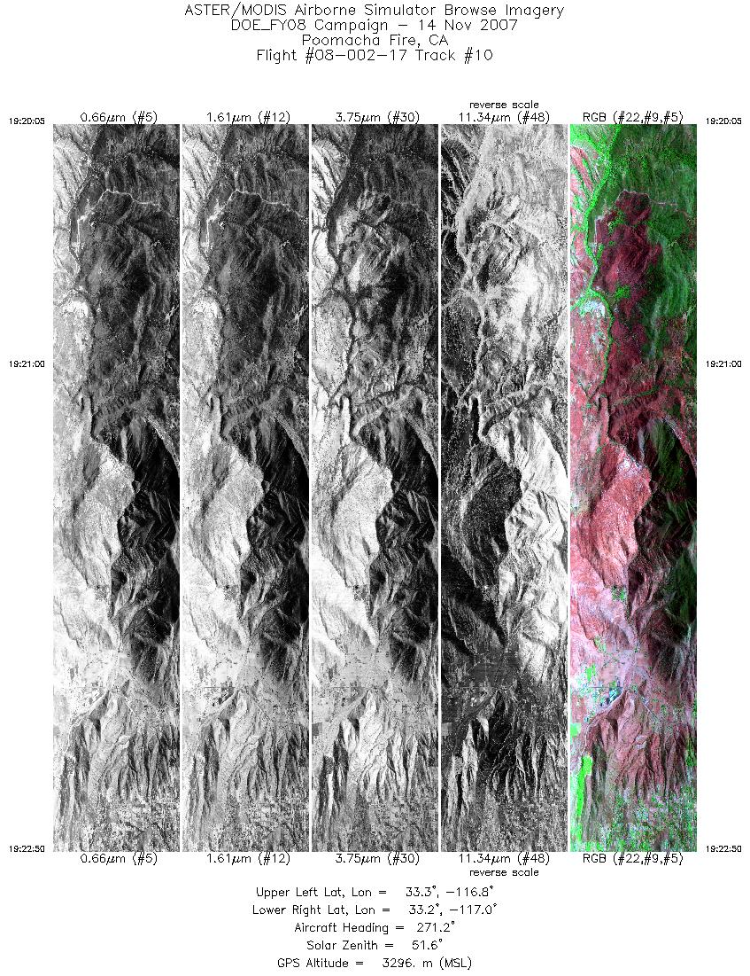
| 10 |
19:20 - 19:22 |
271.4 |
33.260 - 33.261 |
116.812 - 116.997 |
4108 |
3296 |
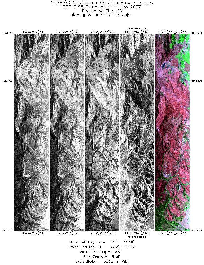
| 11 |
19:26 - 19:29 |
86.9 |
33.279 - 33.278 |
116.983 - 116.806 |
4093 |
3305 |
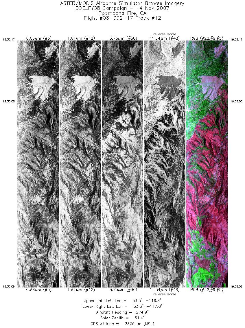
| 12 |
19:32 - 19:35 |
273.9 |
33.296 - 33.297 |
116.783 - 116.974 |
4270 |
3304 |
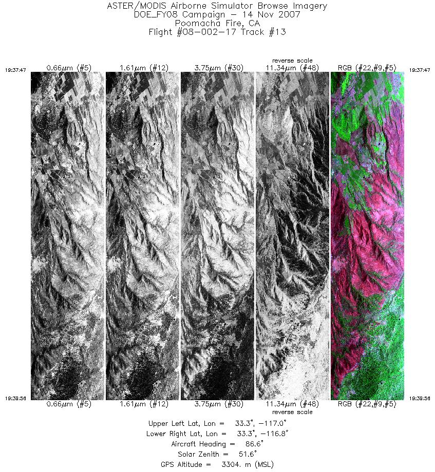
| 13 |
19:37 - 19:39 |
88.4 |
33.314 - 33.314 |
116.986 - 116.846 |
3202 |
3302 |
| 14 |
19:43 - 19:45 |
272.2 |
33.331 - 33.332 |
116.857 - 116.995 |
3038 |
3304 |
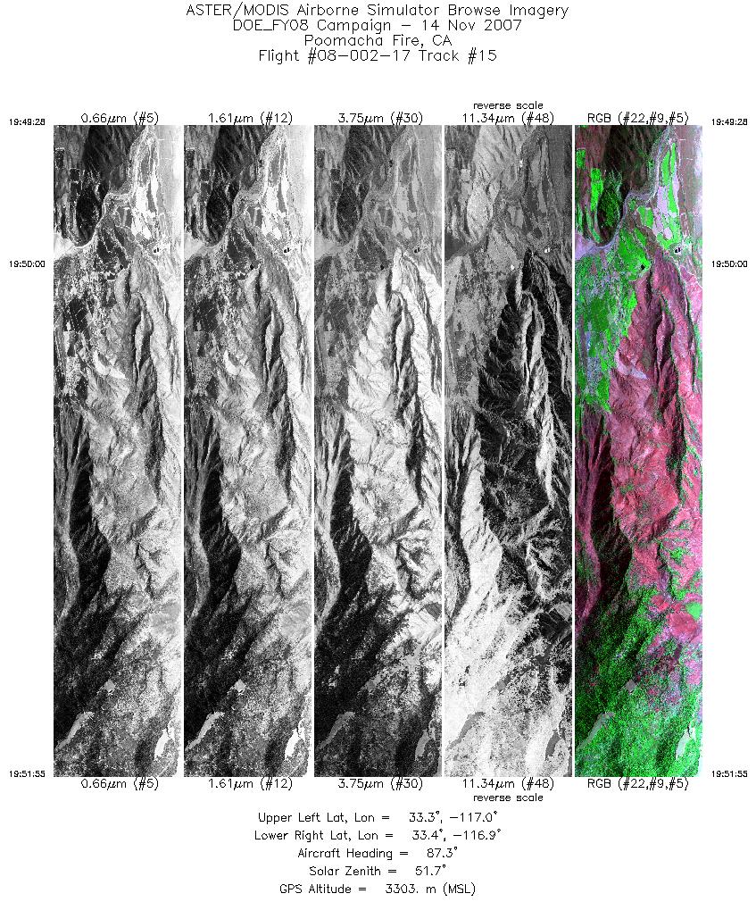
| 15 |
19:49 - 19:51 |
87.2 |
33.348 - 33.348 |
117.044 - 116.885 |
3651 |
3302 |
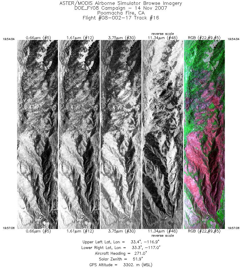
| 16 |
19:54 - 19:57 |
271.8 |
33.364 - 33.365 |
116.875 - 117.025 |
3306 |
3302 |
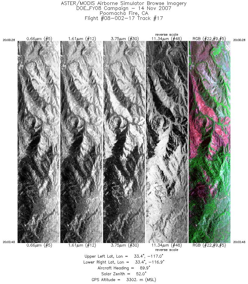
| 17 |
20:00 - 20:02 |
88.8 |
33.383 - 33.383 |
117.034 - 116.884 |
3453 |
3301 |
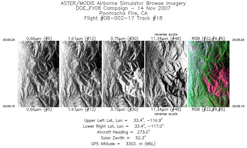
| 18 |
20:05 - 20:06 |
273.3 |
33.405 - 33.405 |
116.936 - 116.988 |
1141 |
3302 |
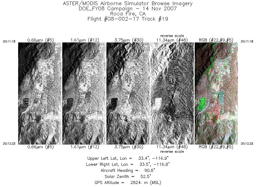
| 19 |
20:11 - 20:12 |
90.6 |
33.448 - 33.448 |
116.908 - 116.835 |
1688 |
2822 |
|


