Flight: 08-002-11
Date: November 12, 2007
Aircraft: DOE B200, #796
Deployment: RSL November 2007
Flight Location: Southern California Fires
Principal Investigator: Hook (JPL), Myers / Coffland (UCSC)
Additional Sensors: None
|
Data Evaluation
Overall data quality is good.
|
Processing Information
Level-1B Data in HDF format is available
Flight Line Summary
Spectral Band Configuration
Spectral Response Function Table
Spectral Response Function (text)
|
Browse Imagery
Flight Tracks: 23
Scanlines: 113718
|
Browse Imagery Table
|
Click a Flight Track number to view a quicklook image
Lat/Lon ranges are for the BEG-END scanline nadir pixels
|
Flight
Track |
Time Span
(UTC) |
Heading
(Deg) |
Lat Range
(Deg N) |
Lon Range
(Deg W) |
Length
(Scanlines) |
Altitude
(Meters) |
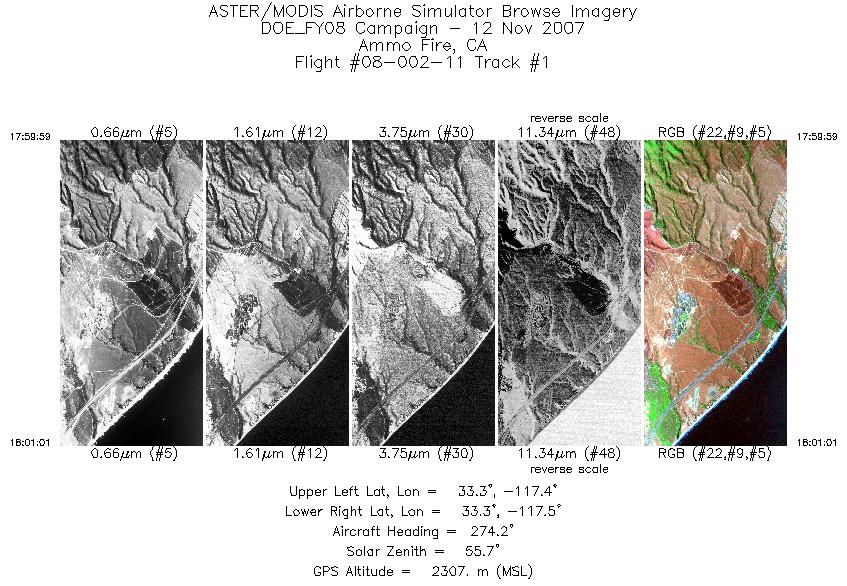
| 1 |
17:59 - 18:01 |
274.1 |
33.281 - 33.282 |
117.401 - 117.468 |
1530 |
2306 |
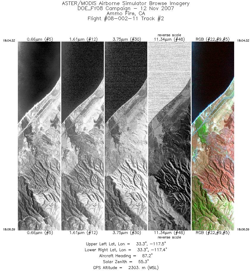
| 2 |
18:04 - 18:06 |
87.2 |
33.306 - 33.305 |
117.522 - 117.383 |
3180 |
2303 |
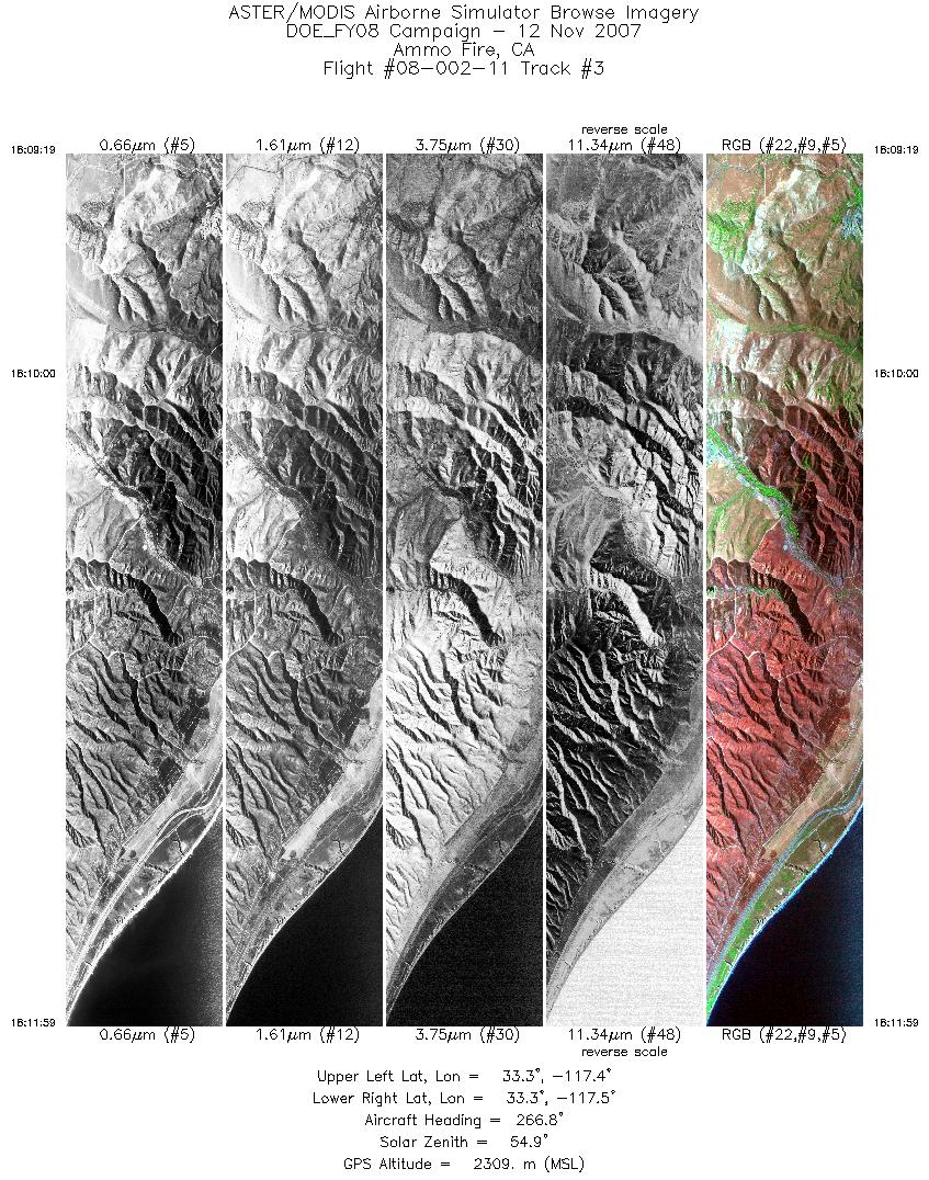
| 3 |
18:09 - 18:11 |
270.0 |
33.327 - 33.327 |
117.353 - 117.526 |
3984 |
2311 |
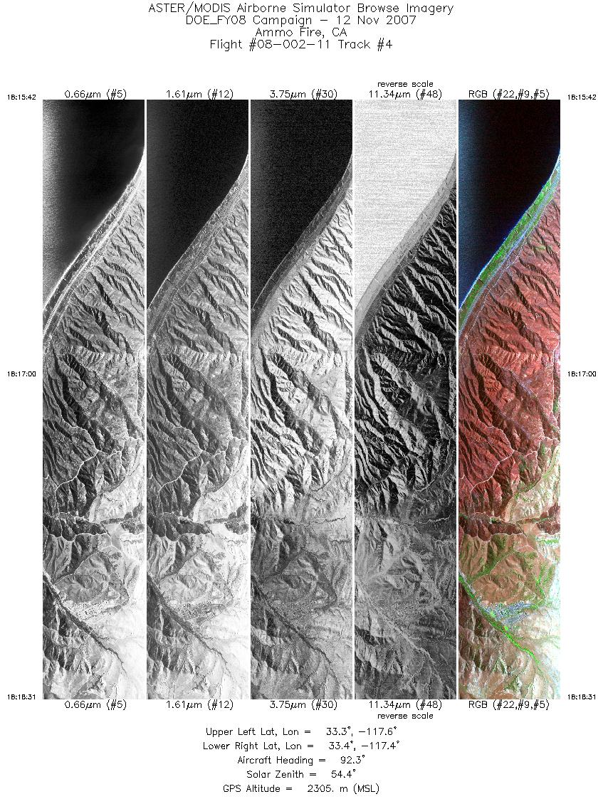
| 4 |
18:15 - 18:18 |
89.4 |
33.348 - 33.349 |
117.568 - 117.383 |
4216 |
2303 |
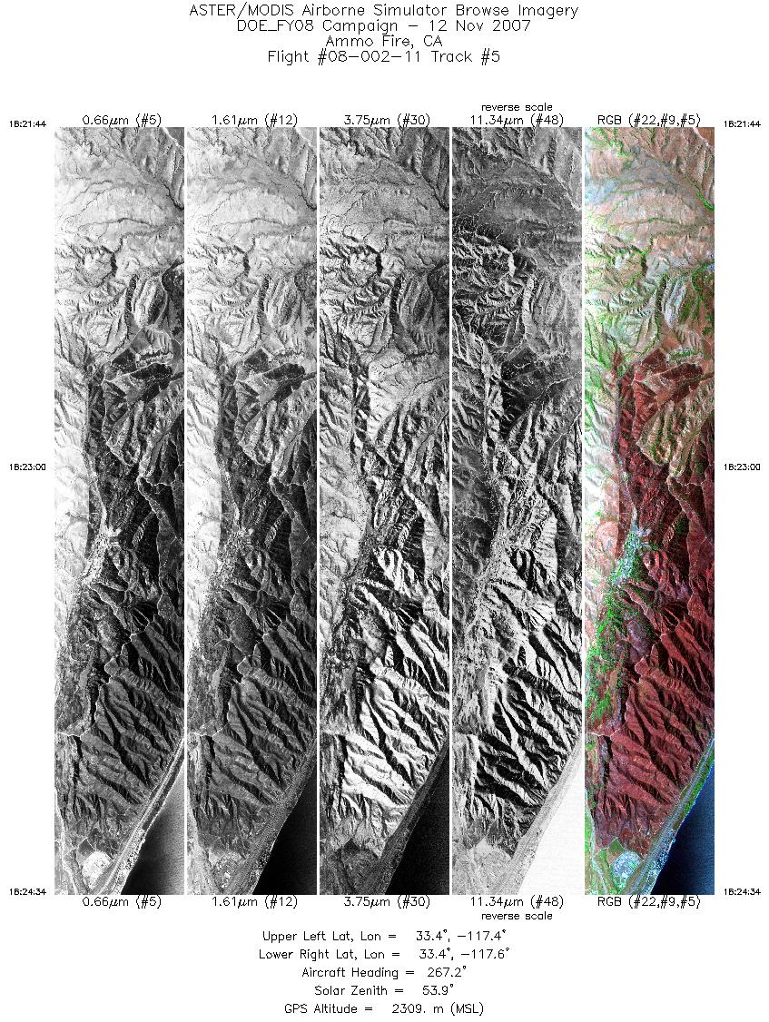
| 5 |
18:21 - 18:24 |
269.5 |
33.371 - 33.372 |
117.379 - 117.565 |
4234 |
2310 |
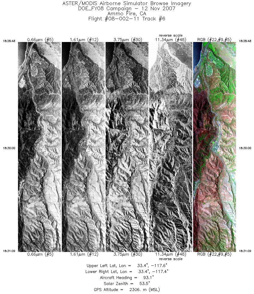
| 6 |
18:28 - 18:31 |
90.7 |
33.392 - 33.392 |
117.587 - 117.433 |
3500 |
2306 |
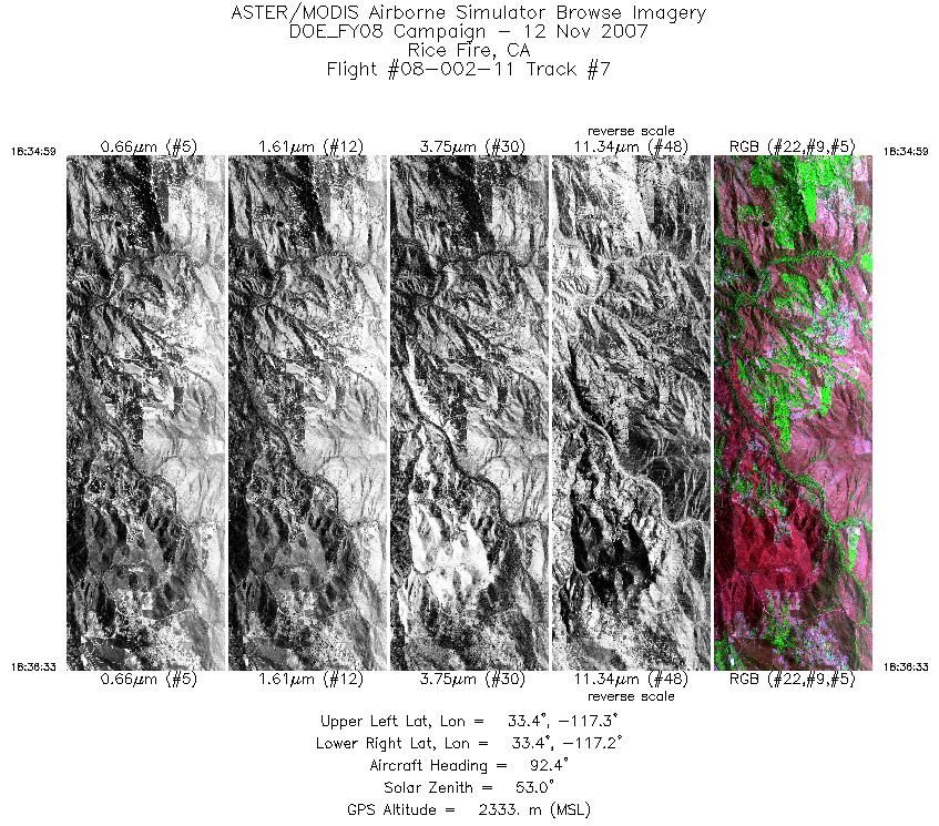
| 7 |
18:34 - 18:36 |
89.7 |
33.420 - 33.421 |
117.267 - 117.166 |
2327 |
2332 |
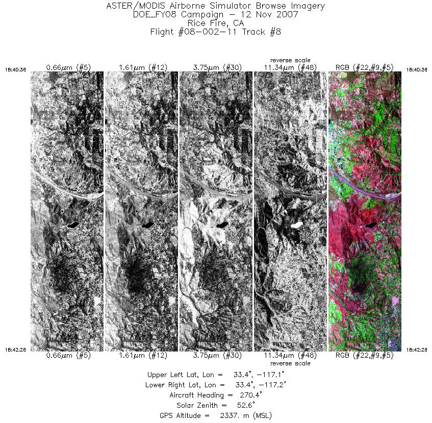
| 8 |
18:40 - 18:42 |
272.3 |
33.400 - 33.399 |
117.118 - 117.242 |
2748 |
2335 |
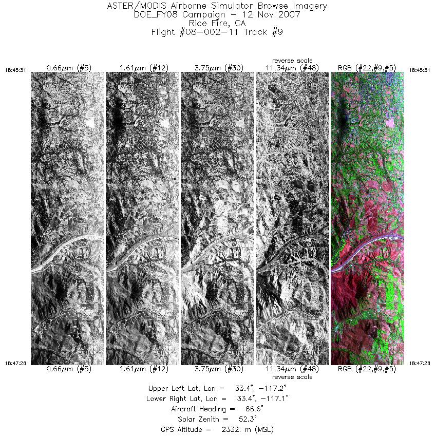
| 9 |
18:45 - 18:47 |
89.2 |
33.377 - 33.376 |
117.240 - 117.119 |
2855 |
2334 |
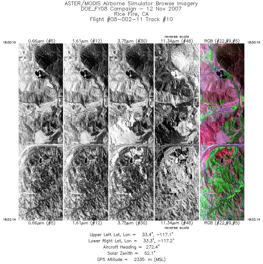
| 10 |
18:50 - 18:52 |
272.4 |
33.354 - 33.354 |
117.087 - 117.213 |
2858 |
2337 |
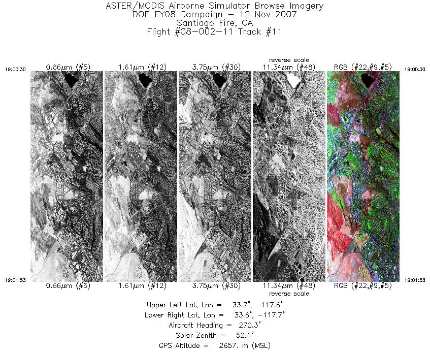
| 11 |
19:00 - 19:01 |
270.8 |
33.662 - 33.662 |
117.625 - 117.720 |
2077 |
2657 |
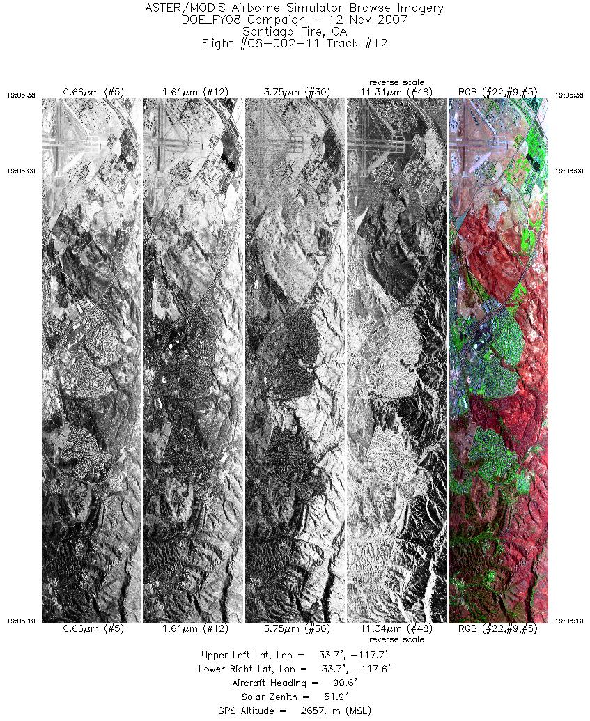
| 12 |
19:05 - 19:08 |
90.4 |
33.684 - 33.684 |
117.742 - 117.574 |
3779 |
2655 |
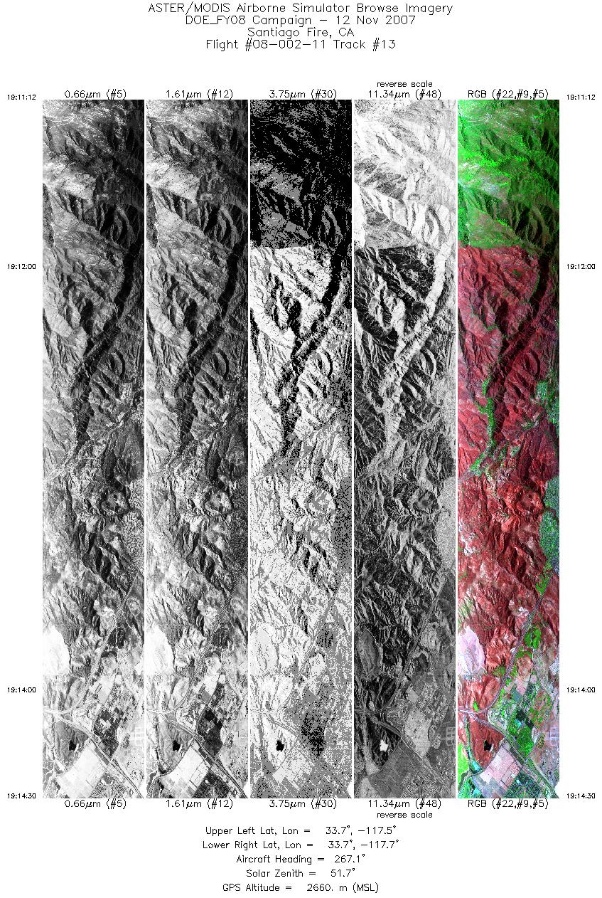
| 13 |
19:11 - 19:14 |
269.4 |
33.703 - 33.703 |
117.530 - 117.748 |
4914 |
2659 |
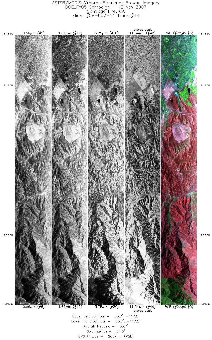
| 14 |
19:17 - 19:20 |
86.6 |
33.716 - 33.717 |
117.785 - 117.547 |
5376 |
2656 |
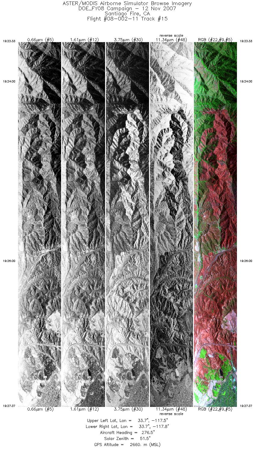
| 15 |
19:23 - 19:27 |
273.6 |
33.730 - 33.733 |
117.500 - 117.766 |
6068 |
2656 |
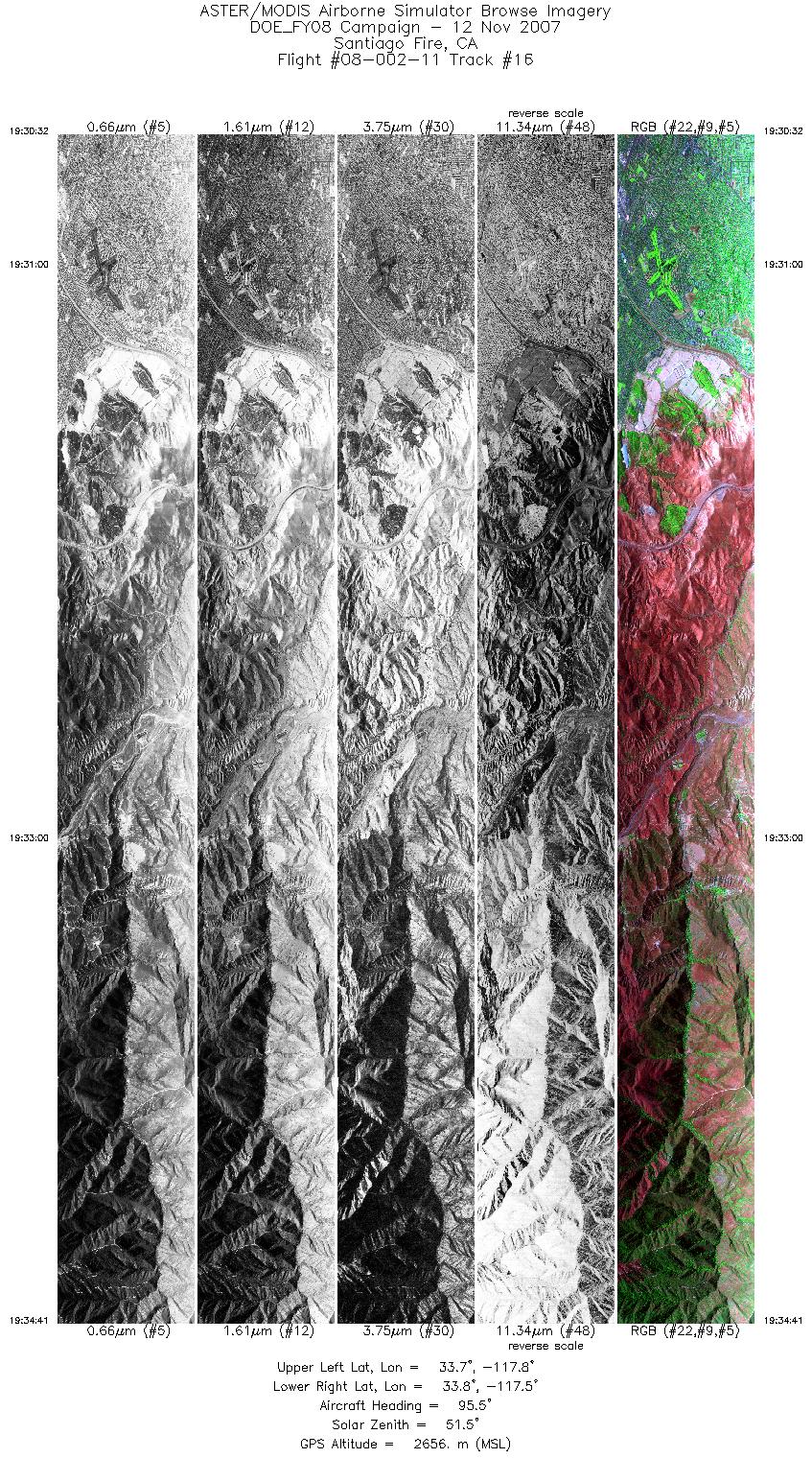
| 16 |
19:30 - 19:34 |
92.5 |
33.747 - 33.746 |
117.812 - 117.538 |
6202 |
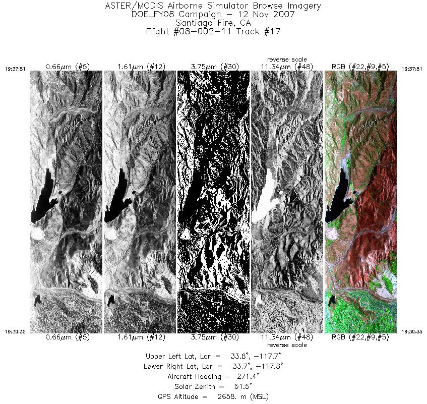
2657 |
| 17 |
19:37 - 19:39 |
271.5 |
33.766 - 33.766 |
117.662 - 117.779 |
2606 |
2658 |
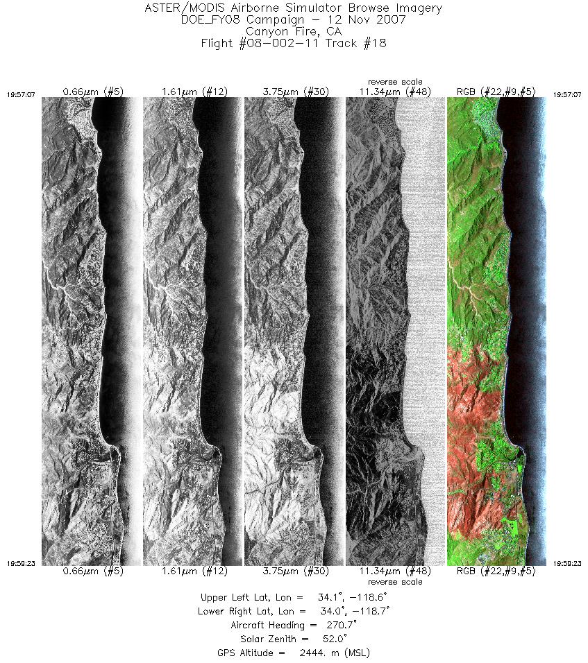
| 18 |
19:57 - 19:59 |
272.9 |
34.042 - 34.042 |
118.565 - 118.720 |
3384 |
2444 |
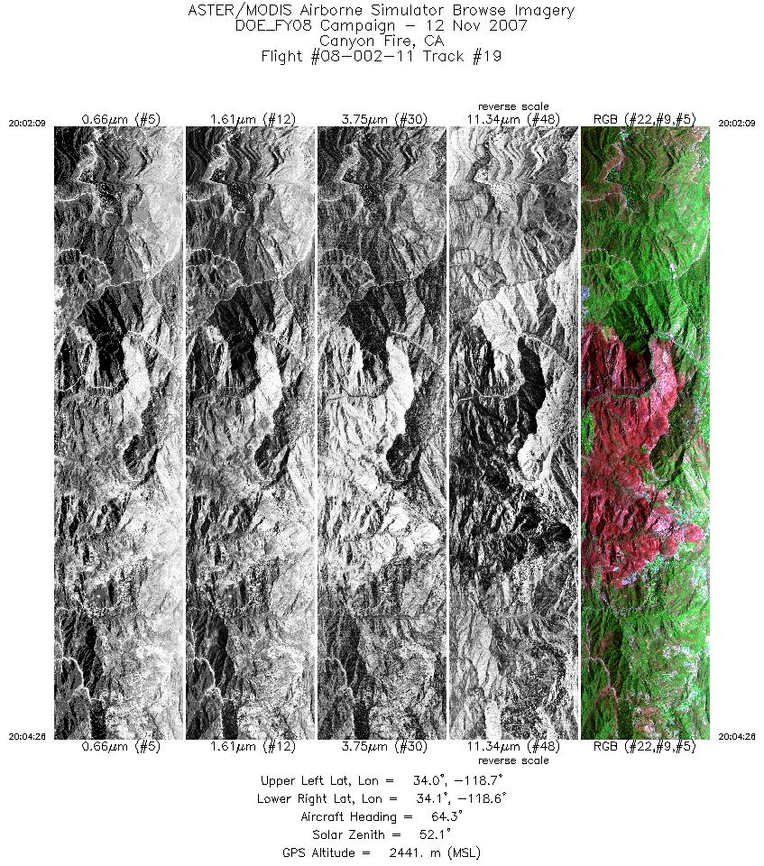
| 19 |
20:02 - 20:04 |
76.7 |
34.064 - 34.064 |
118.754 - 118.606 |
3401 |
2439 |
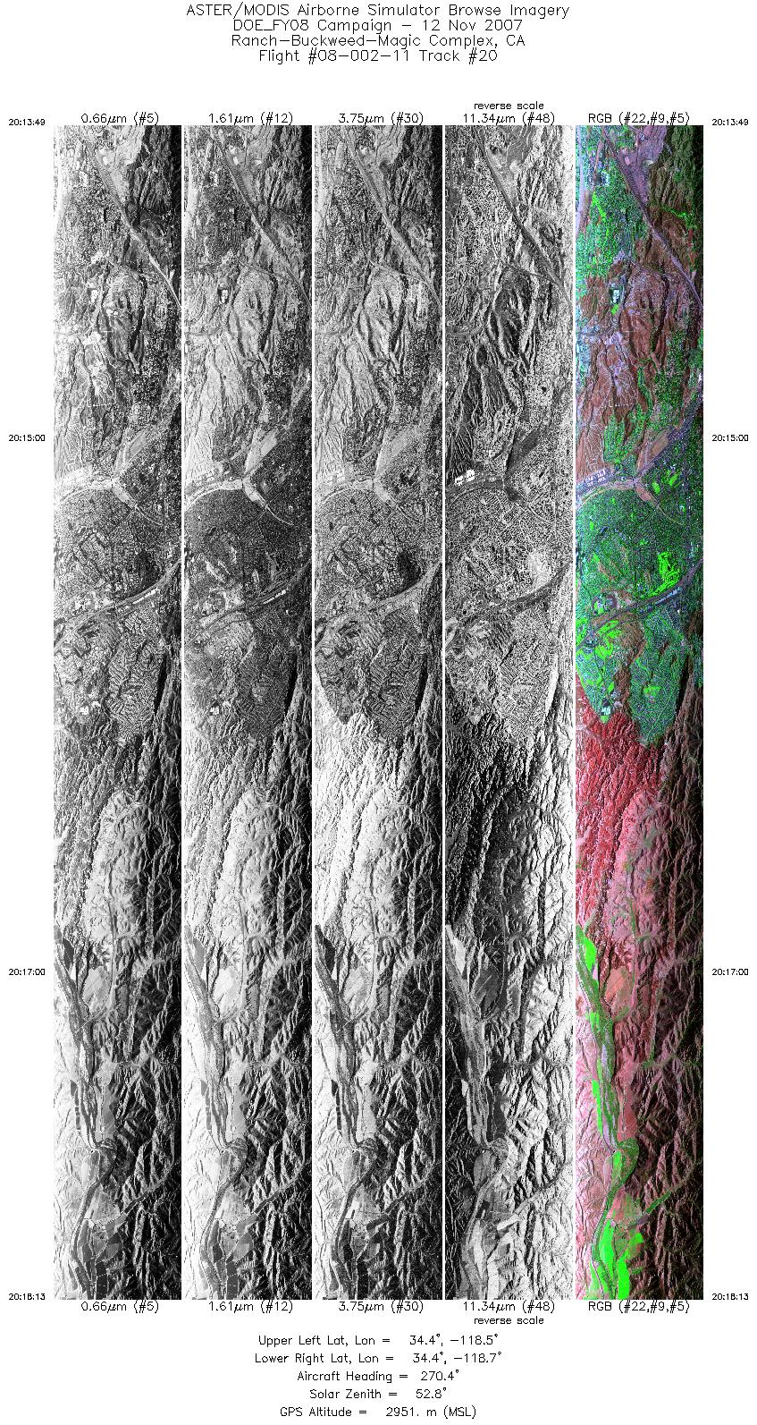
| 20 |
20:13 - 20:18 |
273.3 |
34.393 - 34.395 |
118.454 - 118.744 |
6569 |
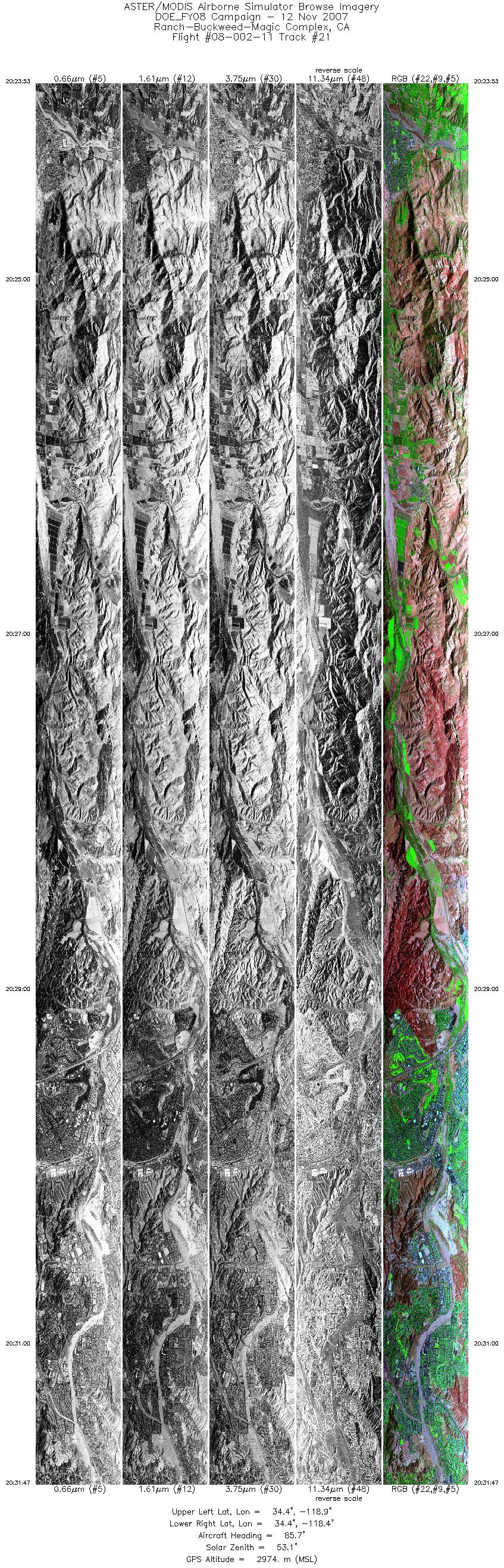
2952 |
| 21 |
20:23 - 20:31 |
87.7 |
34.418 - 34.416 |
118.946 - 118.421 |
11782 |
2970 |
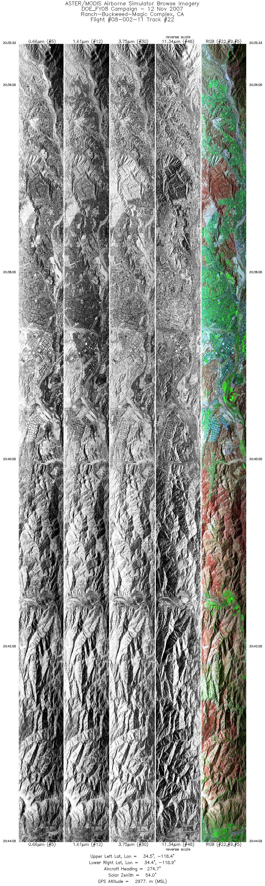
| 22 |
20:35 - 20:44 |
276.8 |
34.436 - 34.439 |
118.354 - 118.933 |
12727 |
2973 |
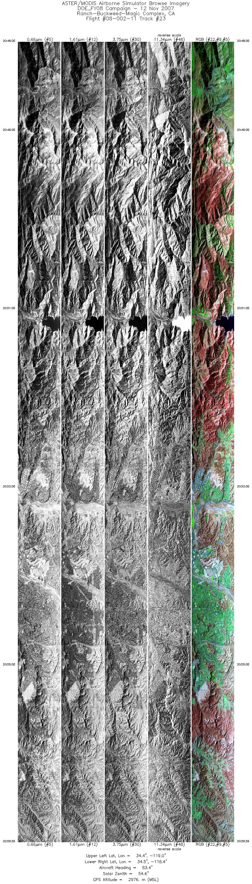
| 23 |
20:48 - 20:56 |
87.8 |
34.460 - 34.457 |
118.960 - 118.360 |
13401 |
2982 |
|


