Flight: 07-601-00
Date: October 2, 2006
Aircraft: NASA ER-2, #806
Deployment: DFRC September 2006
Flight Location: Minnesota & Wisconsin
Principal Investigator: Moeller (UWisc), Hook (JPL)
Additional Sensors: AVIRIS
|
Data Evaluation
Weather: Cloudy skies
|
Processing Information
Level-1B Data in HDF format is available
Flight Line Summary
Spectral Band Configuration
Spectral Response Function Table
Spectral Response Function (text)
|
Browse Imagery
Flight Tracks: 21
Scanlines: 166378
|
Browse Imagery Table
|
Click a Flight Track number to view a quicklook image
Lat/Lon ranges are for the BEG-END scanline nadir pixels
|
Flight
Track |
Time Span
(UTC) |
Heading
(Deg) |
Lat Range
(Deg N) |
Lon Range
(Deg W) |
Length
(Scanlines) |
Altitude
(Meters) |
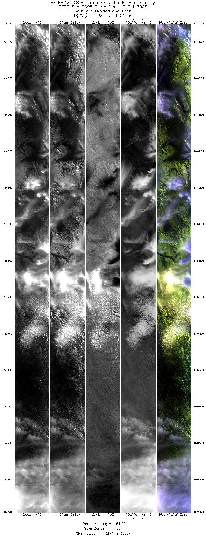
| 1 |
14:40 - 15:07 |
55.2 |
36.062 - 37.849 |
114.815 - 111.742 |
9999 |
19161 |
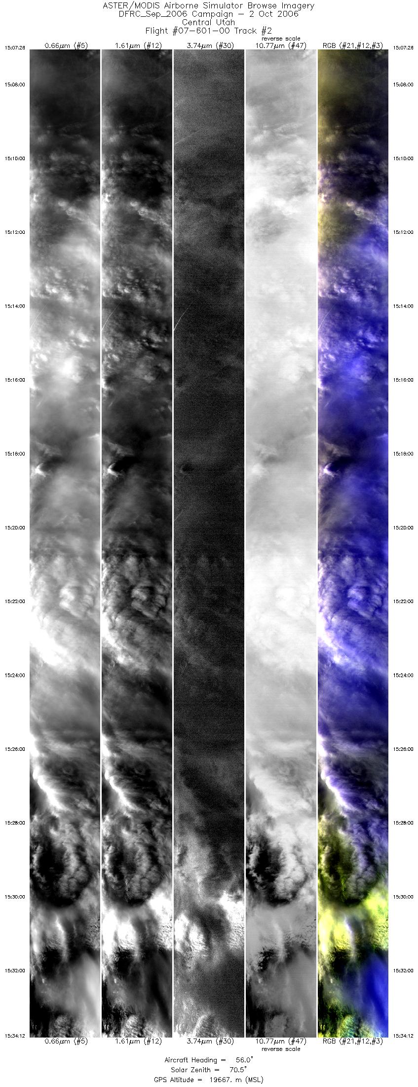
| 2 |
15:07 - 15:34 |
53.8 |
37.849 - 39.689 |
111.741 - 108.630 |
9999 |
19647 |
| 3 |
15:34 - 16:00 |
52.5 |
39.689 - 41.463 |
108.630 - 105.494 |
9999 |
19777 |
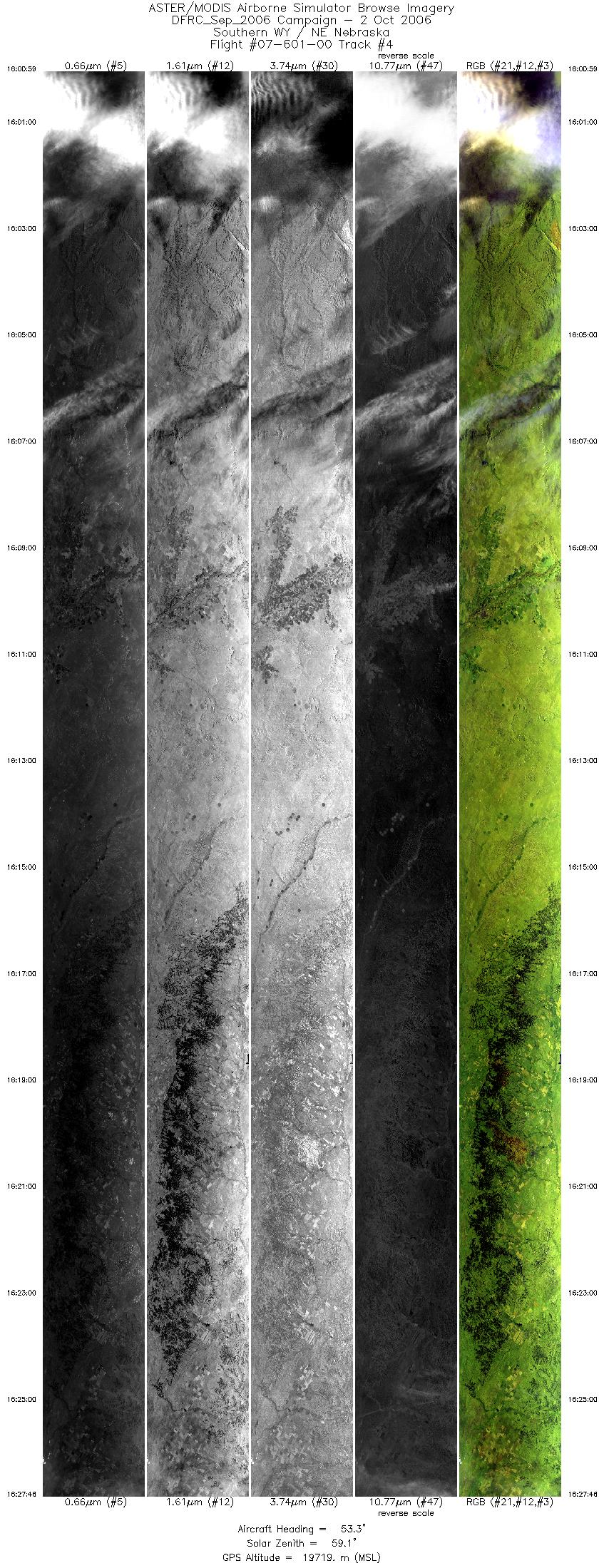
| 4 |
16:00 - 16:27 |
54.3 |
41.463 - 43.188 |
105.494 - 102.132 |
9999 |
19684 |
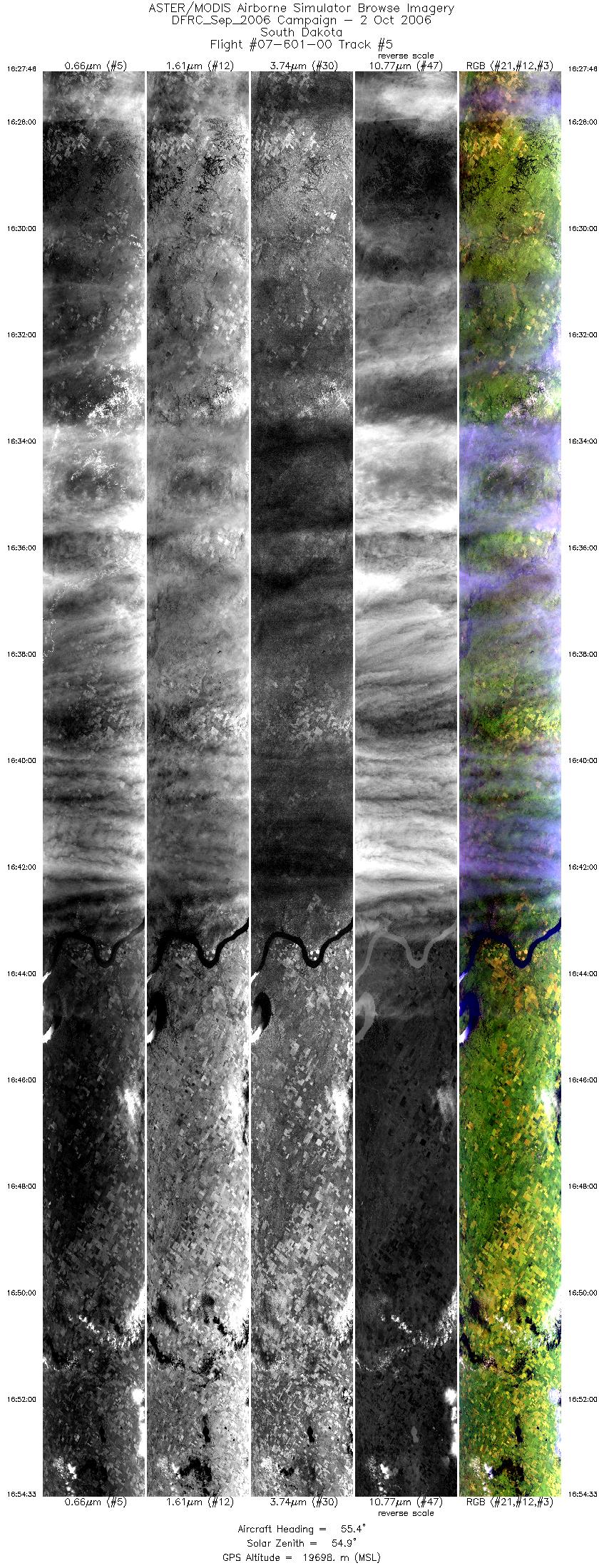
| 5 |
16:27 - 16:54 |
57.0 |
43.189 - 44.845 |
102.132 - 98.500 |
9999 |
19703 |
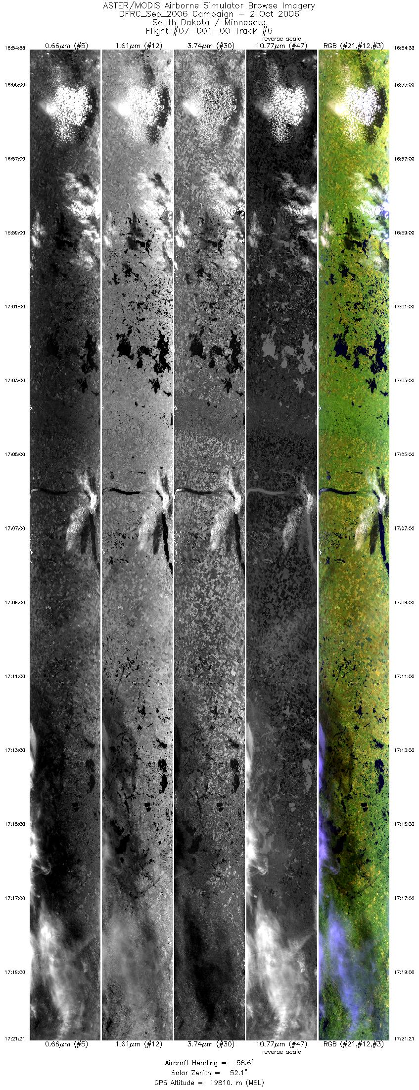
| 6 |
16:54 - 17:21 |
60.2 |
44.845 - 46.390 |
98.499 - 94.632 |
9999 |
19840 |
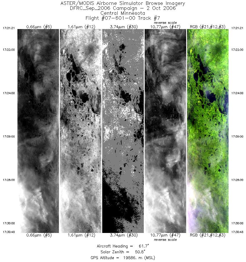
| 7 |
17:21 - 17:30 |
65.0 |
46.390 - 46.887 |
94.632 - 93.199 |
3511 |
19891 |
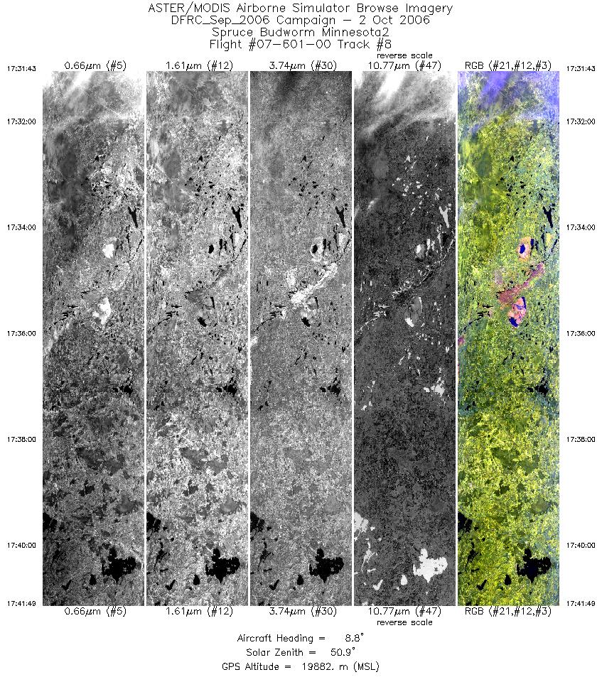
| 8 |
17:31 - 17:41 |
9.9 |
46.972 - 48.139 |
93.100 - 92.786 |
3767 |
19865 |
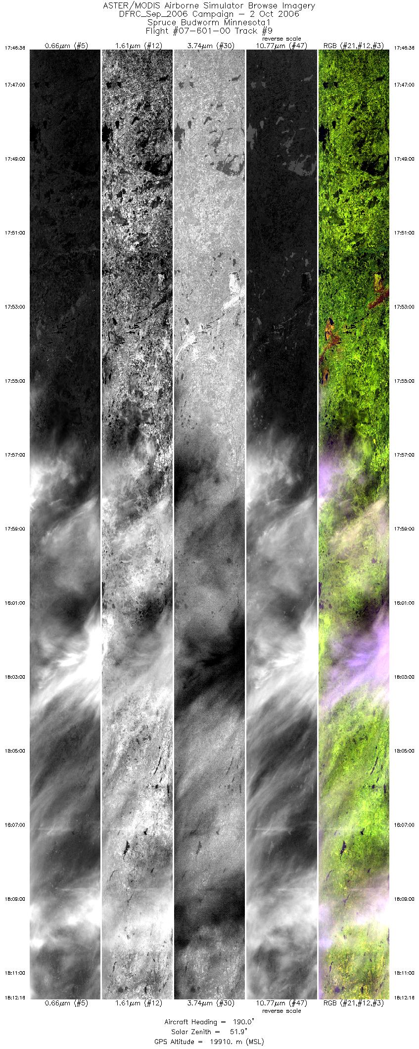
| 9 |
17:46 - 18:12 |
190.9 |
48.280 - 45.532 |
92.605 - 93.348 |
9580 |
19813 |
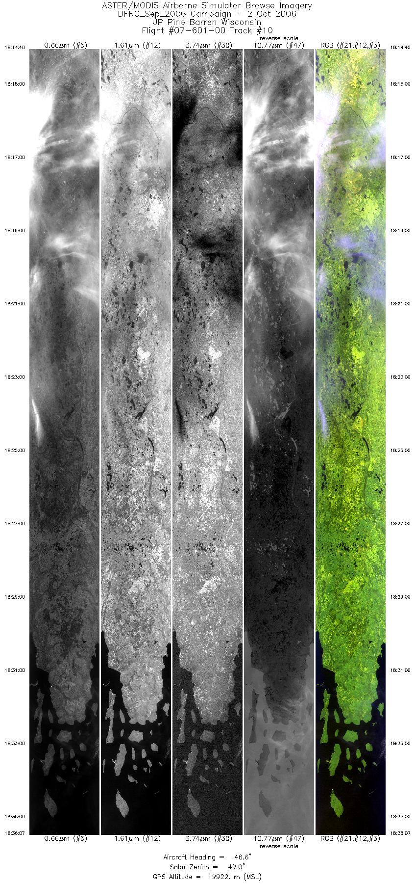
| 10 |
18:14 - 18:36 |
48.2 |
45.456 - 47.152 |
93.083 - 90.379 |
8006 |
19806 |
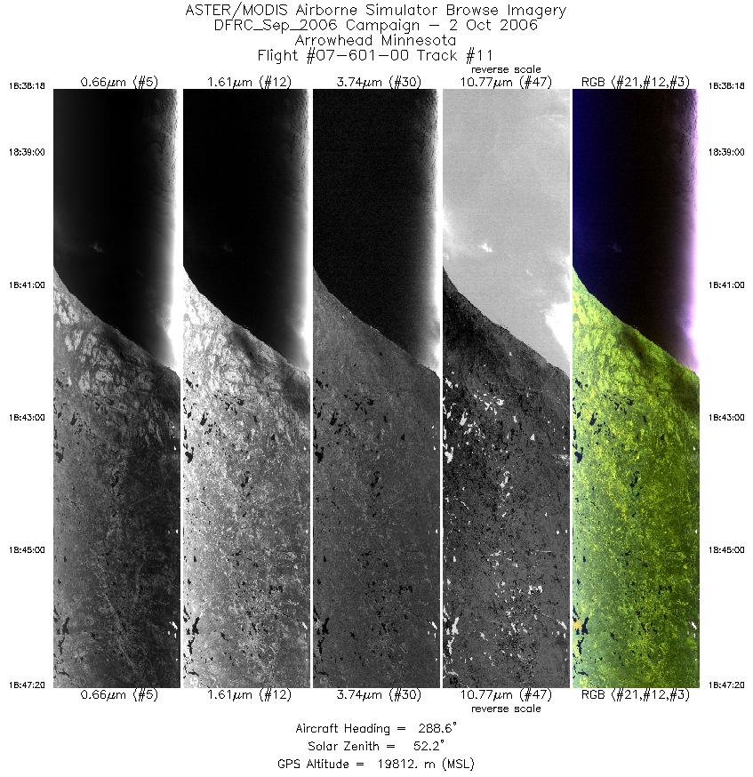
| 11 |
18:38 - 18:47 |
289.2 |
47.364 - 47.743 |
90.376 - 91.758 |
3373 |
19807 |
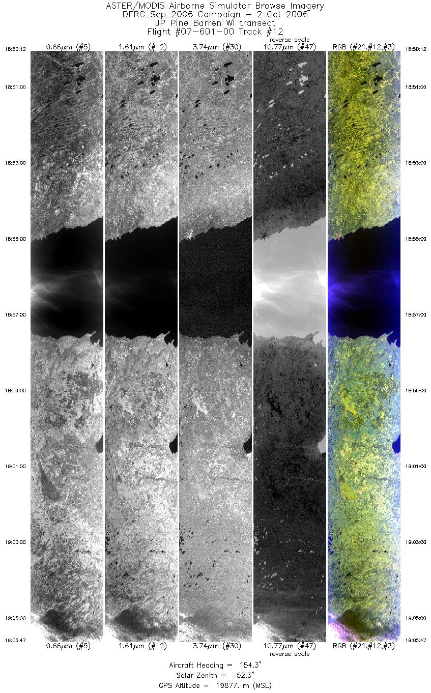
| 12 |
18:50 - 19:05 |
153.6 |
47.545 - 46.045 |
91.930 - 90.685 |
5812 |
19771 |
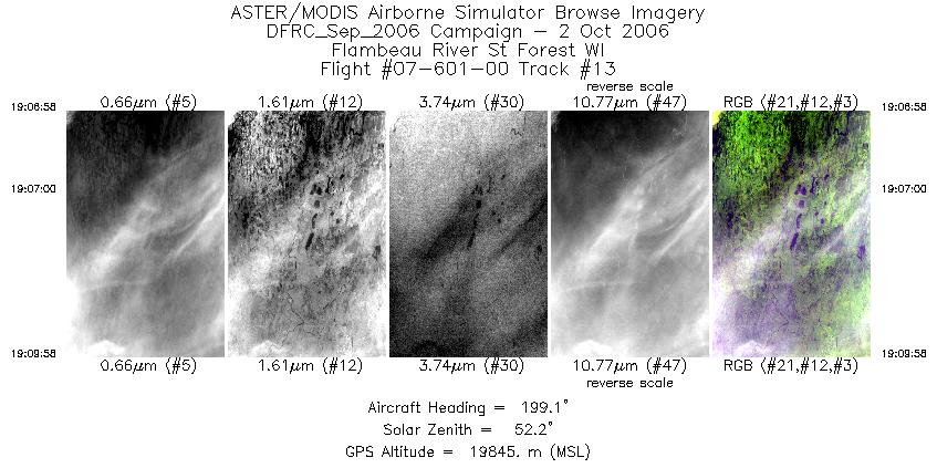
| 13 |
19:06 - 19:09 |
197.9 |
45.917 - 45.600 |
90.669 - 90.794 |
1117 |
19872 |
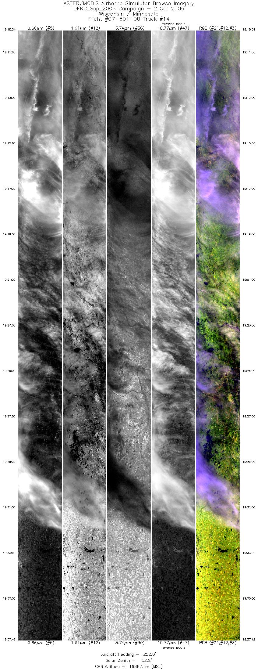
| 14 |
19:10 - 19:37 |
251.1 |
45.528 - 44.544 |
90.890 - 94.792 |
9999 |
19802 |
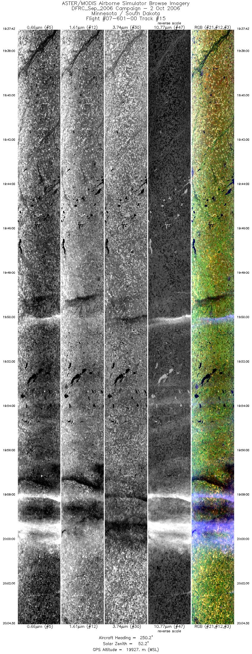
| 15 |
19:37 - 20:04 |
248.3 |
44.544 - 43.434 |
94.792 - 98.542 |
9999 |
19896 |
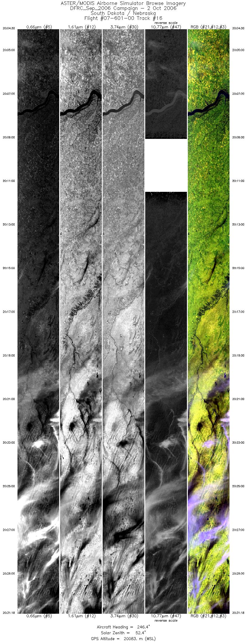
| 16 |
20:04 - 20:31 |
245.2 |
43.434 - 42.214 |
98.542 - 102.132 |
9999 |
20079 |
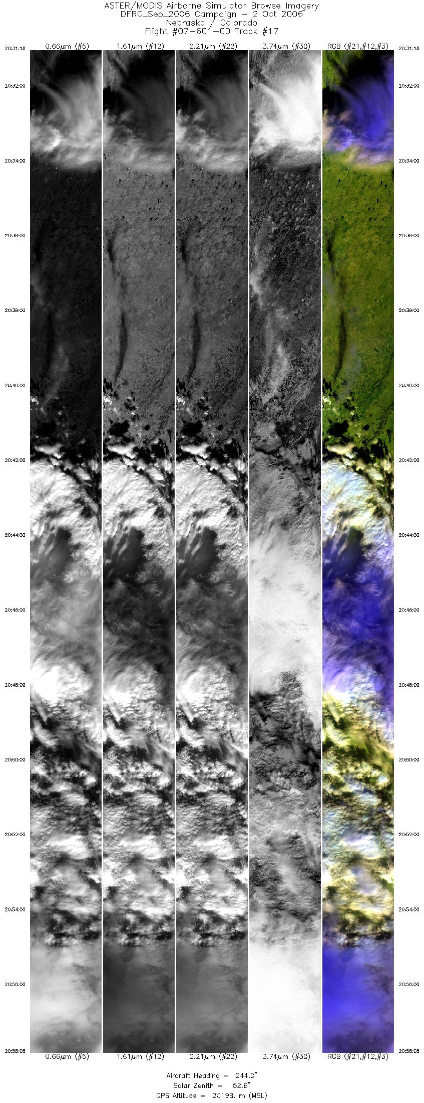
| 17 |
20:31 - 20:58 |
242.0 |
42.214 - 40.846 |
102.133 - 105.620 |
9999 |
20193 |
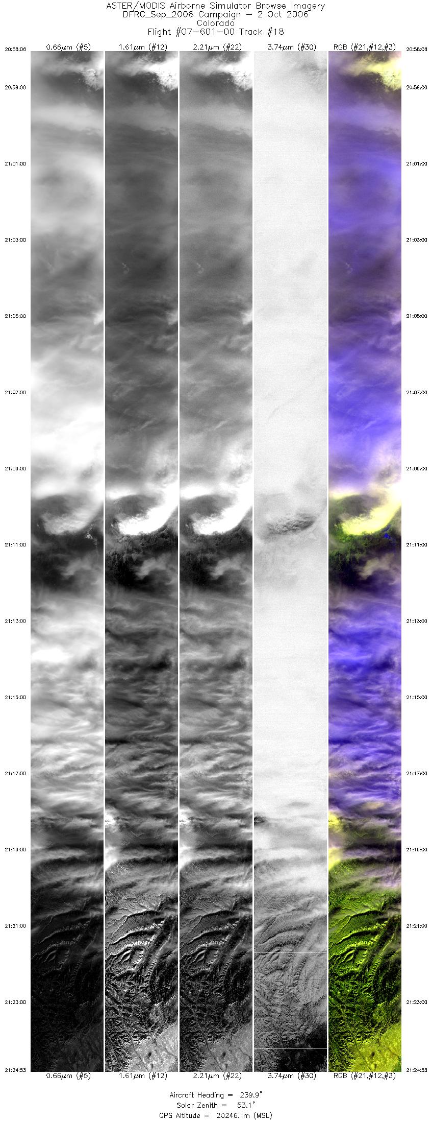
| 18 |
20:58 - 21:24 |
238.6 |
40.846 - 39.338 |
105.620 - 108.867 |
9999 |
20232 |
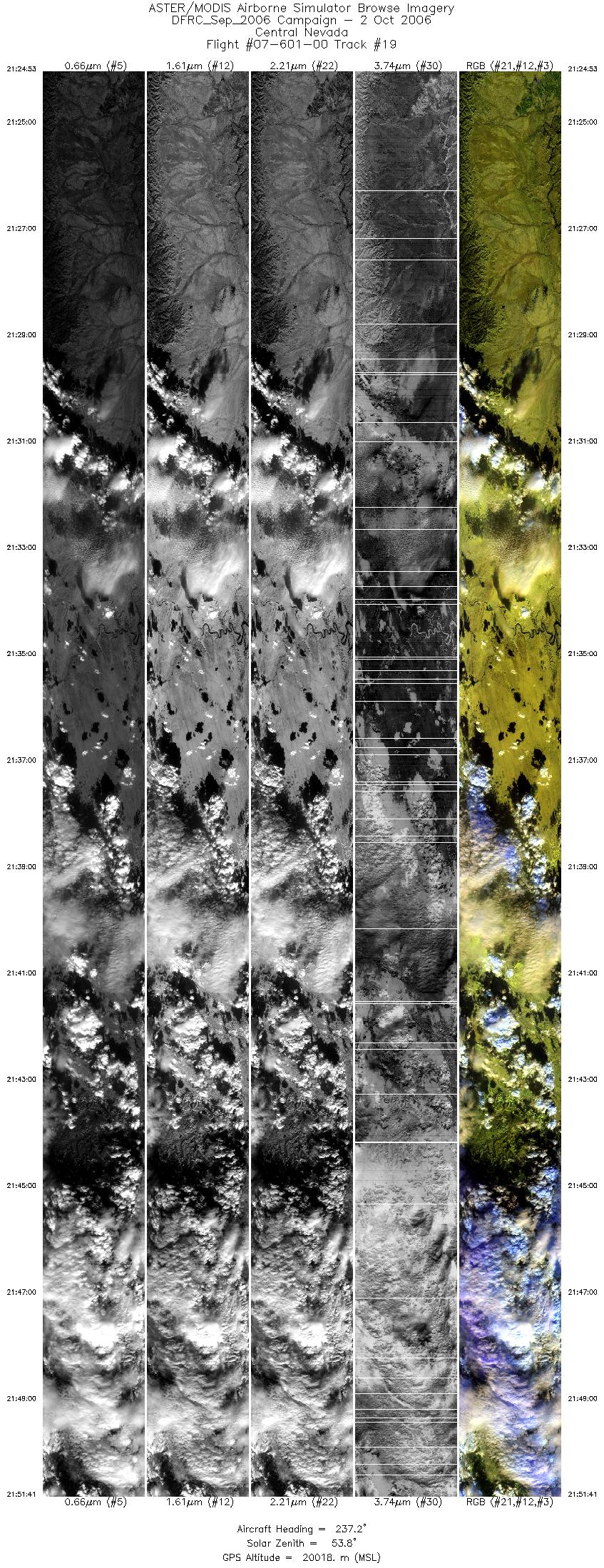
| 19 |
21:24 - 21:51 |
236.0 |
39.338 - 37.703 |
108.868 - 112.003 |
9999 |
20129 |
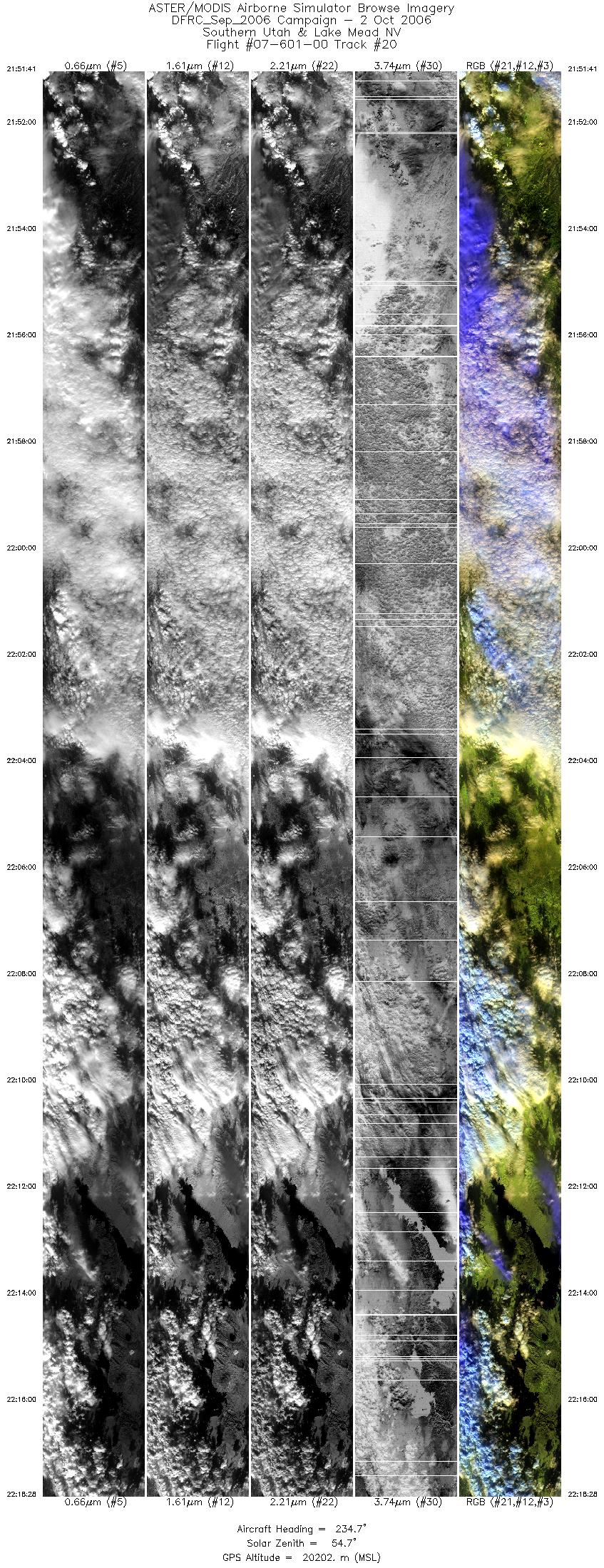
| 20 |
21:51 - 22:18 |
233.5 |
37.703 - 35.963 |
112.003 - 114.981 |
9999 |
20152 |
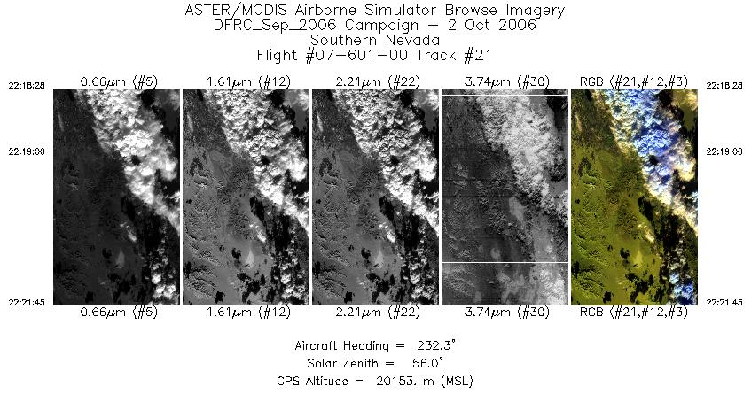
| 21 |
22:18 - 22:21 |
232.4 |
35.962 - 35.744 |
114.981 - 115.338 |
1225 |
20160 |
|


