Flight: 07-004-04
Date: September 01, 2007
Aircraft: DOE B200, #796
Deployment: RSL August 2007
Flight Location: Southern California
Principal Investigator: Peltzer (NASA-JPL)
Additional Sensors: None
|
Data Evaluation
Overall data quality is good.
|
Processing Information
Level-1B Data in HDF format is available
Flight Line Summary
Spectral Band Configuration
Spectral Response Function Table
Spectral Response Function (text)
|
Browse Imagery
Flight Tracks: 16
Scanlines: 68806
|
Browse Imagery Table
|
Click a Flight Track number to view a quicklook image
Lat/Lon ranges are for the BEG-END scanline nadir pixels
|
Flight
Track |
Time Span
(UTC) |
Heading
(Deg) |
Lat Range
(Deg N) |
Lon Range
(Deg W) |
Length
(Scanlines) |
Altitude
(Meters) |
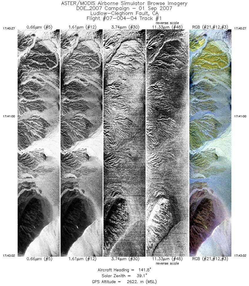
| 1 |
17:40 - 17:43 |
140.5 |
34.999 - 34.908 |
116.289 - 116.191 |
3866 |
2621 |
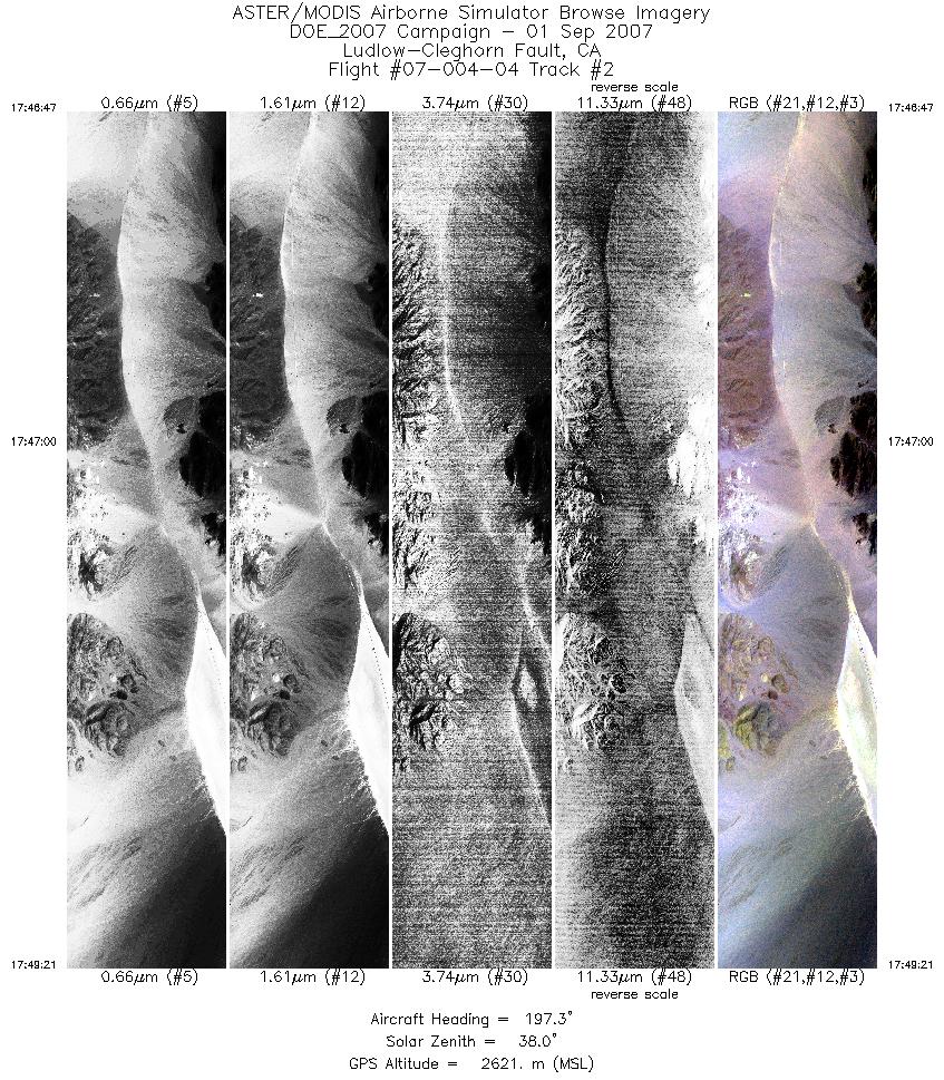
| 2 |
17:46 - 17:49 |
194.5 |
34.940 - 34.825 |
116.188 - 116.220 |
3847 |
2621 |
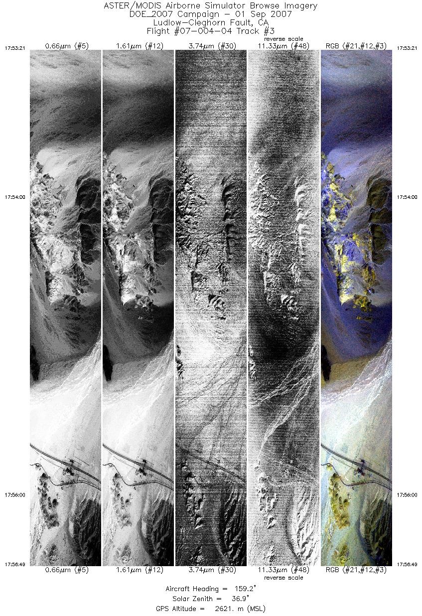
| 3 |
17:53 - 17:56 |
158.6 |
34.844 - 34.695 |
116.224 - 116.151 |
5181 |
2621 |
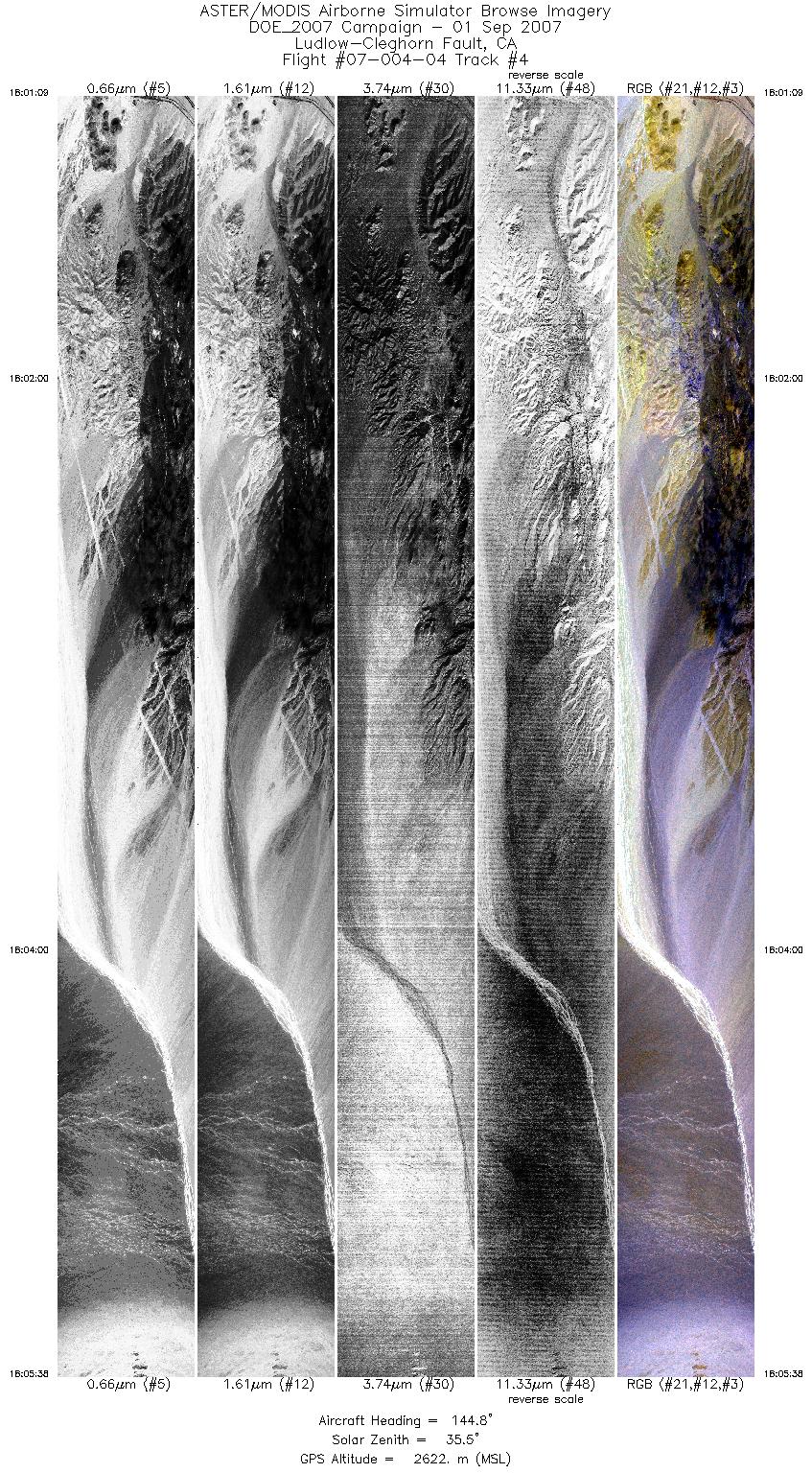
| 4 |
18:01 - 18:05 |
143.9 |
34.717 - 34.552 |
116.166 - 116.012 |
6684 |
2621 |
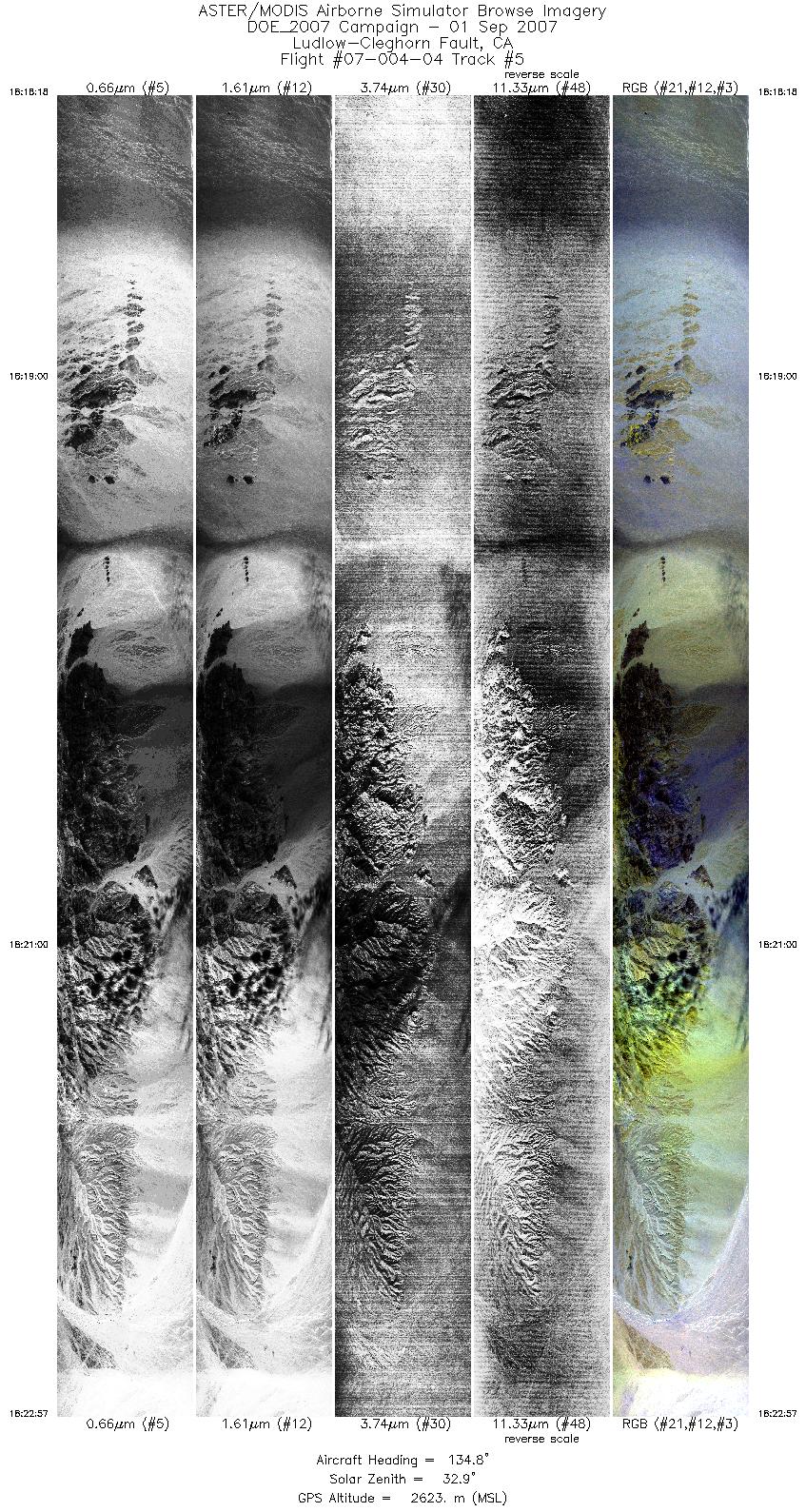
| 5 |
18:18 - 18:22 |
134.6 |
34.576 - 34.424 |
116.041 - 115.857 |
6949 |
2624 |
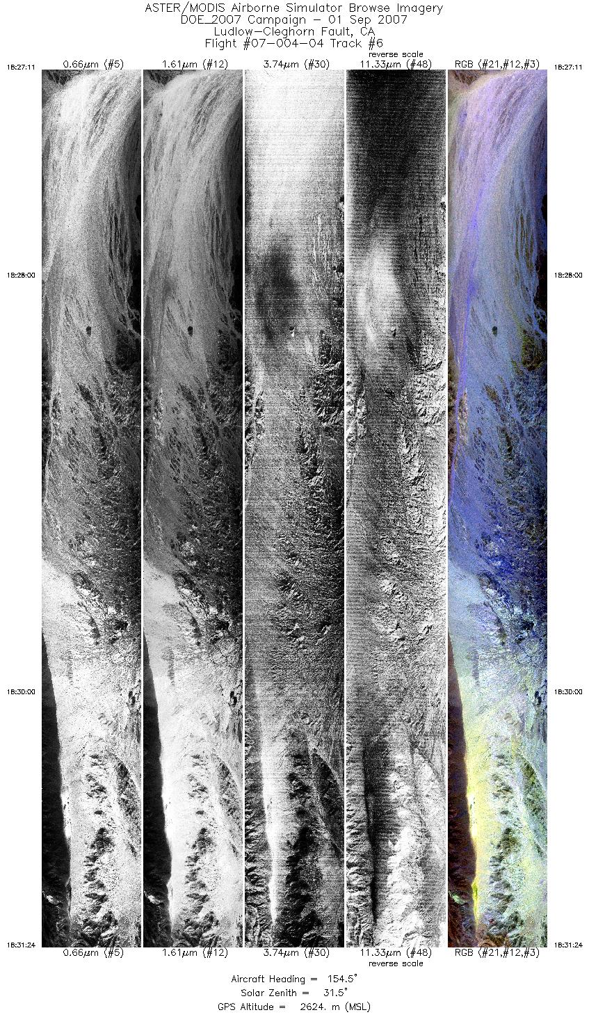
| 6 |
18:27 - 18:31 |
156.4 |
34.430 - 34.251 |
115.863 - 115.777 |
6310 |
2624 |
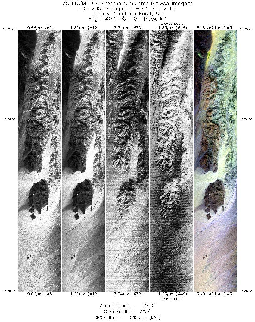
| 7 |
18:35 - 18:38 |
142.8 |
34.273 - 34.168 |
115.794 - 115.693 |
4337 |
2622 |
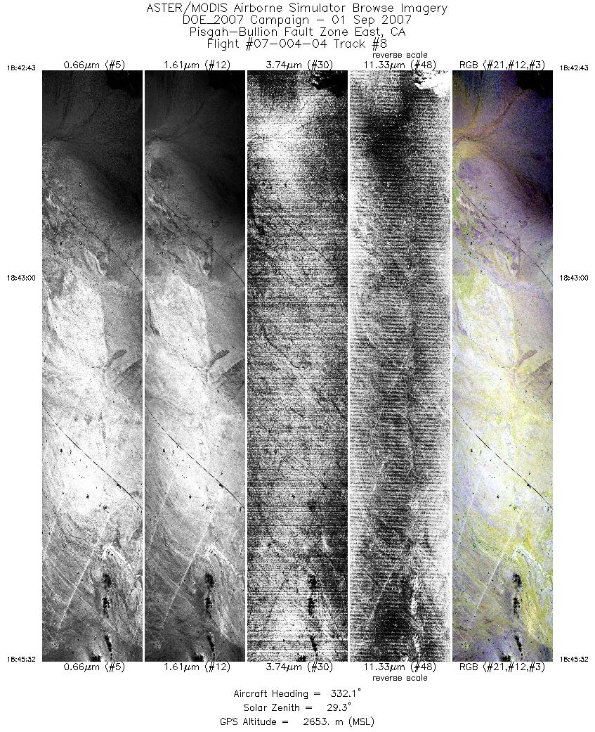
| 8 |
18:42 - 18:45 |
329.3 |
34.091 - 34.205 |
115.838 - 115.921 |
4209 |
2653 |
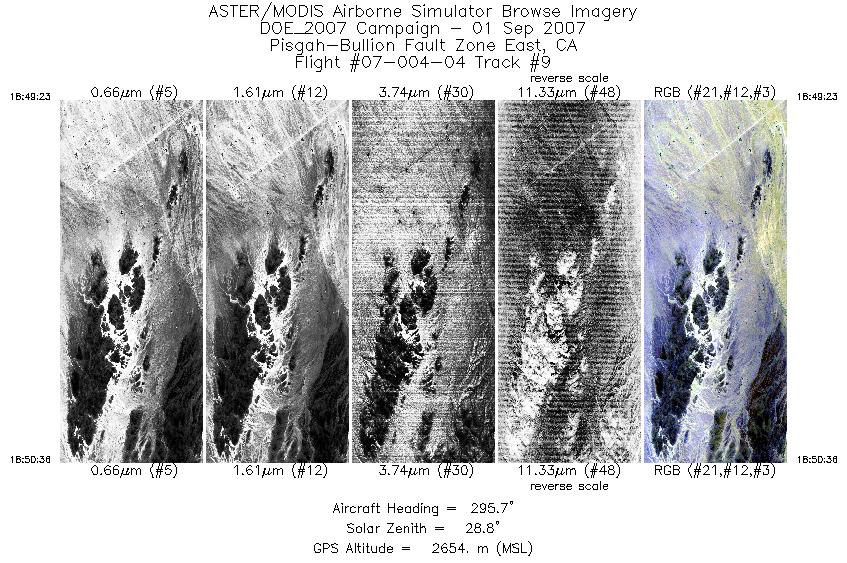
| 9 |
18:49 - 18:50 |
292.9 |
34.192 - 34.216 |
115.897 - 115.958 |
1815 |
2654 |
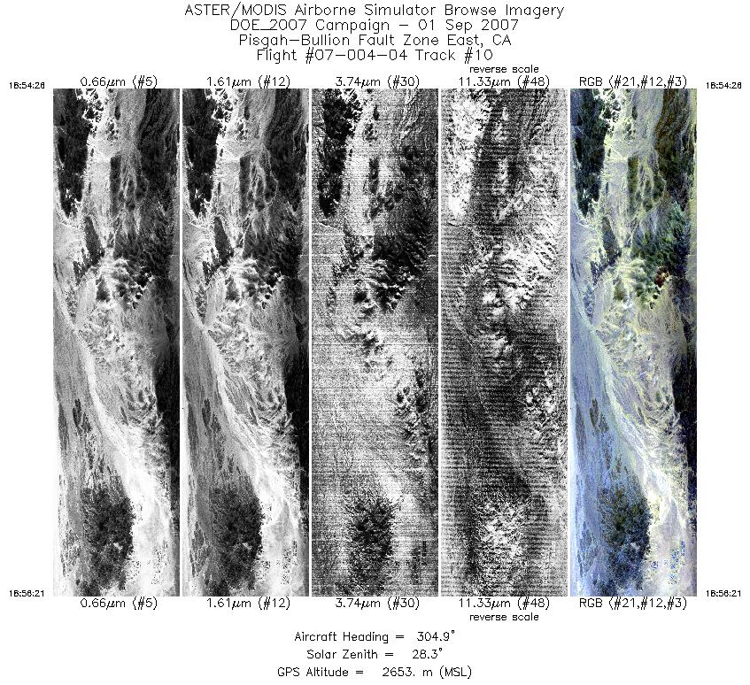
| 10 |
18:54 - 18:56 |
305.6 |
34.205 - 34.260 |
115.938 - 116.023 |
2872 |
2653 |
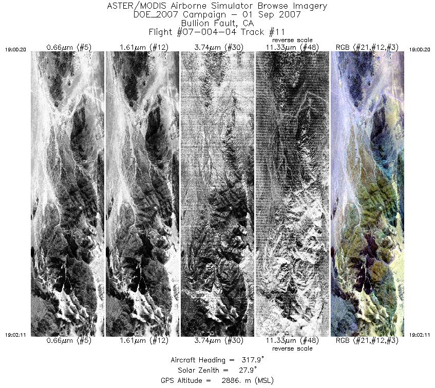
| 11 |
19:00 - 19:02 |
318.2 |
34.254 - 34.322 |
116.015 - 116.083 |
2780 |
2885 |
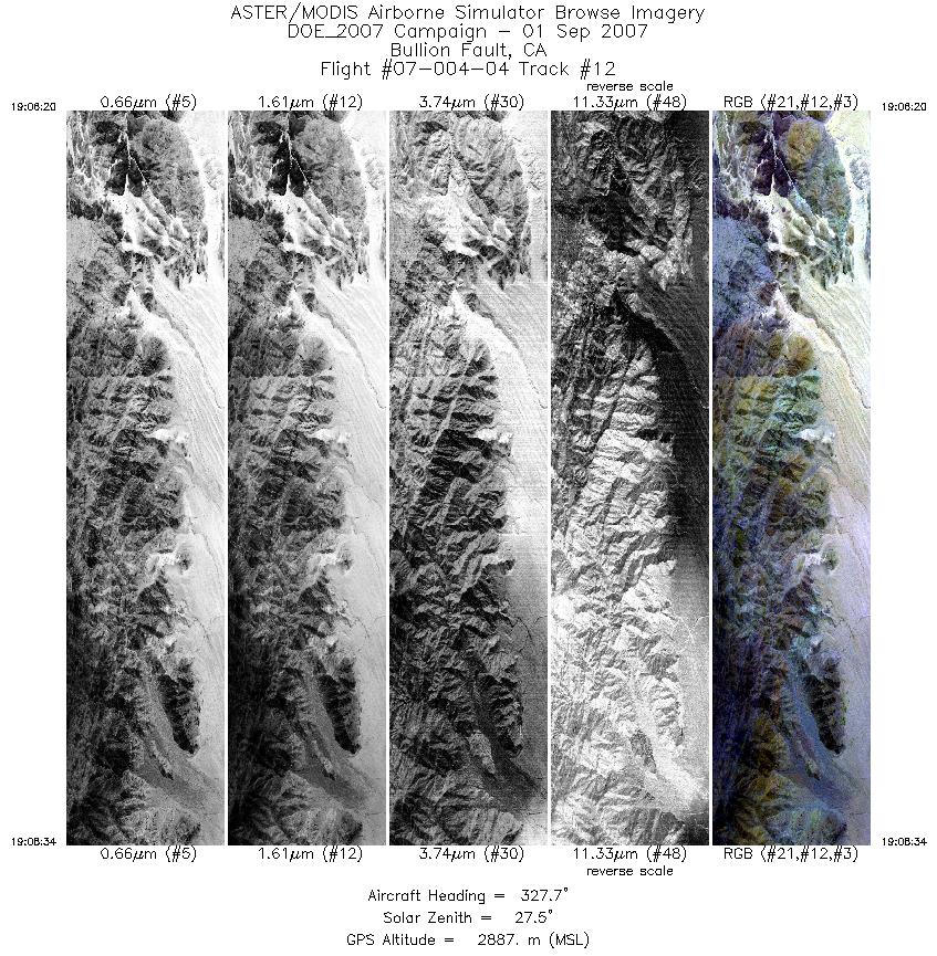
| 12 |
19:06 - 19:08 |
328.9 |
34.300 - 34.391 |
116.066 - 116.125 |
3328 |
2885 |
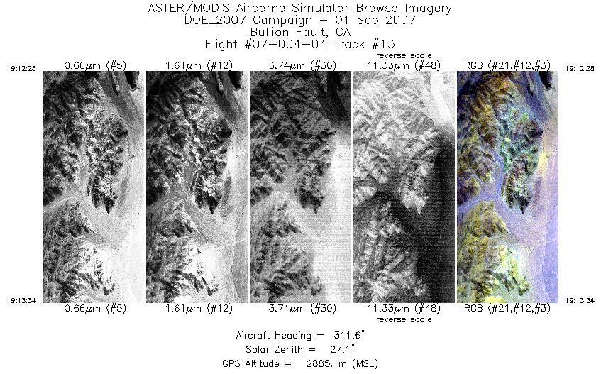
| 13 |
19:12 - 19:13 |
311.5 |
34.382 - 34.417 |
116.114 - 116.161 |
1636 |
2886 |
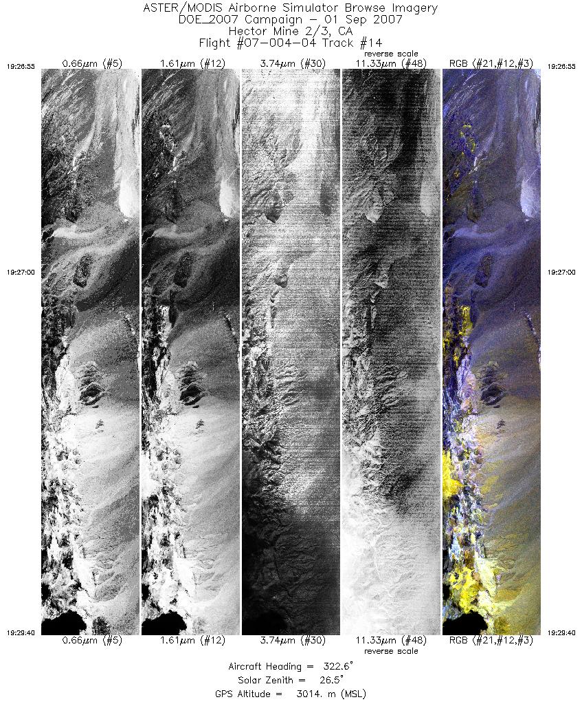
| 14 |
19:26 - 19:29 |
319.3 |
34.452 - 34.550 |
116.228 - 116.333 |
4117 |
3006 |
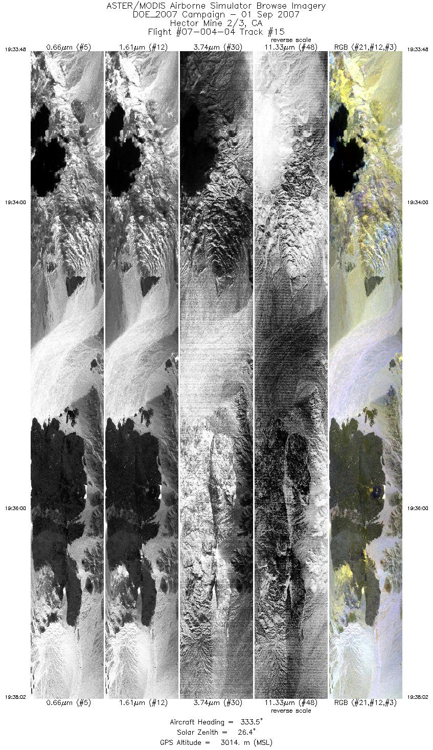
| 15 |
19:33 - 19:38 |
334.1 |
34.533 - 34.711 |
116.321 - 116.415 |
6332 |
3016 |
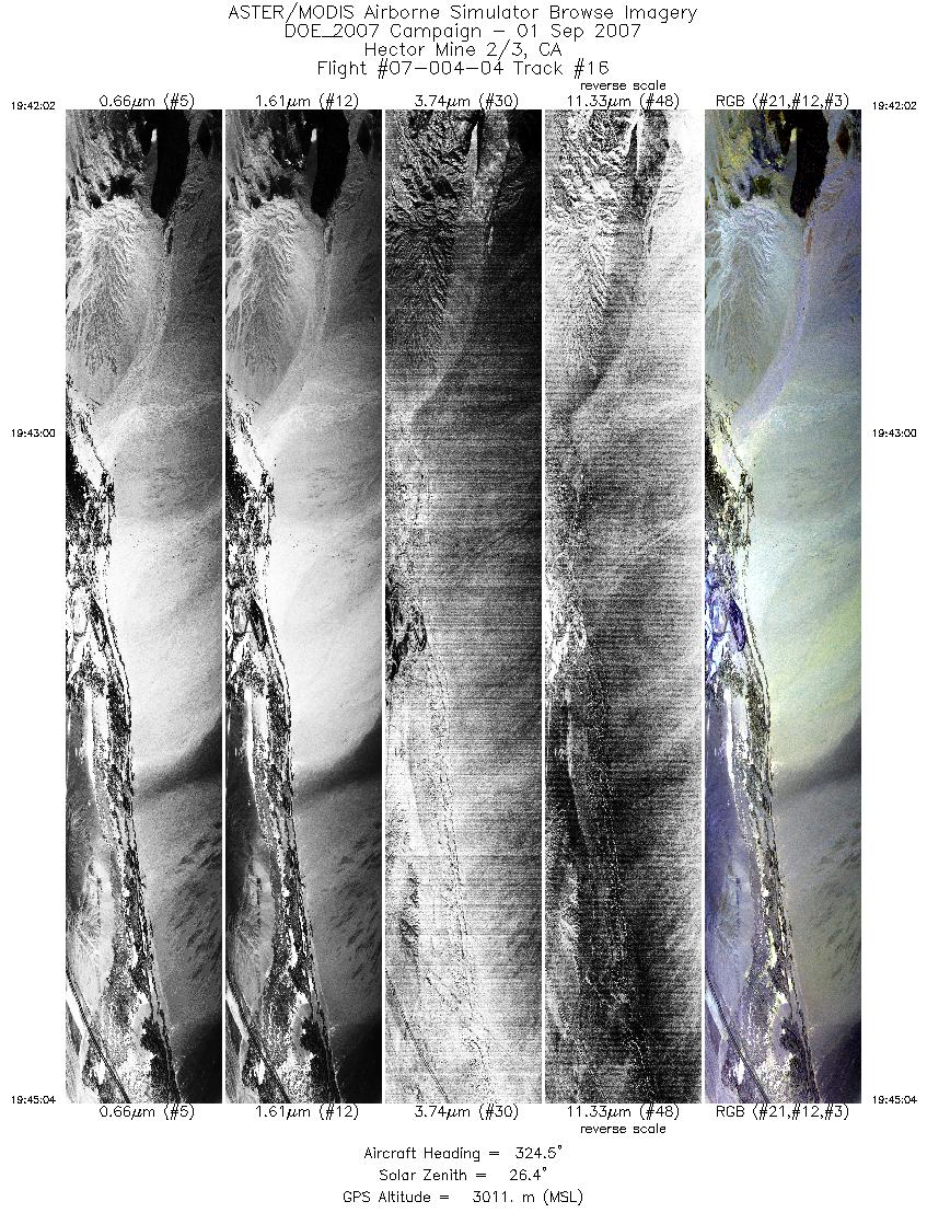
| 16 |
19:42 - 19:45 |
323.8 |
34.681 - 34.791 |
116.393 - 116.493 |
4543 |
3012 |
|


