Flight: 06-908-00
Date: December 9, 2005
Aircraft: NASA ER-2, #809
Deployment: DFRC Fall 2005
Flight Location: California
Principal Investigator: Hook, Bruegge (JPL)
Additional Sensors: MAS
|
Data Evaluation
Weather: Clear to cloudy skies
Haze: Moderate to heavy
Turbulence: Light to moderate
Data quality is good.
|
Processing Information
Level-1B Data in HDF format is available
Flight Line Summary
Spectral Band Configuration
Spectral Response Function Table
Spectral Response Function (text)
|
Browse Imagery
Flight Tracks: 14
Scanlines: 51459
|
Browse Imagery Table
|
Click a Flight Track number to view a quicklook image
Lat/Lon ranges are for the BEG-END scanline nadir pixels
|
Flight
Track |
Time Span
(UTC) |
Heading
(Deg) |
Lat Range
(Deg N) |
Lon Range
(Deg W) |
Length
(Scanlines) |
Altitude
(Meters) |
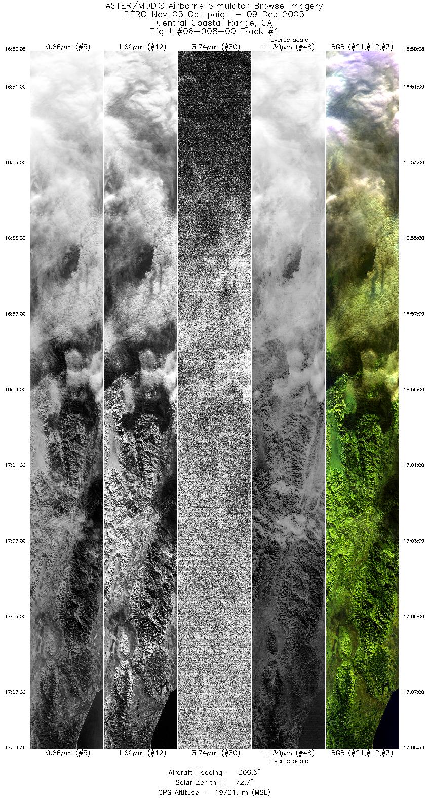
| 1 |
16:50 - 17:08 |
305.5 |
35.857 - 37.001 |
119.685 - 121.893 |
6898 |
19210 |
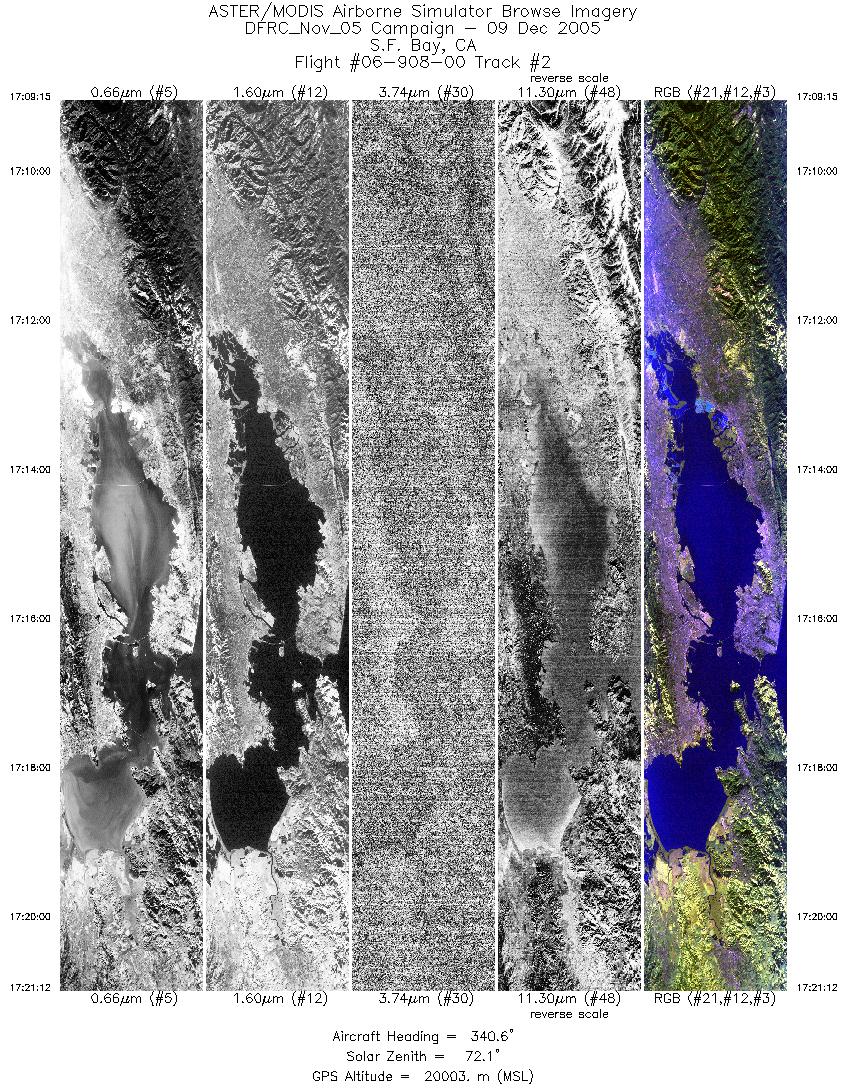
| 2 |
17:09 - 17:21 |
339.9 |
37.057 - 38.294 |
121.952 - 122.625 |
4459 |
20015 |
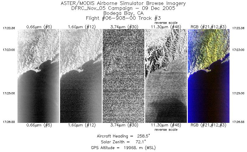
| 3 |
17:22 - 17:26 |
258.5 |
38.358 - 38.244 |
122.790 - 123.407 |
1614 |
19972 |
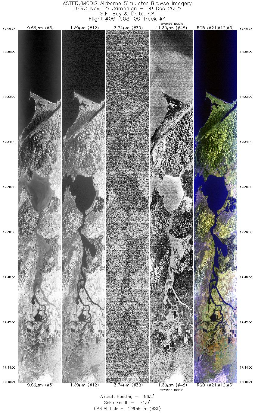
| 4 |
17:29 - 17:45 |
88.7 |
38.057 - 38.059 |
123.394 - 121.194 |
5843 |
19906 |
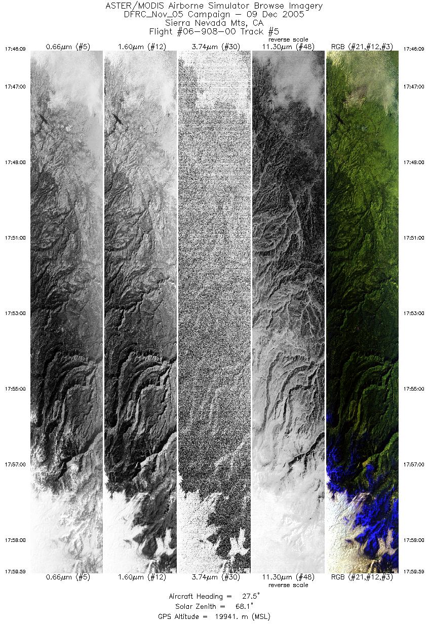
| 5 |
17:46 - 17:59 |
26.3 |
38.120 - 39.518 |
121.064 - 120.265 |
5164 |
19917 |
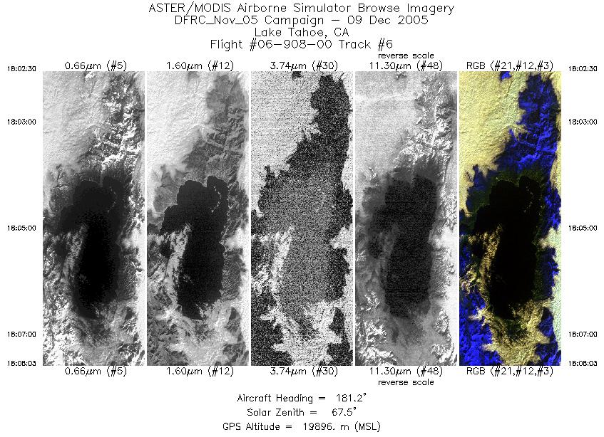
| 6 |
18:02 - 18:08 |
181.1 |
39.475 - 38.835 |
120.023 - 120.023 |
2074 |
19880 |
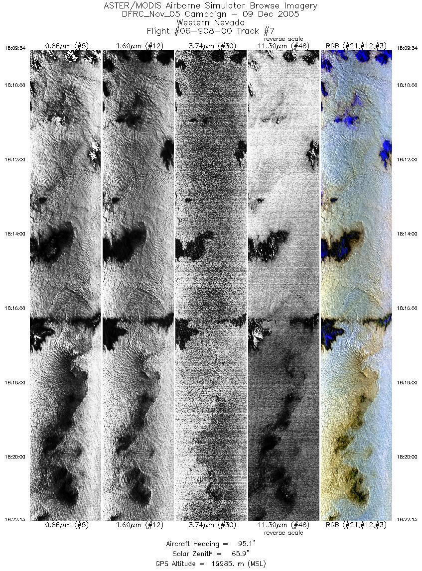
| 7 |
18:09 - 18:22 |
94.0 |
38.719 - 38.647 |
119.891 - 118.068 |
4738 |
19968 |
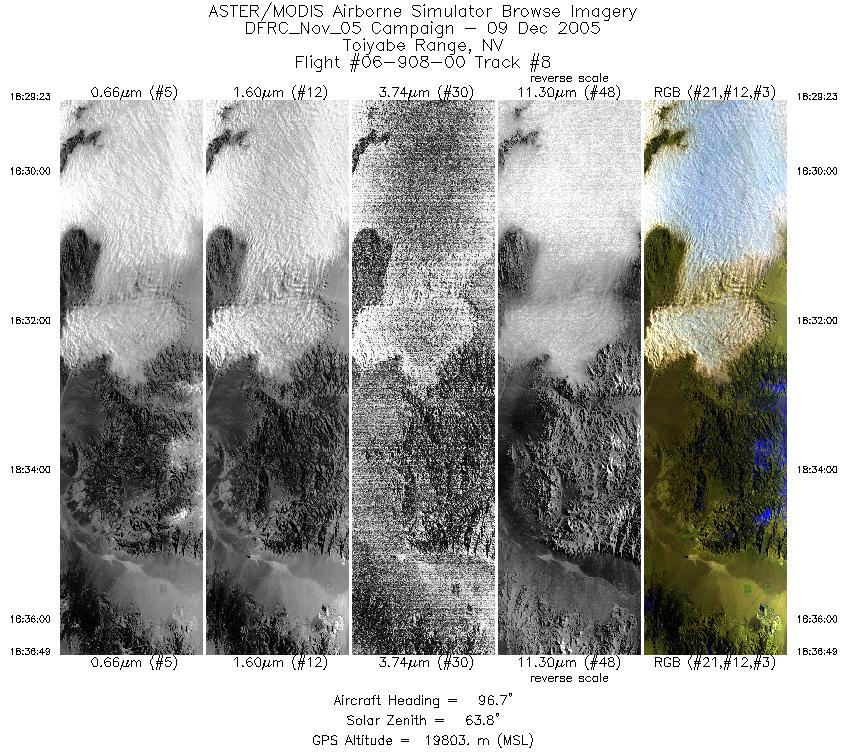
| 8 |
18:29 - 18:36 |
95.1 |
38.652 - 38.595 |
118.096 - 117.030 |
2775 |
19822 |
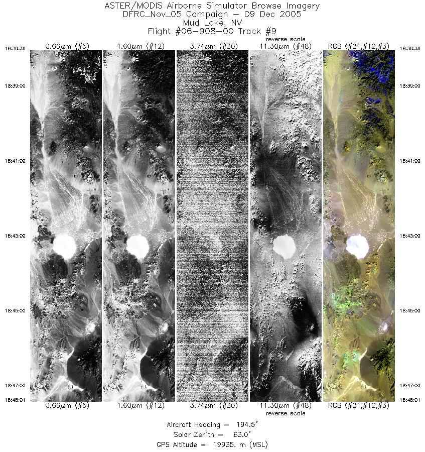
| 9 |
18:38 - 18:48 |
194.0 |
38.455 - 37.400 |
116.886 - 117.193 |
3504 |
19909 |
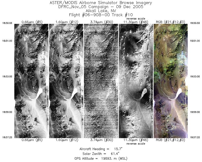
| 10 |
18:50 - 18:57 |
15.1 |
37.440 - 38.131 |
117.440 - 117.230 |
2397 |
19900 |
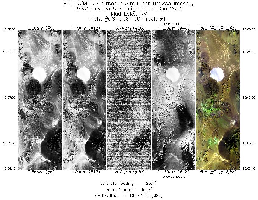
| 11 |
19:00 - 19:06 |
194.8 |
38.082 - 37.395 |
116.993 - 117.195 |
2283 |
19905 |
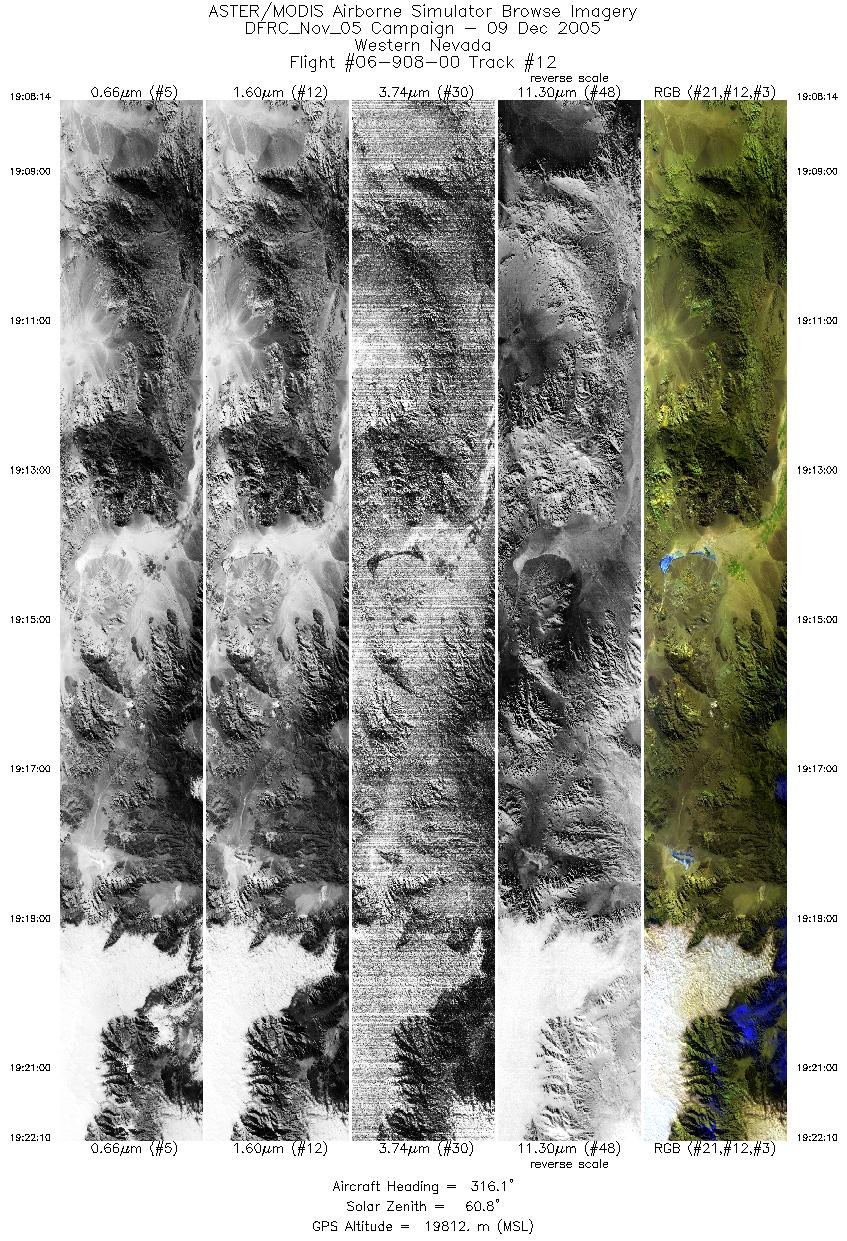
| 12 |
19:08 - 19:22 |
316.8 |
37.337 - 38.461 |
117.426 - 118.803 |
5205 |
19787 |
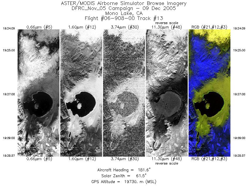
| 13 |
19:24 - 19:29 |
181.1 |
38.394 - 37.730 |
119.012 - 119.019 |
2166 |
19743 |
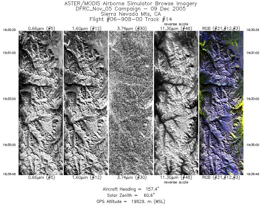
| 14 |
19:30 - 19:36 |
155.7 |
37.672 - 37.029 |
119.002 - 118.604 |
2339 |
19841 |
|


