


FLIGHT SUMMARY INFORMATION
Flight Track Map


|
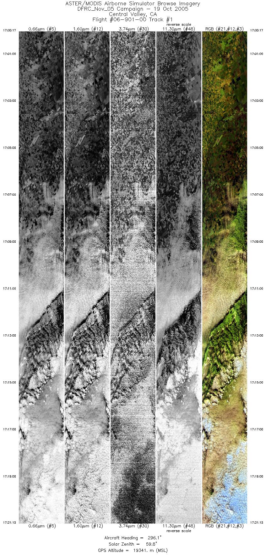
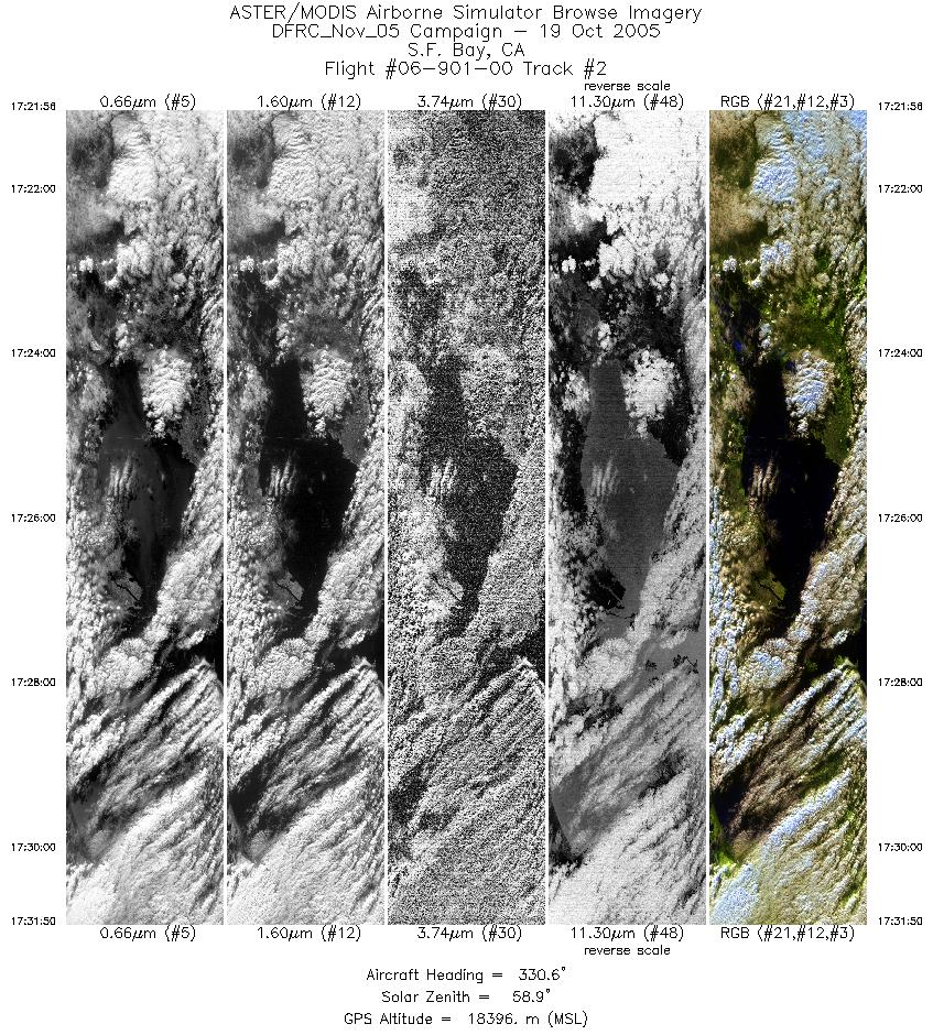
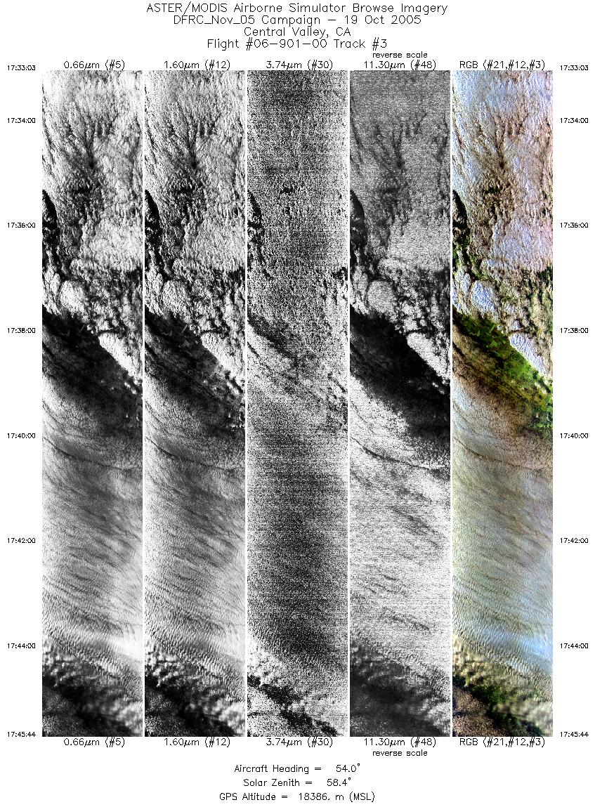
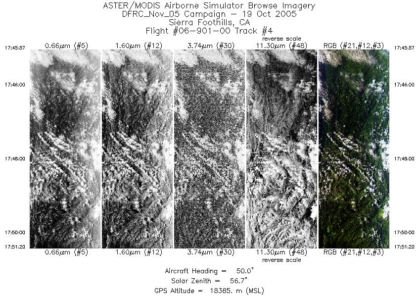
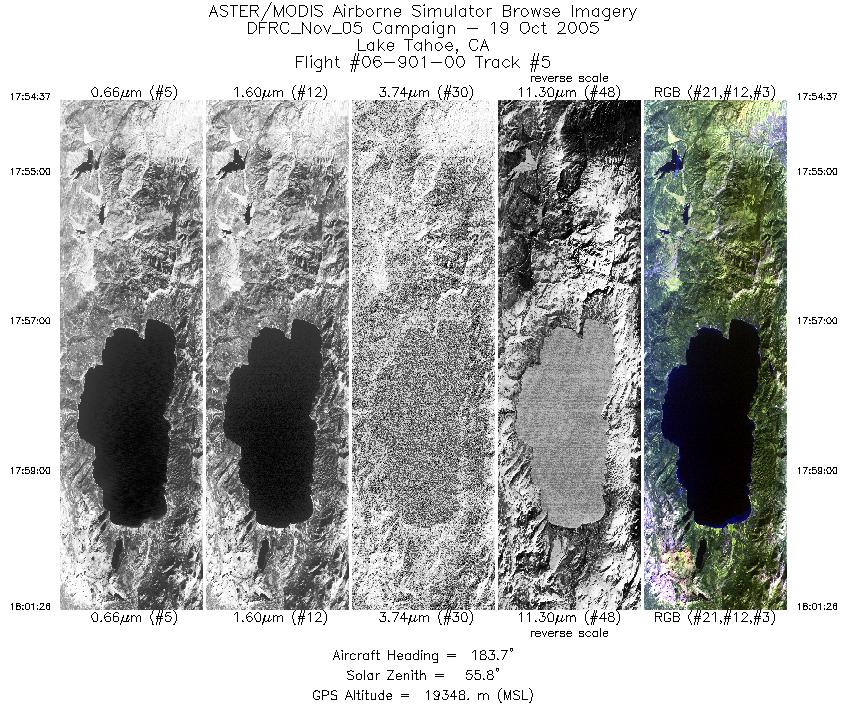
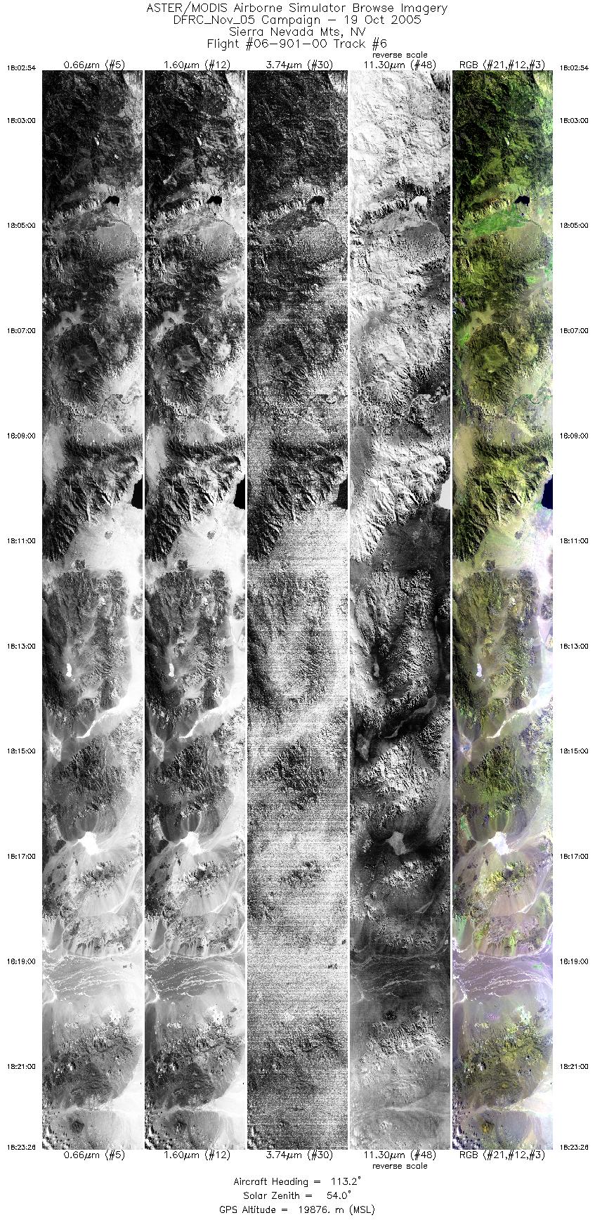
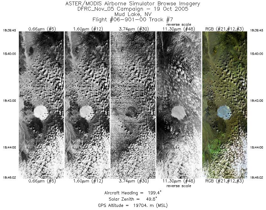
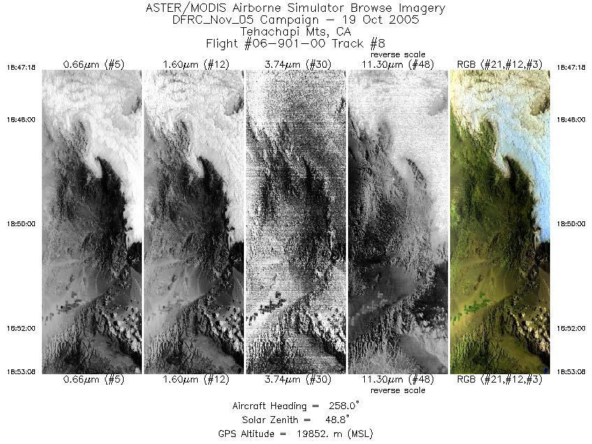
Flight: 06-901-00 Date: October 19, 2005 Aircraft: NASA ER-2, #809 Deployment: DFRC Fall 2005 Flight Location: California Principal Investigator: Hook, Bruegge (JPL) Additional Sensors: MAS |
||||||||||||||||||||||||||||||||||||||||||||||||||||||||||||||||||||||||||||||||||||
|
Data Evaluation Weather: Clear to cloudy skies Haze: Moderate to heavy Turbulence: Light to moderate Data quality is good. |
||||||||||||||||||||||||||||||||||||||||||||||||||||||||||||||||||||||||||||||||||||
|
Processing Information Level-1B Data in HDF format is available Flight Line Summary Spectral Band Configuration Spectral Response Function Table Spectral Response Function (text) |
||||||||||||||||||||||||||||||||||||||||||||||||||||||||||||||||||||||||||||||||||||
|
Browse Imagery Flight Tracks: 8 Scanlines: 33060 |
||||||||||||||||||||||||||||||||||||||||||||||||||||||||||||||||||||||||||||||||||||
|
||||||||||||||||||||||||||||||||||||||||||||||||||||||||||||||||||||||||||||||||||||


