Flight: 05-003-30
Date: April 1, 2005
Aircraft: NASA WB57, #926
Deployment: CARTA II
Flight Location: Costa Rica
Principal Investigator: CENAT (Diaz)
Additional Sensors: RC-30, DCS, Hymap
|
Data Evaluation
Data quality is good.
Port 4 (bands 41-50) has some coherent noise during the first couple of lines.
|
Processing Information
Level-1B Data in HDF format is available
Flight Line Summary
Spectral Band Configuration
Spectral Response Function Table
Spectral Response Function (text)
|
Browse Imagery
Flight Tracks: 14
Scanlines: 100998
|
Browse Imagery Table
|
Click a Flight Track number to view a quicklook image
Lat/Lon ranges are for the BEG-END scanline nadir pixels
|
Flight
Track |
Time Span
(UTC) |
Heading
(Deg) |
Lat Range
(Deg N) |
Lon Range
(Deg W) |
Length
(Scanlines) |
Altitude
(Meters) |
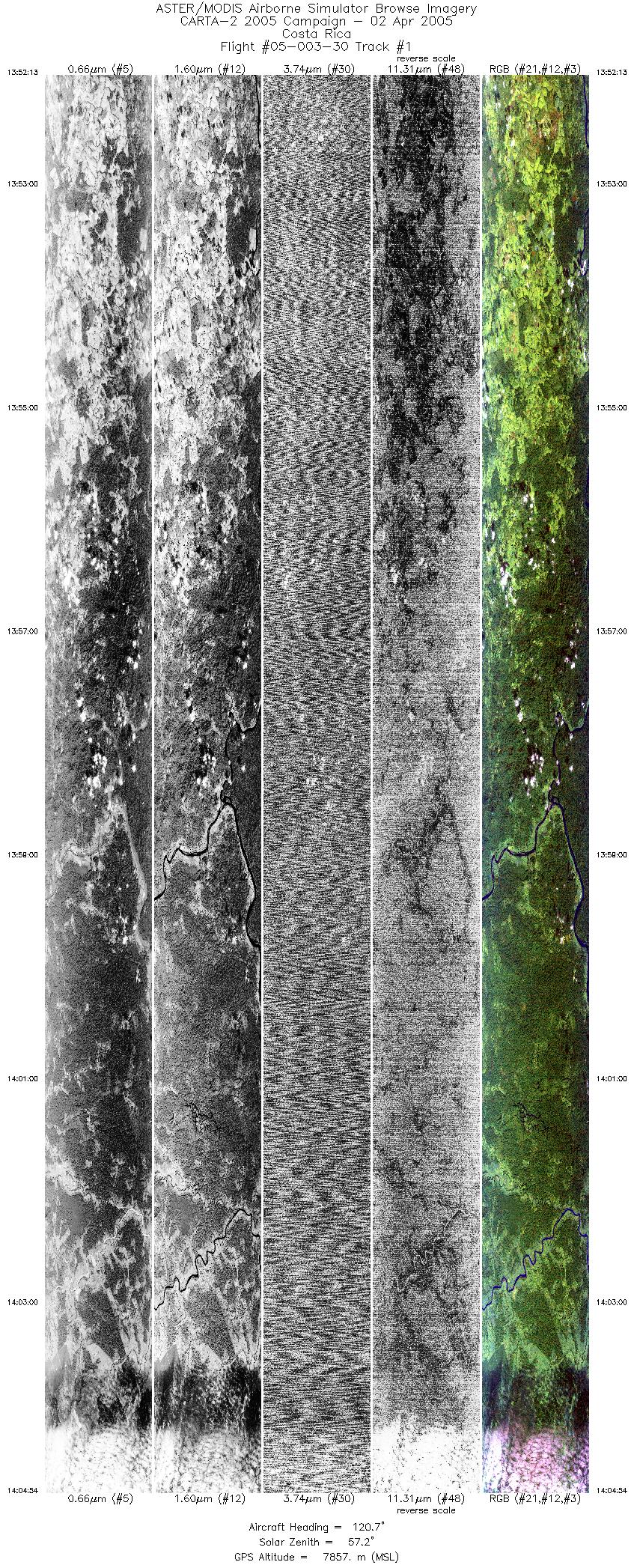
| 1 |
13:52 - 14:04 |
121.3 |
11.004 - 10.554 |
84.552 - 83.890 |
9470 |
7848 |
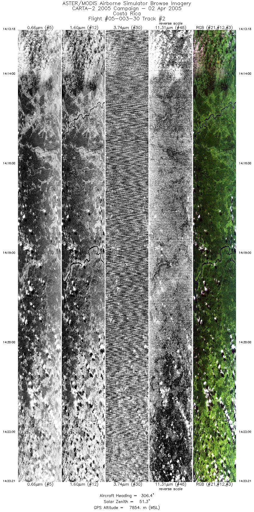
| 2 |
14:13 - 14:23 |
305.1 |
10.506 - 10.924 |
83.883 - 84.495 |
7540 |
7839 |
| 3 |
14:28 - 14:34 |
121.5 |
10.773 - 10.564 |
84.680 - 84.371 |
4267 |
8190 |
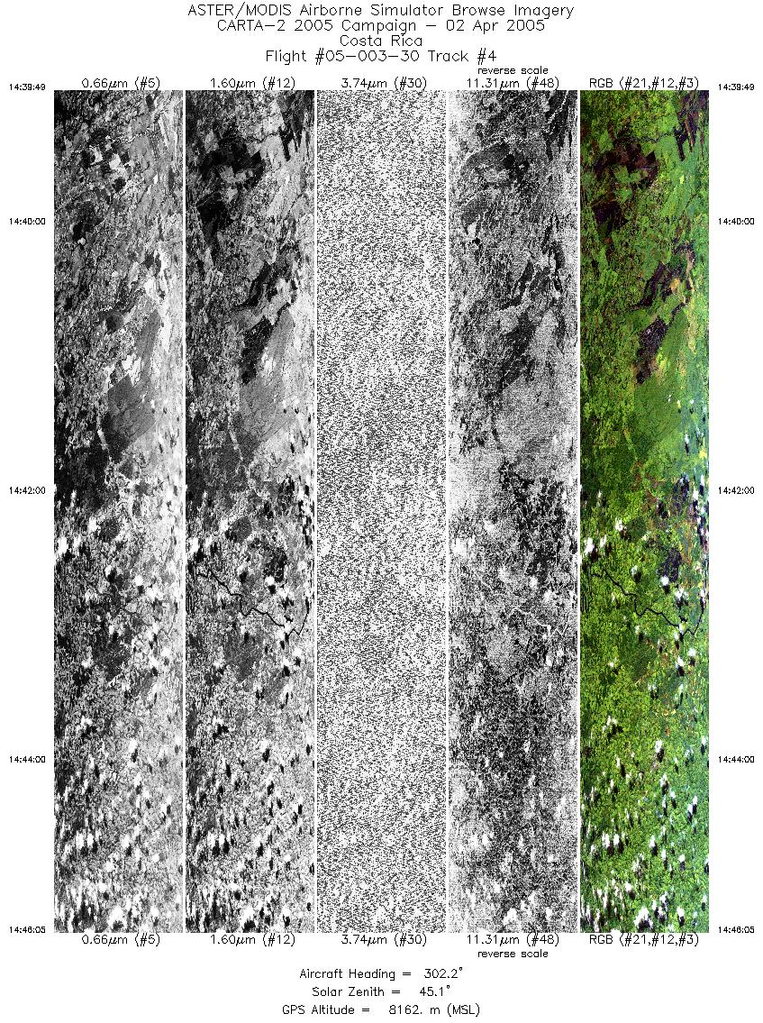
| 4 |
14:39 - 14:46 |
303.5 |
10.430 - 10.680 |
84.225 - 84.595 |
4677 |
8154 |
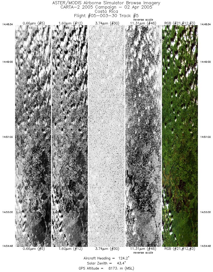
| 5 |
14:48 - 14:54 |
123.5 |
10.705 - 10.490 |
84.679 - 84.366 |
4403 |
8170 |
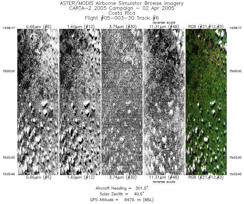
| 6 |
14:59 - 15:02 |
302.1 |
10.506 - 10.645 |
84.435 - 84.640 |
2531 |
8475 |
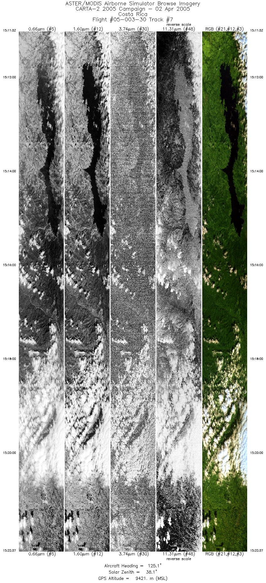
| 7 |
15:11 - 15:22 |
124.6 |
10.576 - 10.137 |
85.019 - 84.374 |
8278 |
9422 |
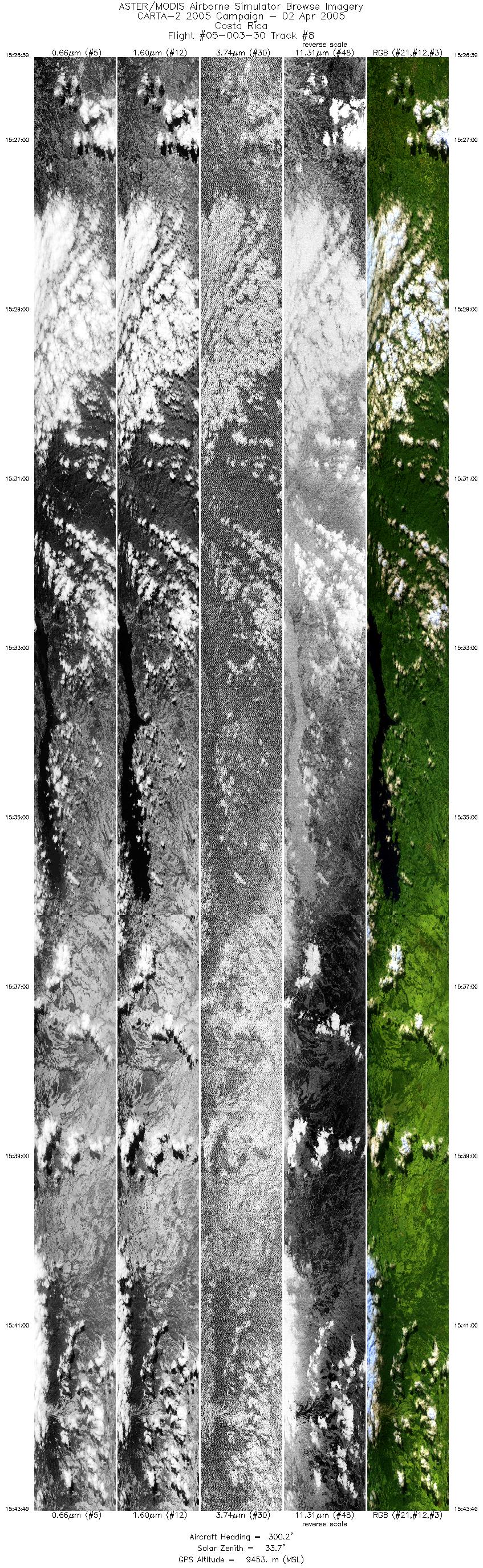
| 8 |
15:26 - 15:43 |
300.8 |
10.100 - 10.836 |
84.365 - 85.449 |
12822 |
9442 |
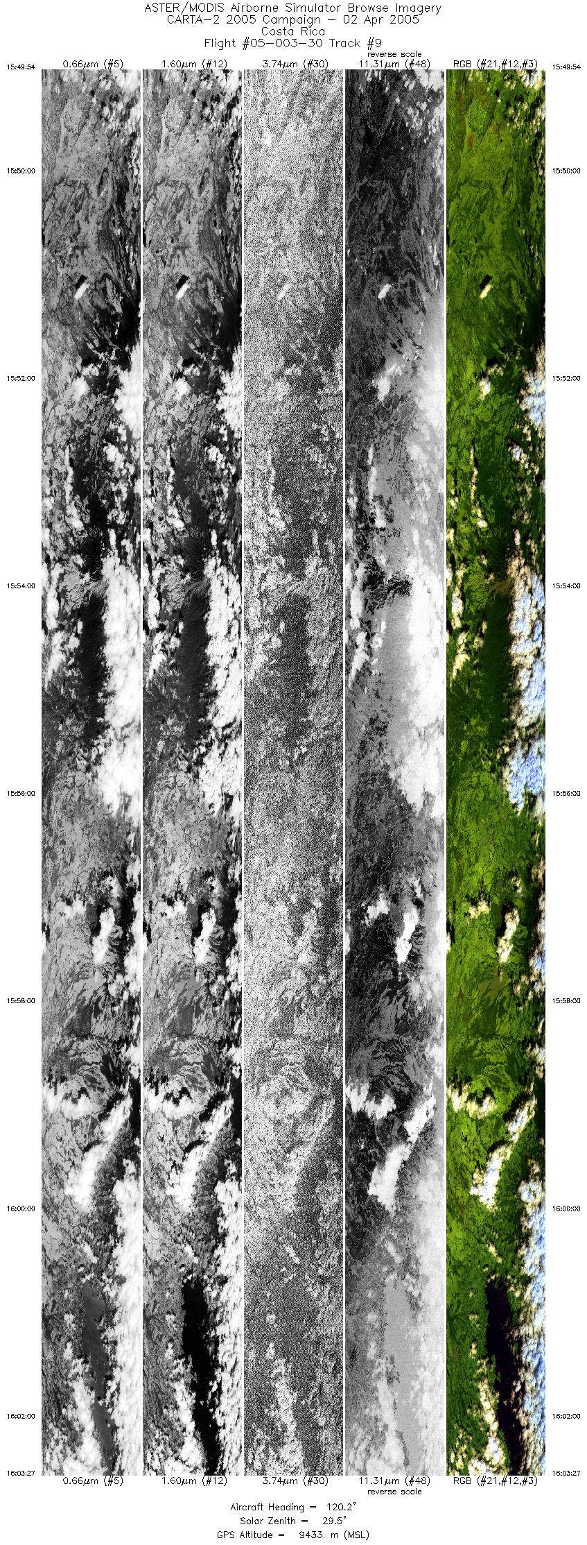
| 9 |
15:49 - 16:03 |
122.7 |
11.004 - 10.473 |
85.651 - 84.866 |
10135 |
9424 |
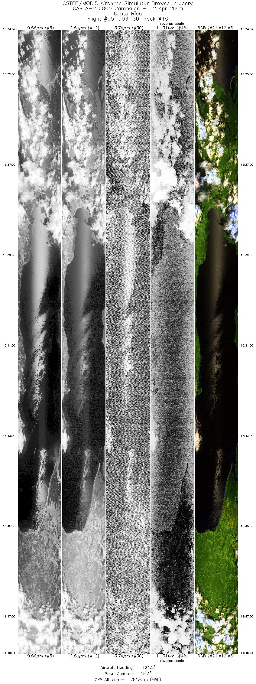
| 10 |
16:34 - 16:48 |
123.8 |
8.864 - 8.349 |
83.687 - 82.938 |
10310 |
7817 |
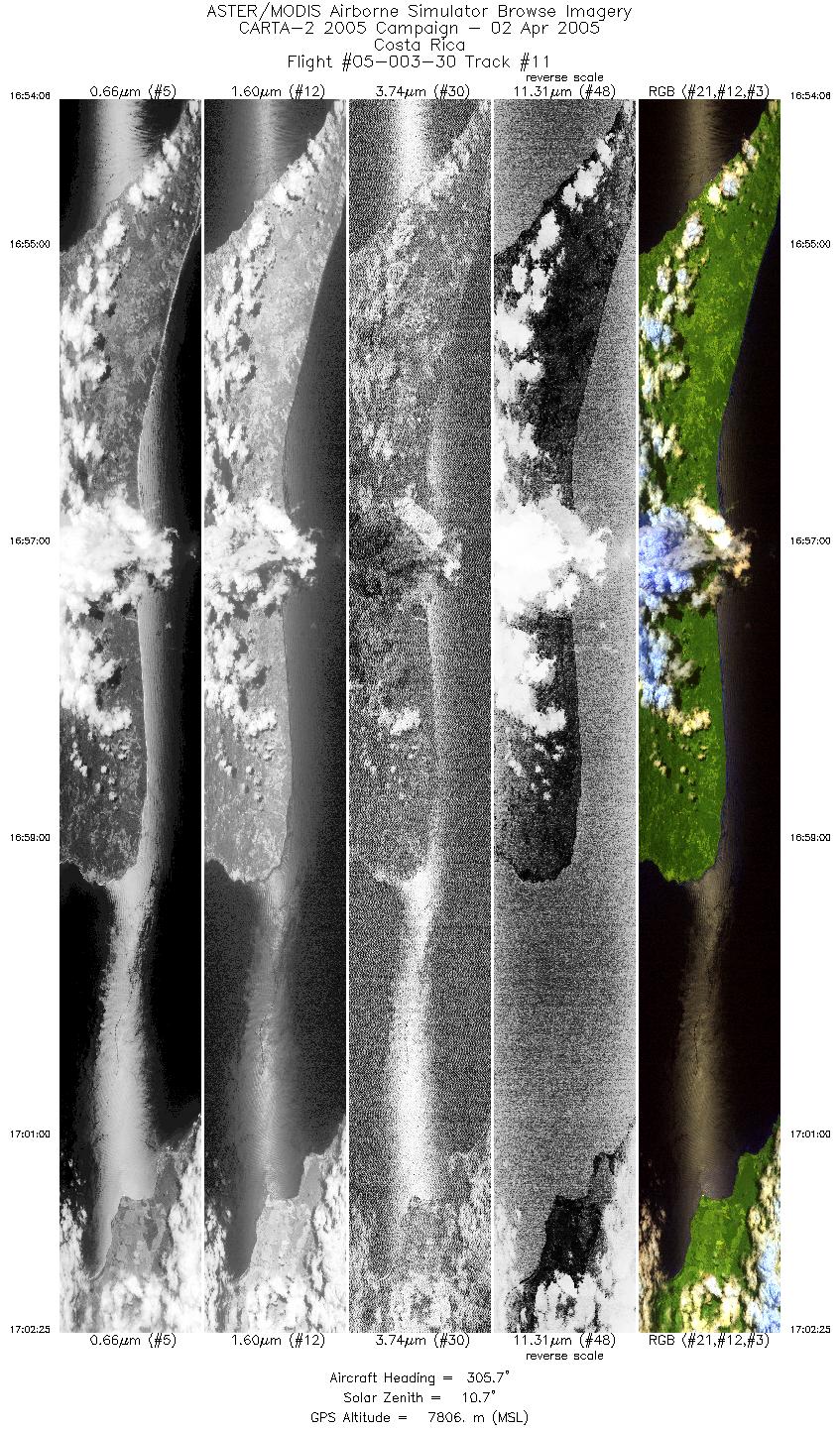
| 11 |
16:54 - 17:02 |
304.9 |
8.162 - 8.498 |
82.842 - 83.329 |
6221 |
7782 |
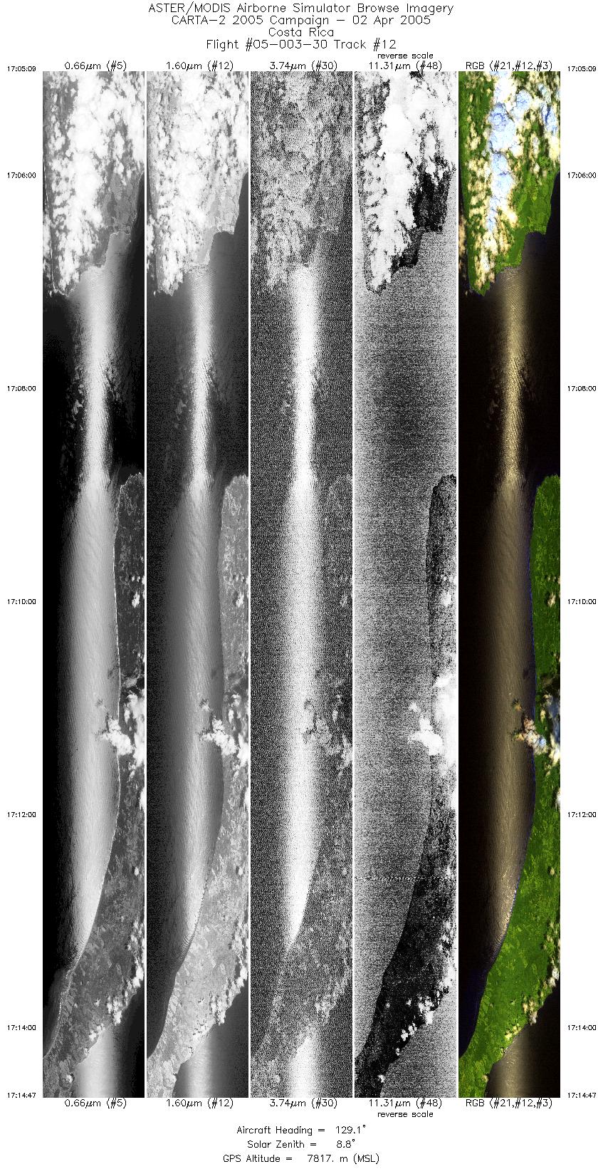
| 12 |
17:05 - 17:14 |
126.1 |
8.491 - 8.124 |
83.378 - 82.847 |
7206 |
7811 |
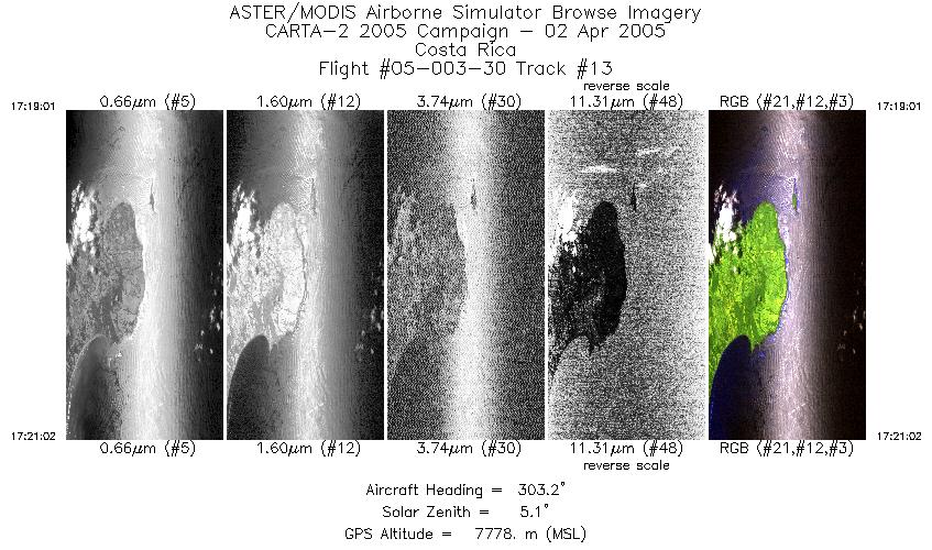
| 13 |
17:19 - 17:21 |
304.0 |
8.000 - 8.077 |
82.844 - 82.958 |
1503 |
7774 |
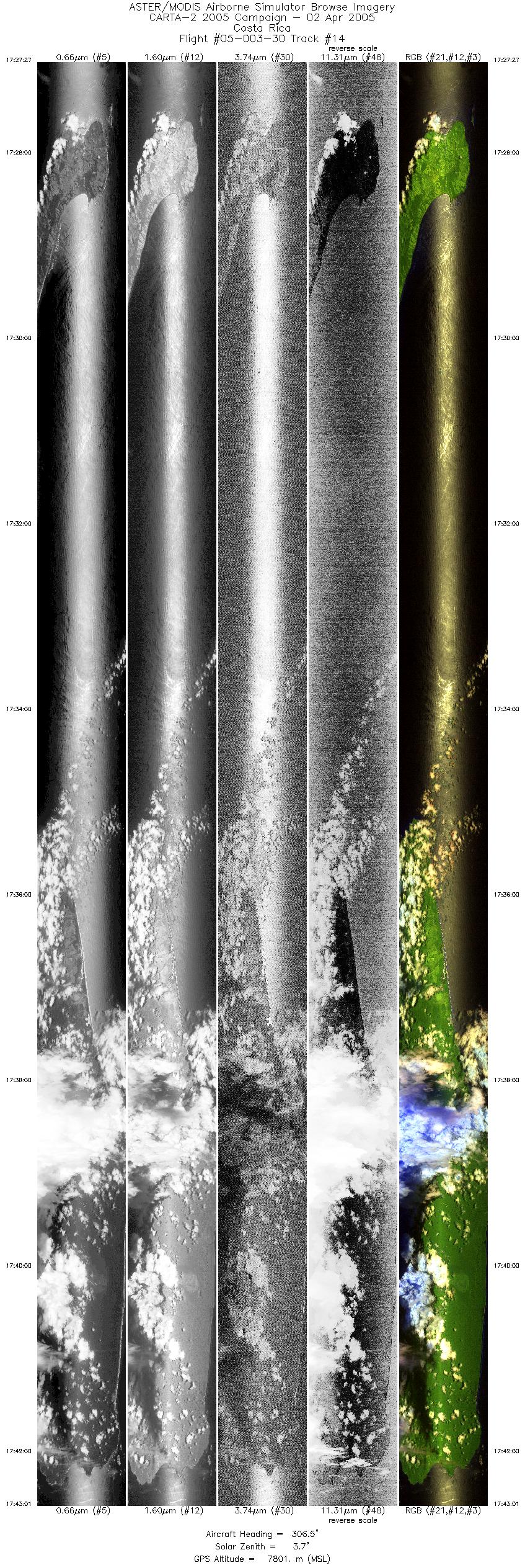
| 14 |
17:27 - 17:43 |
305.2 |
8.022 - 8.661 |
82.821 - 83.746 |
11635 |
7798 |
|


