Flight: 05-003-27
Date: March 30, 2005
Aircraft: NASA WB57, #926
Deployment: CARTA II
Flight Location: Costa Rica
Principal Investigator: CENAT (Diaz)
Additional Sensors: RC-30, DCS, Hymap
|
Data Evaluation
Data quality is good.
Port 4 (bands 41-50) has some coherent noise during the first couple of lines.
|
Processing Information
Level-1B Data in HDF format is available
Flight Line Summary
Spectral Band Configuration
Spectral Response Function Table
Spectral Response Function (text)
|
Browse Imagery
Flight Tracks: 14
Scanlines: 110594
|
Browse Imagery Table
|
Click a Flight Track number to view a quicklook image
Lat/Lon ranges are for the BEG-END scanline nadir pixels
|
Flight
Track |
Time Span
(UTC) |
Heading
(Deg) |
Lat Range
(Deg N) |
Lon Range
(Deg W) |
Length
(Scanlines) |
Altitude
(Meters) |
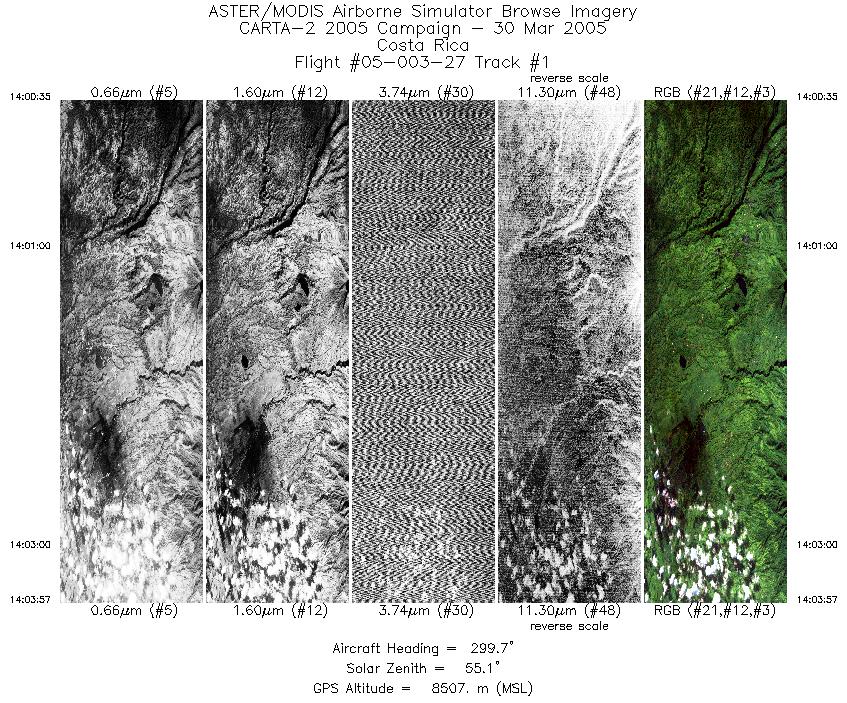
| 1 |
14:00 - 14:03 |
300.0 |
10.262 - 10.397 |
84.126 - 84.324 |
2519 |
8495 |
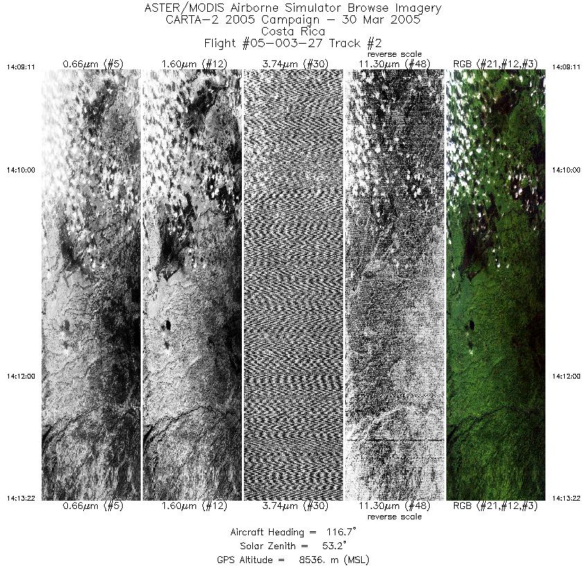
| 2 |
14:09 - 14:13 |
118.4 |
10.477 - 10.324 |
84.347 - 84.120 |
3129 |
8516 |
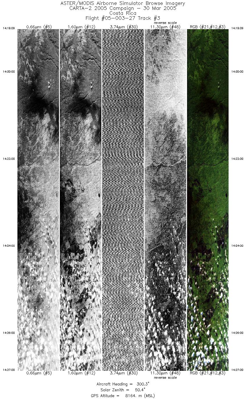
| 3 |
14:19 - 14:27 |
301.7 |
10.251 - 10.553 |
83.964 - 84.408 |
5860 |
8171 |
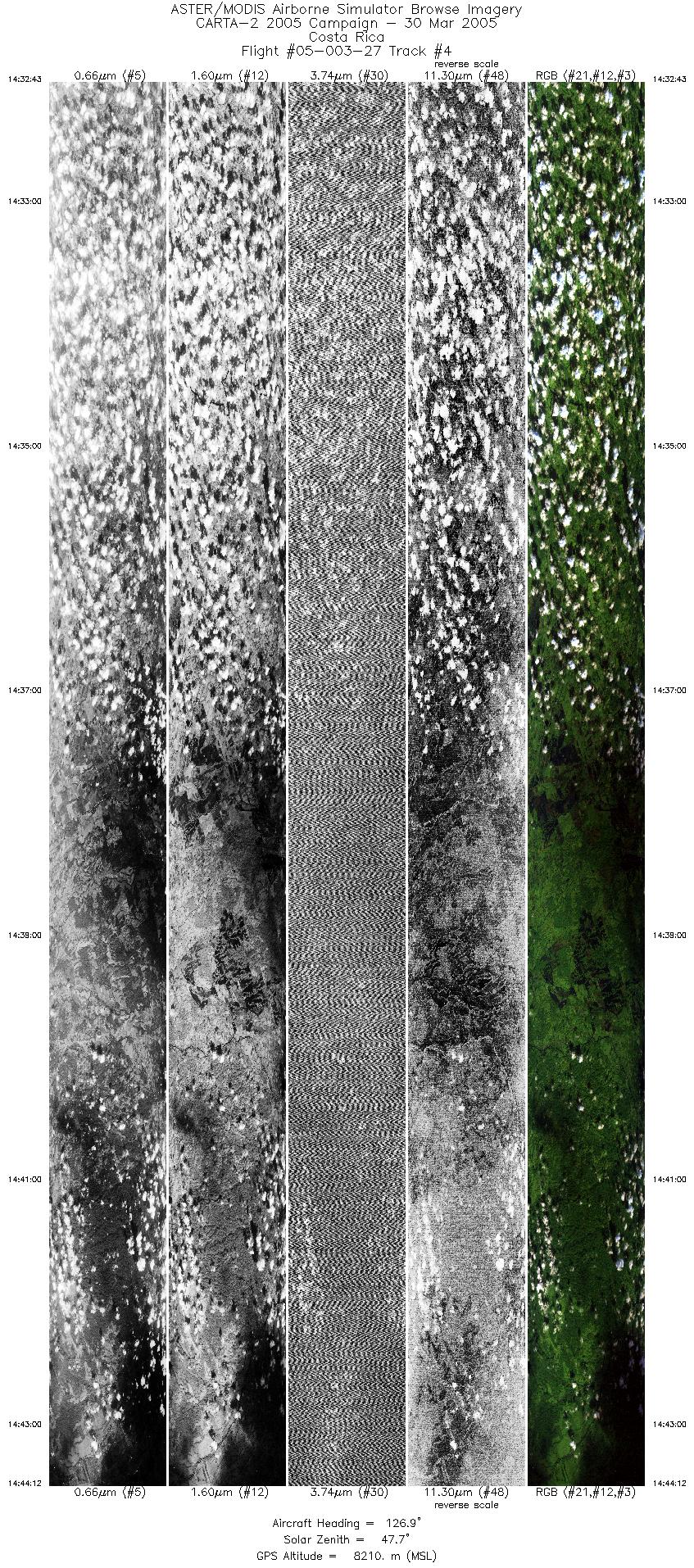
| 4 |
14:32 - 14:44 |
124.8 |
10.722 - 10.293 |
84.553 - 83.924 |
8573 |
8201 |
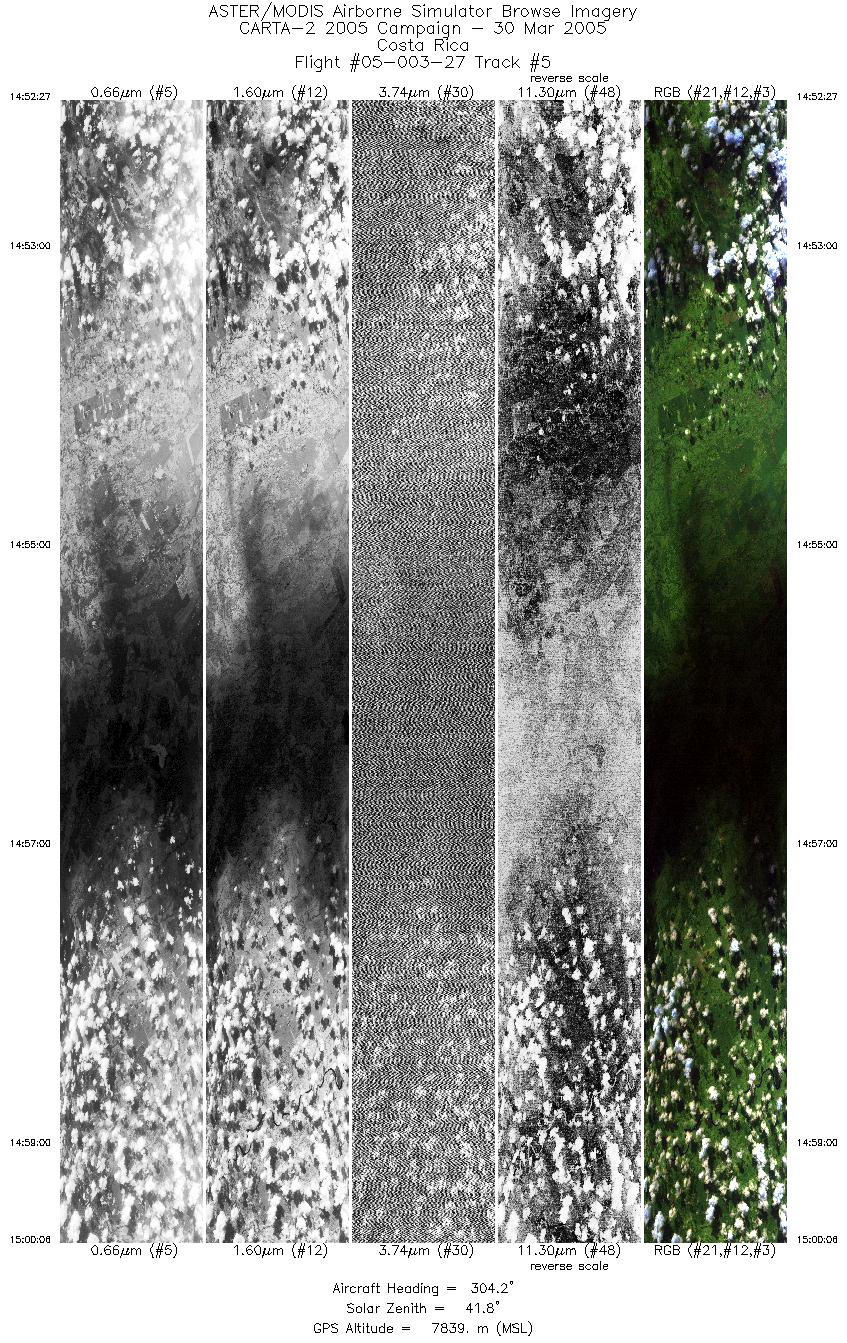
| 5 |
14:52 - 15:00 |
305.7 |
10.310 - 10.623 |
83.592 - 84.051 |
5716 |
7830 |
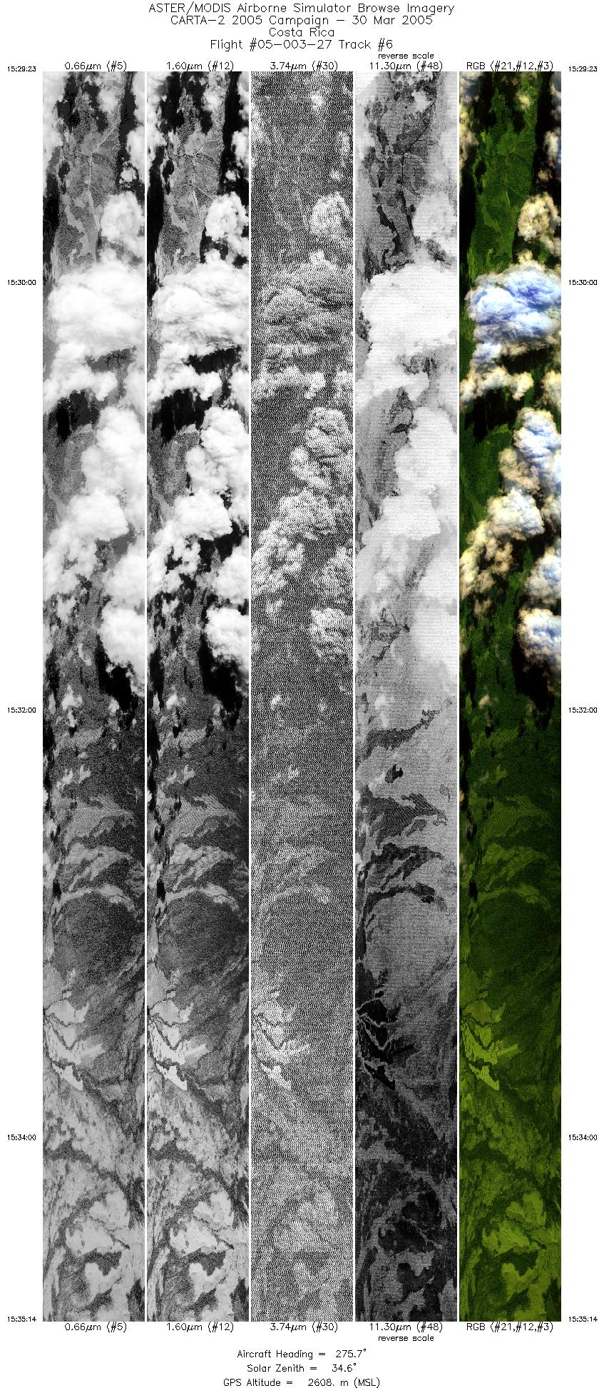
| 6 |
15:29 - 15:35 |
273.8 |
11.013 - 11.013 |
85.309 - 85.560 |
8756 |
2612 |
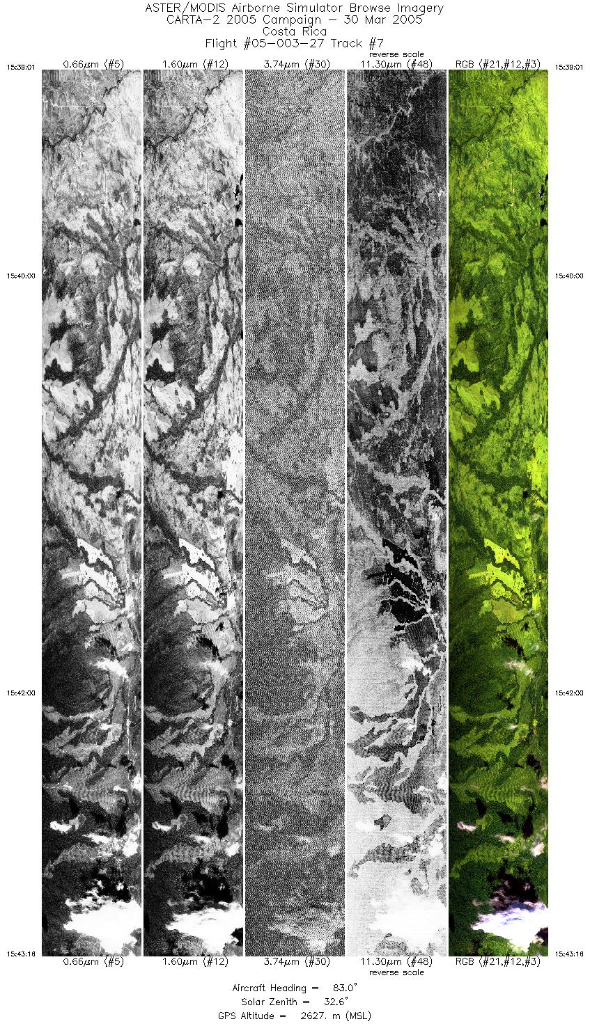
| 7 |
15:39 - 15:43 |
85.2 |
11.022 - 11.022 |
85.615 - 85.425 |
6374 |
2620 |
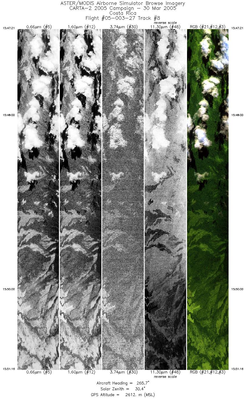
| 8 |
15:47 - 15:51 |
268.6 |
11.005 - 11.005 |
85.365 - 85.537 |
5864 |
2607 |
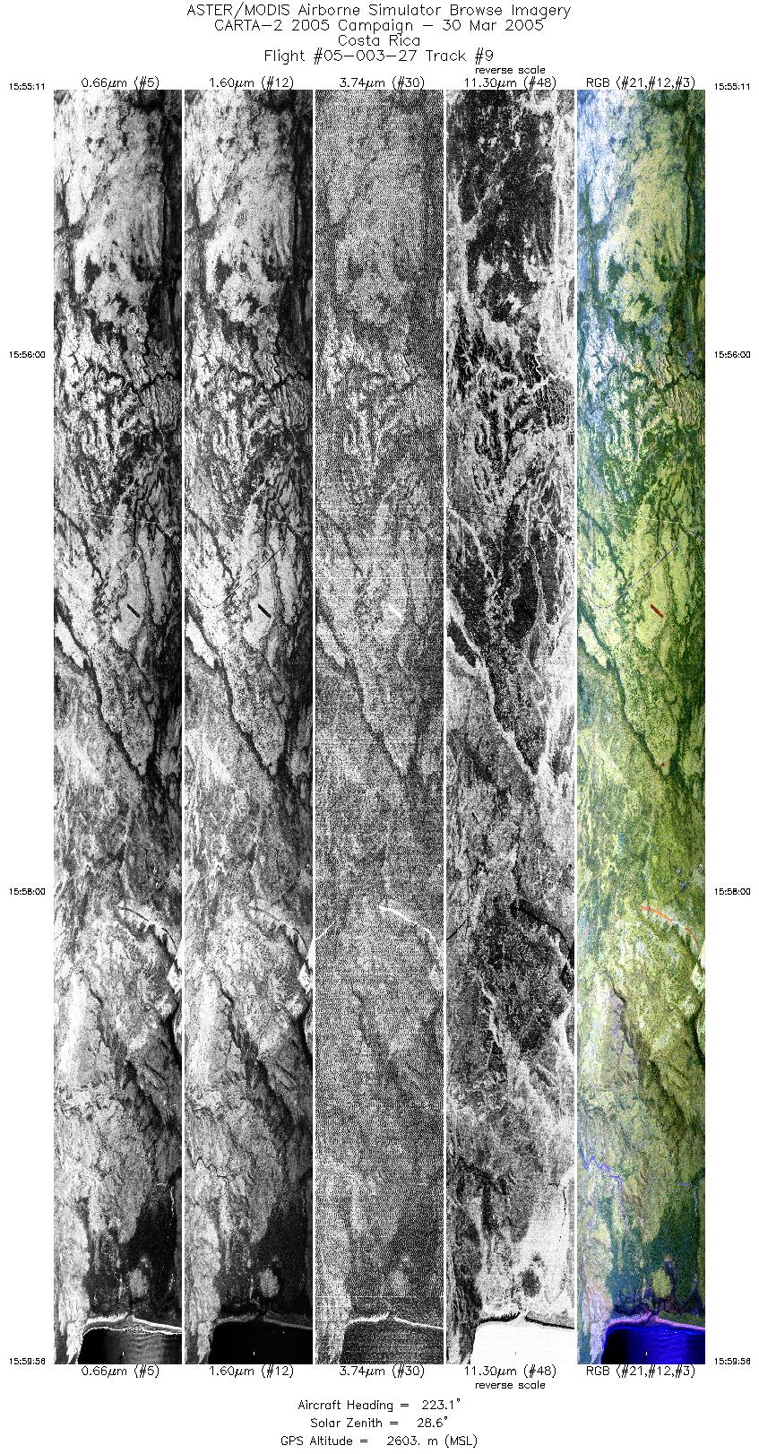
| 9 |
15:55 - 15:59 |
225.9 |
10.935 - 10.792 |
85.532 - 85.685 |
7112 |
2577 |
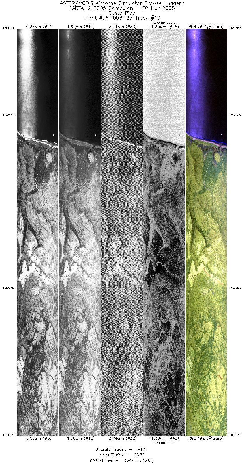
| 10 |
16:03 - 16:08 |
43.0 |
10.745 - 10.883 |
85.710 - 85.562 |
7046 |
2620 |
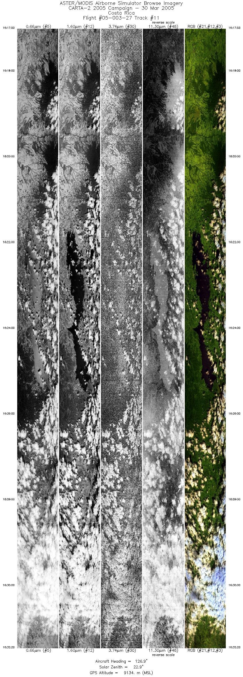
| 11 |
16:17 - 16:32 |
125.7 |
10.759 - 10.191 |
85.242 - 84.403 |
10779 |
8817 |
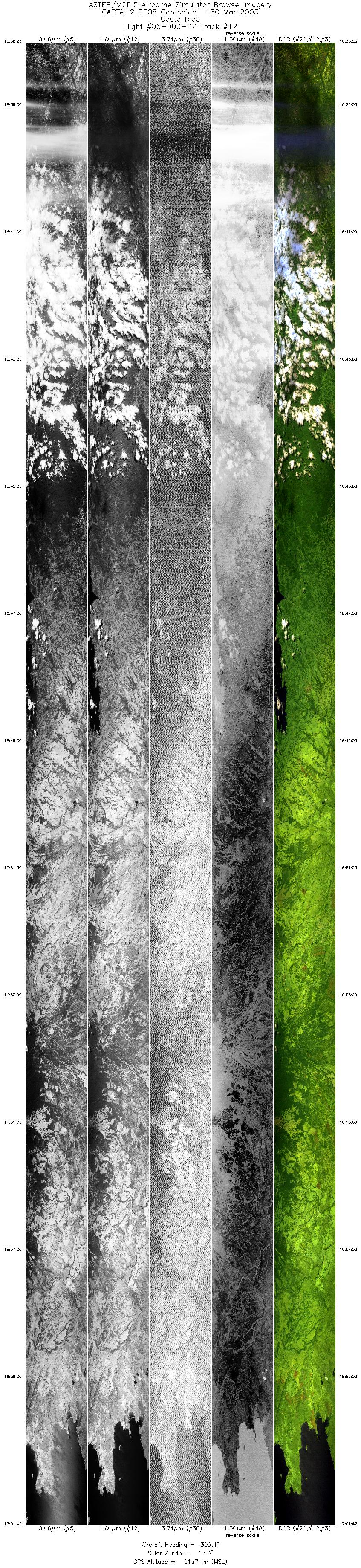
| 12 |
16:38 - 17:01 |
307.3 |
10.035 - 11.035 |
84.317 - 85.790 |
17393 |
9187 |
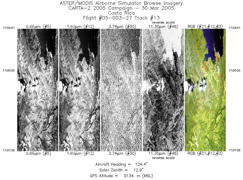
| 13 |
17:04 - 17:07 |
124.1 |
10.949 - 10.836 |
85.756 - 85.590 |
2132 |
9149 |
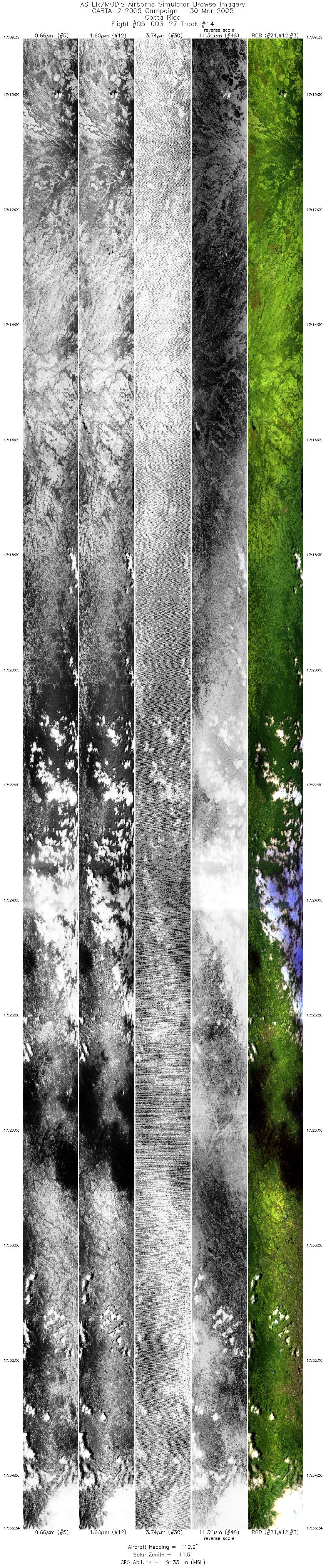
| 14 |
17:09 - 17:35 |
121.9 |
10.777 - 9.755 |
85.459 - 83.954 |
19341 |
9138 |
|


