Flight: 05-003-25
Date: March 27, 2005
Aircraft: NASA WB57, #926
Deployment: CARTA II
Flight Location: Costa Rica
Principal Investigator: CENAT (Diaz)
Additional Sensors: RC-30, DCS, Hymap
|
Data Evaluation
Data quality is good.
Port 4 (bands 41-50) has some coherent noise during the first couple of lines.
|
Processing Information
Level-1B Data in HDF format is available
Flight Line Summary
Spectral Band Configuration
Spectral Response Function Table
Spectral Response Function (text)
|
Browse Imagery
Flight Tracks: 14
Scanlines: 79328
|
Browse Imagery Table
|
Click a Flight Track number to view a quicklook image
Lat/Lon ranges are for the BEG-END scanline nadir pixels
|
Flight
Track |
Time Span
(UTC) |
Heading
(Deg) |
Lat Range
(Deg N) |
Lon Range
(Deg W) |
Length
(Scanlines) |
Altitude
(Meters) |
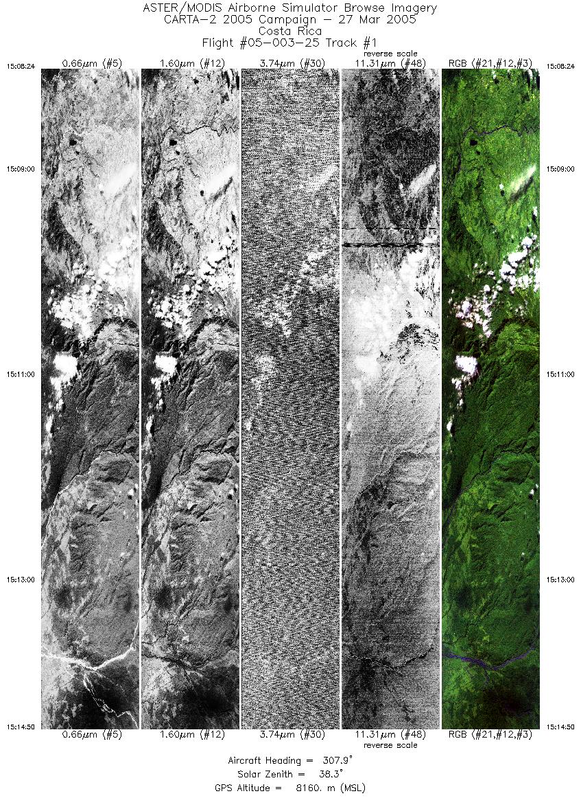
| 1 |
15:08 - 15:14 |
307.4 |
9.946 - 10.216 |
83.568 - 83.965 |
4812 |
8152 |
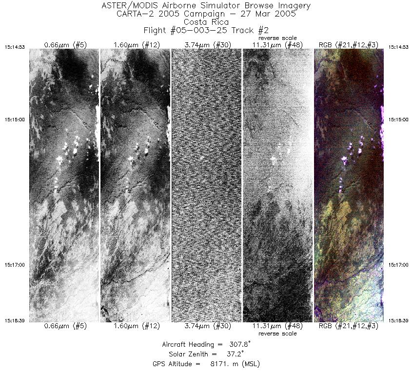
| 2 |
15:14 - 15:18 |
306.9 |
10.218 - 10.375 |
83.969 - 84.197 |
2811 |
8166 |
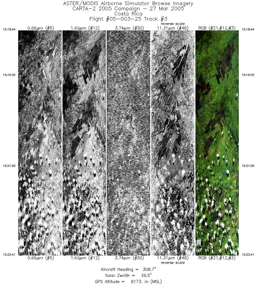
| 3 |
15:18 - 15:23 |
307.4 |
10.378 - 10.584 |
84.202 - 84.503 |
3707 |
8175 |
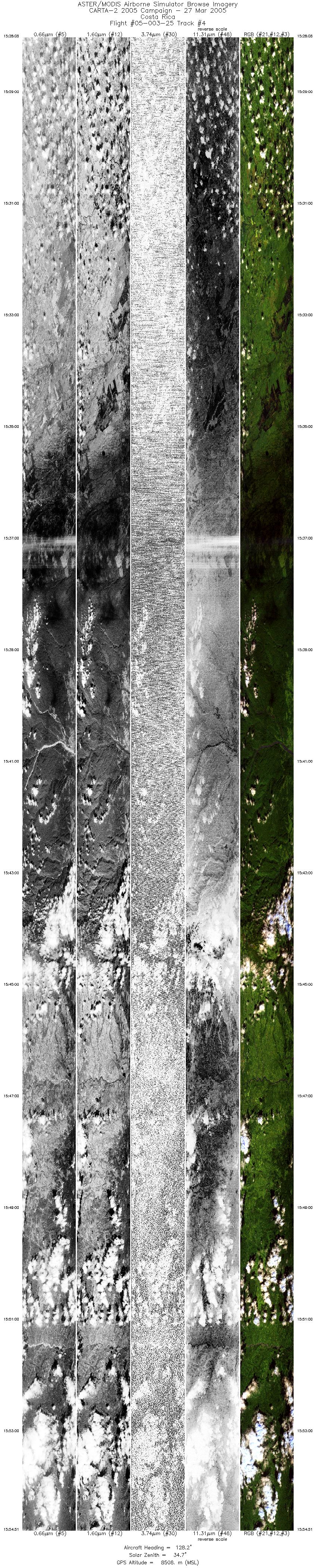
| 4 |
15:28 - 15:54 |
127.3 |
10.623 - 9.660 |
84.606 - 83.202 |
20000 |
8526 |
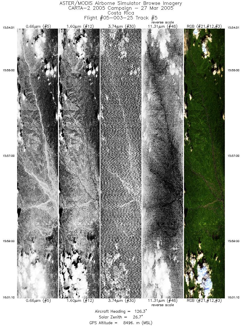
| 5 |
15:54 - 16:01 |
125.0 |
9.660 - 9.438 |
83.201 - 82.878 |
4717 |
8498 |
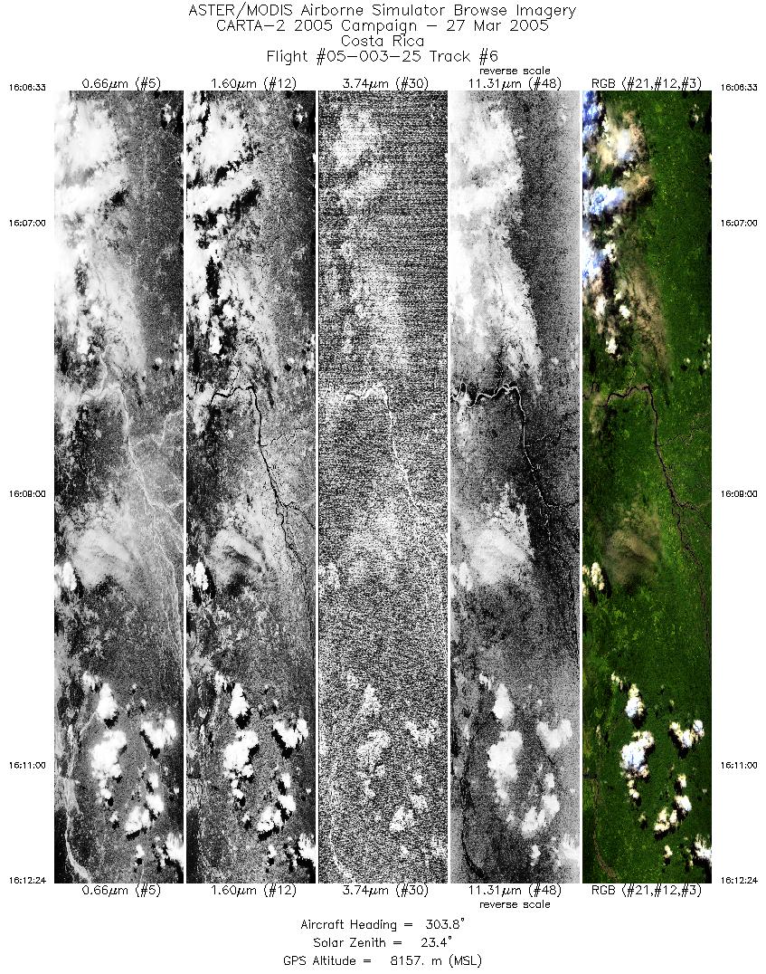
| 6 |
16:06 - 16:12 |
305.0 |
9.456 - 9.704 |
82.756 - 83.117 |
4380 |
8158 |
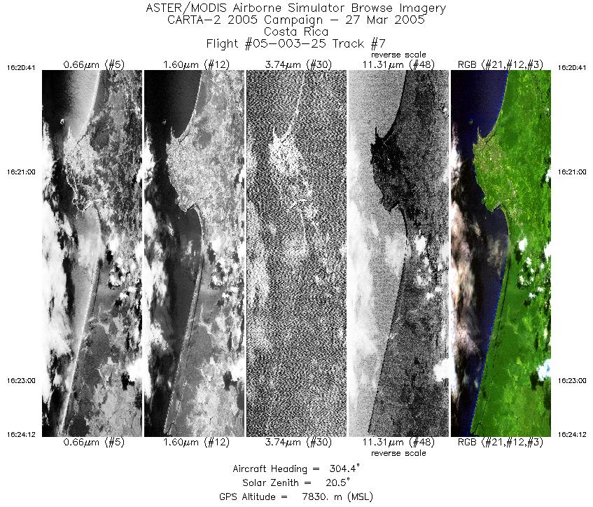
| 7 |
16:20 - 16:24 |
305.2 |
9.945 - 10.089 |
83.001 - 83.212 |
2624 |
7854 |
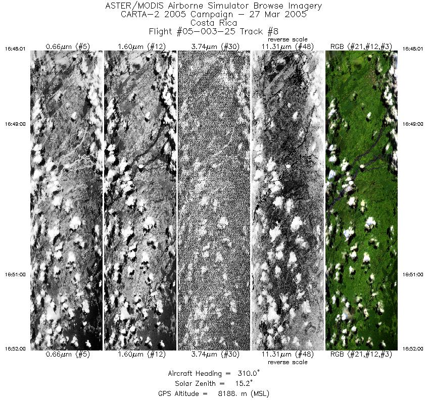
| 8 |
16:48 - 16:51 |
307.7 |
10.213 - 10.381 |
83.755 - 84.000 |
2972 |
8202 |
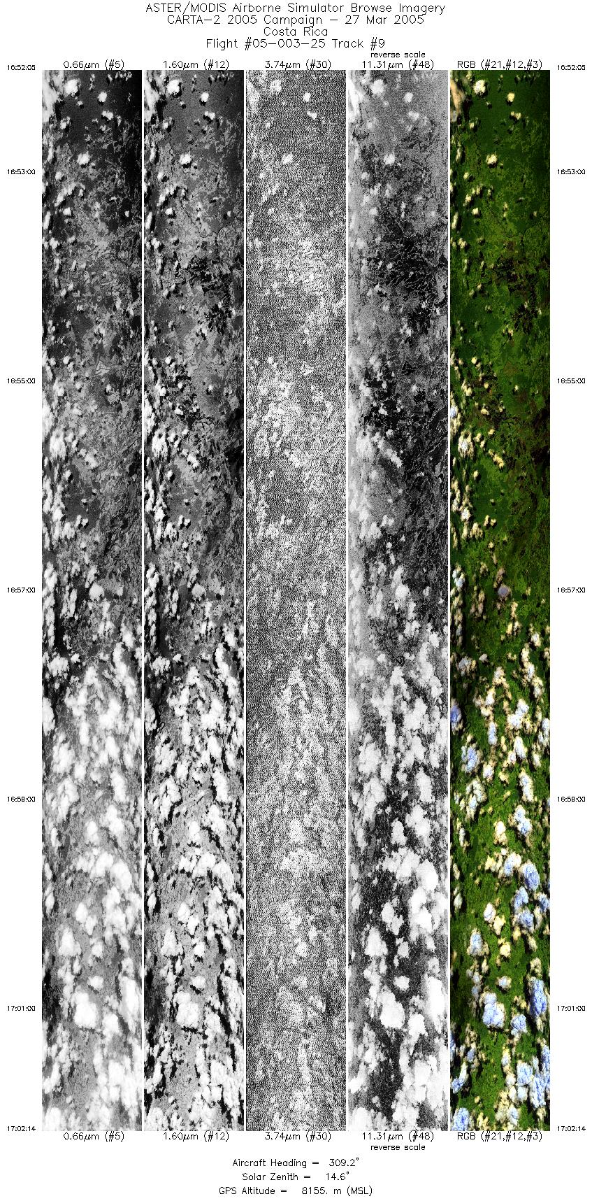
| 9 |
16:52 - 17:02 |
308.1 |
10.384 - 10.799 |
84.005 - 84.614 |
7586 |
8174 |
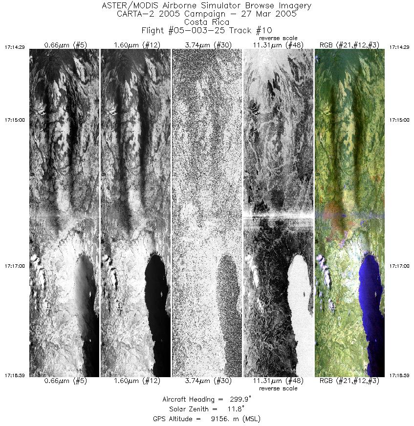
| 10 |
17:14 - 17:18 |
302.3 |
10.952 - 11.137 |
85.475 - 85.749 |
3360 |
9175 |
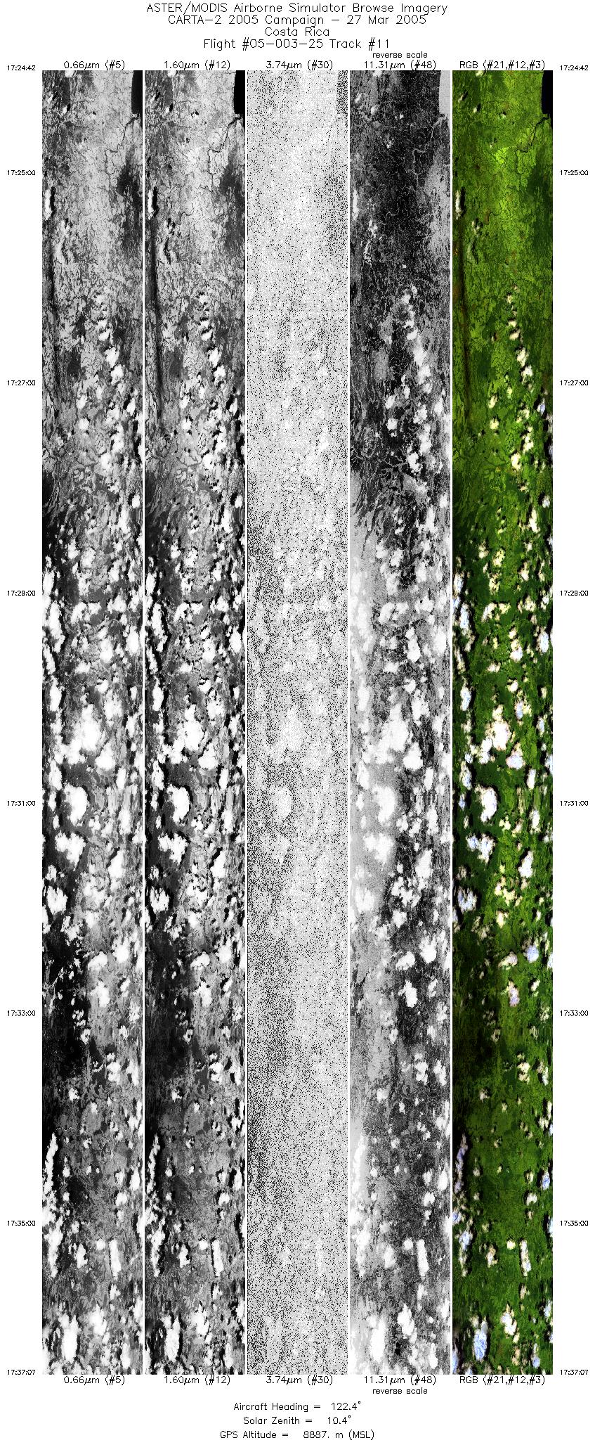
| 11 |
17:24 - 17:37 |
124.6 |
11.218 - 10.743 |
85.671 - 84.972 |
9279 |
8885 |
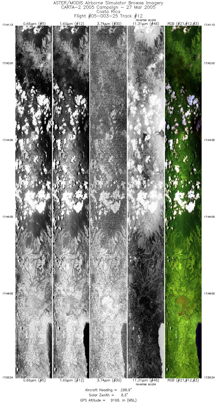
| 12 |
17:41 - 17:50 |
302.8 |
10.751 - 11.160 |
85.126 - 85.730 |
6872 |
9154 |
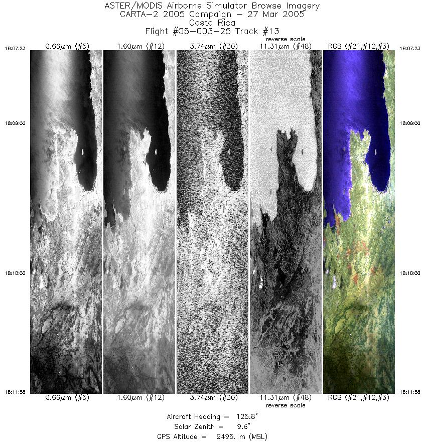
| 13 |
18:07 - 18:11 |
126.3 |
11.076 - 10.891 |
85.807 - 85.530 |
3427 |
9481 |
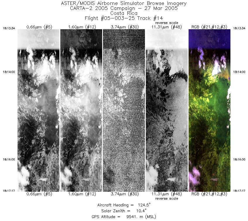
| 14 |
18:13 - 18:17 |
124.6 |
10.824 - 10.685 |
85.434 - 85.225 |
2781 |
9487 |
|


