Flight: 05-003-13
Date: March 10, 2005
Aircraft: NASA WB57, #926
Deployment: CARTA II
Flight Location: Costa Rica
Principal Investigator: CENAT (Diaz)
Additional Sensors: RC-30, DCS, Hymap
|
Data Evaluation
Data quality is ok.
Port 4 Dewar lost its sealer plug causing all the LN2 to escape; no usable data for bands 41-50.
Data from Port 3 has also been affected.
|
Processing Information
Level-1B Data in HDF format is available
Flight Line Summary
Spectral Band Configuration
Spectral Response Function Table
Spectral Response Function (text)
|
Browse Imagery
Flight Tracks: 15
Scanlines: 109191
|
Browse Imagery Table
|
Click a Flight Track number to view a quicklook image
Lat/Lon ranges are for the BEG-END scanline nadir pixels
|
Flight
Track |
Time Span
(UTC) |
Heading
(Deg) |
Lat Range
(Deg N) |
Lon Range
(Deg W) |
Length
(Scanlines) |
Altitude
(Meters) |
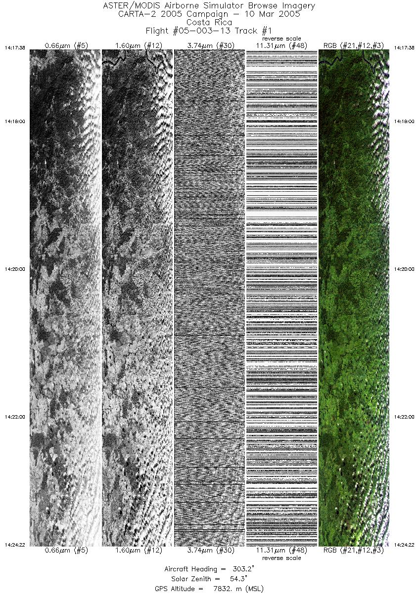
| 1 |
14:17 - 14:24 |
304.3 |
10.687 - 10.959 |
84.209 - 84.610 |
5030 |
7807 |
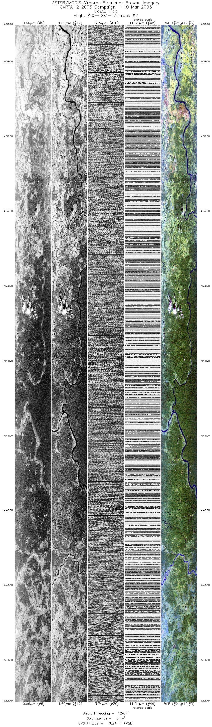
| 2 |
14:32 - 14:50 |
129.4 |
11.143 - 10.538 |
84.695 - 83.806 |
13519 |
7827 |
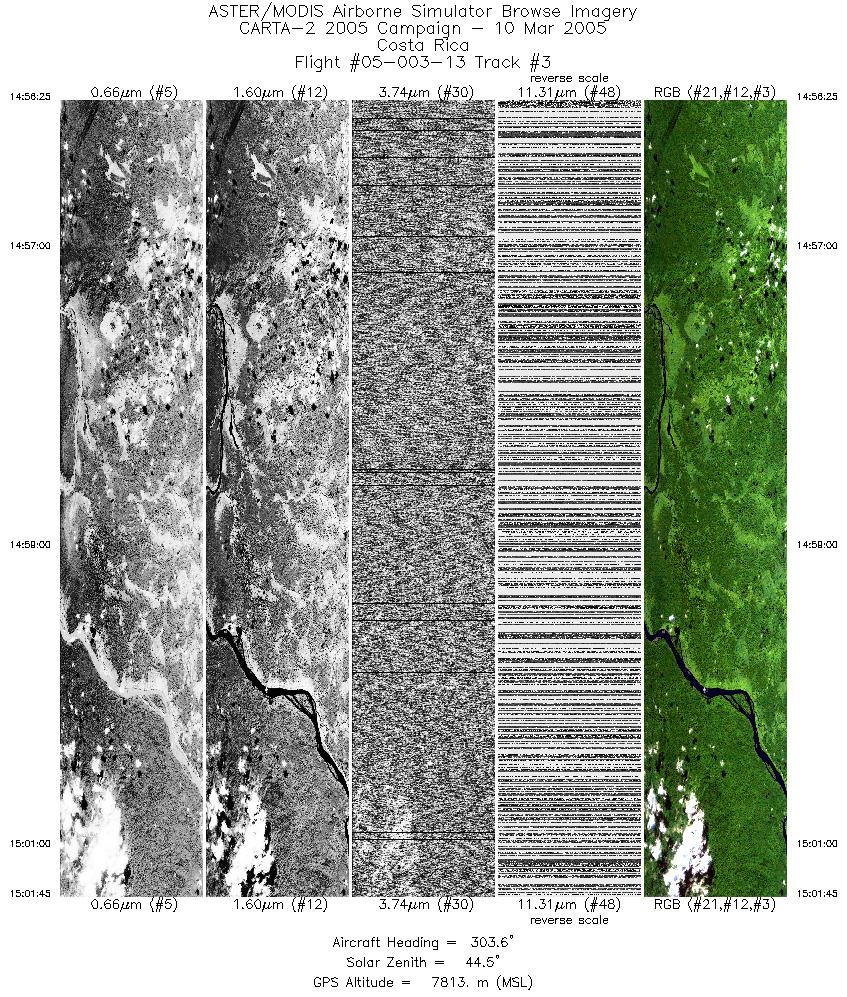
| 3 |
14:56 - 15:01 |
305.2 |
10.581 - 10.790 |
83.622 - 83.926 |
3989 |
7811 |
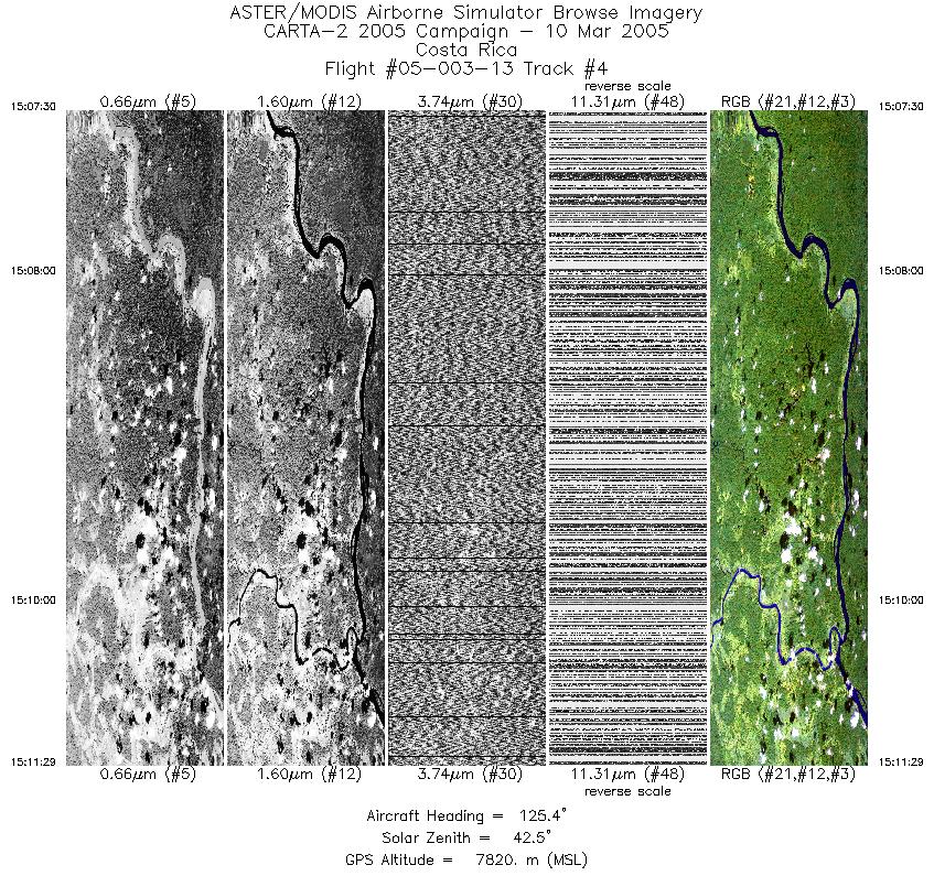
| 4 |
15:07 - 15:11 |
124.8 |
10.789 - 10.662 |
84.109 - 83.924 |
2976 |
7817 |
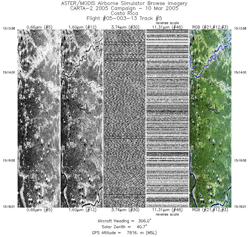
| 5 |
15:13 - 15:18 |
305.3 |
10.600 - 10.755 |
83.957 - 84.184 |
3032 |
7812 |
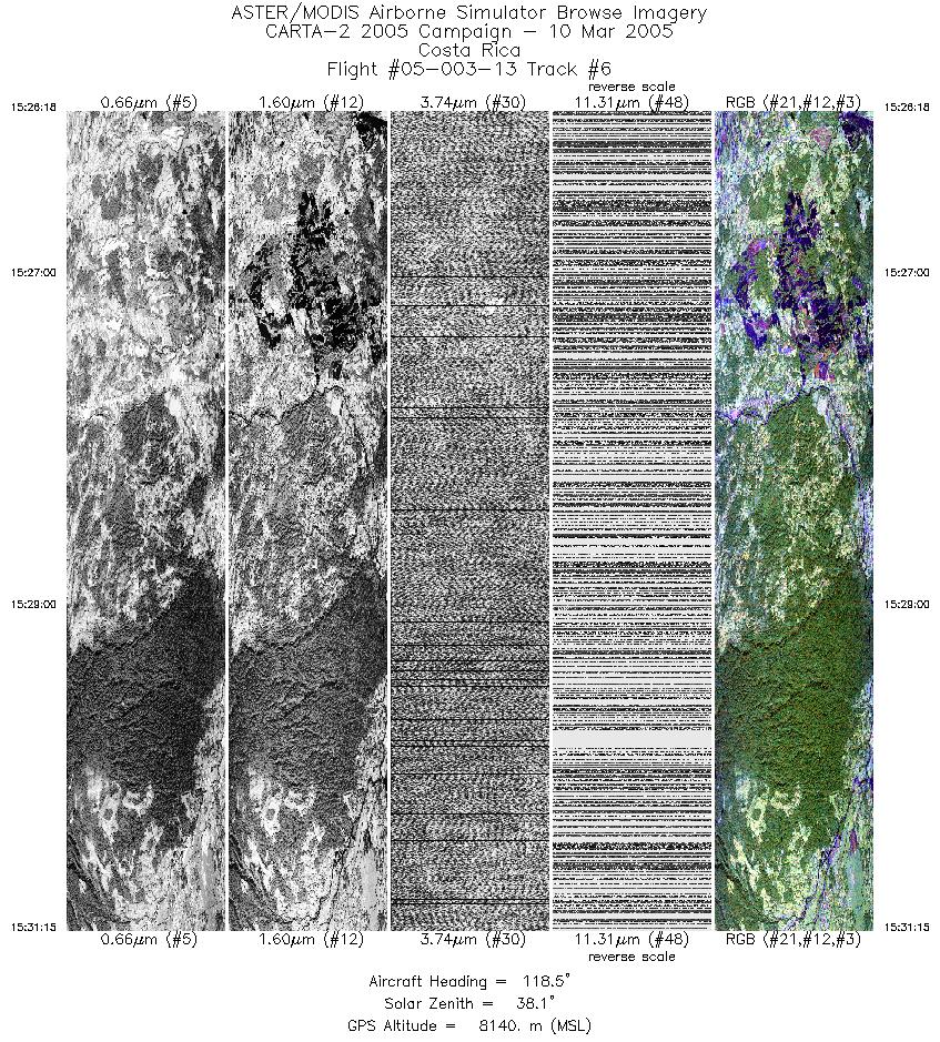
| 6 |
15:26 - 15:31 |
122.3 |
10.484 - 10.320 |
84.204 - 83.964 |
3699 |
8142 |
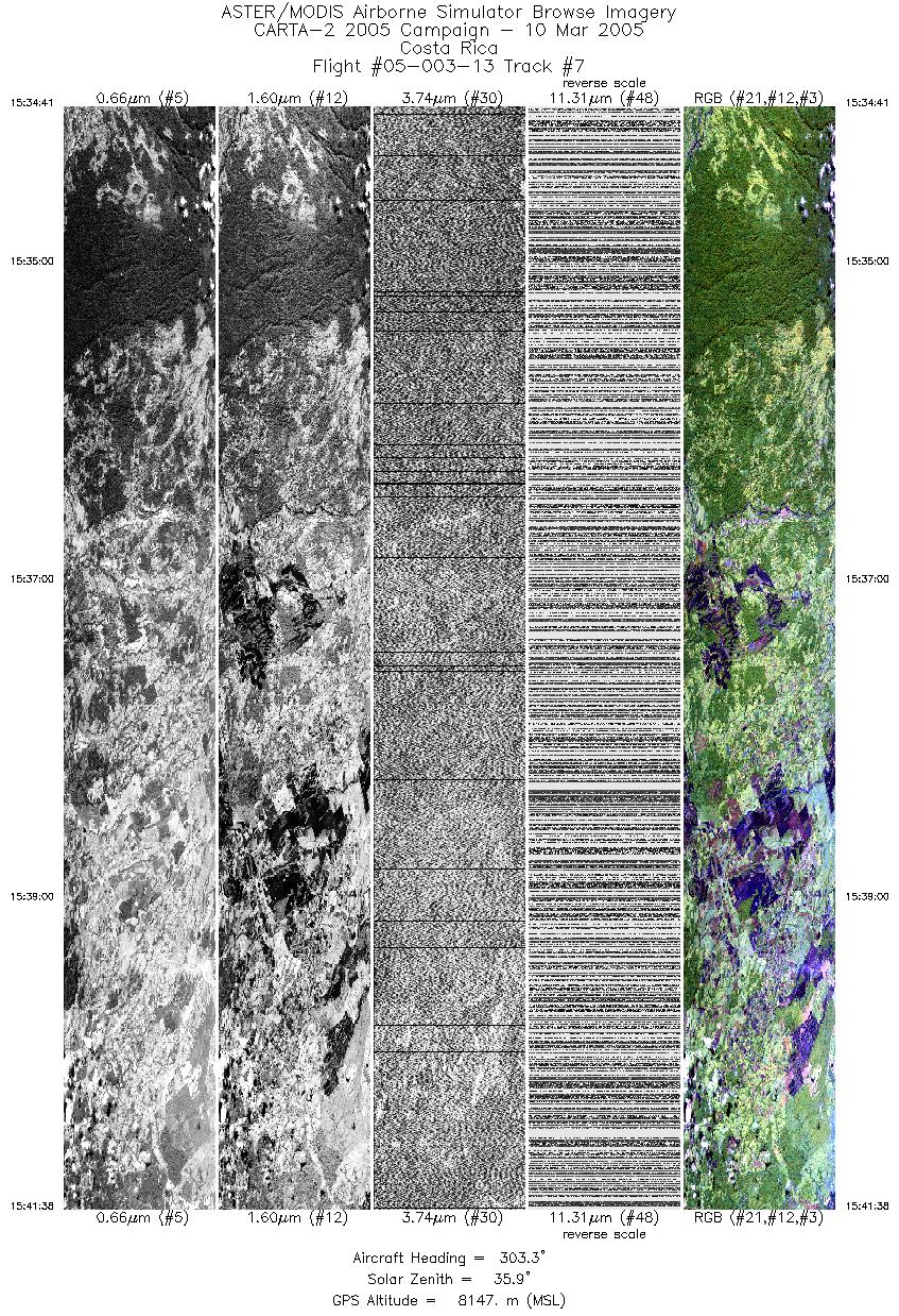
| 7 |
15:34 - 15:41 |
305.4 |
10.298 - 10.570 |
83.983 - 84.381 |
5193 |
8142 |
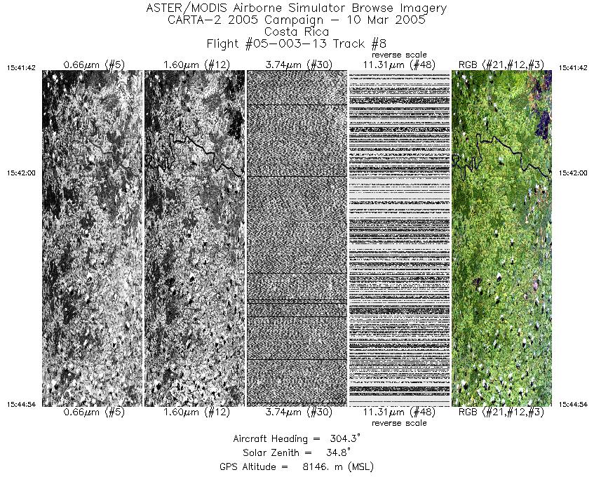
| 8 |
15:41 - 15:44 |
305.5 |
10.572 - 10.698 |
84.384 - 84.569 |
2401 |
8146 |
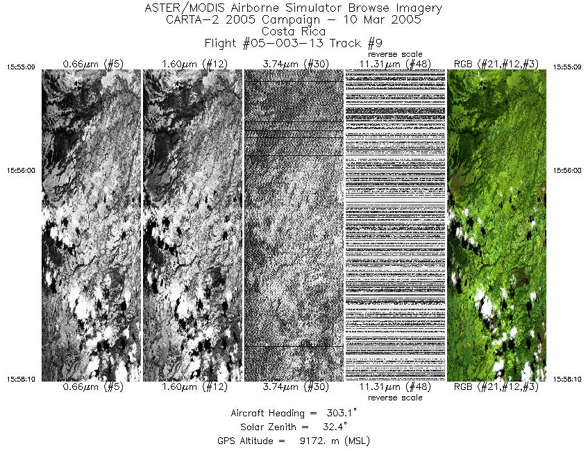
| 9 |
15:55 - 15:58 |
303.9 |
10.572 - 10.691 |
85.103 - 85.281 |
2250 |
9172 |
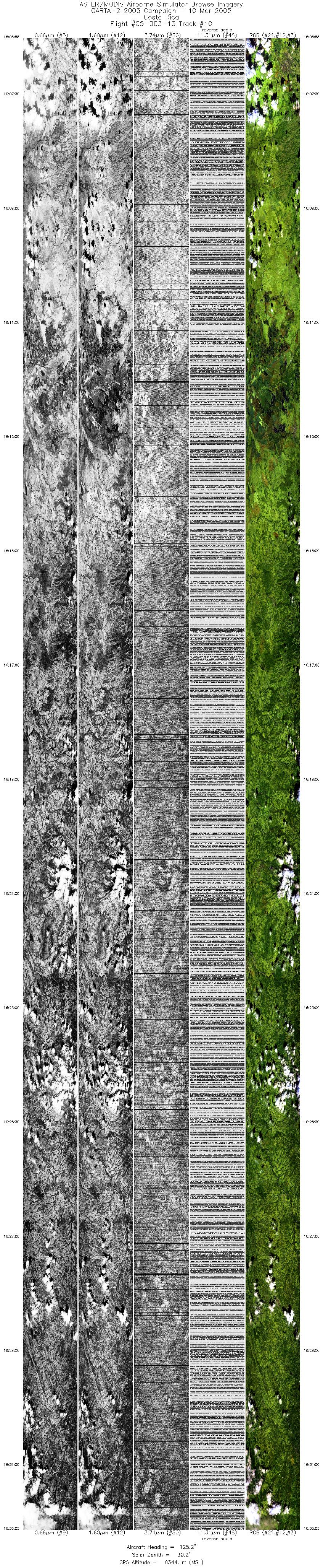
| 10 |
16:06 - 16:33 |
123.8 |
10.629 - 9.710 |
85.477 - 84.126 |
19502 |
8332 |
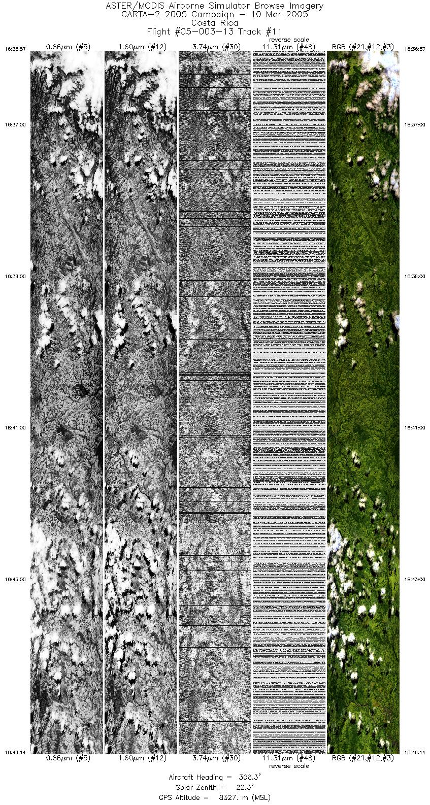
| 11 |
16:36 - 16:46 |
305.2 |
9.689 - 10.047 |
84.145 - 84.668 |
6932 |
8323 |
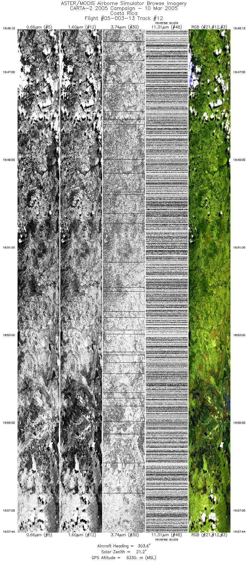
| 12 |
16:46 - 16:57 |
305.1 |
10.048 - 10.485 |
84.669 - 85.313 |
8577 |
8332 |
| 13 |
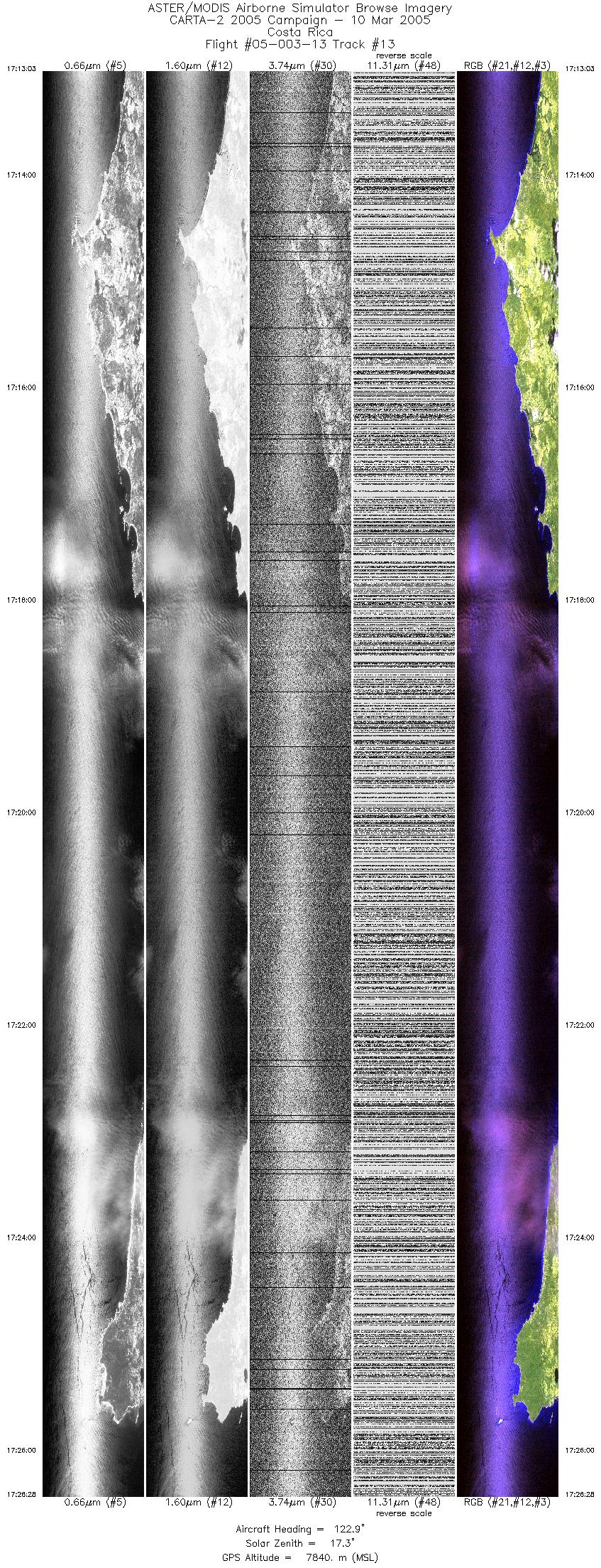
17:13 - 17:26 |
124.7 |
9.970 - 9.526 |
85.731 - 85.074 |
10034 |
7831 |
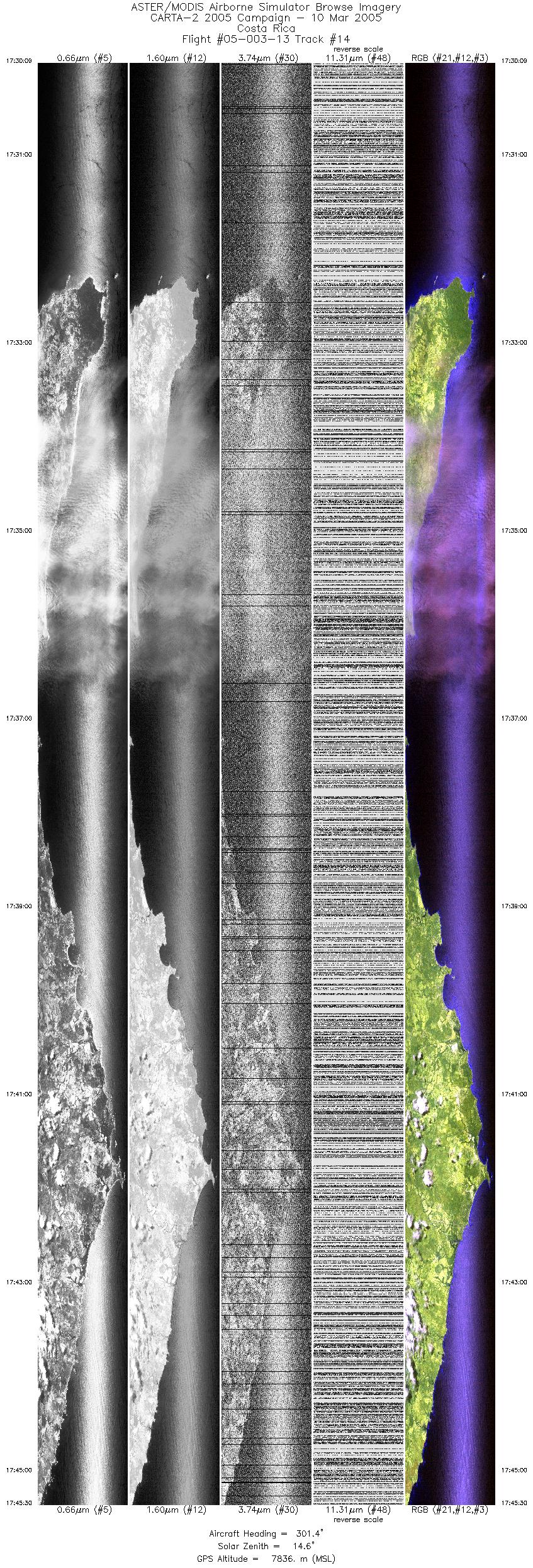
| 14 |
17:30 - 17:45 |
303.4 |
9.490 - 10.084 |
84.960 - 85.835 |
11467 |
7833 |
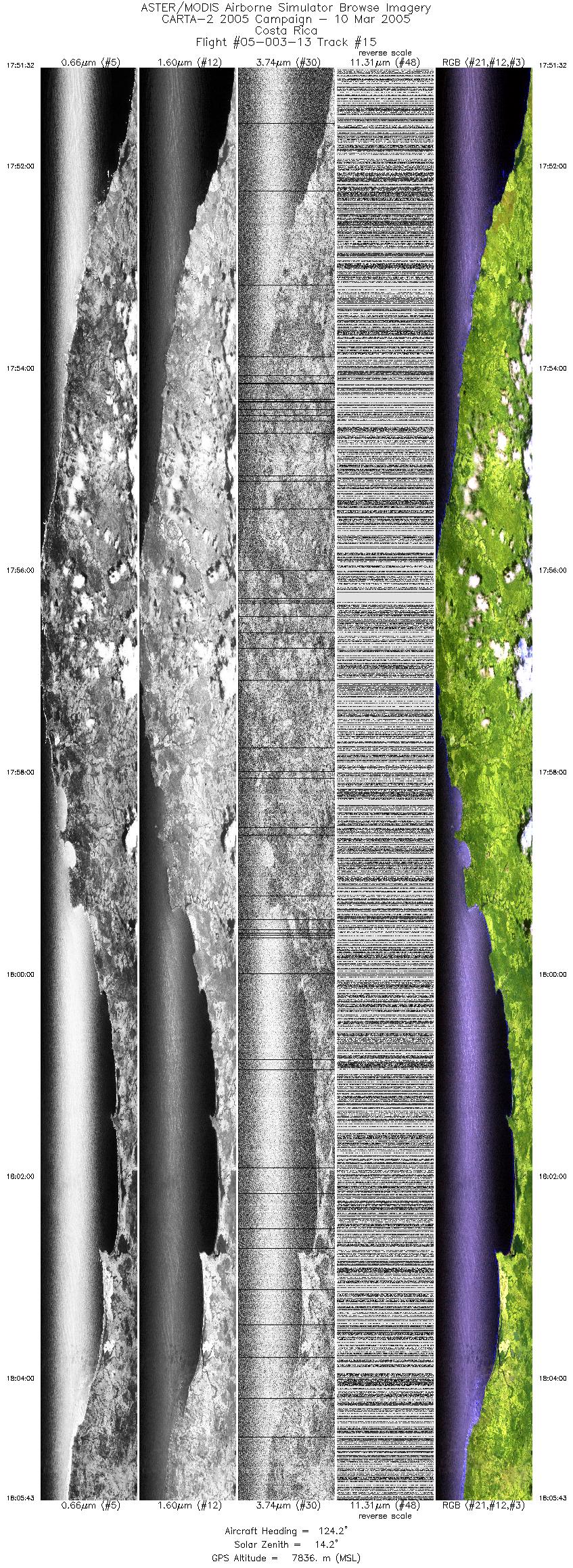
| 15 |
17:51 - 18:05 |
125.7 |
10.149 - 9.667 |
85.871 - 85.160 |
10590 |
7834 |
|


