Flight: 05-003-10
Date: March 6, 2005
Aircraft: NASA WB57, #926
Deployment: CARTA II
Flight Location: Costa Rica
Principal Investigator: CENAT (Diaz)
Additional Sensors: RC-30, DCS, Hymap
|
Data Evaluation
Data quality is good.
|
Processing Information
Level-1B Data in HDF format is available
Flight Line Summary
Spectral Band Configuration
Spectral Response Function Table
Spectral Response Function (text)
|
Browse Imagery
Flight Tracks: 12
Scanlines: 85420
|
Browse Imagery Table
|
Click a Flight Track number to view a quicklook image
Lat/Lon ranges are for the BEG-END scanline nadir pixels
|
Flight
Track |
Time Span
(UTC) |
Heading
(Deg) |
Lat Range
(Deg N) |
Lon Range
(Deg W) |
Length
(Scanlines) |
Altitude
(Meters) |
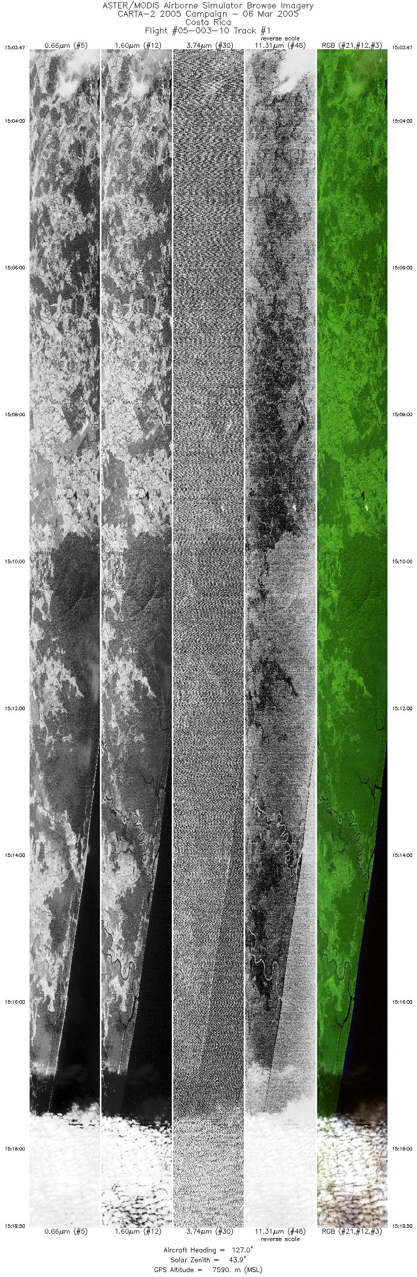
| 1 |
15:03 - 15:19 |
123.0 |
10.648 - 10.128 |
83.904 - 83.128 |
11968 |
7585 |
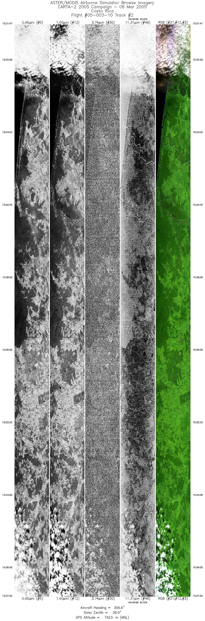
| 2 |
15:21 - 15:37 |
306.5 |
10.097 - 10.647 |
83.160 - 83.964 |
11771 |
7602 |
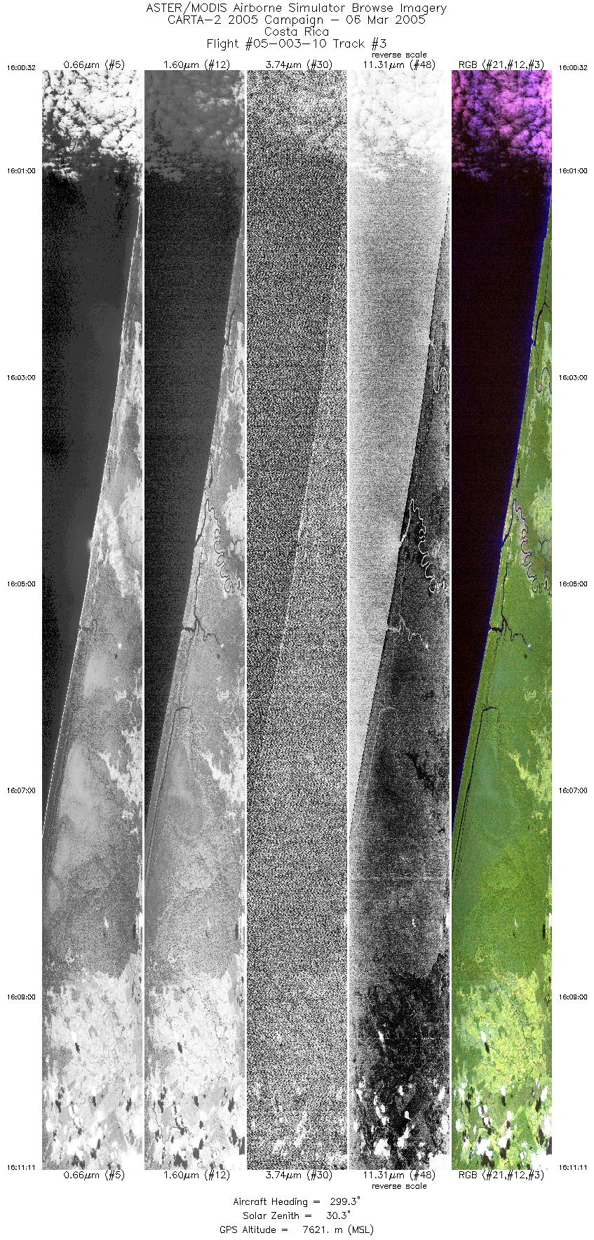
| 3 |
16:00 - 16:11 |
301.9 |
10.154 - 10.523 |
83.120 - 83.659 |
7936 |
7614 |
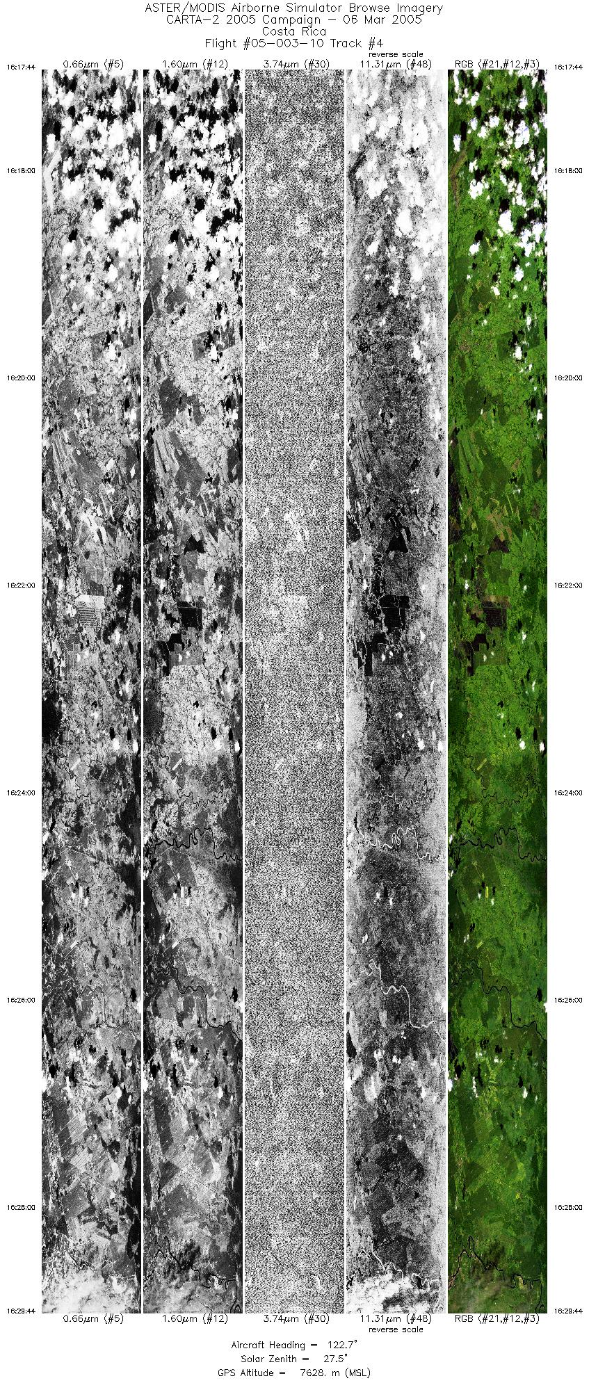
| 4 |
16:17 - 16:29 |
122.2 |
10.483 - 10.073 |
83.847 - 83.245 |
8945 |
7627 |
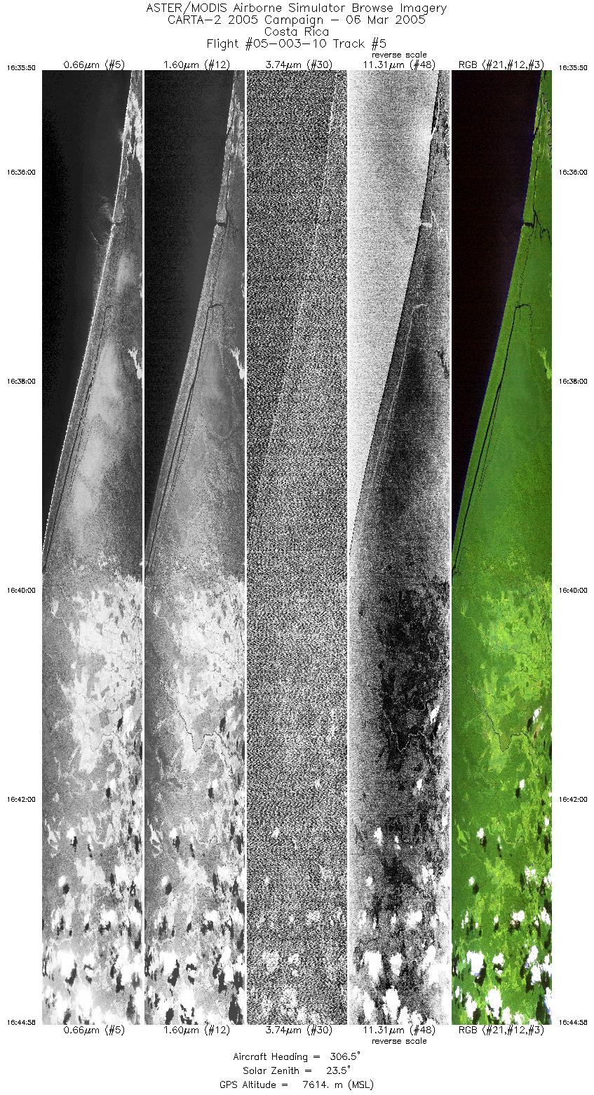
| 5 |
16:35 - 16:44 |
305.3 |
10.321 - 10.632 |
83.303 - 83.758 |
6809 |
7610 |
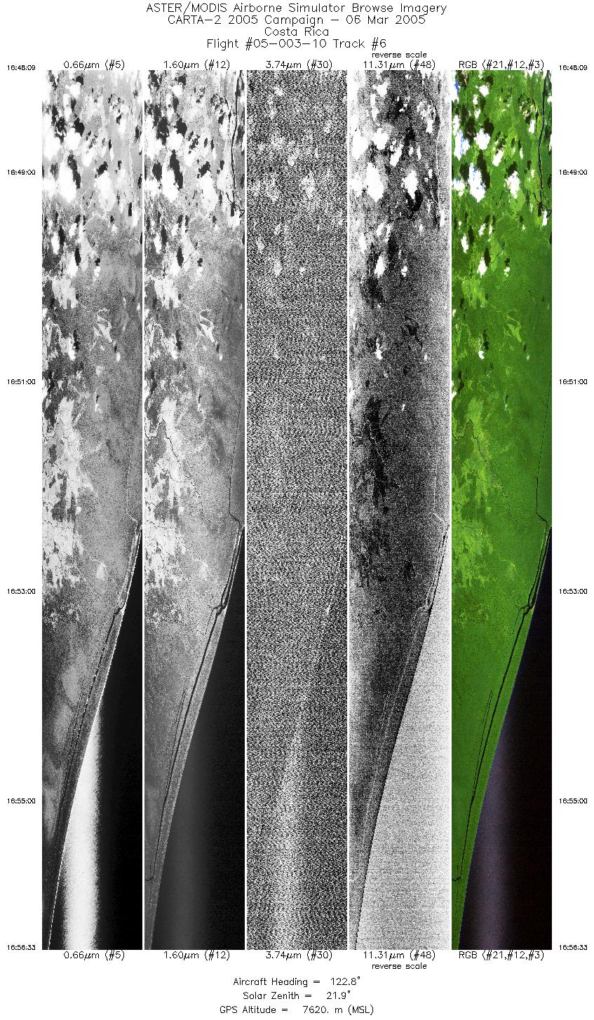
| 6 |
16:48 - 16:56 |
124.5 |
10.679 - 10.407 |
83.770 - 83.366 |
6275 |
7618 |
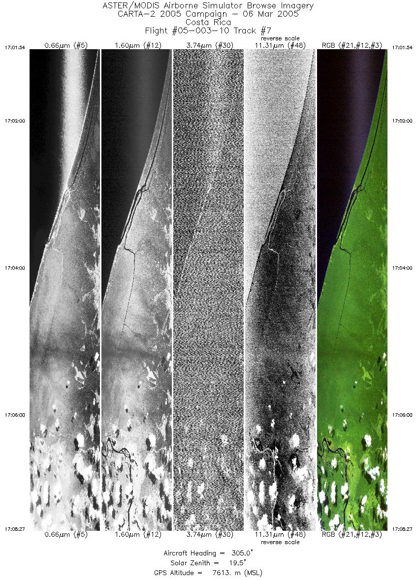
| 7 |
17:01 - 17:08 |
304.4 |
10.477 - 10.702 |
83.405 - 83.736 |
4897 |
7612 |
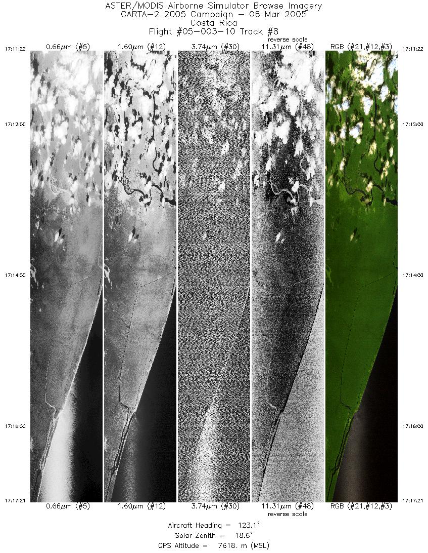
| 8 |
17:11 - 17:17 |
124.6 |
10.755 - 10.558 |
83.753 - 83.463 |
4464 |
7609 |
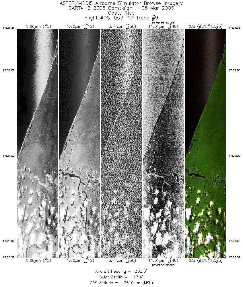
| 9 |
17:21 - 17:26 |
304.9 |
10.601 - 10.785 |
83.461 - 83.731 |
4014 |
7608 |
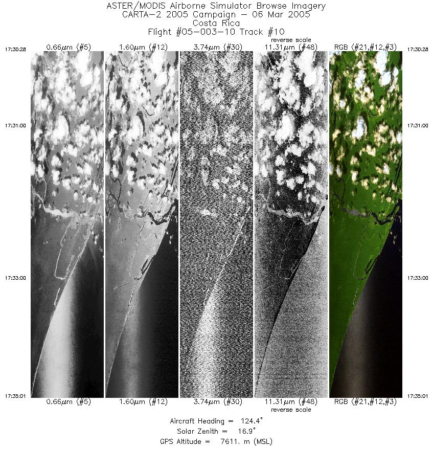
| 10 |
17:30 - 17:35 |
124.6 |
10.817 - 10.668 |
83.718 - 83.498 |
3394 |
7609 |
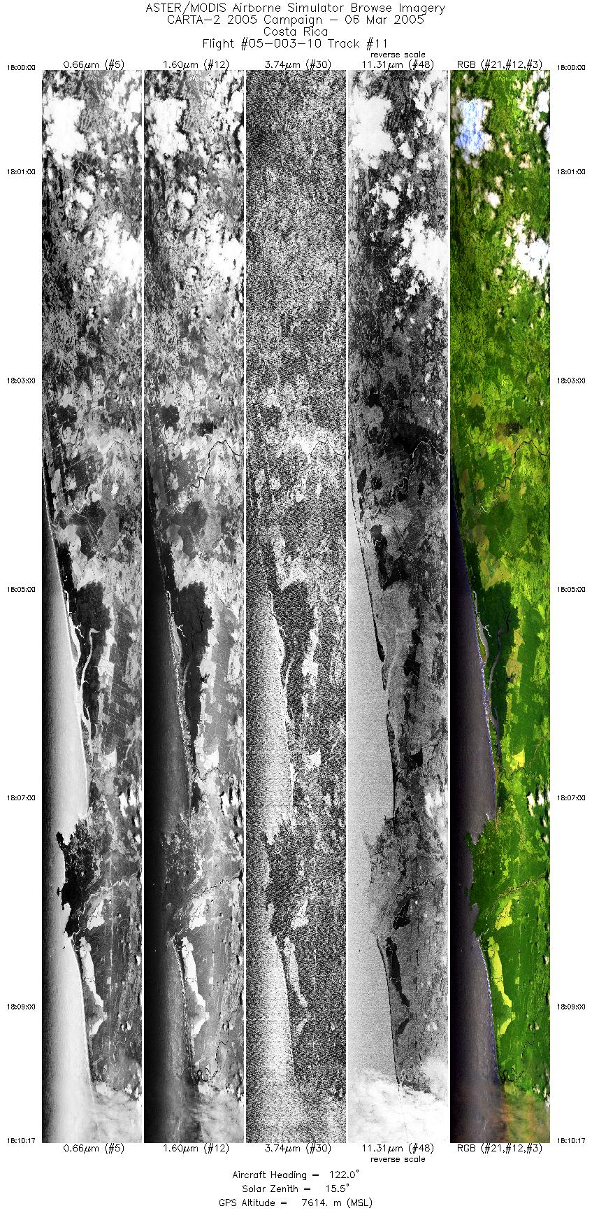
| 11 |
18:00 - 18:10 |
122.6 |
9.683 - 9.328 |
84.528 - 84.004 |
7670 |
7615 |
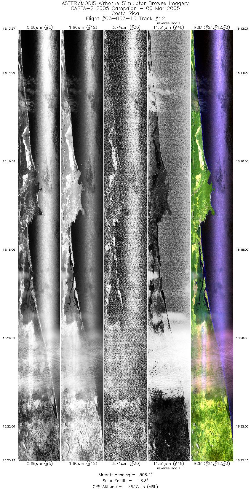
| 12 |
18:13 - 18:23 |
306.3 |
9.260 - 9.591 |
83.965 - 84.450 |
7277 |
7599 |
|


