Flight: 05-003-06
Date: March 1, 2005
Aircraft: NASA WB57, #926
Deployment: CARTA II
Flight Location: Costa Rica
Principal Investigator: CENAT (Diaz)
Additional Sensors: RC-30, DCS, Hymap
|
Data Evaluation
Data quality is ok.
|
Processing Information
Level-1B Data in HDF format is available
Flight Line Summary
Spectral Band Configuration
Spectral Response Function Table
Spectral Response Function (text)
|
Browse Imagery
Flight Tracks: 13
Scanlines: 118751
|
Browse Imagery Table
|
Click a Flight Track number to view a quicklook image
Lat/Lon ranges are for the BEG-END scanline nadir pixels
|
Flight
Track |
Time Span
(UTC) |
Heading
(Deg) |
Lat Range
(Deg N) |
Lon Range
(Deg W) |
Length
(Scanlines) |
Altitude
(Meters) |
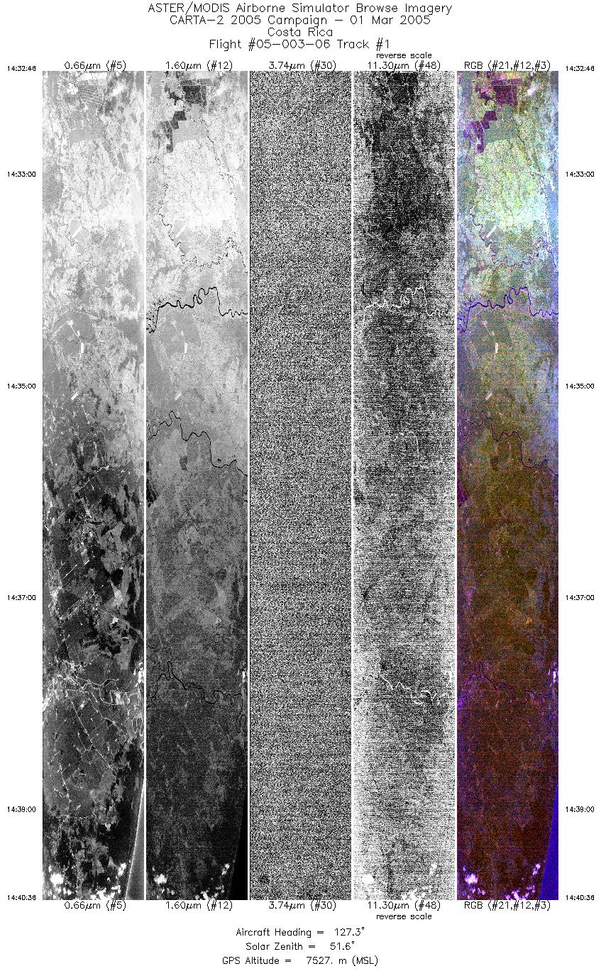
| 1 |
14:32 - 14:40 |
126.6 |
10.313 - 10.008 |
83.597 - 83.150 |
5846 |
7545 |
| 2 |
14:45 - 14:56 |
303.2 |
9.957 - 10.325 |
83.017 - 83.555 |
8200 |
7570 |
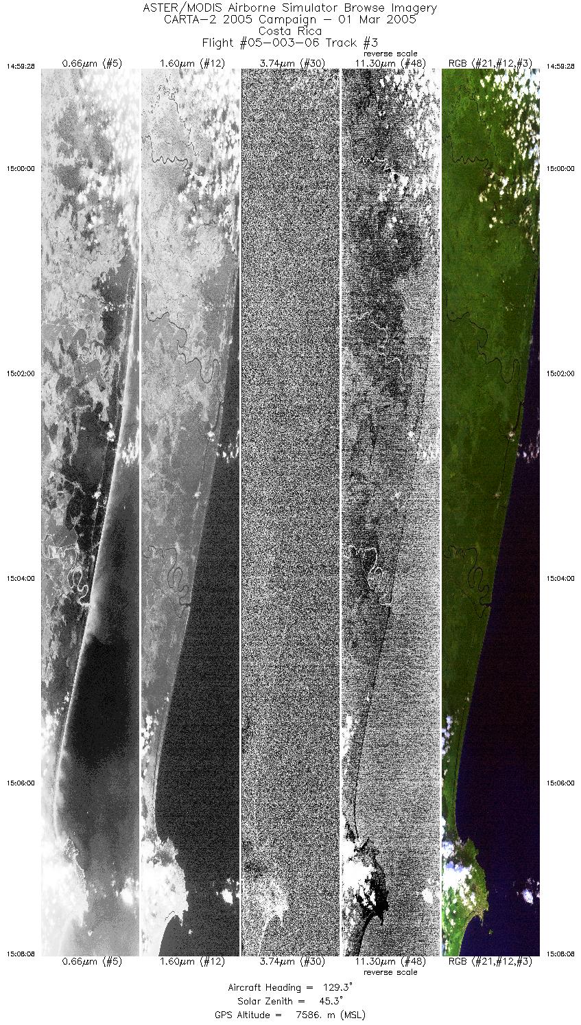
| 3 |
14:59 - 15:08 |
127.9 |
10.315 - 9.986 |
83.478 - 82.999 |
6468 |
7584 |
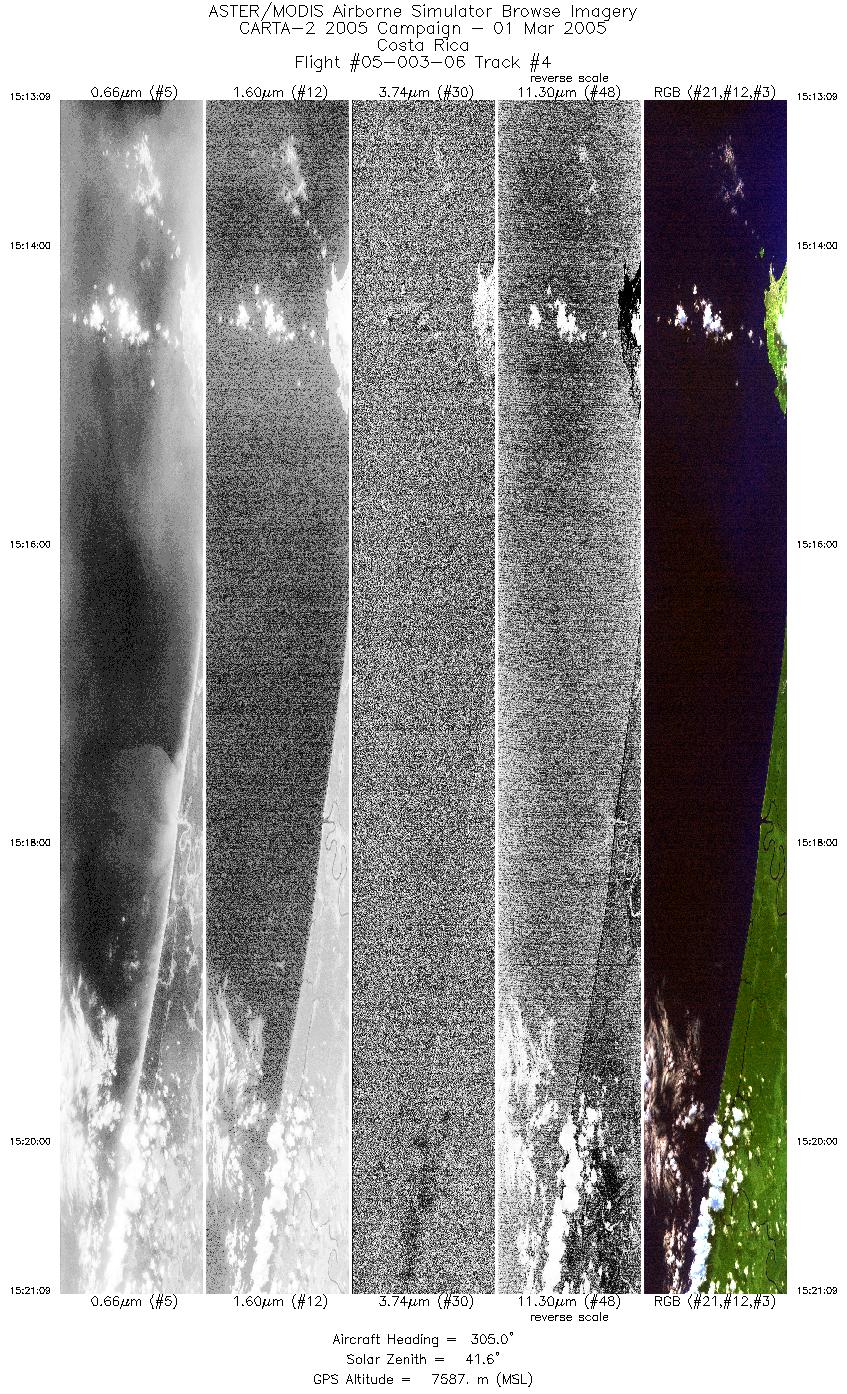
| 4 |
15:13 - 15:21 |
304.6 |
9.989 - 10.251 |
82.941 - 83.324 |
5972 |
7576 |
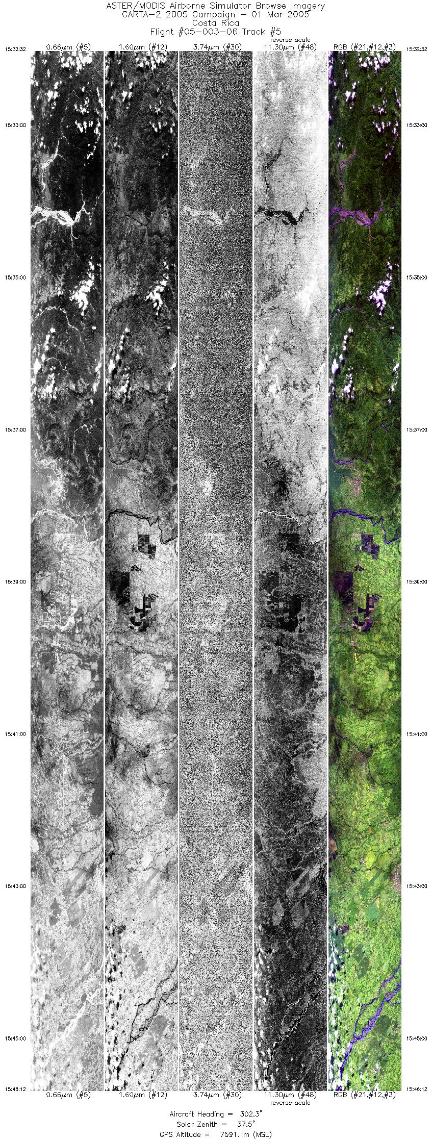
| 5 |
15:32 - 15:46 |
302.8 |
9.887 - 10.345 |
83.218 - 83.889 |
10197 |
7597 |
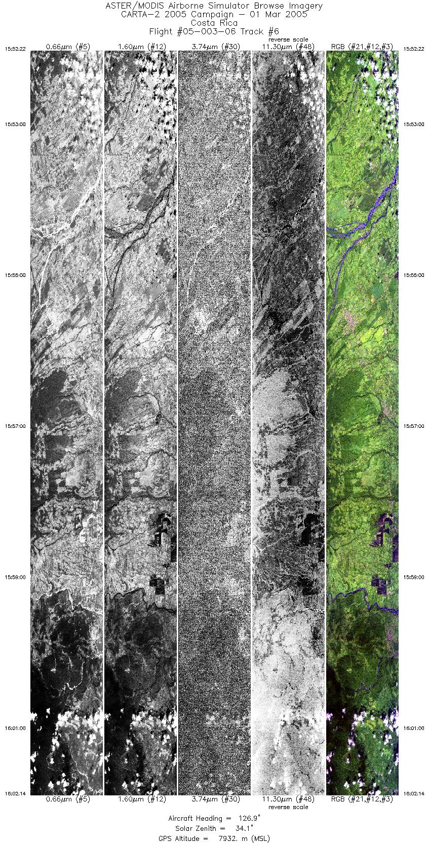
| 6 |
15:52 - 16:02 |
126.2 |
10.373 - 9.980 |
83.988 - 83.412 |
7356 |
7928 |
| 7 |
16:05 - 16:22 |
304.0 |
9.927 - 10.508 |
83.390 - 84.240 |
12638 |
7930 |
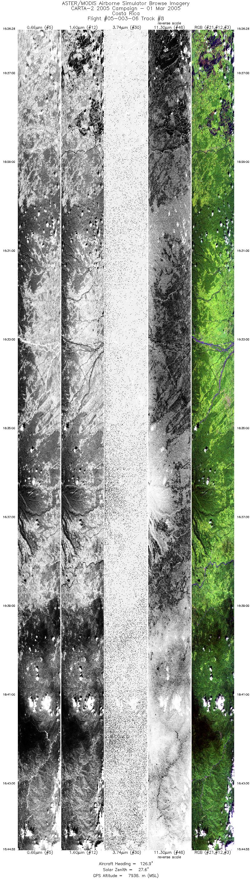
| 8 |
16:26 - 16:44 |
127.5 |
10.502 - 9.784 |
84.282 - 83.231 |
13789 |
7935 |
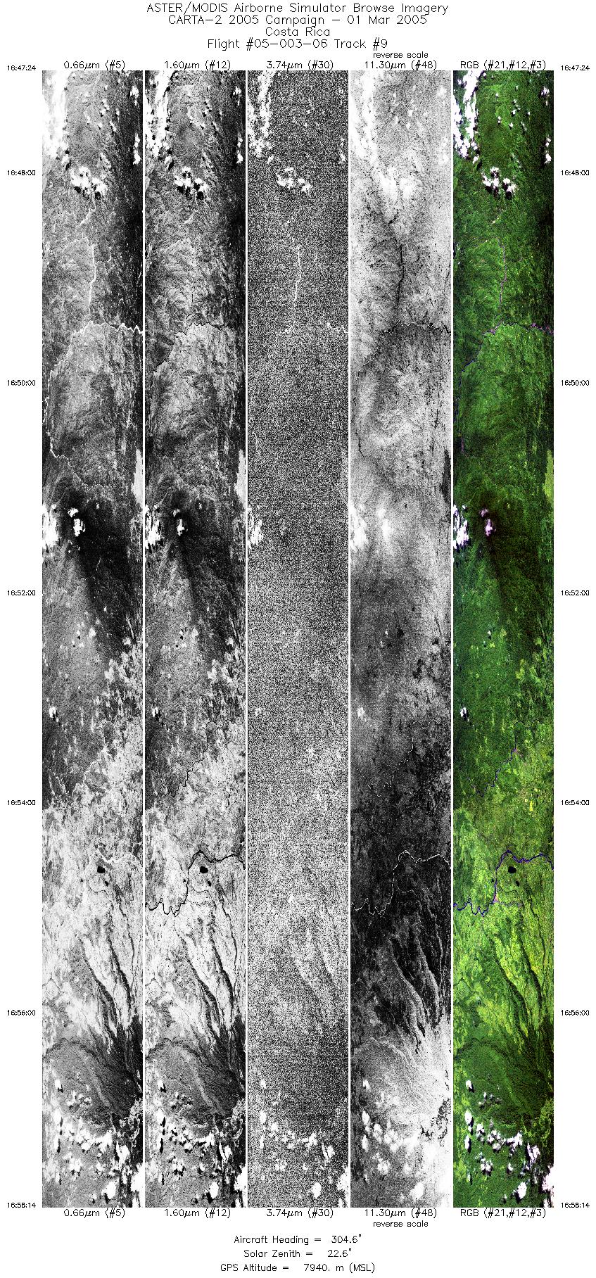
| 9 |
16:47 - 16:58 |
304.1 |
9.740 - 10.112 |
83.220 - 83.761 |
8084 |
7929 |
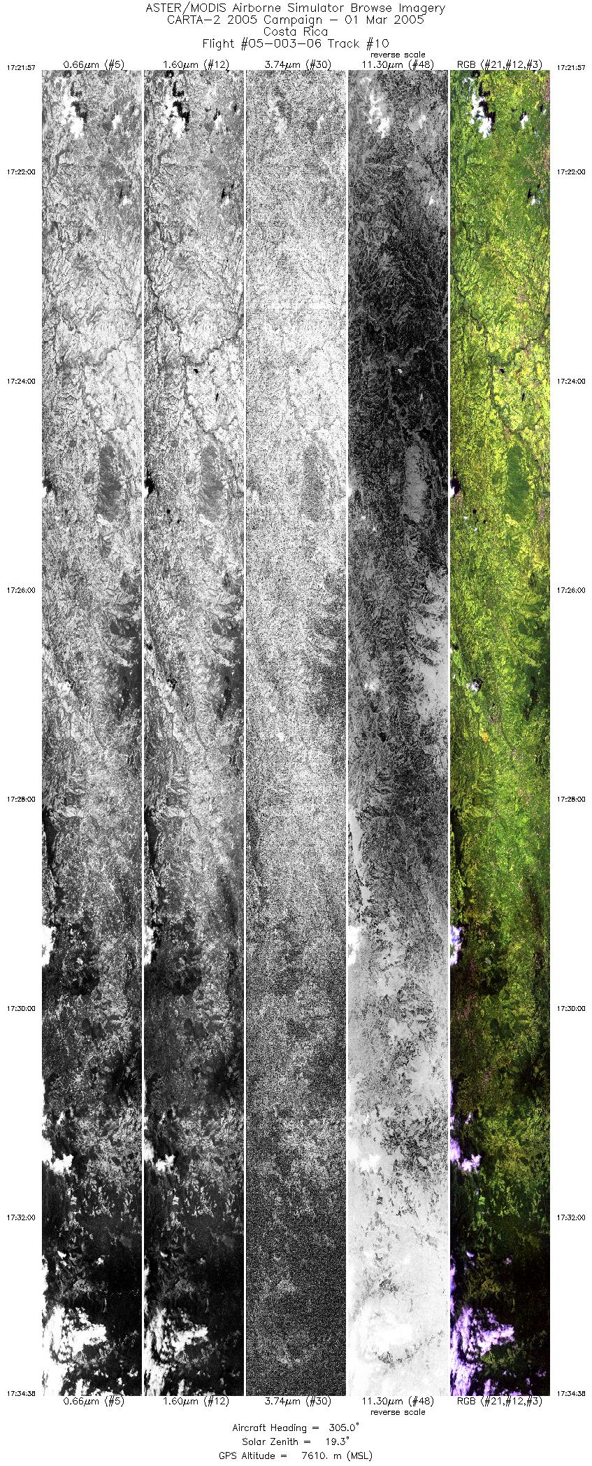
| 10 |
17:21 - 17:34 |
215.0 |
10.612 - 10.681 |
83.478 - 83.516 |
9471 |
7611 |
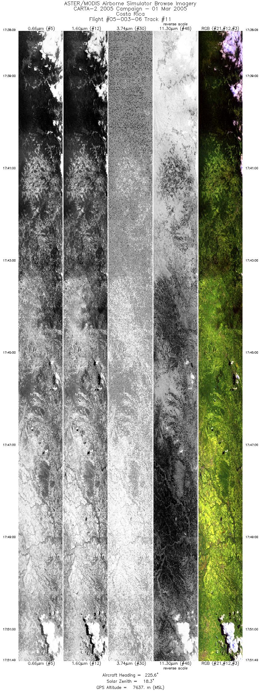
| 11 |
17:38 - 17:51 |
231.6 |
10.504 - 9.916 |
83.603 - 84.416 |
10195 |
7618 |
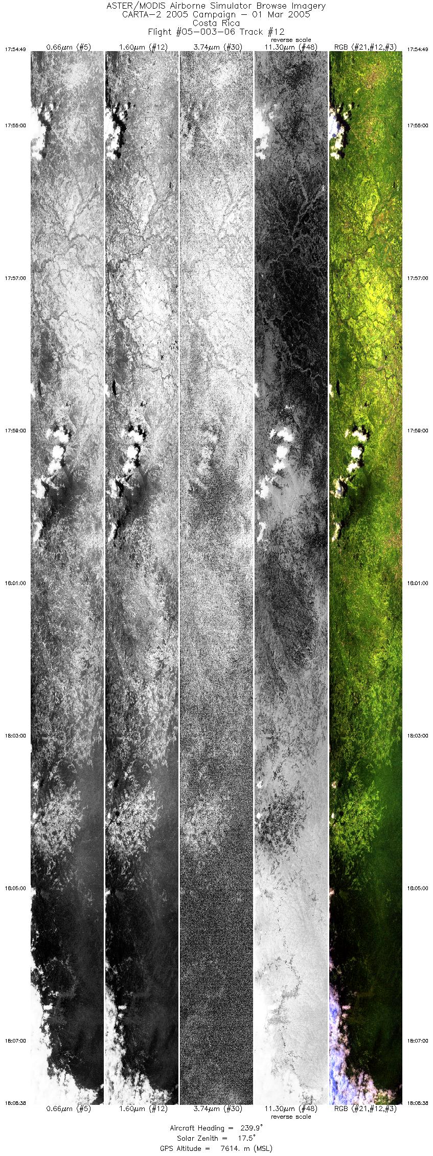
| 12 |
17:54 - 18:08 |
181.3 |
9.822 - 9.385 |
84.571 - 84.089 |
10311 |
7605 |
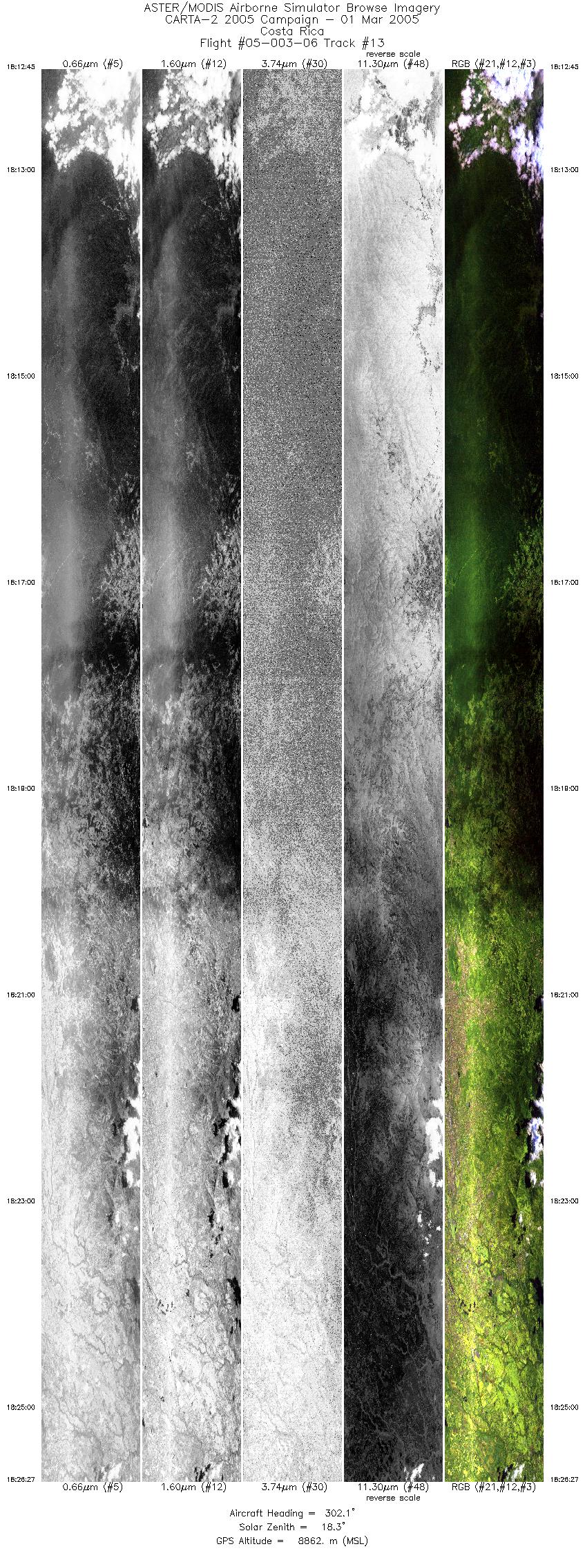
| 13 |
18:12 - 18:26 |
302.4 |
9.533 - 10.017 |
83.626 - 84.335 |
10224 |
8848 |
|


