Flight: 04-007-04
Date: September 25, 2004
Aircraft: Sky Research Caravan, #797
Deployment: Sky September 2004
Flight Location: Ashland, OR
Principal Investigator: F.C.F.
Additional Sensors: Sky Lidar
|
Data Evaluation
Weather: Clear
Haze: Light
Turbulence:
Data quality is good.
|
Processing Information
Level-1B Data in HDF format is available
Flight Line Summary
Spectral Band Configuration
Spectral Response Function Table
Spectral Response Function (text)
|
Browse Imagery
Flight Tracks: 23
Scanlines: 51340
|
Browse Imagery Table
|
Click a Flight Track number to view a quicklook image
Lat/Lon ranges are for the BEG-END scanline nadir pixels
|
Flight
Track |
Time Span
(UTC) |
Heading
(Deg) |
Lat Range
(Deg N) |
Lon Range
(Deg W) |
Length
(Scanlines) |
Altitude
(Meters) |
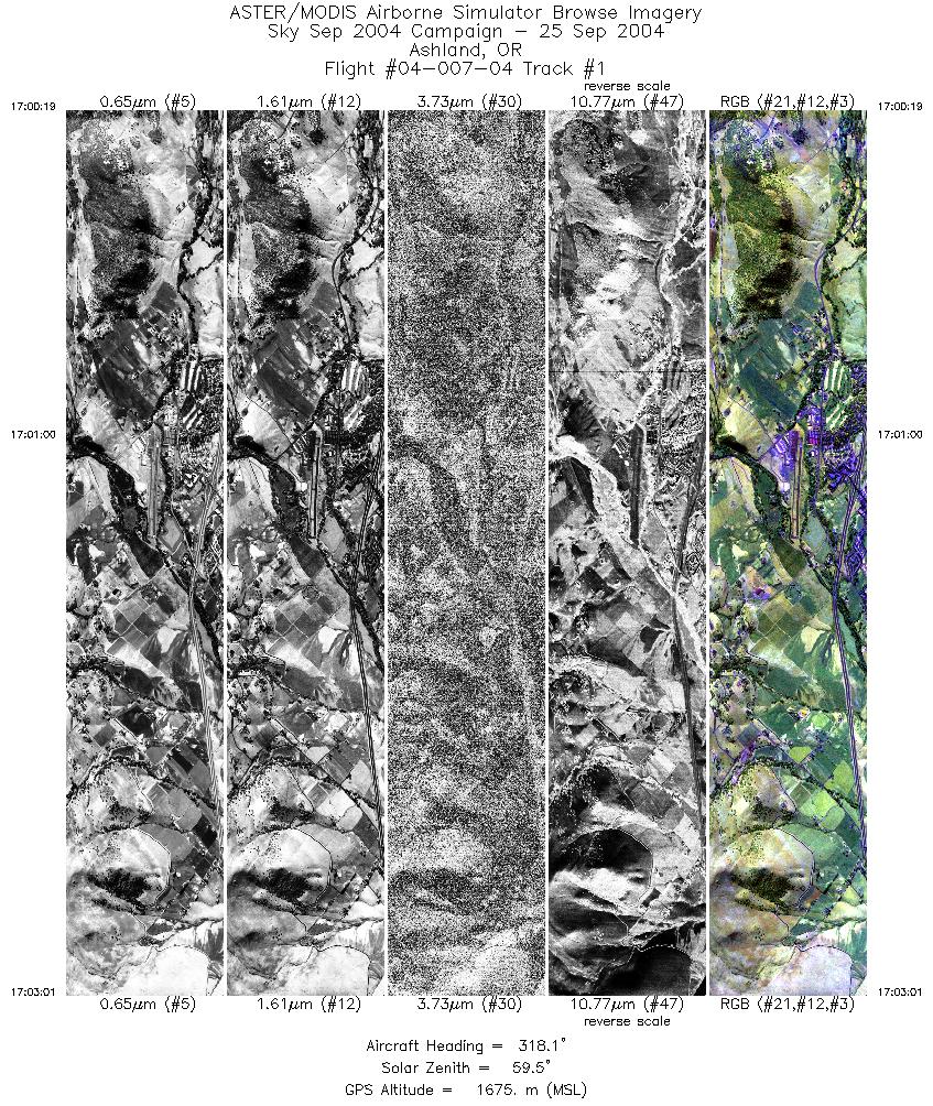
| 1 |
17:00 - 17:03 |
322.5 |
42.161 - 42.229 |
122.624 - 122.703 |
4024 |
1652 |
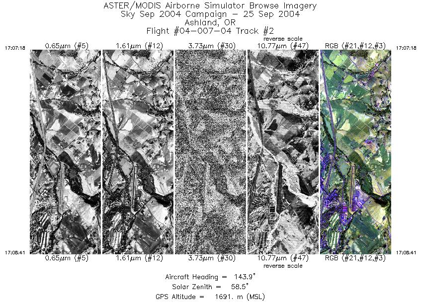
| 2 |
17:07 - 17:08 |
143.0 |
42.217 - 42.180 |
122.689 - 122.646 |
2062 |
1700 |
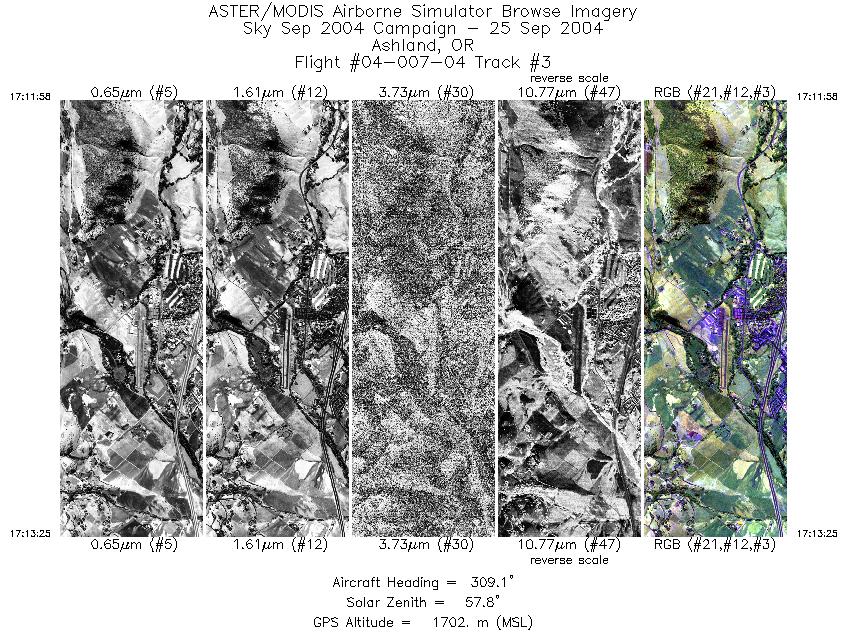
| 3 |
17:11 - 17:13 |
314.2 |
42.166 - 42.209 |
122.629 - 122.679 |
2188 |
1672 |
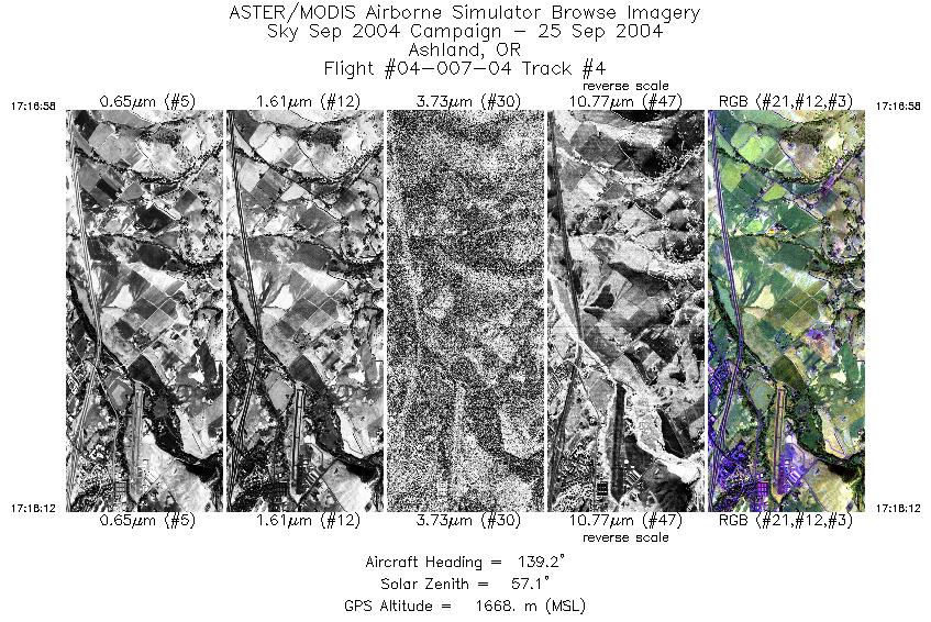
| 4 |
17:16 - 17:18 |
141.7 |
42.218 - 42.186 |
122.691 - 122.654 |
1834 |
1676 |
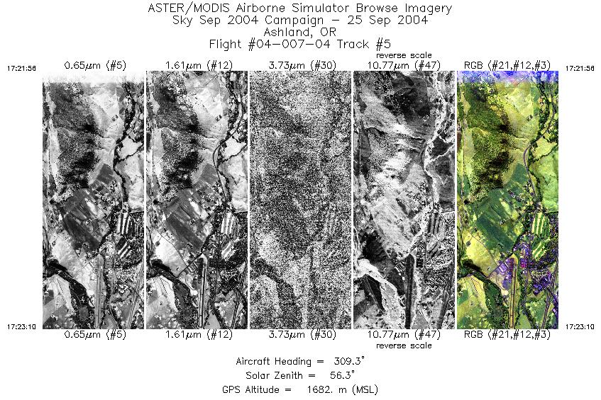
| 5 |
17:21 - 17:23 |
312.6 |
42.163 - 42.194 |
122.627 - 122.663 |
1828 |
1696 |
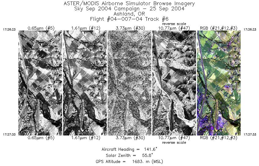
| 6 |
17:26 - 17:27 |
142.2 |
42.216 - 42.186 |
122.688 - 122.653 |
1724 |
1693 |
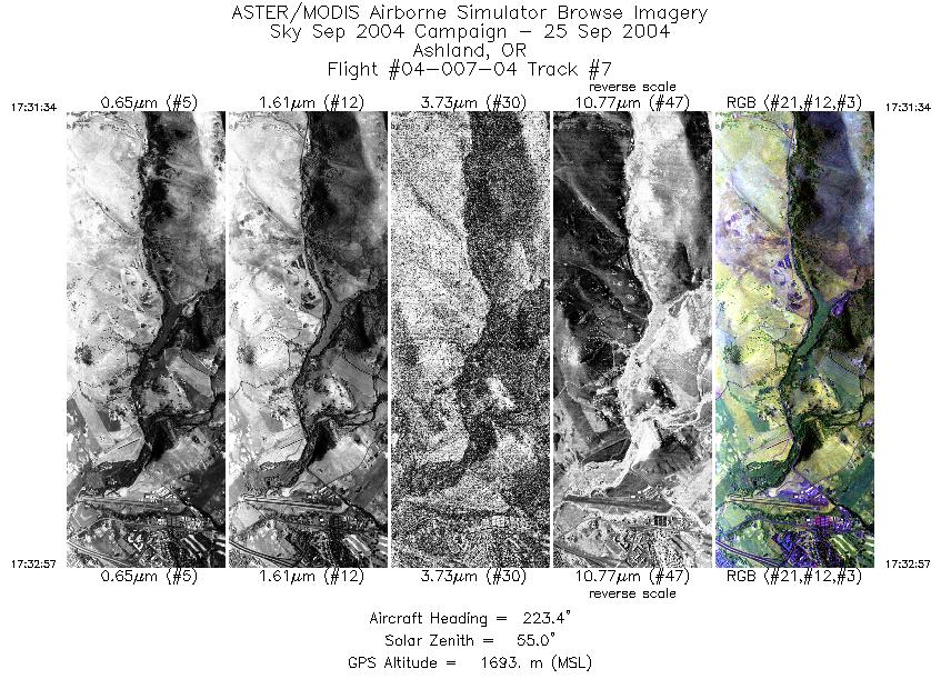
| 7 |
17:31 - 17:32 |
222.4 |
42.215 - 42.185 |
122.616 - 122.664 |
2055 |
1705 |
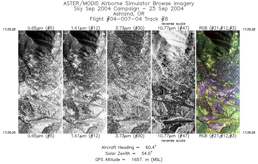
| 8 |
17:35 - 17:36 |
56.5 |
42.166 - 42.190 |
122.697 - 122.655 |
1699 |
1647 |
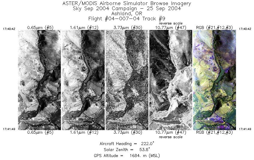
| 9 |
17:40 - 17:41 |
223.7 |
42.212 - 42.187 |
122.621 - 122.660 |
1677 |
1704 |
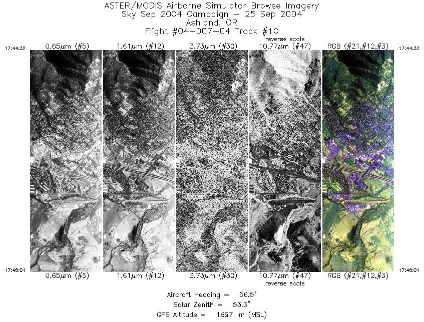
| 10 |
17:44 - 17:46 |
62.4 |
42.165 - 42.198 |
122.697 - 122.641 |
2219 |
1670 |
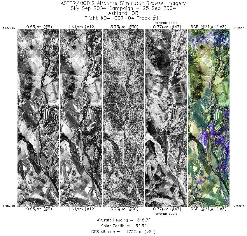
| 11 |
17:50 - 17:52 |
321.4 |
42.156 - 42.207 |
122.623 - 122.677 |
3051 |
1663 |
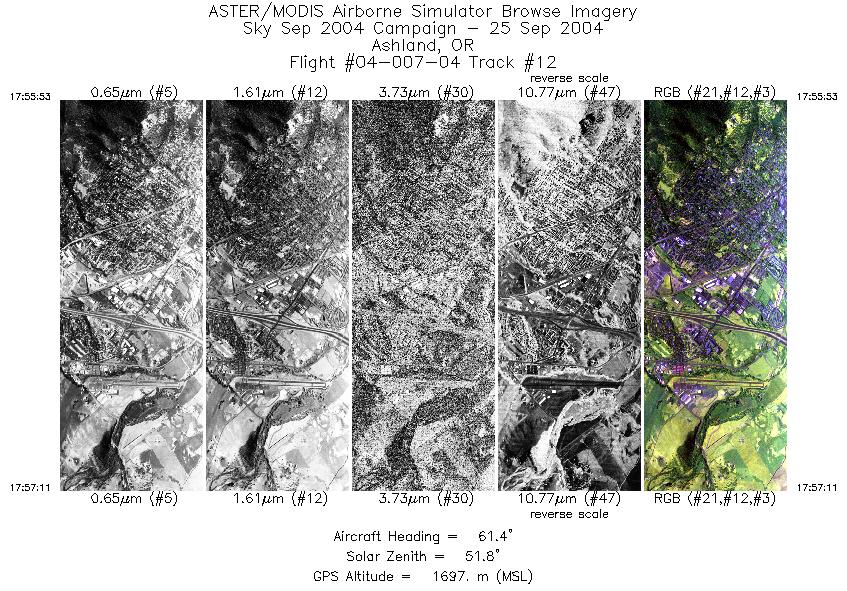
| 12 |
17:55 - 17:57 |
57.9 |
42.171 - 42.197 |
122.693 - 122.649 |
1955 |
1696 |
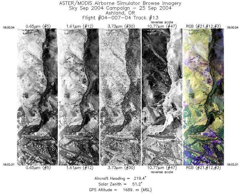
| 13 |
18:00 - 18:02 |
224.1 |
42.217 - 42.183 |
122.619 - 122.671 |
2408 |
1690 |
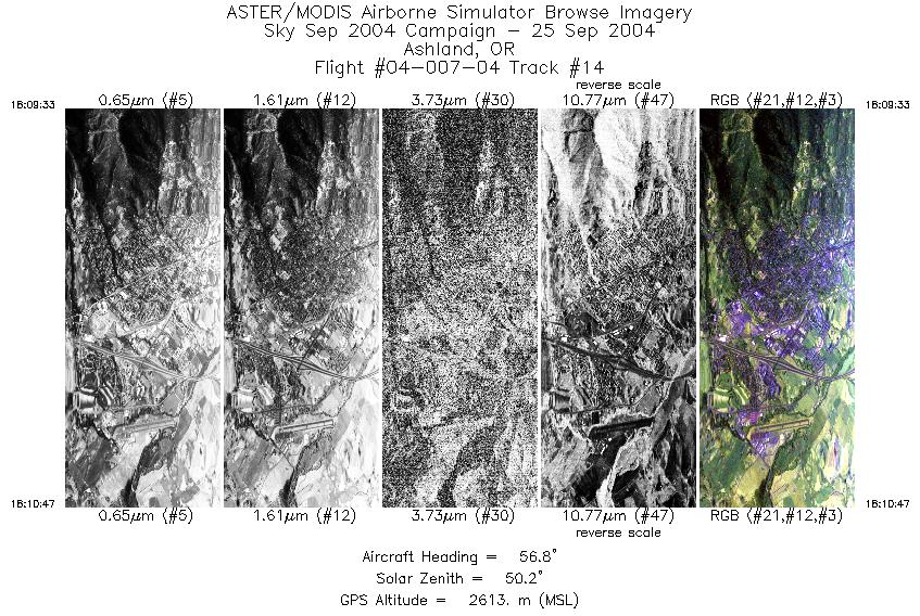
| 14 |
18:09 - 18:10 |
53.9 |
42.165 - 42.194 |
122.699 - 122.652 |
1840 |
2619 |
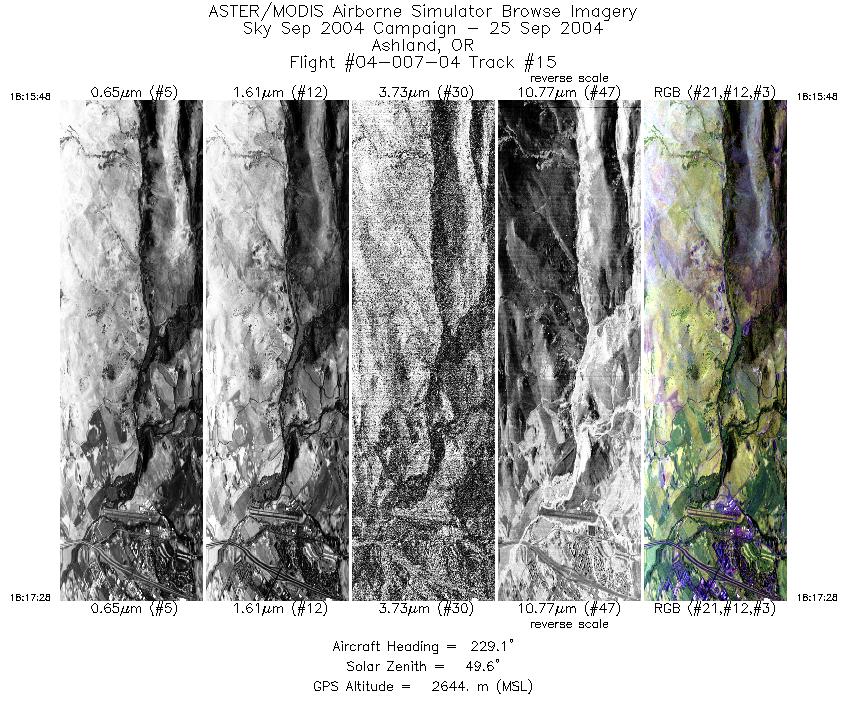
| 15 |
18:15 - 18:17 |
230.2 |
42.219 - 42.184 |
122.612 - 122.669 |
2507 |
2644 |
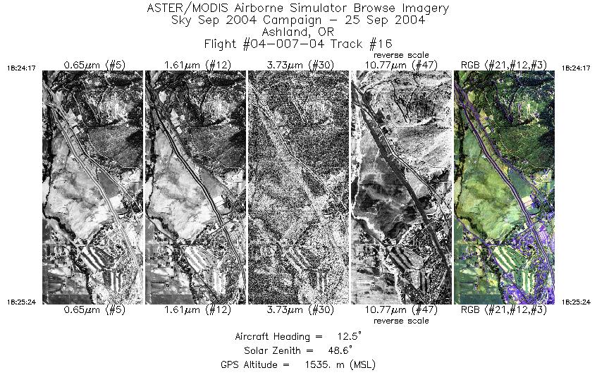
| 16 |
18:24 - 18:25 |
5.5 |
42.151 - 42.183 |
122.656 - 122.654 |
1661 |
1547 |
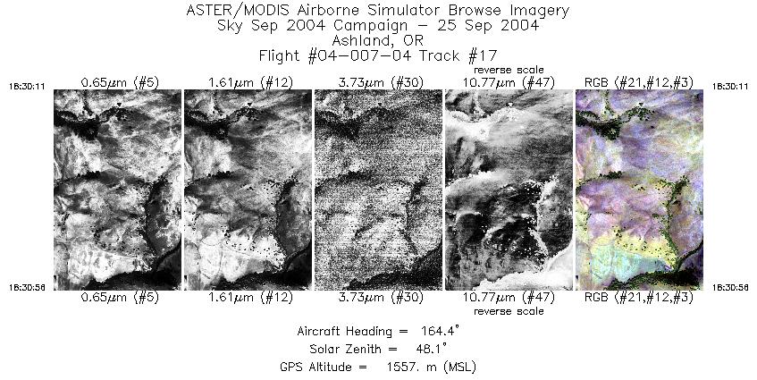
| 17 |
18:30 - 18:30 |
168.7 |
42.235 - 42.215 |
122.660 - 122.655 |
1126 |
1560 |
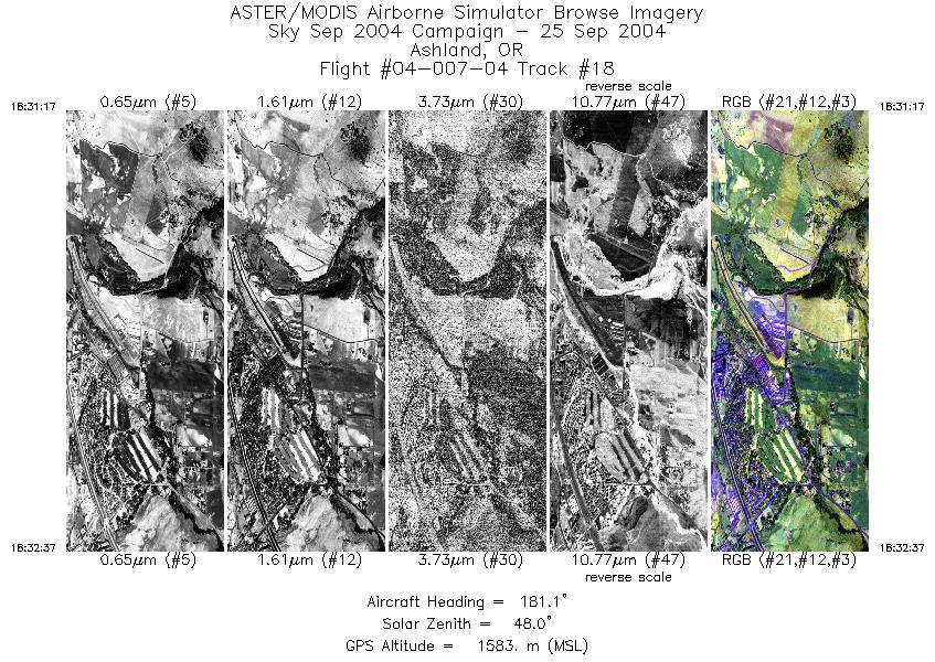
| 18 |
18:31 - 18:32 |
180.0 |
42.206 - 42.172 |
122.654 - 122.654 |
2000 |
1581 |
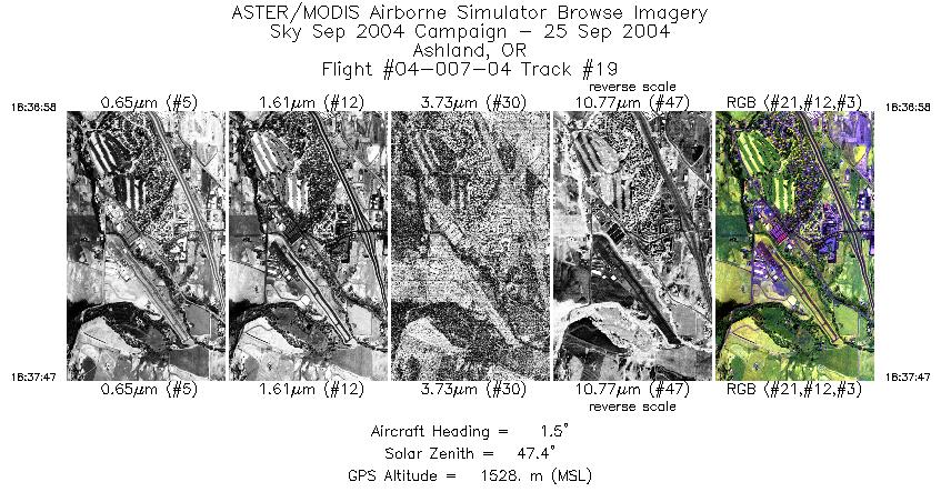
| 19 |
18:36 - 18:37 |
0.9 |
42.174 - 42.196 |
122.659 - 122.660 |
1218 |
1529 |
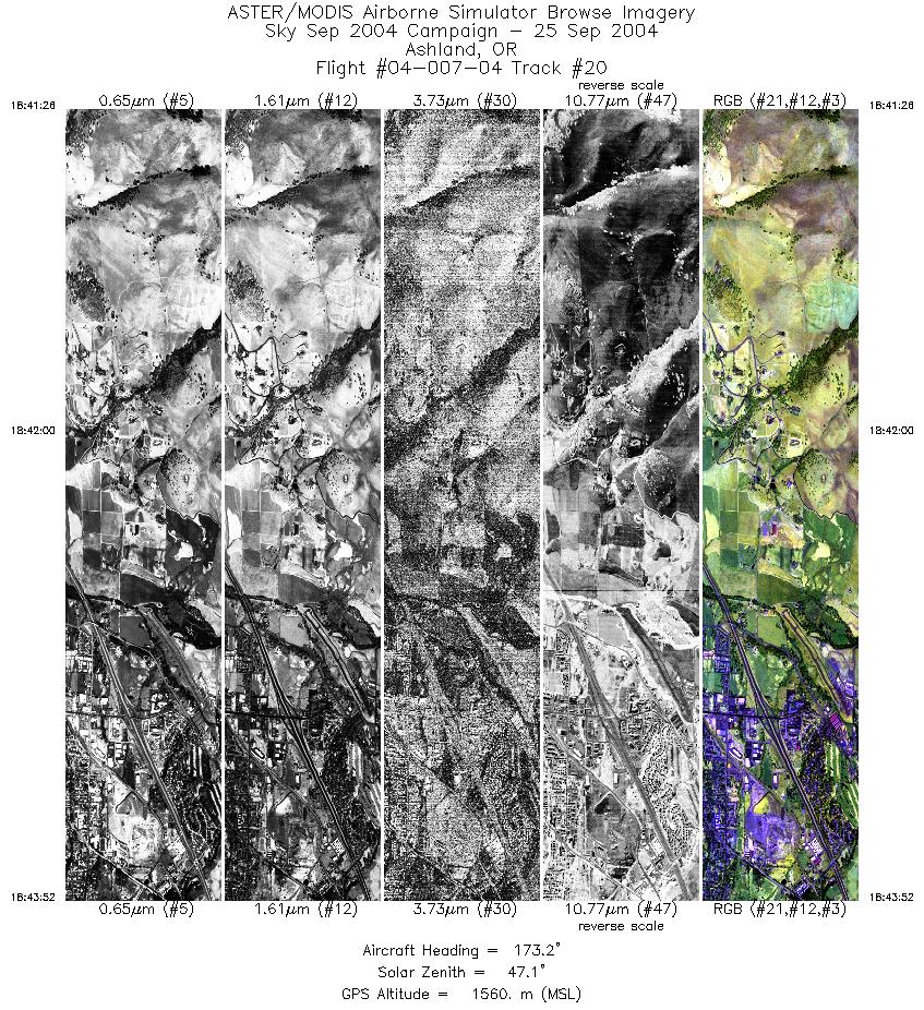
| 20 |
18:41 - 18:43 |
176.6 |
42.231 - 42.171 |
122.665 - 122.665 |
3631 |
1541 |
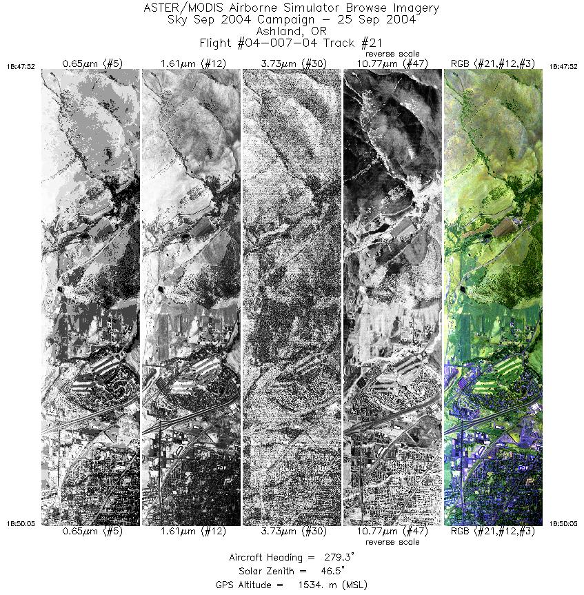
| 21 |
18:47 - 18:50 |
271.9 |
42.179 - 42.181 |
122.601 - 122.684 |
3317 |
1525 |
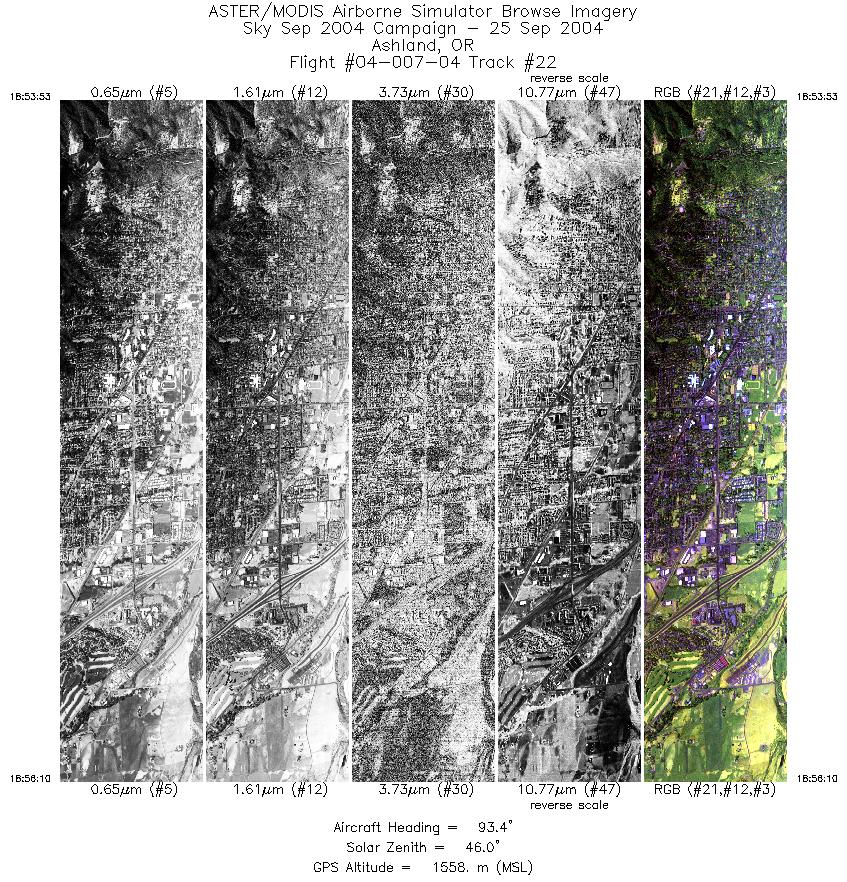
| 22 |
18:53 - 18:56 |
95.5 |
42.186 - 42.185 |
122.725 - 122.644 |
3410 |
1548 |
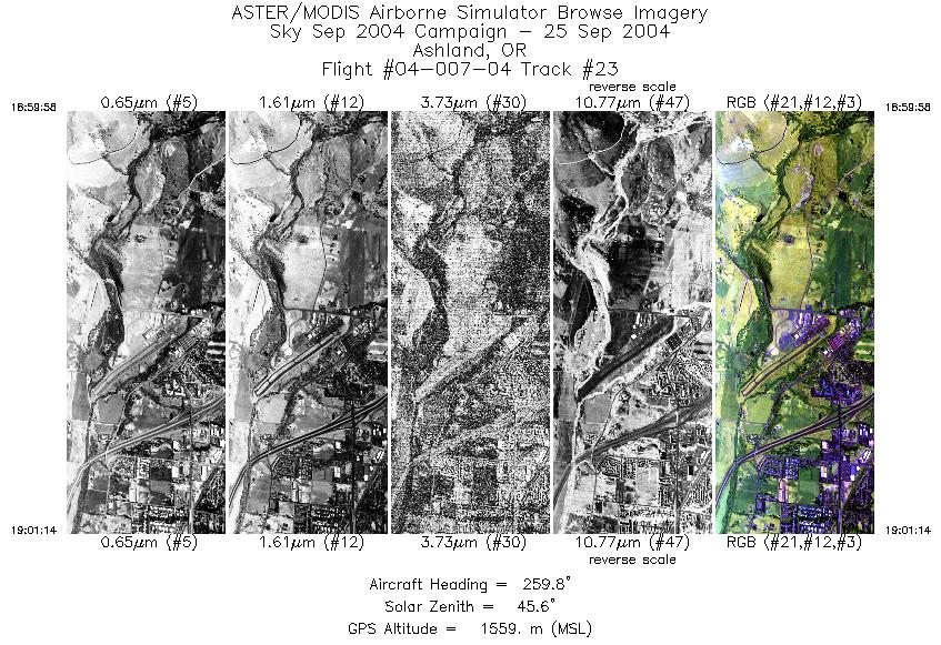
| 23 |
18:59 - 19:01 |
260.6 |
42.189 - 42.189 |
122.631 - 122.679 |
1906 |
1549 |
|


