


FLIGHT SUMMARY INFORMATION
Flight Track Map


|
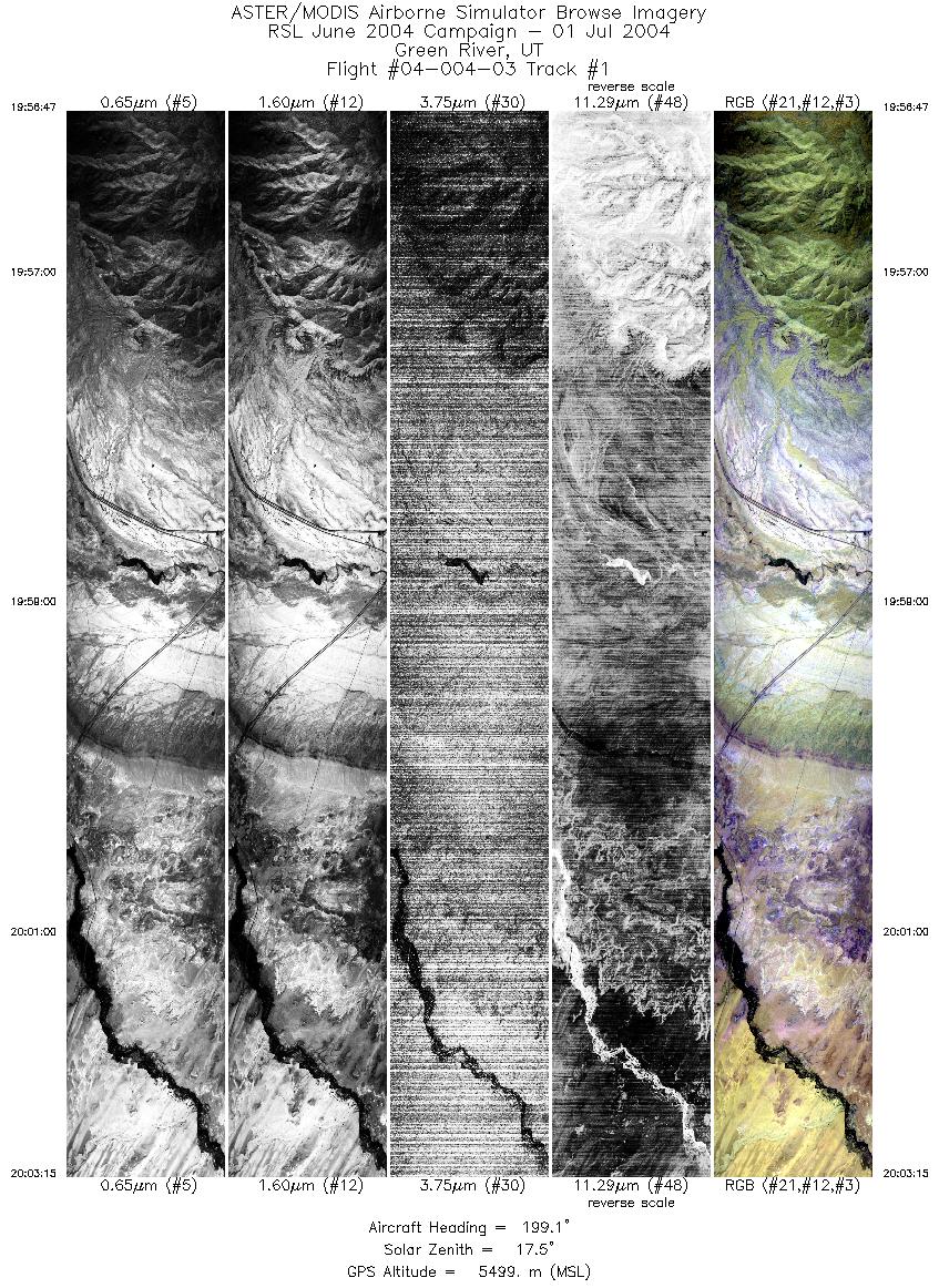
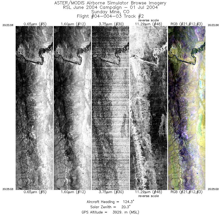
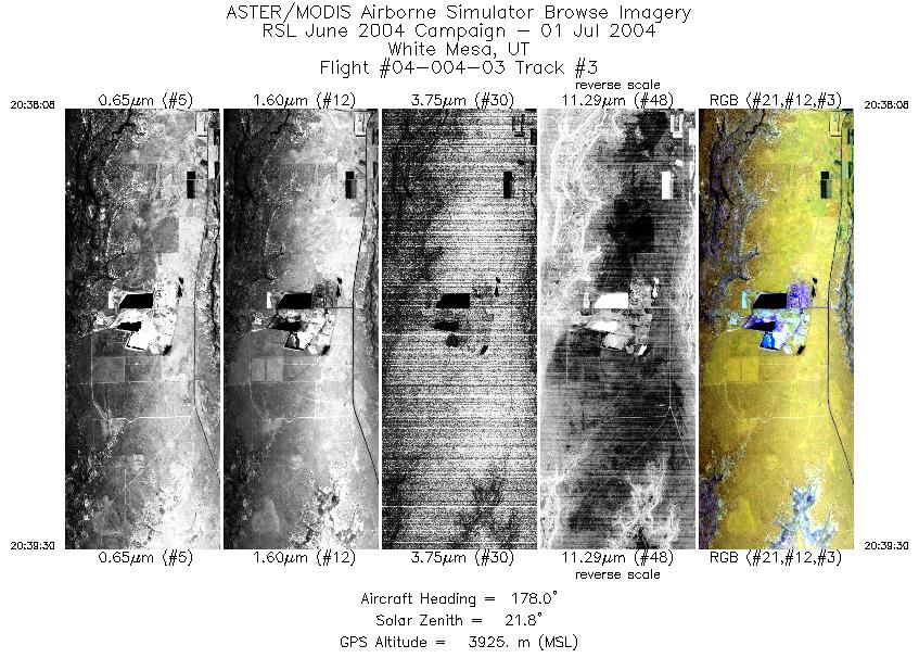
Flight: 04-004-03 Date: July 01, 2004 Aircraft: DOE B200, #798 Deployment: RSL June 2004 Flight Location: Green River & White Mesa, UT / Sunday Mine, CO Principal Investigator: Mullins (USGS), Boardman Additional Sensors: |
|||||||||||||||||||||||||||||||||||||||||||||||||
|
Data Evaluation Weather: Clear to partly cloudy Haze: Light to moderate Turbulence: Heavy to very heavy at low altitudes; moderate to heavy at high altitudes Data quality is good. Green River line was flown at 12.5 scans per second, Sunday Mine and White Mesa lines were flown at 25 scans per second. |
|||||||||||||||||||||||||||||||||||||||||||||||||
|
Processing Information Level-1B Data in HDF format is available Flight Line Summary Spectral Band Configuration Spectral Response Function Table Spectral Response Function (text) |
|||||||||||||||||||||||||||||||||||||||||||||||||
|
Browse Imagery Flight Tracks: 3 Scanlines: 9996 |
|||||||||||||||||||||||||||||||||||||||||||||||||
|
|||||||||||||||||||||||||||||||||||||||||||||||||


