


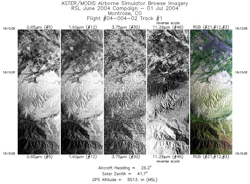
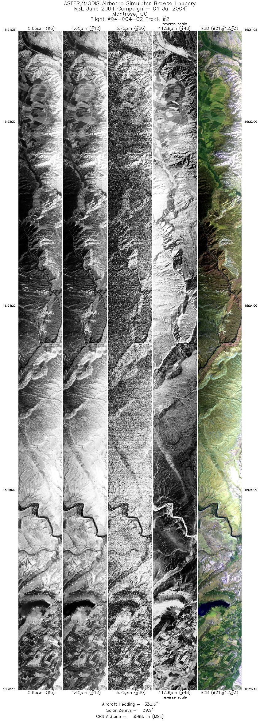
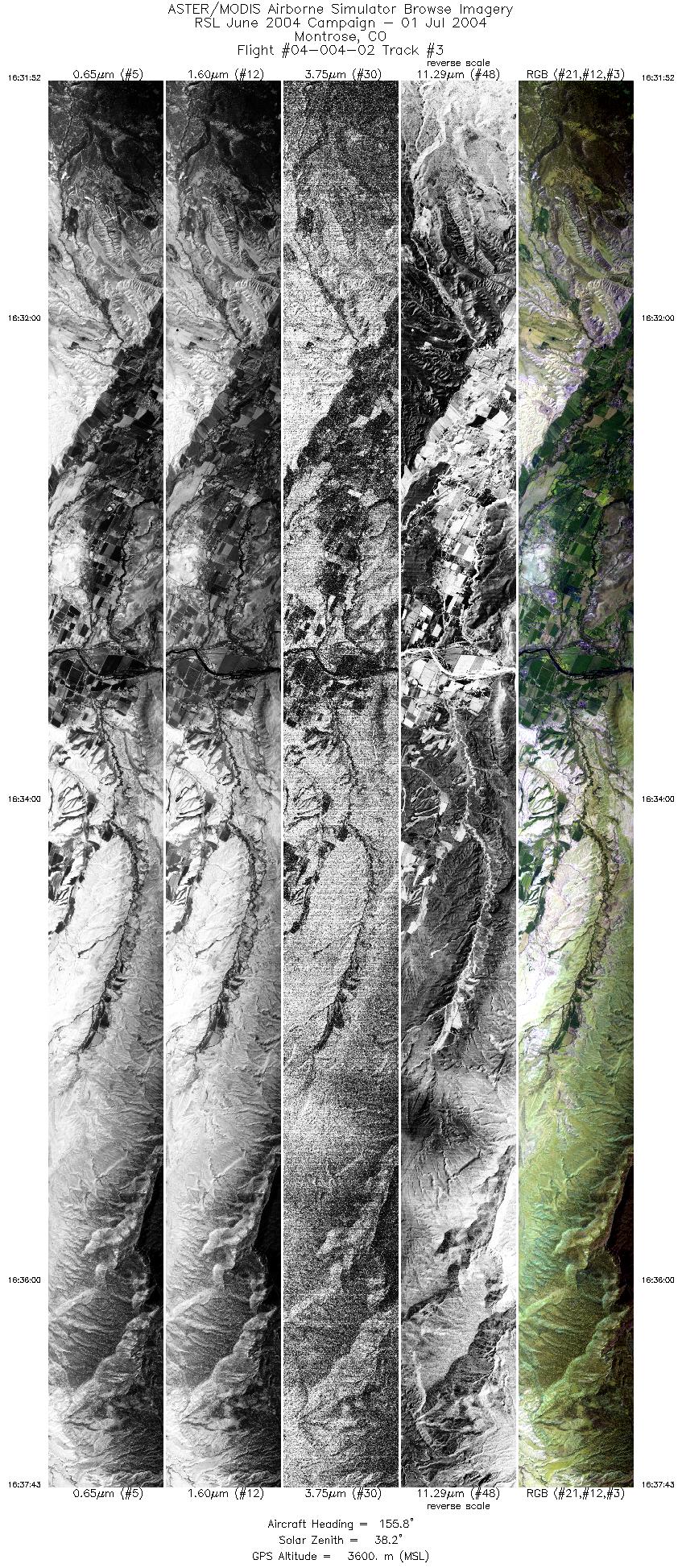
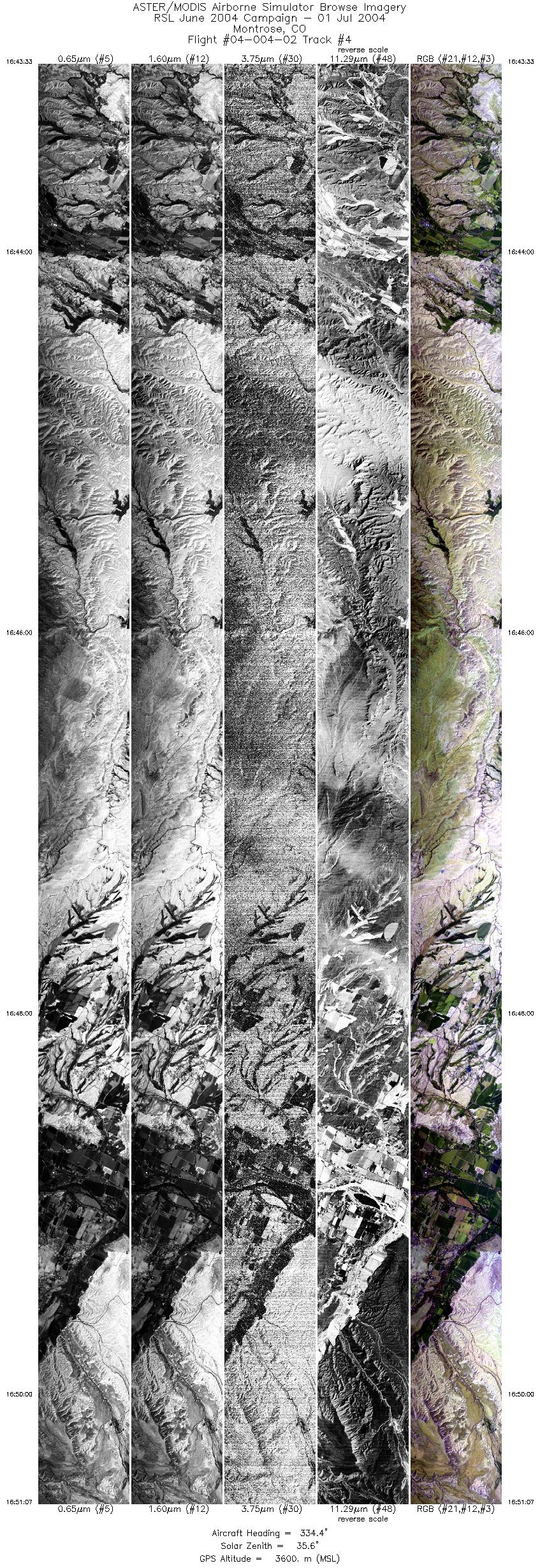
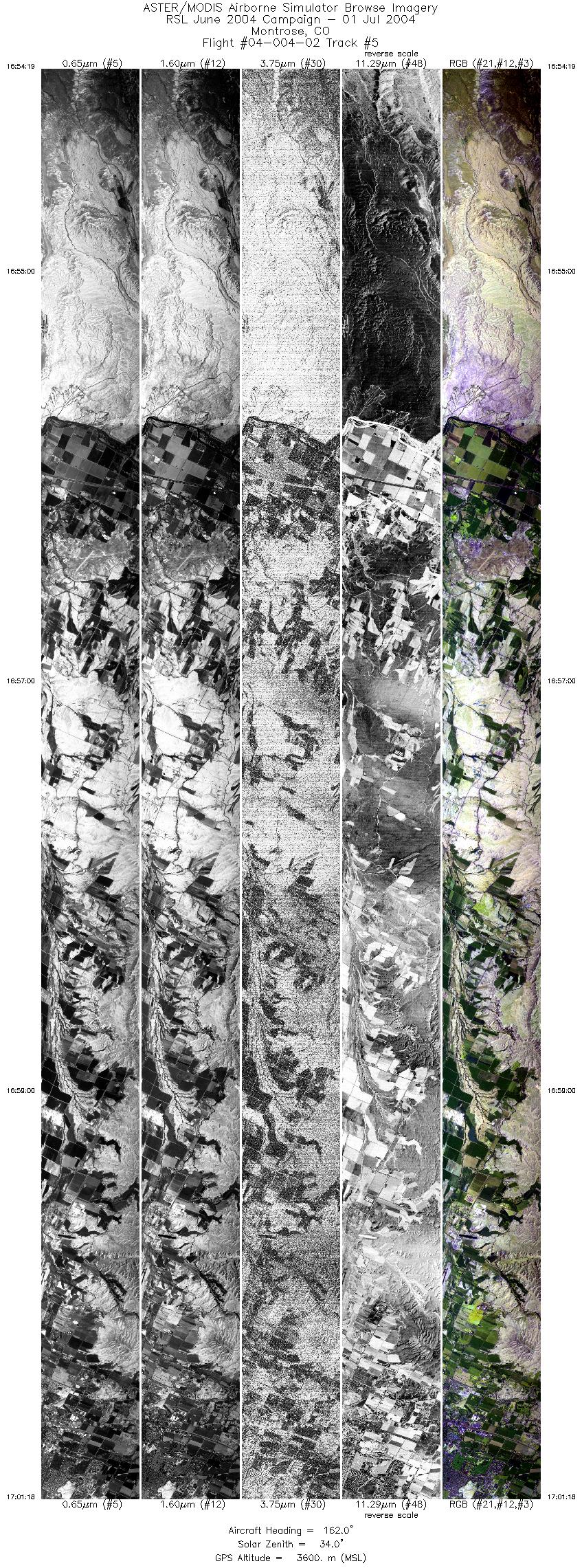
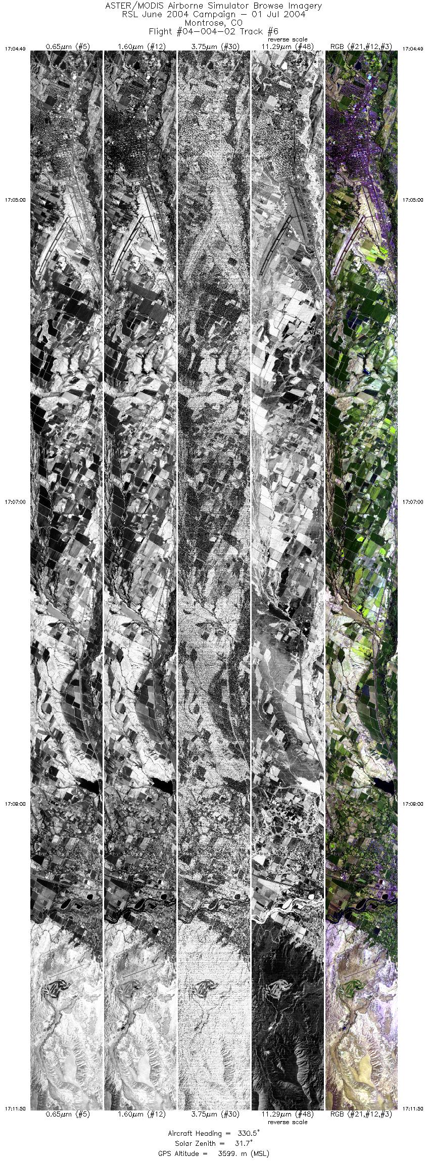
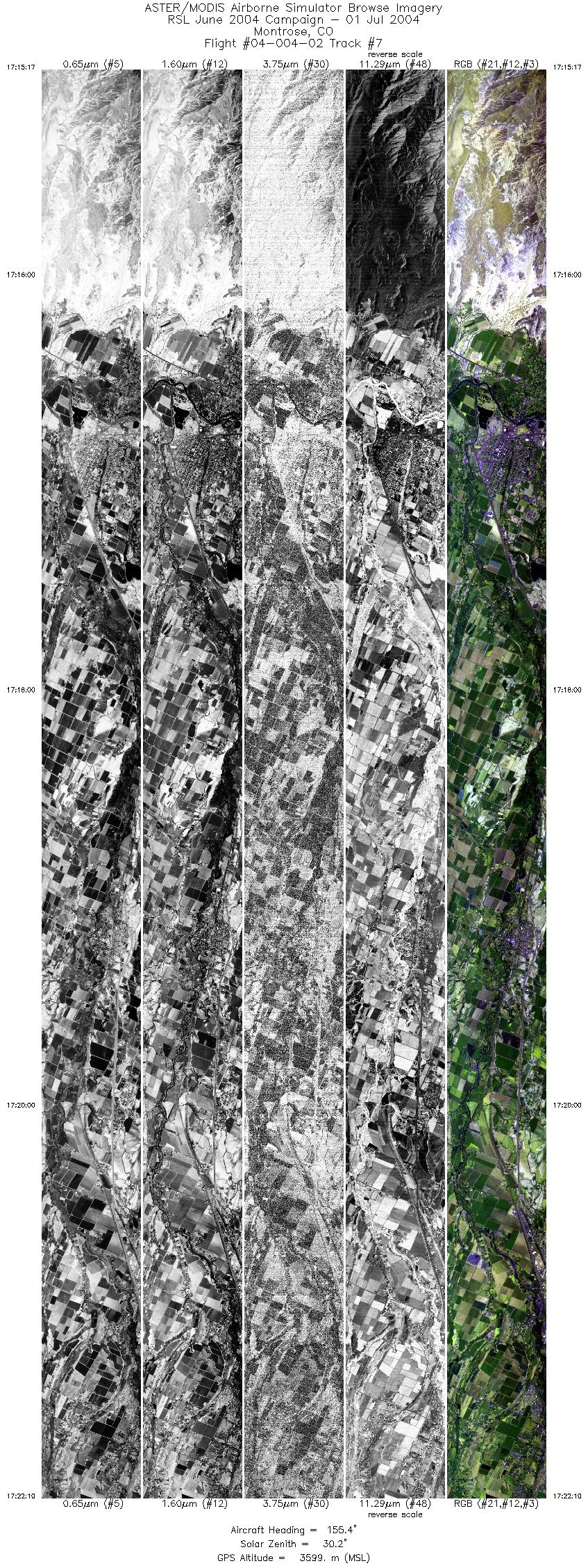
FLIGHT SUMMARY INFORMATION
Flight Track Map


|
Flight: 04-004-02 Date: July 01, 2004 Aircraft: DOE B200, #798 Deployment: RSL June 2004 Flight Location: Montrose, Colorado Principal Investigator: Mullins, Livo (USGS) Additional Sensors: |
|||||||||||||||||||||||||||||||||||||||||||||||||||||||||||||||||||||||||||||
|
Data Evaluation Weather: Clear with cumulous clouds all around. Haze: Light to moderate Turbulence: Heavy to very heavy at low altitudes; moderate to heavy at high altitudes Data quality is good. High altitude over Montrose (line 1) was flown at 12.5 scans per second, lines 2 through 7 were flown at 25 scans per second. |
|||||||||||||||||||||||||||||||||||||||||||||||||||||||||||||||||||||||||||||
|
Processing Information Level-1B Data in HDF format is available Flight Line Summary Spectral Band Configuration Spectral Response Function Table Spectral Response Function (text) |
|||||||||||||||||||||||||||||||||||||||||||||||||||||||||||||||||||||||||||||
|
Browse Imagery Flight Tracks: 7 Scanlines: 64046 |
|||||||||||||||||||||||||||||||||||||||||||||||||||||||||||||||||||||||||||||
|
|||||||||||||||||||||||||||||||||||||||||||||||||||||||||||||||||||||||||||||


