


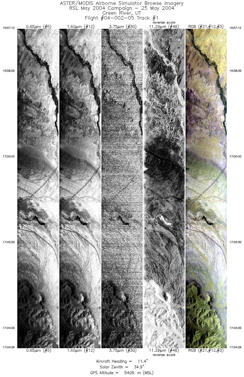
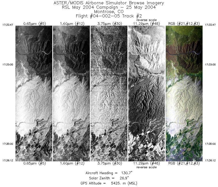
FLIGHT SUMMARY INFORMATION
Flight Track Map


|
Flight: 04-002-05 Date: May 25, 2004 Aircraft: DOE B200, #798 Deployment: RSL May 2004 Flight Location: Green River, UT; Montrose, CO Principal Investigator: Mullins, Livo (USGS) Additional Sensors: |
||||||||||||||||||||||||||||||||||||||||||
|
Data Evaluation Weather: Clear and cloudy, high cross winds induced crab angle in flight path on line 1 Haze: Turbulence: Moderate to heavy. Data quality is good. |
||||||||||||||||||||||||||||||||||||||||||
|
Processing Information Level-1B Data in HDF format is available Flight Line Summary Spectral Band Configuration Spectral Response Function Table Spectral Response Function (text) |
||||||||||||||||||||||||||||||||||||||||||
|
Browse Imagery Flight Tracks: 2 Scanlines: 8197 |
||||||||||||||||||||||||||||||||||||||||||
|
||||||||||||||||||||||||||||||||||||||||||


