


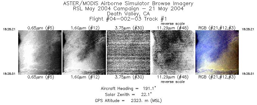
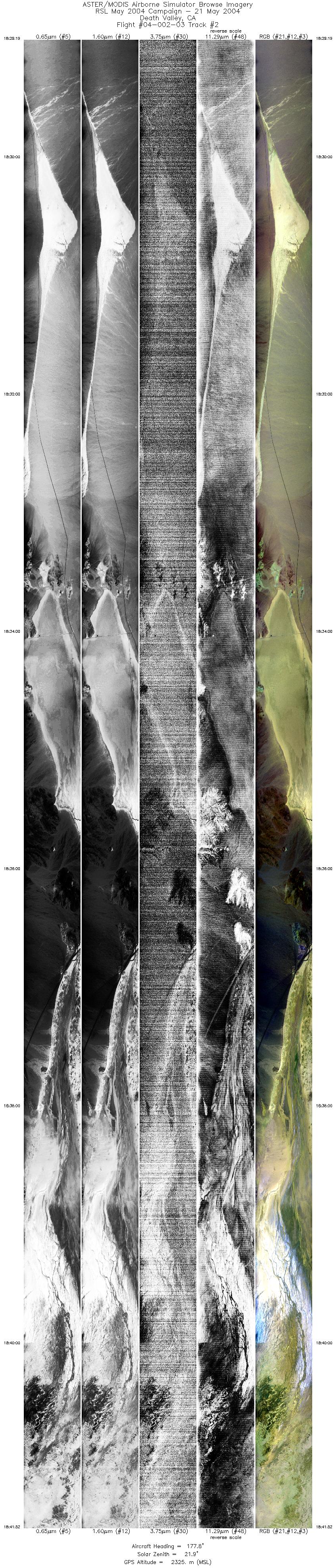
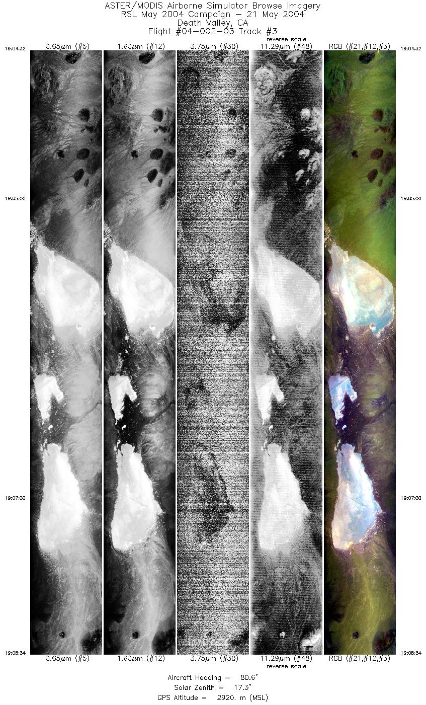
FLIGHT SUMMARY INFORMATION
Flight Track Map


|
Flight: 04-002-03 Date: May 21, 2004 Aircraft: DOE B200, #798 Deployment: RSL May 2004 Flight Location: Death Valley, CA (day) Principal Investigator: Abbot (JPL), Gillespie (UW) Additional Sensors: |
|||||||||||||||||||||||||||||||||||||||||||||||||
|
Data Evaluation Weather: Clear Haze: Moderate to heavy Turbulence was minimal. Data quality is good. Band 50 data is OK during lines 1 and 2, useless during line 3. |
|||||||||||||||||||||||||||||||||||||||||||||||||
|
Processing Information Level-1B Data in HDF format is available Flight Line Summary Spectral Band Configuration Spectral Response Function Table Spectral Response Function (text) |
|||||||||||||||||||||||||||||||||||||||||||||||||
|
Browse Imagery Flight Tracks: 3 Scanlines: 25473 |
|||||||||||||||||||||||||||||||||||||||||||||||||
|
|||||||||||||||||||||||||||||||||||||||||||||||||


