Flight: 04-001-02
Date: October 10, 2003
Aircraft: DOE B200, #798
Deployment: RSL October 2003
Flight Location: Death Valley & Garlock Fault, CA
Principal Investigator: Peltzer (JPL)
Additional Sensors:
|
Data Evaluation
Weather: Clear
Haze: Light to moderate
Turbulence was minimal.
Data quality is good.
|
Processing Information
Level-1B Data in HDF format is available
Flight Line Summary
Spectral Band Configuration
Spectral Response Function Table
Spectral Response Function (text)
|
Browse Imagery
Flight Tracks: 13
Scanlines: 87173
|
Browse Imagery Table
|
Click a Flight Track number to view a quicklook image
Lat/Lon ranges are for the BEG-END scanline nadir pixels
|
Flight
Track |
Time Span
(UTC) |
Heading
(Deg) |
Lat Range
(Deg N) |
Lon Range
(Deg W) |
Length
(Scanlines) |
Altitude
(Meters) |
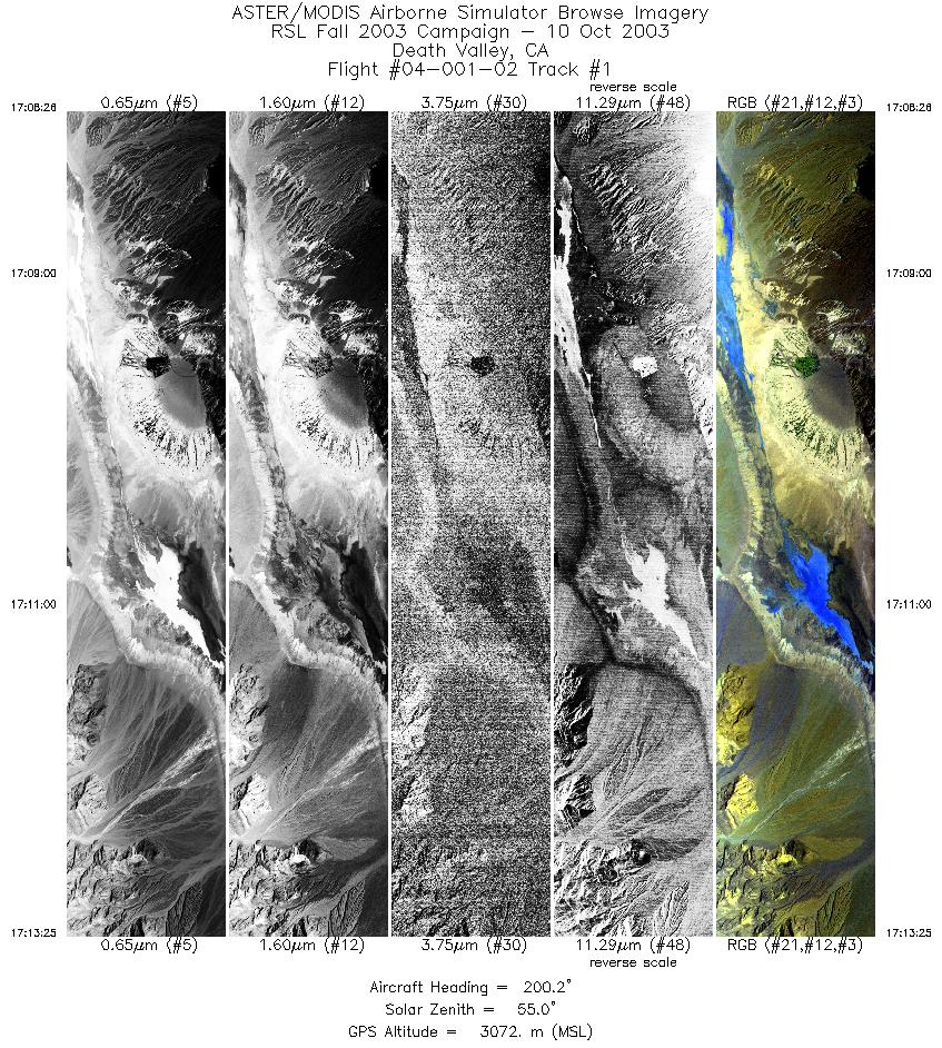
| 1 |
17:08 - 17:13 |
260.5 |
36.547 - 35.976 |
116.841 - 116.751 |
3714 |
3546 |
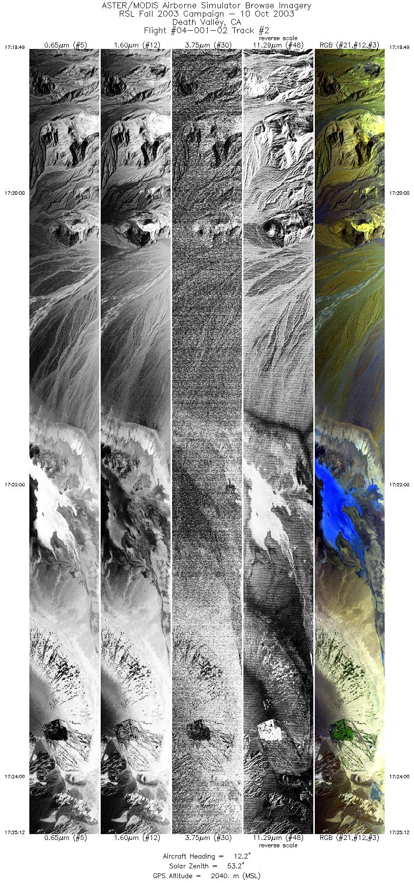
| 2 |
17:19 - 17:25 |
15.5 |
36.236 - 36.495 |
116.969 - 116.862 |
8028 |
2042 |
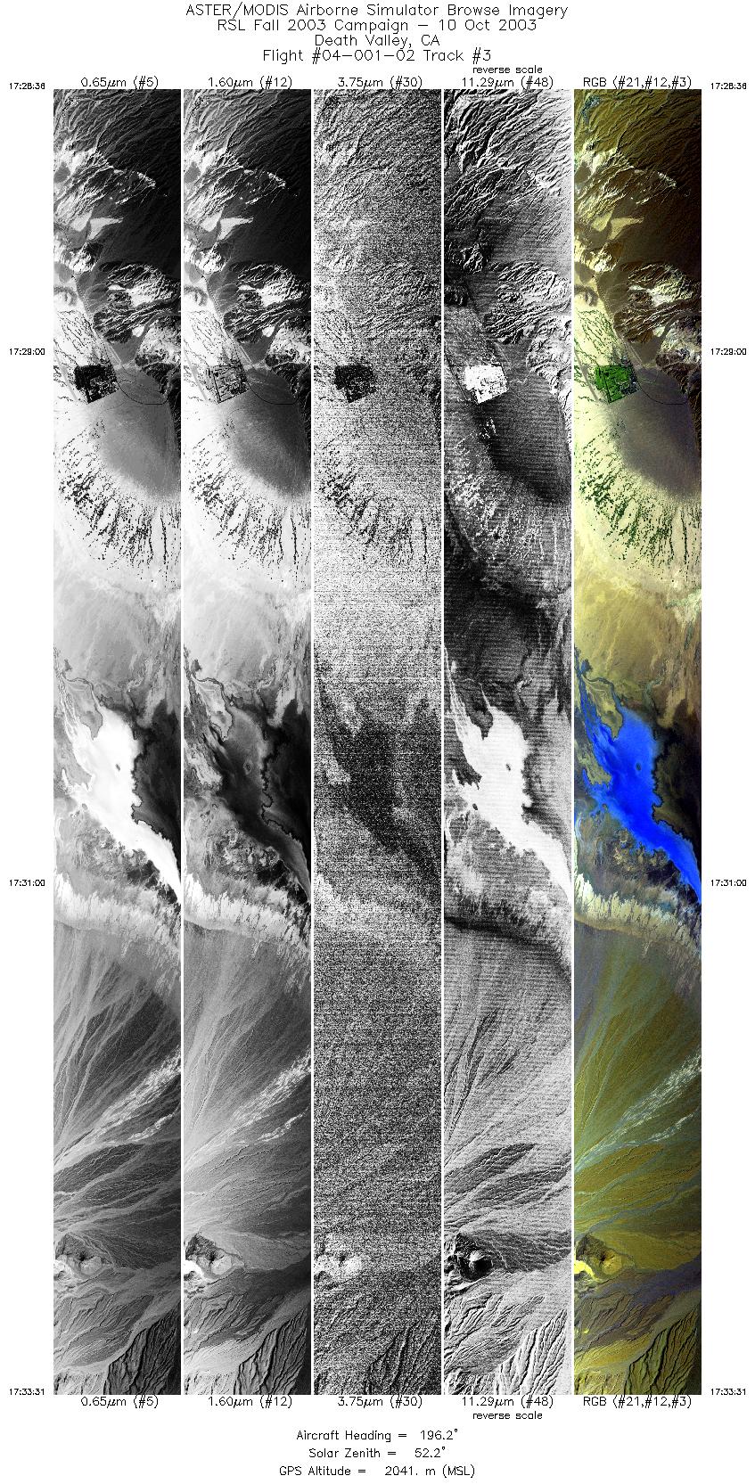
| 3 |
17:28 - 17:33 |
199.3 |
36.510 - 36.266 |
116.842 - 116.944 |
7327 |
2040 |
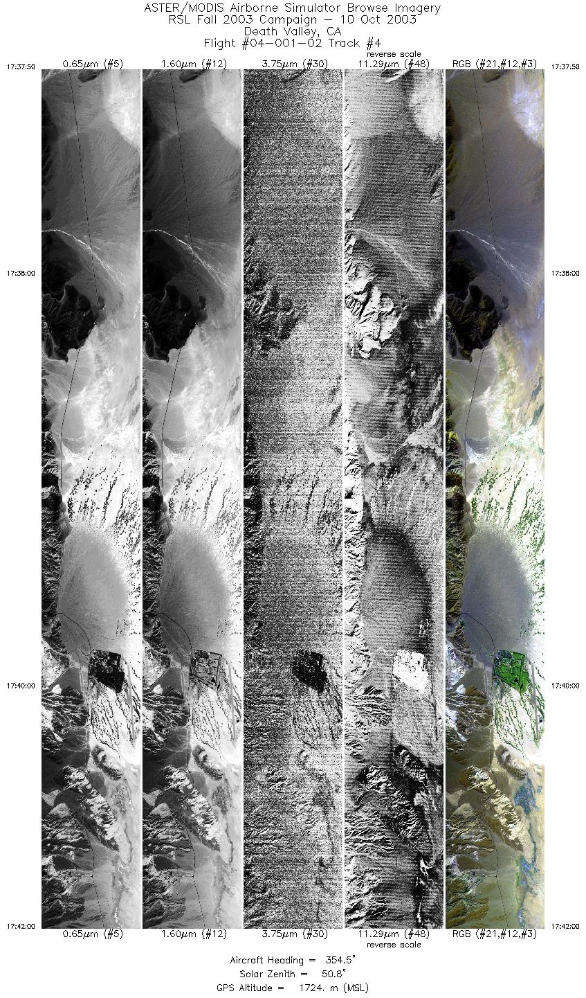
| 4 |
17:37 - 17:41 |
353.4 |
36.334 - 36.513 |
116.840 - 116.878 |
6206 |
1722 |
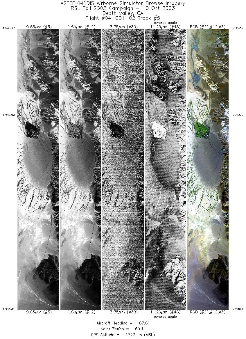
| 5 |
17:45 - 17:48 |
169.3 |
36.509 - 36.366 |
116.878 - 116.847 |
4827 |
1725 |
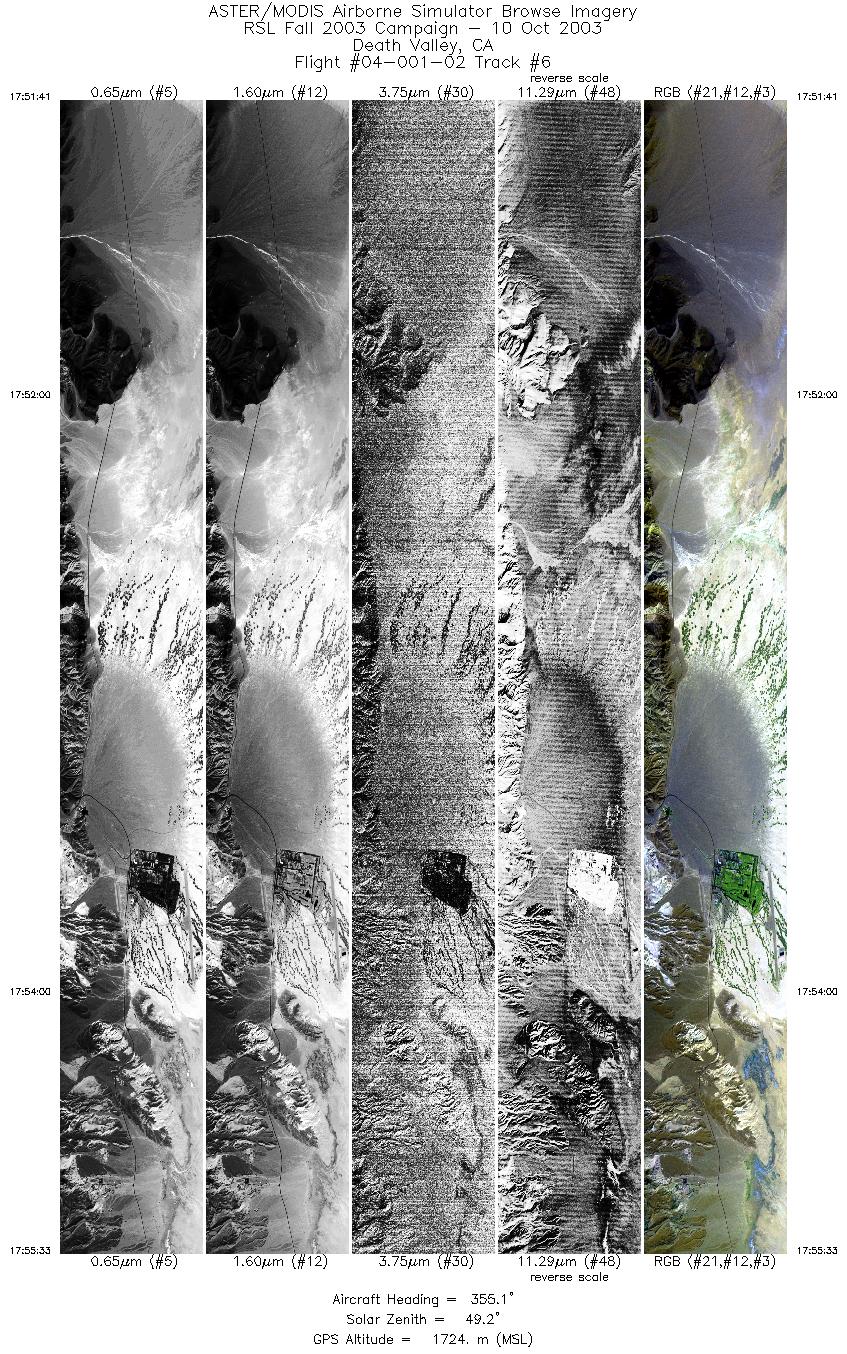
| 6 |
17:51 - 17:55 |
353.2 |
36.348 - 36.512 |
116.843 - 116.878 |
5770 |
1725 |
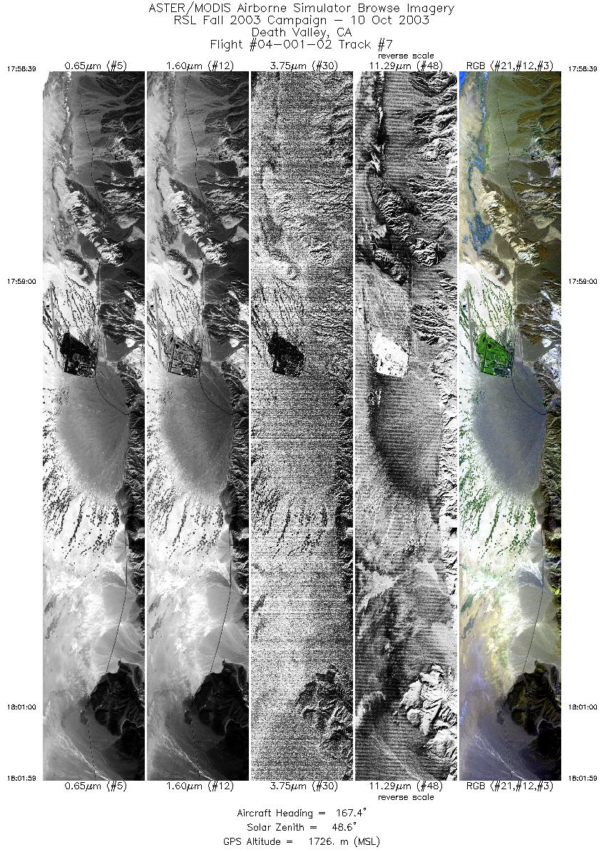
| 7 |
17:58 - 18:01 |
169.2 |
36.519 - 36.370 |
116.880 - 116.847 |
4979 |
1728 |
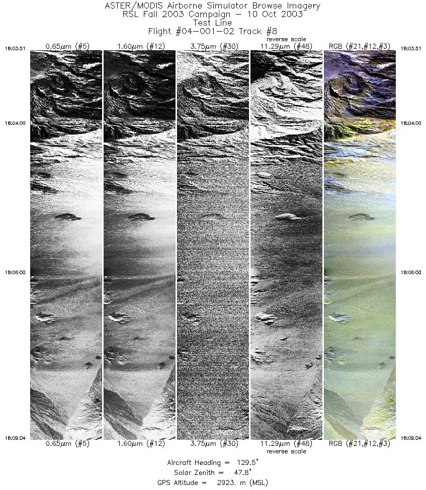
| 8 |
18:03 - 18:09 |
140.5 |
36.299 - 36.097 |
116.776 - 116.549 |
3880 |
2894 |
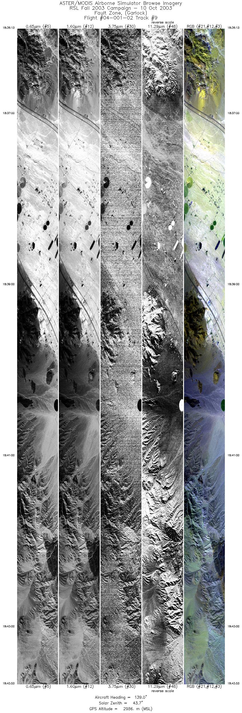
| 9 |
18:36 - 18:43 |
141.5 |
34.957 - 34.658 |
116.819 - 116.501 |
11440 |
2986 |
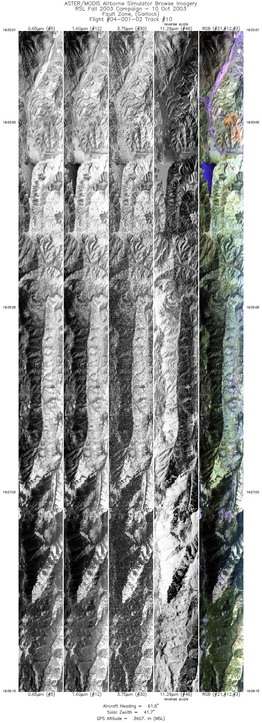
| 10 |
19:22 - 19:29 |
62.9 |
34.809 - 34.982 |
118.935 - 118.536 |
10666 |
3609 |
| 11 |
19:34 - 19:36 |
74.7 |
34.966 - 34.995 |
118.595 - 118.461 |
3178 |
3609 |
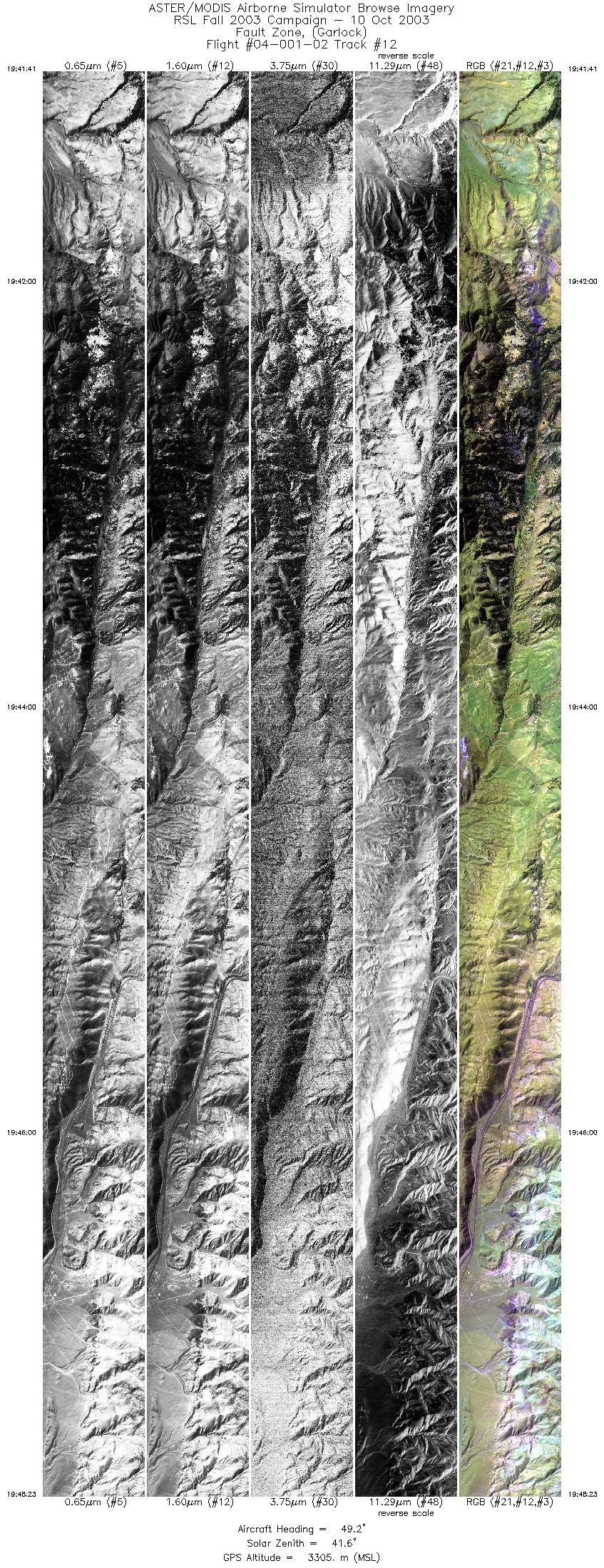
| 12 |
19:41 - 19:48 |
51.3 |
34.957 - 35.164 |
118.518 - 118.174 |
9999 |
3305 |
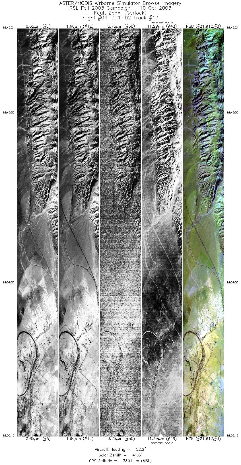
| 13 |
19:48 - 19:53 |
51.1 |
35.164 - 35.312 |
118.174 - 117.928 |
7159 |
3301 |
|


