


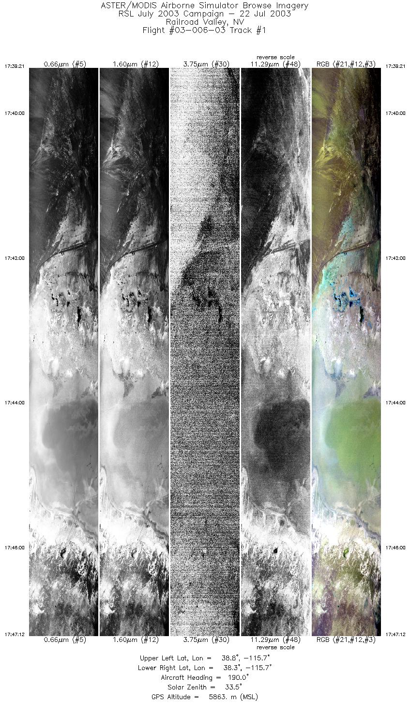
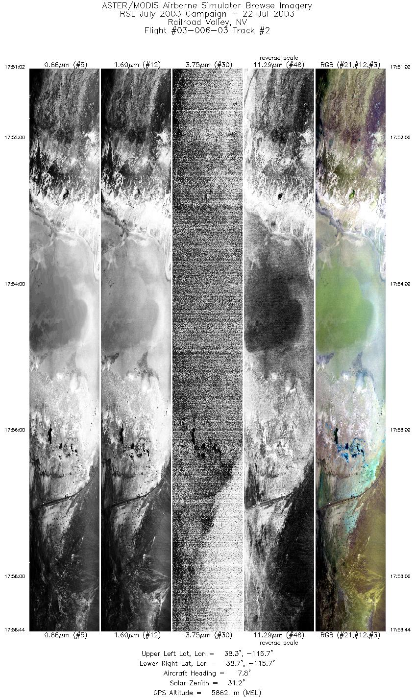
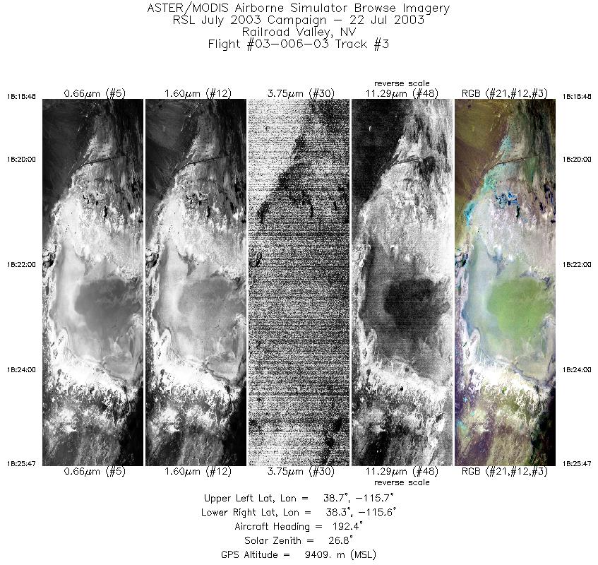
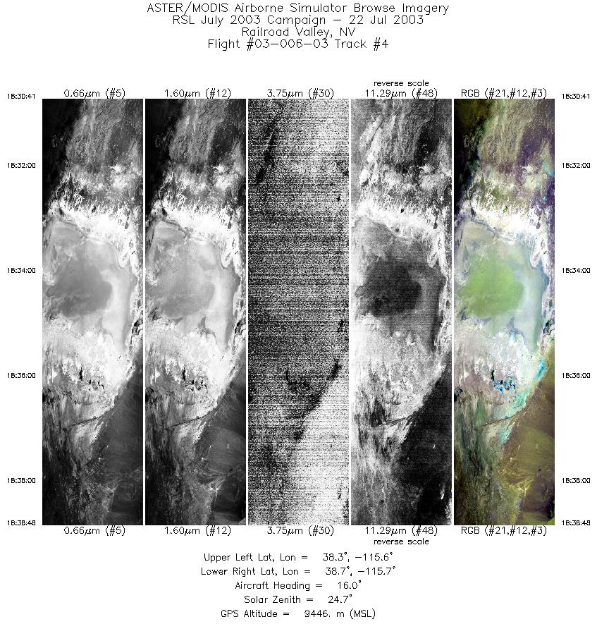
FLIGHT SUMMARY INFORMATION
Flight Track Map


|
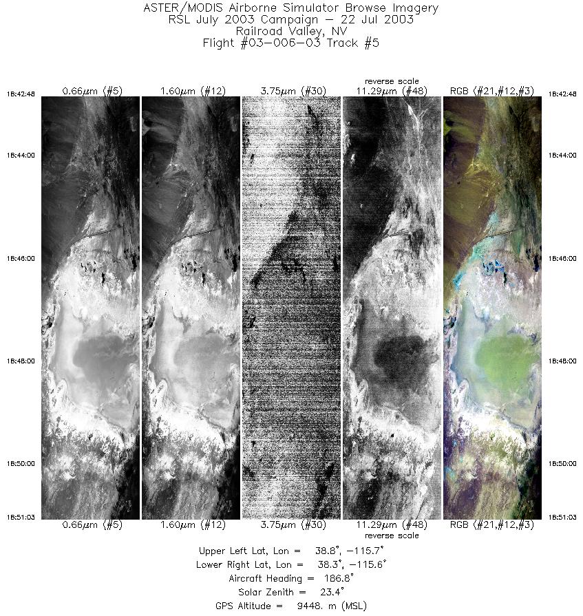
Flight: 03-006-03 Date: July 22, 2003 Aircraft: DOE B200, #798 Deployment: RSL July 2003 Flight Location: Railroad Valley, NV Principal Investigator: Palluconi (JPL) Additional Sensors: |
|||||||||||||||||||||||||||||||||||||||||||||||||||||||||||||||
|
Data Evaluation Weather: Mostly Clear - Cumulous forming throughout flight; minimal impact on data Haze: Light to moderate Trouble maintaining ground speed at higher altitude (run 3), raised ground speed for 10% overlap. Satellite overpass during run 4 |
|||||||||||||||||||||||||||||||||||||||||||||||||||||||||||||||
|
Processing Information Level-1B Data in HDF format is available Flight Line Summary Spectral Band Configuration Spectral Response Function Table Spectral Response Function (text) |
|||||||||||||||||||||||||||||||||||||||||||||||||||||||||||||||
|
Browse Imagery Flight Tracks: 5 Scanlines: 20310 |
|||||||||||||||||||||||||||||||||||||||||||||||||||||||||||||||
|
|||||||||||||||||||||||||||||||||||||||||||||||||||||||||||||||


