


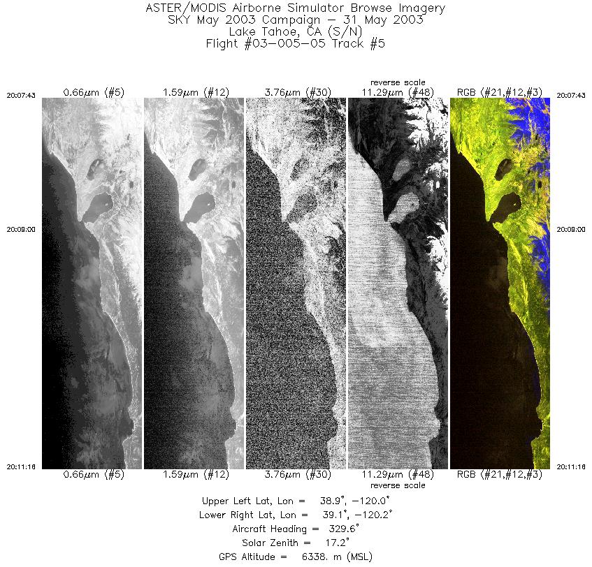
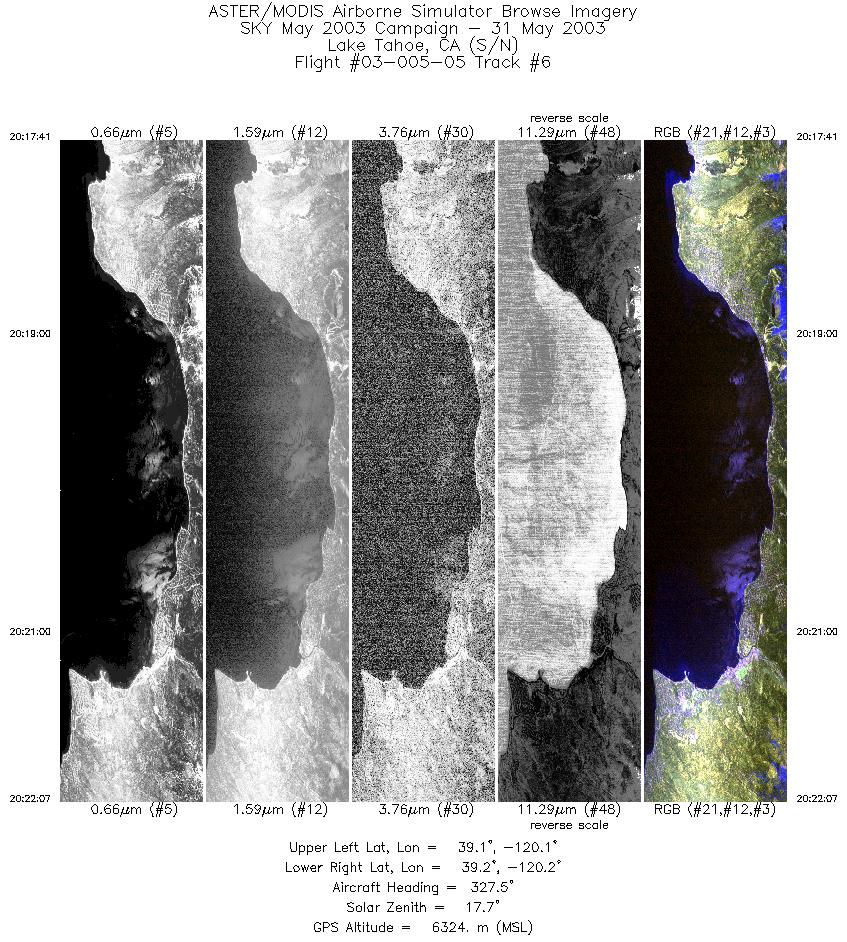
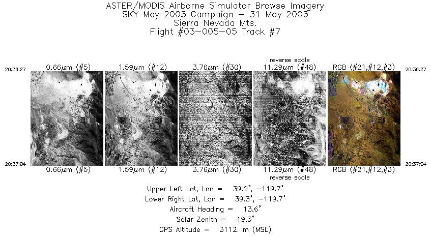
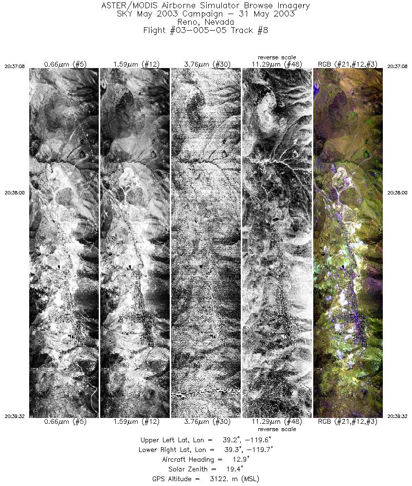
FLIGHT SUMMARY INFORMATION
Flight Track Map


|
Flight: 03-005-05 Date: May 31, 2003 Aircraft: Sky Research Caravan, #797 Deployment: Sky May 2003 Flight Location: Lake Tahoe, CA Principal Investigator: F.C.F. Additional Sensors: |
||||||||||||||||||||||||||||||||||||||||||||||||||||||||||||||||||||||||||||||||||||
|
Data Evaluation Data quality is ok, problems with integration into a new airplane is still evident in data. |
||||||||||||||||||||||||||||||||||||||||||||||||||||||||||||||||||||||||||||||||||||
|
Processing Information Level-1B Data in HDF format is available Flight Line Summary Spectral Band Configuration Spectral Response Function Table Spectral Response Function (text) |
||||||||||||||||||||||||||||||||||||||||||||||||||||||||||||||||||||||||||||||||||||
|
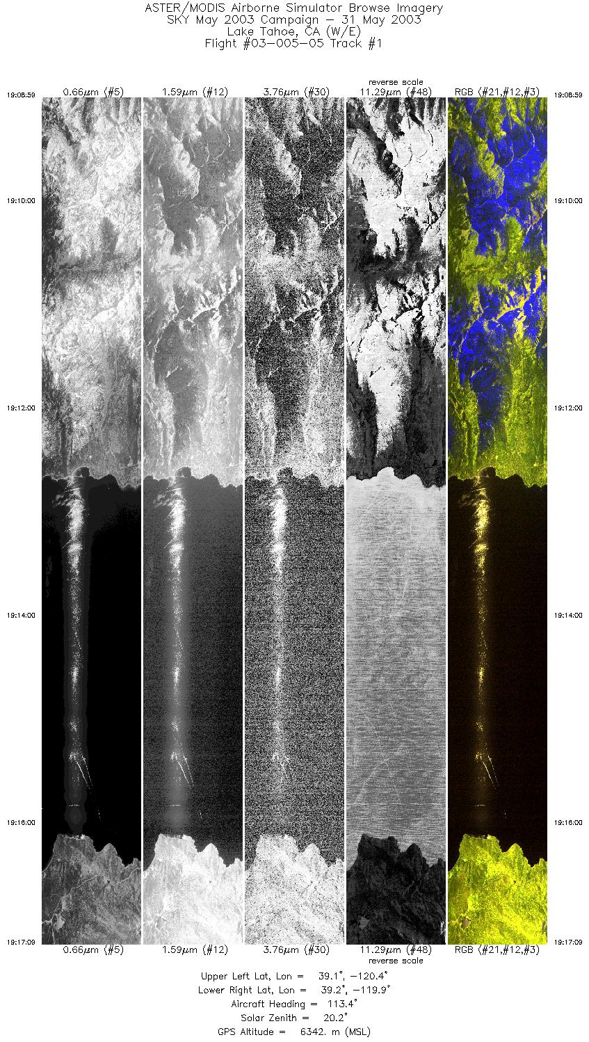
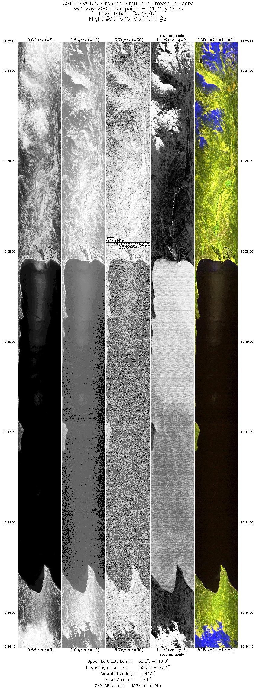
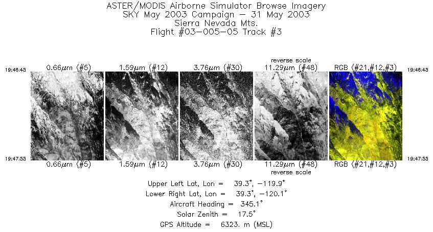
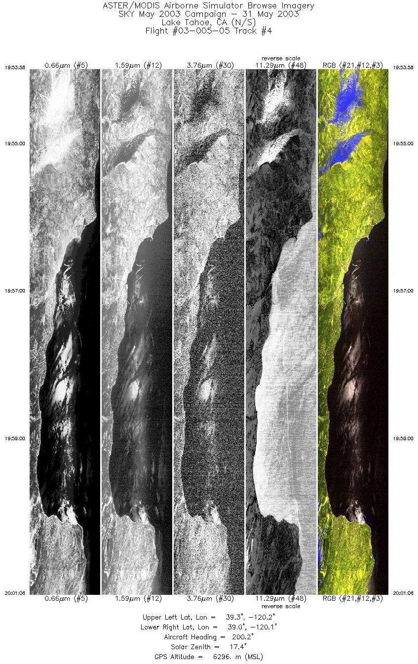
Browse Imagery Flight Tracks: 8 Scanlines: 32796 |
||||||||||||||||||||||||||||||||||||||||||||||||||||||||||||||||||||||||||||||||||||
|
||||||||||||||||||||||||||||||||||||||||||||||||||||||||||||||||||||||||||||||||||||


