Flight: 02-973-00
Date: September 26, 2002
Aircraft: NASA ER-2, #809
Deployment: DFRC September 2002
Flight Location: Williams Fire (San Dimas), Lake Tahoe, Mono Lake; CA
Principal Investigator: Pilot Proficiency
Additional Sensors:
|
Data Evaluation
Flight lines are very clear.
|
Processing Information
Level-1B Data in HDF format is available
Flight Line Summary
Spectral Band Configuration
Spectral Response Function Table
Spectral Response Function (text)
|
Browse Imagery
Flight Tracks: 12
Scanlines: 31208
|
Browse Imagery Table
|
Click a Flight Track number to view a quicklook image
Lat/Lon ranges are for the BEG-END scanline nadir pixels
|
Flight
Track |
Time Span
(UTC) |
Heading
(Deg) |
Lat Range
(Deg N) |
Lon Range
(Deg W) |
Length
(Scanlines) |
Altitude
(Meters) |
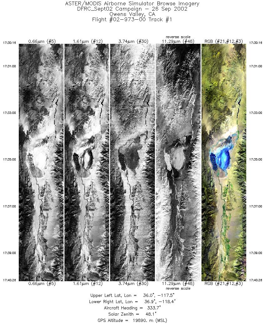
| 1 |
17:30 - 17:40 |
335.6 |
35.933 - 37.004 |
117.694 - 118.257 |
3797 |
19785 |
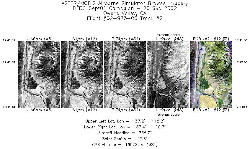
| 2 |
17:41 - 17:44 |
339.1 |
37.150 - 37.465 |
118.356 - 118.513 |
1132 |
19949 |
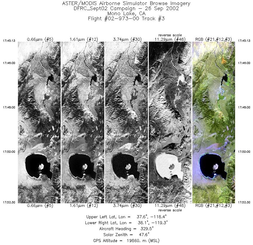
| 3 |
17:45 - 17:52 |
326.6 |
37.496 - 38.152 |
118.532 - 119.168 |
2716 |
19876 |
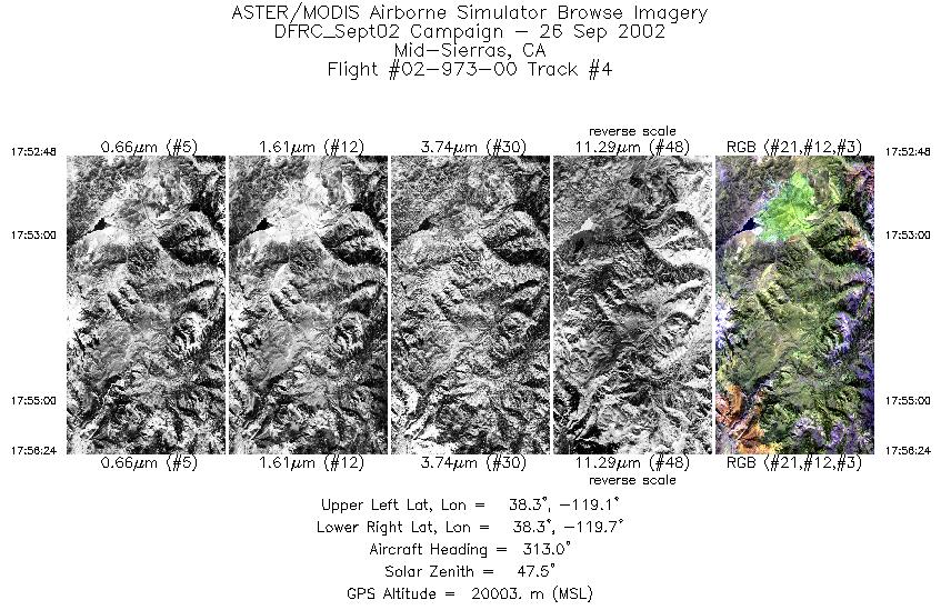
| 4 |
17:52 - 17:56 |
313.4 |
38.177 - 38.446 |
119.198 - 119.580 |
1348 |
19995 |
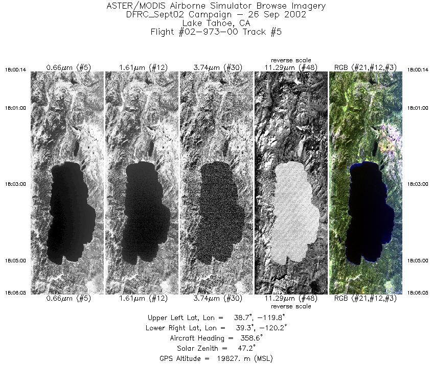
| 5 |
18:00 - 18:06 |
359.2 |
38.674 - 39.337 |
120.014 - 120.018 |
2189 |
19914 |
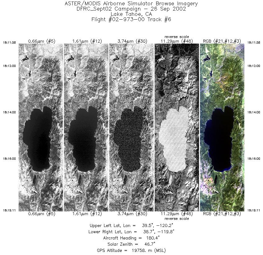
| 6 |
18:11 - 18:19 |
180.9 |
39.546 - 38.745 |
120.017 - 120.019 |
2698 |
19716 |
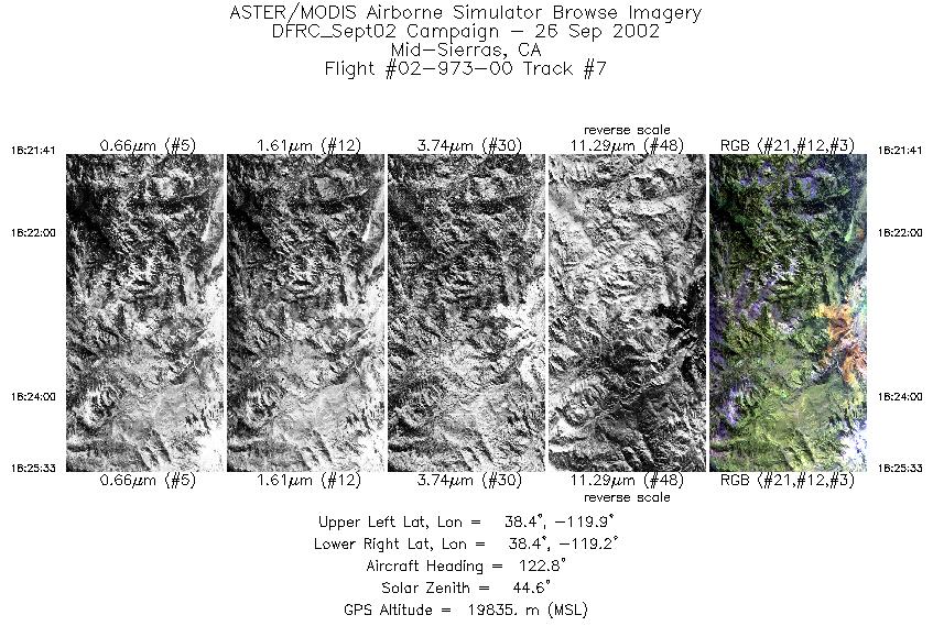
| 7 |
18:21 - 18:25 |
122.1 |
38.529 - 38.301 |
119.813 - 119.338 |
1446 |
19824 |
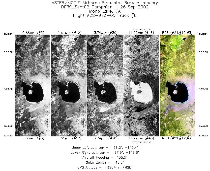
| 8 |
18:25 - 18:31 |
139.7 |
38.276 - 37.792 |
119.299 - 118.814 |
2062 |
19937 |
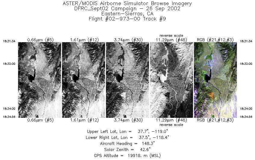
| 9 |
18:31 - 18:34 |
150.0 |
37.778 - 37.450 |
118.802 - 118.573 |
1255 |
19916 |
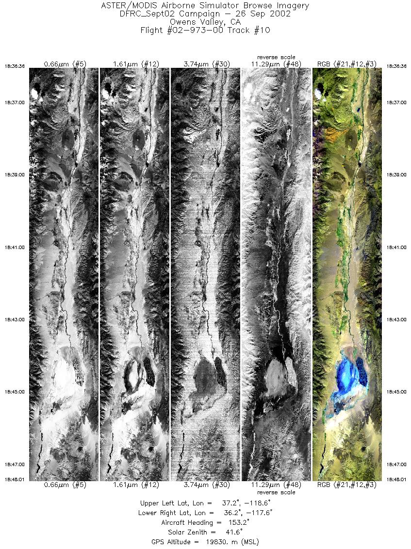
| 10 |
18:36 - 18:48 |
157.2 |
37.308 - 36.158 |
118.422 - 117.816 |
4266 |
19813 |
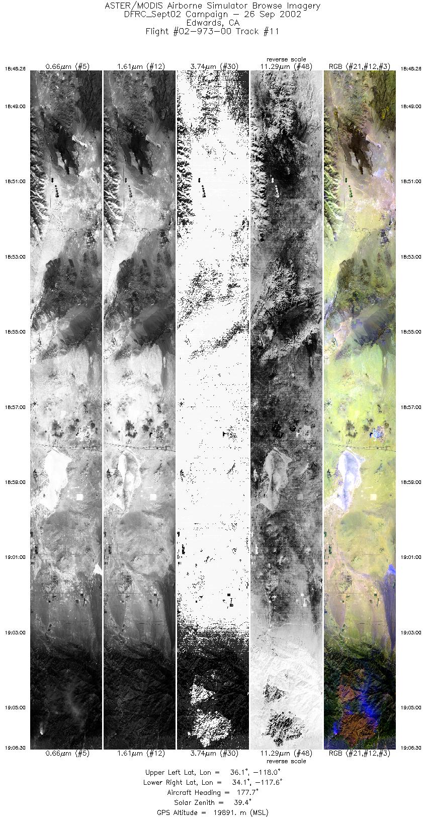
| 11 |
18:48 - 19:06 |
179.3 |
36.113 - 34.125 |
117.804 - 117.766 |
6751 |
19831 |
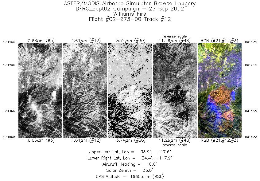
| 12 |
19:11 - 19:15 |
6.1 |
33.934 - 34.397 |
117.796 - 117.749 |
1548 |
19622 |
|


