


FLIGHT SUMMARY INFORMATION
Flight Track Map


|
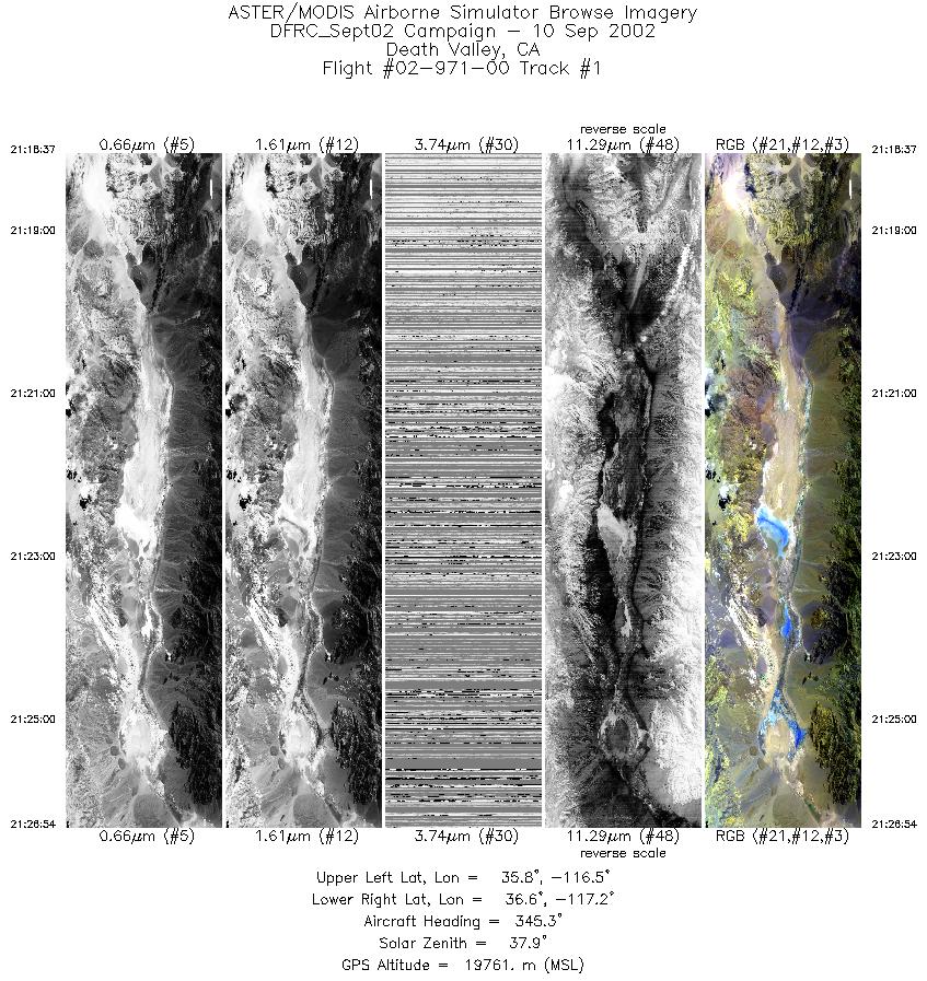
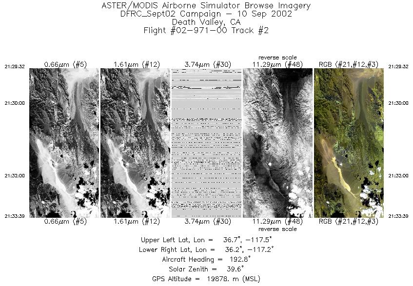
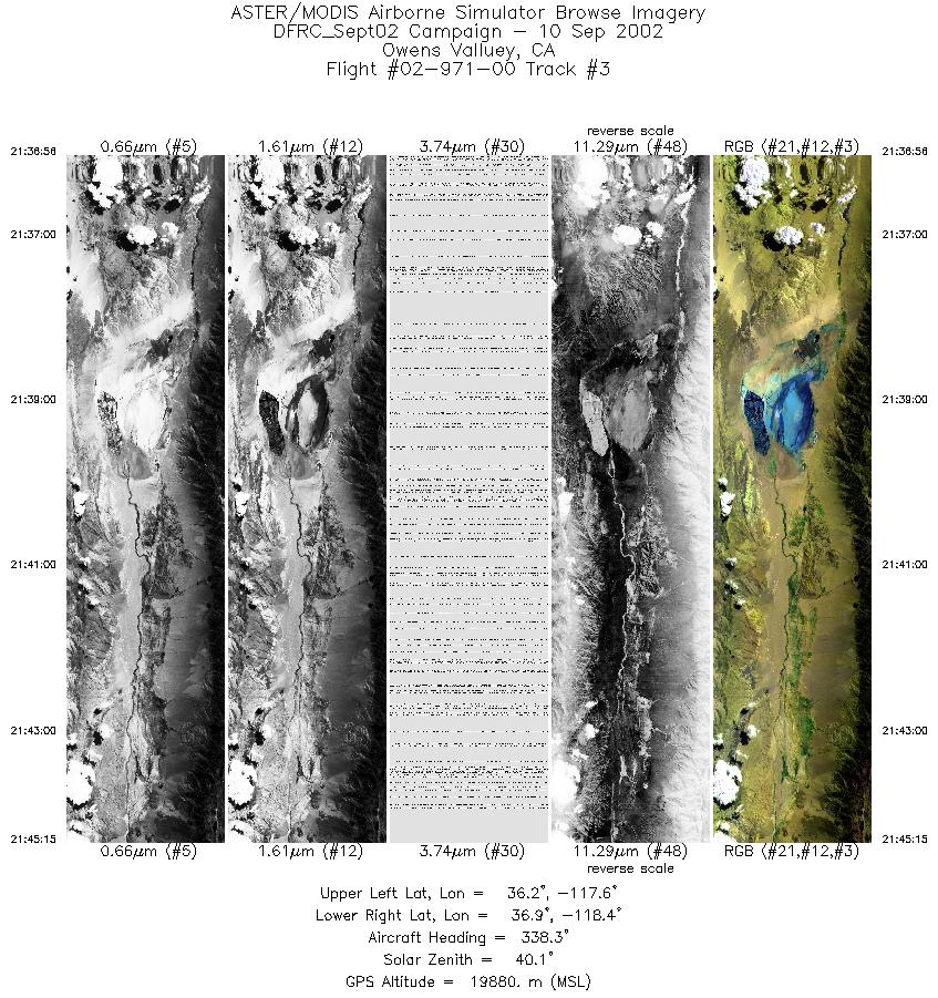
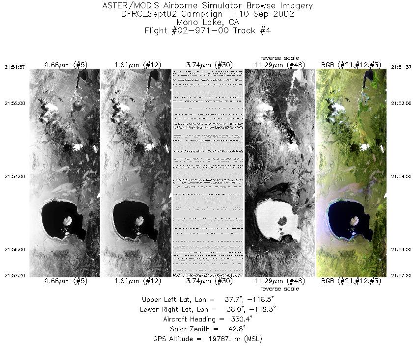
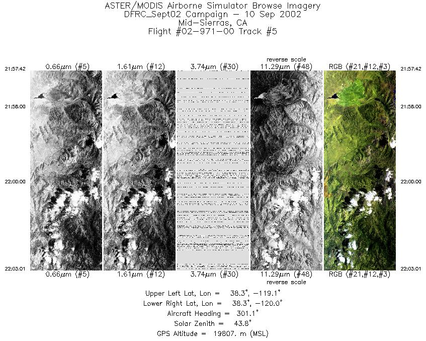
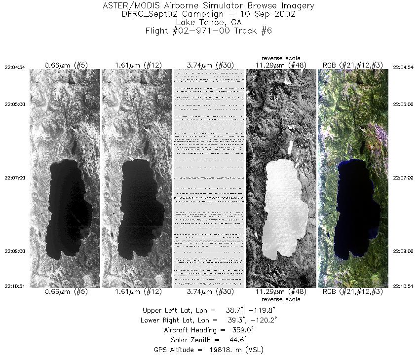
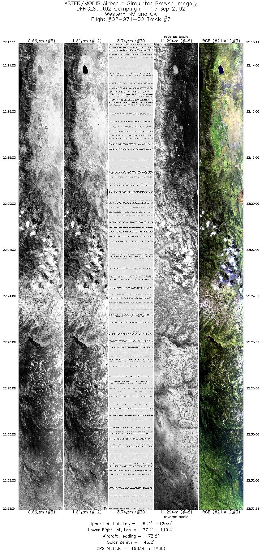
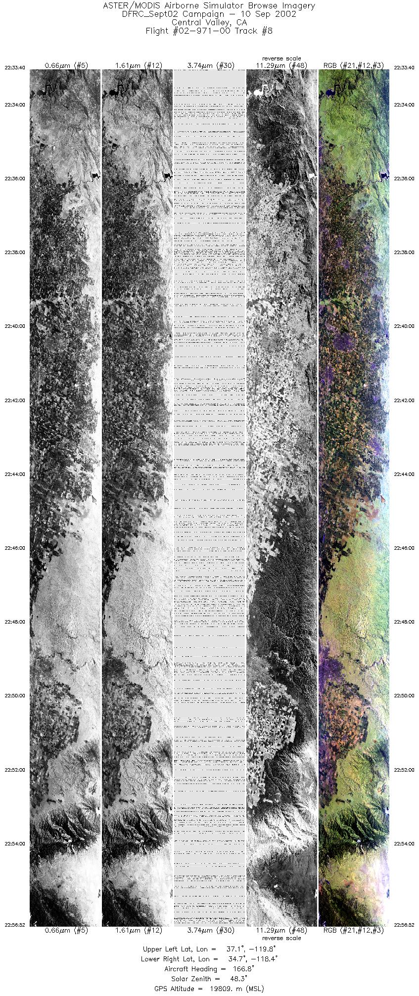
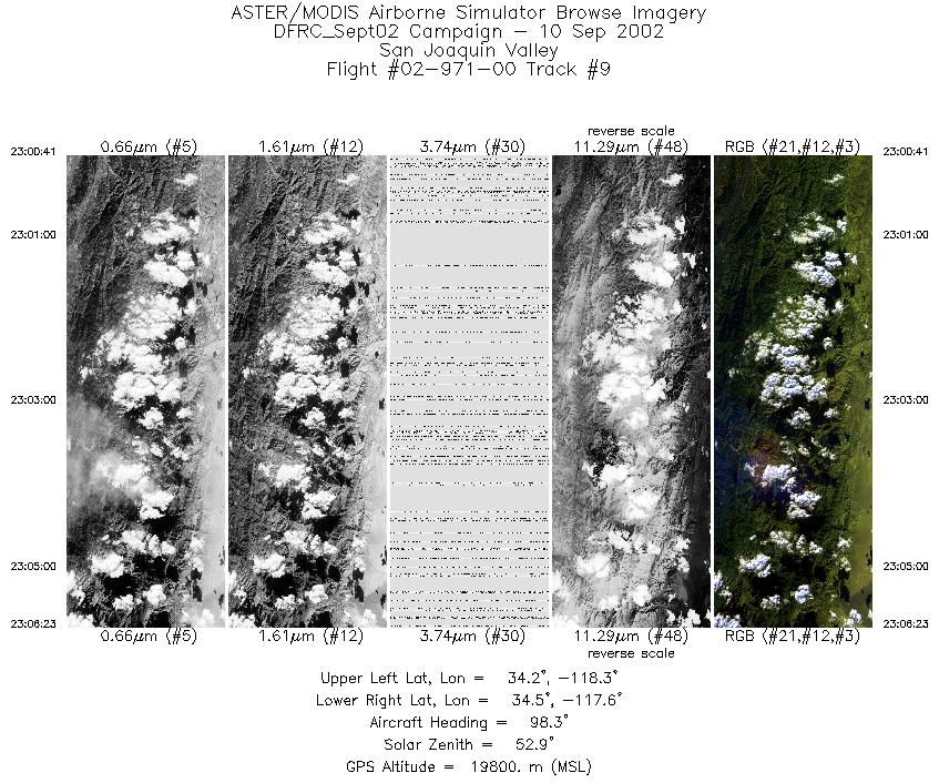
Flight: 02-971-00 Date: September 10, 2002 Aircraft: NASA ER-2, #809 Deployment: DFRC September 2002 Flight Location: Lake Tahoe, Mono Lake; CA Principal Investigator: F.C.F. Additional Sensors: |
|||||||||||||||||||||||||||||||||||||||||||||||||||||||||||||||||||||||||||||||||||||||||||
|
Data Evaluation Flight lines are generally clear with some pilot radio interference. |
|||||||||||||||||||||||||||||||||||||||||||||||||||||||||||||||||||||||||||||||||||||||||||
|
Processing Information Level-1B Data in HDF format is available Flight Line Summary Spectral Band Configuration Spectral Response Function Table Spectral Response Function (text) |
|||||||||||||||||||||||||||||||||||||||||||||||||||||||||||||||||||||||||||||||||||||||||||
|
Browse Imagery Flight Tracks: 9 Scanlines: 32395 |
|||||||||||||||||||||||||||||||||||||||||||||||||||||||||||||||||||||||||||||||||||||||||||
|
|||||||||||||||||||||||||||||||||||||||||||||||||||||||||||||||||||||||||||||||||||||||||||


