


FLIGHT SUMMARY INFORMATION
Flight Track Map


|
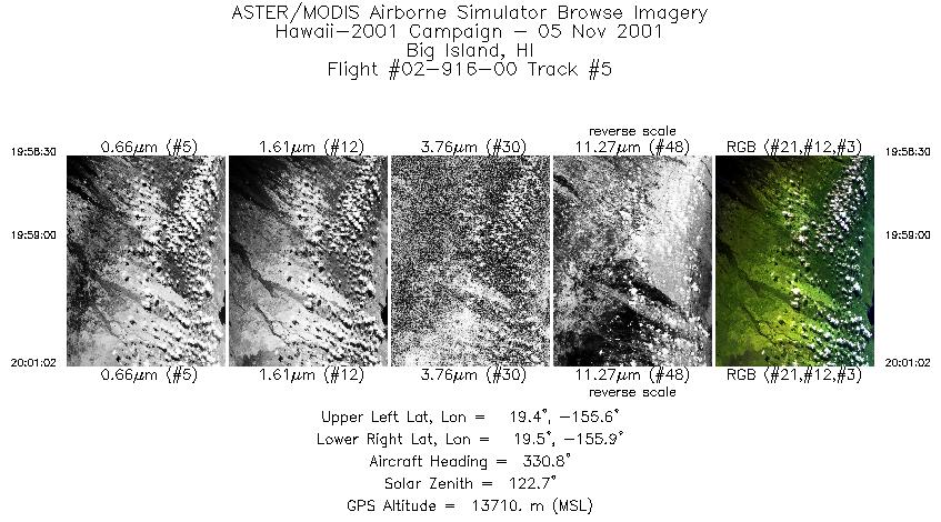
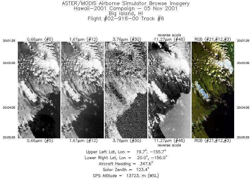
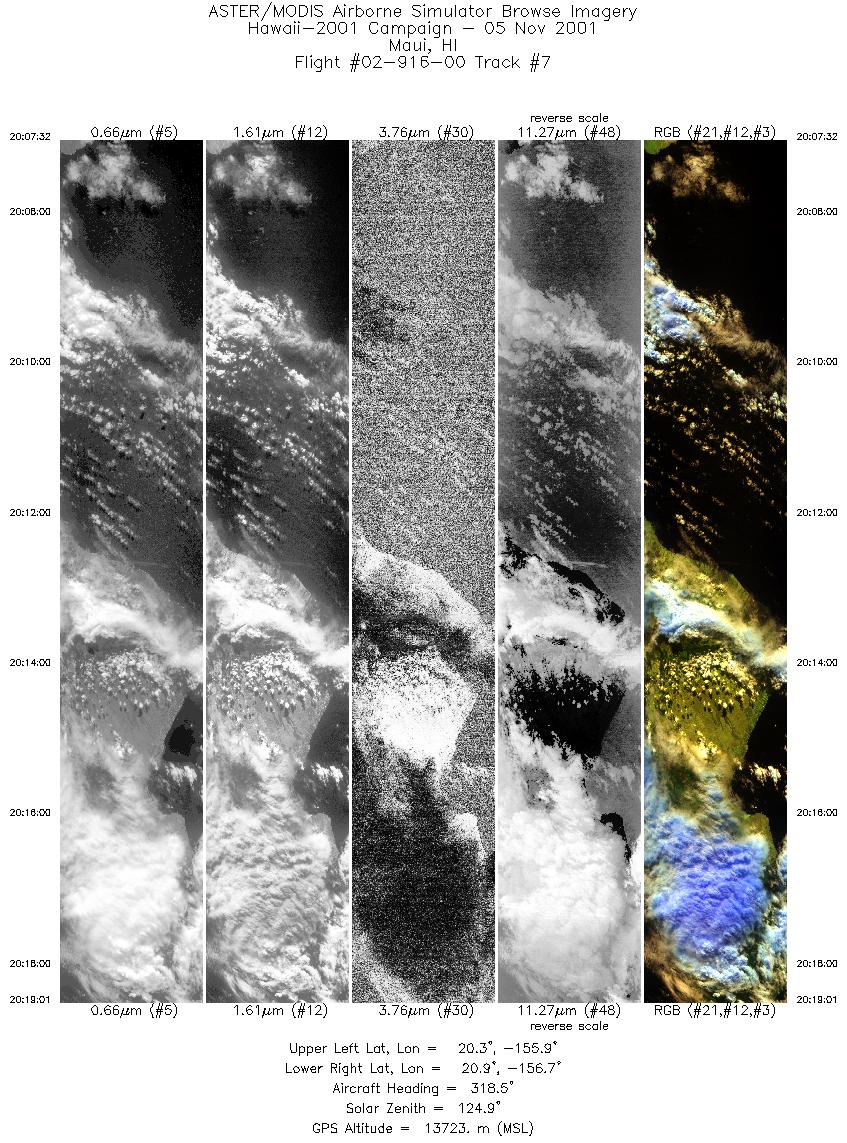
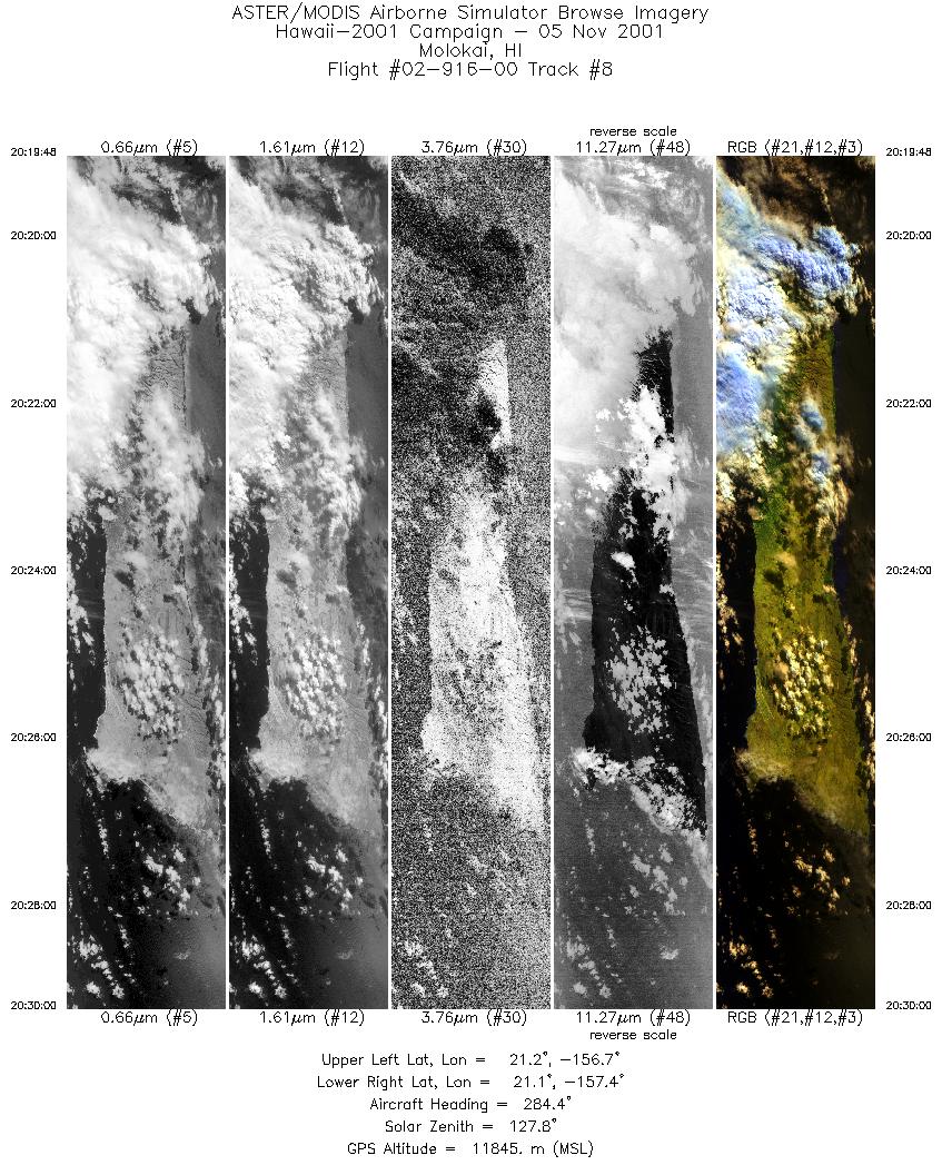
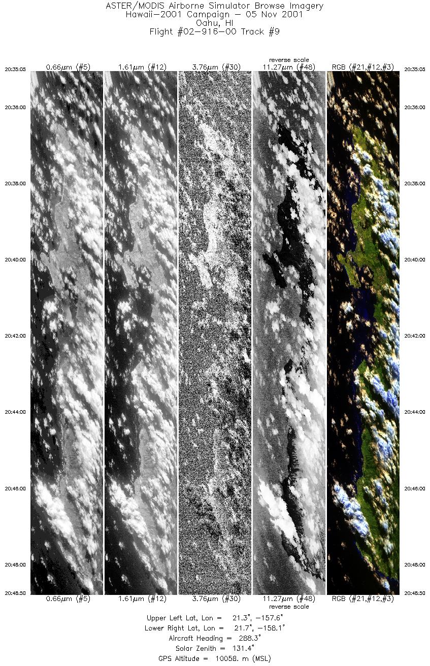
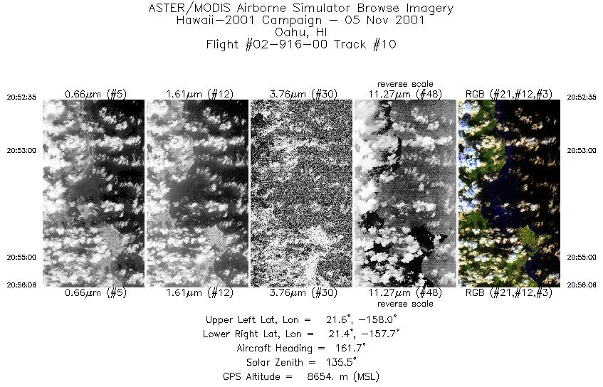
Flight: 02-916-00 Date: November 5, 2001 Aircraft: NASA ER-2, #809 Deployment: Hawaii 2002 Flight Location: Hawaii, Oahu; HI Principal Investigator: Kahle (JPL), Goodman (UCD) Additional Sensors: AVIRIS, RC-10, RC-30 |
||||||||||||||||||||||||||||||||||||||||||||||||||||||||||||||||||||||||||||||||||||||||||||||||||
|
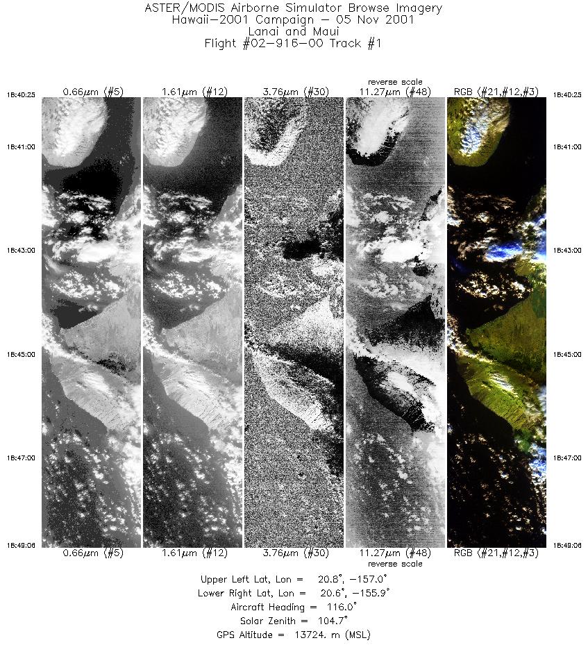
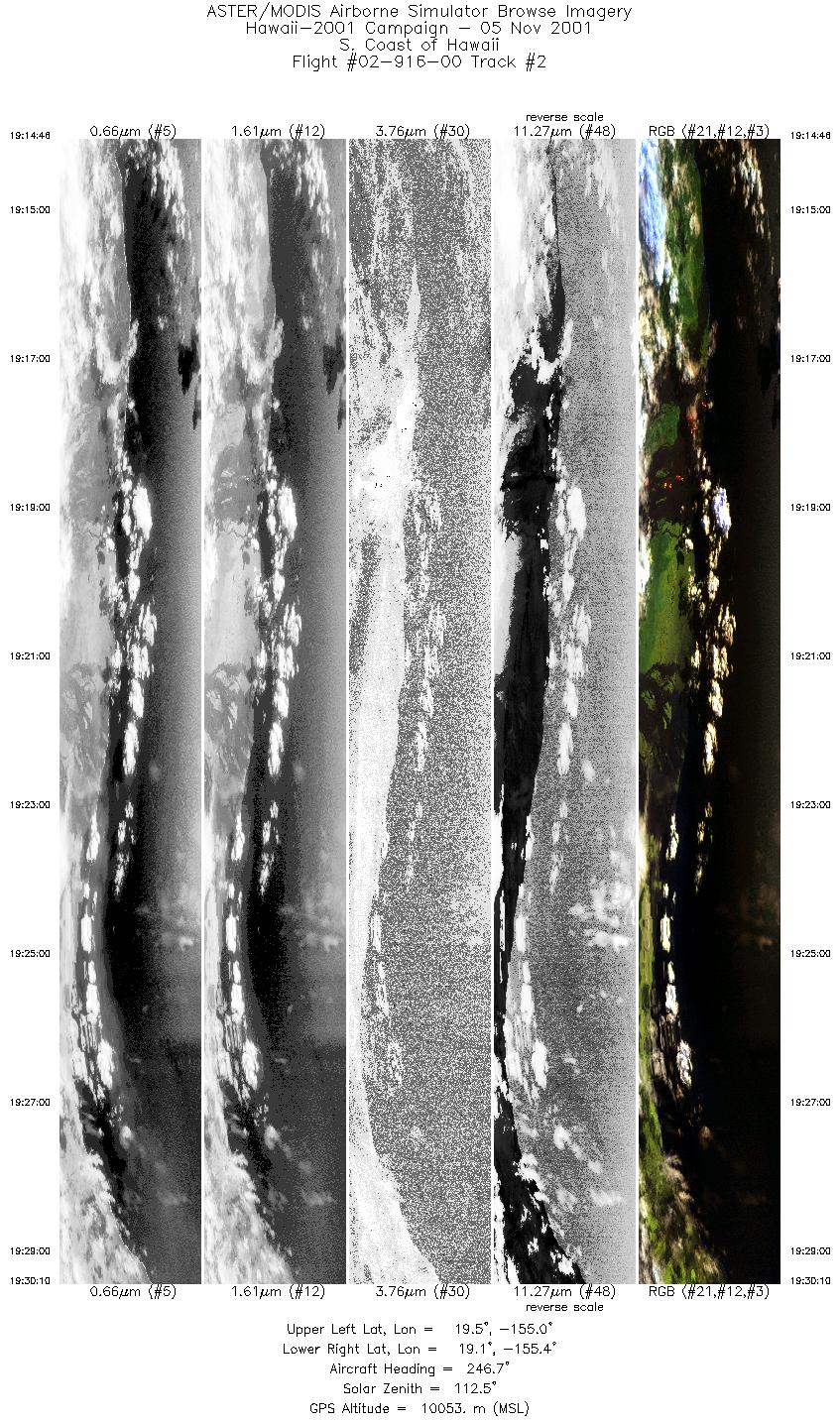
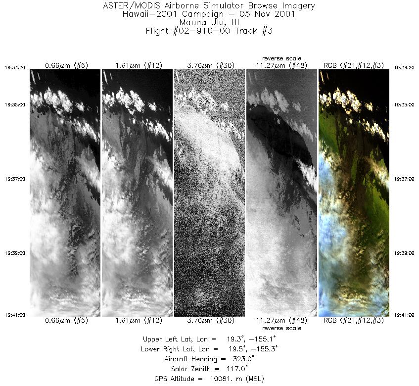
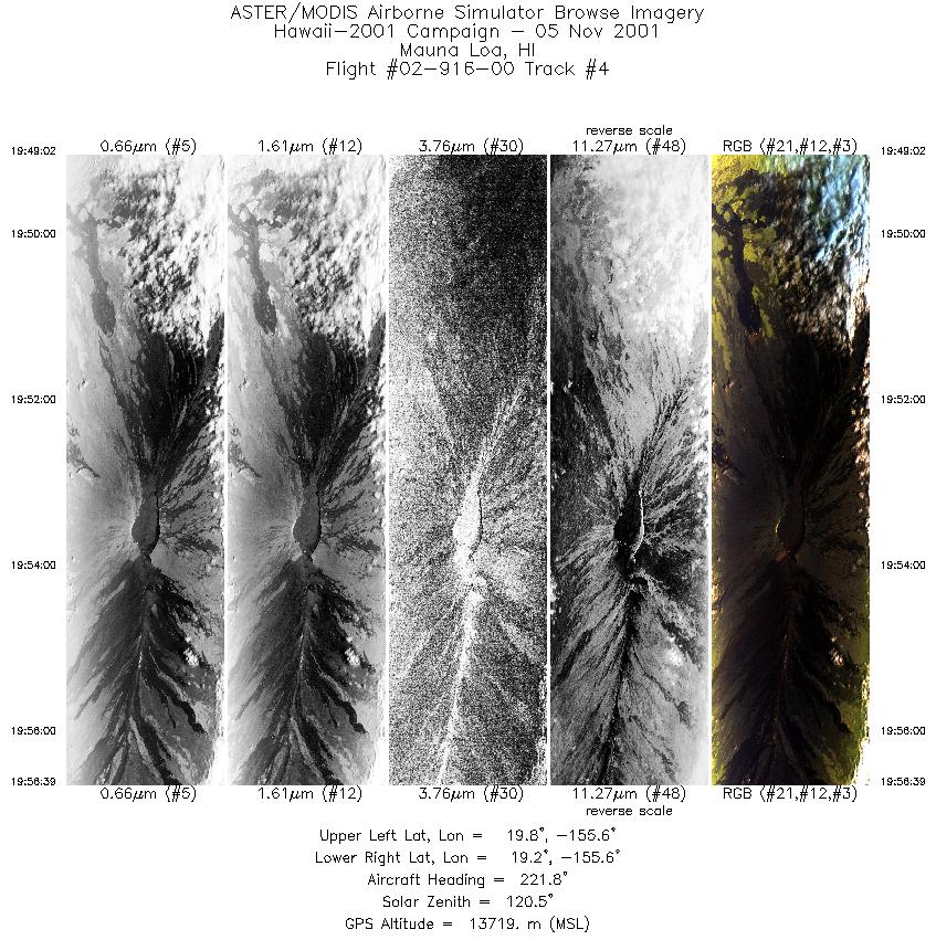
Data Evaluation Flight lines are generally clear with slight haze and some cloud shadows. |
||||||||||||||||||||||||||||||||||||||||||||||||||||||||||||||||||||||||||||||||||||||||||||||||||
|
Processing Information Level-1B Data in HDF format is available Flight Line Summary Spectral Band Configuration Spectral Response Function Table Spectral Response Function (text) |
||||||||||||||||||||||||||||||||||||||||||||||||||||||||||||||||||||||||||||||||||||||||||||||||||
|
Browse Imagery Flight Tracks: 10 Scanlines: 31601 |
||||||||||||||||||||||||||||||||||||||||||||||||||||||||||||||||||||||||||||||||||||||||||||||||||
|
||||||||||||||||||||||||||||||||||||||||||||||||||||||||||||||||||||||||||||||||||||||||||||||||||


