Flight: 02-912-00
Date: October 30, 2001
Aircraft: NASA ER-2, #809
Deployment: Hawaii 2002
Flight Location: Kahoolawe, Hawaii; HI
Principal Investigator: Asner (UCO), Goodman (UCD), Kahle / Realmuto (JPL)
Additional Sensors: AVIRIS, RC-30
|
Data Evaluation
Flight lines are generally clear with slight haze and some cloud shadows.
|
Processing Information
Level-1B Data in HDF format is available
Flight Line Summary
Spectral Band Configuration
Spectral Response Function Table
Spectral Response Function (text)
|
Browse Imagery
Flight Tracks: 17
Scanlines: 34779
|
Browse Imagery Table
|
Click a Flight Track number to view a quicklook image
Lat/Lon ranges are for the BEG-END scanline nadir pixels
|
Flight
Track |
Time Span
(UTC) |
Heading
(Deg) |
Lat Range
(Deg N) |
Lon Range
(Deg W) |
Length
(Scanlines) |
Altitude
(Meters) |
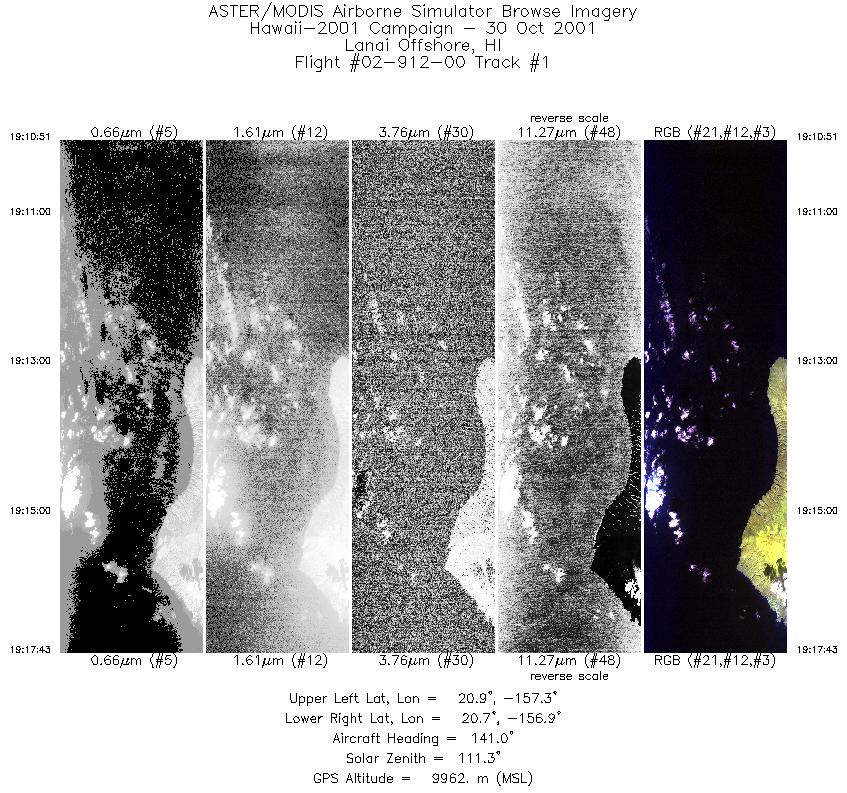
| 1 |
19:10 - 19:17 |
140.6 |
20.981 - 20.976 |
157.220 - 157.216 |
2567 |
9959 |
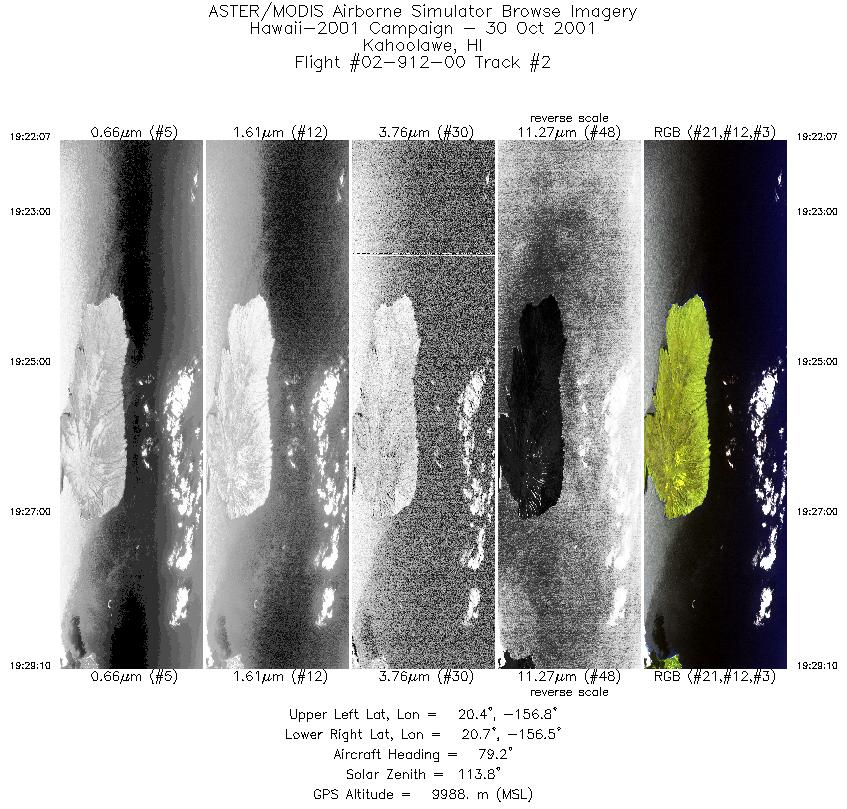
| 2 |
19:22 - 19:29 |
77.3 |
20.485 - 20.487 |
156.820 - 156.813 |
2646 |
9985 |
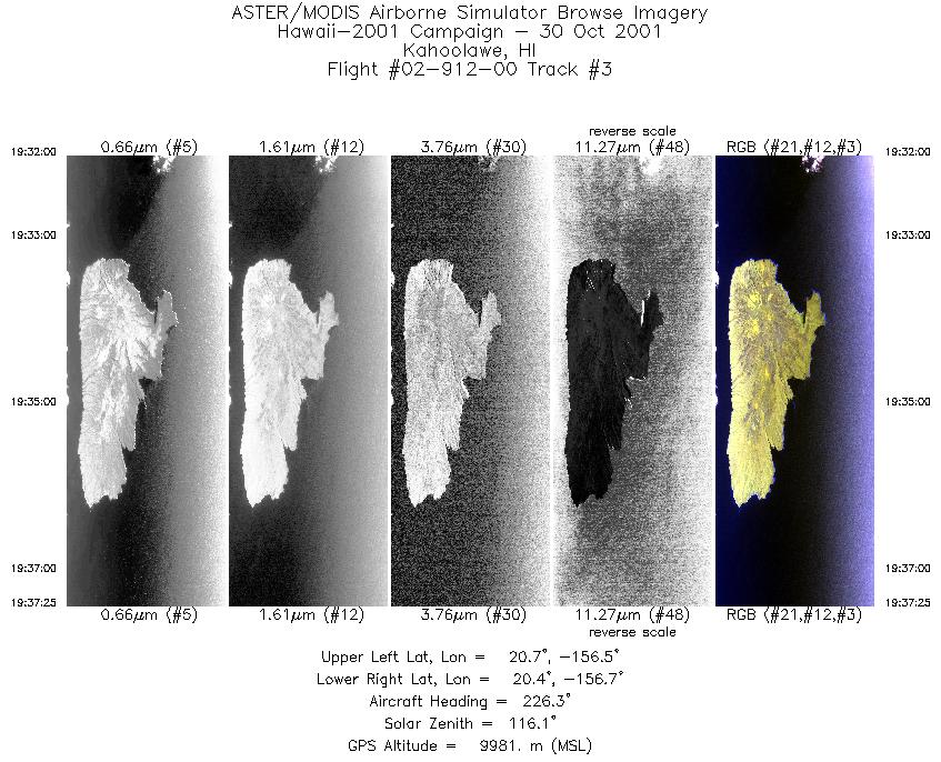
| 3 |
19:31 - 19:37 |
225.0 |
20.604 - 20.599 |
156.467 - 156.473 |
2034 |
9976 |
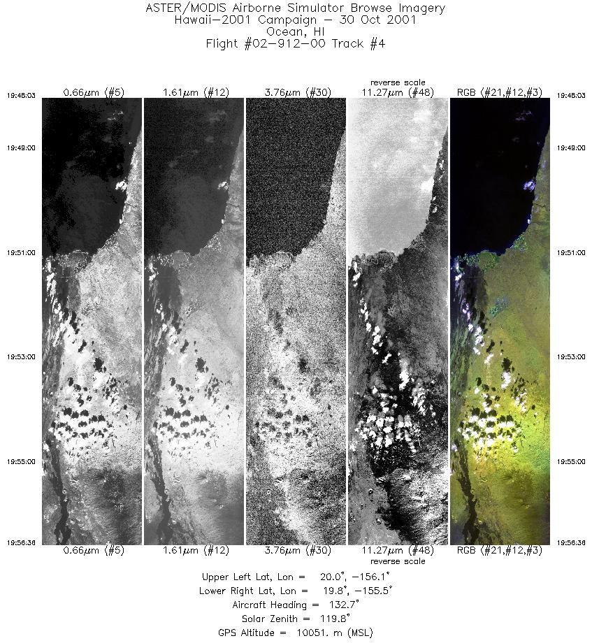
| 4 |
19:48 - 19:56 |
134.3 |
20.103 - 20.097 |
155.995 - 155.987 |
3202 |
10054 |
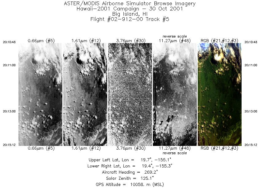
| 5 |
20:10 - 20:15 |
267.2 |
19.581 - 19.580 |
155.141 - 155.147 |
1672 |
10078 |
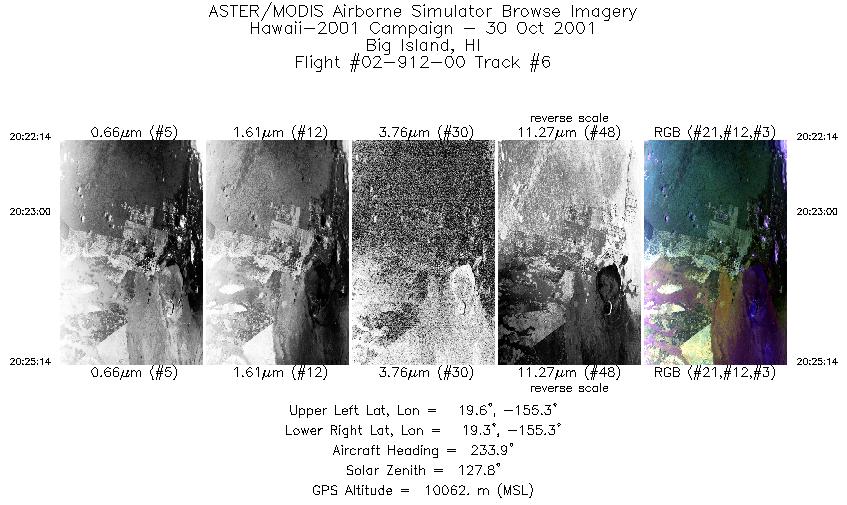
| 6 |
20:22 - 20:25 |
233.1 |
19.507 - 19.503 |
155.232 - 155.236 |
1126 |
10053 |
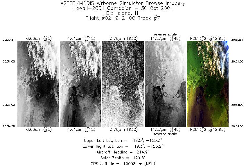
| 7 |
20:30 - 20:34 |
214.3 |
19.494 - 19.489 |
155.191 - 155.194 |
1494 |
10053 |
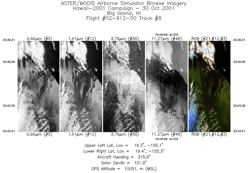
| 8 |
20:39 - 20:43 |
316.3 |
19.216 - 19.221 |
155.129 - 155.133 |
1560 |
10037 |
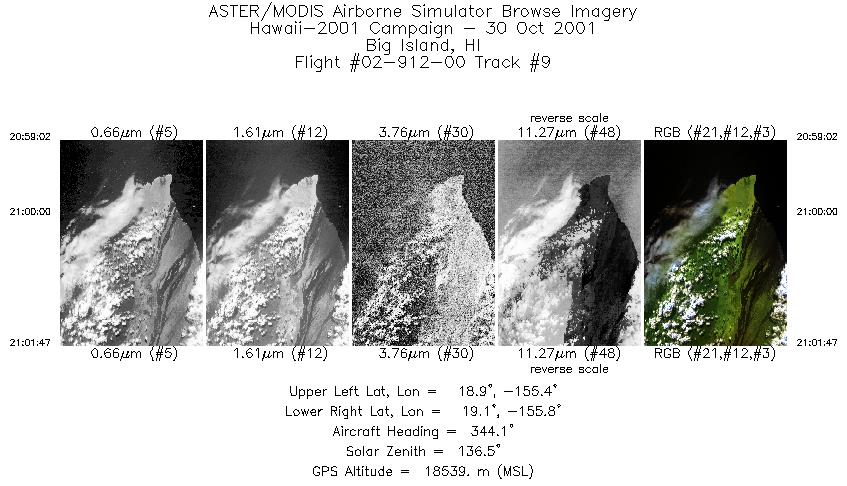
| 9 |
20:59 - 21:01 |
344.4 |
18.886 - 18.899 |
155.589 - 155.590 |
1031 |
18294 |
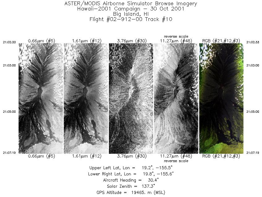
| 10 |
21:02 - 21:07 |
30.7 |
19.261 - 19.274 |
155.690 - 155.684 |
1790 |
18999 |
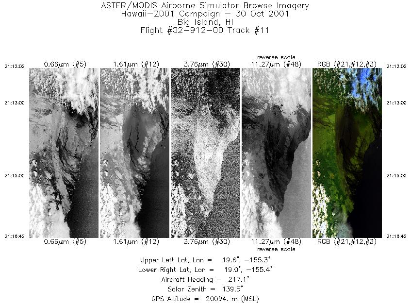
| 11 |
21:12 - 21:16 |
215.9 |
19.524 - 19.512 |
155.192 - 155.201 |
1751 |
20079 |
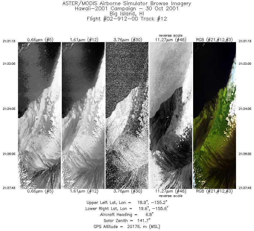
| 12 |
21:21 - 21:27 |
6.8 |
18.912 - 18.927 |
155.422 - 155.422 |
2443 |
20065 |
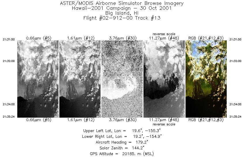
| 13 |
21:31 - 21:35 |
178.9 |
19.572 - 19.558 |
155.120 - 155.120 |
1341 |
20149 |
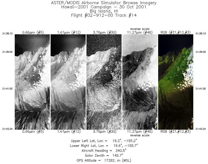
| 14 |
21:38 - 21:43 |
340.5 |
19.105 - 19.118 |
155.353 - 155.360 |
1946 |
18952 |
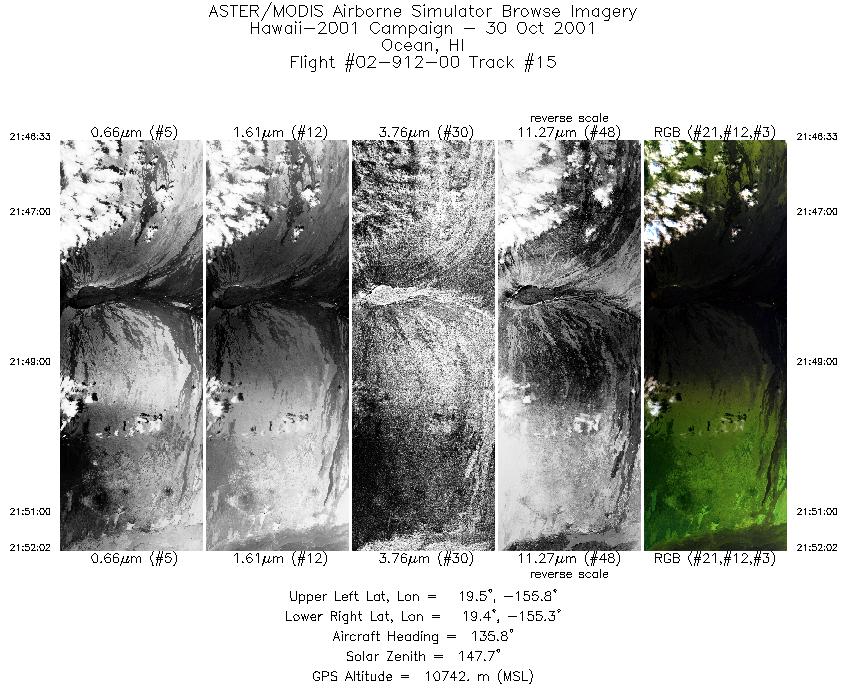
| 15 |
21:46 - 21:52 |
135.6 |
19.600 - 19.592 |
155.705 - 155.696 |
2058 |
12467 |
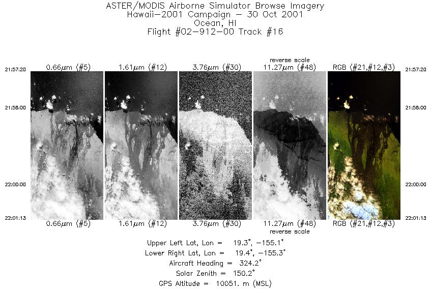
| 16 |
21:57 - 22:01 |
322.9 |
19.207 - 19.213 |
155.135 - 155.138 |
1460 |
10086 |
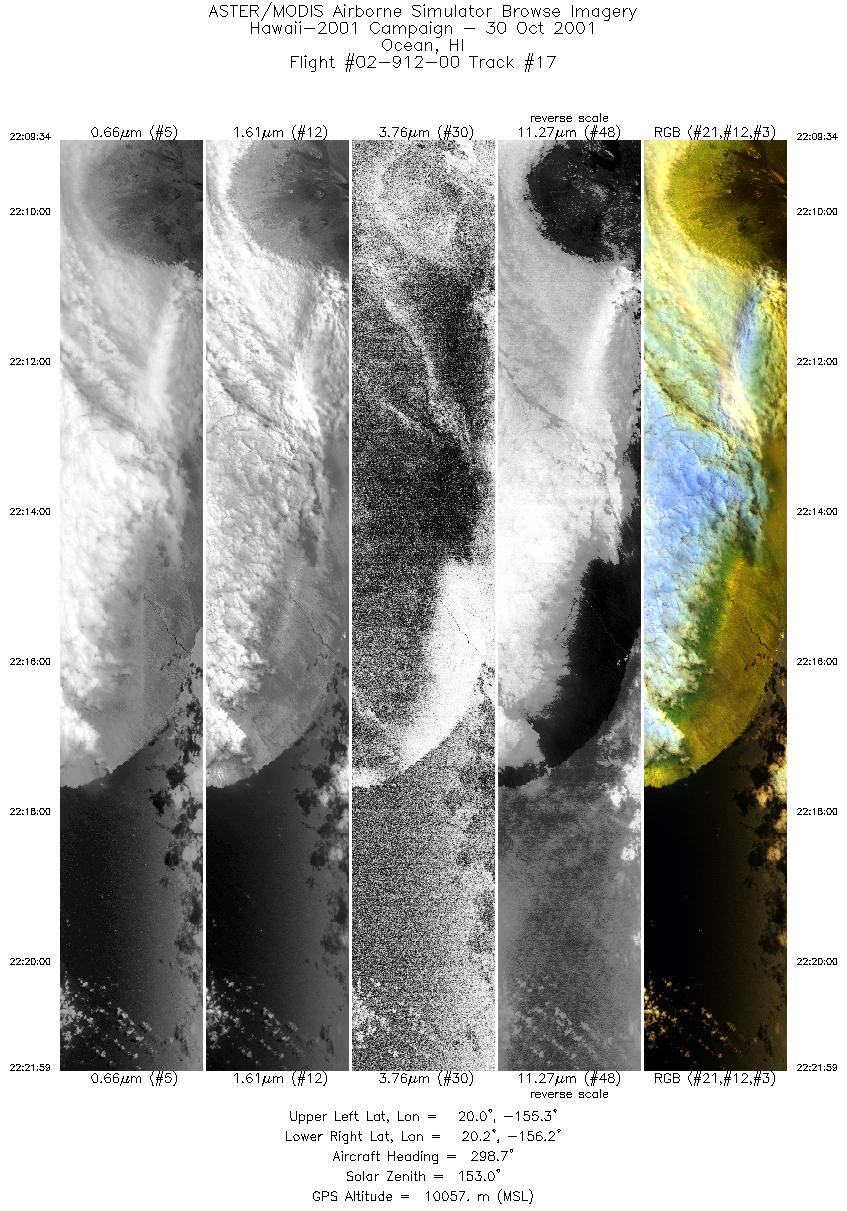
| 17 |
22:09 - 22:21 |
297.5 |
19.879 - 19.884 |
155.363 - 155.371 |
4658 |
10090 |
|


