Flight: 02-911-00
Date: October 29, 2001
Aircraft: NASA ER-2, #809
Deployment: Hawaii 2002
Flight Location: Hawaii, Molokai, Kauai; HI
Principal Investigator: Asner (UCO), Kahle (JPL)
Additional Sensors: AVIRIS, RC-30
|
Data Evaluation
Flight lines are generally clear with slight haze and some cloud shadows.
|
Processing Information
Level-1B Data in HDF format is available
Flight Line Summary
Spectral Band Configuration
Spectral Response Function Table
Spectral Response Function (text)
|
Browse Imagery
Flight Tracks: 18
Scanlines: 49082
|
Browse Imagery Table
|
Click a Flight Track number to view a quicklook image
Lat/Lon ranges are for the BEG-END scanline nadir pixels
|
Flight
Track |
Time Span
(UTC) |
Heading
(Deg) |
Lat Range
(Deg N) |
Lon Range
(Deg W) |
Length
(Scanlines) |
Altitude
(Meters) |
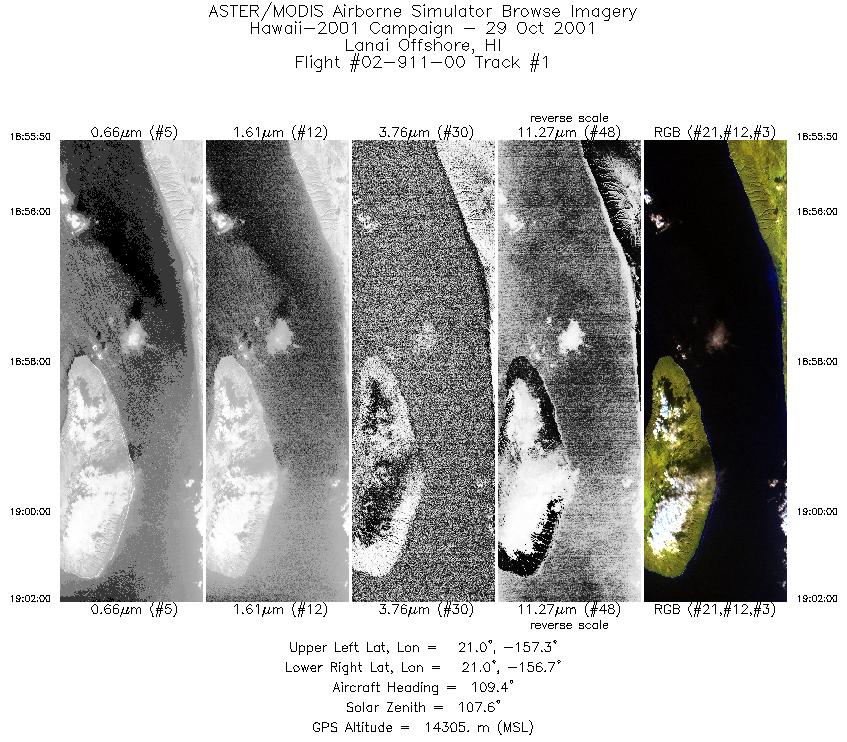
| 1 |
18:55 - 19:02 |
110.6 |
21.071 - 20.846 |
157.270 - 156.752 |
2310 |
-999 |
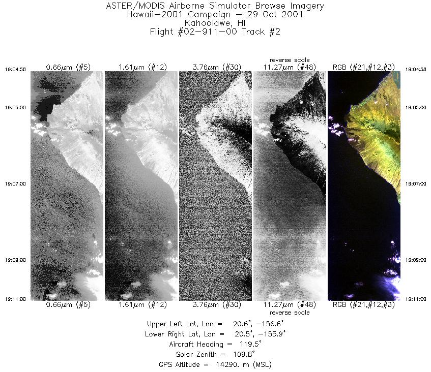
| 2 |
19:04 - 19:11 |
121.2 |
20.709 - 20.383 |
156.502 - 156.009 |
2260 |
-999 |
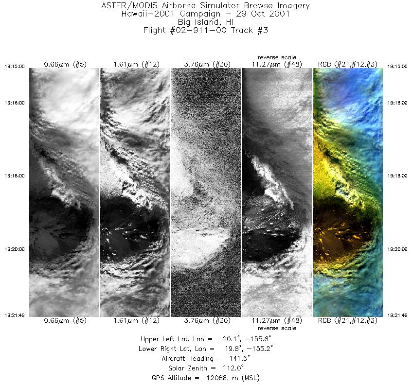
| 3 |
19:15 - 19:21 |
142.0 |
20.159 - 19.706 |
155.694 - 155.307 |
2560 |
-999 |
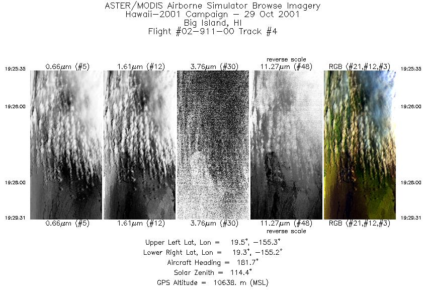
| 4 |
19:25 - 19:29 |
202.3 |
19.510 - 19.340 |
155.203 - 155.293 |
1482 |
-999 |
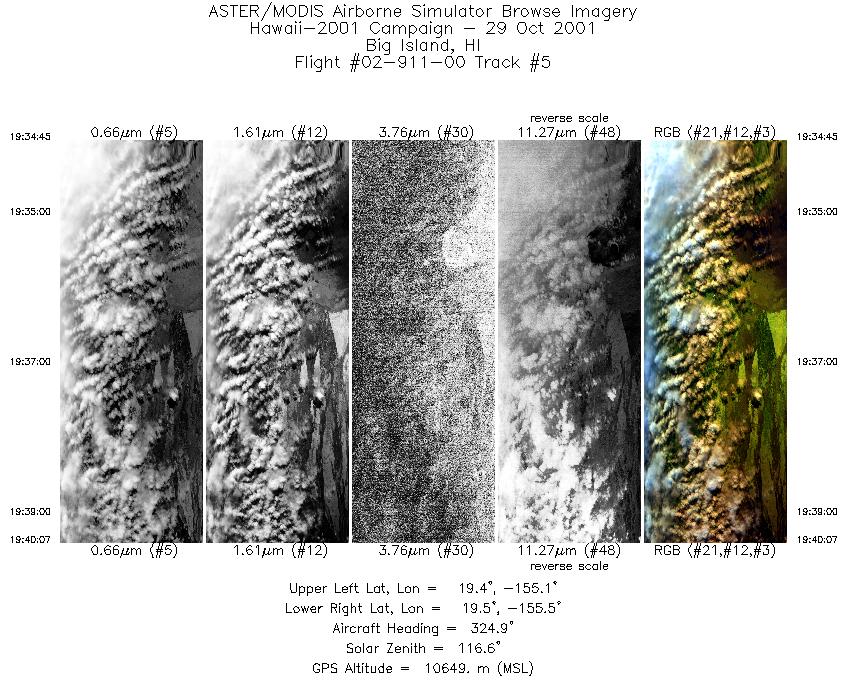
| 5 |
19:34 - 19:40 |
318.5 |
19.386 - 19.566 |
155.198 - 155.397 |
2015 |
-999 |
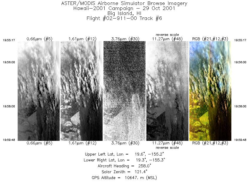
| 6 |
19:55 - 19:59 |
244.0 |
19.527 - 19.379 |
155.192 - 155.365 |
1696 |
-999 |
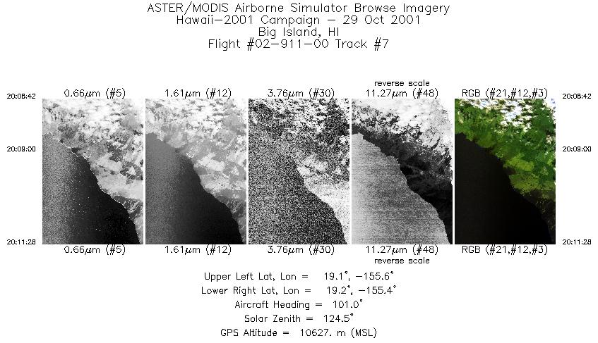
| 7 |
20:08 - 20:11 |
98.8 |
19.155 - 19.124 |
155.604 - 155.364 |
1039 |
-999 |
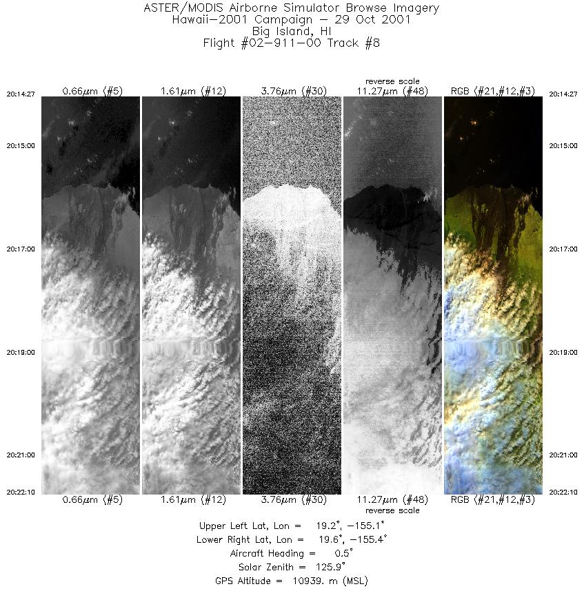
| 8 |
20:14 - 20:22 |
352.0 |
19.178 - 19.603 |
155.153 - 155.256 |
2893 |
-999 |
| 9 |
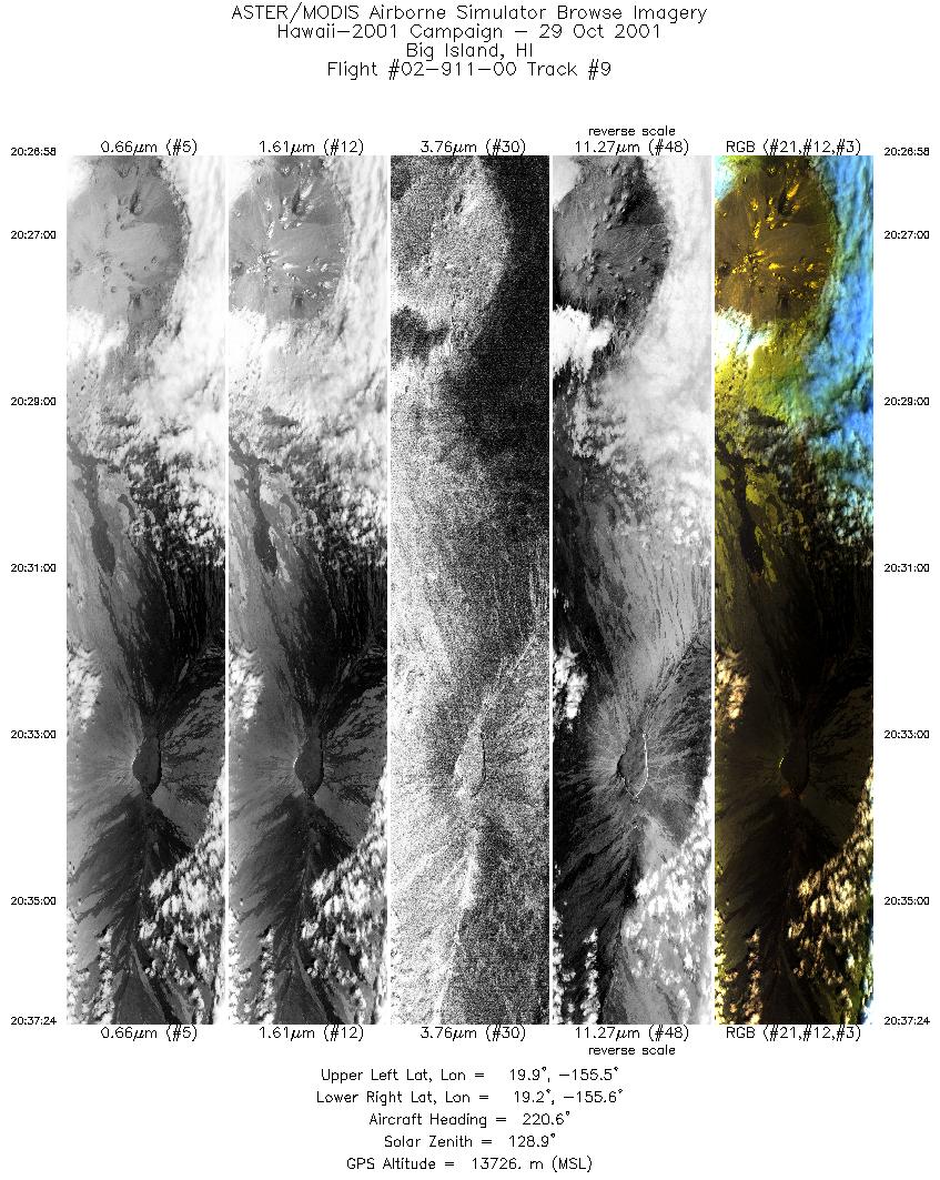
20:26 - 20:37 |
215.1 |
19.878 - 19.309 |
155.397 - 155.669 |
3919 |
-999 |
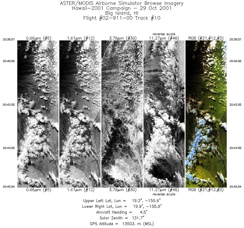
| 10 |
20:39 - 20:45 |
358.0 |
19.333 - 19.877 |
155.732 - 155.708 |
2554 |
-999 |
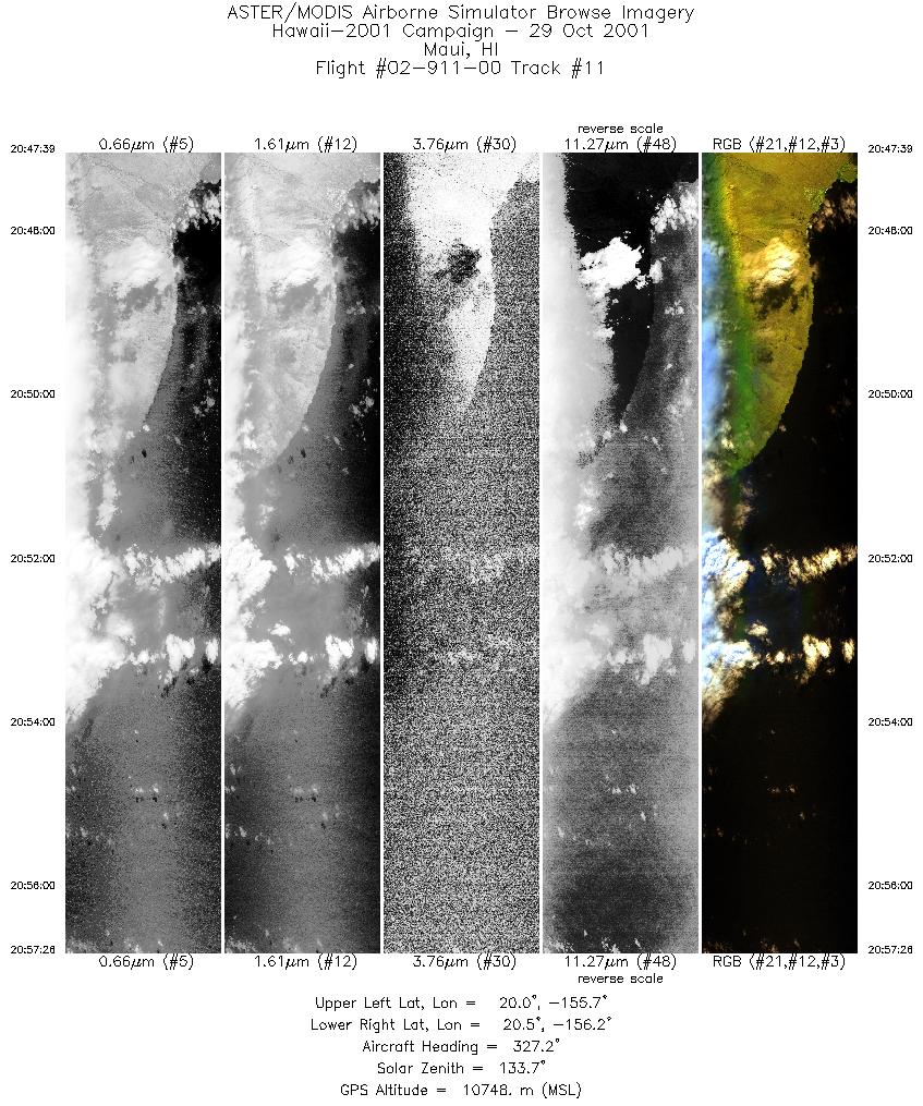
| 11 |
20:47 - 20:57 |
329.0 |
20.001 - 20.537 |
155.765 - 156.152 |
3677 |
-999 |
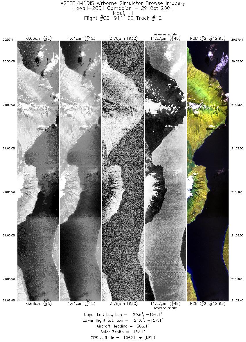
| 12 |
20:57 - 21:09 |
303.6 |
20.549 - 21.043 |
156.165 - 157.010 |
4499 |
-999 |
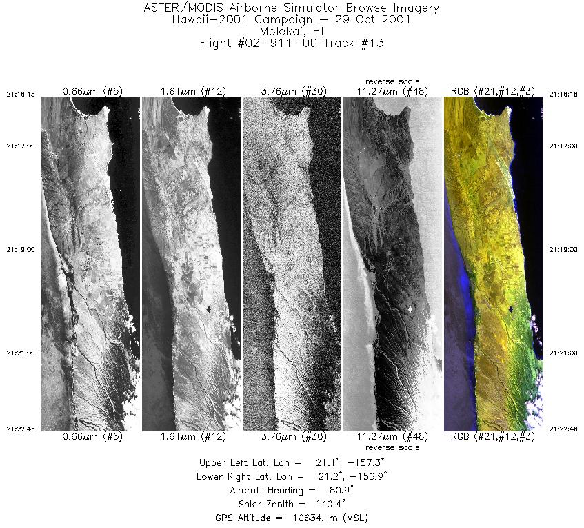
| 13 |
21:16 - 21:22 |
93.1 |
21.194 - 21.081 |
157.266 - 156.931 |
2429 |
-999 |
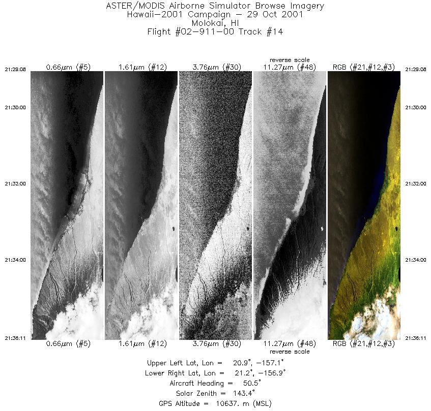
| 14 |
21:29 - 21:36 |
59.3 |
21.004 - 21.132 |
157.203 - 156.876 |
2646 |
-999 |
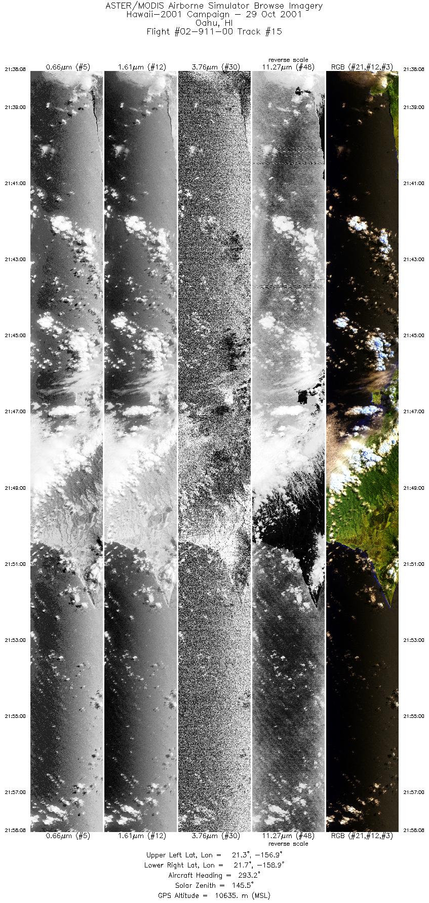
| 15 |
21:38 - 21:58 |
294.7 |
21.212 - 21.805 |
156.913 - 158.811 |
7509 |
-999 |
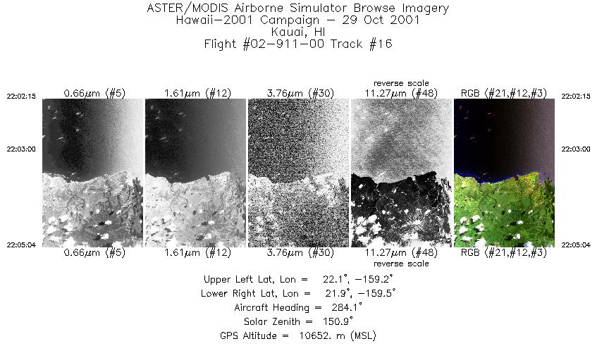
| 16 |
22:02 - 22:05 |
283.0 |
21.996 - 22.023 |
159.176 - 159.459 |
1057 |
-999 |
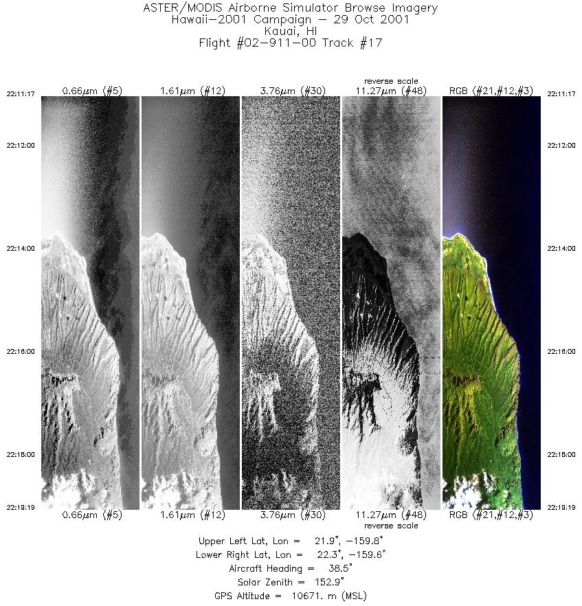
| 17 |
22:11 - 22:19 |
52.3 |
21.981 - 22.170 |
159.916 - 159.565 |
3011 |
-999 |
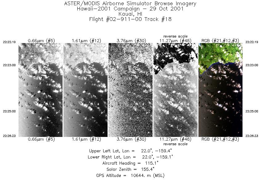
| 18 |
22:22 - 22:26 |
116.2 |
22.085 - 21.910 |
159.382 - 159.122 |
1526 |
-999 |
|


