Flight: 02-906-00
Date: October 20, 2001
Aircraft: NASA ER-2, #809
Deployment: Hawaii 2002
Flight Location: Hawaii, HI
Principal Investigator: Asner (UCO), Kahle (JPL)
Additional Sensors: AVIRIS, RC-30
|
Data Evaluation
Flight lines are generally clear with slight haze and some cloud shadows.
|
Processing Information
Level-1B Data in HDF format is available
Flight Line Summary
Spectral Band Configuration
Spectral Response Function Table
Spectral Response Function (text)
|
Browse Imagery
Flight Tracks: 15
Scanlines: 45128
|
Browse Imagery Table
|
Click a Flight Track number to view a quicklook image
Lat/Lon ranges are for the BEG-END scanline nadir pixels
|
Flight
Track |
Time Span
(UTC) |
Heading
(Deg) |
Lat Range
(Deg N) |
Lon Range
(Deg W) |
Length
(Scanlines) |
Altitude
(Meters) |
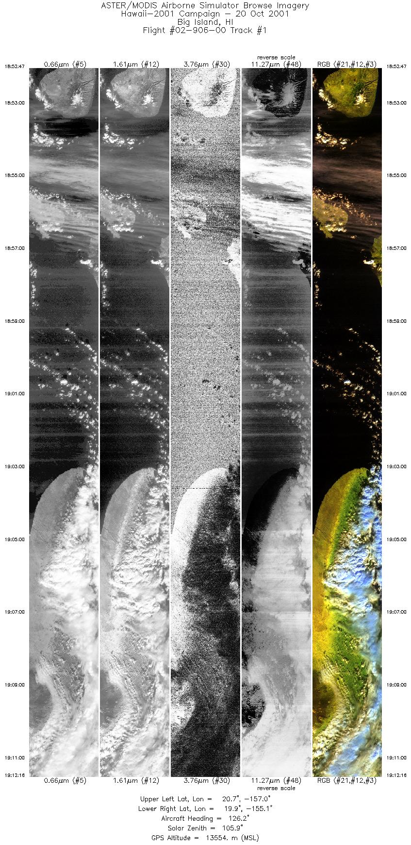
| 1 |
18:52 - 19:12 |
126.6 |
20.833 - 19.838 |
156.975 - 155.208 |
7293 |
13389 |
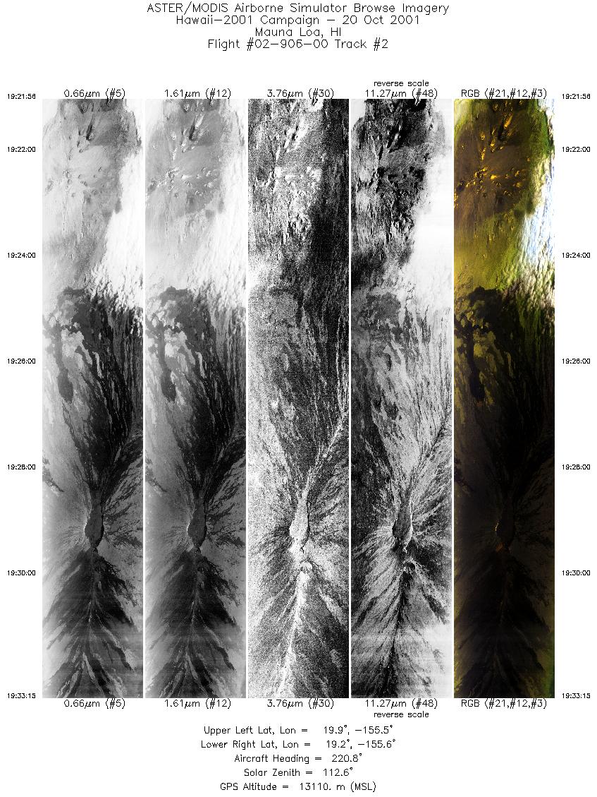
| 2 |
19:21 - 19:33 |
219.2 |
19.878 - 19.313 |
155.406 - 155.668 |
4247 |
13116 |
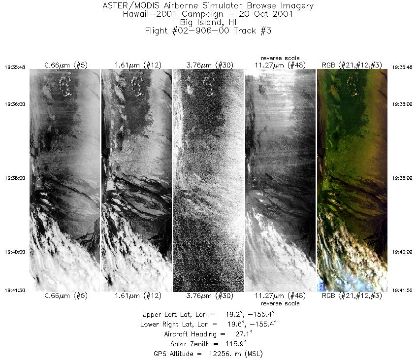
| 3 |
19:35 - 19:41 |
18.5 |
19.264 - 19.621 |
155.534 - 155.311 |
2269 |
12062 |
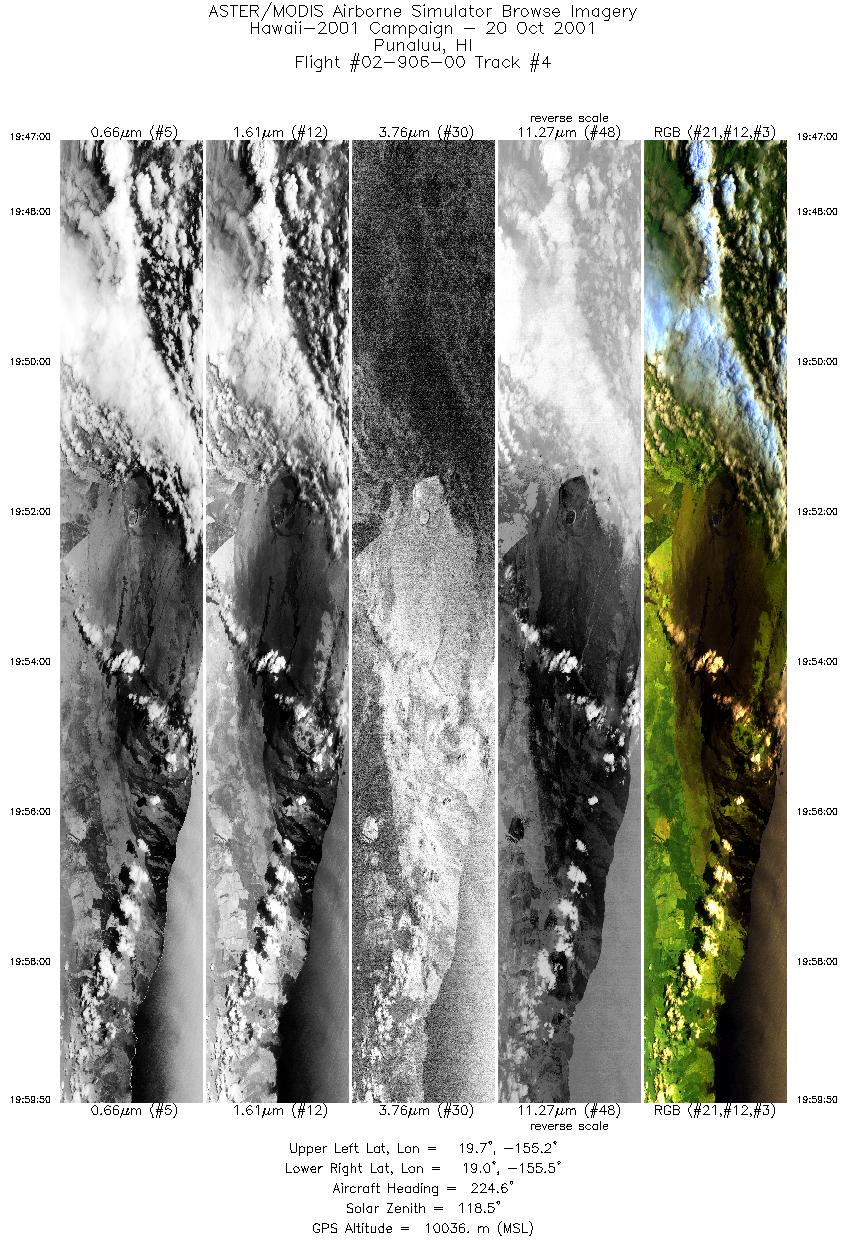
| 4 |
19:47 - 19:59 |
225.6 |
19.612 - 19.091 |
155.123 - 155.541 |
4817 |
10048 |
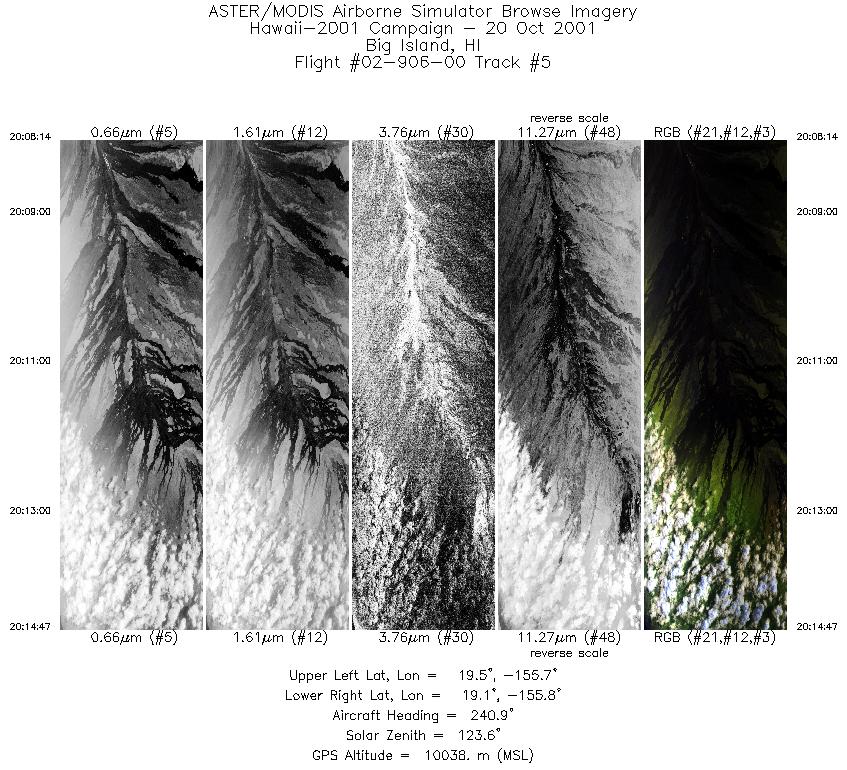
| 5 |
20:08 - 20:14 |
237.3 |
19.382 - 19.164 |
155.616 - 155.850 |
2454 |
10030 |
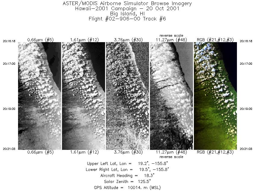
| 6 |
20:16 - 20:21 |
19.4 |
19.210 - 19.487 |
155.894 - 155.743 |
1793 |
10052 |
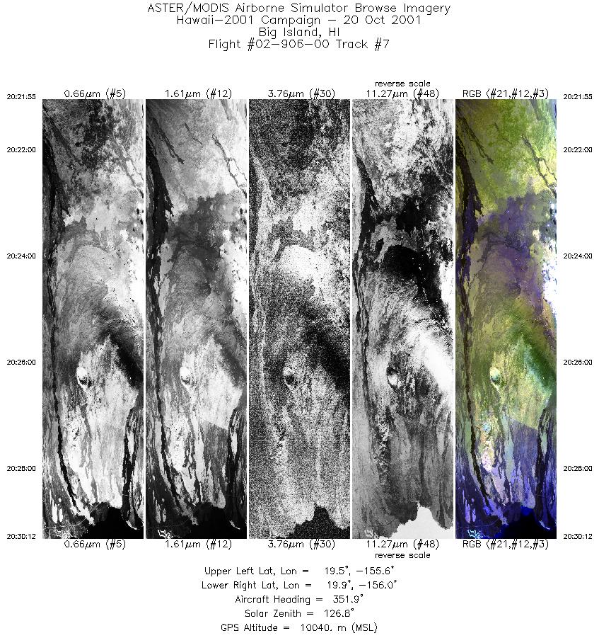
| 7 |
20:21 - 20:30 |
338.4 |
19.529 - 19.897 |
155.737 - 155.915 |
3108 |
10050 |
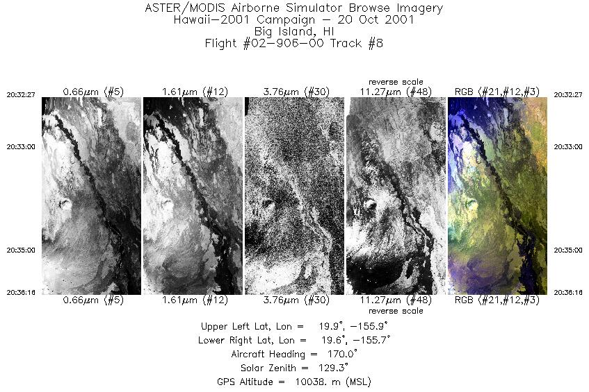
| 8 |
20:32 - 20:36 |
175.8 |
19.911 - 19.644 |
155.829 - 155.778 |
1428 |
10029 |
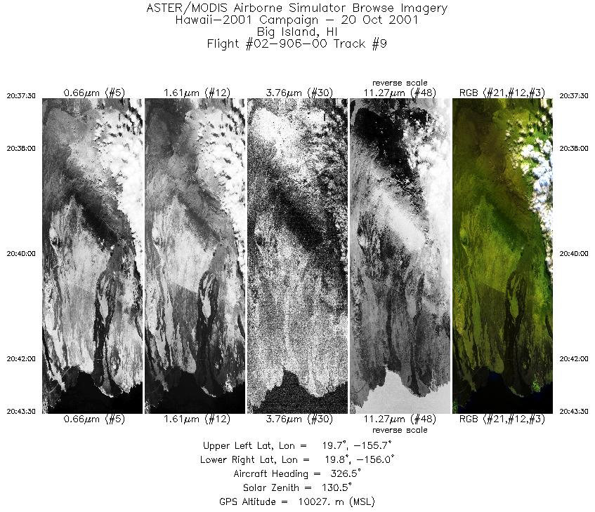
| 9 |
20:37 - 20:43 |
325.7 |
19.628 - 19.875 |
155.818 - 155.952 |
2250 |
10058 |
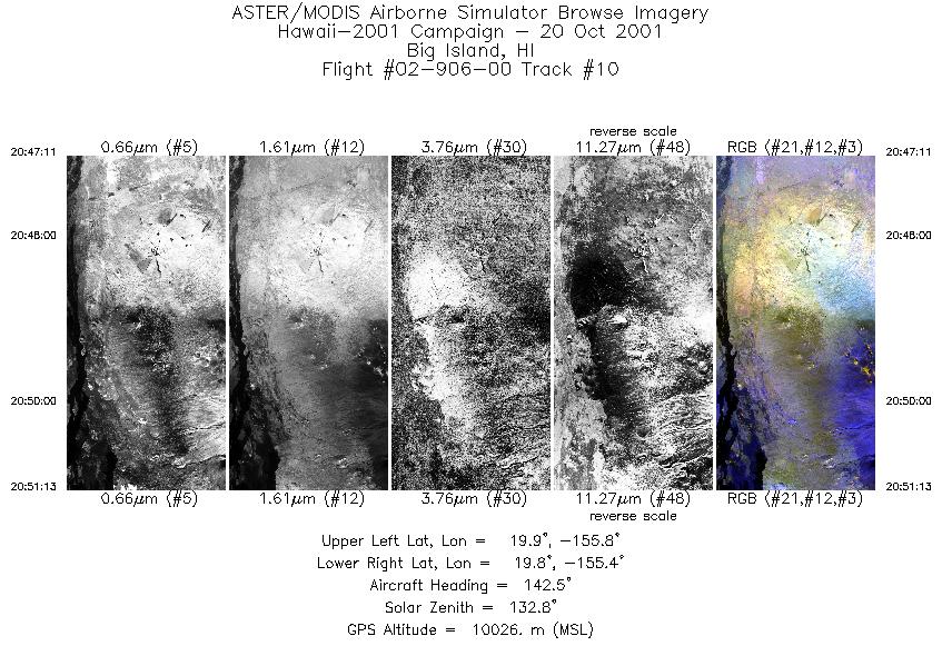
| 10 |
20:47 - 20:51 |
141.2 |
19.911 - 19.722 |
155.730 - 155.486 |
1508 |
10021 |
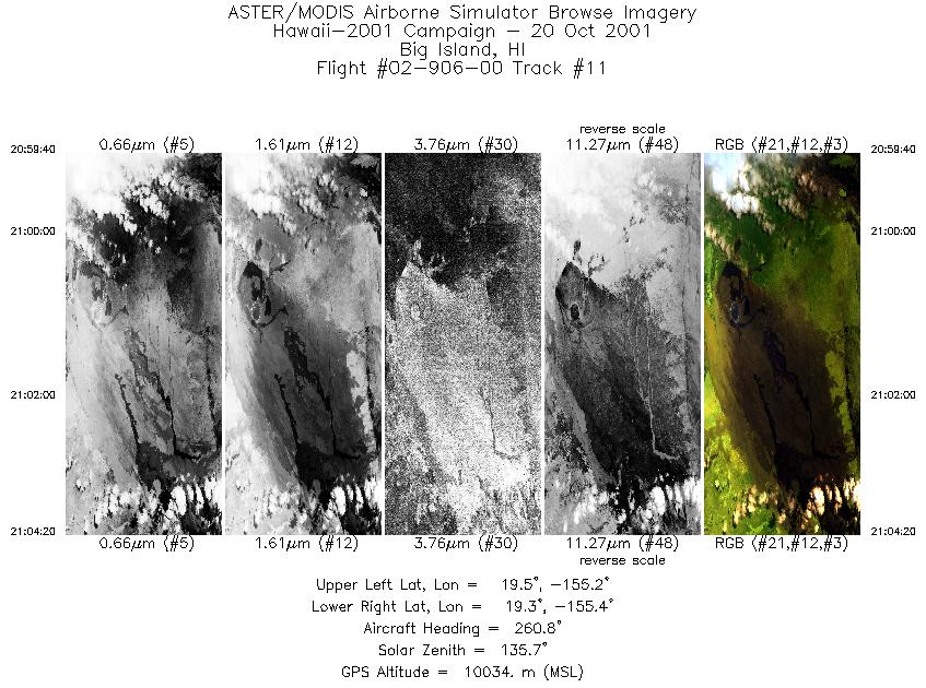
| 11 |
20:59 - 21:04 |
260.8 |
19.388 - 19.337 |
155.186 - 155.395 |
1750 |
10044 |
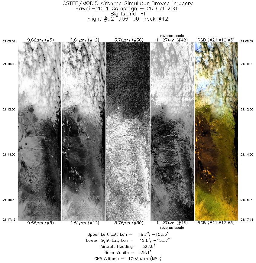
| 12 |
21:09 - 21:17 |
316.2 |
19.627 - 19.872 |
155.336 - 155.621 |
2947 |
10011 |
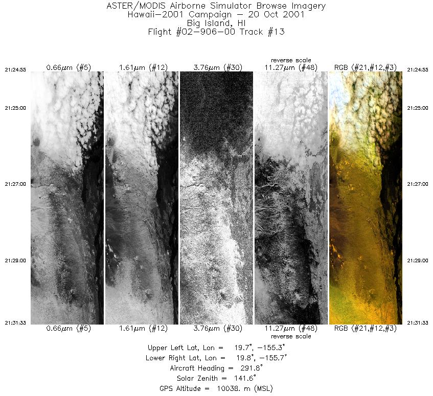
| 13 |
21:24 - 21:31 |
298.8 |
19.660 - 19.843 |
155.377 - 155.637 |
2484 |
10037 |
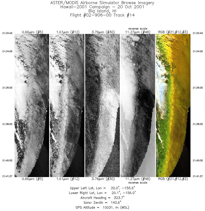
| 14 |
21:33 - 21:41 |
315.6 |
19.952 - 20.195 |
155.628 - 155.911 |
2950 |
10033 |
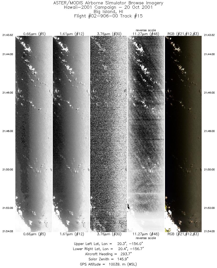
| 15 |
21:43 - 21:54 |
291.6 |
20.254 - 20.464 |
156.028 - 156.698 |
3830 |
10046 |
|


