Flight: 02-904-00
Date: October 16, 2001
Aircraft: NASA ER-2, #809
Deployment: Hawaii 2002
Flight Location: Hawaii, HI
Principal Investigator: Asner (UCO)
Additional Sensors: AVIRIS, RC-30
|
Data Evaluation
Flight lines are generally clear with slight haze and some cloud shadows.
|
Processing Information
Level-1B Data in HDF format is available
Flight Line Summary
Spectral Band Configuration
Spectral Response Function Table
Spectral Response Function (text)
|
Browse Imagery
Flight Tracks: 13
Scanlines: 33650
|
Browse Imagery Table
|
Click a Flight Track number to view a quicklook image
Lat/Lon ranges are for the BEG-END scanline nadir pixels
|
Flight
Track |
Time Span
(UTC) |
Heading
(Deg) |
Lat Range
(Deg N) |
Lon Range
(Deg W) |
Length
(Scanlines) |
Altitude
(Meters) |
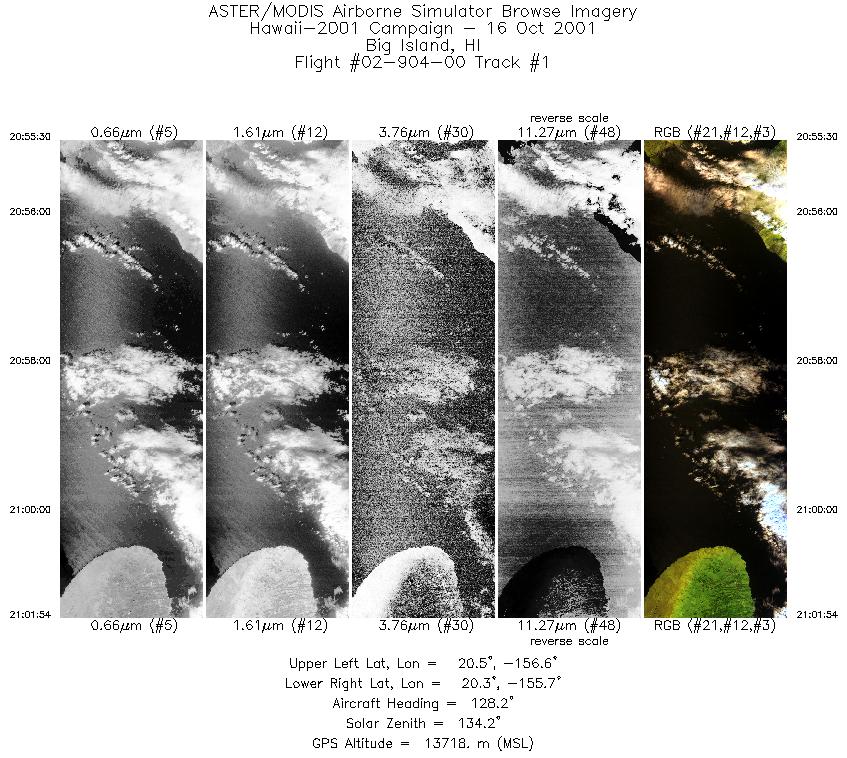
| 1 |
20:55 - 21:01 |
127.9 |
20.615 - 20.179 |
156.516 - 155.777 |
2391 |
13711 |
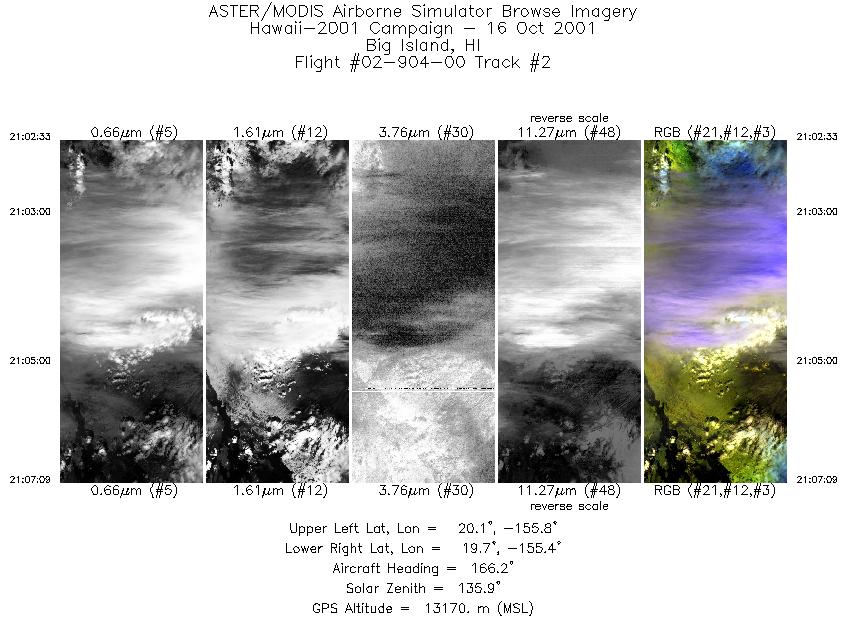
| 2 |
21:02 - 21:07 |
167.1 |
20.120 - 19.688 |
155.722 - 155.512 |
1718 |
12911 |
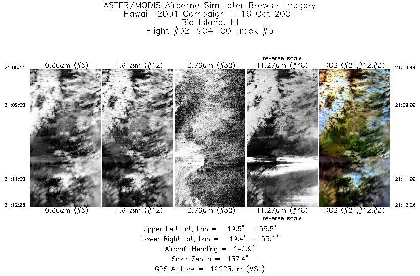
| 3 |
21:08 - 21:12 |
140.4 |
19.571 - 19.385 |
155.421 - 155.193 |
1386 |
10470 |
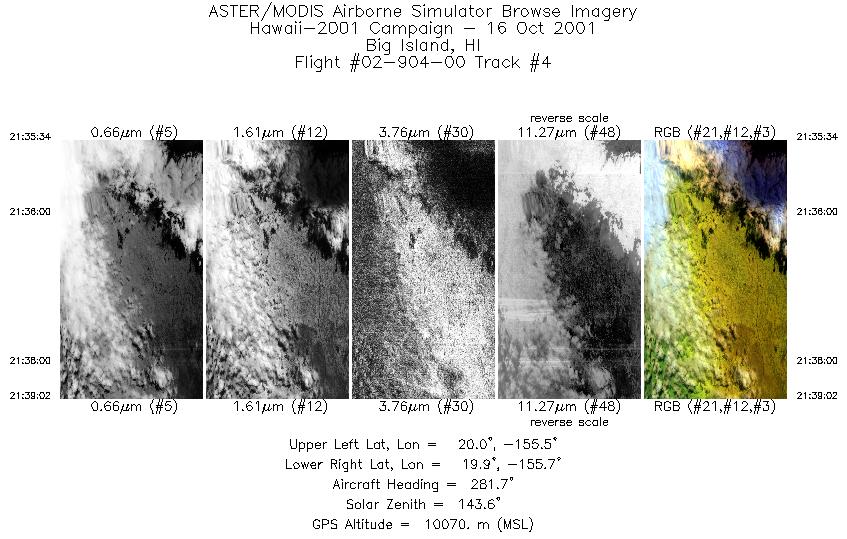
| 4 |
21:35 - 21:39 |
292.2 |
19.901 - 19.990 |
155.484 - 155.611 |
1299 |
10073 |
| 5 |
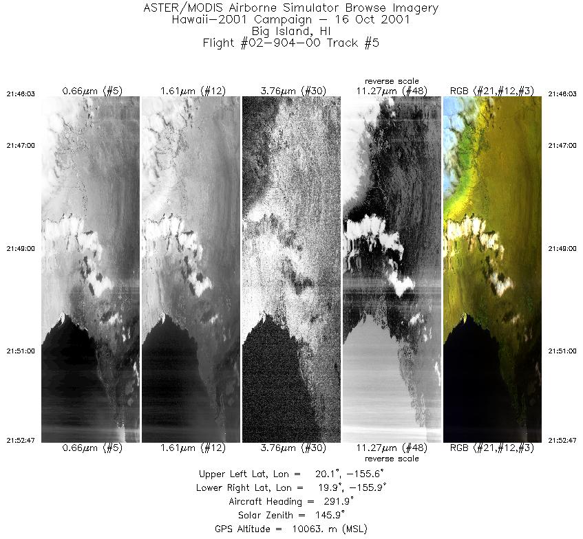
21:46 - 21:52 |
275.0 |
19.983 - 19.965 |
155.651 - 155.911 |
2524 |
10058 |
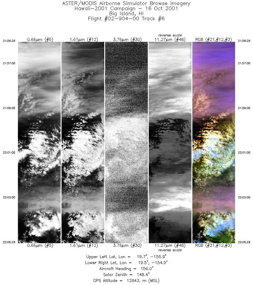
| 6 |
21:56 - 22:05 |
137.5 |
19.781 - 19.373 |
155.835 - 154.926 |
3372 |
11289 |
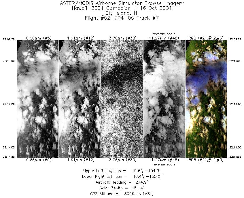
| 7 |
22:09 - 22:14 |
275.9 |
19.508 - 19.513 |
154.900 - 155.165 |
2039 |
8522 |
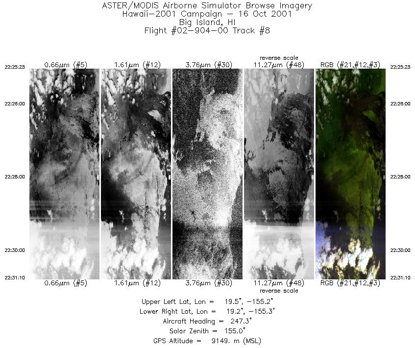
| 8 |
22:25 - 22:31 |
248.7 |
19.386 - 19.286 |
155.149 - 155.348 |
2154 |
9138 |
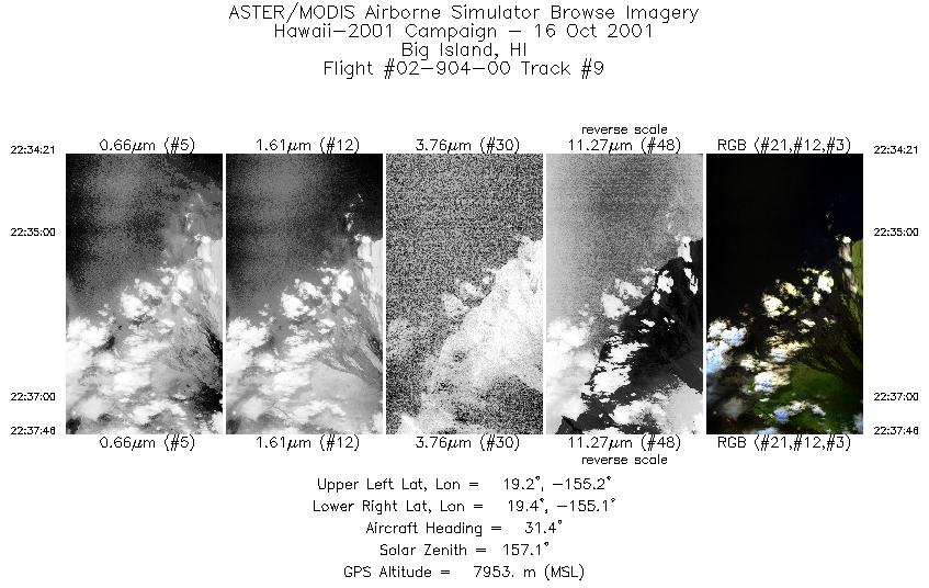
| 9 |
22:34 - 22:37 |
31.3 |
19.185 - 19.355 |
155.221 - 155.083 |
1281 |
7941 |
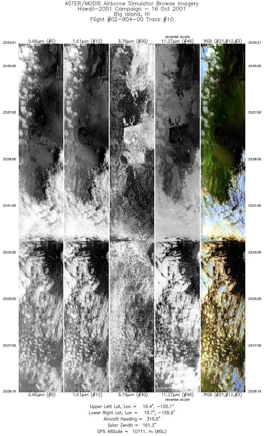
| 10 |
22:54 - 23:09 |
310.3 |
19.312 - 19.790 |
155.138 - 155.847 |
5597 |
11436 |
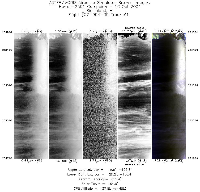
| 11 |
23:10 - 23:17 |
311.3 |
19.862 - 20.321 |
155.923 - 156.335 |
2672 |
13723 |
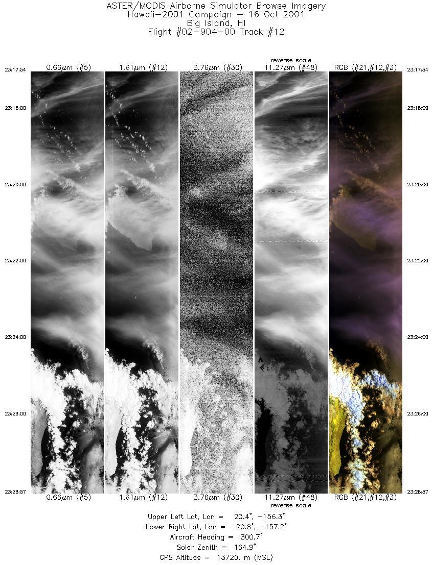
| 12 |
23:17 - 23:28 |
300.8 |
20.335 - 20.849 |
156.352 - 157.144 |
4138 |
13716 |
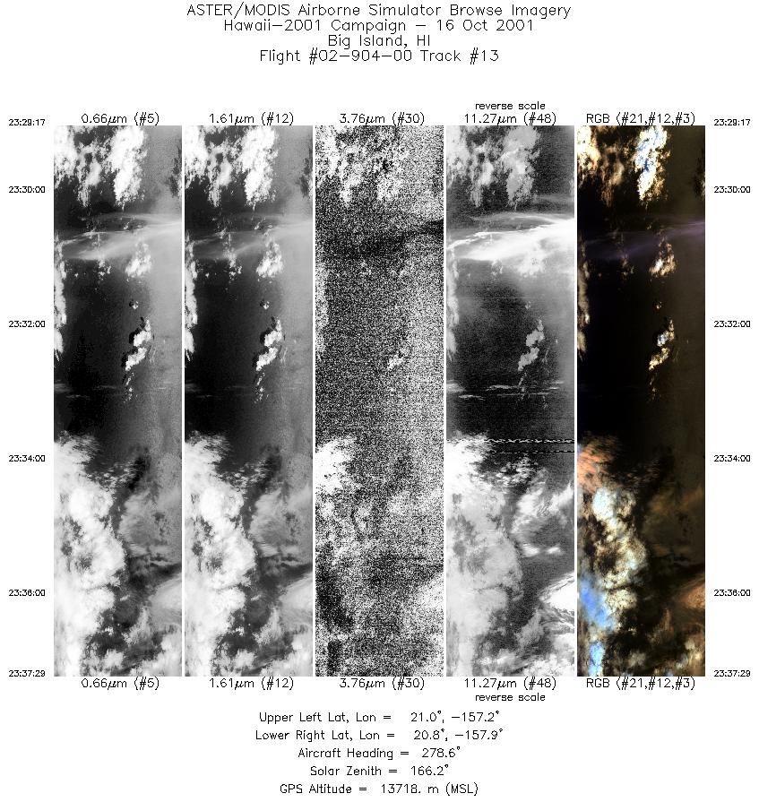
| 13 |
23:29 - 23:37 |
277.5 |
20.859 - 20.912 |
157.170 - 157.875 |
3079 |
13703 |
|


