Flight: 02-903-00
Date: October 15, 2001
Aircraft: NASA ER-2, #809
Deployment: Hawaii 2002
Flight Location: DFRC, CA to Oahu, HI
Principal Investigator: Ferry Flight
Additional Sensors: AVIRIS, RC-10, RC-30
|
Data Evaluation
Flight lines are generally clear with slight haze and some cloud shadows.
|
Processing Information
Level-1B Data in HDF format is available
Flight Line Summary
Spectral Band Configuration
Spectral Response Function Table
Spectral Response Function (text)
|
Browse Imagery
Flight Tracks: 13
Scanlines: 109941
|
Browse Imagery Table
|
Click a Flight Track number to view a quicklook image
Lat/Lon ranges are for the BEG-END scanline nadir pixels
|
Flight
Track |
Time Span
(UTC) |
Heading
(Deg) |
Lat Range
(Deg N) |
Lon Range
(Deg W) |
Length
(Scanlines) |
Altitude
(Meters) |
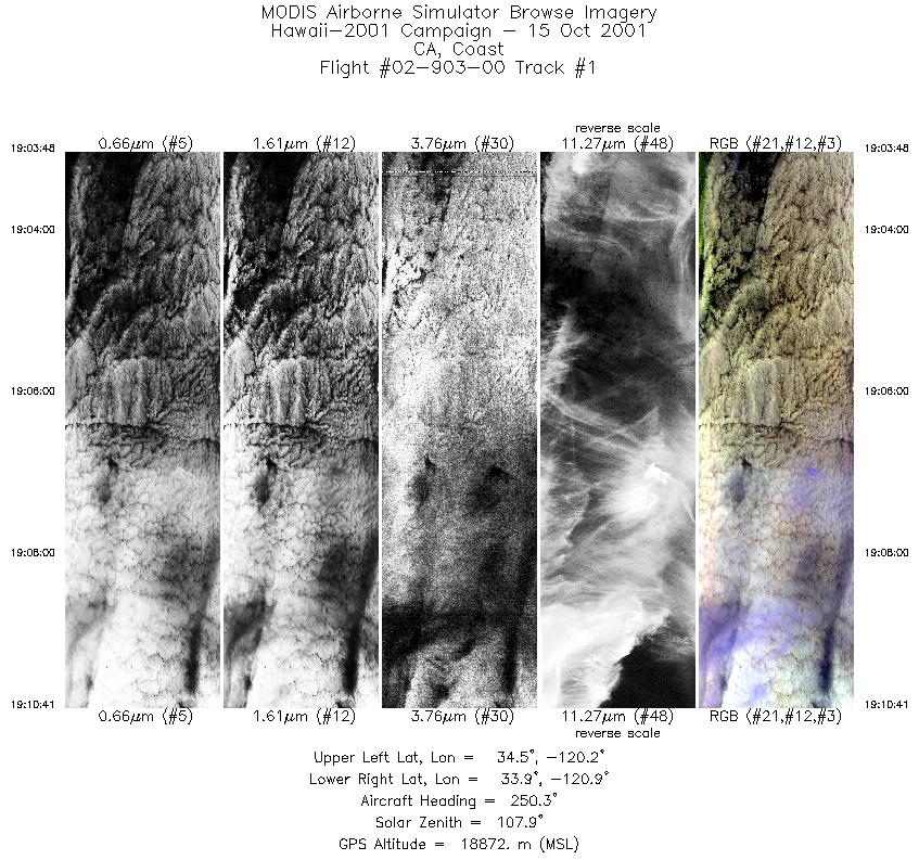
| 1 |
19:03 - 19:10 |
248.9 |
34.377 - 34.068 |
120.150 - 121.012 |
2570 |
18920 |
| 2 |
19:11 - 19:23 |
242.6 |
34.033 - 33.497 |
121.152 - 122.548 |
4283 |
19685 |
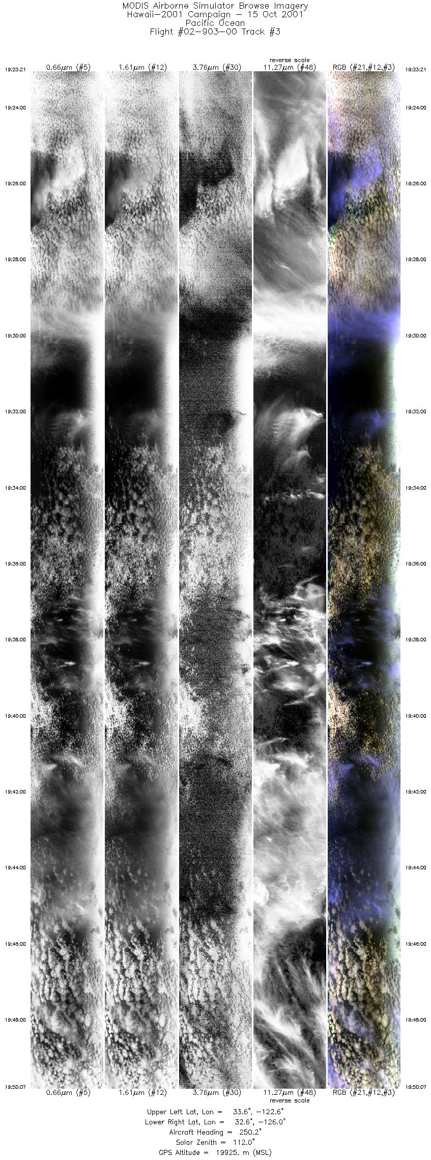
| 3 |
19:23 - 19:50 |
252.3 |
33.492 - 32.718 |
122.561 - 126.048 |
9999 |
19906 |
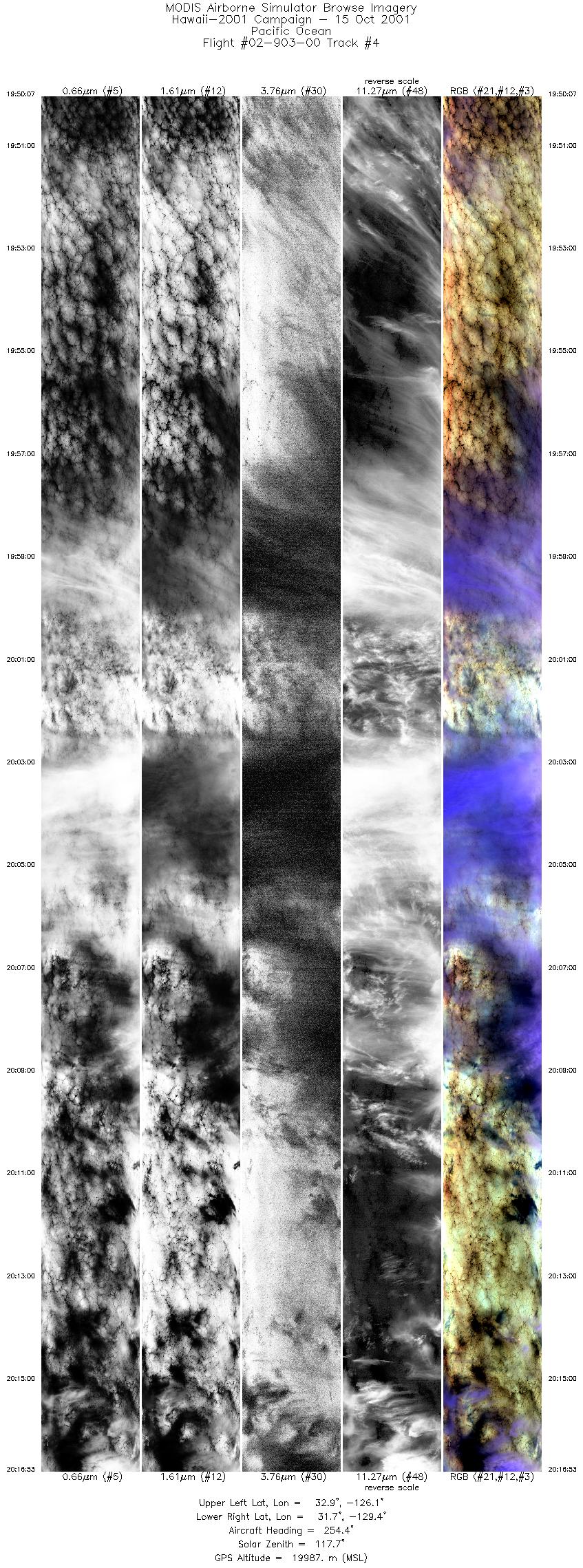
| 4 |
19:50 - 20:16 |
253.3 |
32.718 - 31.854 |
126.048 - 129.469 |
9999 |
19958 |
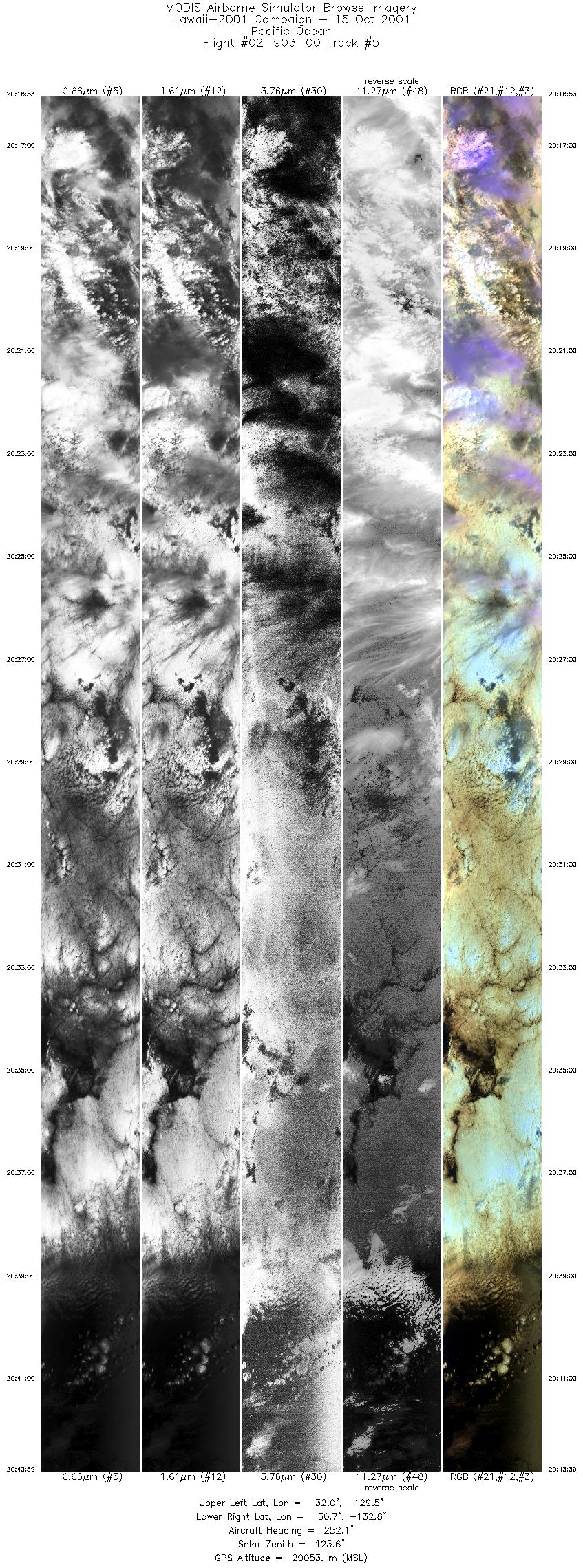
| 5 |
20:16 - 20:43 |
252.2 |
31.854 - 30.886 |
129.469 - 132.866 |
9999 |
20014 |
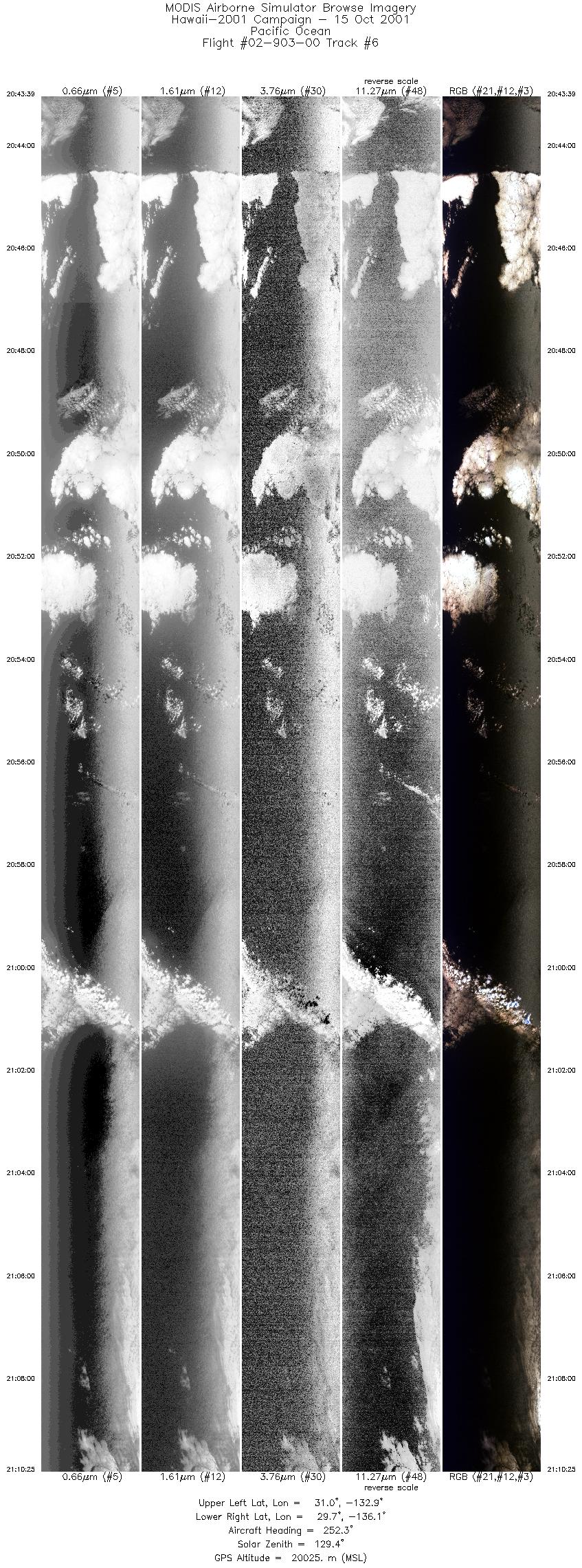
| 6 |
20:43 - 21:10 |
251.4 |
30.886 - 29.831 |
132.867 - 136.190 |
9999 |
20057 |
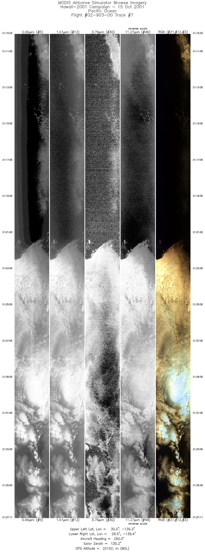
| 7 |
21:10 - 21:37 |
249.2 |
29.831 - 28.701 |
136.191 - 139.430 |
9999 |
20186 |
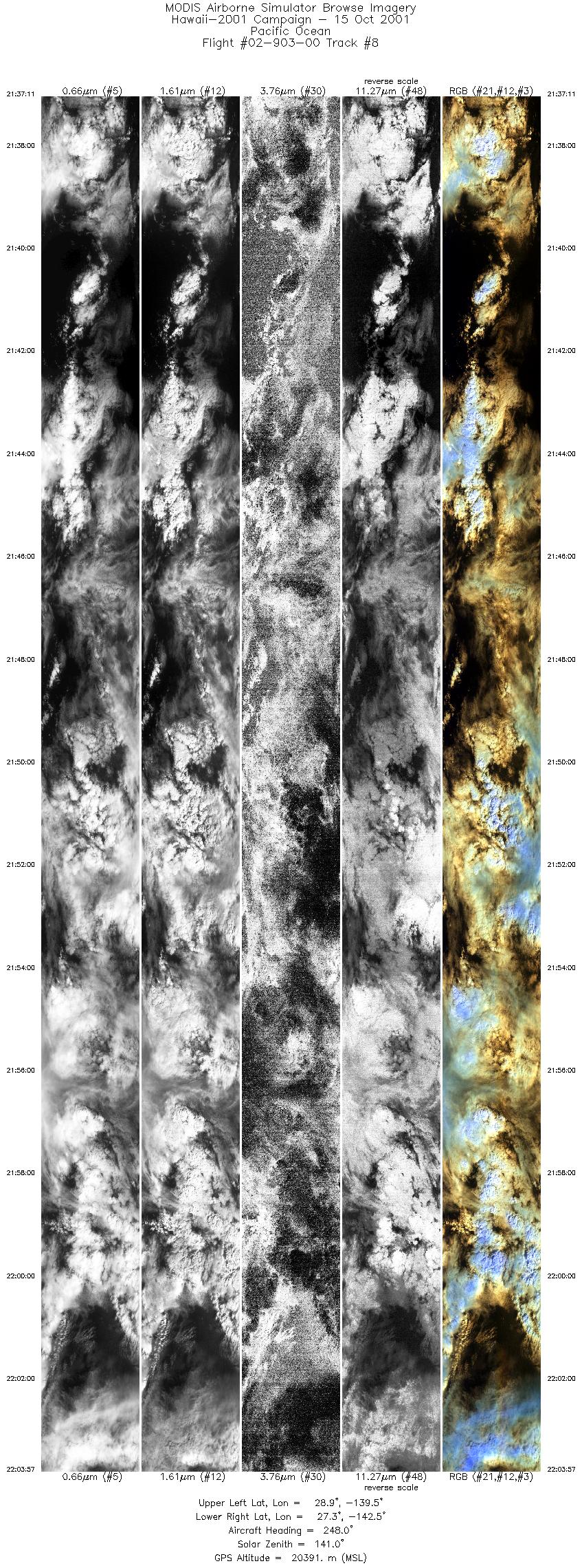
| 8 |
21:37 - 22:03 |
247.4 |
28.701 - 27.504 |
139.430 - 142.568 |
9999 |
20377 |
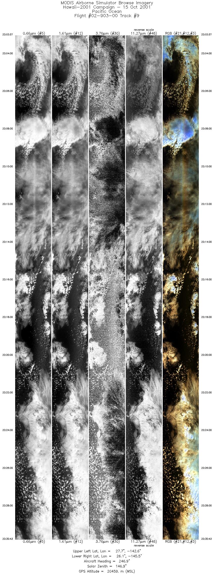
| 9 |
22:03 - 22:30 |
245.8 |
27.504 - 26.248 |
142.568 - 145.614 |
9999 |
20477 |
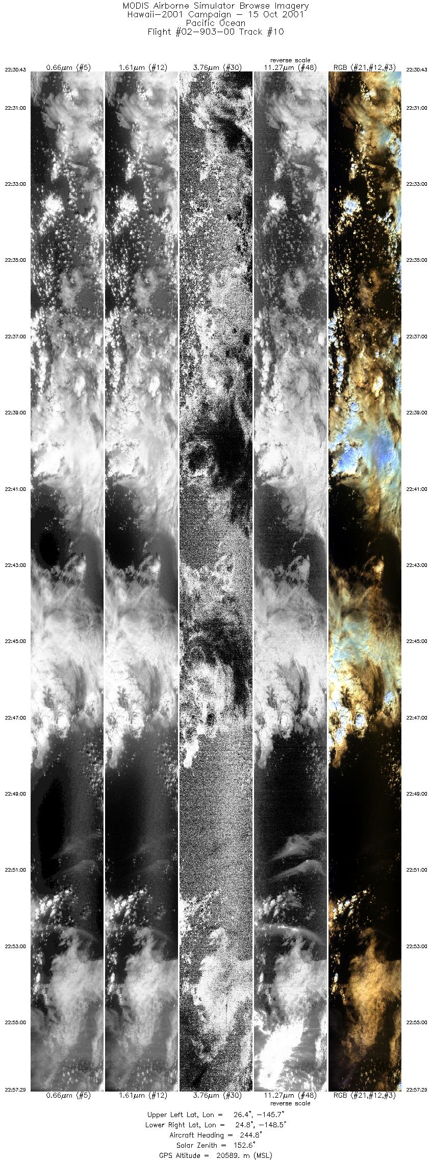
| 10 |
22:30 - 22:57 |
244.4 |
26.248 - 24.918 |
145.614 - 148.618 |
9999 |
20580 |
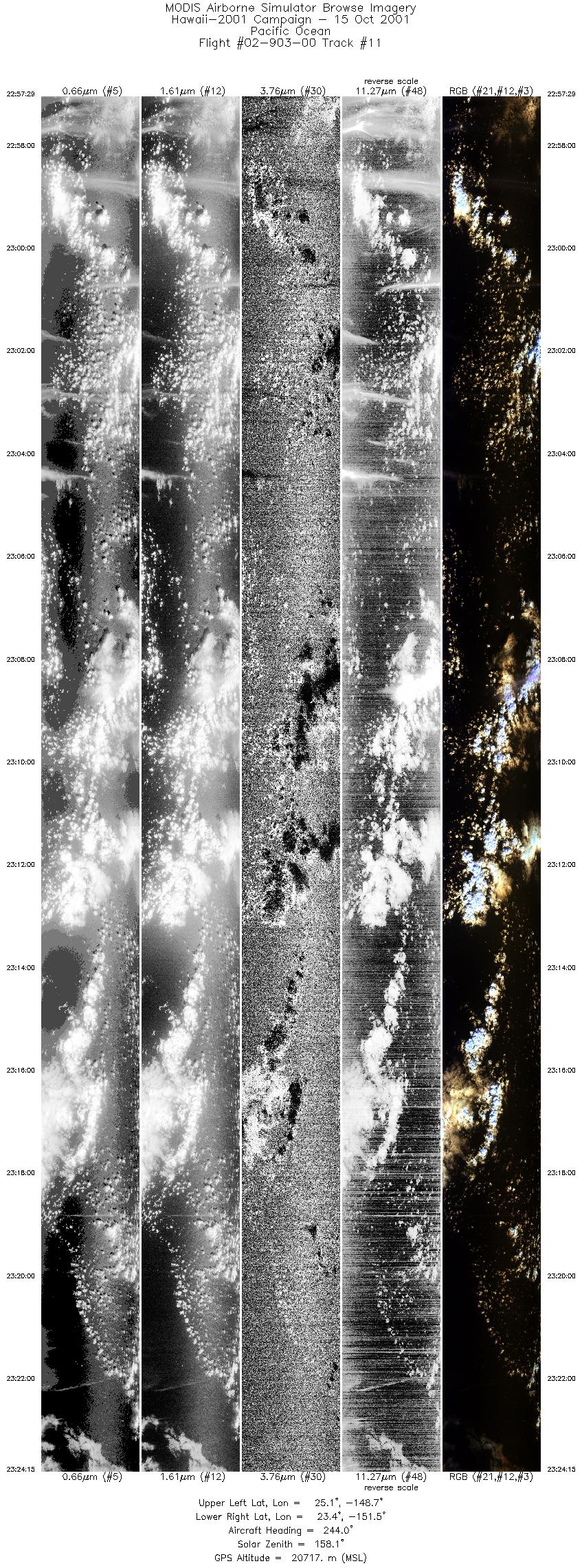
| 11 |
22:57 - 23:24 |
243.2 |
24.917 - 23.534 |
148.618 - 151.544 |
9999 |
20702 |
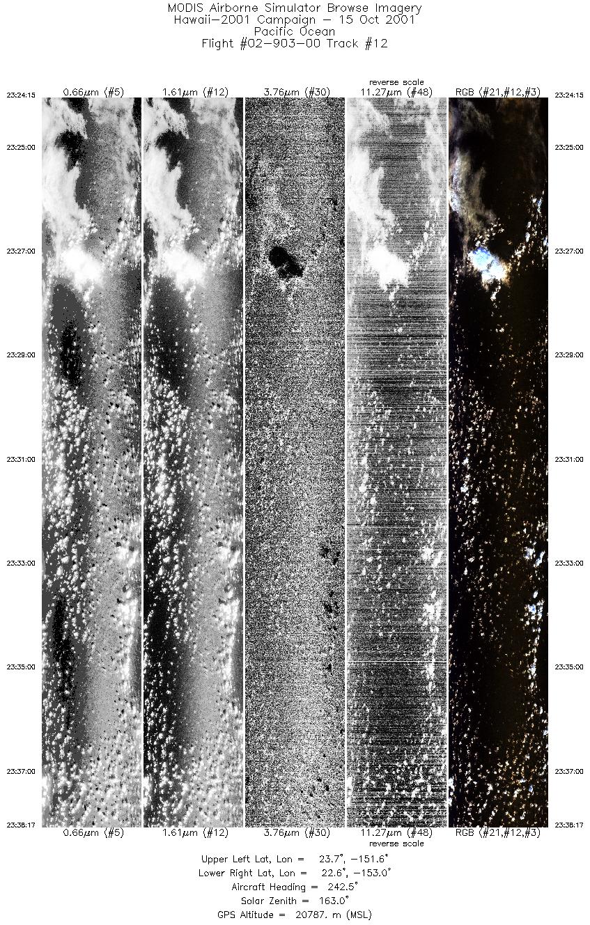
| 12 |
23:24 - 23:38 |
242.6 |
23.534 - 22.777 |
151.545 - 153.069 |
5243 |
20771 |
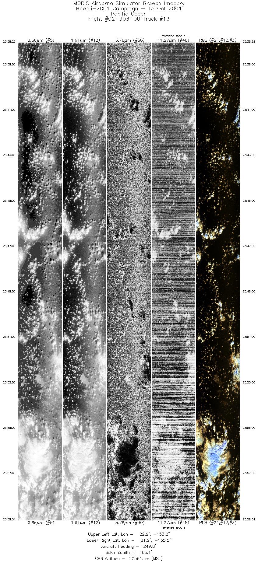
| 13 |
23:38 - 23:59 |
251.6 |
22.767 - 22.024 |
153.091 - 155.584 |
7854 |
20398 |
|


