Flight: 01-125-00
Date: August 18, 2001
Aircraft: NASA ER-2, #806
Deployment: DFRC July/August 2001
Flight Location: Mono Lake, Pinto Basin, Ft. Irwin, Kings River; California
Principal Investigator: Melack, Ustin
Additional Sensors: AVIRIS, RC-10
|
Data Evaluation
Flight lines are generally clear with slight haze and some cloud shadows.
|
Processing Information
Level-1B Data in HDF format is available
Flight Line Summary
Spectral Band Configuration
Spectral Response Function Table
Spectral Response Function (text)
|
Browse Imagery
Flight Tracks: 18
Scanlines: 46154
|
Browse Imagery Table
|
Click a Flight Track number to view a quicklook image
Lat/Lon ranges are for the BEG-END scanline nadir pixels
|
Flight
Track |
Time Span
(UTC) |
Heading
(Deg) |
Lat Range
(Deg N) |
Lon Range
(Deg W) |
Length
(Scanlines) |
Altitude
(Meters) |
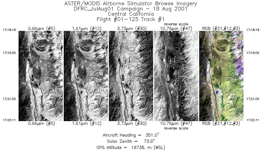
| 1 |
17:18 - 17:22 |
351.2 |
36.903 - 36.918 |
118.271 - 118.274 |
1460 |
18367 |
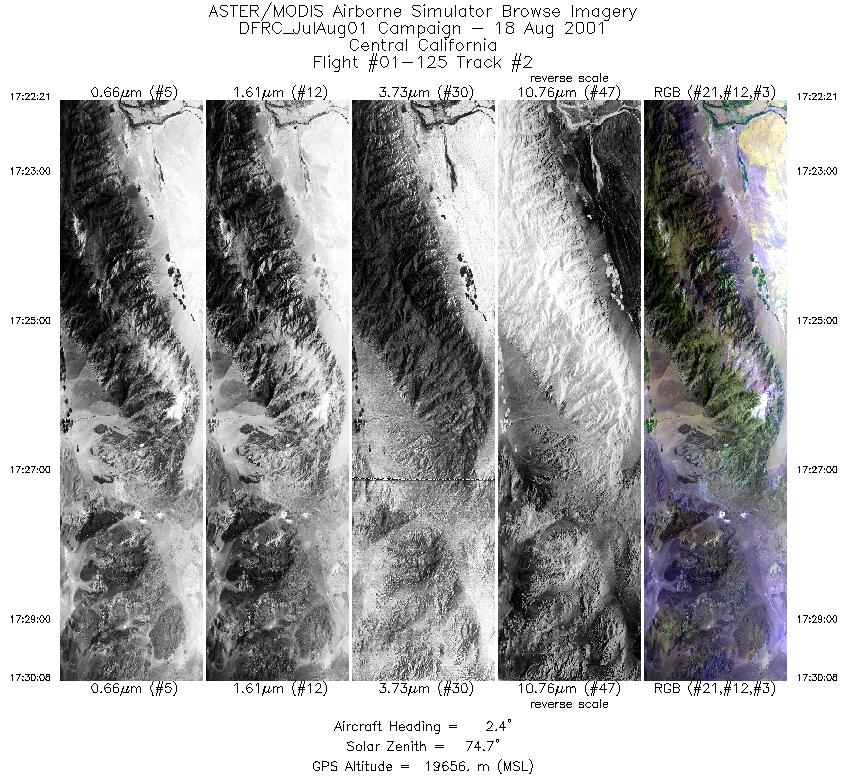
| 2 |
17:22 - 17:30 |
4.9 |
37.368 - 37.383 |
118.362 - 118.361 |
2905 |
19153 |
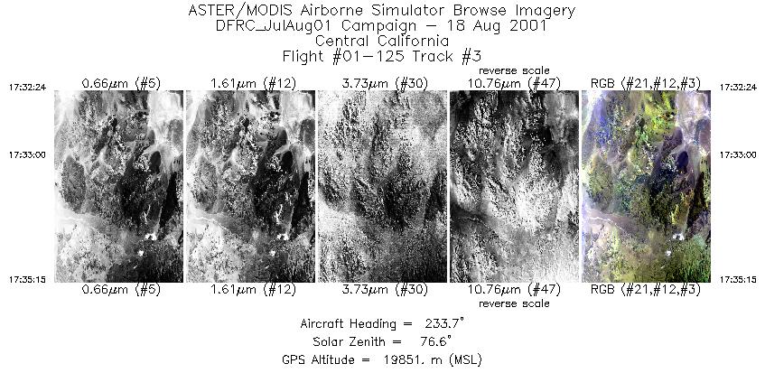
| 3 |
17:32 - 17:35 |
234.5 |
38.191 - 38.182 |
117.998 - 118.014 |
1067 |
19788 |
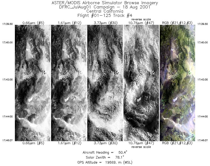
| 4 |
17:39 - 17:46 |
47.9 |
38.050 - 38.061 |
118.708 - 118.695 |
2348 |
19833 |
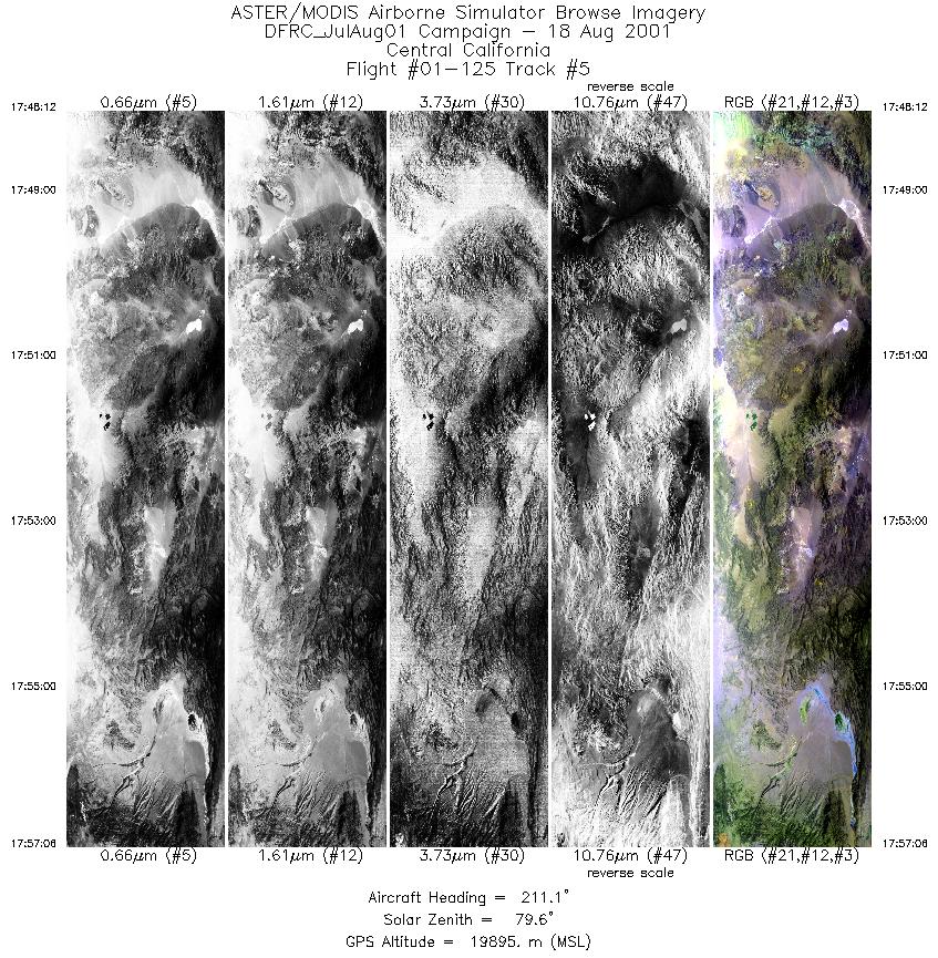
| 5 |
17:48 - 17:57 |
210.5 |
38.658 - 38.646 |
118.182 - 118.192 |
3329 |
19736 |
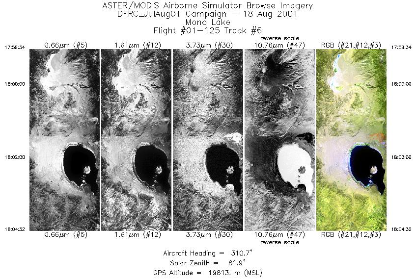
| 6 |
17:59 - 18:04 |
309.8 |
37.843 - 37.853 |
118.587 - 118.601 |
1858 |
19745 |
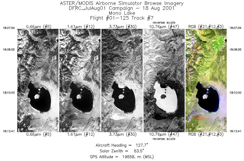
| 7 |
18:07 - 18:12 |
126.9 |
38.205 - 38.196 |
119.400 - 119.386 |
1792 |
19722 |
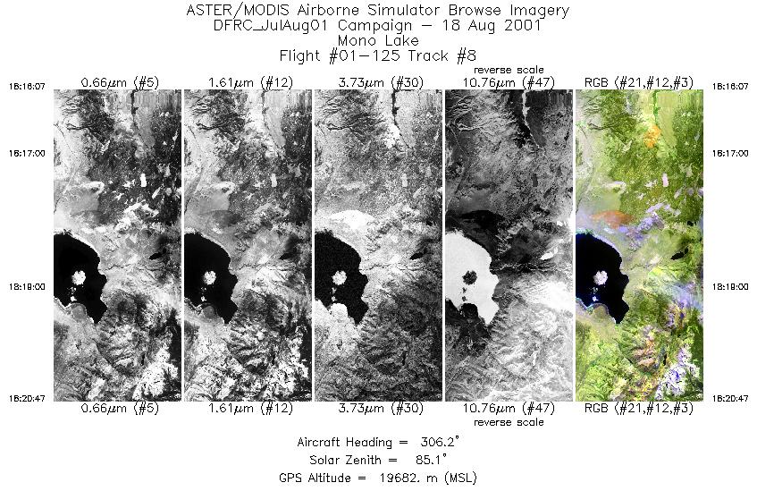
| 8 |
18:16 - 18:20 |
307.0 |
37.747 - 37.756 |
118.759 - 118.775 |
1748 |
19643 |
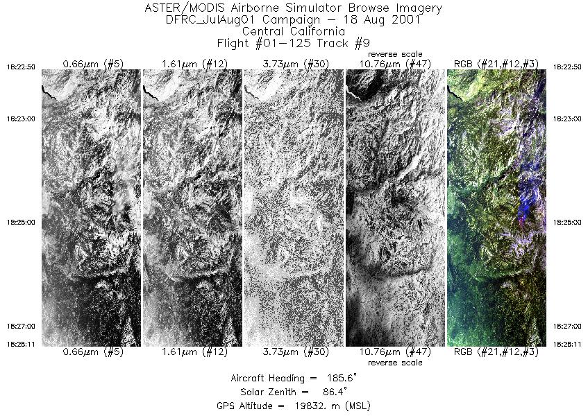
| 9 |
18:22 - 18:28 |
184.6 |
37.977 - 37.962 |
119.537 - 119.539 |
2001 |
19744 |
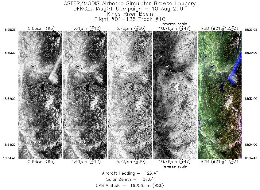
| 10 |
18:29 - 18:34 |
128.6 |
37.293 - 37.284 |
119.564 - 119.550 |
2090 |
19888 |
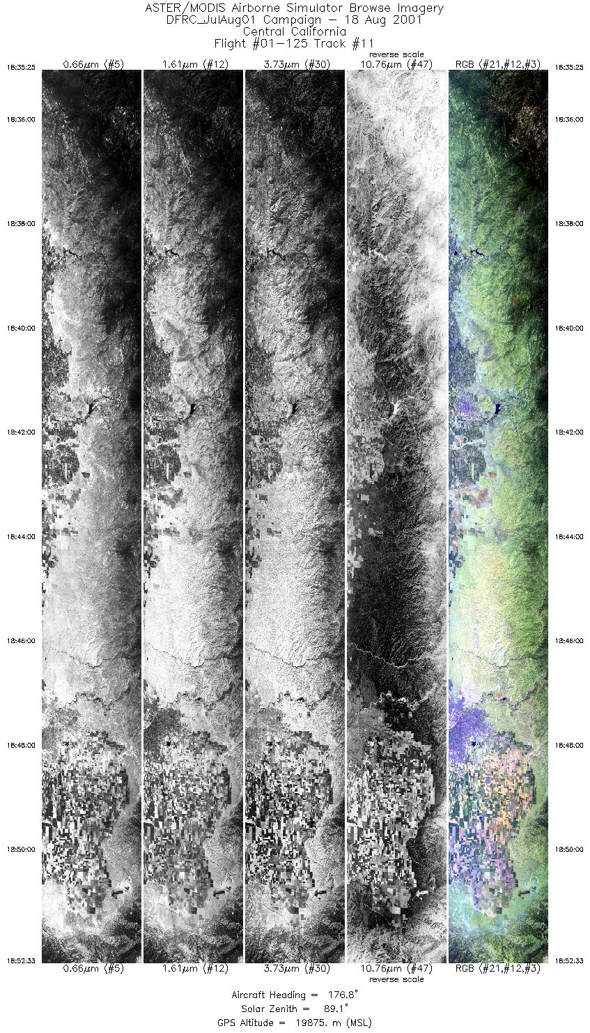
| 11 |
18:35 - 18:52 |
177.9 |
36.811 - 36.796 |
118.942 - 118.942 |
6409 |
19902 |
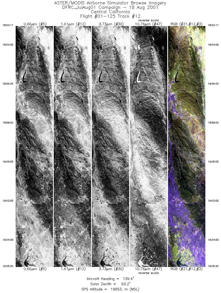
| 12 |
18:53 - 19:05 |
137.2 |
34.794 - 34.783 |
118.833 - 118.822 |
4627 |
19907 |
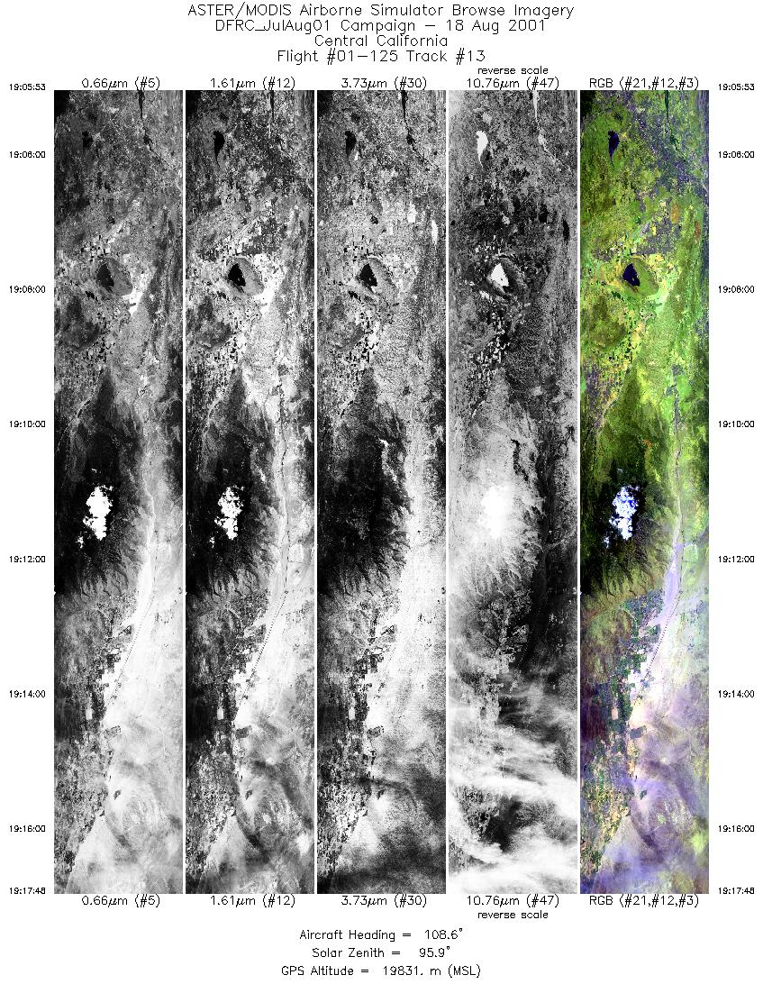
| 13 |
19:05 - 19:17 |
106.5 |
33.923 - 33.919 |
117.525 - 117.508 |
4464 |
19825 |
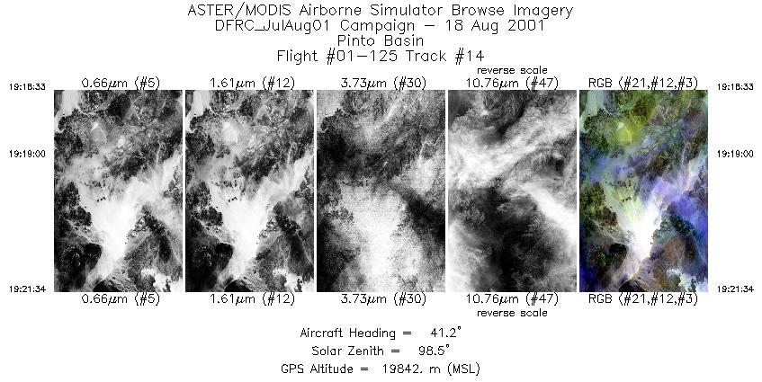
| 14 |
19:18 - 19:21 |
41.0 |
33.741 - 33.752 |
115.901 - 115.889 |
1128 |
19845 |
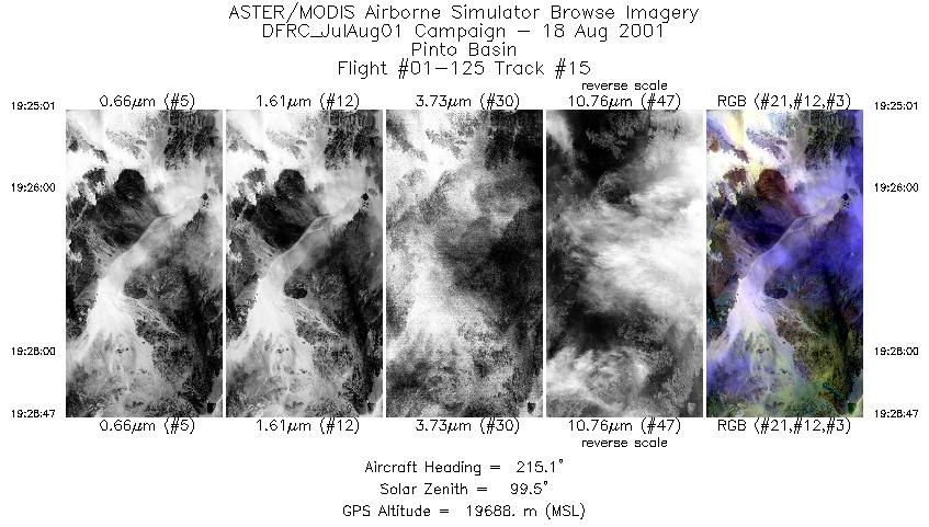
| 15 |
19:25 - 19:28 |
215.6 |
34.097 - 34.084 |
115.440 - 115.451 |
1405 |
19652 |
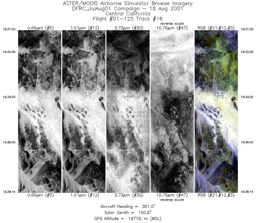
| 16 |
19:31 - 19:38 |
353.2 |
33.816 - 33.830 |
116.014 - 116.017 |
2693 |
19703 |
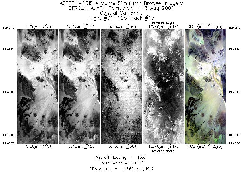
| 17 |
19:40 - 19:45 |
15.4 |
34.860 - 34.874 |
116.044 - 116.040 |
2018 |
19853 |
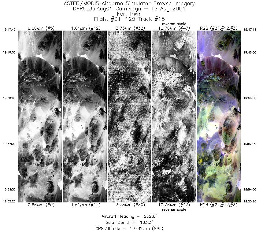
| 18 |
19:47 - 19:55 |
232.5 |
35.590 - 35.581 |
116.032 - 116.047 |
2812 |
19761 |
|


