Flight: 01-123-00
Date: August 16, 2001
Aircraft: NASA ER-2, #806
Deployment: DFRC July/August 2001
Flight Location: Lake Tahoe, Mono Lake; California
Principal Investigator: Hook (JPL)
Additional Sensors: AVIRIS, RC-10
|
Data Evaluation
Flight lines are generally clear with slight haze and some cloud shadows.
|
Processing Information
Level-1B Data in HDF format is available
Flight Line Summary
Spectral Band Configuration
Spectral Response Function Table
Spectral Response Function (text)
|
Browse Imagery
Flight Tracks: 15
Scanlines: 39539
|
Browse Imagery Table
|
Click a Flight Track number to view a quicklook image
Lat/Lon ranges are for the BEG-END scanline nadir pixels
|
Flight
Track |
Time Span
(UTC) |
Heading
(Deg) |
Lat Range
(Deg N) |
Lon Range
(Deg W) |
Length
(Scanlines) |
Altitude
(Meters) |
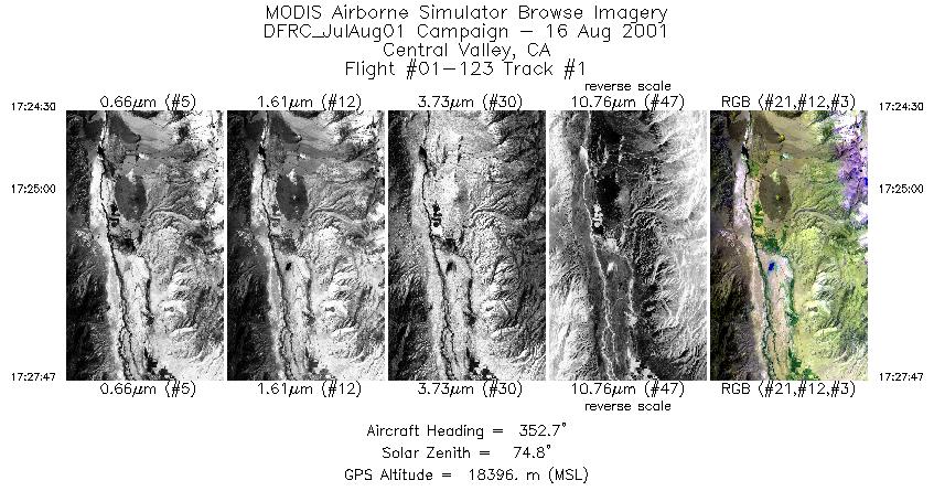
| 1 |
17:24 - 17:27 |
352.5 |
36.991 - 37.006 |
118.291 - 118.294 |
1226 |
18078 |
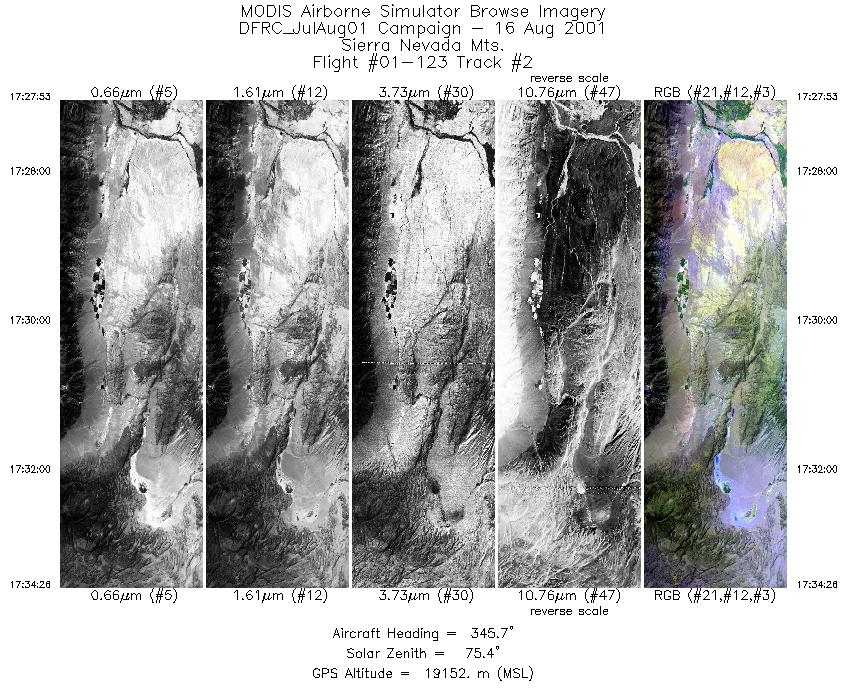
| 2 |
17:27 - 17:34 |
344.1 |
37.368 - 37.382 |
118.368 - 118.374 |
2443 |
18690 |
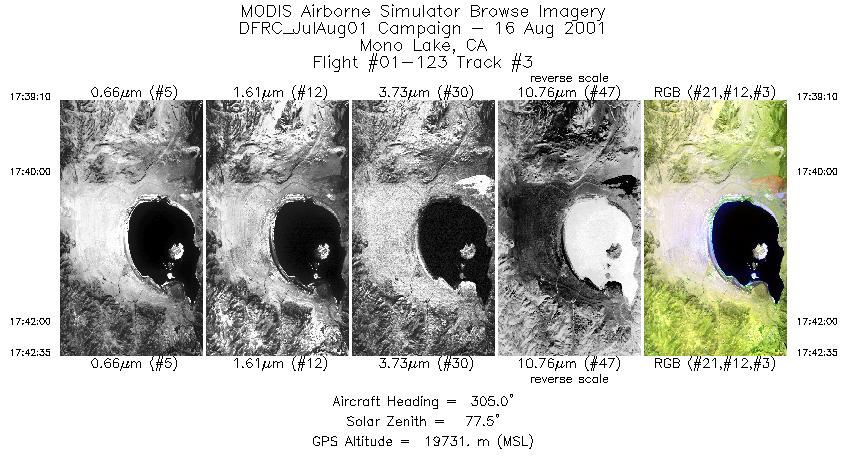
| 3 |
17:39 - 17:42 |
305.8 |
37.936 - 37.945 |
118.727 - 118.743 |
1280 |
19619 |
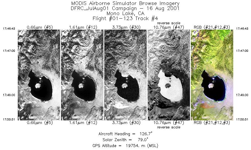
| 4 |
17:46 - 17:50 |
125.8 |
38.169 - 38.160 |
119.332 - 119.316 |
1537 |
19662 |
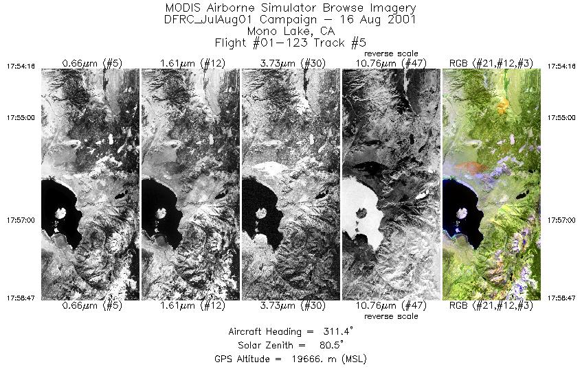
| 5 |
17:54 - 17:58 |
311.6 |
37.748 - 37.758 |
118.754 - 118.768 |
1693 |
19592 |
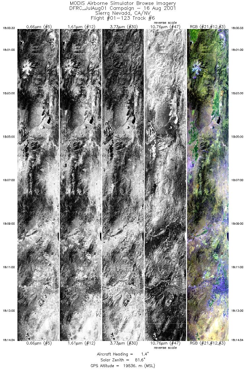
| 6 |
18:00 - 18:14 |
3.6 |
38.223 - 38.238 |
119.377 - 119.376 |
5375 |
19729 |
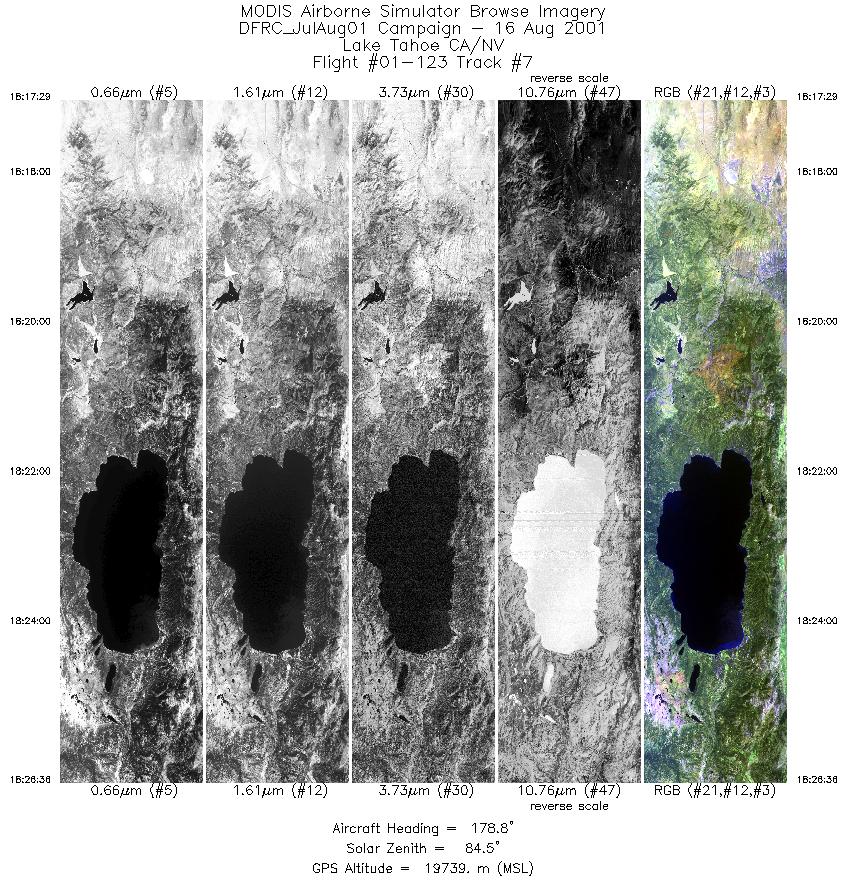
| 7 |
18:17 - 18:26 |
178.2 |
39.779 - 39.764 |
120.015 - 120.015 |
3415 |
19710 |
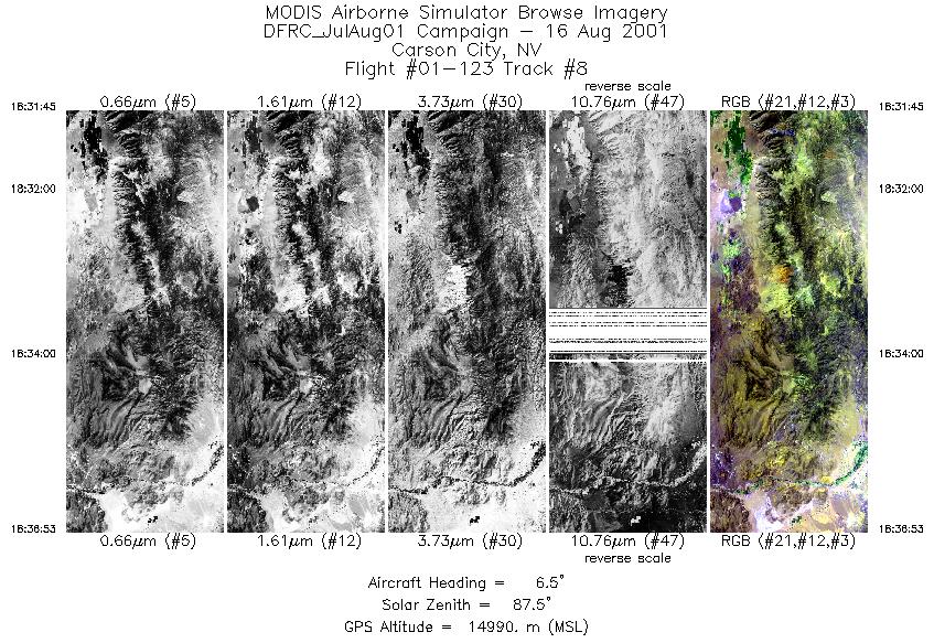
| 8 |
18:31 - 18:36 |
4.8 |
38.832 - 38.846 |
119.481 - 119.480 |
1918 |
16414 |
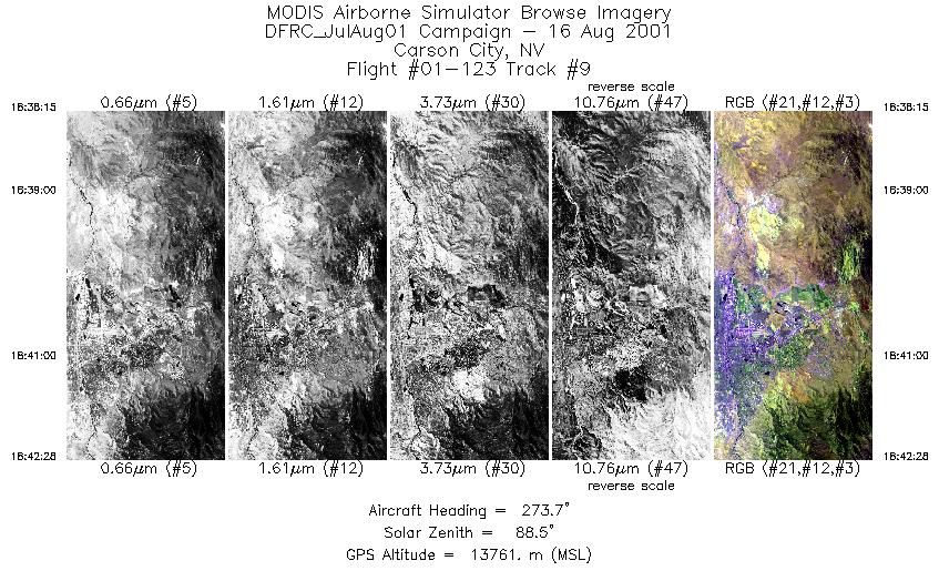
| 9 |
18:38 - 18:42 |
271.3 |
39.448 - 39.448 |
119.504 - 119.518 |
1578 |
13751 |
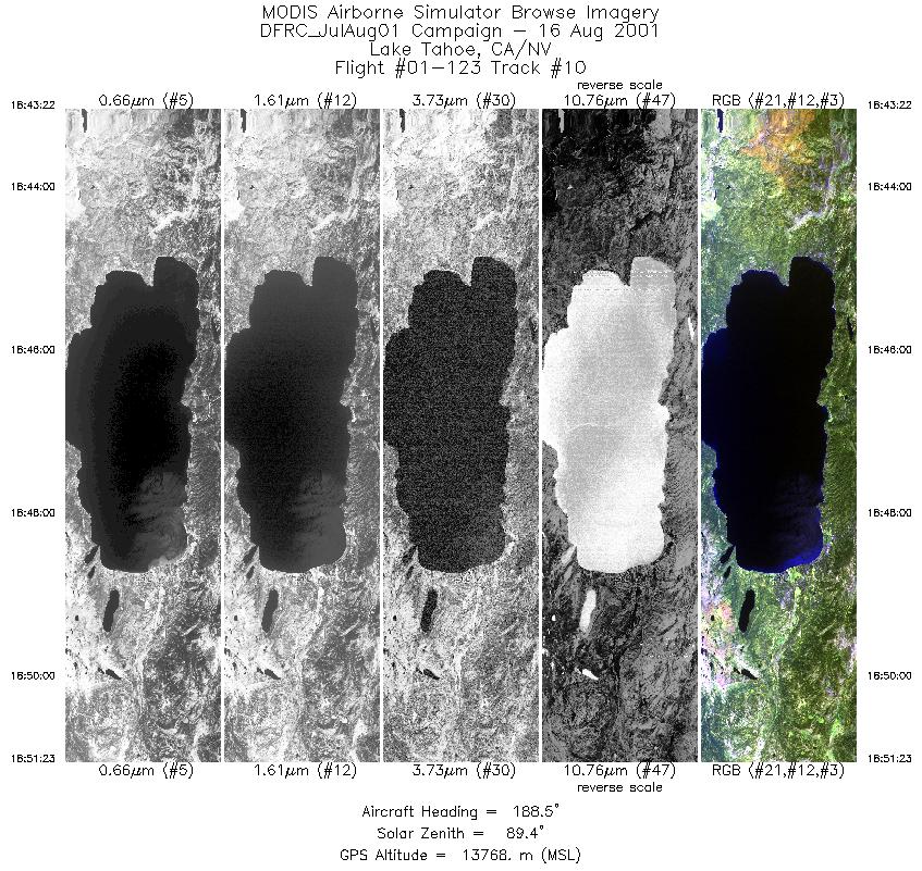
| 10 |
18:43 - 18:51 |
185.9 |
39.400 - 39.390 |
120.006 - 120.007 |
3005 |
13788 |
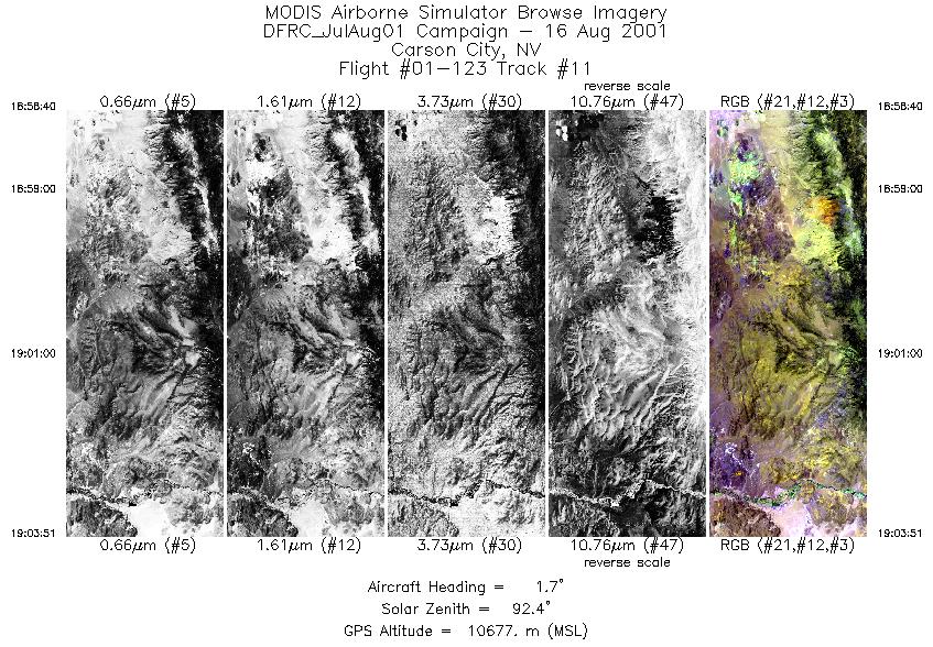
| 11 |
18:58 - 19:03 |
0.3 |
38.951 - 38.960 |
119.421 - 119.420 |
1942 |
10672 |
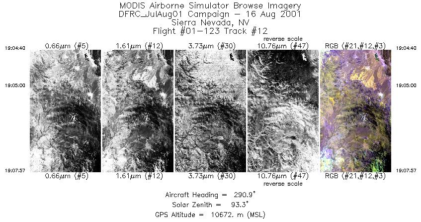
| 12 |
19:04 - 19:07 |
287.5 |
39.375 - 39.377 |
119.403 - 119.414 |
1232 |
10697 |
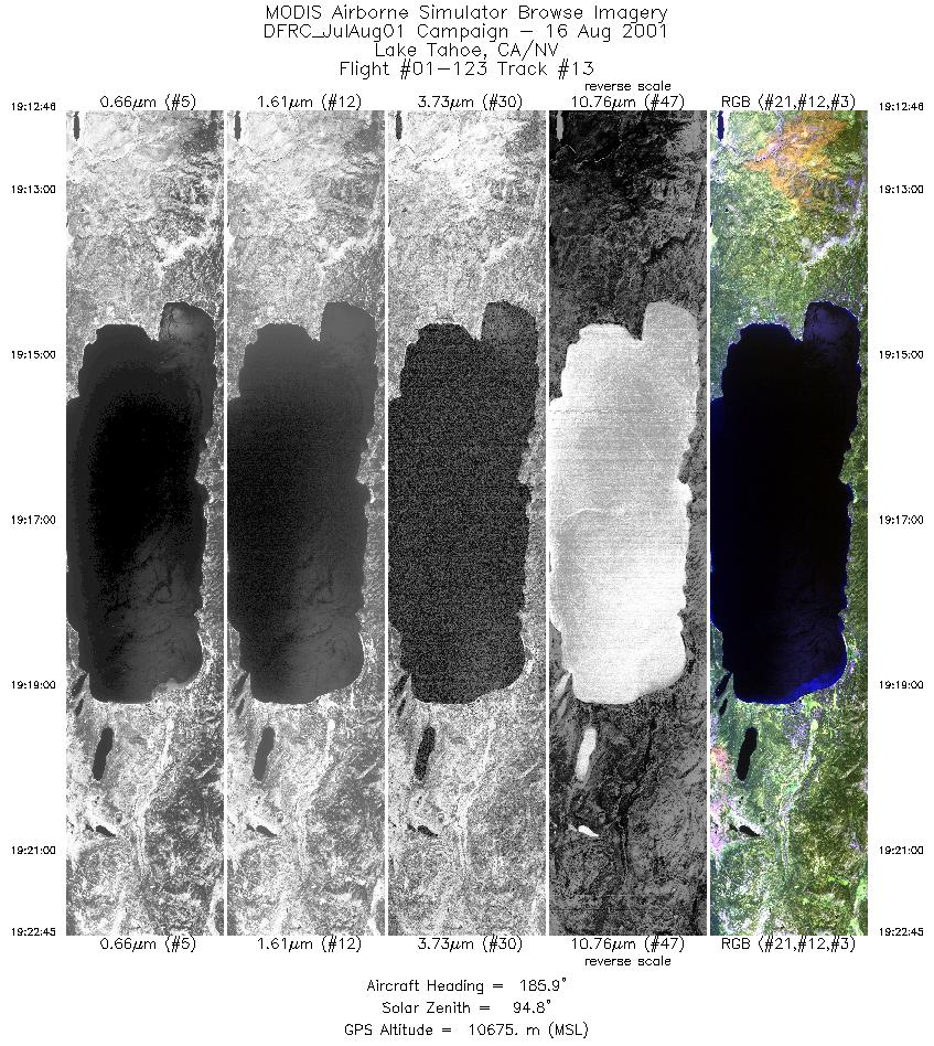
| 13 |
19:12 - 19:22 |
184.2 |
39.407 - 39.397 |
120.016 - 120.015 |
3743 |
10688 |
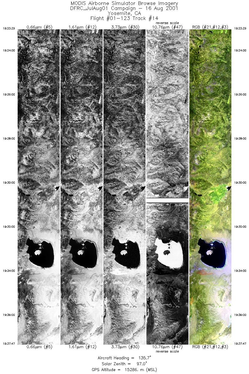
| 14 |
19:23 - 19:37 |
133.7 |
38.706 - 38.699 |
119.989 - 119.979 |
5365 |
11049 |
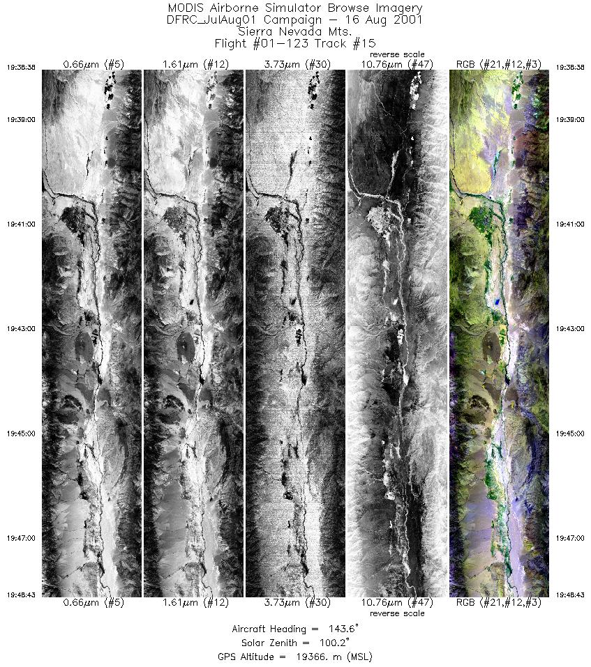
| 15 |
19:38 - 19:48 |
146.8 |
37.678 - 37.666 |
118.480 - 118.470 |
3787 |
18480 |
|


