Flight: 01-115-00
Date: August 10, 2001
Aircraft: NASA ER-2, #806
Deployment: DFRC July/August 2001
Flight Location: Vancouver Island, BC, Canada
Principal Investigator: Goodenough (UBC)
Additional Sensors: AVIRIS, RC-10
|
Data Evaluation
Flight lines are generally clear with slight haze and some cloud shadows.
|
Processing Information
Level-1B Data in HDF format is available
Flight Line Summary
Spectral Band Configuration
Spectral Response Function Table
Spectral Response Function (text)
|
Browse Imagery
Flight Tracks: 20
Scanlines: 109999
|
Browse Imagery Table
|
Click a Flight Track number to view a quicklook image
Lat/Lon ranges are for the BEG-END scanline nadir pixels
|
Flight
Track |
Time Span
(UTC) |
Heading
(Deg) |
Lat Range
(Deg N) |
Lon Range
(Deg W) |
Length
(Scanlines) |
Altitude
(Meters) |
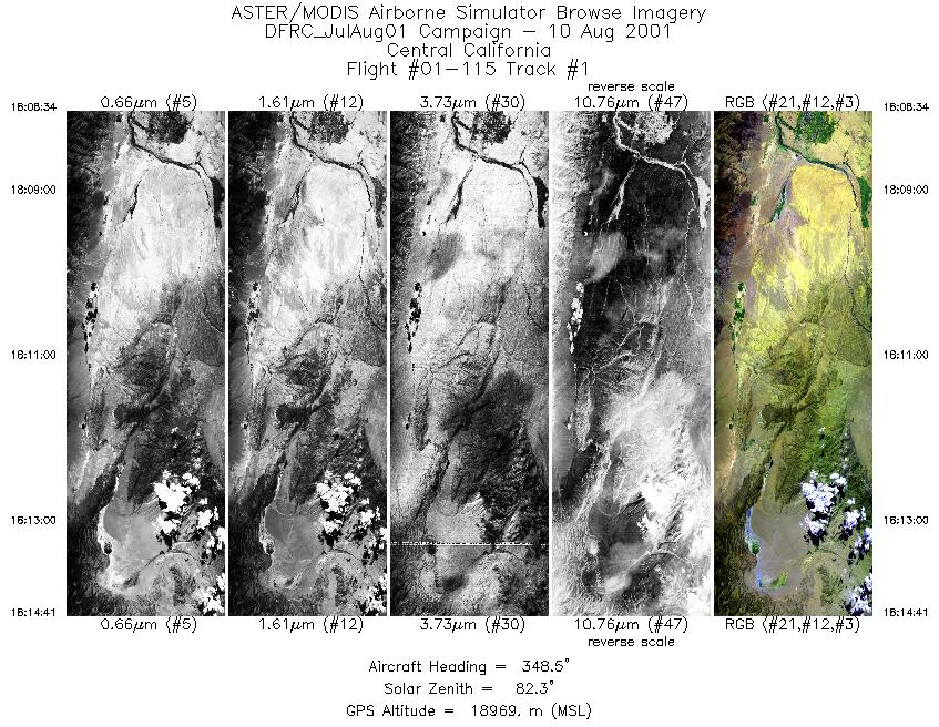
| 1 |
18:08 - 18:14 |
345.7 |
37.360 - 37.375 |
118.363 - 118.368 |
2282 |
18515 |
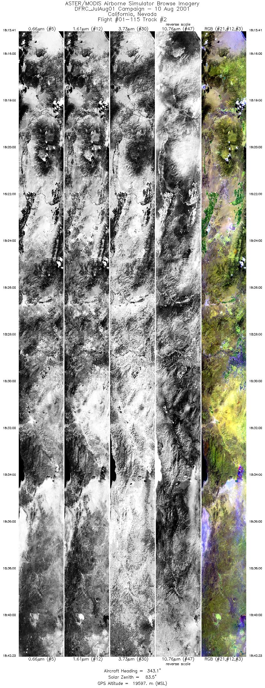
| 2 |
18:15 - 18:42 |
344.4 |
38.083 - 38.097 |
118.803 - 118.809 |
10000 |
19333 |
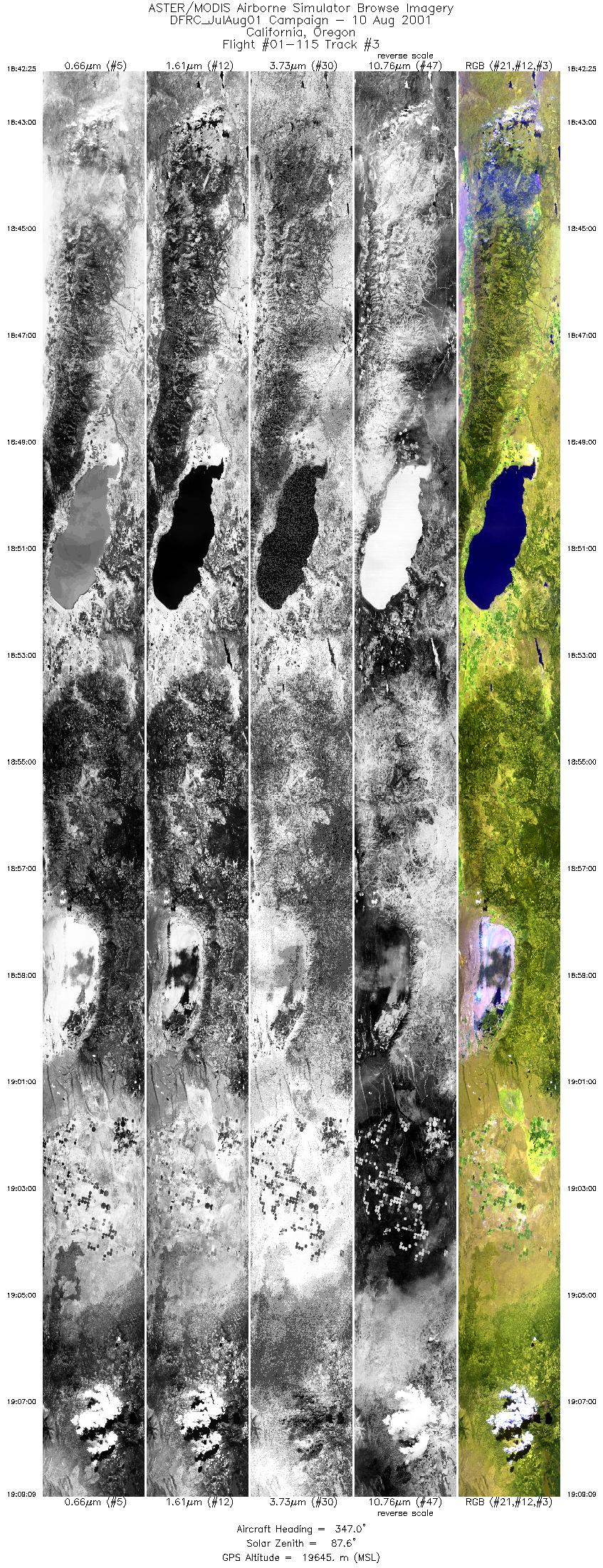
| 3 |
18:42 - 19:09 |
346.9 |
40.949 - 40.963 |
120.124 - 120.129 |
10000 |
19635 |
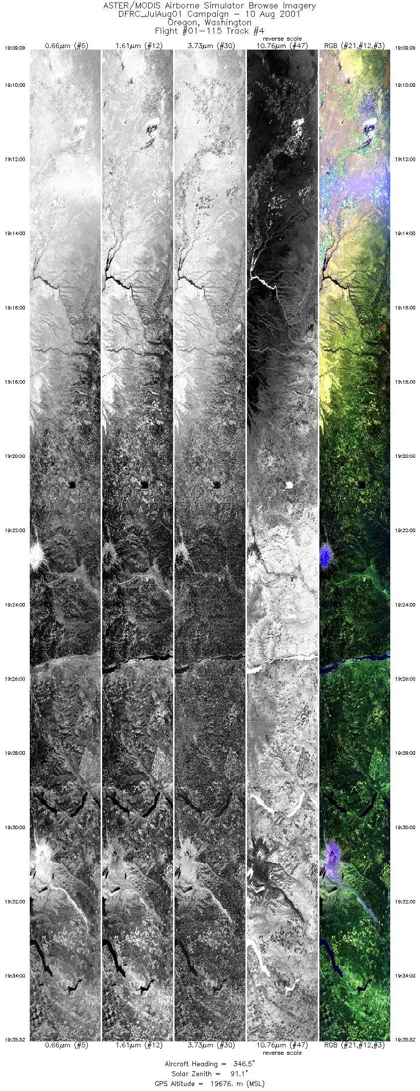
| 4 |
19:09 - 19:35 |
346.5 |
43.905 - 43.919 |
121.173 - 121.178 |
10000 |
19538 |
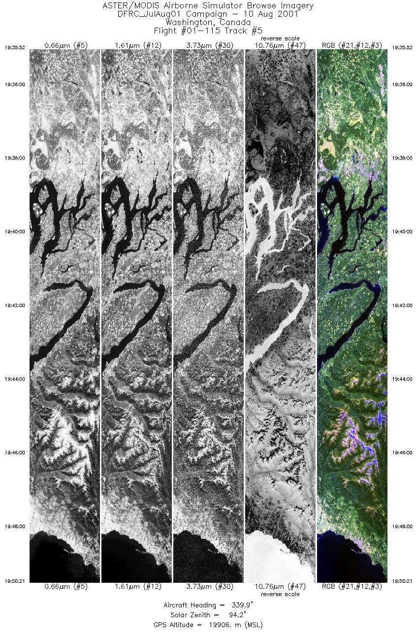
| 5 |
19:35 - 19:50 |
339.8 |
46.700 - 46.714 |
122.587 - 122.595 |
5423 |
19856 |
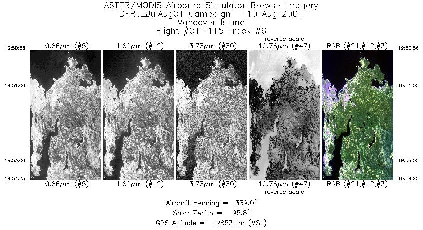
| 6 |
19:50 - 19:54 |
340.9 |
48.292 - 48.306 |
123.509 - 123.517 |
1306 |
19860 |
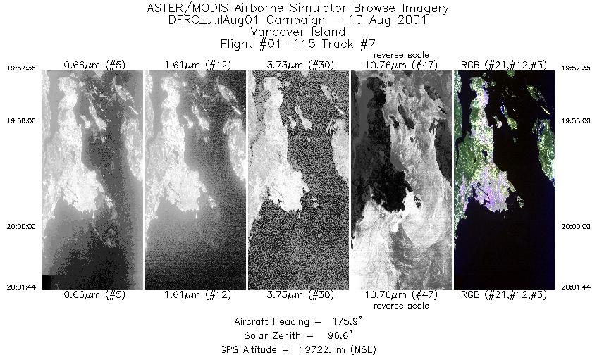
| 7 |
19:57 - 20:01 |
176.9 |
48.716 - 48.700 |
123.337 - 123.336 |
1557 |
19620 |
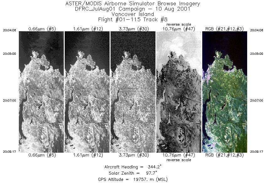
| 8 |
20:04 - 20:09 |
345.3 |
48.209 - 48.222 |
123.583 - 123.589 |
1942 |
19760 |
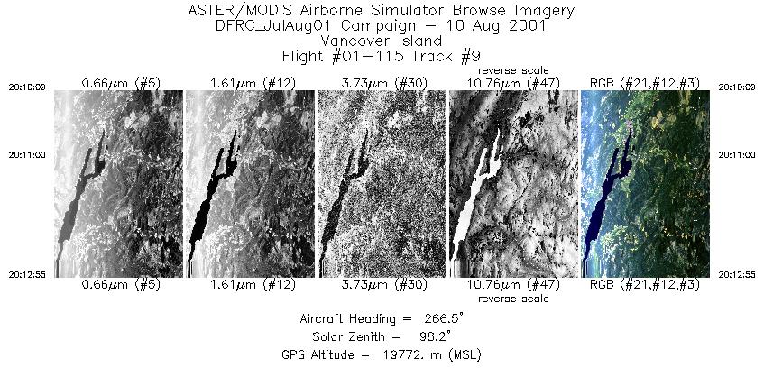
| 9 |
20:10 - 20:12 |
264.5 |
48.799 - 48.797 |
123.957 - 123.979 |
1042 |
19760 |
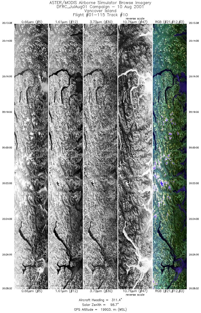
| 10 |
20:13 - 20:28 |
313.9 |
48.795 - 48.805 |
124.550 - 124.566 |
5582 |
19801 |
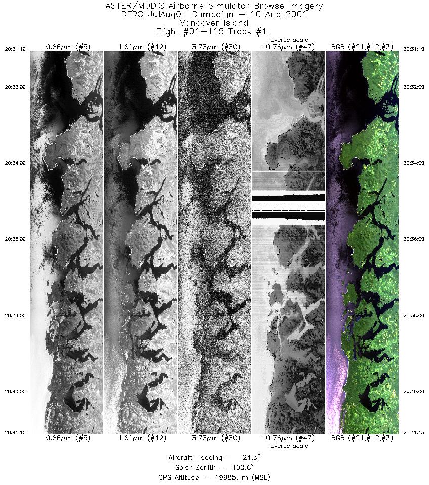
| 11 |
20:31 - 20:41 |
123.4 |
49.639 - 49.631 |
126.868 - 126.849 |
3782 |
19853 |
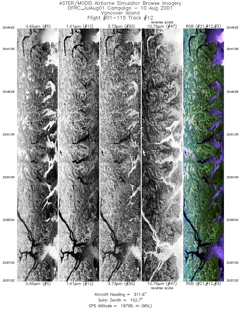
| 12 |
20:46 - 20:57 |
310.3 |
48.967 - 48.977 |
125.051 - 125.068 |
4435 |
19795 |
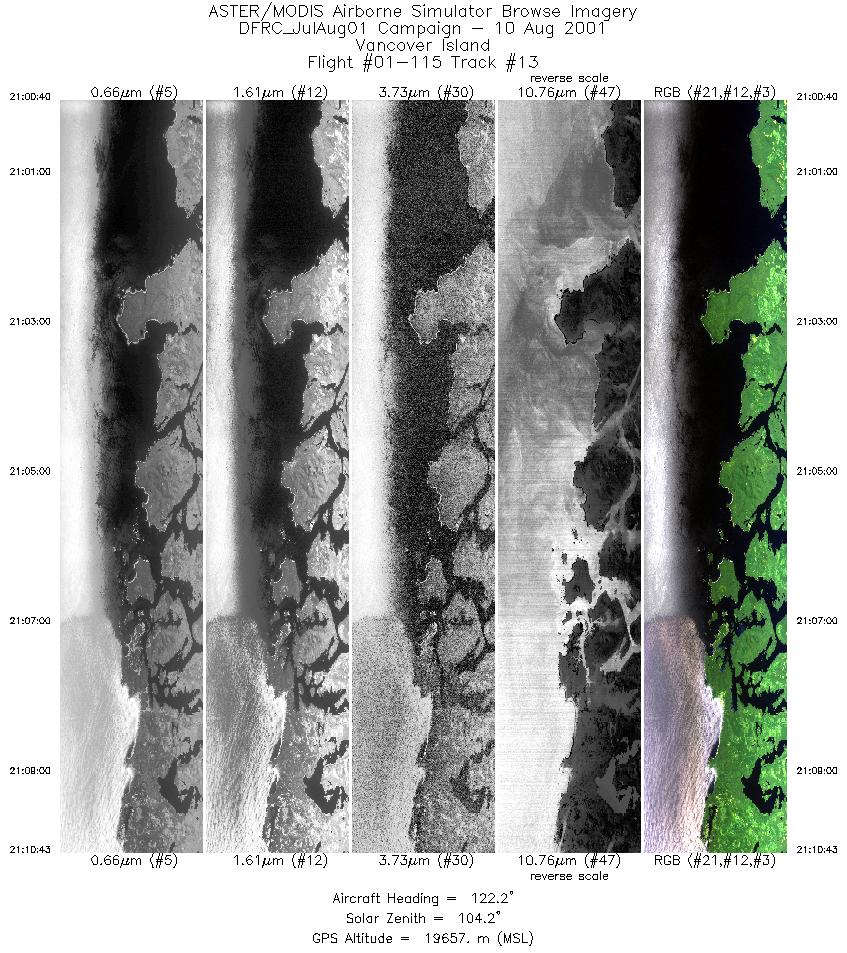
| 13 |
21:00 - 21:10 |
121.5 |
49.592 - 49.583 |
126.948 - 126.929 |
3768 |
19643 |
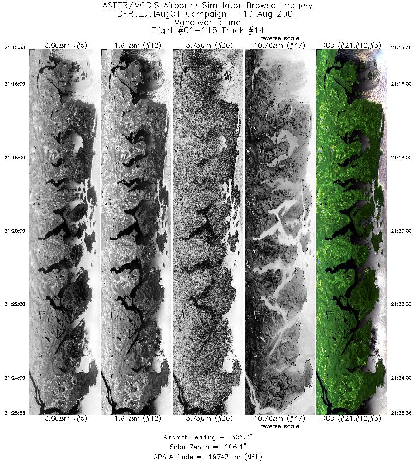
| 14 |
21:15 - 21:25 |
304.6 |
48.933 - 48.941 |
125.155 - 125.174 |
3735 |
19592 |
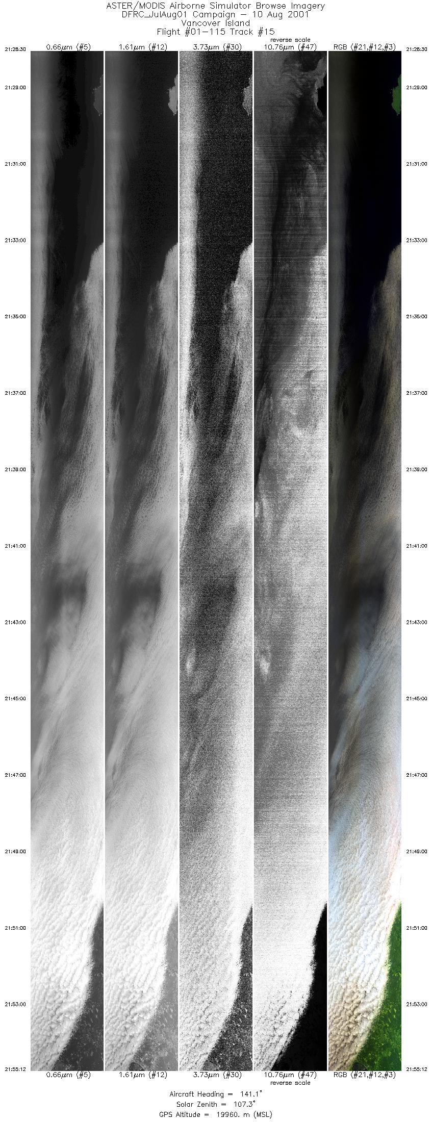
| 15 |
21:28 - 21:55 |
140.2 |
49.430 - 49.418 |
126.826 - 126.812 |
10000 |
19877 |
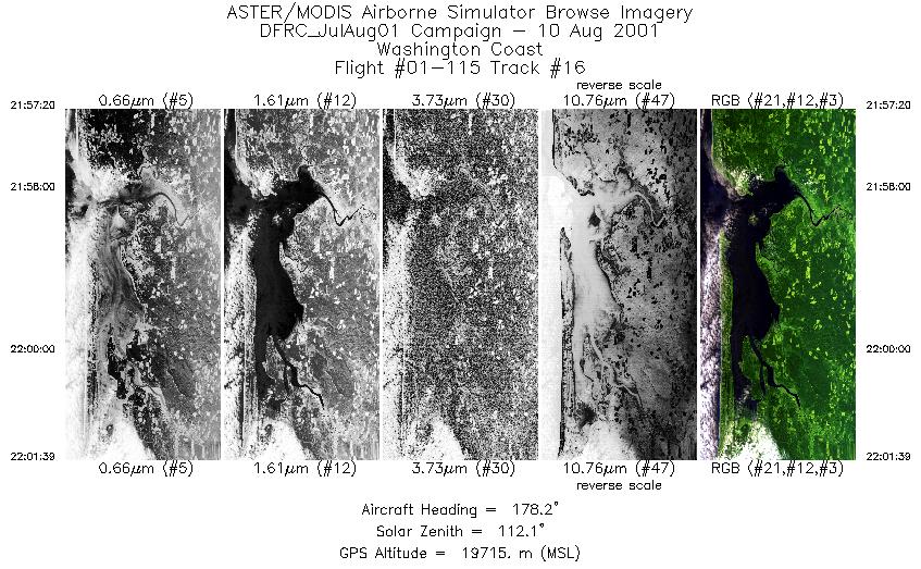
| 16 |
21:57 - 22:01 |
179.0 |
46.825 - 46.810 |
123.908 - 123.908 |
1615 |
19814 |
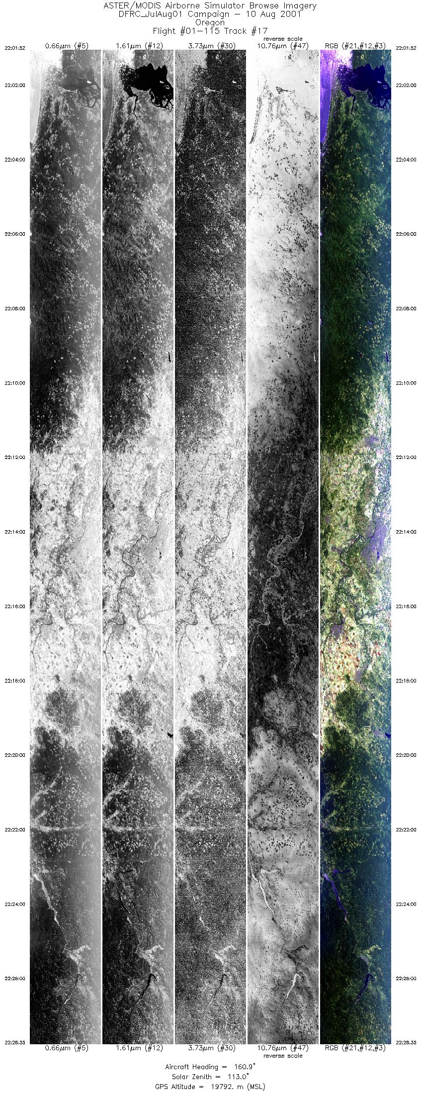
| 17 |
22:01 - 22:28 |
159.4 |
46.303 - 46.289 |
123.889 - 123.882 |
10000 |
19744 |
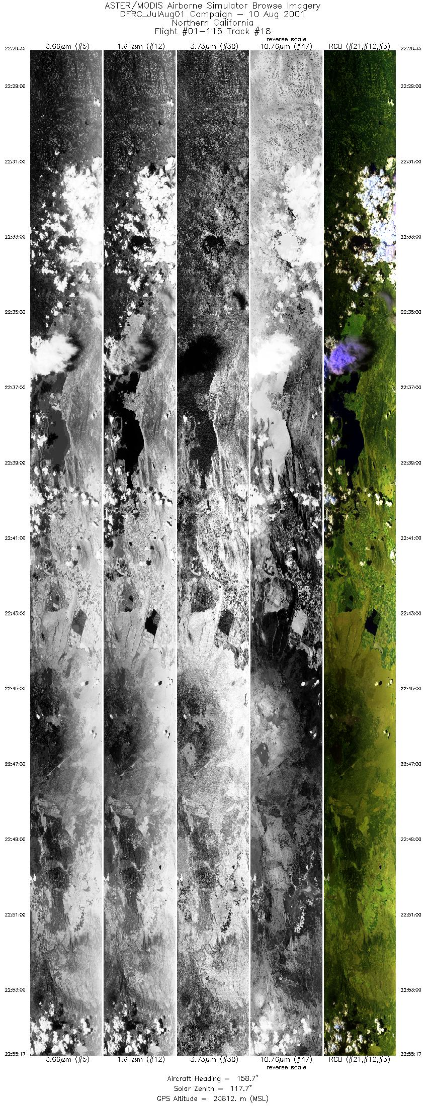
| 18 |
22:28 - 22:55 |
158.7 |
43.489 - 43.475 |
122.390 - 122.383 |
10000 |
19856 |
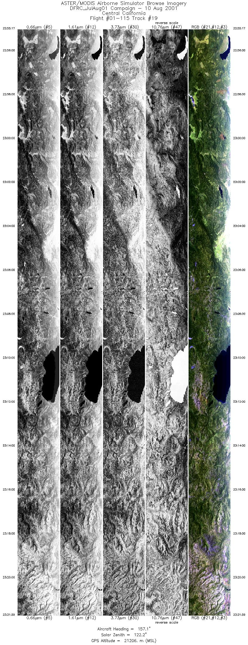
| 19 |
22:55 - 23:21 |
157.1 |
40.665 - 40.651 |
120.981 - 120.974 |
10000 |
21040 |
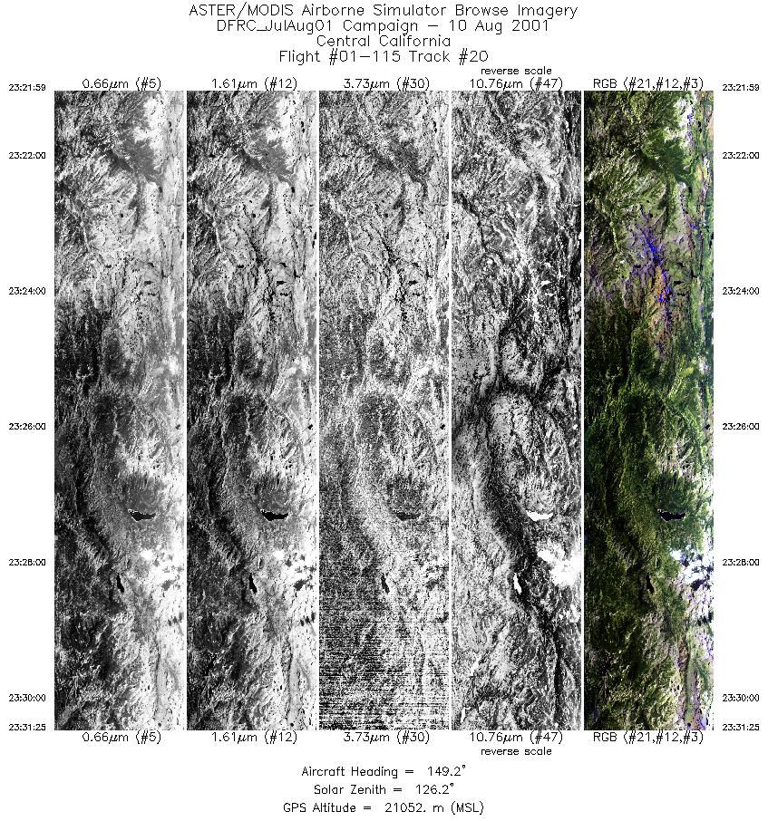
| 20 |
23:21 - 23:31 |
149.3 |
37.967 - 37.955 |
119.434 - 119.425 |
3530 |
21249 |
|


