Flight: 00-002-02
Date: June 2, 2000
Aircraft: DOE B-200 Kingair
Deployment: RSL June 2000
Flight Location: Inyo Domes, CA; White Mountains, CA
Principal Investigator: Christensen (ASU), Hook (JPL)
Additional Sensors: RC-30
|
Data Evaluation
|
Processing Information
Level-1B Data in HDF format is available
Flight Line Summary
Spectral Band Configuration
Spectral Response Function Table
Spectral Response Function (text)
|
Browse Imagery
Flight Tracks: 12
Scanlines: 66751
|
Browse Imagery Table
|
Click a Flight Track number to view a quicklook image
Lat/Lon ranges are for the BEG-END scanline nadir pixels
|
Flight
Track |
Time Span
(UTC) |
Heading
(Deg) |
Lat Range
(Deg N) |
Lon Range
(Deg W) |
Length
(Scanlines) |
Altitude
(Meters) |
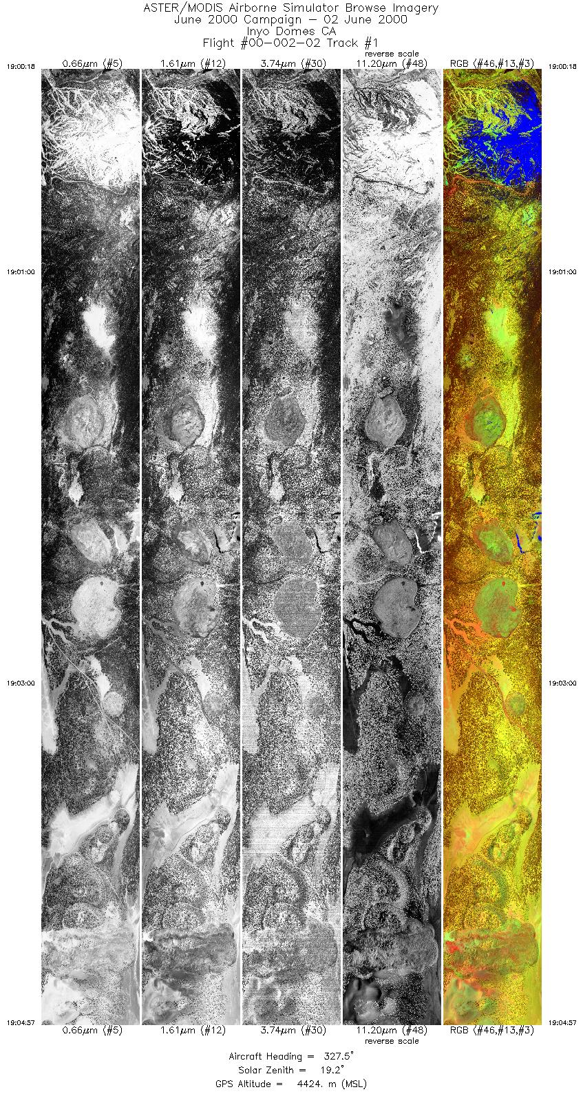
| 1 |
19:00 - 19:04 |
343.2 |
37.625 - 37.868 |
119.003 - 119.018 |
6942 |
4423 |
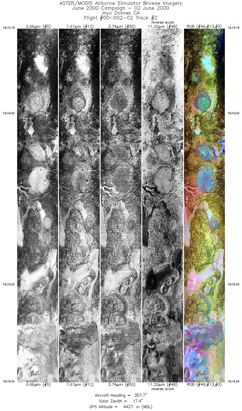
| 2 |
19:15 - 19:19 |
359.2 |
37.666 - 37.875 |
119.017 - 119.018 |
6170 |
4424 |
| 3 |
19:19 - 19:23 |
359.5 |
37.875 - 38.074 |
119.018 - 119.018 |
6178 |
4426 |
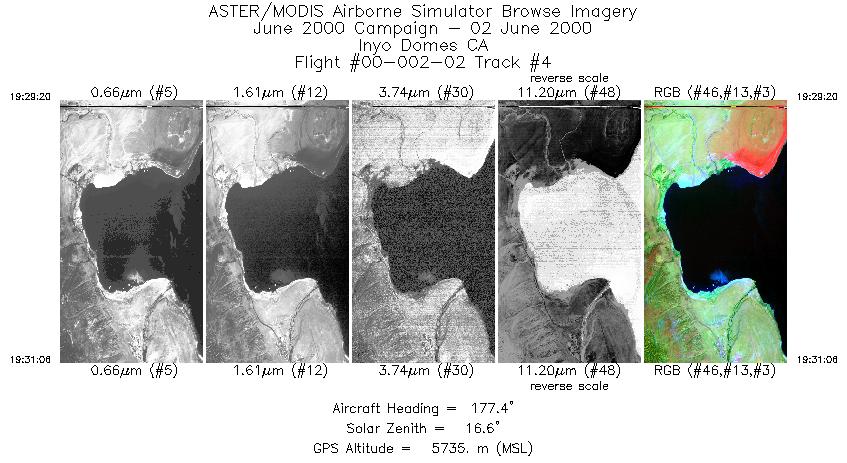
| 4 |
19:29 - 19:31 |
178.5 |
38.041 - 37.953 |
119.123 - 119.123 |
1318 |
5732 |
| 5 |
19:44 - 19:46 |
272.0 |
37.608 - 37.611 |
118.800 - 118.901 |
3483 |
5730 |
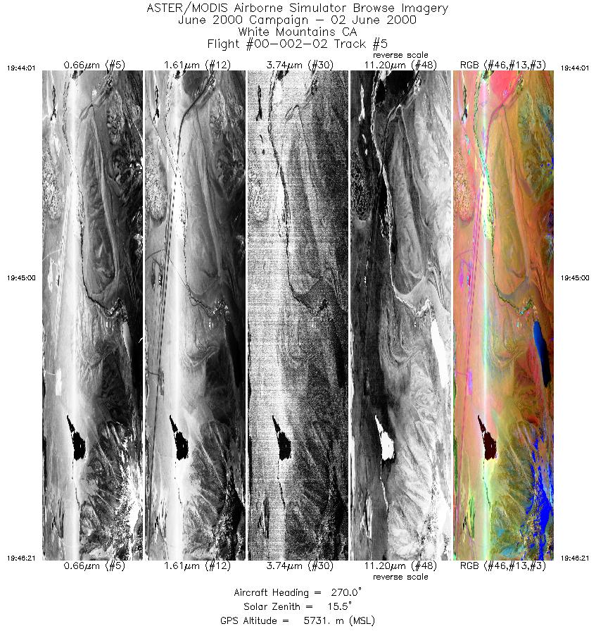
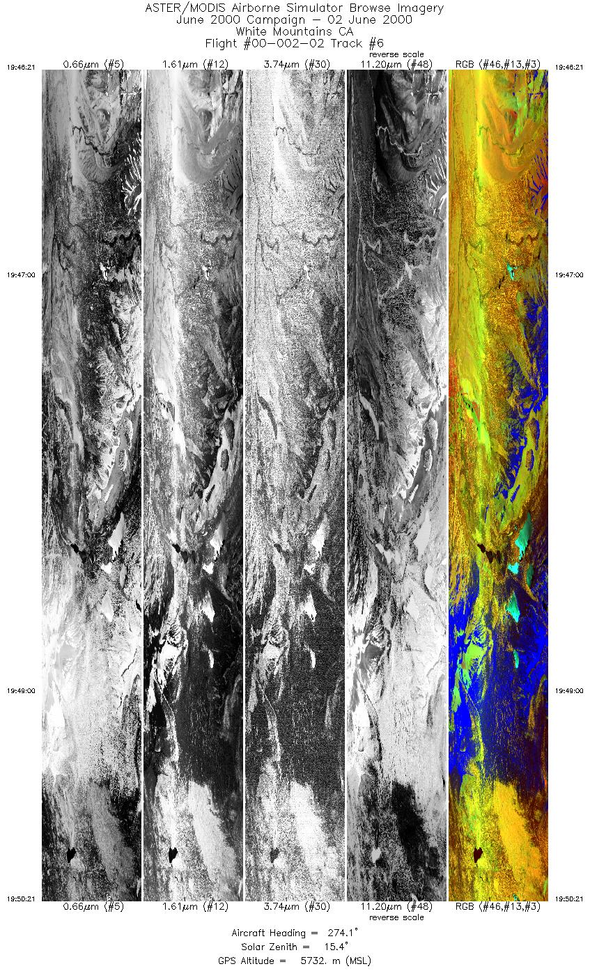
| 6 |
19:46 - 19:50 |
274.0 |
37.611 - 37.617 |
118.902 - 119.081 |
5971 |
5731 |
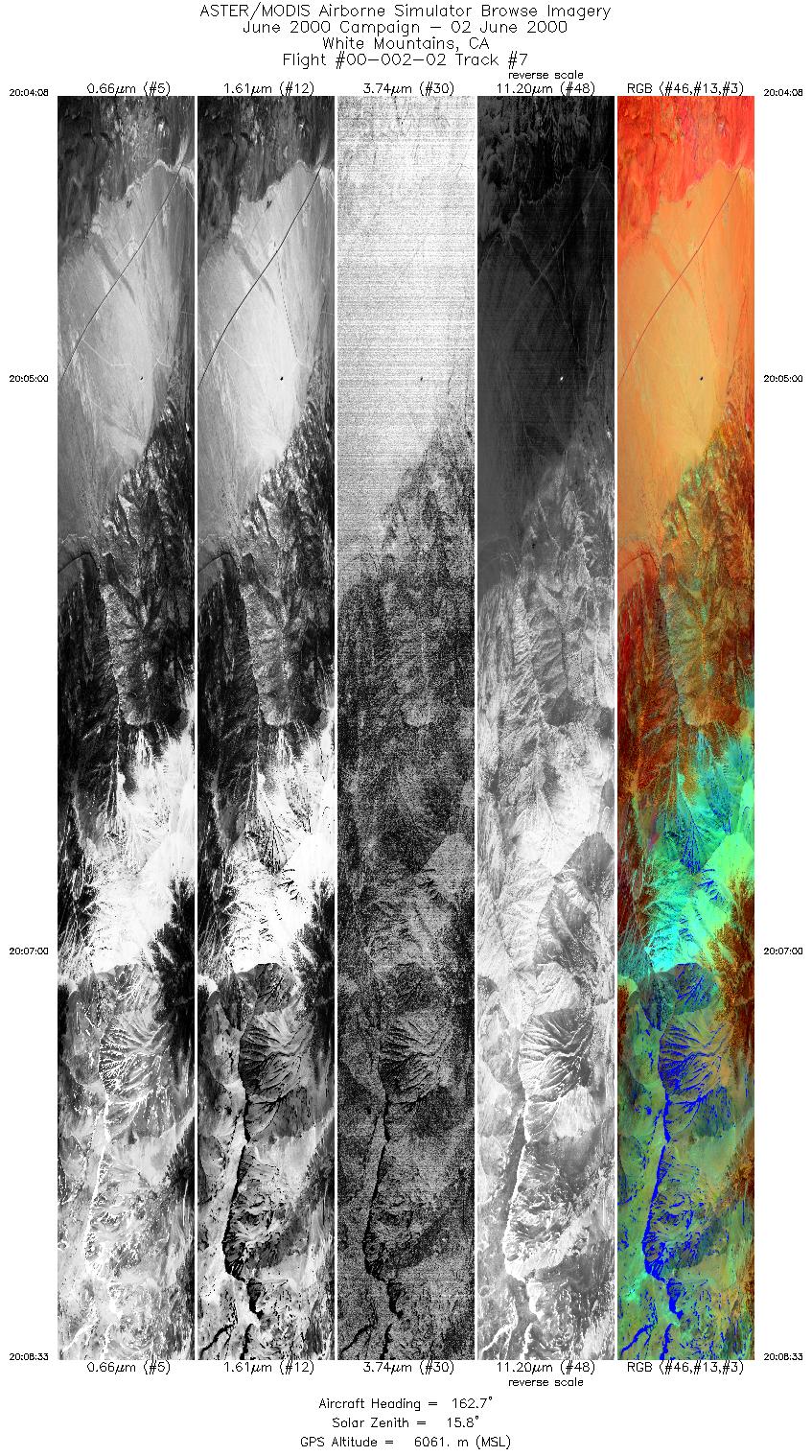
| 7 |
20:04 - 20:08 |
162.0 |
37.947 - 37.771 |
118.419 - 118.322 |
6591 |
6062 |
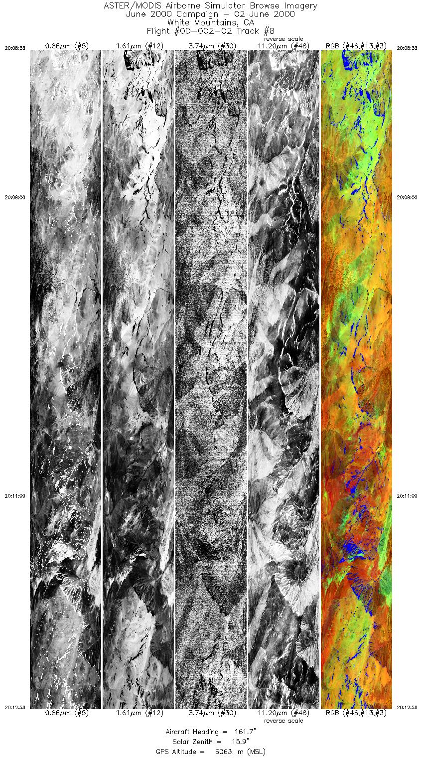
| 8 |
20:08 - 20:12 |
161.7 |
37.770 - 37.600 |
118.322 - 118.228 |
6619 |
6064 |
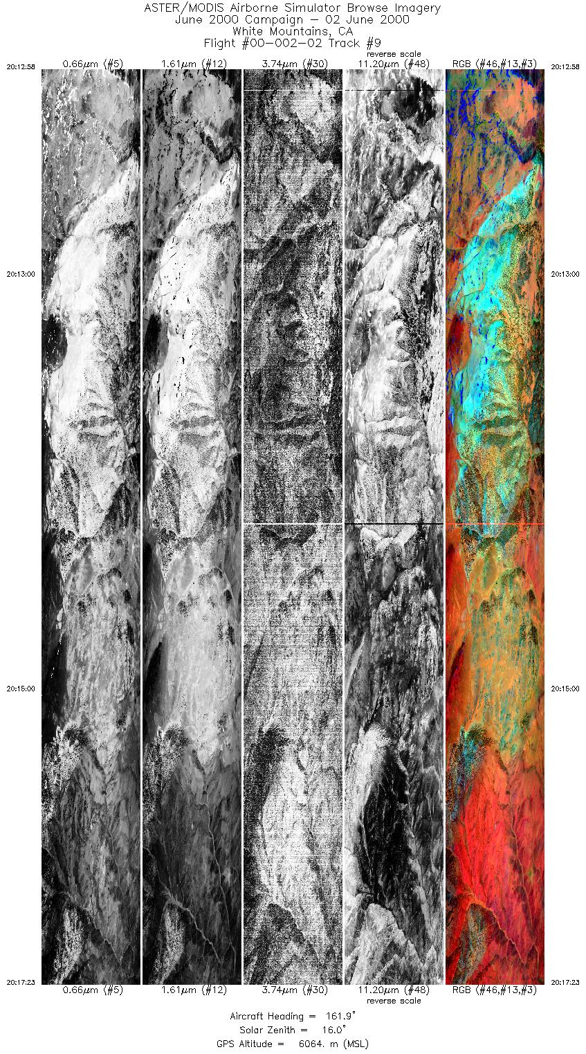
| 9 |
20:12 - 20:17 |
162.1 |
37.599 - 37.424 |
118.228 - 118.130 |
6617 |
6066 |
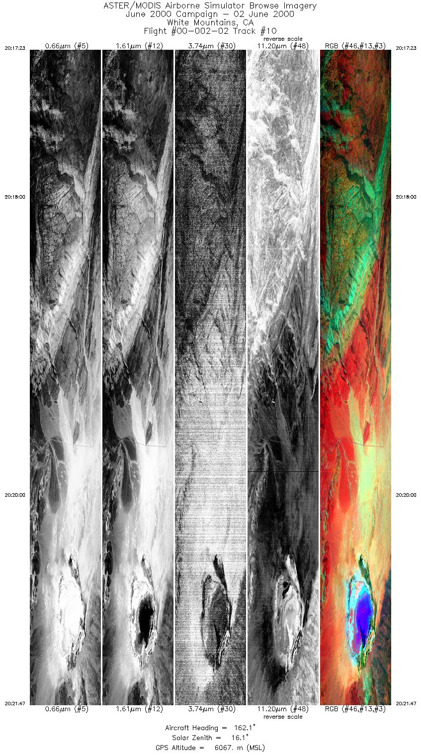
| 10 |
20:17 - 20:21 |
161.7 |
37.424 - 37.252 |
118.130 - 118.035 |
6586 |
6065 |
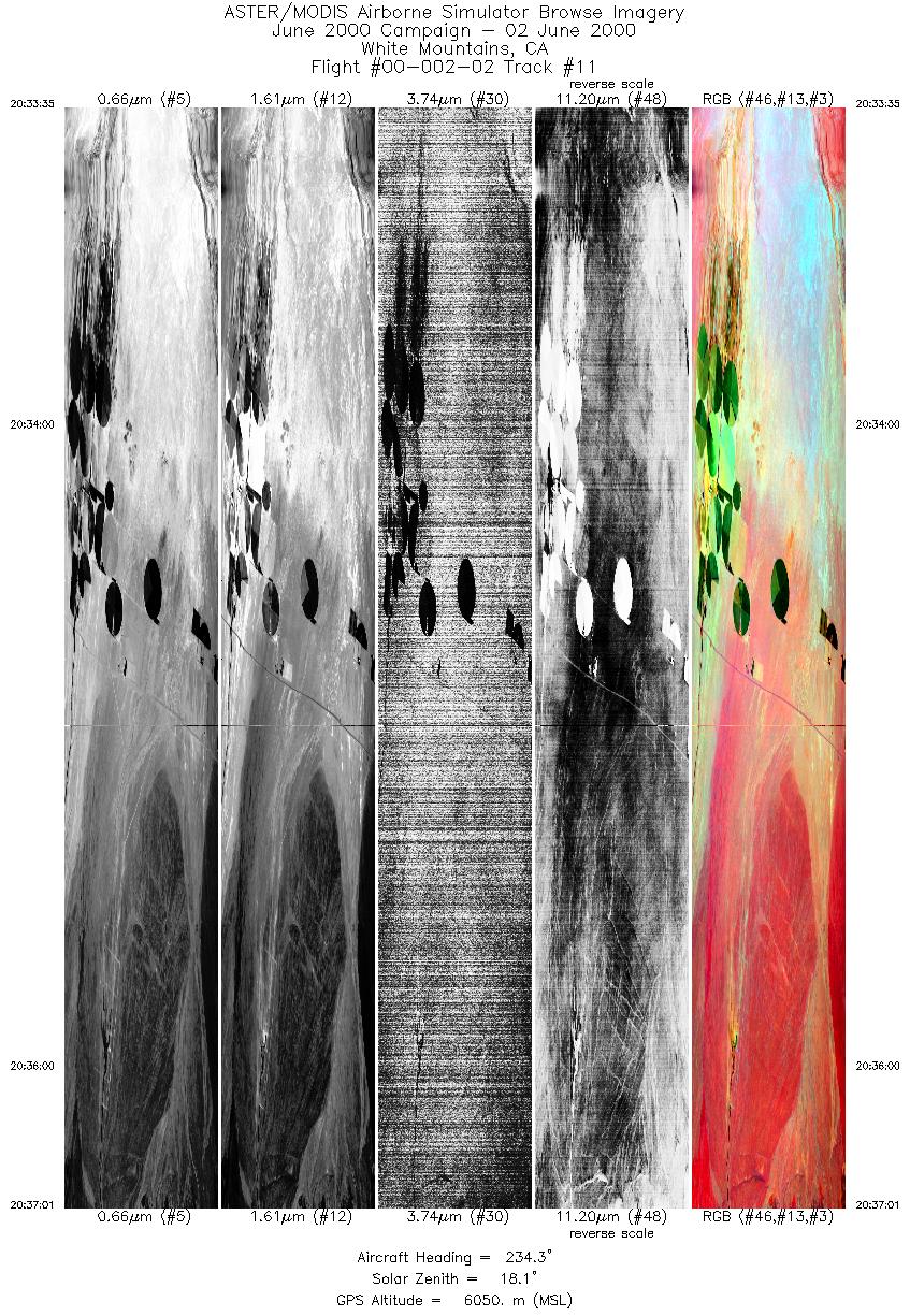
| 11 |
20:33 - 20:37 |
243.1 |
37.812 - 37.775 |
118.019 - 118.180 |
5126 |
6050 |
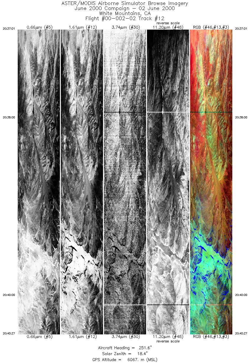
| 12 |
20:37 - 20:40 |
251.5 |
37.775 - 37.741 |
118.180 - 118.338 |
5150 |
6066 |
|


