OVERVIEW
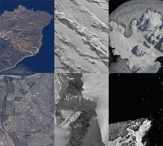
The Digital Mapping System (DMS) is an airborne digital camera that acquires high resolution natural color and panchromatic imagery from low and medium altitude research aircraft. Data acquired by DMS are used by a variety of scientific programs to monitor variation in environmental conditions, assess global change, and respond to natural disasters.
The DMS instrument is maintained and operated by the Airborne Sensor Facility (ASF) located at the NASA Ames Research Center in Mountain View, California, under the oversight of the EOS Project Science Office at NASA Goddard. Instrument scheduling is coordinated by the ASF, with formal arrangements made via the NASA Suborbital Science Program Flight Request process (see contact information for more details).
RECENT CAMPAIGN
- Operation IceBridge 2018
- Dates: 22 March - 19 April, 2018
- Location: Greenland
- Status: Level-1B imagery is available
- View this campaign
IMAGE GALLERY
- Operation IceBridge
- Images acquired by DMS during the Operation IceBridge Campaigns.
MOVIE GALLERY
- Operation IceBridge
- Movies from various sources about and shot during the Operation IceBridge Campaign.
RELATED WEB SITES
- NSIDC Home Page
- The National Snow and Ice Data Center supports research into our world's frozen Cryosphere.
- IceBridge Information
- Operation IceBridge, a multi-year NASA field campaign, is the largest airborne survey of Earth's polar ice ever flown.
- SARP Information
- The Student Airborne Research Program is a eight-week summer program for junior and senior undergraduate students.

Home
Sample Imagery

These images are from Operation IceBridge, collected in the Fall of 2009.
- NASA Official: Matt Fladeland
- Project Manager: James Jacobson
- Website Editor: Eric Fraim
- Last Updated: March 21, 2024


