|
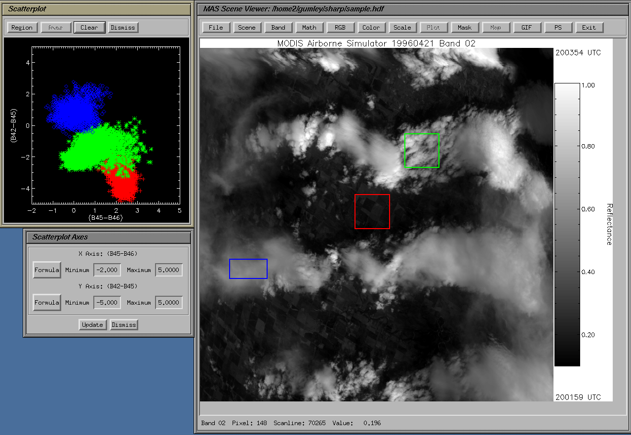
This page is provided to assist in unpacking and
interpreting processed MODIS Airborne Simulator (MAS)
Level-1B data (calibrated and geolocated radiances).
MAS Level-1B data are stored in Hierarchical Data Format, version 4, (HDF4). HDF is a multi-object file format for the transfer of graphical and numerical data between machines, and allows the user to create, access, and share scientific data in a form that is self-describing and network-transparent. "Self-describing" means that a file includes information defining the data it contains. "Network-transparent" means that a file is represented in a form that can be accessed by computers with different ways of storing integers, characters, and floating-point numbers. HDF files allow direct access, so that a small subset of a large dataset may be accessed efficiently, without first reading through all the preceding data. It should be noted that HDF4 files should only be accessed through the HDF4 library of subroutine and function calls (from FORTRAN or C). HDF is not a data format which can be unpacked easily by knowing word locations, byte ordering and so on. With HDF, the user is insulated from these details, so that differences in system specific storage details are transparent. MAS Level-1B data are organized into straight line flight tracks (or flight lines). In other words, each file of MAS data contains all the data pertaining to a single straight line flight track. In general, there are between 10 and 30 straight line flight tracks in a given flight, and 10 to 20 flights in a given mission. MAS HDF4 files can be uniquely described (and therefore ordered) by specifying the flight day and a flight line number. Users typically specify flight days which interest them when ordering MAS data. In this case, all the straight line flight tracks on the specified days are included. |