
|
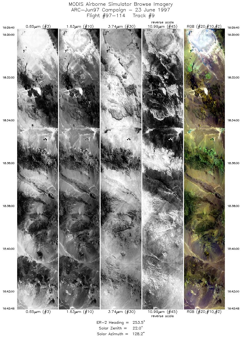
Sample Image

23 June 1997
Track 09
scanlines 100-4100 of 4920


Flightline begins over Railroad Valley, Nevada, and proceeds almost due west over the Pancake Range, into Hot Creek Valley and Range. Continuing westward over Stone Cabin Valley and the Monitor Range. Flight track ends over the 7100 foot Thunder Mountian in the Ralston Valley.
R: 2.14 microns
G: 1.63 microns
B: 0.55 microns
|
|
Mission Summary
Date: Jun 23, 1997
ER-2 Flight Number: 97-114
Deployment: ARC-Jun97
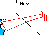
Flight Location: Railroad Valley and Lunar Crater, NV (day)
Principal Investigators: Dr. Zhengming Wan (UCSB), Dr. Ann Kahle (JPL)
Additional Sensors: 12" RC-10 (CIR), AVIRIS
Objective: Validation of an algorithim used to calculate land surface temperatures and emissivity based on thermal infrared data (Wan).
Level-1B Processing Information
Level-1B Data processed by: Ames Research Center
Level-1B Data Version: #10
Level-1B Configuration: (sample file)
Calibration Type: Final
Calibration Version: 1.0
Temperature Adjustment: No
Status: Completed with final calibration
|
|
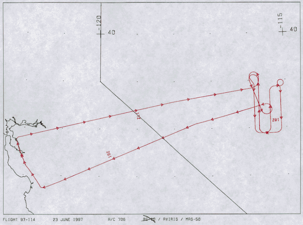
Flight Track Map

|
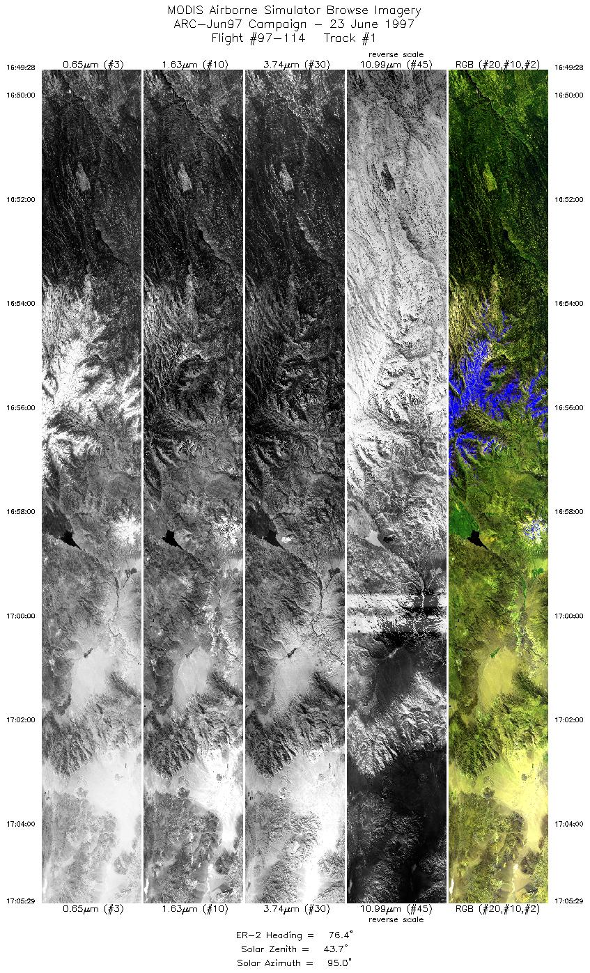
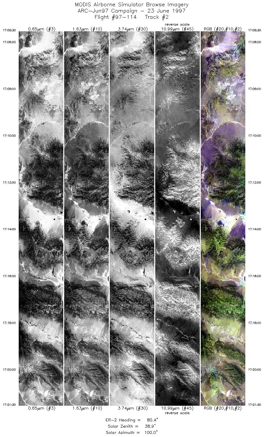
Level-1B Browse Imagery
Straight Line Flight Tracks: 10
Scanlines Processed: 37913
Solar Azimuth and Zenith Angles
|
Browse Images
|
Click on the Flight Track number to load images.
Lat/Lon ranges are for the BEG-END scanline nadir pixels.
|
Flight
Track |
Time_Span
(GMT) |
Heading
(Deg) |
Lat_Range
(Deg_N) |
Lon_Range
(Deg_W) |
Length
(Scanlines) |
Altitude
(Meters) |
| 1 |
16:49-17:05 |
76 |
38.12-38.53 |
120.50-118.27 |
5987 |
~20000 |
| 2 |
17:05-17:21 |
80 |
38.53-38.83 |
118.27-115.96 |
5989 |
~20000 |
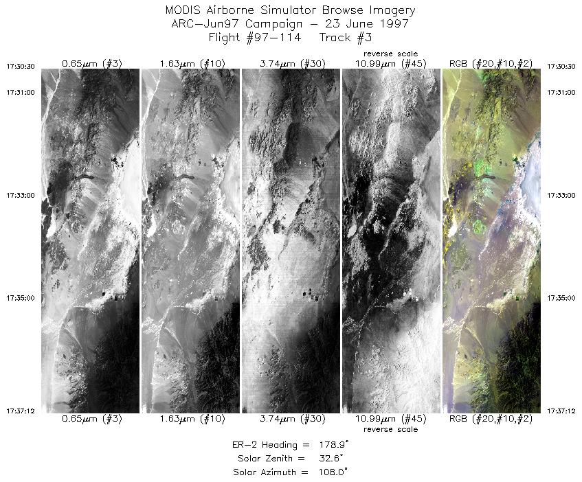
| 3 |
17:30-17:37 |
179 |
38.75-37.99 |
115.84-115.83 |
2510 |
~20000 |
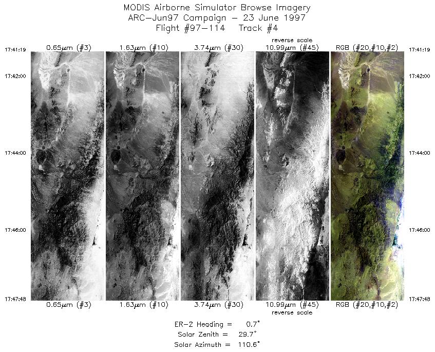
| 4 |
17:41-17:47 |
1 |
38.00-38.75 |
115.42-115.42 |
2429 |
~20000 |
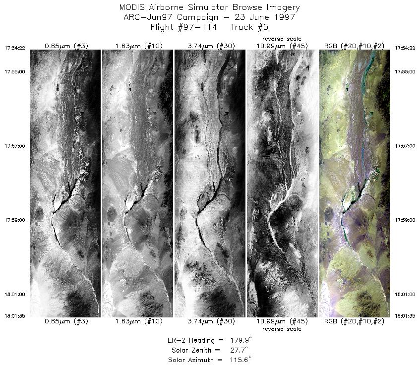
| 5 |
17:54-17:56 |
180 |
38.81-38.60 |
115.12-115.12 |
688 |
~20000 |
| 6 |
17:56-18:01 |
180 |
38.60-38.00 |
115.12-115.12 |
1998 |
~20000 |
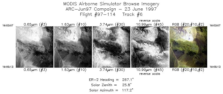
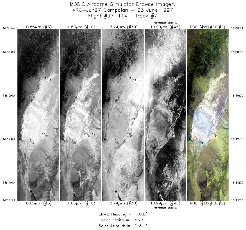
| 7 |
18:03-18:05 |
267 |
37.88-37.88 |
115.26-115.56 |
787 |
~20000 |
| 8 |
18:06-18:14 |
1 |
38.00-38.90 |
115.71-115.71 |
2959 |
~20000 |
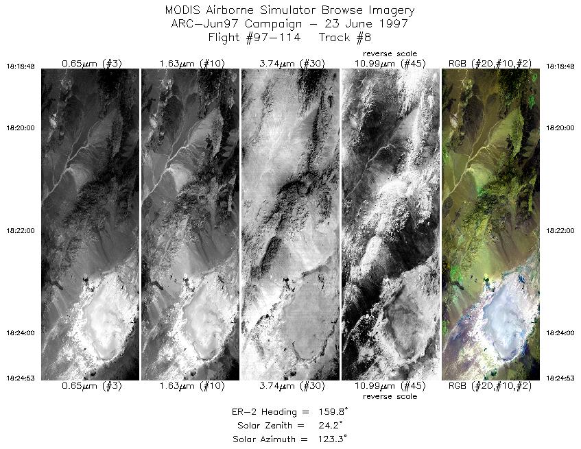
| 9 |
18:18-18:24 |
160 |
38.99-38.35 |
115.95-115.64 |
2279 |
~20000 |
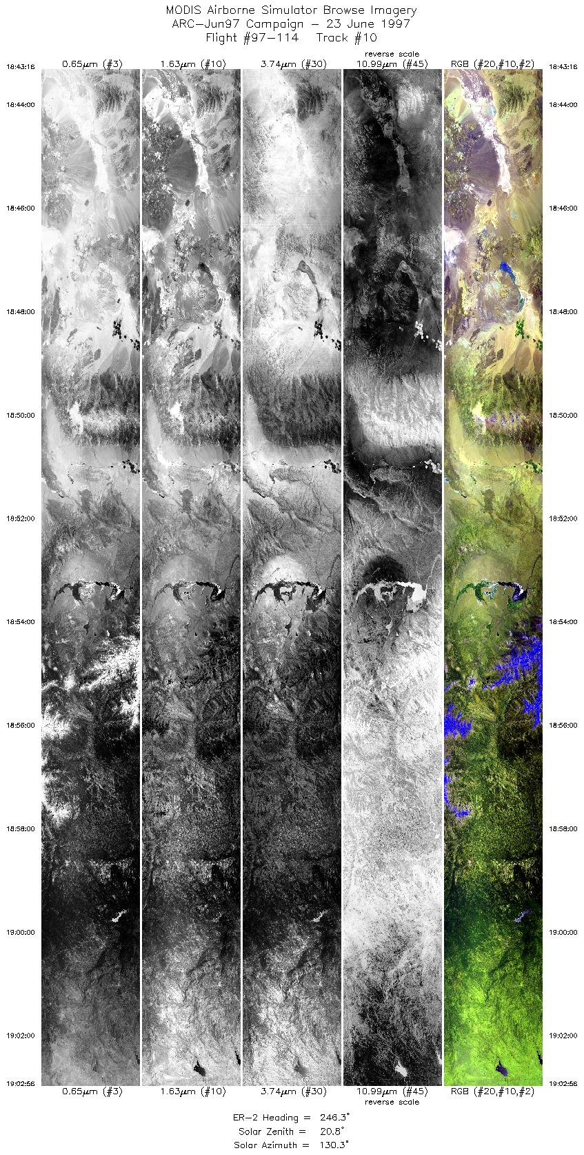
| 10 |
18:29-18:42 |
254 |
38.48-38.10 |
115.59-117.39 |
4920 |
~20000 |
|
Images 01 through 10 in sequence |
Data Evalutation
Track 1 has no data in channels 43 and 48-50. Remaining tracks appear OK.
Spectral Summary
Spectral Band Configuration
Spectral Response Files
Level-1B Data Distribution
NASA Goddard Space Flight Center DAAC
Related Web Sites
NASA ER-2 1997 Flight Summary Reports
JPL AVIRIS Web Page
Airborne Sensors Facility Page
NASA ER-2 Aircraft Program
|
|
