
|
Sample Image

03 March 1997
Track 02
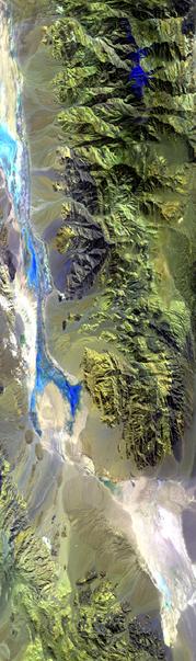

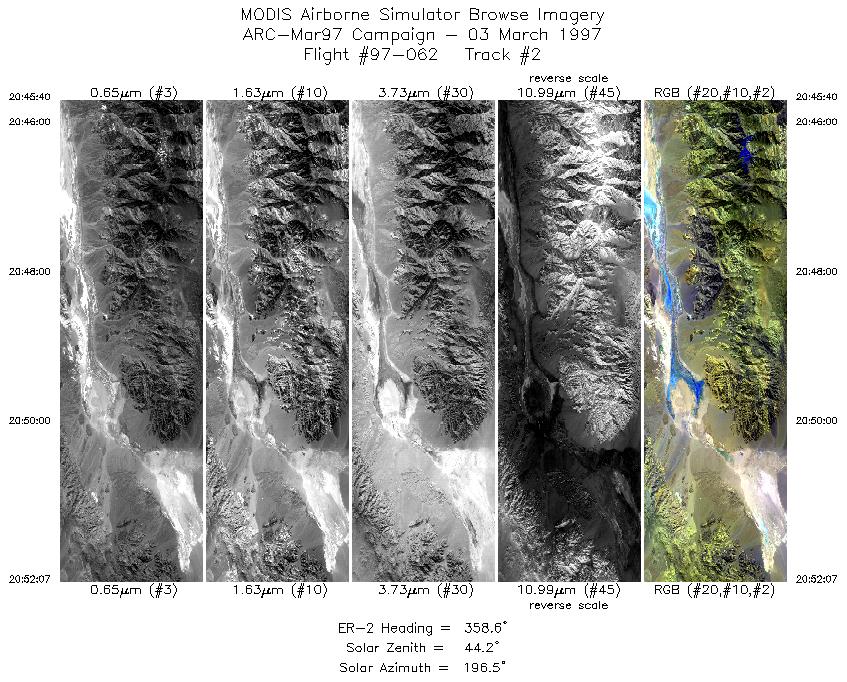
Flightline begins over the snowcapped Panamint Range, with Death Valley to the left (east) in the image. Continues north, up the Panamints, over Tucki Mountain, across Death Valley, and ends over the Amargosa Range.
R: 2.14 microns
G: 1.63 microns
B: 0.55 microns
|
|
Mission Summary
Date: Mar 03, 1997
ER-2 Flight Number: 97-062
Deployment: ARC-Mar97
Flight Location: Death Valley, CA
Principal Investigator: Dr. Zhengming Wan (UCSB)
Additional Sensors: 12" RC-10 (CIR)
Objective: Validation of an algorithim used to calculate land surface temperatures and emissivity based on thermal infrared data (Wan).
Level-1B Processing Information
Level-1B Data processed by: Ames Research Center
Level-1B Data Version: #09
Level-1B Configuration: (sample file)
Calibration Type: Final
Calibration Version: 1.0
Temperature Adjustment: No
Status: Completed with final calibration, no changes from preliminary calibration.
|
|
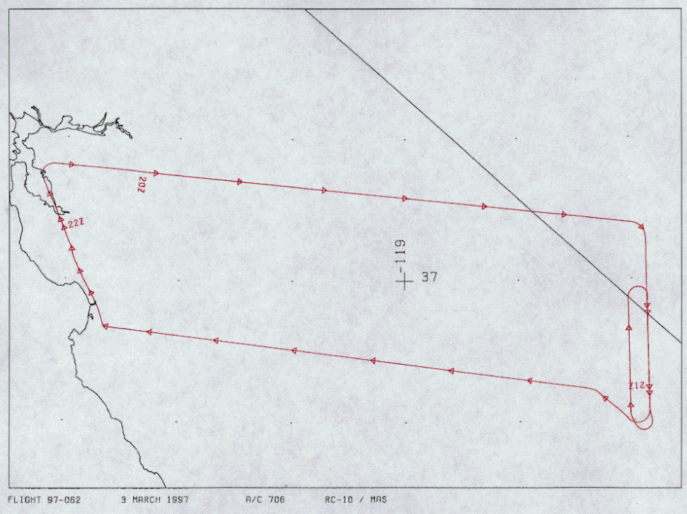
Flight Track Map

|
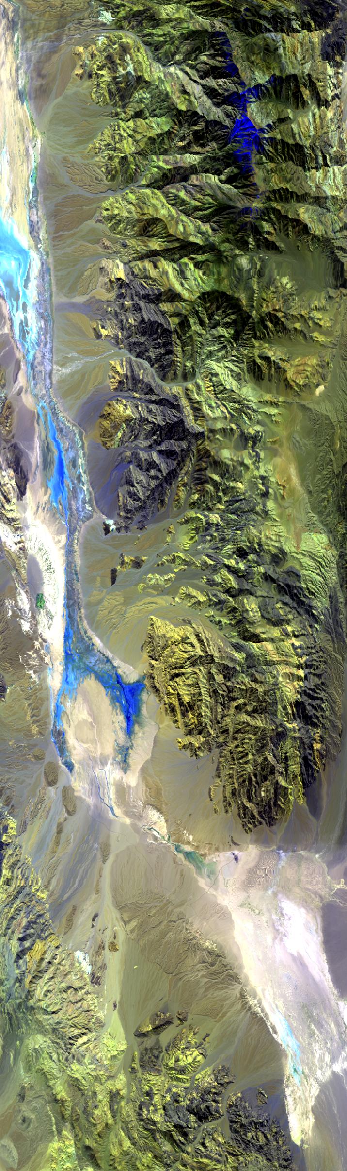
Level-1B Browse Imagery
Straight Line Flight Tracks: 6
Scanlines Processed: 17298
Solar Azimuth and Zenith Angles
|
Browse Images
|
Click on the Flight Track number to load images.
Lat/Lon ranges are for the BEG-END scanline nadir pixels.
|
Flight
Track |
Time_Span
(GMT) |
Heading
(Deg) |
Lat_Range
(Deg_N) |
Lon_Range
(Deg_W) |
Length
(Scanlines) |
Altitude
(Meters) |
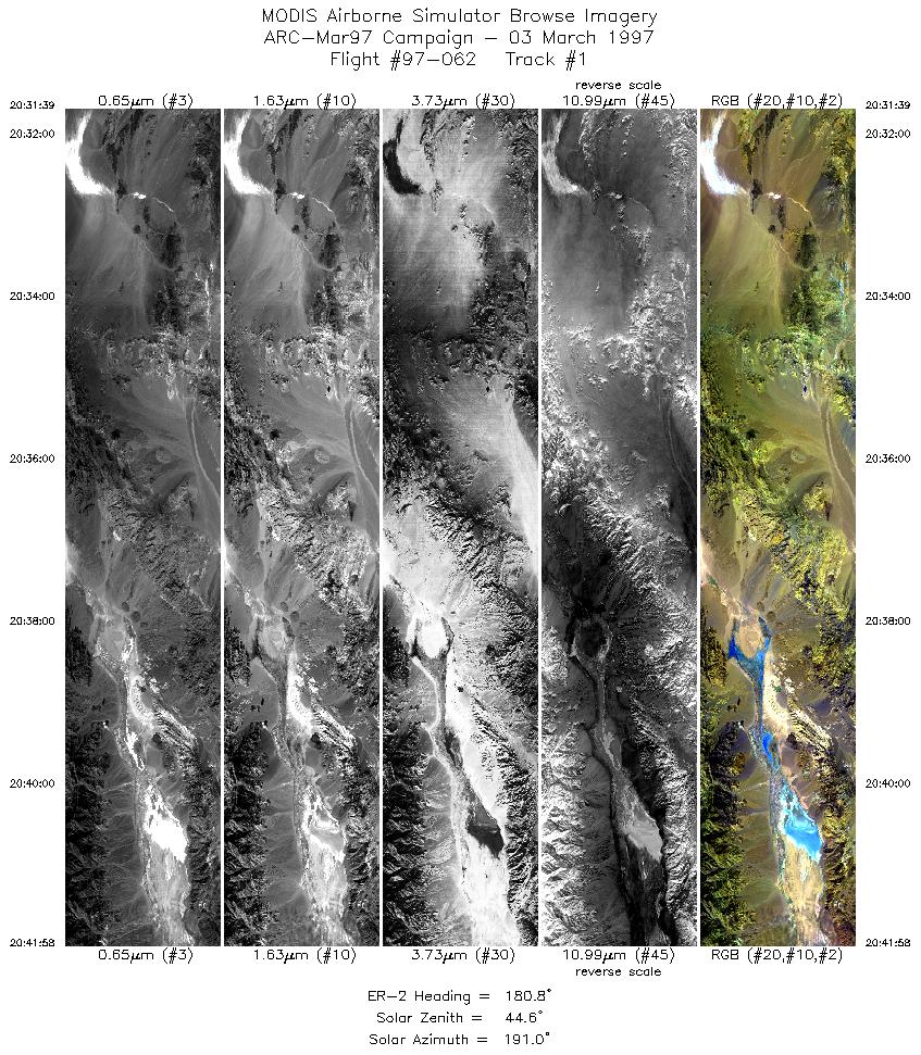
| 1 |
20:31-20:41 |
181 |
37.27-36.09 |
116.86-116.86 |
3857 |
~20000 |
| 2 |
20:45-20:52 |
359 |
36.10-36.80 |
117.03-117.03 |
2412 |
~20000 |
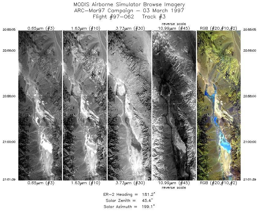
| 3 |
20:55-21:01 |
181 |
36.82-36.07 |
116.86-116.86 |
2456 |
~20000 |
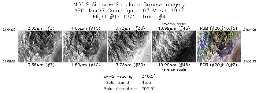
| 4 |
21:04-21:05 |
310 |
36.05-36.15 |
117.10-117.24 |
523 |
~20000 |
| 5 |
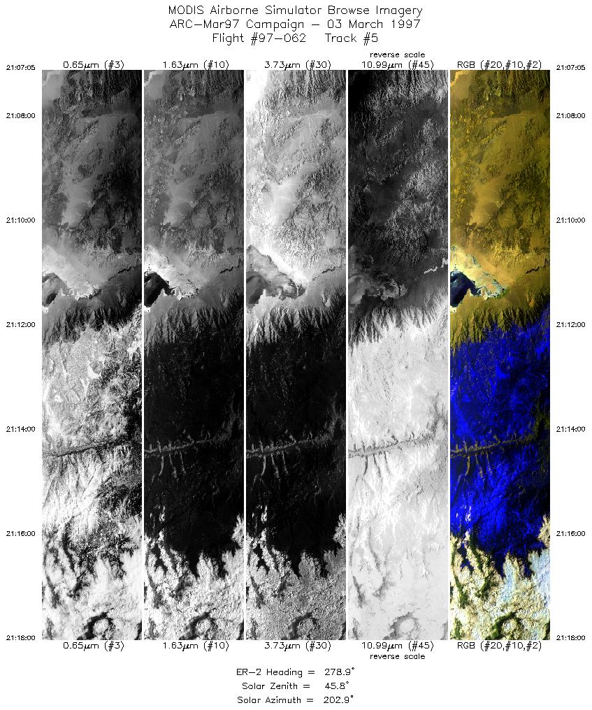
21:07-21:18 |
279 |
36.23-36.40 |
117.42-118.92 |
4083 |
~20000 |
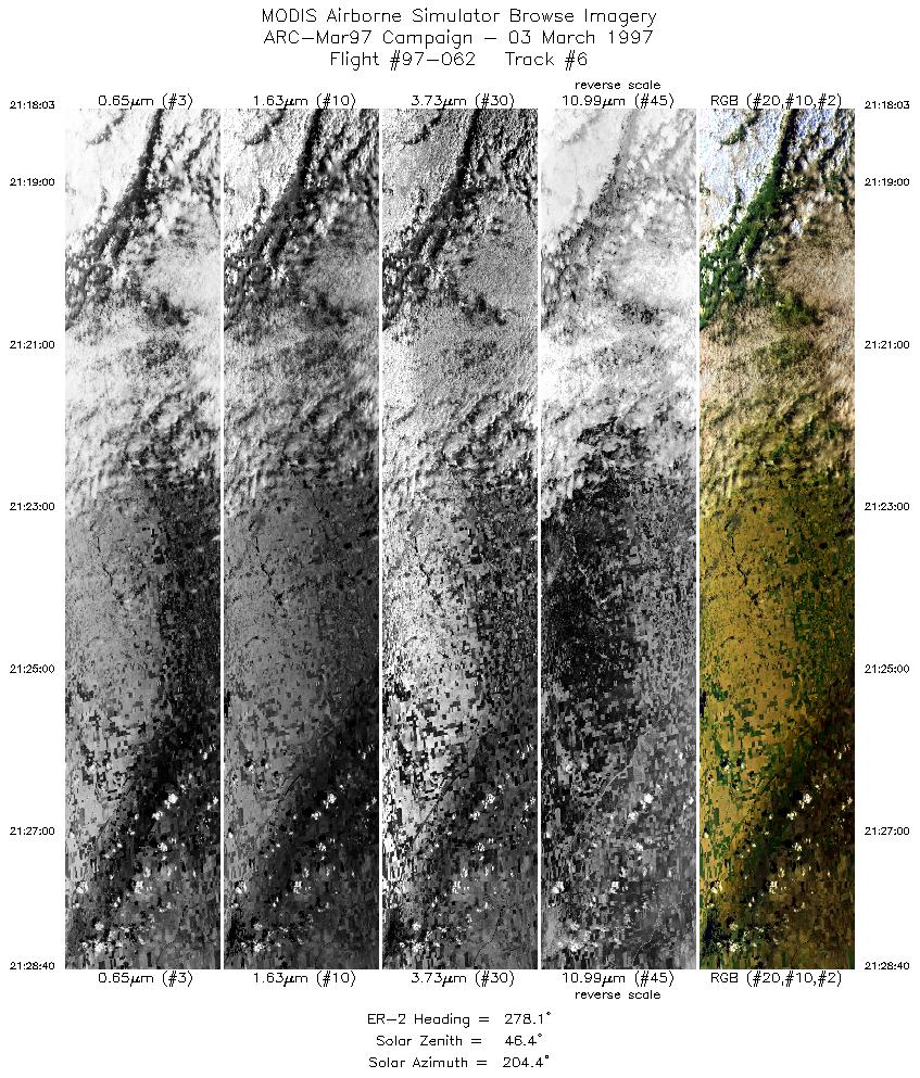
| 6 |
21:18-21:28 |
278 |
36.40-36.56 |
118.92-120.40 |
3967 |
~20000 |
|
Images 01 through 06 in sequence |
Data Evalutation
Track 1 shows buffetting noise early in flightline because aircraft is
gaining altitude. Track 6 has dropped scanlines early in the flightline,
channel 5 has noise.
Spectral Summary
Spectral Band Configuration (preliminary)
Spectral Response Files (preliminary)
Level-1B Data Distribution
NASA Goddard Space Flight Center DAAC
Related Web Sites
NASA ER-2 1997 Flight Summary Reports
Airborne Sensors Facility Page
NASA ER-2 Aircraft Program
|
|