
|
Sample Image

04 June 1996
Track #07


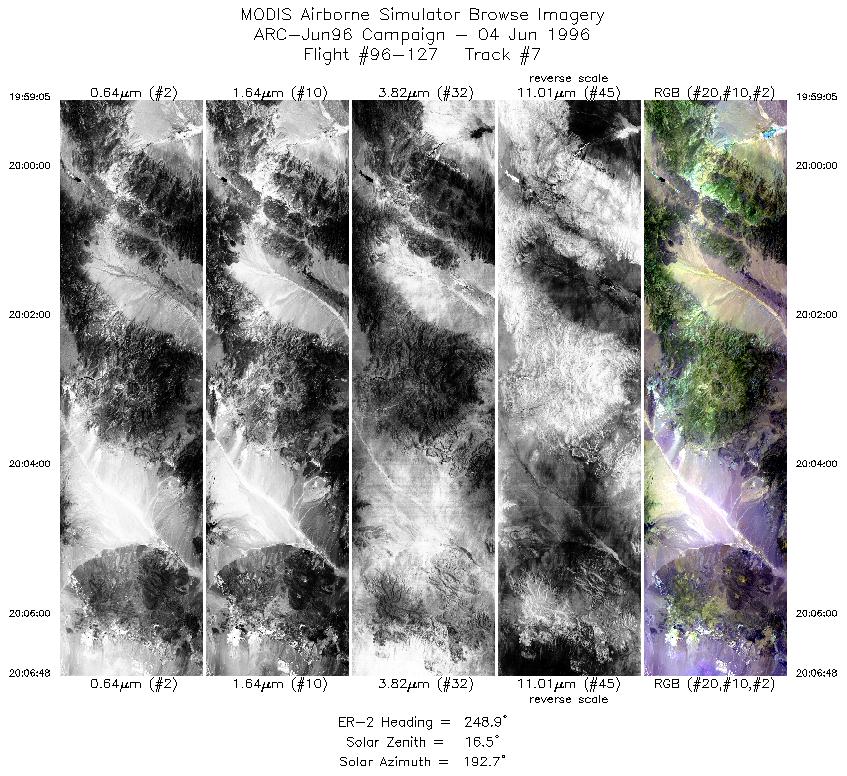
Flightline begins over the Hot Creek Range into Stone Cabin Valley. Proceeds into the Monitor Range with direct overflight of Big Ten Peak, ending in the San Antonio Mtns.
R: 2.15 microns
G: 1.65 microns
B: 0.55 microns
|
|
Mission Summary
Date: June 04, 1996
ER-2 Flight Number: 96-127
Deployment: ARC-Jun96
Flight Location: Lunar Lake and Railraod Valley, Nevada
Principal Investigator: Dr. Zhengming Wan (USCB)
Additional Sensors: 12" RC-10 (CIR)
Objective: Validation of an algorithim used to calculate land surface temperatures and emissivity based on thermal infrared data.
Level-1B Processing Information
Level-1B Data processed by: Ames Research Center
Level-1B Data Version: #09
Level-1B Configuration: (sample file)
Calibration Type: Final
Calibration Version: 1.0
Temperature Adjustment: No
Status: Completed with final calibration
|
|
Flight Track Map

|
Level-1B Browse Imagery
Straight Line Flight Tracks: 09
Scanlines Processed: 26146
Solar Azimuth and Zenith Angles
|
Browse Images
|
Click on the Flight Track number to load images.
Lat/Lon ranges are for the BEG-END scanline nadir pixels.
|
Flight
Track |
Time_Span
(GMT) |
Heading
(Deg) |
Lat_Range
(Deg_N) |
Lon_Range
(Deg_W) |
Length
(Scanlines) |
Altitude
(Meters) |
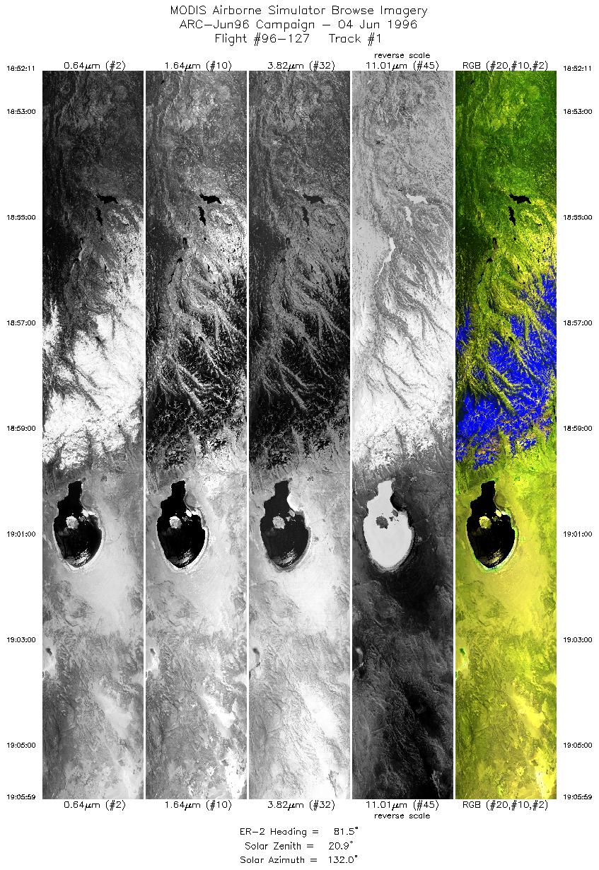
| 1 |
18:52-19:05 |
82 |
37.94-38.12 |
120.25-118.30 |
5154 |
~20000 |
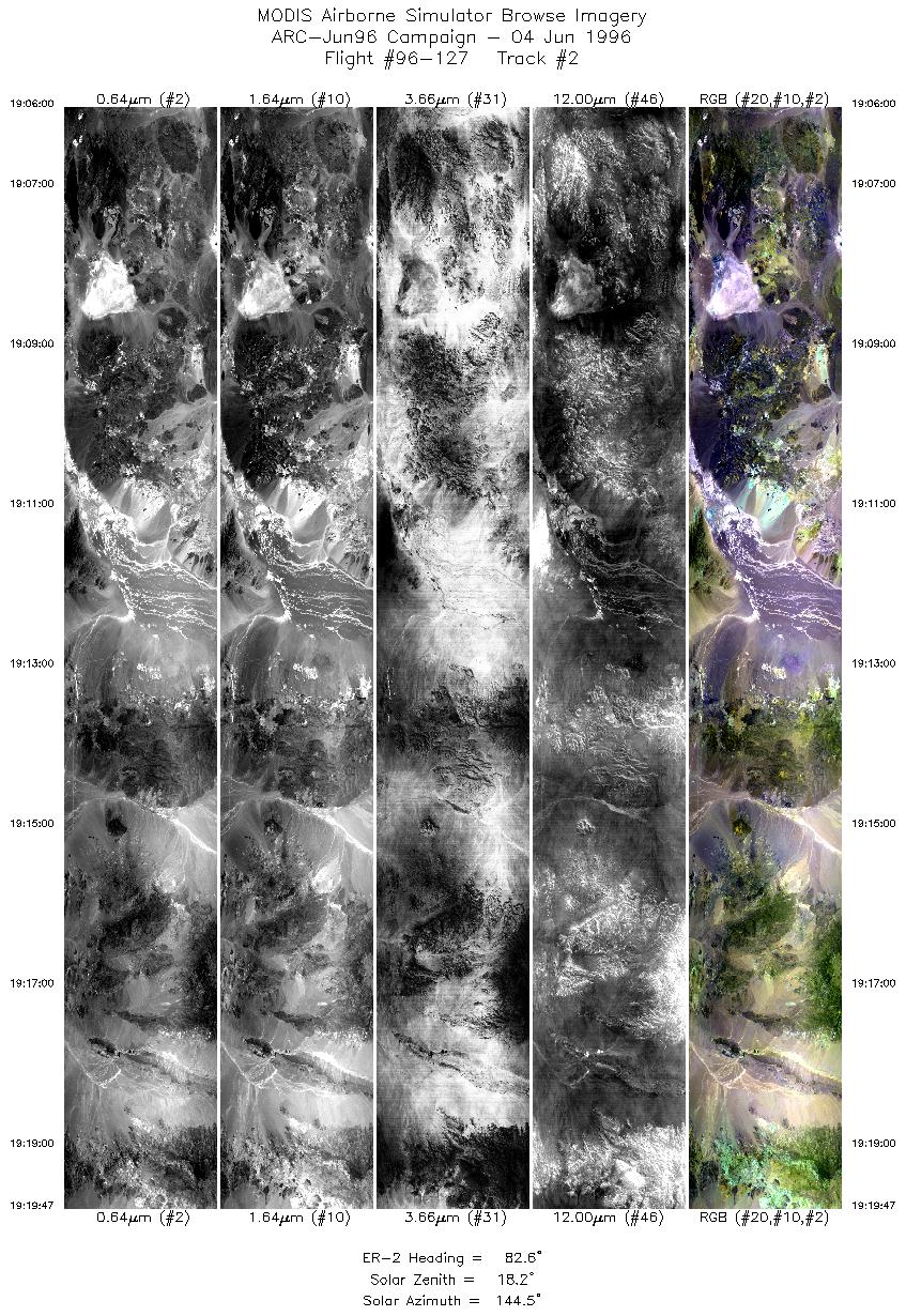
| 2 |
19:06-19:19 |
83 |
38.12-38.27 |
118.30-116.36 |
5150 |
~20000 |
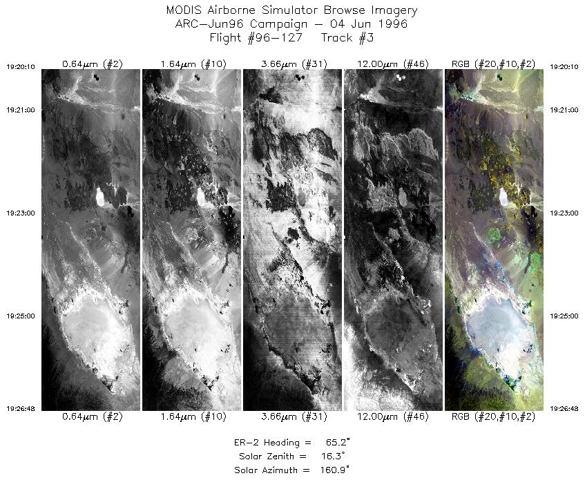
| 3 |
19:20-19:26 |
65 |
38.28-38.56 |
116.31-115.45 |
2478 |
~20000 |
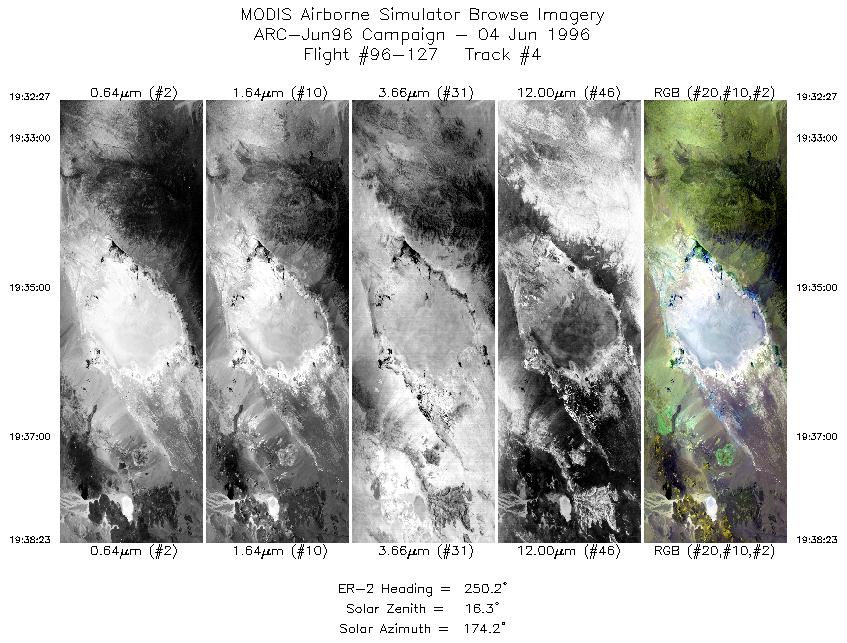
| 4 |
19:32-19:38 |
250 |
38.62-38.36 |
115.25-116.05 |
2217 |
~20000 |
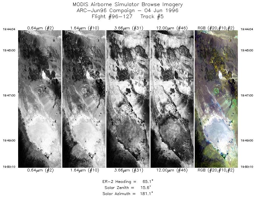
| 5 |
19:44-19:50 |
65 |
38.30-38.55 |
116.24-115.45 |
2279 |
~20000 |
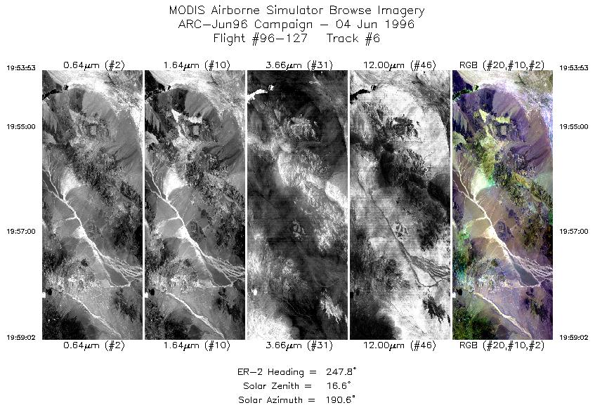
| 6 |
19:53-19:59 |
248 |
38.79-38.56 |
115.56-116.27 |
1924 |
~20000 |
| 7 |
19:59-20:06 |
249 |
38.56-38.22 |
116.28-117.33 |
2883 |
~20000 |
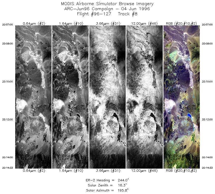
| 8 |
20:07-20:14 |
244 |
38.20-37.80 |
117.36-118.33 |
2821 |
~20000 |
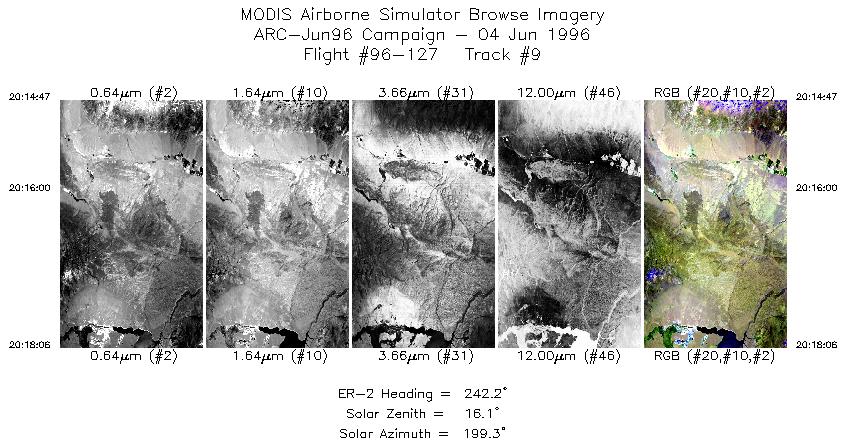
| 9 |
20:14-20:18 |
242 |
37.79-37.61 |
118.35-118.77 |
1240 |
~20000 |
|
Images 01 through 09 in sequence |
Data Evalutation
No problems with data set.
Spectral Summary
Spectral Band Configuration
Spectral Response Files
Level-1B Data Distribution
NASA Goddard Space Flight Center DAAC
Related Web Sites
Airborne Sensors Facility Page
NASA ER-2 Aircraft Program
|
|
