
|
Sample Image

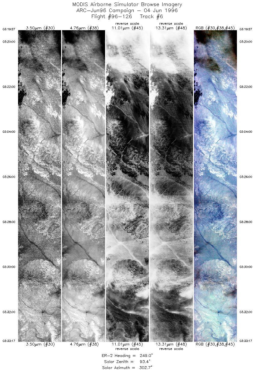
04 June 1996
Track #06
scanlines 250-4900 of 5169
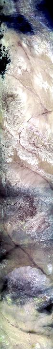

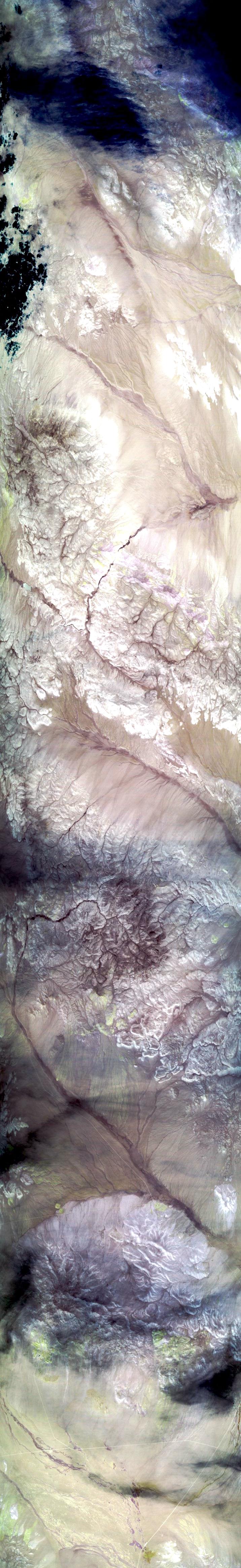
This is a night flightline beginning over the Grant Range. Proceeding over Railroad Valley, and the Pancake, Hot Creek, and Monitor Ranges of the Toiyabe National Forest. North is approximately to the left.
R: 2.15 microns
G: 1.65 microns
B: 0.55 microns
|
|
Mission Summary
Date: June 04, 1996
ER-2 Flight Number: 96-126
Deployment: ARC-Jun96
Flight Location: Lunar Lake and Railraod Valley, Nevada (night flight)
Principal Investigator: Dr. Zhengming Wan (UCSB)
Additional Sensors: none
Objective: Validation of an algorithim used to calculate land surface temperatures and emissivity based on thermal infrared data.
Level-1B Processing Information
Level-1B Data processed by: Ames Research Center
Level-1B Data Version: #09
Level-1B Configuration: (sample file)
Calibration Type: Final
Calibration Version: 1.0
Temperature Adjustment: No
Status: Completed with final calibration
|
|
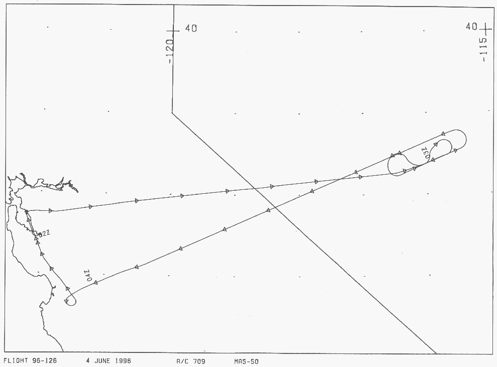
Flight Track Map

|
Level-1B Browse Imagery
Straight Line Flight Tracks: 07
Scanlines Processed: 20341
Solar Azimuth and Zenith Angles
|
Browse Images
|
Click on the Flight Track number to load images.
Lat/Lon ranges are for the BEG-END scanline nadir pixels.
|
Flight
Track |
Time_Span
(GMT) |
Heading
(Deg) |
Lat_Range
(Deg_N) |
Lon_Range
(Deg_W) |
Length
(Scanlines) |
Altitude
(Meters) |
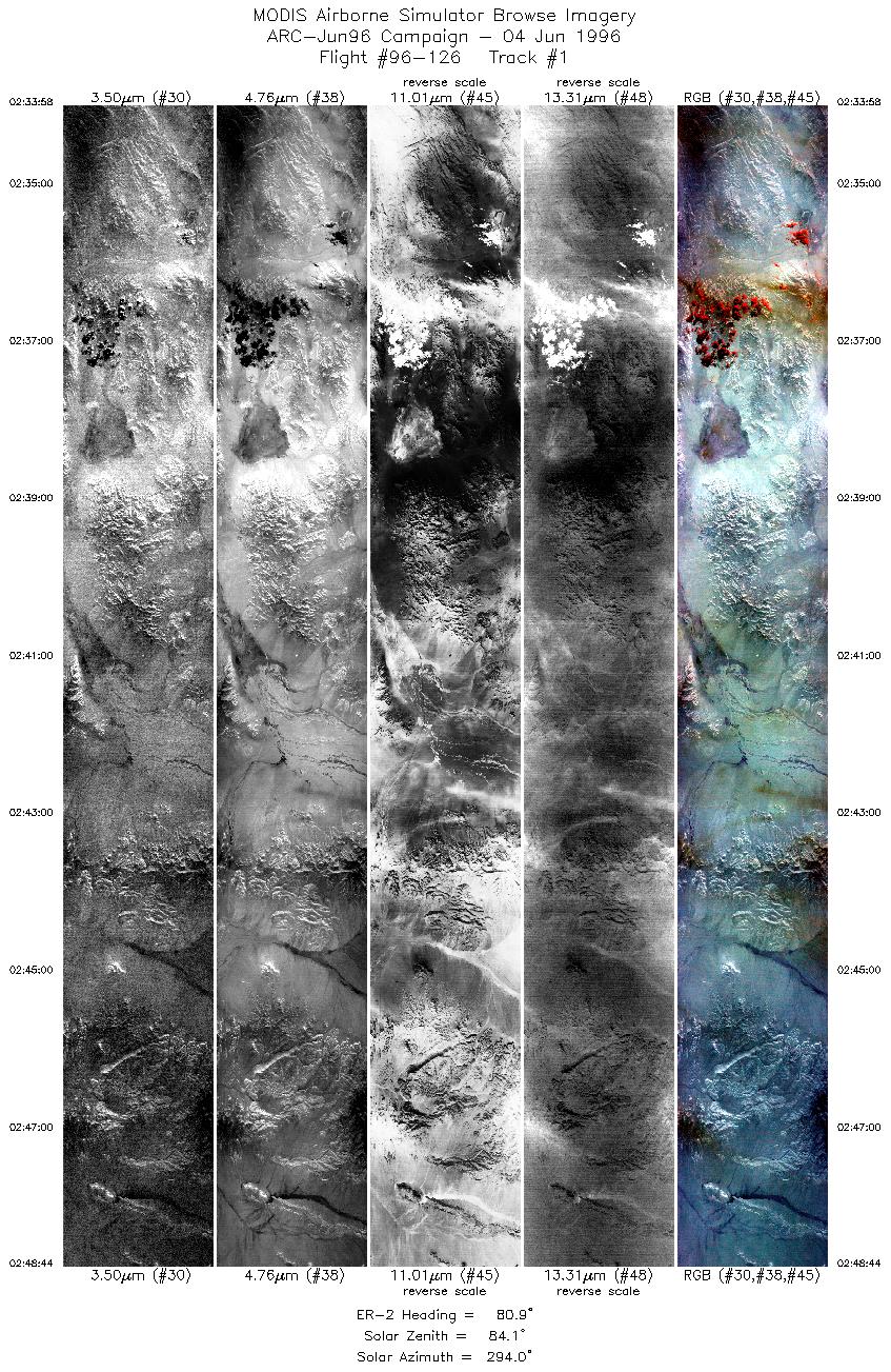
| 1 |
02:33-02:48 |
81 |
38.10-38.26 |
118.56-116.51 |
5519 |
~20000 |
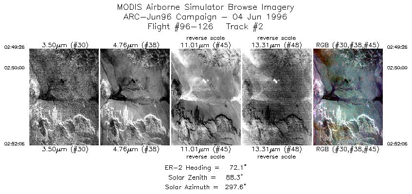
| 2 |
02:49-02:52 |
72 |
38.27-38.36 |
116.41-116.05 |
997 |
~20000 |
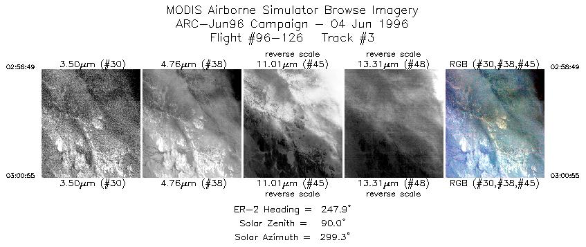
| 3 |
02:58-03:00 |
248 |
38.46-38.37 |
115.75-116.03 |
785 |
~20000 |
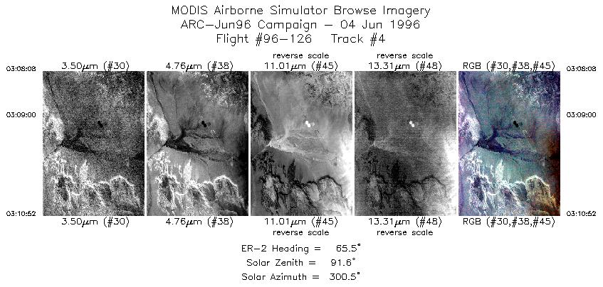
| 4 |
03:08-03:10 |
65 |
38.24-38.36 |
116.41-116.06 |
1022 |
~20000 |
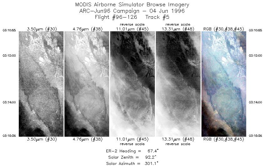
| 5 |
03:10-03:15 |
67 |
38.36-38.55 |
116.05-115.46 |
1687 |
~20000 |
| 6 |
03:19-03:33 |
249 |
38.75-38.12 |
115.68-117.59 |
5169 |
~20000 |
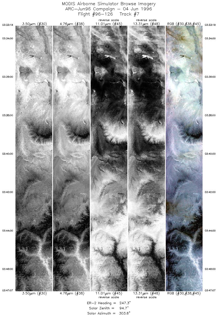
| 7 |
03:33-03:47 |
247 |
38.12-37.47 |
117.59-119.46 |
5162 |
~20000 |
|
Images 01 through 07 in sequence |
Data Evalutation
Excellent data quality.
Spectral Summary
Spectral Band Configuration
Spectral Response Files
Level-1B Data Distribution
NASA Goddard Space Flight Center DAAC
Related Web Sites
Airborne Sensors Facility Page
NASA ER-2 Aircraft Program
|
|