
|
Sample Image

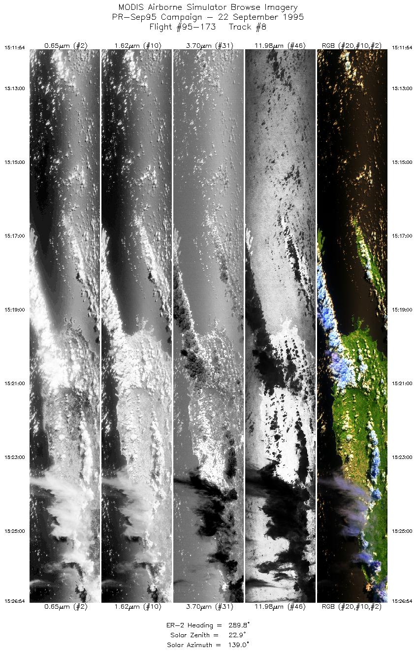
22 Sept 1995
Track #08
scanlines 1500-5623 of 5623


The flightline begins over the Isla de Vieques, continuing along the north coast of Puerto Rico. San Juan is visible near the end of the flightline.
R: 2.14 microns
G: 1.62 microns
B: 0.55 microns
|
|
Mission Summary
Date: September 22, 1995
ER-2 Flight Number: 95-173
Deployment: Puerto Rico-Sep95
Flight Location: Puerto Rico and Saint Thomas
Principal Investigator: Dr. Armond Joyce (SSC)
Additional Sensors: Dual 24" HR732 (NC and CIR)
Objective: Data used to study land/sea interactions in Puerto Rico and the Southeastern United States.
Level-1B Processing Information
Level-1B Data processed by: Ames Research Center
Level-1B Data Version: #09
Level-1B Configuration: (sample file)
Calibration Type: Final
Calibration Version: 1.0
Temperature Adjustment: 24C
Status: Completed with final calibration
|
|
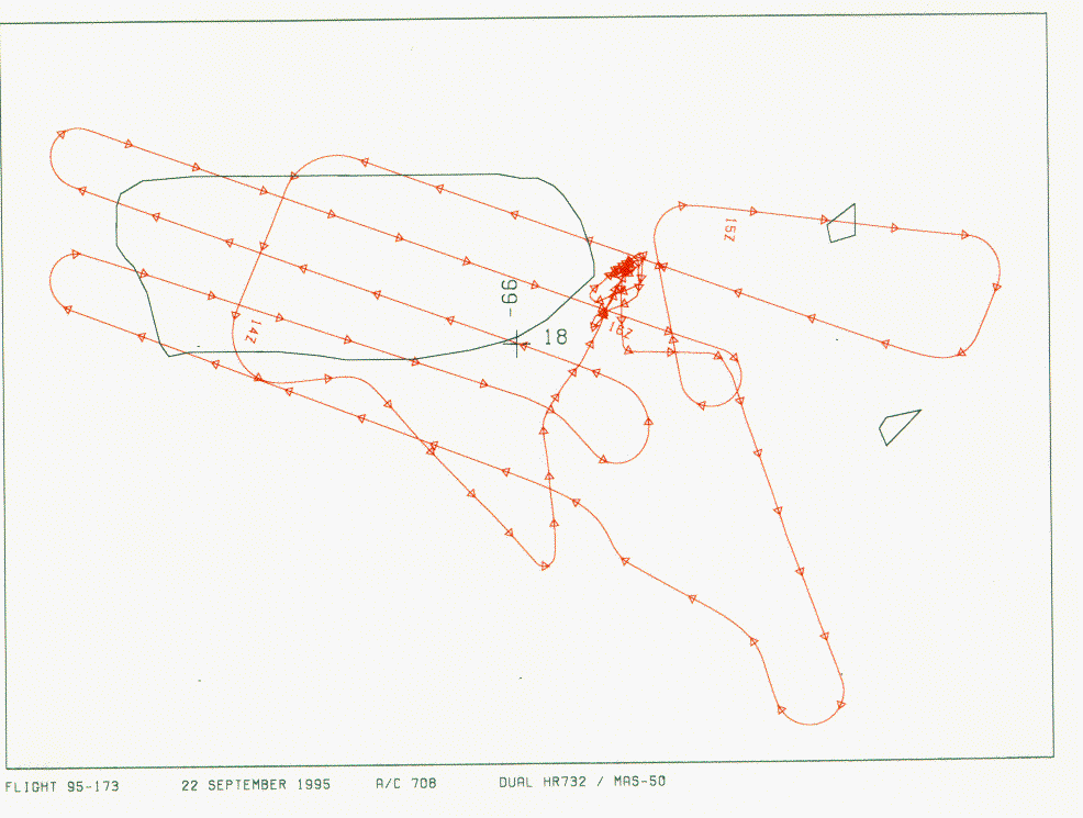
Flight Track Map


|
Level-1B Browse Imagery
Straight Line Flight Tracks: 08
Scanlines Processed: 32366
Solar Azimuth and Zenith Angles
|
Browse Images
|
Click on the Flight Track number to load images.
Lat/Lon ranges are for the BEG-END scanline nadir pixels.
|
Flight
Track |
Time_Span
(GMT) |
Heading
(Deg) |
Lat_Range
(Deg_N) |
Lon_Range
(Deg_W) |
Length
(Scanlines) |
Altitude
(Meters) |
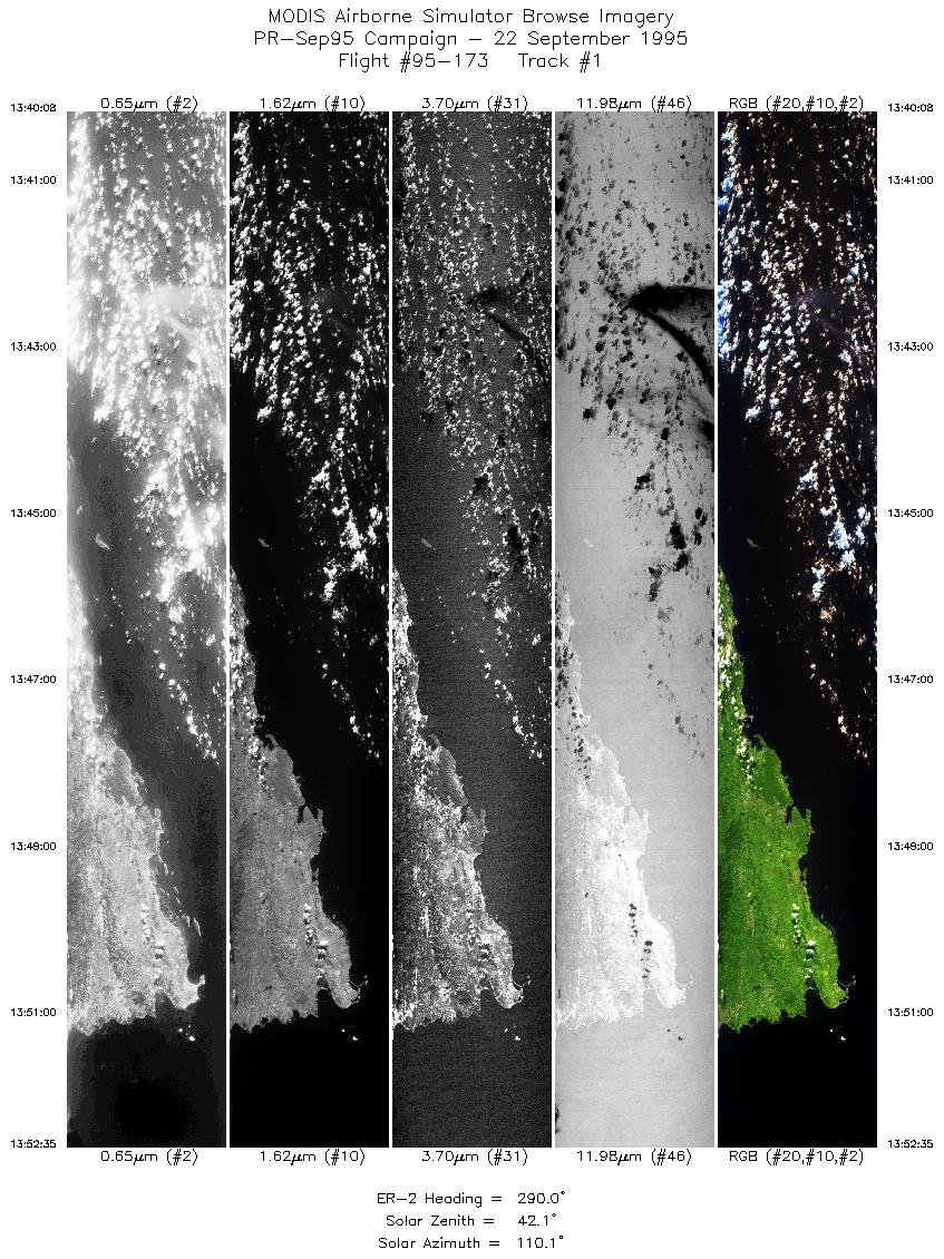
| 1 |
13:40-13:52 |
290 |
17.59-18.11 |
65.96-67.38 |
4653 |
~20000 |
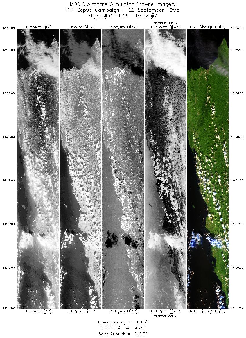
| 2 |
13:55-14:07 |
108 |
18.28-17.84 |
67.35-65.98 |
4816 |
~20000 |
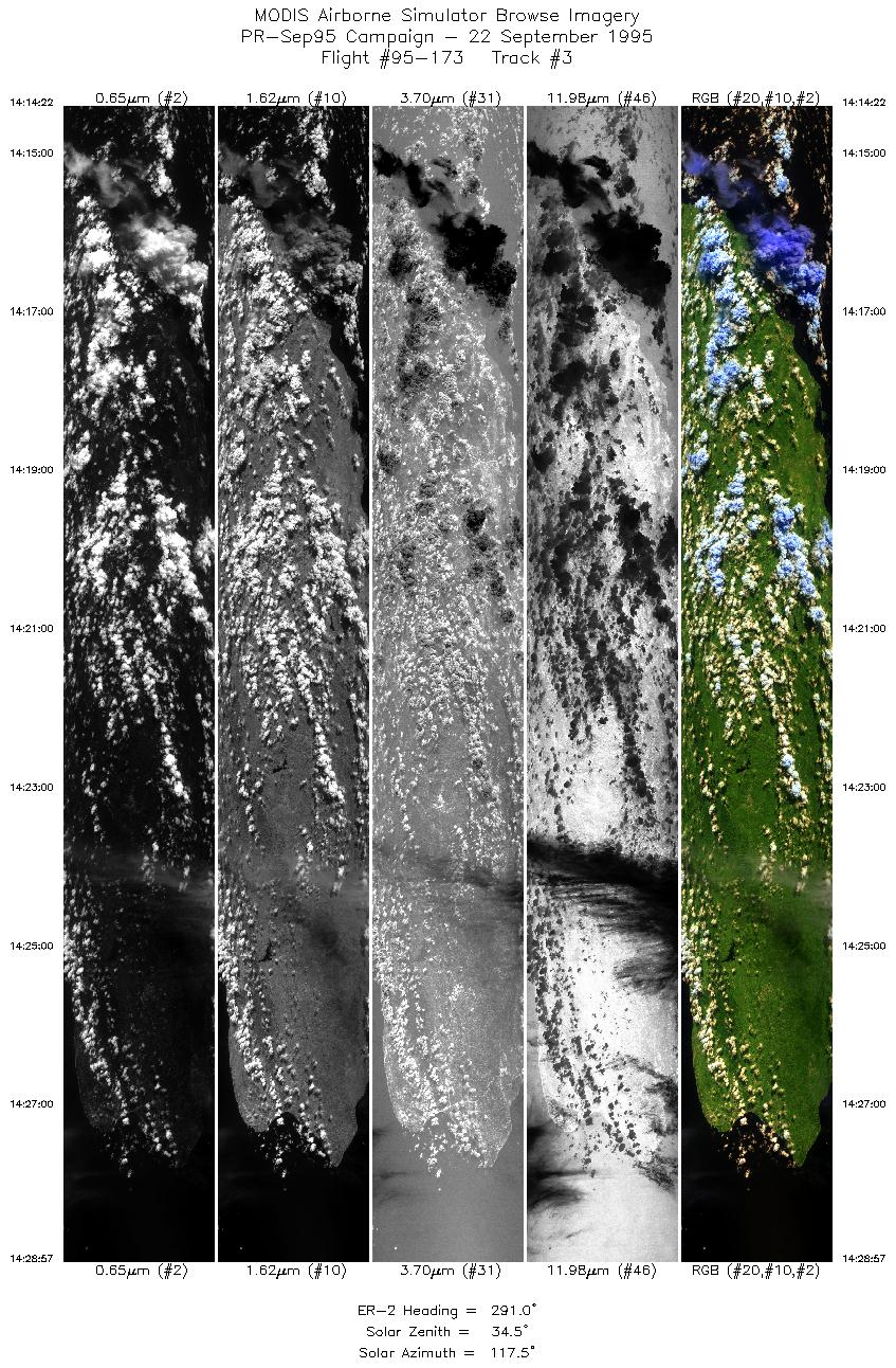
| 3 |
14:14-14:28 |
291 |
17.90-18.48 |
65.70-67.38 |
5462 |
~20000 |
| 4 |
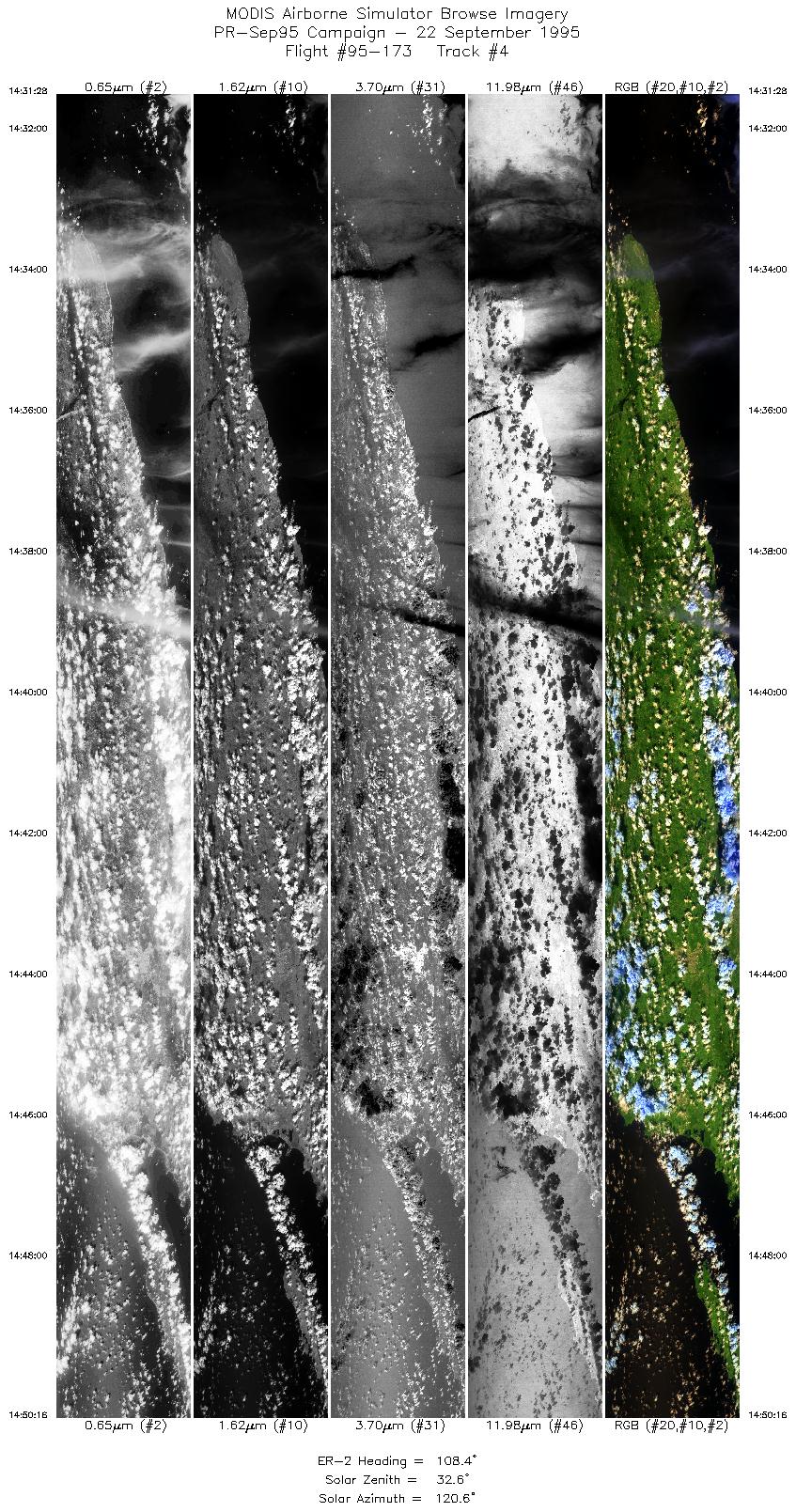
14:31-14:50 |
108 |
18.65-17.98 |
67.35-65.36 |
7045 |
~20000 |
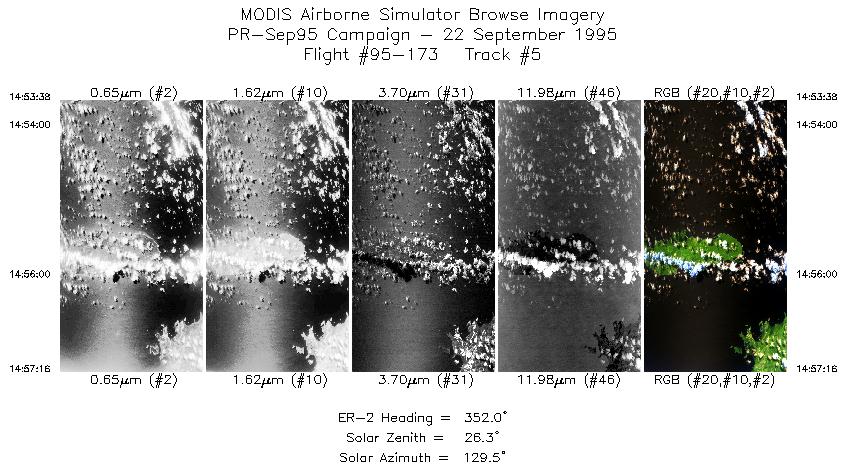
| 5 |
14:53-14:57 |
352 |
17.88-18.29 |
65.49-65.56 |
1362 |
~20000 |
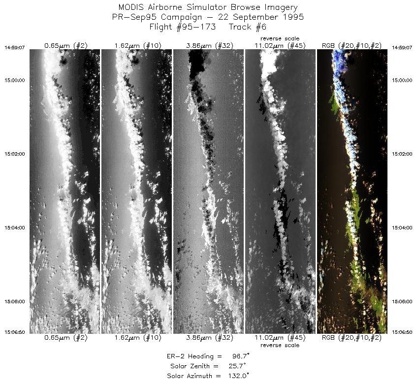
| 6 |
14:59-15:06 |
97 |
18.41-18.30 |
65.43-64.58 |
2892 |
~20000 |
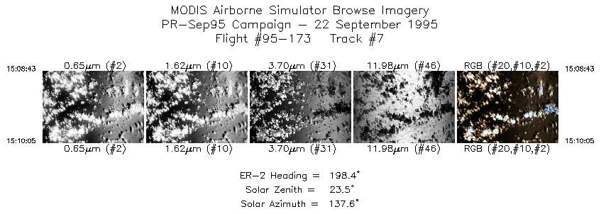
| 7 |
15:08-15:10 |
198 |
18.15-18.01 |
64.49-64.55 |
513 |
~20000 |
| 8 |
15:11-15:26 |
290 |
17.95-18.56 |
64.74-66.49 |
5623 |
~20000 |
|
Images 01 through 08 in sequence |
Data Evalutation
Data quality is nominal.
Spectral Summary
Spectral Band Configuration
Spectral Response Files
Level-1B Data Distribution
NASA Goddard Space Flight Center DAAC
Related Web Sites
Airborne Sensors Facility Page
NASA ER-2 Aircraft Program
|
|
