
|
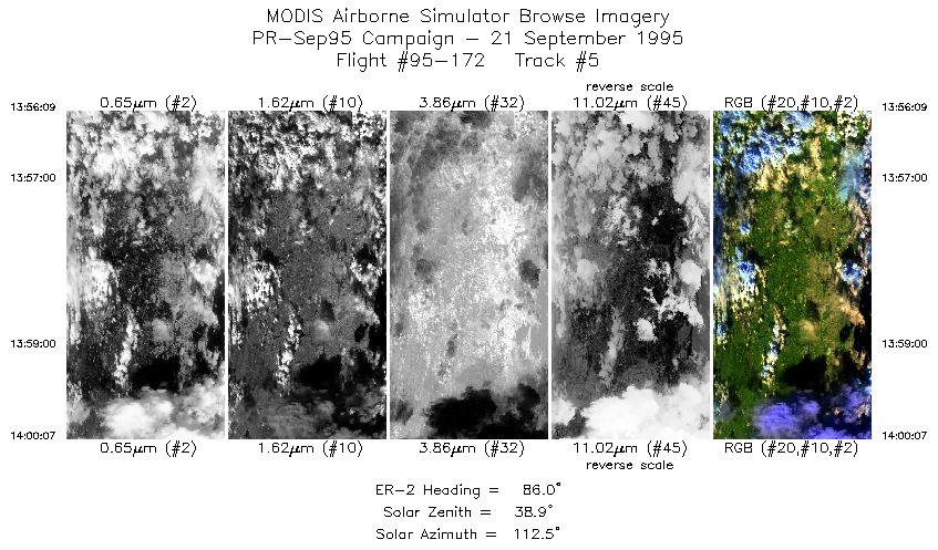
Sample Image

21 Sept 1995
Track #05
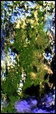

Overflight of the north coast of Puerto Rico, ending just east of San Juan. North is to the right.
R: 2.14 microns
G: 1.62 microns
B: 0.55 microns
|
|
Mission Summary
Date: September 21, 1995
ER-2 Flight Number: 95-172
Deployment: Puerto Rico-Sep95
Flight Location: Puerto Rico and Saint Croix
Principal Investigator: Dr. Armond Joyce (SSC)
Additional Sensors: Dual 24" HR732 (NC and CIR)
Objective: Data used to study land/sea interactions in Puerto Rico and the Southeastern United States.
Level-1B Processing Information
Level-1B Data processed by: Ames Research Center
evel-1B Data Version: #09
Level-1B Configuration: (sample file)
Calibration Type: Final
Calibration Version: 1.0
Temperature Adjustment: 24C
Status: Completed with final calibration
|
|
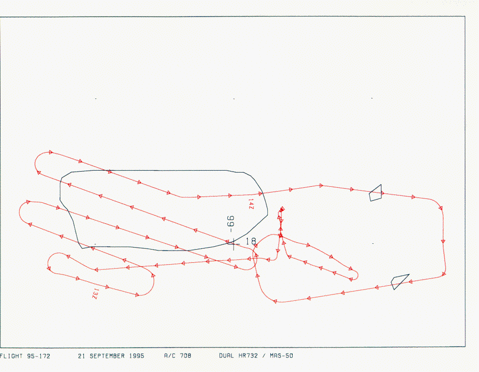
Flight Track Map


|
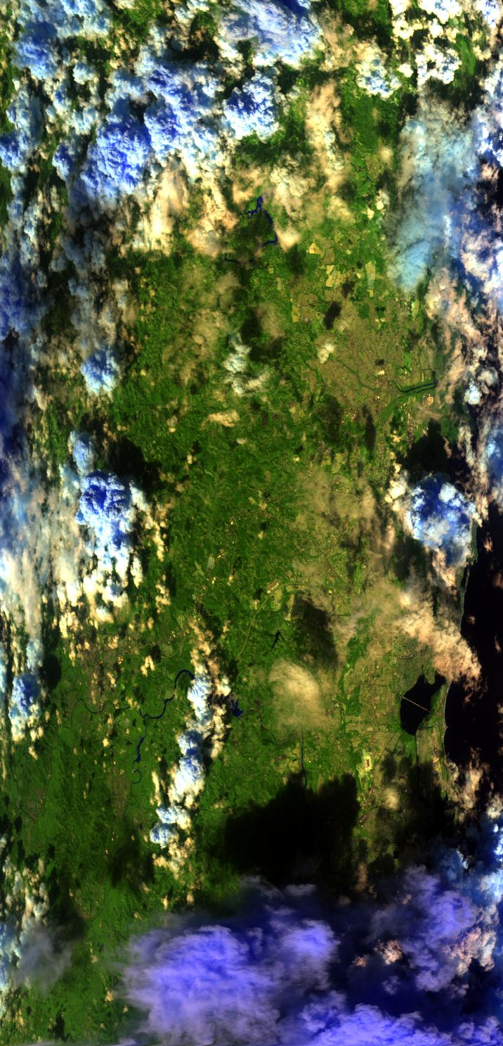
Level-1B Browse Imagery
Straight Line Flight Tracks: 09
Scanlines Processed: 23821
Solar Azimuth and Zenith Angles
|
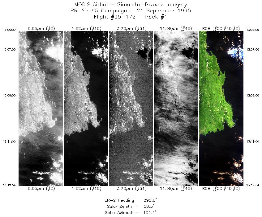
Browse Images
|
Click on the Flight Track number to load images.
Lat/Lon ranges are for the BEG-END scanline nadir pixels.
|
Flight
Track |
Time_Span
(GMT) |
Heading
(Deg) |
Lat_Range
(Deg_N) |
Lon_Range
(Deg_W) |
Length
(Scanlines) |
Altitude
(Meters) |
| 1 |
13:06-13:12 |
293 |
17.87-18.14 |
66.71-67.48 |
2523 |
~20000 |
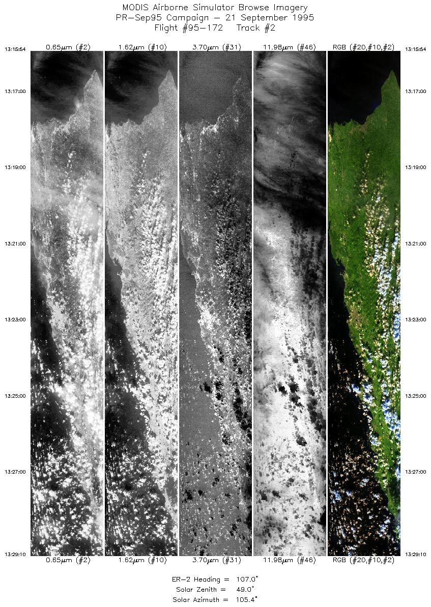
| 2 |
13:15-13:29 |
107 |
18.28-17.83 |
67.36-65.94 |
4964 |
~20000 |
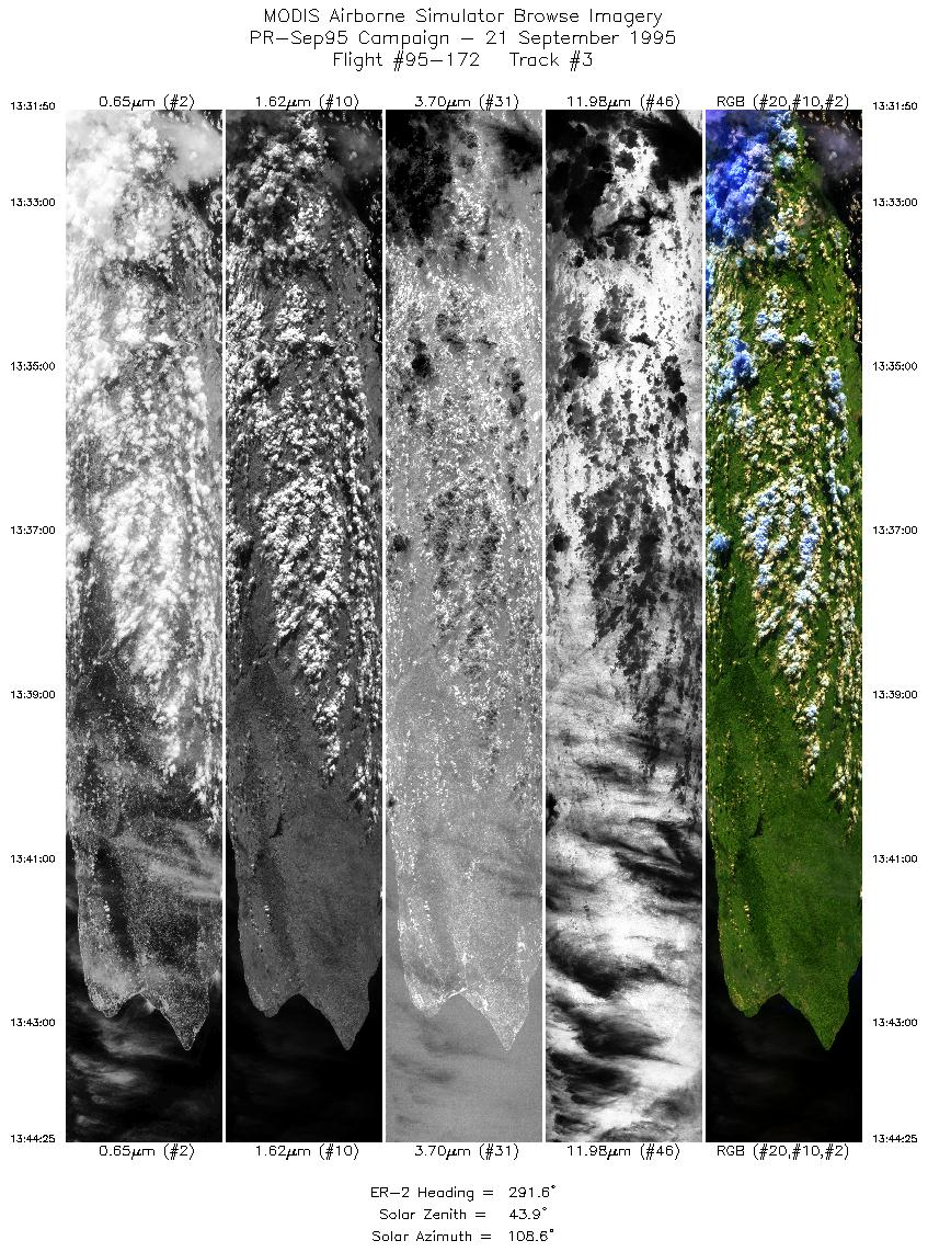
| 3 |
13:31-13:44 |
292 |
17.98-18.48 |
65.94-67.37 |
4713 |
~20000 |
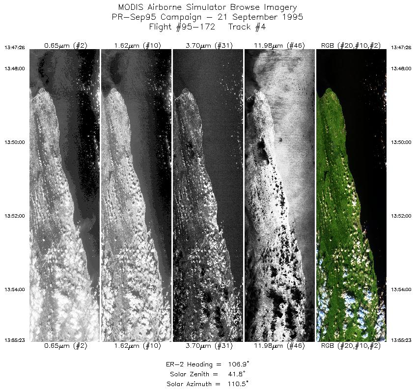
| 4 |
13:47-13:55 |
107 |
18.62-18.33 |
67.25-66.40 |
2980 |
~20000 |
| 5 |
13:56-14:00 |
86 |
18.32-18.34 |
66.32-65.88 |
1487 |
~20000 |
| 6 |
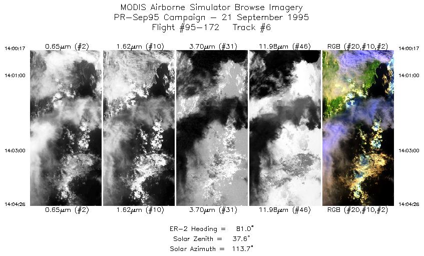
14:00-14:04 |
81 |
18.34-18.40 |
65.86-65.40 |
1556 |
~20000 |
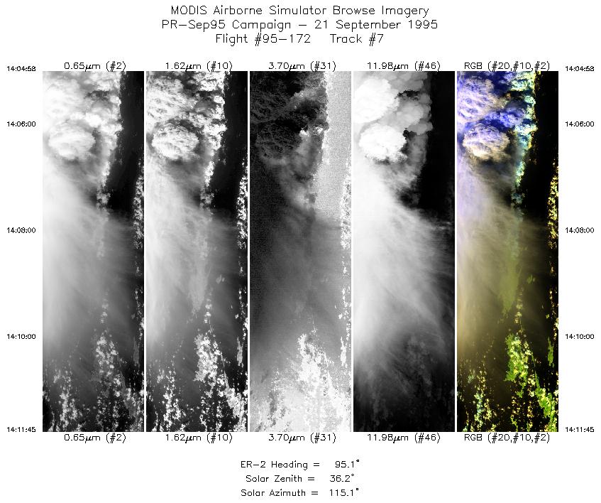
| 7 |
14:04-14:11 |
95 |
18.40-18.30 |
65.35-64.60 |
2542 |
~20000 |
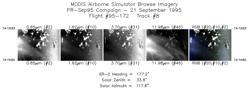
| 8 |
14:13-14:14 |
177 |
18.17-18.00 |
64.49-64.49 |
544 |
~20000 |
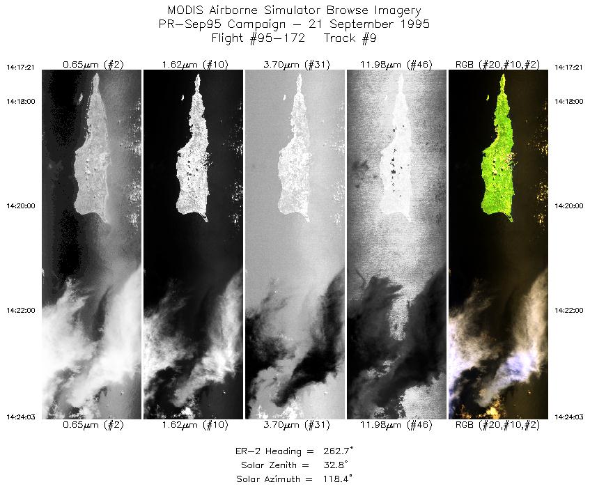
| 9 |
14:17-14:24 |
263 |
17.76-17.64 |
64.55-65.37 |
2512 |
~20000 |
|
Images 01 through 09 in sequence |
Data Evalutation
Data quality is nominal.
Spectral Summary
Spectral Band Configuration
Spectral Response Files
Level-1B Data Distribution
NASA Goddard Space Flight Center DAAC
Related Web Sites
Airborne Sensors Facility Page
NASA ER-2 Aircraft Program
|
|