
|
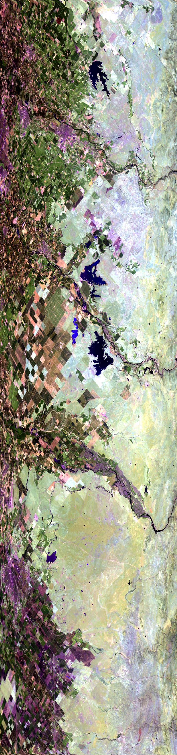
Sample Image

10 Aug 1995
Track #09
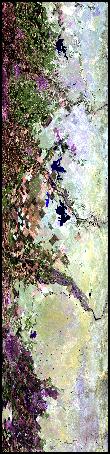

Flightline moving to the southeast through the San Joaquin Valley. Begins over Woodward Reservoir, north of Modesto, then proceeds over the Dallas-Warner Reservoir, Toulumne River, and Turlock Lake. Ends south of the Merced River.
R: 2.14 microns
G: 1.62 microns
B: 0.55 microns
|
|
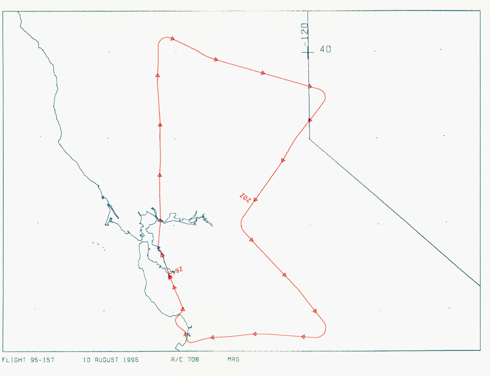
Mission Summary
Date: August 10, 1995
ER-2 Flight Number: 95-157
Deployment: ARC-Aug95
Flight Location: Northern California
Principal Investigator: Ames Research Center
Additional Sensors: CLS, VIS
Objective: Functional Check Flight
Level-1B Processing Information
Level-1B Data processed by: Ames Research Center
Level-1B Data Version: #09
Level-1B Configuration: (sample file)
Calibration Type: Final
Calibration Version: 1.0
Temperature Adjustment: 24C
Status: Completed with final calibration
|
|
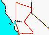
Flight Track Map

|
Level-1B Browse Imagery
Straight Line Flight Tracks: 11
Scanlines Processed: 18457
Solar Azimuth and Zenith Angles
|
Browse Images
|
Click on the Flight Track number to load images.
Lat/Lon ranges are for the BEG-END scanline nadir pixels.
|
Flight
Track |
Time_Span
(GMT) |
Heading
(Deg) |
Lat_Range
(Deg_N) |
Lon_Range
(Deg_W) |
Length
(Scanlines) |
Altitude
(Meters) |
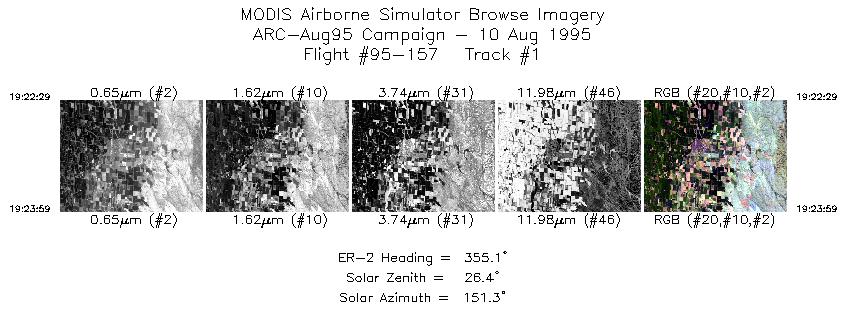
| 1 |
19:22-19:23 |
355 |
39.45-39.62 |
122.24-122.26 |
560 |
~20000 |
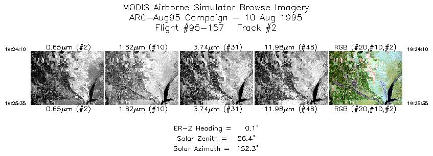
| 2 |
19:24-19:25 |
0 |
39.64-39.81 |
122.26-122.26 |
530 |
~20000 |
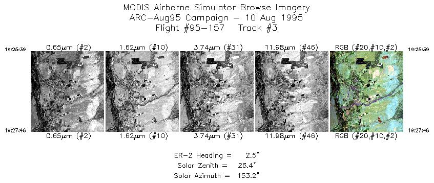
| 3 |
19:25-19:27 |
3 |
39.82-40.06 |
122.25-122.25 |
792 |
~20000 |
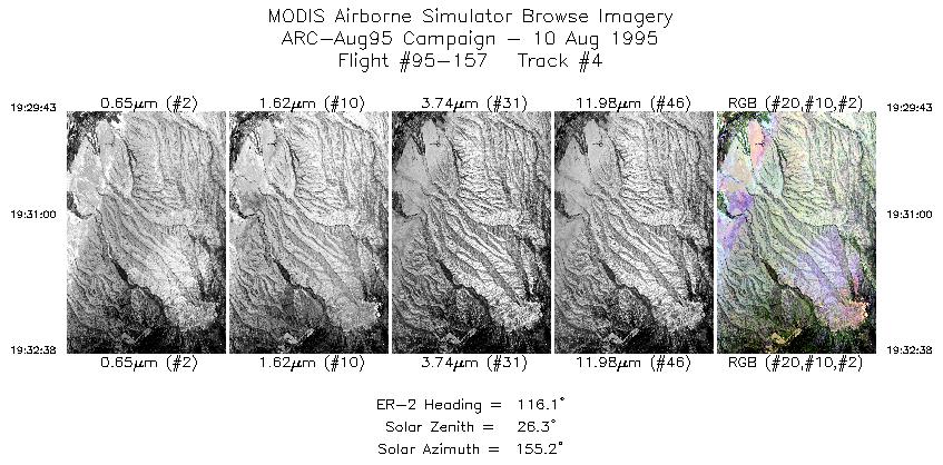
| 4 |
19:29-19:32 |
116 |
40.17-40.02 |
122.06-121.68 |
1090 |
~20000 |
| 5 |
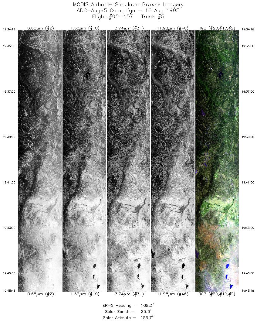
19:34-19:45 |
108 |
39.94-39.57 |
121.47-119.84 |
4301 |
~20000 |
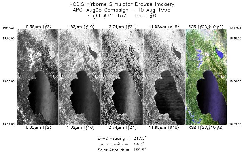
| 6 |
19:47-19:52 |
217 |
39.42-39.02 |
119.78-120.18 |
1678 |
~20000 |
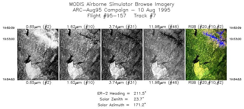
| 7 |
19:52-19:54 |
212 |
38.98-38.74 |
120.22-120.40 |
899 |
~20000 |
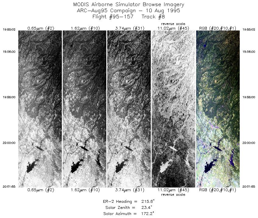
| 8 |
19:55-20:01 |
216 |
38.73-38.10 |
120.41-120.98 |
2577 |
~20000 |
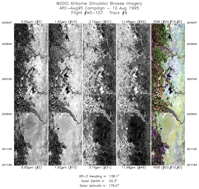
| 9 |
20:03-20:11 |
138 |
37.91-37.25 |
120.95-120.17 |
3039 |
~20000 |
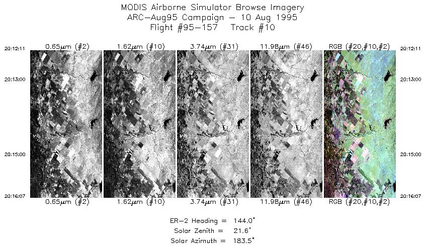
| 10 |
20:12-20:16 |
144 |
37.23-36.88 |
120.15-119.82 |
1473 |
~20000 |
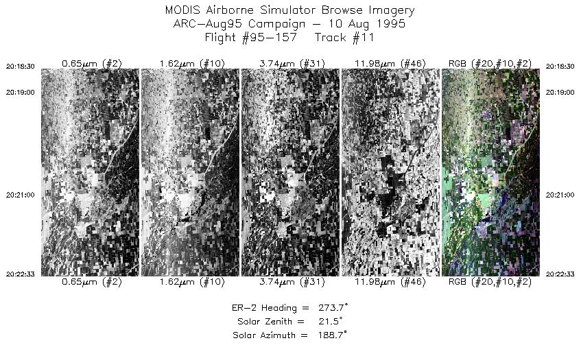
| 11 |
20:18-20:22 |
274 |
36.70-36.74 |
119.94-120.51 |
1518 |
~20000 |
|
Images 01 through 11 in sequence |
Data Evalutation
Some smearing at start of flightline in some tracks. Otherwise data quality
is excellent.
Spectral Summary
Spectral Band Configuration
Spectral Response Files
Level-1B Data Distribution
NASA Goddard Space Flight Center DAAC
Related Web Sites
Cloud Lidar System (CLS)
Airborne Sensors Facility Page
NASA ER-2 Aircraft Program
|
|