
|
Sample Image

21 June 1995
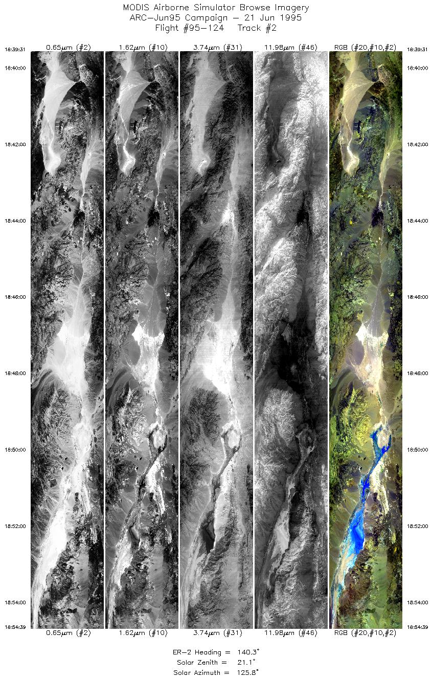
Track 02
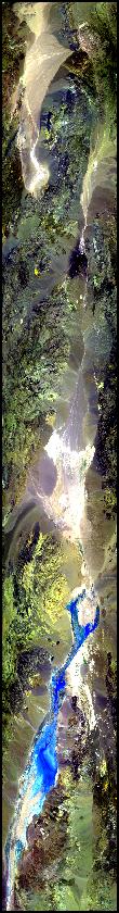

The fight track begins over a large alluvial fan in the Eureka Valley. Continues over the Last Chance Range into Salt Creek wash and Salt Creek Lake, the heart of Death Valley. The Panamint Range is to the left (west) and the Amargosa Range is to the right (east).
R: 2.14 microns
G: 1.62 microns
B: 0.55 microns
|
|
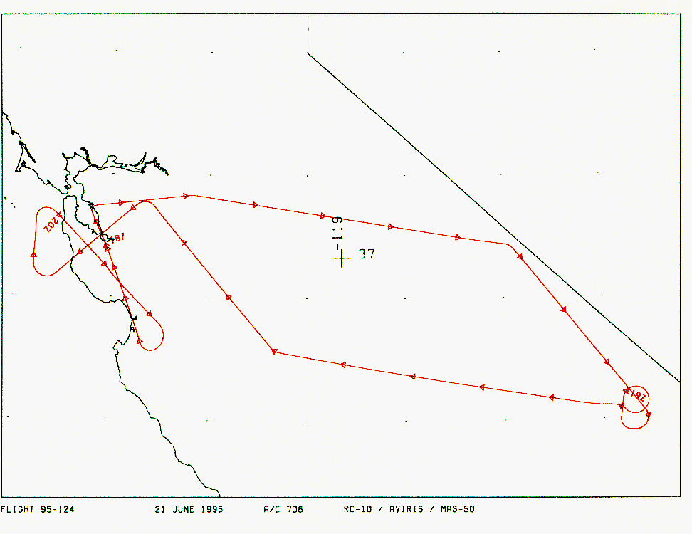
Mission Summary
Date: June 21, 1995
ER-2 Flight Number: 95-124
Deployment: ARC-Jun95
Flight Location: Death Valley and Jasper Ridge, California
Principal Investigators: Dr. Fred Kruse (AIG), Dr. Susan Ustin (UCD)
Additional Sensors: 12" RC-10 (CIR), AVIRIS
Objective: Support Shuttle Imaging Radar in developing data sets for lithographic mapping (Kruse). Data used to better understand biospheric-atmospheric interactions (Ustin).
Level-1B Processing Information
Level-1B Data processed by: Ames Research Center
Level-1B Data Version: #09
Level-1B Configuration: (sample file)
Calibration Type: Final
Calibration Version: 1.0
Temperature Adjustment: 35C
Status: Completed with final calibration
|
|
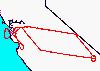
Flight Track Map

|
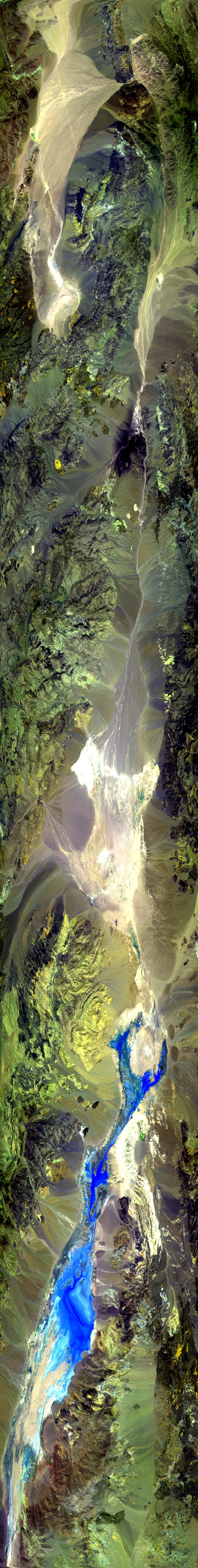
Level-1B Browse Imagery
Straight Line Flight Tracks: 8
Scanlines Processed: 30747
Solar Azimuth and Zenith Angles
|
Browse Images
|
Click on the Flight Track number to load images.
Lat/Lon ranges are for the BEG-END scanline nadir pixels.
|
Flight
Track |
Time_Span
(GMT) |
Heading
(Deg) |
Lat_Range
(Deg_N) |
Lon_Range
(Deg_W) |
Length
(Scanlines) |
Altitude
(Meters) |
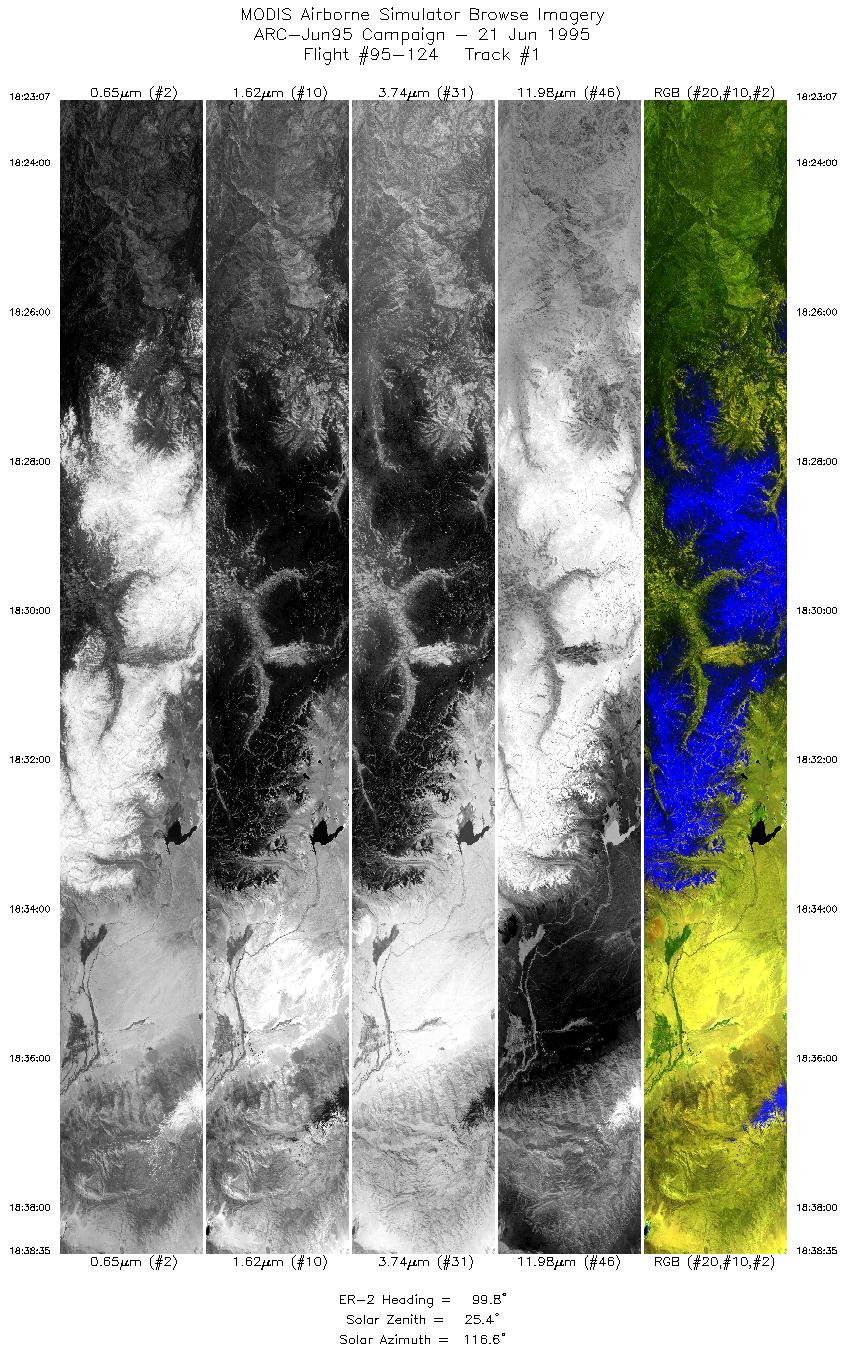
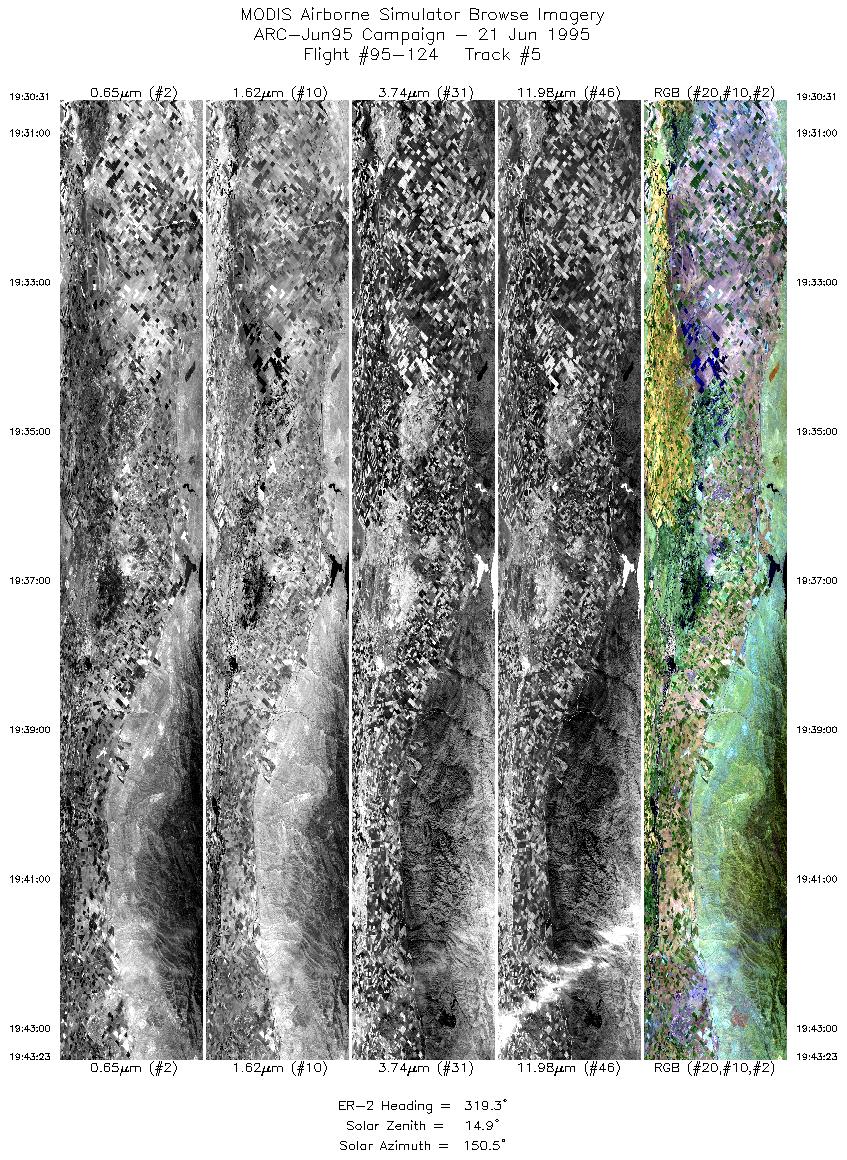
| 1 |
18:23-18:38 |
100 |
37.71-37.43 |
120.12-117.98 |
5771 |
~20000 |
| 2 |
18:39-18:54 |
140 |
37.38-36.06 |
117.86-116.57 |
5648 |
~20000 |
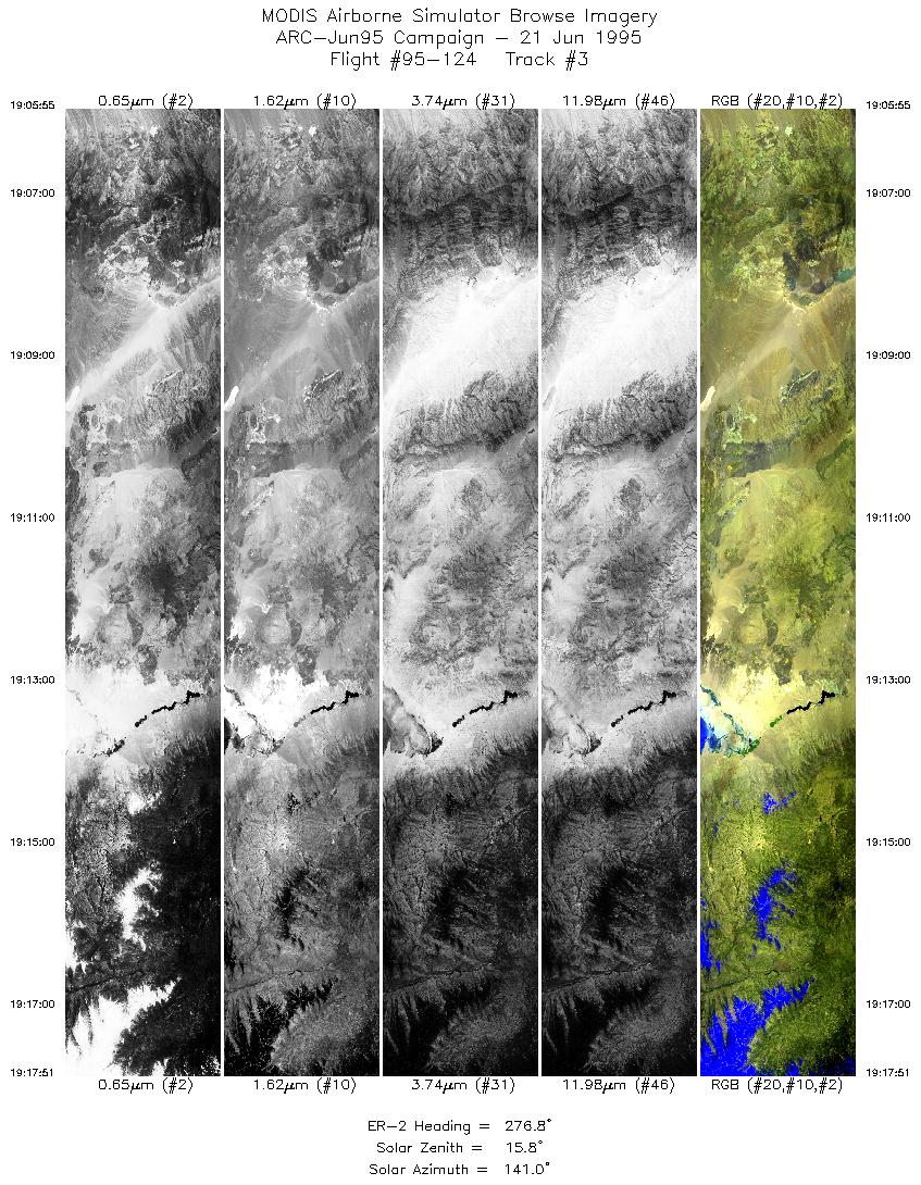
| 3 |
19:05-19:17 |
277 |
36.10-36.32 |
116.92-118.59 |
4454 |
~20000 |
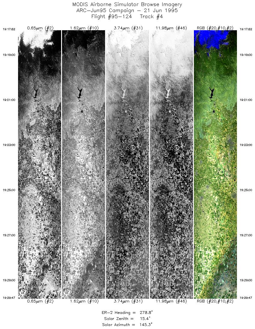
| 4 |
19:17-19:29 |
279 |
36.32-36.56 |
118.59-120.26 |
4447 |
~20000 |
| 5 |
19:30-19:43 |
319 |
36.60-37.73 |
120.36-121.56 |
4802 |
~20000 |
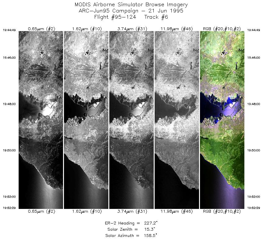
| 6 |
19:44-19:52 |
227 |
37.75-37.18 |
121.74-122.56 |
2862 |
~20000 |
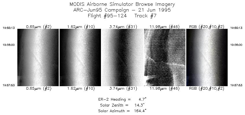
| 7 |
19:55-19:57 |
5 |
37.32-37.62 |
122.79-122.77 |
996 |
~20000 |
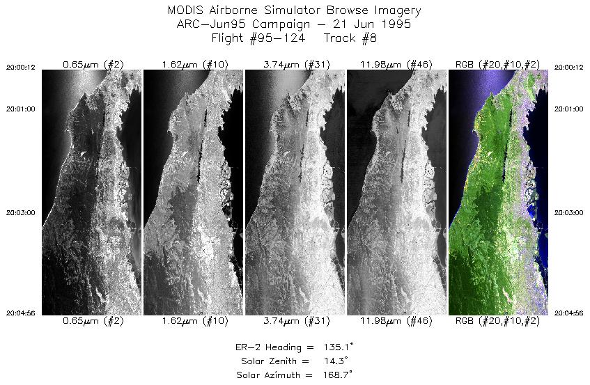
| 8 |
20:00-20:04 |
135 |
37.65-37.28 |
122.53-122.08 |
1767 |
~20000 |
|
Images 01 through 08 in sequence |
Data Evalutation
Data quality is nominal.
Spectral Summary
Spectral Band Configuration
Spectral Response Files
Level-1B Data Distribution
NASA Goddard Space Flight Center DAAC
Related Web Sites
JPL AVIRIS Web Page
Airborne Sensors Facility Page
NASA ER-2 Aircraft Program
|
|