
|
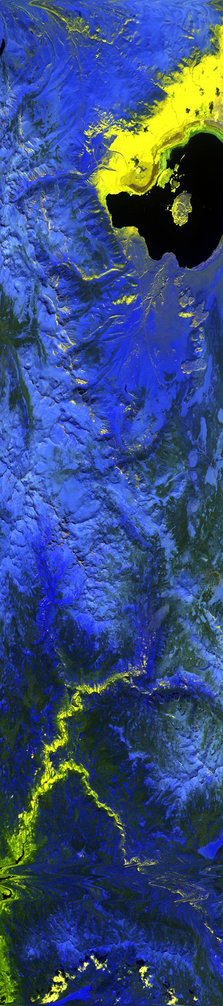
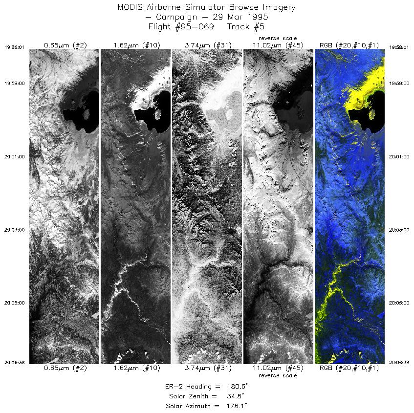
Sample Image

29 March 1995
Track #05


Snow covered peaks of the Sierra Nevada surrounding Mono Basin. North is toward the top of the image.
R: 2.14 microns
G: 1.62 microns
B: 0.55 microns
|
|
Mission Summary
Date: March 29, 1995
ER-2 Flight Number: 95-069
Deployment: pre-ALASKA
Flight Location: Mammoth Mtn and Mono Lake, California
Principal Investigator: Dr. Zhengming Wan (UCSB)
Additional Sensors: 6" RC-10 (BW), MIR
Objective: Validation of an algorithim used to calculate land surface temperatures and emissivity based on thermal infrared data.
Level-1B Processing Information
Level-1B Data processed by: Ames Research Center
Level-1B Data Version: #09
Level-1B Configuration: (sample file)
Calibration Type: Final
Calibration Version: 1.0
Temperature Adjustment: 36C
Status: Completed with final calibration
|
|
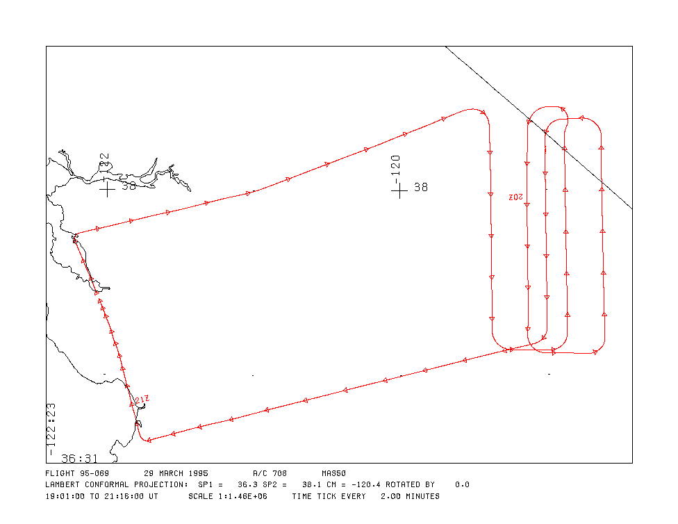
Flight Track Map

|
Level-1B Browse Imagery
Straight Line Flight Tracks: 9
Scanlines Processed: 22832
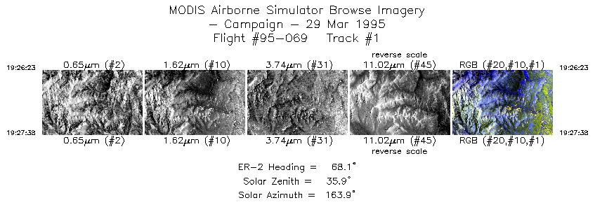
Solar Azimuth and Zenith Angles
|
Browse Images
|
Click on the Flight Track number to load images.
Lat/Lon ranges are for the BEG-END scanline nadir pixels.
|
Flight
Track |
Time_Span
(GMT) |
Heading
(Deg) |
Lat_Range
(Deg_N) |
Lon_Range
(Deg_W) |
Length
(Scanlines) |
Altitude
(Meters) |
| 1 |
19:26-19:27 |
68 |
38.37-38.43 |
119.75-119.58 |
467 |
~20000 |
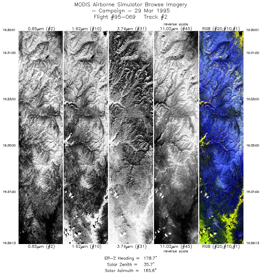
| 2 |
19:30-19:39 |
179 |
38.29-37.25 |
119.38-119.38 |
3443 |
~20000 |
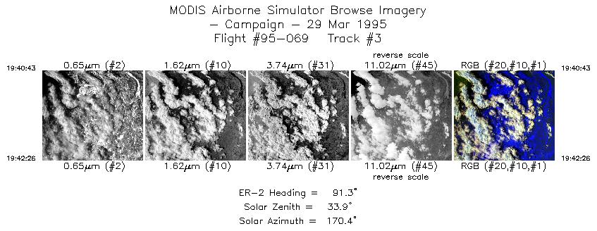
| 3 |
19:40-19:42 |
91 |
37.14-37.13 |
119.24-119.00 |
643 |
~20000 |
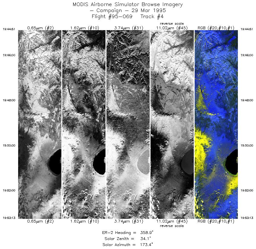
| 4 |
19:44-19:53 |
359 |
37.34-38.29 |
118.87-118.87 |
3134 |
~20000 |
| 5 |
19:58-20:06 |
181 |
38.20-37.23 |
119.13-119.13 |
3227 |
~20000 |
| 6 |
20:08-20:09 |
90 |
37.12-37.11 |
119.01-118.74 |
701 |
~20000 |
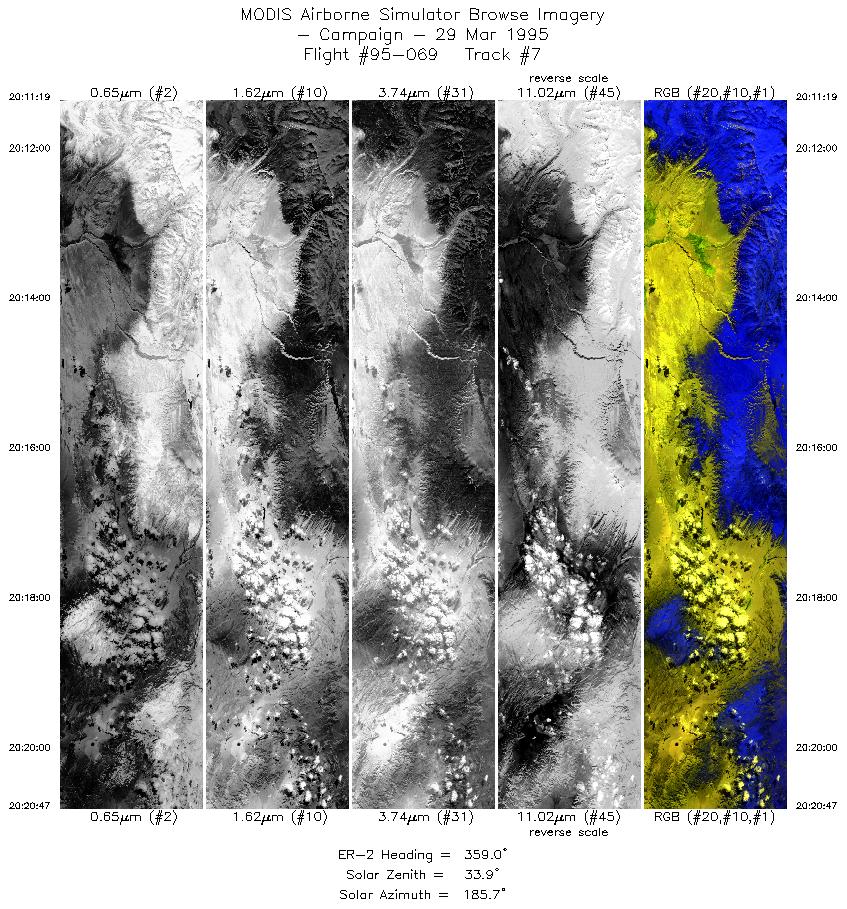
| 7 |
20:11-20:20 |
359 |
37.19-38.27 |
118.61-118.61 |
3547 |
~20000 |
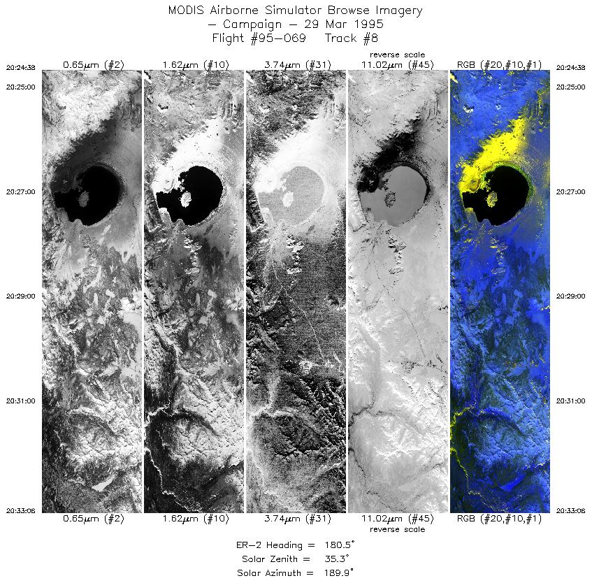
| 8 |
20:24-20:33 |
180 |
38.28-37.32 |
119.00-119.00 |
3173 |
~20000 |
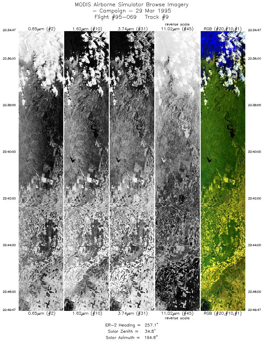
| 9 |
20:34-20:46 |
257 |
37.17-36.85 |
119.10-120.73 |
4497 |
~20000 |
|
Images 01 through 09 in sequence |
Data Evalutation
Small number of bad scanlines, otherwise data quality
is nominal.
Spectral Summary
Spectral Band Configuration
Spectral Response Files
Level-1B Data Distribution
NASA Goddard Space Flight Center DAAC
Related Web Sites
Airborne Sensors Facility Page
NASA ER-2 Aircraft Program
|
|