WILDLAND FIRES
- Station Fire BAER (November 19, 2009)
- A post-burn mosaic of the 525 square mile fire that claimed the lives of two firefighters and destroyed hundreds of structures near Pasadena, California.
- Basin Complex Fire (July 8, 2008)
- This 162,000+ acre fire on the Central Coast of California burned for over a month and consumed 26 homes before firefighters were able to fully contain it.
- Poomacha Fire (October 28, 2007)
- This 49,500+ acre fire started on the La Jolla Indian Reservation near Palomar Mountain, quickly spreading south to join the Witch Fire.
- Poomacha Fire in 3D (October 28, 2007)
- A close-up of the main fire front draped over a three dimensional digital elevation model; the actively burning hot-spots are colored bright yellow.
- Zaca Fire BAER (September 8, 2007)
- The Ikhana re-acquired this fire once it had been fully contained for Burned Area Emergency Response planning purposes.
- Zaca Fire (August 16, 2007)
- This 240,000+ acre fire near Santa Barbara is the fourth-largest fire in California's history. Luckily the fire burned away from populated areas.
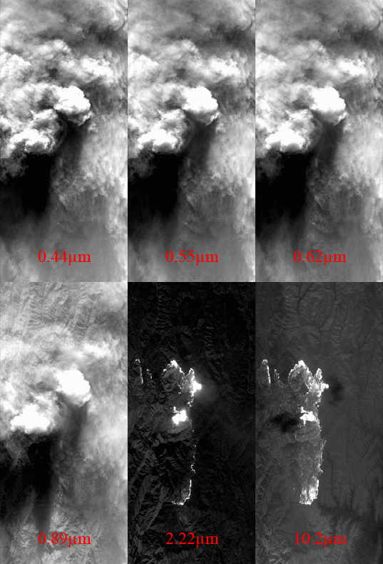
- Zaca Fire Visible (August 16, 2007)
- This image illustrates how smoke obscures the ground beneath the airplane in the visible portion of the electromagnetic spectrum.

Fire Imagery
| Zaca Fire |
|
Flight 07-042-00 Track #16 |

|
- NASA Official: Matt Fladeland
- Project Manager: James Jacobson
- Website Editor: Eric Fraim
- Last Updated: March 19, 2024


