Flight: 12-801-04
Date: 18 Oct 2011
Location: Central California
Deployment: WSFM 2011
Configuration: Land 2.5 (16-Channel)
Principal Investigators: Ambrosia (CSUMB)
Additional Sensors: None
|
Fire Coverage
Henry Coe
|
Data Evaluation
Overall quality is good
|
Processing Information
Level-1B Data in HDF format is available
Flight Line Summary
Spectral Band Configuration
Spectral Response Function Table
Spectral Response Function (text)
|
Browse Imagery
Flight Tracks: 27
Scanlines: 103174
|
Browse Imagery Table
|
Click a Flight Track number to view a quicklook image
Lat/Lon ranges are for the BEG-END scanline nadir pixels
|
Flight
Track |
Time Span
(GMT) |
Heading
(Deg) |
Lat Range
(Deg N) |
Lon Range
(Deg W) |
Length
(Scanlines) |
Altitude
(Meters) |
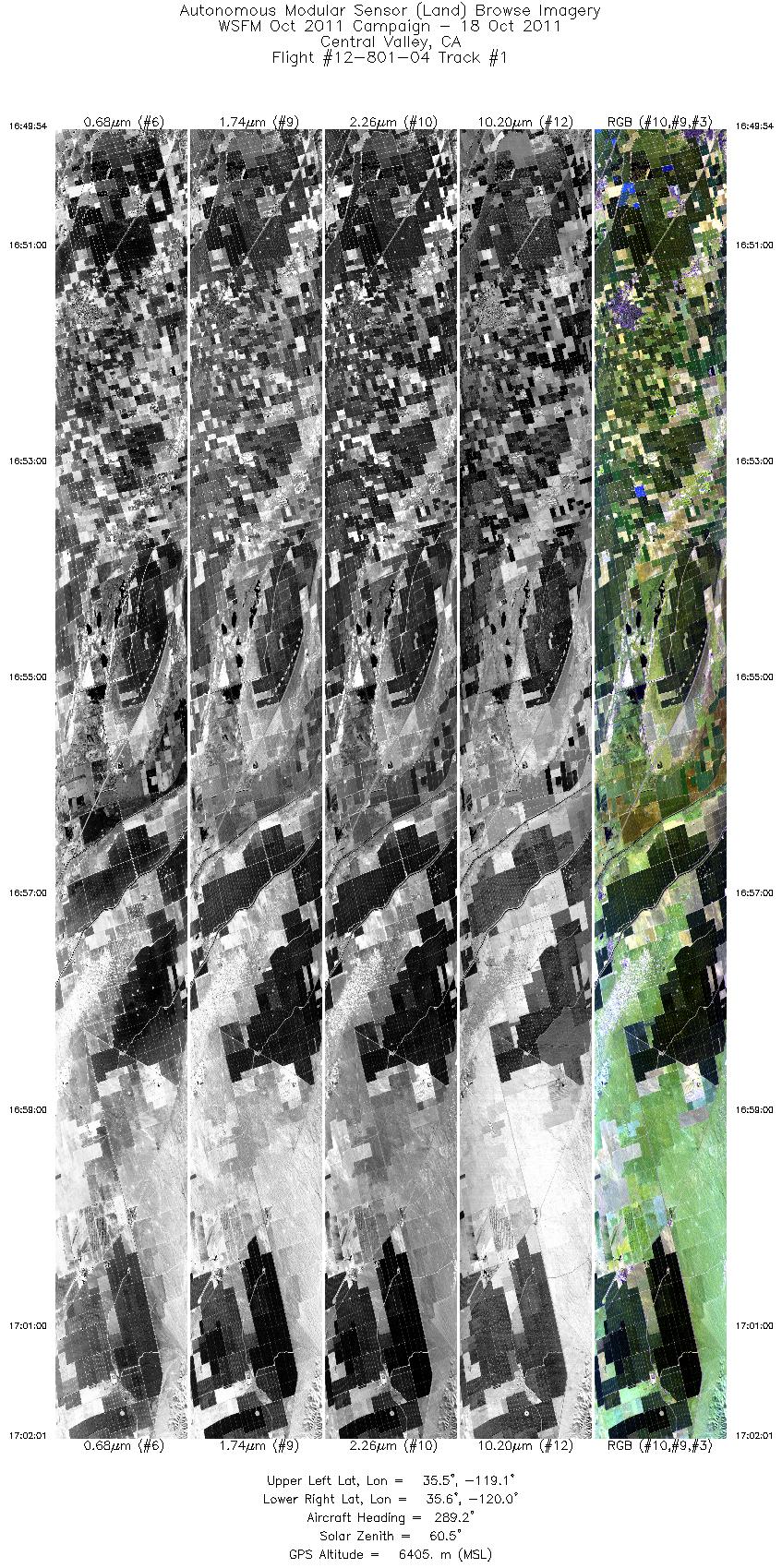
| 1 |
16:49 - 17:02 |
289.3 |
35.441 - 35.652 |
119.133 - 119.995 |
7096 |
6406 |
| 2 |
17:38 - 17:41 |
0.5 |
37.146 - 37.280 |
121.568 - 121.568 |
2192 |
4095 |
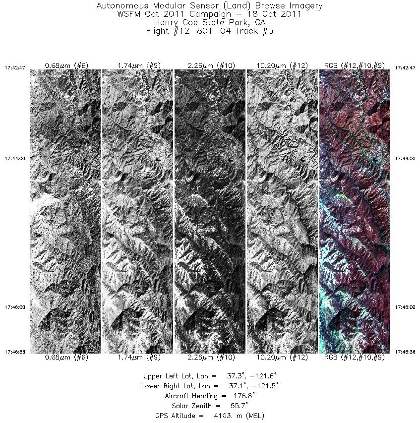
| 3 |
17:42 - 17:46 |
178.1 |
37.276 - 37.125 |
121.536 - 121.536 |
2868 |
4100 |
| 4 |
17:48 - 17:52 |
332.5 |
37.142 - 37.298 |
121.500 - 121.532 |
2926 |
4105 |
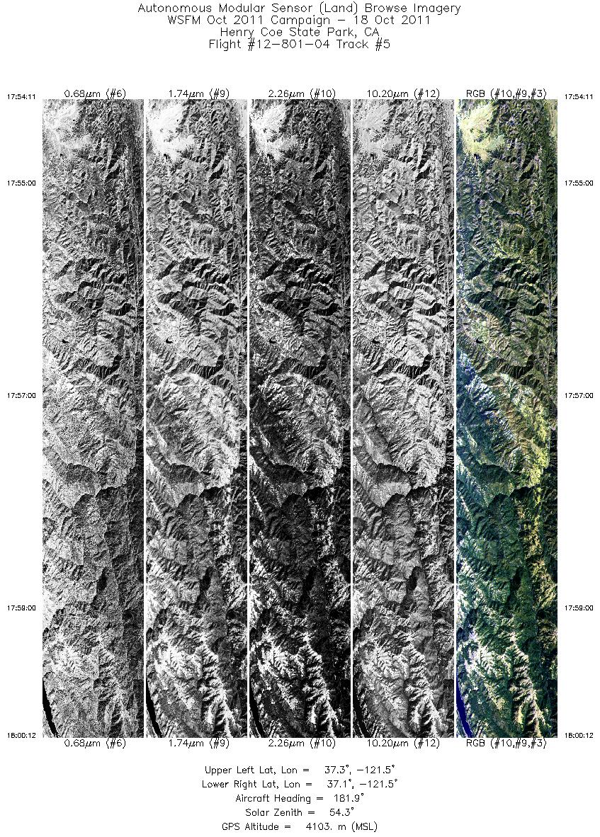
| 5 |
17:54 - 18:00 |
181.2 |
37.319 - 37.082 |
121.499 - 121.502 |
4514 |
4106 |
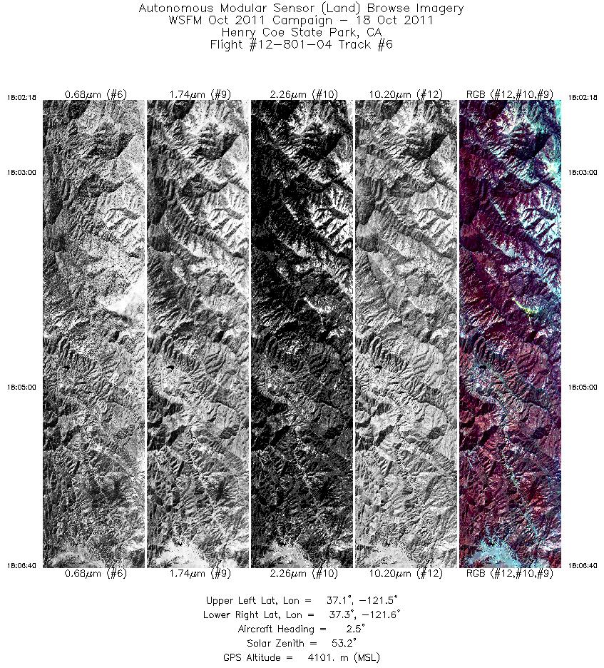
| 6 |
18:02 - 18:06 |
4.7 |
37.122 - 37.310 |
121.534 - 121.529 |
3281 |
4096 |
| 7 |
18:08 - 18:12 |
175.3 |
37.300 - 37.144 |
121.573 - 121.570 |
2807 |
4100 |
| 8 |
18:18 - 18:21 |
350.5 |
37.160 - 37.298 |
121.565 - 121.578 |
2330 |
4100 |
| 9 |
18:24 - 18:29 |
180.0 |
37.285 - 37.102 |
121.535 - 121.543 |
3464 |
4105 |
| 10 |
18:30 - 18:33 |
1.9 |
37.120 - 37.264 |
121.499 - 121.498 |
2419 |
4100 |
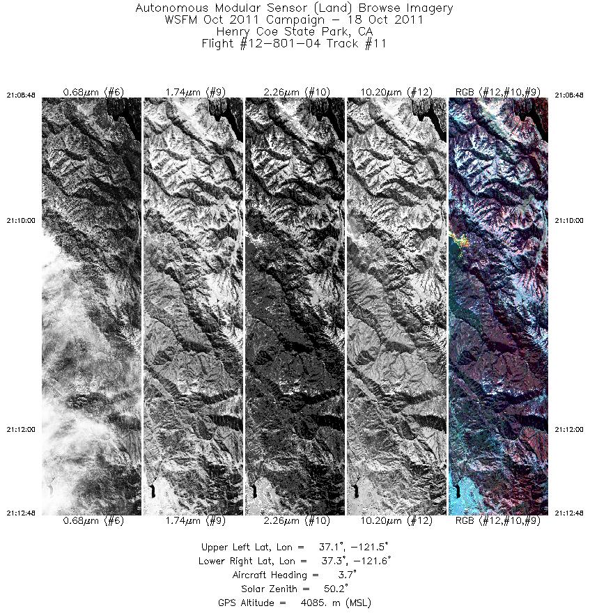
| 11 |
21:08 - 21:12 |
0.0 |
37.144 - 37.324 |
121.569 - 121.567 |
3000 |
4084 |
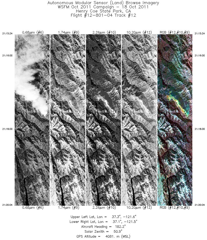
| 12 |
21:15 - 21:20 |
178.8 |
37.270 - 37.099 |
121.535 - 121.534 |
3501 |
4078 |
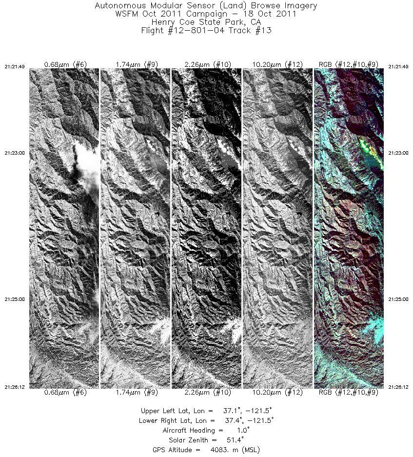
| 13 |
21:21 - 21:26 |
27.3 |
37.138 - 37.329 |
121.498 - 121.463 |
3287 |
4082 |
| 14 |
21:30 - 21:34 |
176.1 |
37.267 - 37.110 |
121.498 - 121.497 |
3116 |
4076 |
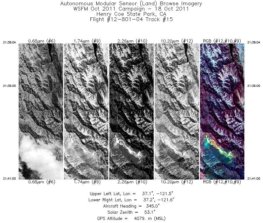
| 15 |
21:38 - 21:40 |
352.5 |
37.099 - 37.226 |
121.529 - 121.531 |
2196 |
4074 |
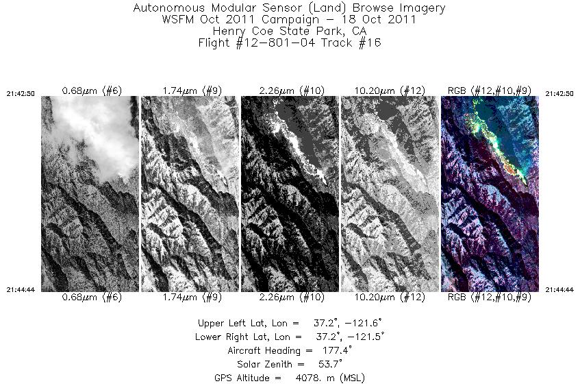
| 16 |
21:42 - 21:44 |
176.7 |
37.214 - 37.149 |
121.534 - 121.534 |
1432 |
4078 |
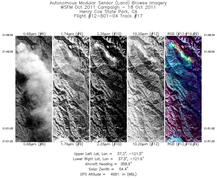
| 17 |
21:48 - 21:51 |
359.1 |
37.176 - 37.306 |
121.532 - 121.532 |
2076 |
4085 |
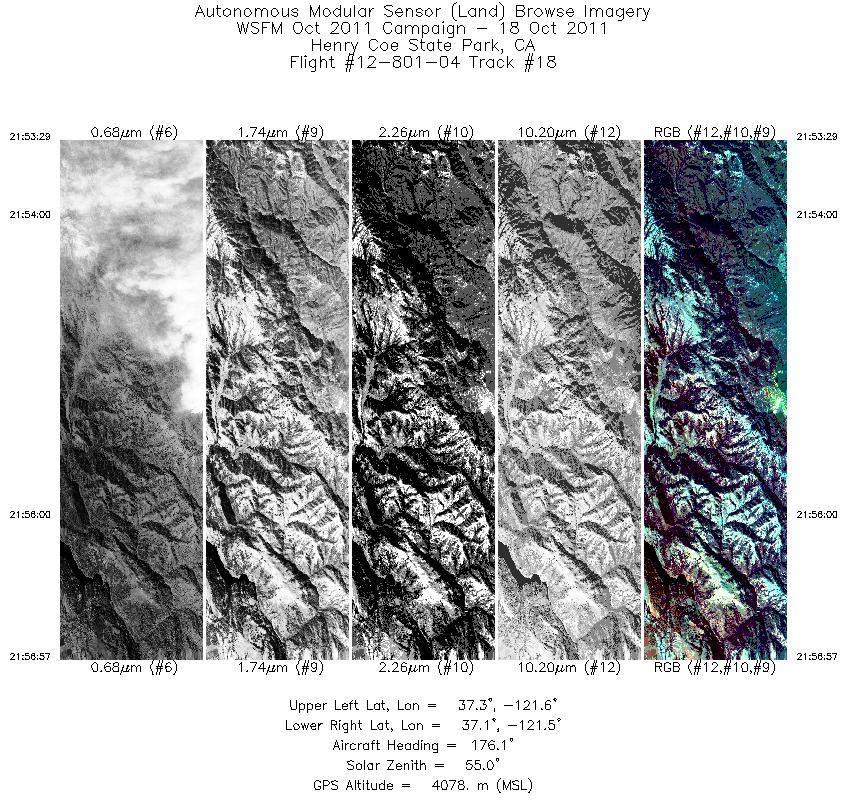
| 18 |
21:53 - 21:56 |
170.8 |
37.275 - 37.133 |
121.569 - 121.567 |
2603 |
4082 |
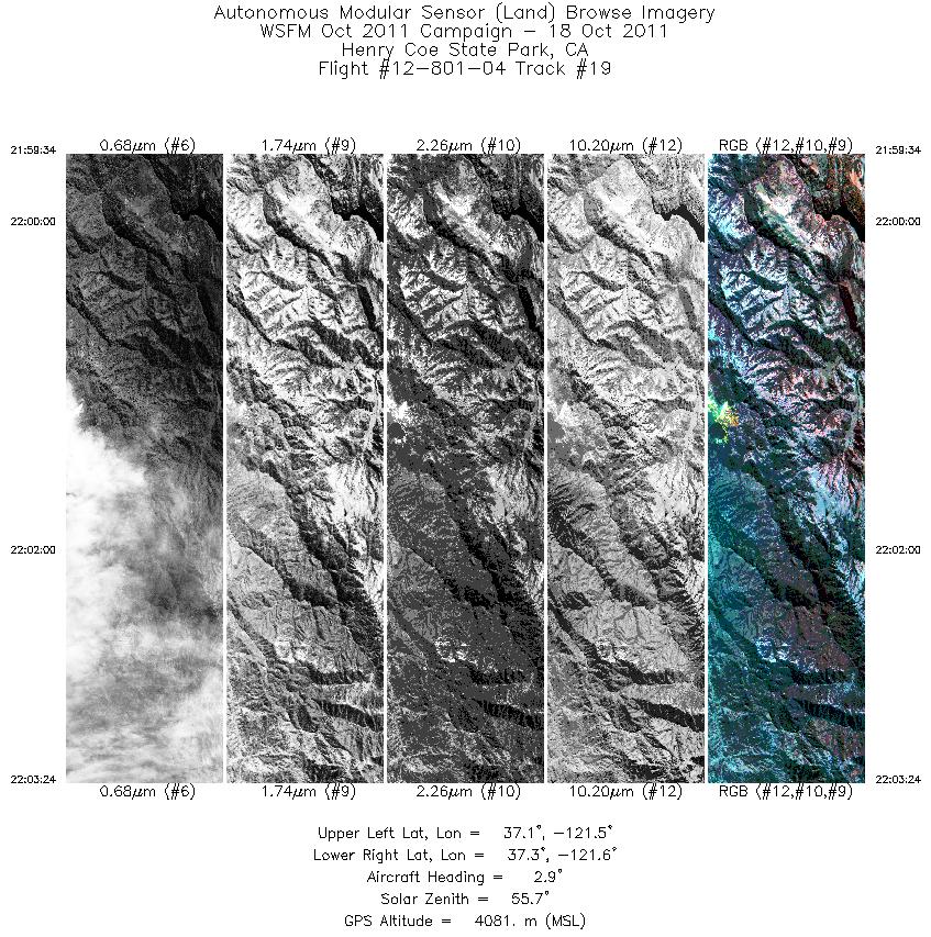
| 19 |
21:59 - 22:03 |
358.5 |
37.135 - 37.308 |
121.568 - 121.573 |
2869 |
4082 |
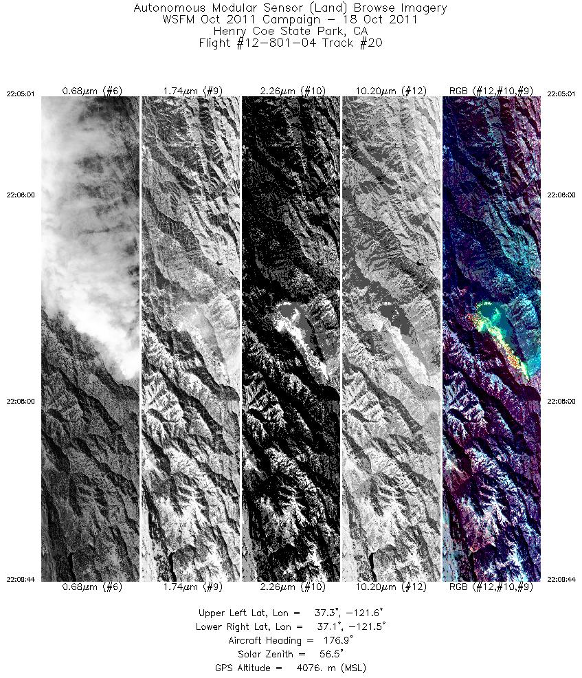
| 20 |
22:05 - 22:09 |
173.4 |
37.289 - 37.111 |
121.535 - 121.534 |
3534 |
4072 |
| 21 |
22:15 - 22:19 |
0.0 |
37.157 - 37.304 |
121.502 - 121.497 |
2435 |
4083 |
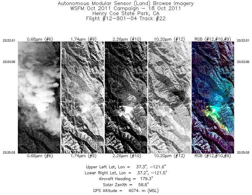
| 22 |
22:22 - 22:25 |
178.8 |
37.277 - 37.162 |
121.535 - 121.535 |
1892 |
4074 |
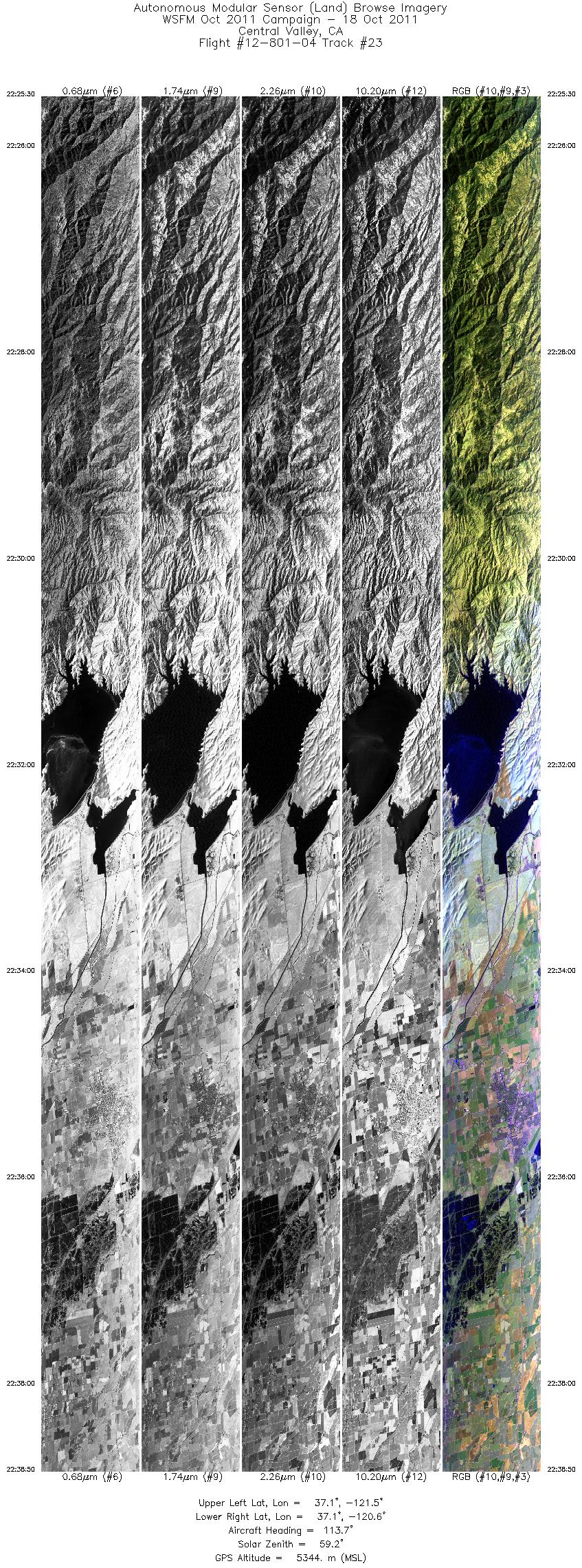
| 23 |
22:25 - 22:38 |
106.3 |
37.147 - 37.026 |
121.520 - 120.578 |
9999 |
4866 |
| 24 |
22:39 - 22:41 |
112.6 |
37.024 - 36.973 |
120.564 - 120.361 |
2172 |
5564 |
| 25 |
22:42 - 23:00 |
130.0 |
36.971 - 36.344 |
120.353 - 119.288 |
13653 |
5569 |
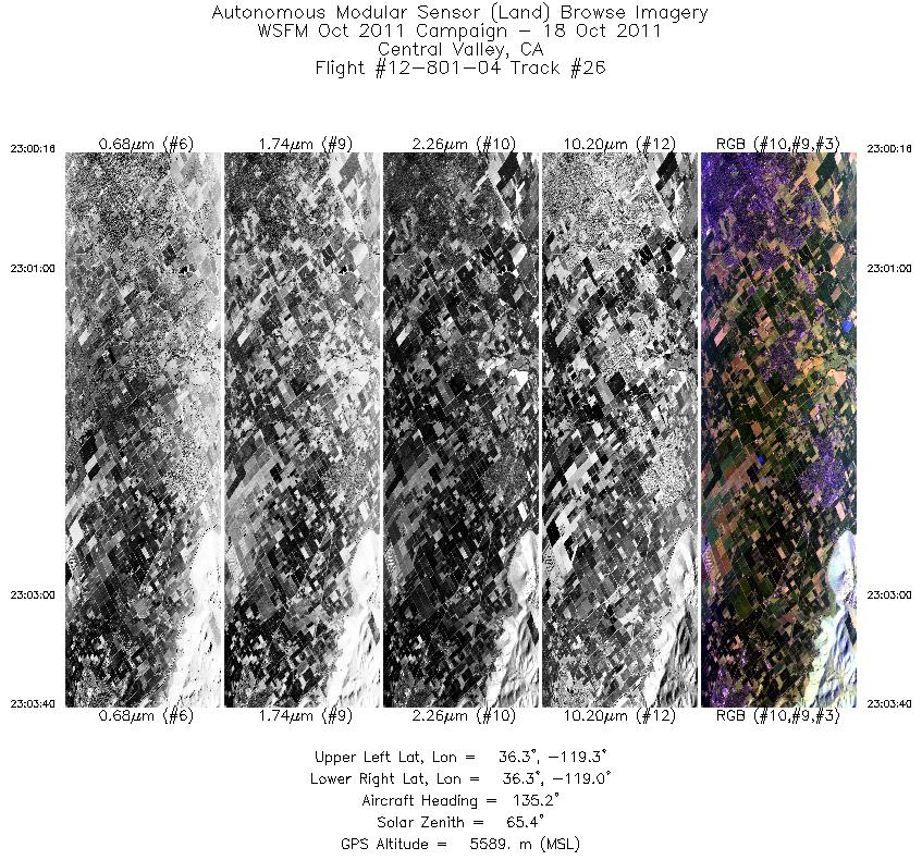
| 26 |
23:00 - 23:03 |
132.3 |
36.343 - 36.229 |
119.286 - 119.071 |
2551 |
5653 |
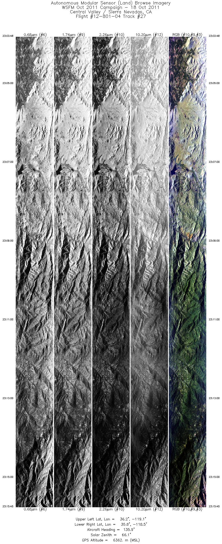
| 27 |
23:03 - 23:15 |
139.1 |
36.224 - 35.775 |
119.063 - 118.505 |
8961 |
6093 |
|


