Flight: 08-066-00
Date: 08 Jul 2008
Location: California Fires
Deployment: WSFM 2008
Configuration: Land 2.5 (12-Channel)
Principal Investigators: Ambrosia (CSUMB)
Additional Sensors: None
|
Fire Coverage
Piute / Clover / American River Complex / Yuba River Complex /
Butte Lightning Complex / Basin Complex / Indians / Gap
|
Data Evaluation
Overall quality is good
|
Processing Information
Level-1B Data in HDF format is available
Flight Line Summary
Spectral Band Configuration
Spectral Response Function Table
Spectral Response Function (text)
|
Browse Imagery
Flight Tracks: 36
Scanlines: 99973
|
Browse Imagery Table
|
Click a Flight Track number to view a quicklook image
Lat/Lon ranges are for the BEG-END scanline nadir pixels
|
Flight
Track |
Time Span
(GMT) |
Heading
(Deg) |
Lat Range
(Deg N) |
Lon Range
(Deg W) |
Length
(Scanlines) |
Altitude
(Meters) |
| 1 |
15:12 - 15:15 |
277.6 |
34.987 - 34.980 |
117.371 - 117.589 |
1577 |
7319 |
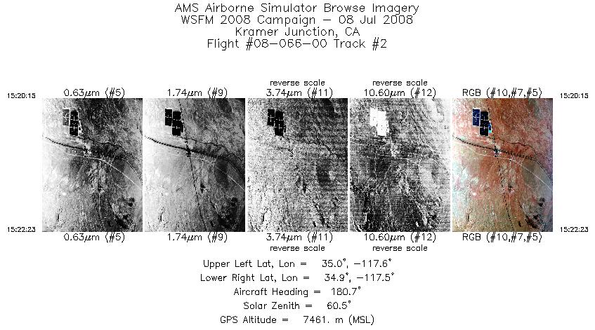
| 2 |
15:20 - 15:22 |
177.0 |
35.041 - 34.930 |
117.535 - 117.533 |
957 |
7461 |
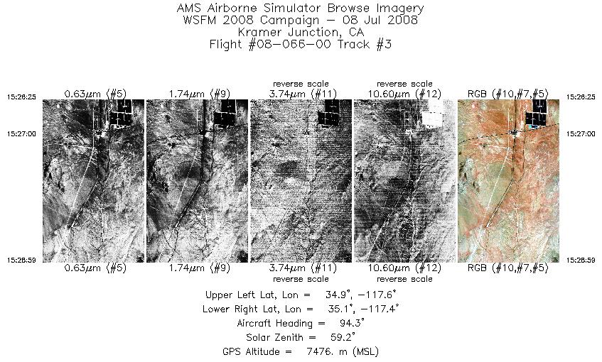
| 3 |
15:26 - 15:28 |
89.6 |
34.988 - 34.986 |
117.578 - 117.423 |
1154 |
7474 |
| 4 |
15:33 - 15:36 |
16.2 |
34.958 - 35.076 |
117.542 - 117.525 |
1198 |
7472 |
| 5 |
15:50 - 15:54 |
12.9 |
35.424 - 35.605 |
118.287 - 118.269 |
1636 |
7479 |
| 6 |
15:57 - 16:00 |
184.1 |
35.565 - 35.409 |
118.420 - 118.450 |
1446 |
7458 |
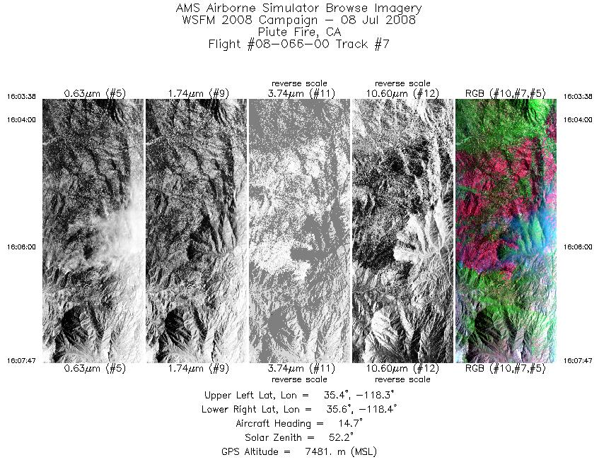
| 7 |
16:03 - 16:07 |
9.6 |
35.419 - 35.622 |
118.354 - 118.341 |
1871 |
7478 |
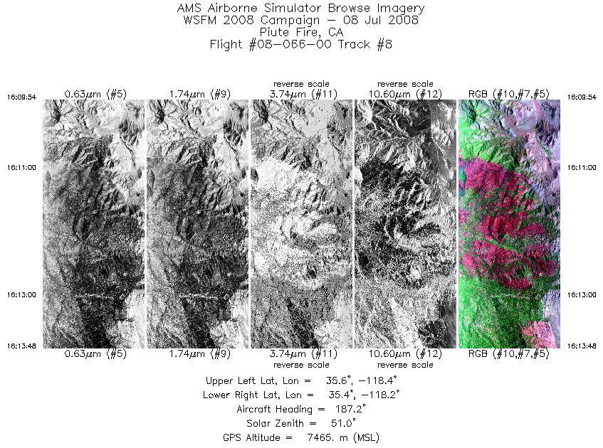
| 8 |
16:09 - 16:13 |
181.3 |
35.605 - 35.409 |
118.274 - 118.300 |
1753 |
7467 |
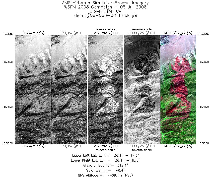
| 9 |
16:30 - 16:35 |
302.7 |
36.076 - 36.142 |
117.944 - 118.223 |
2195 |
7476 |
| 10 |
17:04 - 17:15 |
317.2 |
37.471 - 37.907 |
119.469 - 119.918 |
5147 |
7294 |
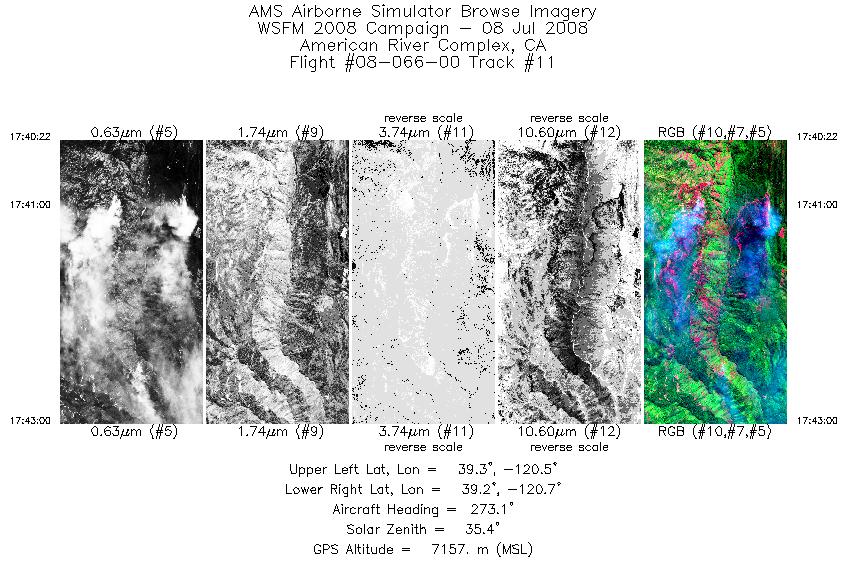
| 11 |
17:40 - 17:42 |
275.6 |
39.227 - 39.210 |
120.544 - 120.733 |
1421 |
7157 |
| 12 |
17:44 - 17:49 |
8.5 |
39.274 - 39.567 |
120.775 - 120.760 |
2892 |
7159 |
| 13 |
17:57 - 18:07 |
353.6 |
39.574 - 40.069 |
121.182 - 121.178 |
4930 |
7142 |
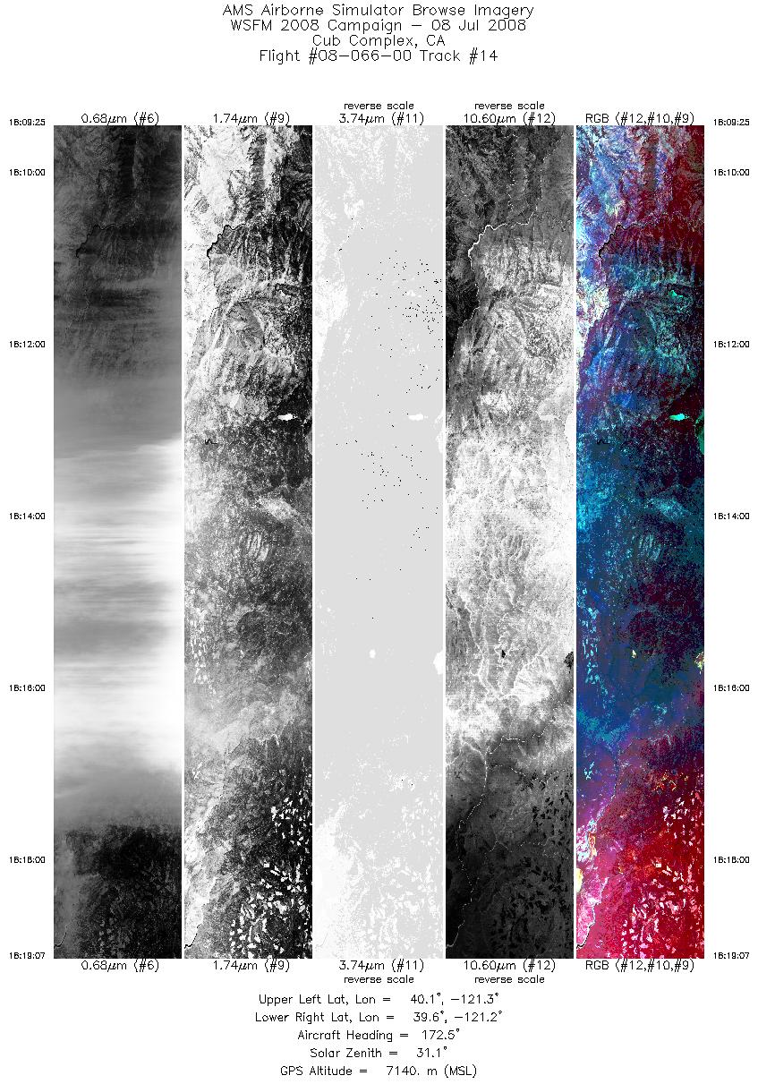
| 14 |
18:09 - 18:19 |
174.8 |
40.065 - 39.602 |
121.254 - 121.243 |
4658 |
7138 |
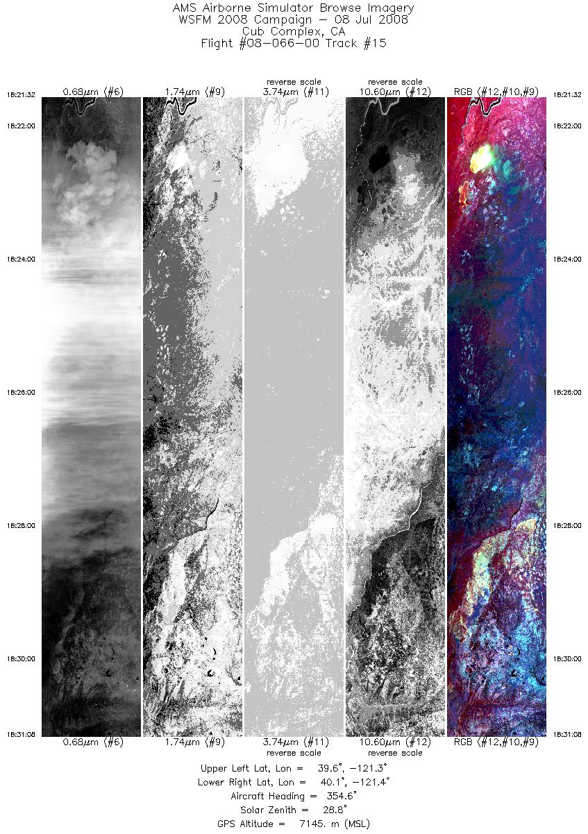
| 15 |
18:21 - 18:31 |
359.5 |
39.594 - 40.048 |
121.340 - 121.332 |
4611 |
7142 |
| 16 |
18:51 - 19:05 |
181.1 |
40.281 - 39.608 |
121.436 - 121.424 |
6781 |
7143 |
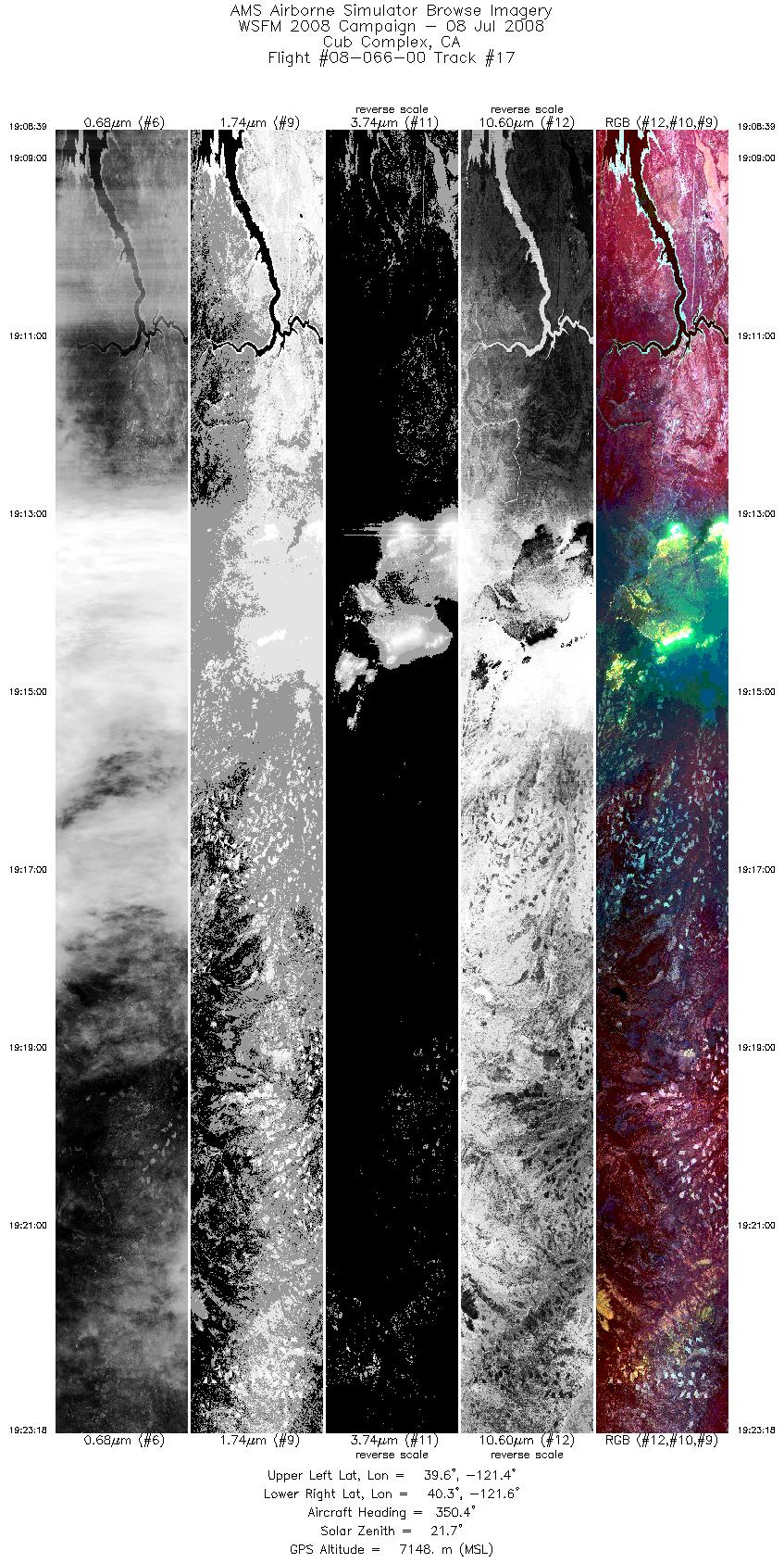
| 17 |
19:08 - 19:23 |
353.4 |
39.557 - 40.258 |
121.496 - 121.518 |
7037 |
7145 |
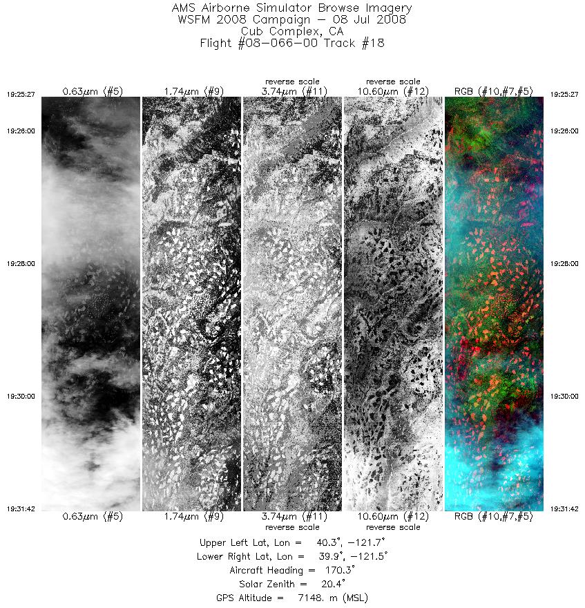
| 18 |
19:25 - 19:31 |
175.3 |
40.264 - 39.952 |
121.605 - 121.587 |
3000 |
7144 |
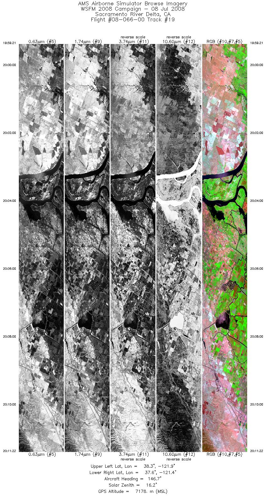
| 19 |
19:59 - 20:11 |
150.9 |
38.337 - 37.608 |
121.852 - 121.456 |
6494 |
7178 |
| 20 |
20:34 - 20:42 |
134.8 |
36.336 - 35.981 |
121.827 - 121.451 |
3866 |
7803 |
| 21 |
20:45 - 20:55 |
329.5 |
36.032 - 36.390 |
121.409 - 121.813 |
4505 |
7792 |
| 22 |
20:58 - 21:08 |
127.7 |
36.402 - 36.038 |
121.704 - 121.288 |
4732 |
7793 |
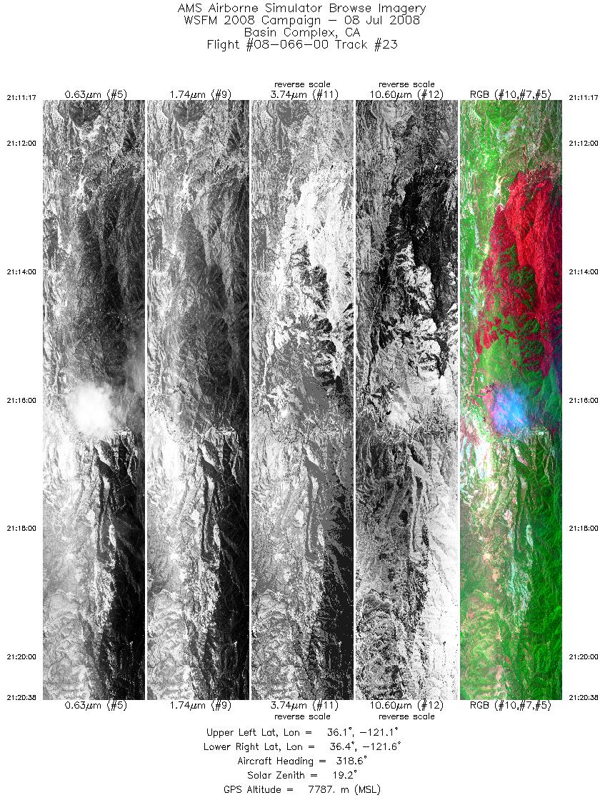
| 23 |
21:11 - 21:20 |
316.3 |
36.071 - 36.391 |
121.202 - 121.582 |
4203 |
7788 |
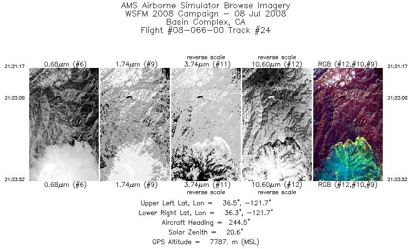
| 24 |
21:21 - 21:23 |
240.0 |
36.396 - 36.327 |
121.620 - 121.757 |
1166 |
7787 |
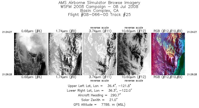
| 25 |
21:24 - 21:26 |
305.8 |
36.323 - 36.384 |
121.792 - 121.886 |
906 |
7788 |
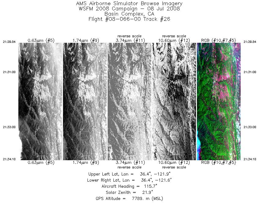
| 26 |
21:29 - 21:34 |
120.3 |
36.504 - 36.384 |
121.859 - 121.685 |
1922 |
7789 |
| 27 |
21:36 - 21:39 |
318.4 |
36.337 - 36.452 |
121.744 - 121.875 |
1464 |
7788 |
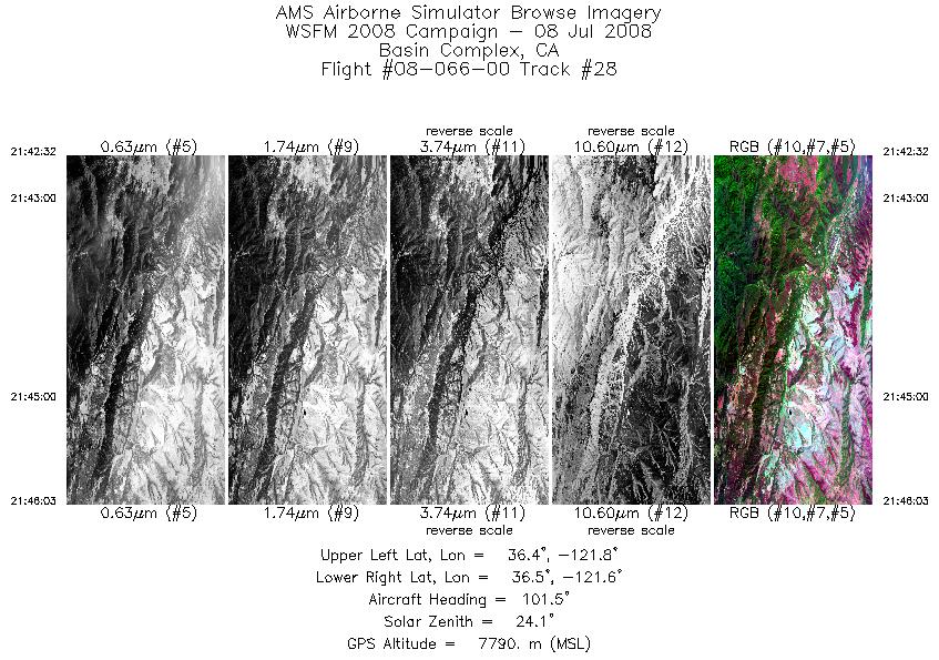
| 28 |
21:42 - 21:46 |
96.7 |
36.457 - 36.443 |
121.785 - 121.602 |
1579 |
7790 |
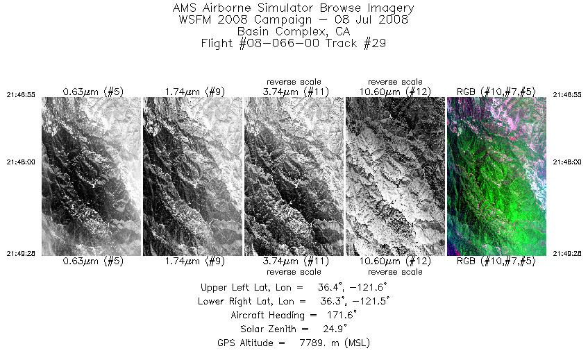
| 29 |
21:46 - 21:49 |
176.4 |
36.415 - 36.291 |
121.573 - 121.591 |
1146 |
7790 |
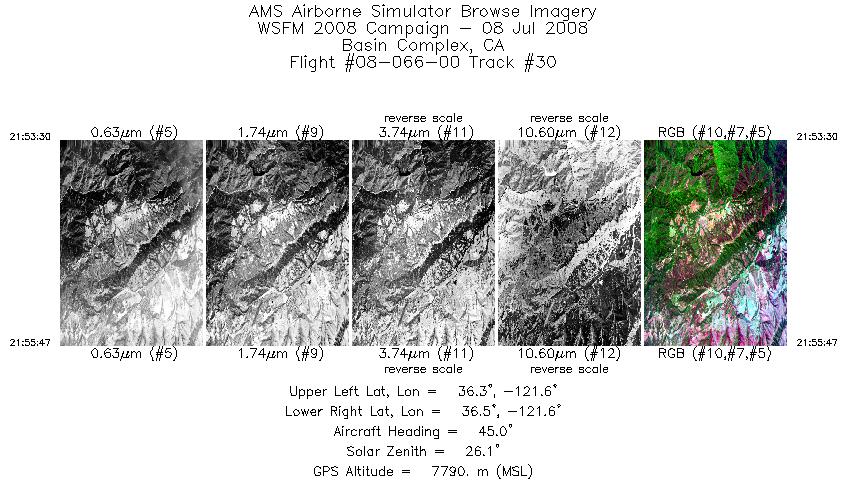
| 30 |
21:53 - 21:55 |
49.5 |
36.381 - 36.440 |
121.697 - 121.602 |
1034 |
7791 |
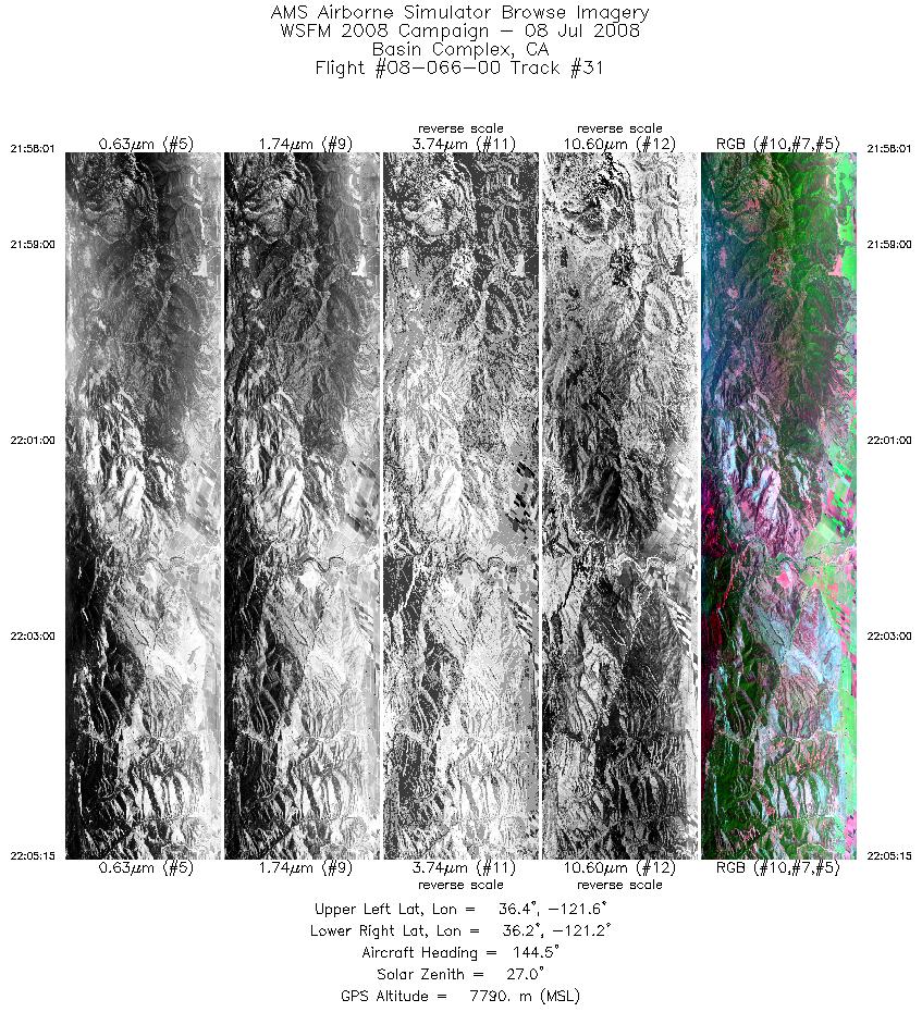
| 31 |
21:58 - 22:05 |
134.6 |
36.416 - 36.180 |
121.493 - 121.216 |
3252 |
7790 |
| 32 |
22:44 - 22:47 |
261.0 |
34.494 - 34.474 |
119.795 - 120.004 |
1585 |
7443 |
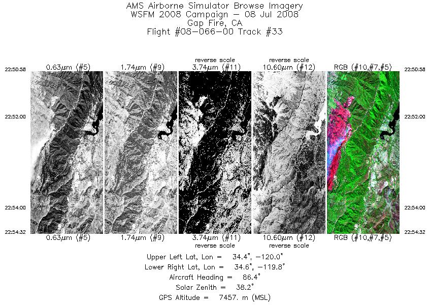
| 33 |
22:50 - 22:54 |
82.5 |
34.505 - 34.547 |
119.967 - 119.767 |
1600 |
7458 |
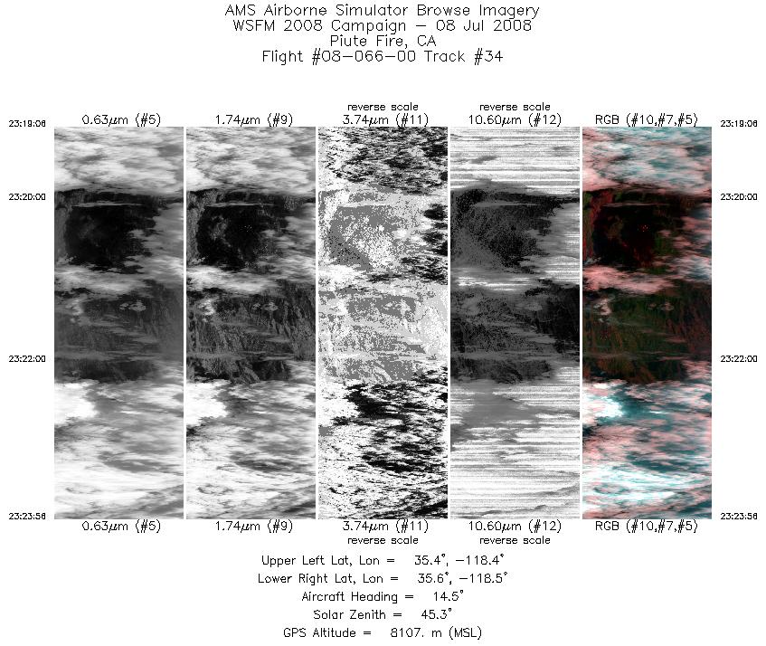
| 34 |
23:19 - 23:23 |
11.6 |
35.401 - 35.631 |
118.434 - 118.433 |
2173 |
8112 |
| 35 |
23:26 - 23:31 |
179.9 |
35.604 - 35.381 |
118.342 - 118.365 |
2066 |
8103 |
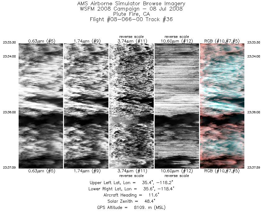
| 36 |
23:33 - 23:37 |
8.8 |
35.387 - 35.606 |
118.286 - 118.277 |
2016 |
8104 |
|


