Flight: 08-053-00
Date: 28 Oct 2007
Location: Southern California Fires
Deployment: WSFM 2007
Configuration: Land 2.5 (12-Channel)
Principal Investigators: Ambrosia (CSUMB)
Additional Sensors: None
|
Fire Coverage
Witch / Harris / Poomacha / Rice / Ammo / Santiago / Esperanza
Slide / Grass Valley / Buckweed / Ranch / Magic
|
Data Evaluation
Overall quality is good
|
Processing Information
Level-1B Data in HDF format is available
Flight Line Summary
Spectral Band Configuration
Spectral Response Function Table
Spectral Response Function (text)
|
Browse Imagery
Flight Tracks: 39
Scanlines: 115332
|
Browse Imagery Table
|
Click a Flight Track number to view a quicklook image
Lat/Lon ranges are for the BEG-END scanline nadir pixels
|
Flight
Track |
Time Span
(GMT) |
Heading
(Deg) |
Lat Range
(Deg N) |
Lon Range
(Deg W) |
Length
(Scanlines) |
Altitude
(Meters) |
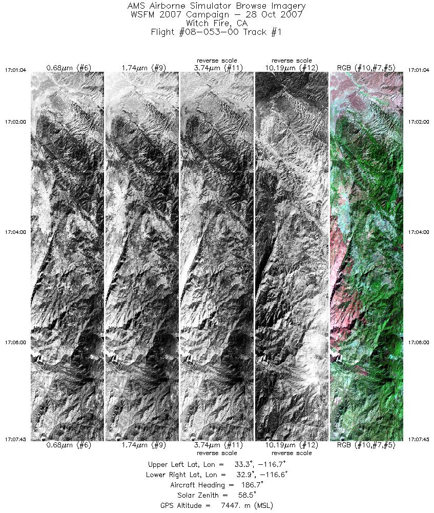
| 1 |
17:01 - 17:07 |
181.1 |
33.270 - 32.887 |
116.661 - 116.634 |
3603 |
7448 |
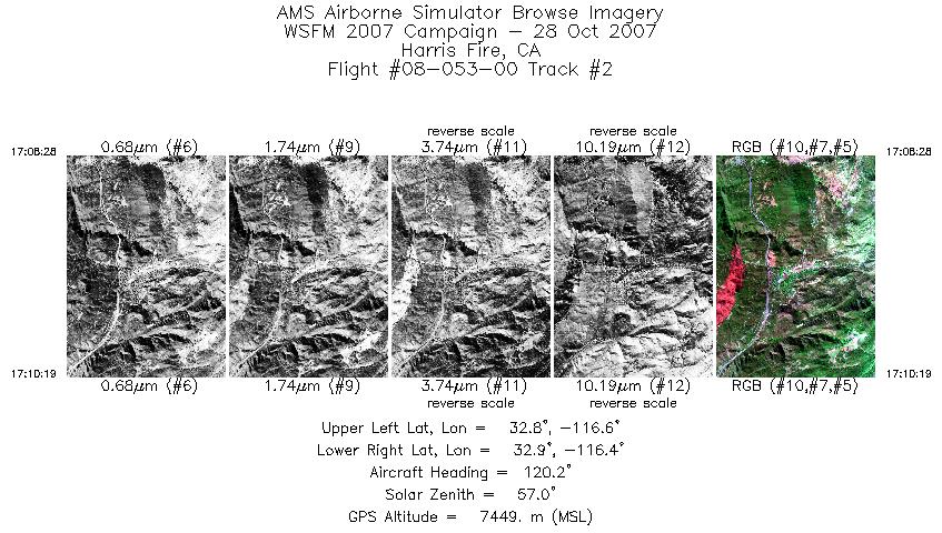
| 2 |
17:08 - 17:10 |
116.0 |
32.853 - 32.819 |
116.604 - 116.469 |
1003 |
7449 |
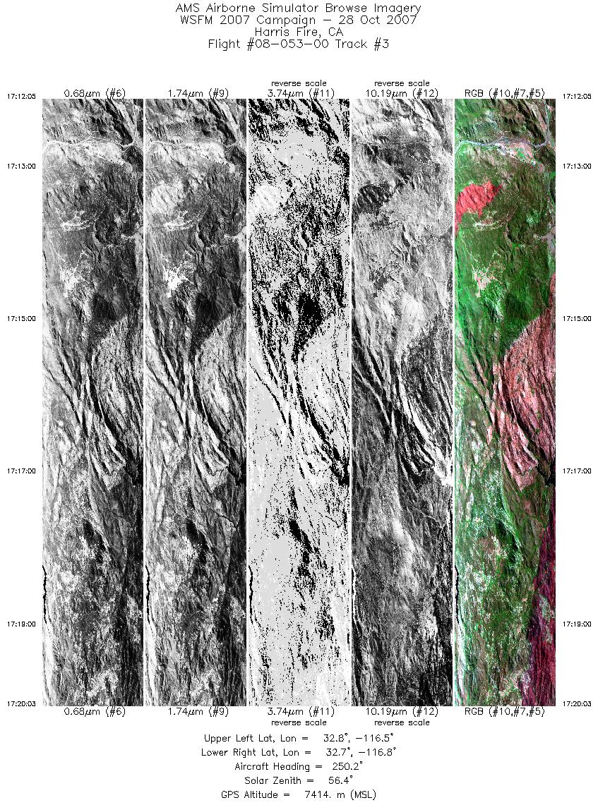
| 3 |
17:12 - 17:20 |
251.4 |
32.762 - 32.727 |
116.454 - 116.821 |
4306 |
7415 |
| 4 |
17:21 - 17:23 |
77.4 |
32.761 - 32.802 |
116.788 - 116.664 |
1169 |
7411 |
| 5 |
17:24 - 17:27 |
92.3 |
32.804 - 32.813 |
116.651 - 116.473 |
1631 |
7416 |
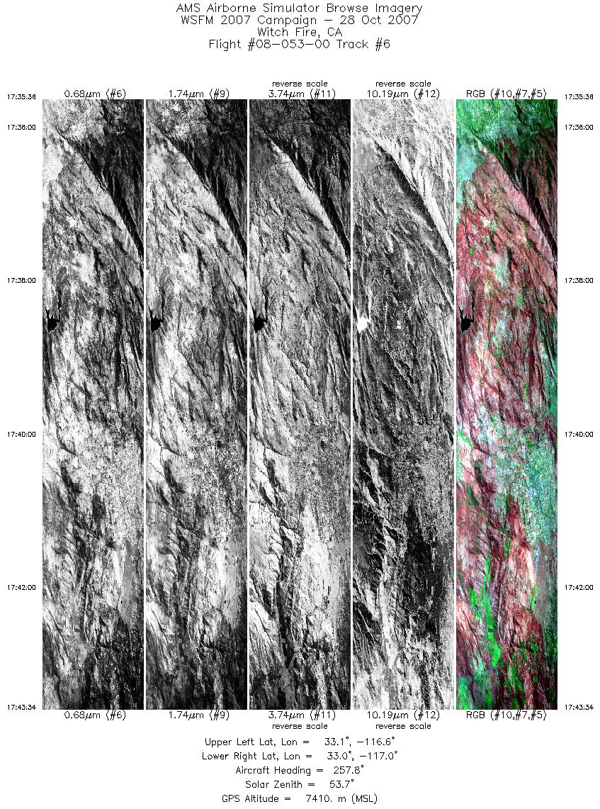
| 6 |
17:35 - 17:43 |
258.3 |
33.068 - 33.070 |
116.632 - 117.006 |
4305 |
7413 |
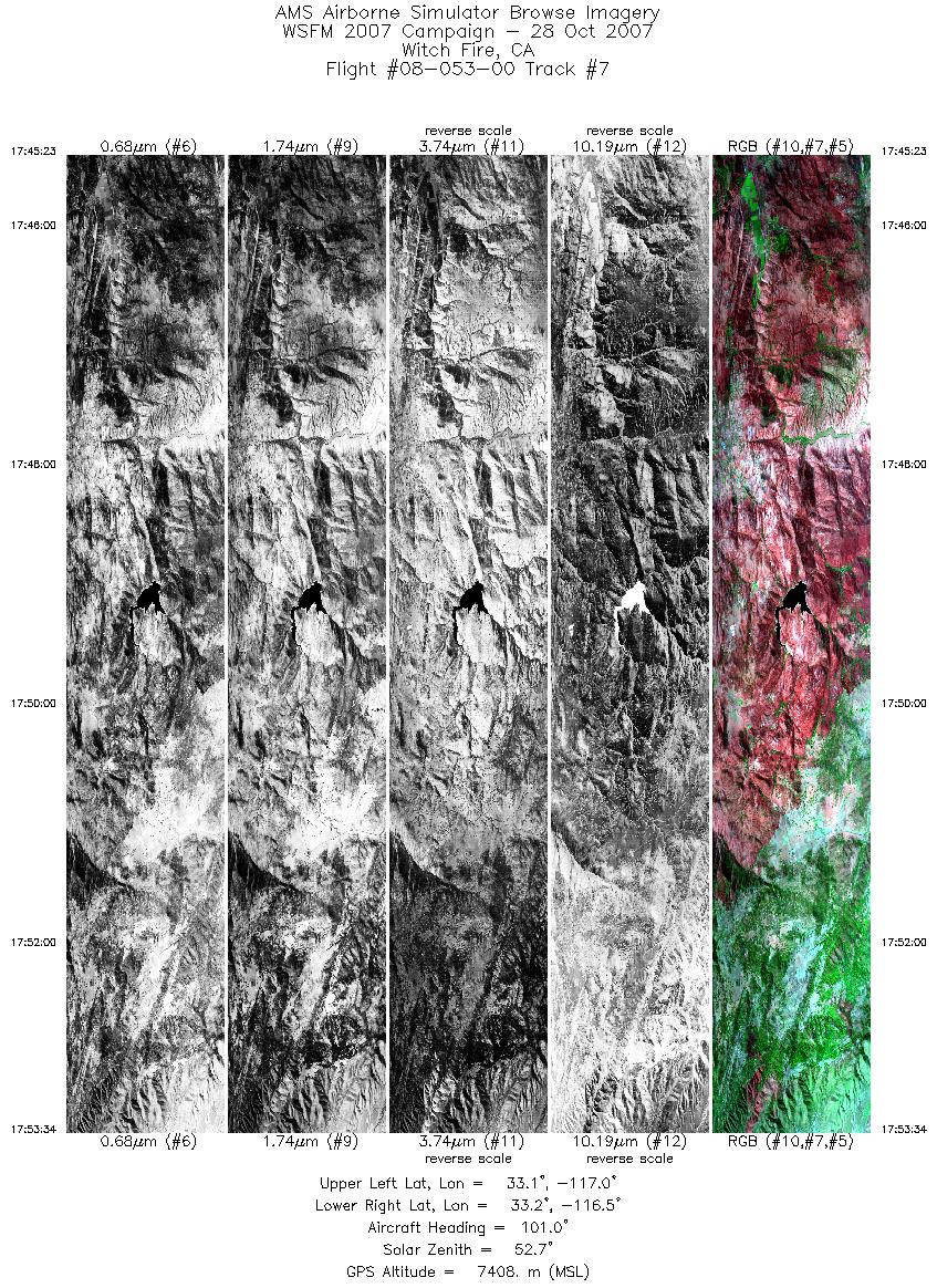
| 7 |
17:45 - 17:53 |
99.6 |
33.111 - 33.107 |
116.997 - 116.559 |
4424 |
7412 |
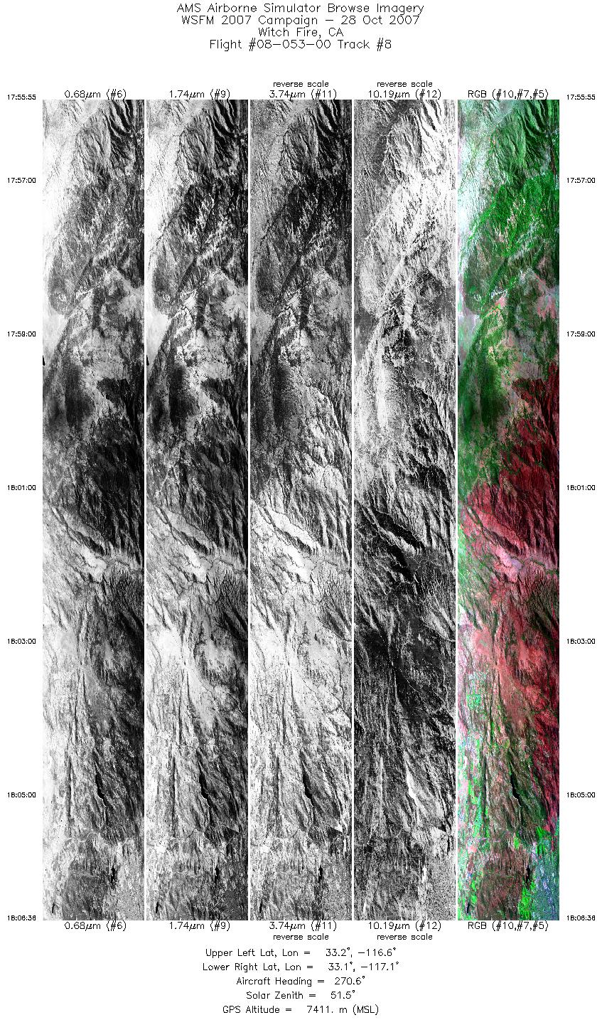
| 8 |
17:55 - 18:06 |
266.0 |
33.176 - 33.180 |
116.569 - 117.072 |
5773 |
7409 |
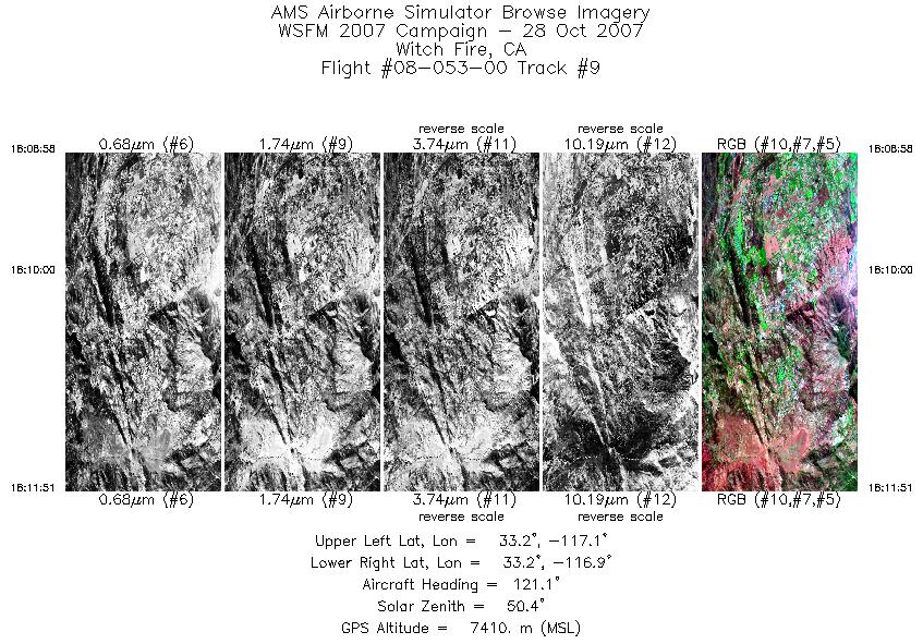
| 9 |
18:08 - 18:11 |
123.4 |
33.247 - 33.188 |
117.042 - 116.903 |
1558 |
7410 |
| 10 |
18:12 - 18:15 |
93.8 |
33.188 - 33.190 |
116.850 - 116.709 |
1308 |
7414 |
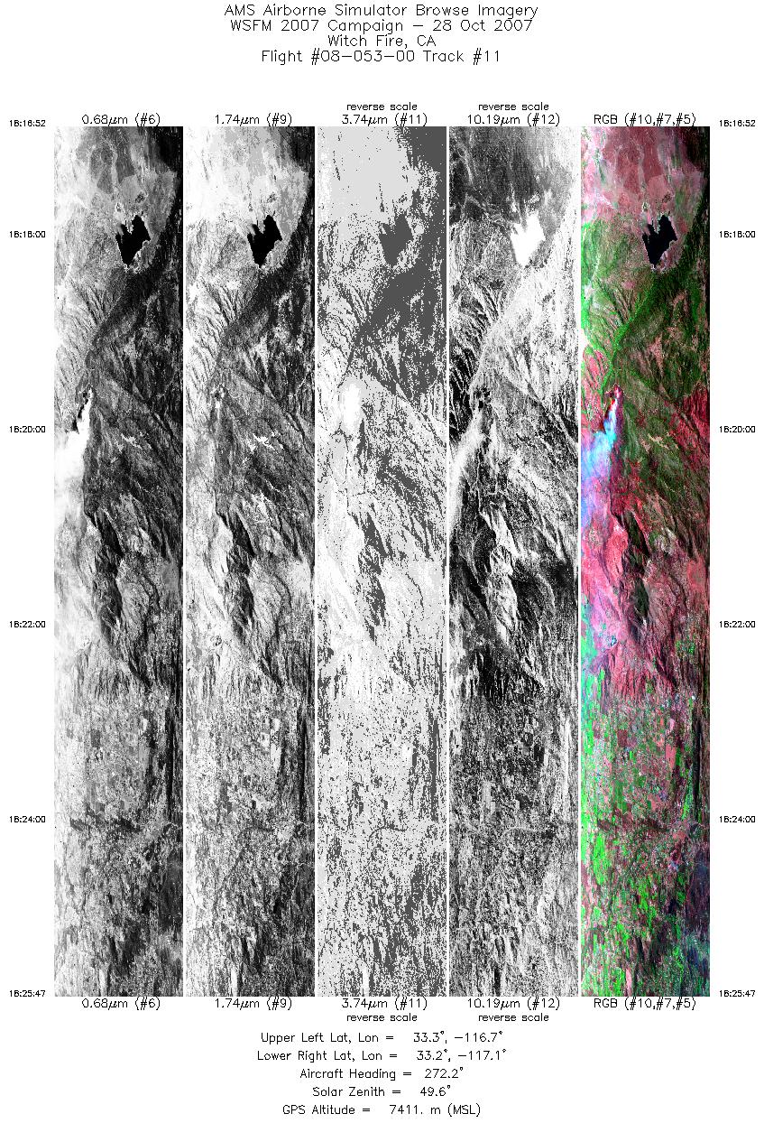
| 11 |
18:16 - 18:25 |
265.9 |
33.246 - 33.242 |
116.695 - 117.122 |
4822 |
7410 |
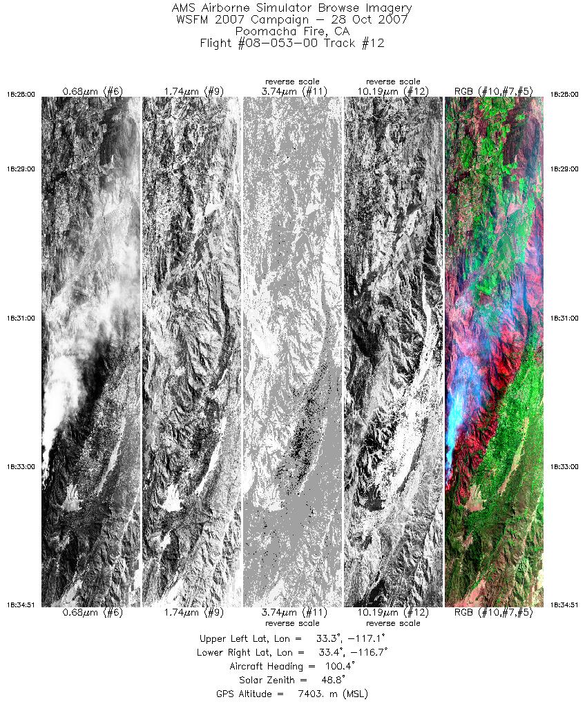
| 12 |
18:28 - 18:34 |
99.0 |
33.312 - 33.312 |
117.105 - 116.745 |
3696 |
7405 |
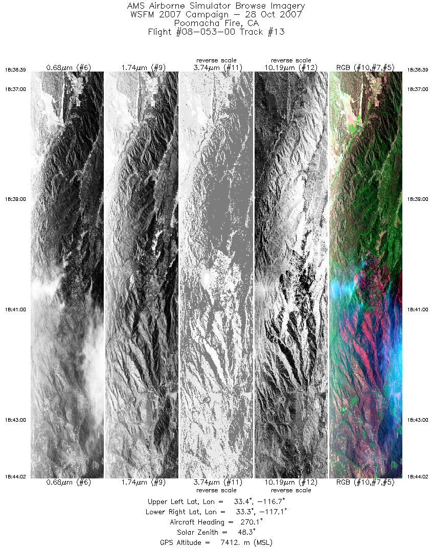
| 13 |
18:36 - 18:44 |
266.4 |
33.372 - 33.378 |
116.736 - 117.090 |
3981 |
7409 |
| 14 |
18:44 - 18:48 |
269.4 |
33.378 - 33.414 |
117.092 - 117.294 |
2236 |
7406 |
| 15 |
18:56 - 18:58 |
224.7 |
33.367 - 33.298 |
117.324 - 117.415 |
1383 |
7410 |
| 16 |
19:05 - 19:08 |
302.7 |
33.365 - 33.461 |
117.444 - 117.550 |
1728 |
7389 |
| 17 |
19:10 - 19:12 |
24.7 |
33.518 - 33.614 |
117.556 - 117.497 |
1112 |
7400 |
| 18 |
19:14 - 19:18 |
289.3 |
33.691 - 33.772 |
117.518 - 117.717 |
2541 |
7388 |
| 19 |
19:21 - 19:25 |
127.5 |
33.772 - 33.703 |
117.629 - 117.468 |
2026 |
7388 |
| 20 |
19:27 - 19:29 |
132.7 |
33.650 - 33.580 |
117.470 - 117.349 |
1250 |
7411 |
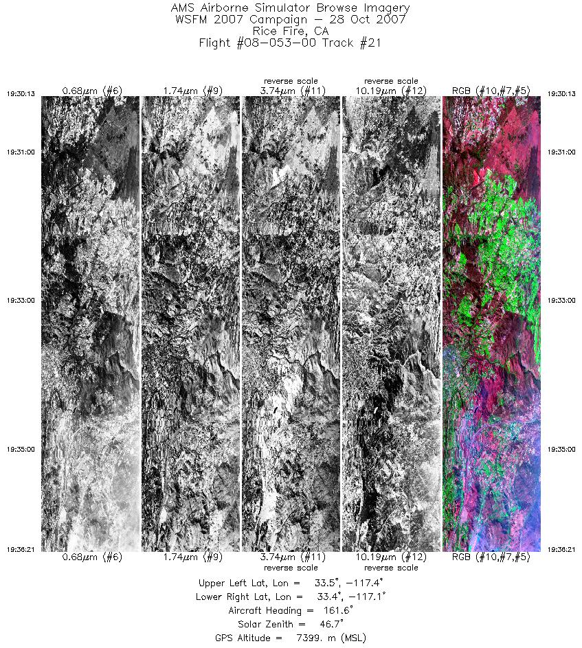
| 21 |
19:30 - 19:36 |
153.7 |
33.543 - 33.360 |
117.315 - 117.111 |
3321 |
7410 |
| 22 |
19:39 - 19:44 |
18.7 |
33.417 - 33.668 |
116.964 - 116.864 |
2533 |
7405 |
| 23 |
19:44 - 19:49 |
5.5 |
33.671 - 33.917 |
116.863 - 116.834 |
2827 |
7400 |
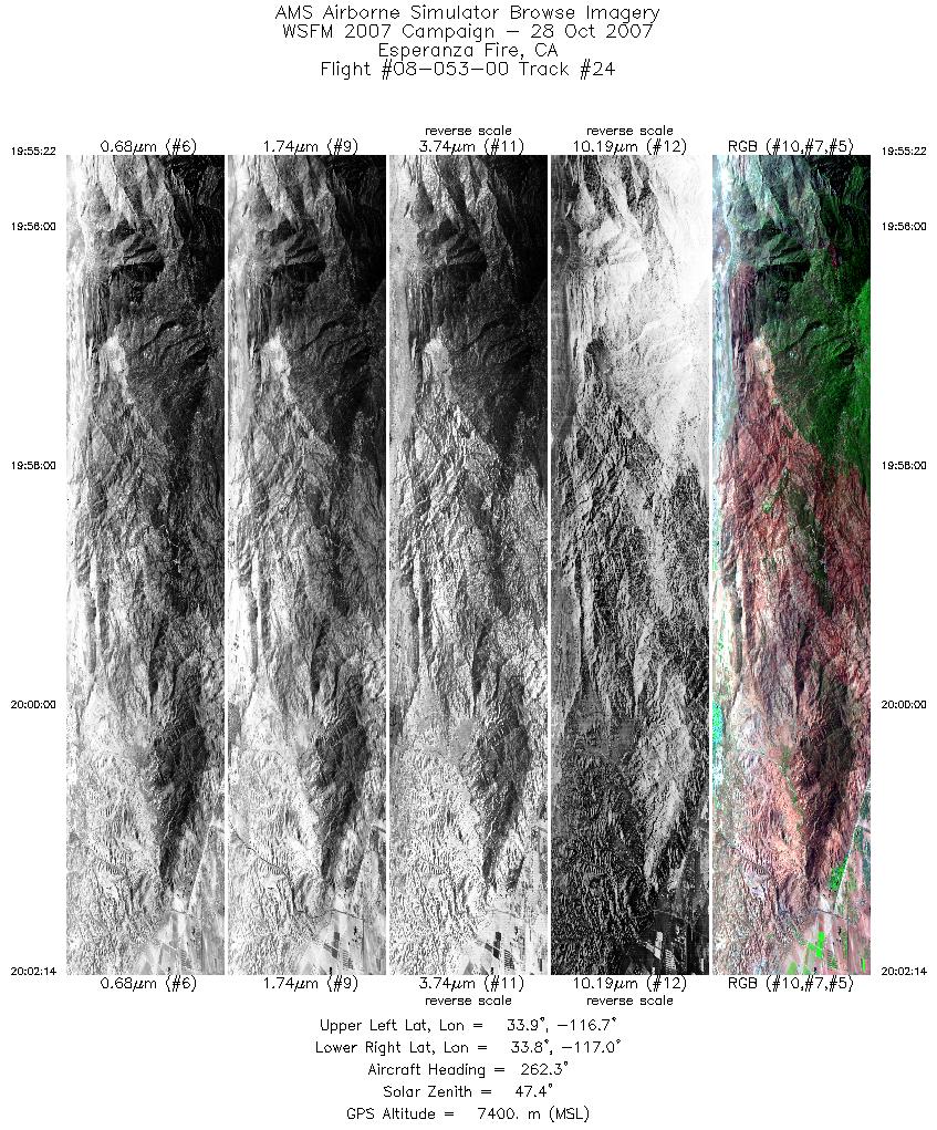
| 24 |
19:55 - 20:02 |
260.8 |
33.870 - 33.860 |
116.683 - 117.030 |
3707 |
7402 |
| 25 |
20:04 - 20:09 |
94.4 |
33.821 - 33.814 |
116.991 - 116.680 |
2917 |
7401 |
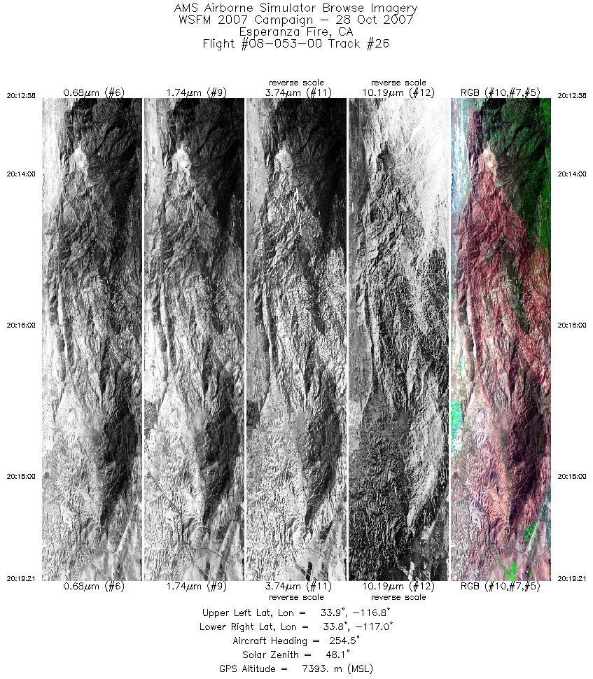
| 26 |
20:12 - 20:19 |
252.6 |
33.864 - 33.854 |
116.733 - 117.023 |
3450 |
7399 |
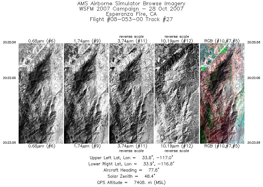
| 27 |
20:20 - 20:23 |
72.6 |
33.822 - 33.897 |
117.002 - 116.809 |
1621 |
7401 |
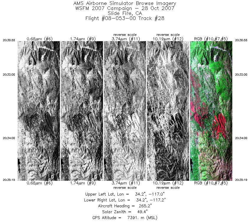
| 28 |
20:30 - 20:35 |
263.0 |
34.194 - 34.211 |
116.996 - 117.202 |
2376 |
7384 |
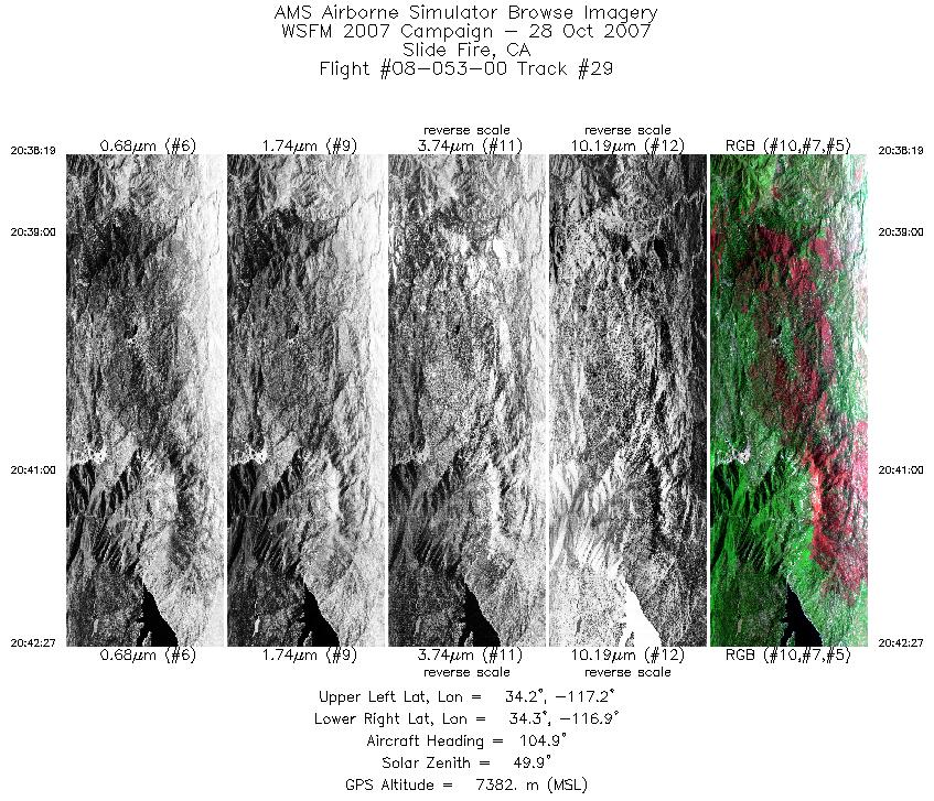
| 29 |
20:38 - 20:42 |
102.2 |
34.241 - 34.244 |
117.158 - 116.956 |
2239 |
7383 |
| 30 |
20:49 - 20:53 |
258.4 |
34.266 - 34.267 |
117.170 - 117.390 |
2485 |
7394 |
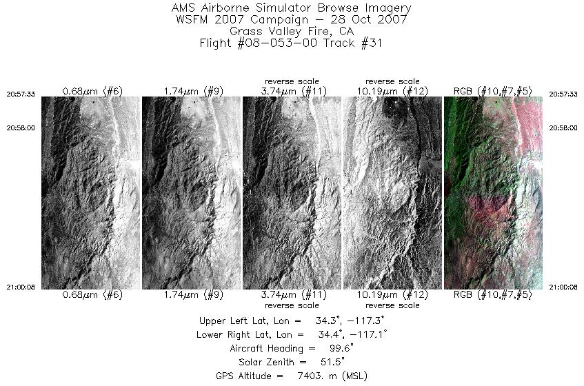
| 31 |
20:57 - 21:00 |
95.4 |
34.316 - 34.328 |
117.309 - 117.134 |
1400 |
7400 |
| 32 |
21:03 - 21:06 |
259.2 |
34.266 - 34.270 |
117.172 - 117.326 |
1696 |
7397 |
| 33 |
21:23 - 21:37 |
258.2 |
34.564 - 34.566 |
118.271 - 118.984 |
7827 |
7381 |
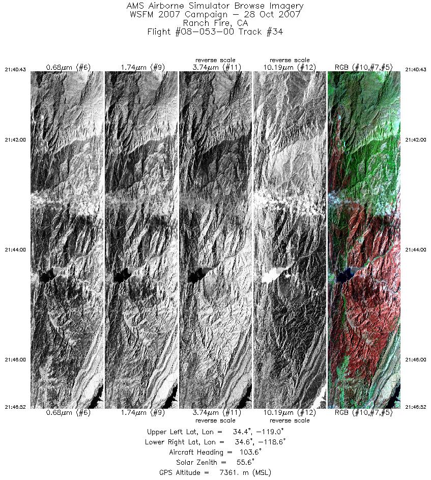
| 34 |
21:40 - 21:46 |
103.8 |
34.495 - 34.502 |
118.943 - 118.629 |
3316 |
7360 |
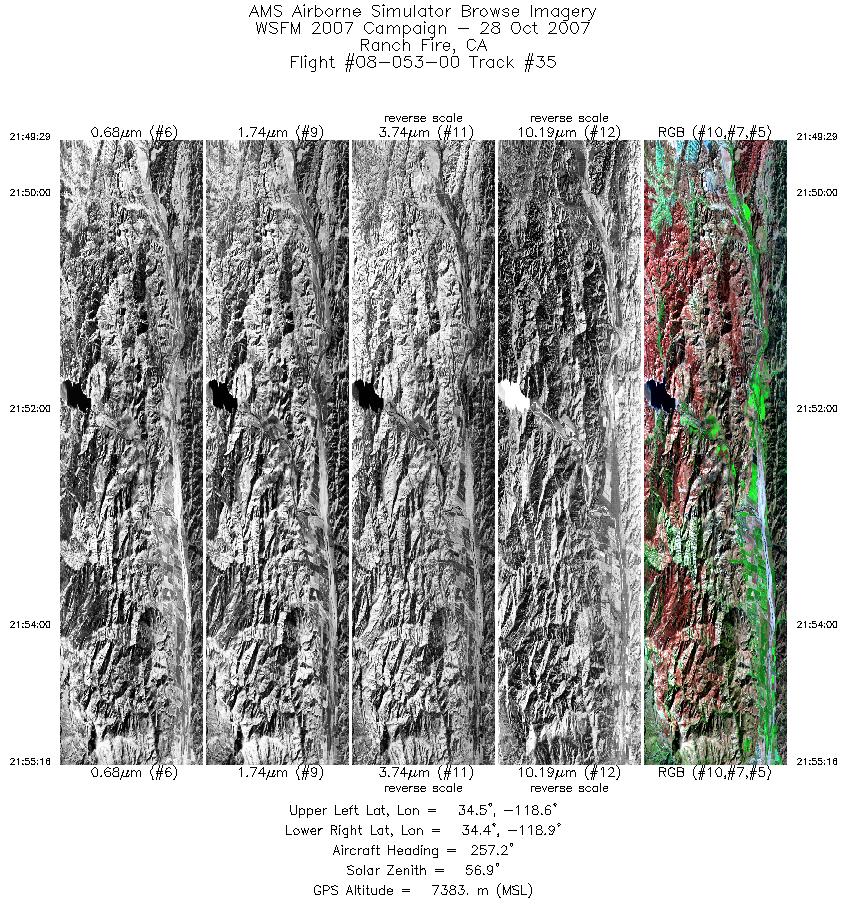
| 35 |
21:49 - 21:55 |
260.5 |
34.431 - 34.429 |
118.622 - 118.906 |
3129 |
7383 |
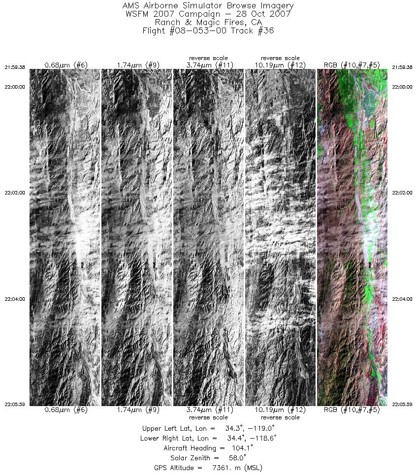
| 36 |
21:59 - 22:05 |
103.8 |
34.379 - 34.381 |
118.966 - 118.638 |
3429 |
7363 |
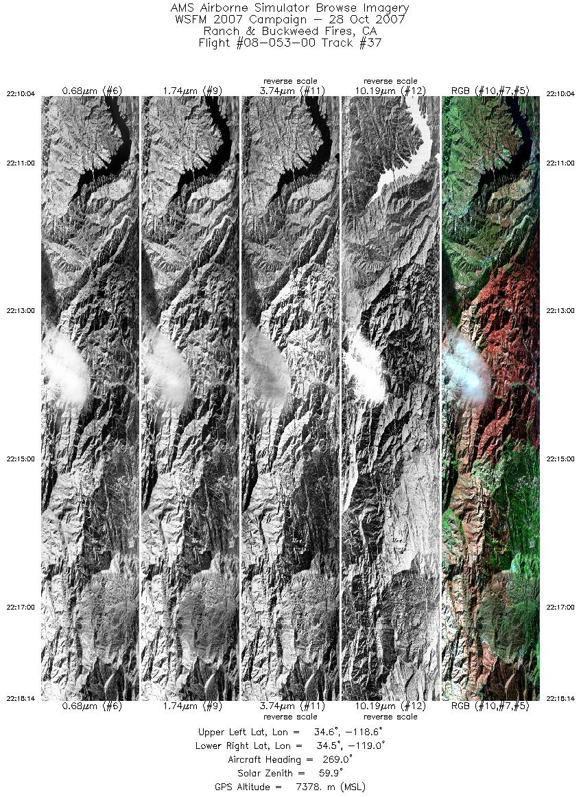
| 37 |
22:10 - 22:18 |
264.2 |
34.561 - 34.565 |
118.576 - 118.969 |
4408 |
7374 |
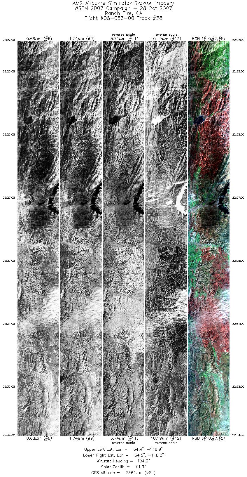
| 38 |
22:22 - 22:34 |
108.6 |
34.490 - 34.494 |
118.890 - 118.231 |
6765 |
7353 |
| 39 |
22:34 - 22:38 |
112.7 |
34.494 - 34.430 |
118.230 - 117.954 |
2031 |
7380 |
|


